Catégorie : Comprendre
 Articles, analyses et conférences pédagogiques.
L’histoire de l’art avec le regard d’un amoureux de toutes les renaissances.
FR/EN/NE/GE/IT/ES
Le jour où l’Église faillit interdire la polyphonie en musique
par Karel Vereycken
Durant l’Antiquité, l’art musical (et donc celui de l’Église primitive) ne connaissait apparemment que la monodie. La grande invention du Moyen Âge fut celle de la polyphonie où chaque voix contribue à un tout harmonique. Au XVIe siècle, lors du Concile de Trente, certains cardinaux ont cherché à l’interdire…
C’est au IXe siècle que l’art de la polyphonie commence à apparaître et à se développer, de manière encore discrète mais manifeste, à l’église tout d’abord.
Aux XIe et XIIe siècles, l’abbaye bénédictine Saint-Martial de Limoges ainsi que d’autres églises et abbayes jouent un rôle important dans le développement de la polyphonie. Celle-ci connaîtra un premier rayonnement national et international à Paris (alors qualifiée de « nouvelle Athènes »), aux XIIe et XIIIe siècles, grâce aux chantres-compositeurs de l’École de Notre-Dame de Paris, cathédrale nouvellement construite et centre culturel de premier plan (tout comme le sera l’université, créée à Paris au milieu du XIIIe siècle, par le théologien Robert de Sorbon).
À Notre-Dame, les chantres les plus connus furent Léonin et Pérotin. Ils représentent les premiers grands créateurs de ce que les musiciens du siècle suivant appelleront l’Ars antiqua, par opposition à l’Ars nova, dont les créateurs se lancèrent dans de nouvelles recherches, parfois très abstraites, comme chez Philippe de Vitry.
L’usage liturgique de la musique de l’ars nova fut déjà rejeté au XIVe siècle par le pape Jean XXII dans sa décrétale Docta Sanctorum Patrum (vers 1323), mais accepté par le pape Clément VI.
A cause de la polyphonie, le chant monophonique, déjà harmonisé pour un simple orgue, s’est vu altéré, fragmenté, et dissimulé derrière des mélodies profanes. Les paroles des poèmes d’amour courtois pouvaient être chantés en dessus de textes sacrés, ou des textes sacrés pouvaient être placés à l’intérieur d’une mélodie profane. Pour les autorités religieuses, ce n’était pas tant la polyphonie qui était une offense dans les âges médiévaux, mais la notion de musique profane qui se combine au sacré et prenant place dans la liturgie.
Le grand compositeur polyphonique né avec le XIVe siècle est le Rémois Guillaume de Machaut (v. 1300-1377), auteur, en particulier, de la première messe polyphonique entière (la Messe Nostre Dame). Comme les autres musiciens, il écrivit aussi bon nombre de pièces profanes, tant l’art de la polyphonie s’était répandu dans bien des domaines musicaux.
Pendant la guerre de Cent Ans, certains duchés situés à l’écart du conflit, comme les Pays-Bas bourguignons et la Bourgogne, connaissent la paix et la prospérité économique. Le développement des manufactures, notamment textiles, dans les Pays-Bas (comté de Hainaut, comté de Flandre, principauté de Liège, duché de Luxembourg et duché de Brabant) y contribue au développement des arts. Pendant près de deux siècles, ces régions feront figure de principal centre culturel de l’Europe.
Si plusieurs foyers de création musicale émergent en Europe, principalement en France et en Italie, c’est l’école franco-flamande qui s’impose. Elle se singularise dès 1420 par le développement fulgurant de la polyphonie et du contrepoint et pose ainsi les bases de l’harmonie moderne.
Bien que l’évolution du langage musical fût continue tout au long de la période, on distingue en général six générations de compositeurs franco-flamands, dont chacune dure une quarantaine d’années et se caractérise par l’influence de quelques compositeurs marquants :
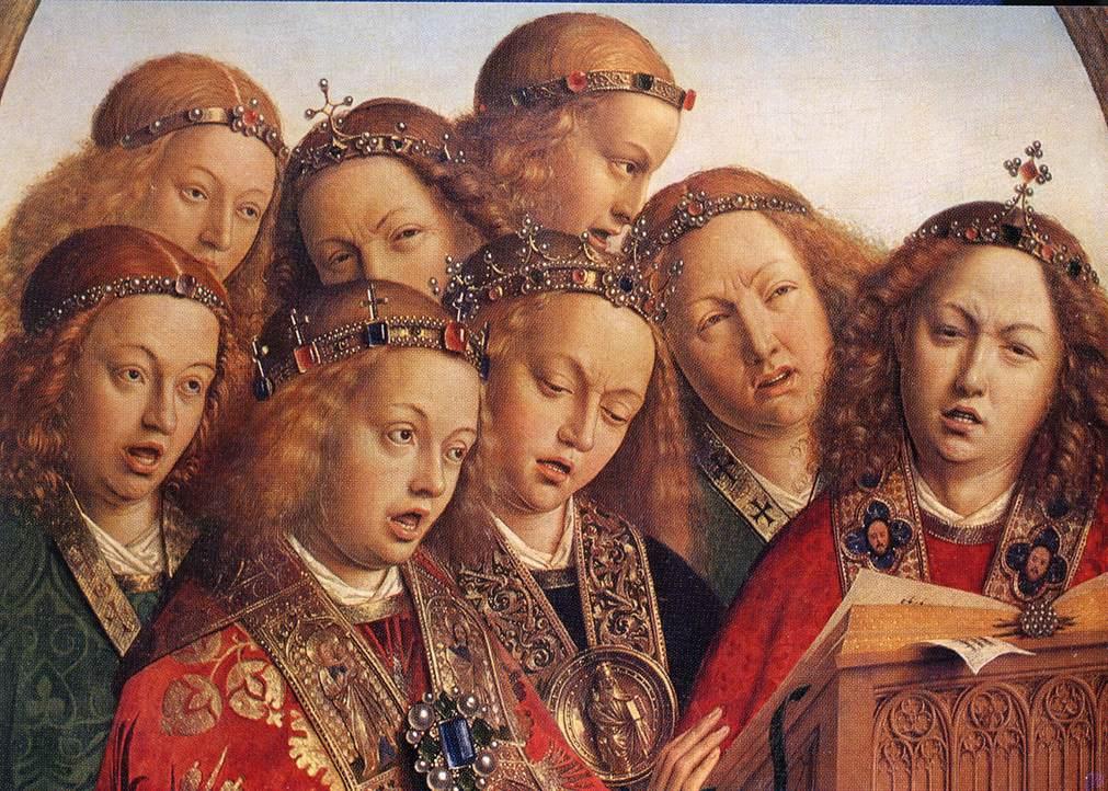
- La première génération (1420-1450), appelée école bourguignonne du fait de la domination bourguignonne dans cette région à l’époque, est principalement représentée par Guillaume Dufay, Gilles Binchois, Johannes de Limburgia et Johannes Ciconia de Liège. Cette génération marque une évolution par rapport à la musique médiévale, car très progressivement s’élabore un début de considération verticale de la musique polyphonique.
- La deuxième génération (1450-1485), dont Johannes Ockeghem et Antoine Busnois furent les compositeurs les plus célèbres, est marquée par le perfectionnement du motet, forme musicale née au XIIIe siècle, et qui devient un lieu privilégié de l’expérimentation du contrepoint.
- La troisième (1480-1520), représentée en premier lieu par Josquin des Prés, souvent considéré comme le plus grand compositeur de l’école franco-flamande de l’époque, mais également Alexandre Agricola, Jacob Obrecht, Loyset Compère, Pierre de La Rue, Heinrich Isaac et Antoine Brumel qui, bien que français, se rattache à l’école franco-flamande par son style.
- Quatrième génération (1520-1560) : Adriaan Willaert, Cyprien de Rore.
- Cinquième génération (1560-1600) : Roland de Lassus, Jacques de Wert.
- Sixième génération (1600-1633) : Matheo Romero, dernier représentant de l’école franco-flamande, actif en Espagne à la Capilla flamenca fondée à Madrid par Charles Quint en 1515.
Dans la suite de Guillaume de Machaut, les compositeurs de l’école franco-flamande développent un nouveau genre musical, dans lequel sont mises en musique les cinq parties de l’ordinaire de la messe : kyrie, gloria, credo, sanctus et agnus Dei.
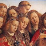
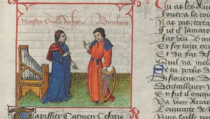
Voici, à titre d’exemple de cette musique polyphonique franco-flamande, Nymphes des bois, déploration sur la mort d’Ockegem, une oeuvre composée par Josquin des Prés en 1497.
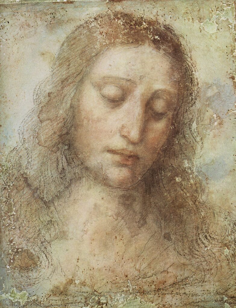
par Léonard de Vinci, vers 1485-1490.
Texte:
Nimphes des bois, deesses des fontaines
Chantres expers de toutes nations
Changés vos voix tant cleres et haultaines
En cris tranchans et lamentations
Car d’Atropos les molestations
Vostr’ Ockeghem par sa rigueur attrappe
Vray tresoir de musicque et chief d’oeuvre
Qui de trépas désormais plus n’eschappe
Dont grant domaige est que la terre coeuvre.
Accoutrez vous d’habits de doeul,
Josquin, Brumel, Pierchon, Compere,
Et plourez grosses larmes d’œil
Perdu avez vostre bon pere,
Requiescat in pace.
Rayonnement international
Les compositeurs franco-flamands ne se contentent pas de rester dans leur patrie mais partent travailler dans d’autres pays d’Europe. Ils se rendent ainsi en Italie, en Espagne, en France et en Allemagne où ils font connaître leur style. Celui-ci se répand rapidement grâce aux nombreux manuscrits (qui subsistent dans plusieurs bibliothèques en Europe ou aux États-Unis) et à l’essor contemporain de l’imprimerie.
Le dôme de la cathédrale Florence, avec sa gigantesque coupole construite par Brunelleschi, fut consacré le 25 mars 1436 avec un motet à quatre voix, Nuper Rosarum Flores, composé pour l’occasion par le flamand Guillaume Dufay. Ce motet, qui décrit le dôme comme décoré par des guirlandes de roses, tire également profit des proportions choisies par l’architecte pour l’édifice.
Dans sa Description de tous les Pays Bas parue en italien à Anvers en 1567 puis traduite et rééditée à de nombreuses reprise, l’historien florentin Lodovico Guicciardini insiste, lui, sur la dimension collective de cette « restauration » de la musique, en soulignant le rôle déterminant de la région dont traite son livre pour l’histoire de la musique1 :
« Les Belges sont aussi les vrais maistres et restaurateurs de la musique : ce sont eux qui l’ont remise sus et réduite à sa perfection, l’ayans si propre et naturelle que hommes et femmes y chantent comme de leur instinct par mesure, et cecy avec grand grace et mélodie : tellement qu’ayans depuis conjoinct l’art à ce naturel, ils font telle preuve et par la voix et par les instrumentz de toutes sortes que chacun voit et scait : veu qu’il n’y a court de Prince Chrestien, en laquelle n’y aye quelcun de ses musiciens.
Et à fin que je parle de ceux de nostre temps : de ceste province sont sortis Jean Tainturier de Nivelle, duquel je fais mention en la ville dont il estoit natif, à cause de l’excellence et sûreté de sa vertu : Josquin de Prez, Obrecht, Ockegem, Richiafort, Adrian Willart, Jean Mouton, Verdelot, Gombert, Lupus Lupi, Courtois, Créquillon, Clément non Papa et Cornille Canis, tous lesquels sont décedez : mais les ensuivants vivent : Cyprian de Rore, Jean le Coich, Philippe de Monte, Orland de Lassus, Mancicourt, Josquin Baston, Chrestien Hollandois, Jacques de Waet, Bonmarché, Severin Cornet, Pierre du Hot, Gérard de Tornhout, Hubert Waelrant, Jacquet de Berchem, lieu voisin d’Anvers, et d’autres encor très renommez et fameux maistres en musique espars en honneur et honnestes degrez par le monde. »
Ce qui fait dire au musicologue belge Paul Van Nevel (directeur du Huelgas Ensemble) :
« La splendeur de la Flandre résidait dans le fait qu’elle exportait non pas des cyclistes, ni des footballeurs, mais des musiciens : des chanteurs et des compositeurs célèbres, à la réputation parfois sulfureuse, aptes à flatter les oreilles des puissants. Ils jouissaient d’une notoriété véritablement internationale, ce qui n’était pas insignifiant dans une Europe où les médias actuels n’existaient pas. »
Une chape de plomb
Au début du XVIe siècle, une « deuxième » Renaissance vient bousculer le monde. Avec la montée de l’humanisme chrétien (Erasme, Rabelais, Briçonnet, Lefèvre d’Etaples, Budé, etc.) et la diffusion des savoirs grâce à l’imprimerie, les courants les plus rétrogrades de l’Église craignent de perdre leur contrôle sur les peuples et les profits qu’ils en tirent.
Aux Pays-Bas bourguignons, c’est notamment le Landjuweel d’Anvers de 1561, grande fête culturelle réunissant des milliers d’habitants qui s’expriment avec grande liberté lors de pièces de théâtres, de farces, de satires et de récitations poétiques et musicales, qui fait craindre le pire aux puissants.
Le Concile de Trente
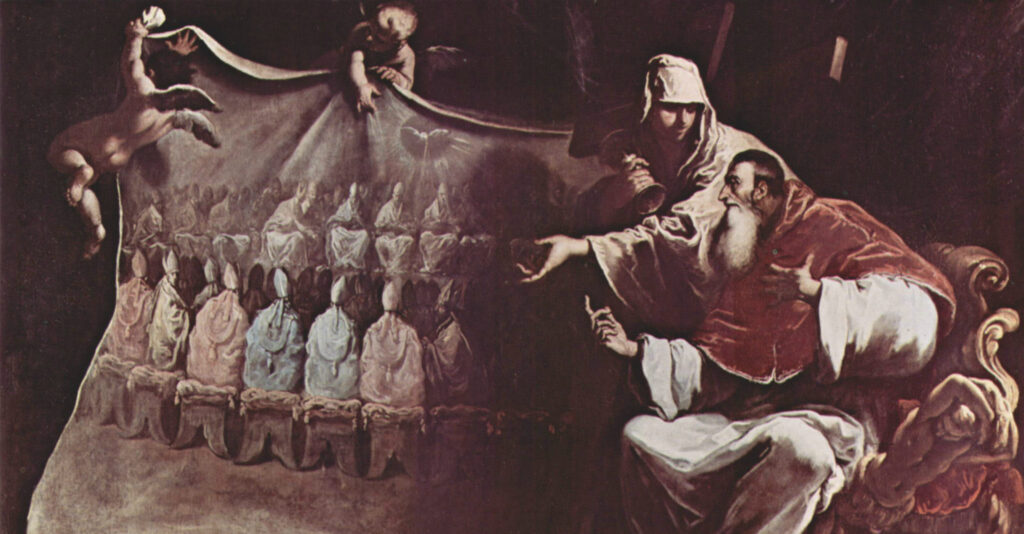
(Musée civil du Palais Farnèse, Rome.)
Les coupables, selon eux, seraient une élite culturelle urbaine ayant trop pris le goût de la liberté et des belles choses, considérée pêle-mêle comme des crypto-luthériens et autres partisans de la Réforme, capables d’entraîner dans leur sillage toute la population.
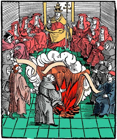
Il faut donc réagir, et vite, en particulier au niveau de l’art et de la culture. Pour ce faire, le pape Paul III convoque des cardinaux pour discuter des fondements du dogme catholique et répondre à la menace protestante. S’ensuivent vingt-cinq sessions qui se tiennent à Trente et à Bologne, durant lesquelles les cardinaux passent en revue les différents dogmes dénoncés par la Réforme. Ce cycle est connu sous le nom de Concile de Trente (1545-1563).
En premier lieu, rejetant les demandes explicites d’Erasme et du Cénacle de Meaux (Lefèvre d’Etaples, Briçonnet, etc.), les Pères du Concile de Trente réaffirment l’usage exclusif du latin aussi bien pour la Bible et la messe que pour la musique.
Selon quels arguments a-t-on imposé le latin au détriment des langues vernaculaires ? Tout d’abord, le latin était considéré comme la langue spirituelle. De plus, on craignait que les traductions engendrent des erreurs d’interprétation des textes, pouvant dans certains cas conduire à l’affirmation d’idées hérétiques. En affirmant la préséance du latin, les autorités religieuses font aussi passer le message suivant : la Bible est l’affaire des théologiens avant d’être celle du peuple. Toutefois, pour faciliter la compréhension des fidèles, le Concile acceptera l’ajout de commentaires en langue vernaculaire durant la messe.
Logos contre Melos
Au niveau pictural, le Concile met les peintres sous tutelle. Leurs œuvres, sans ambiguïté, doivent instruire le peuple par un art didactique illustrant la vie de Marie, celle des Saints, et les Évangiles.
« Le saint concile statue qu’il n’est permis à personne, dans aucun lieu ni église, même exempte, de placer ou faire placer une image inhabituelle, à moins que celle-ci n’ait été approuvée par l’évêque. »2
Les œuvres de Quinten Matsys ou Pieter Bruegel l’ancien n’étaient donc plus les bienvenues dans les églises catholiques. Par contre, Pierre-Paul Rubens, champion du baroque, y était chaudement accueilli.
Sur la plan musical, certains cardinaux partent de la distinction entre le logos (le verbe) et le melos (la mélodie), le premier ne s’adressant qu’à l’esprit, le second, selon eux, qu’aux sens. Ils en concluent en toute logique que le melos utilisé seul, sans être associé au logos, ne procure qu’un plaisir vil et ne permet pas l’élévation de l’âme. CQFD.
Du coup, toute musique qui ne serait pas le vecteur d’un texte religieux est qualifiée de musica troppo molle qu’il faut évidemment bannir. Le melos, grâce à des paroles prononcées, doit donc se joindre au logos pour être vertueux. La musique ne doit en aucun cas nuire à l’intelligibilité du texte. Pour cela, les Pères du Concile suggèrent une prononciation plus articulée des paroles. Toute polyphonie devient d’emblée suspecte car elle peut entraver l’intelligibilité des paroles et conduire l’auditeur à se concentrer davantage sur la musique en soi que sur le texte.
Qu’il existe, comme J.S. Bach et tant d’autres l’ont démontré par la suite, des « idées musicales » capables de transmettre, rien qu’avec des notes (sans paroles), les plus hautes conceptions glorifiant le Créateur et sa Création, ne semble pas leur avoir effleuré l’esprit.
Ainsi, « l’imitation »3 et toute autre technique contrapuntique occasionnant une déclamation différée du texte dans les différentes voix de la polyphonie offusquent fortement les Pères du Concile.
En fin de compte, cette menace de bannir la polyphonie ne déboucha pas sur un interdit, en particulier grâce aux interventions de cardinaux espagnols présents aux différentes sessions du Concile, qui encouragèrent les autres Pères à ne pas appliquer ce décret.
Cependant, intimidés, les compositeurs s’imposeront l’autocensure. Le cas le plus frappant est celui du compositeur italien Giovanni Pierluigi da Palestrina (1525-1594). En composant sa fameuse Missa Papae Marcelli (1562-1563), il s’efforce de démontrer que la polyphonie est tout à fait compatible avec la compréhension du texte… Mais dans cette œuvre, le compositeur favorise une déclamation syllabique du texte en revenant à une musique collective à une voix, chantée à l’unisson comme le grégorien d’avant la Renaissance. Afin d’éviter la monotonie, Palestrina substitue à l’imitation une autre technique de composition en faisant alterner différents groupes de voix. Les six voix de la polyphonie chantent rarement en même temps, ce qui permet d’éviter les dissonances et les frottements suspects. Une grande partie de la pièce n’est chantée au maximum que par quatre d’entre elles, l’ensemble des six voix étant réservé aux passages textuels particulièrement importants qui sont ainsi mis en valeur.
Palestrina renonce donc à l’essentiel en abandonnant « l’imitation », ce procédé de composition utilisé dans le canon, où un motif du morceau de musique se répète successivement plus ou moins littéralement dans différentes voix.
Plusieurs pays et villes acceptèrent les décrets du Concile de Trente, tels que l’Espagne, Rome, ou la totalité des Églises catholiques des îles britanniques. En revanche, la France refusa catégoriquement d’en appliquer les règles. De plus, les compositeurs accueillirent ces décrets de manière très variée. L’école milanaise, notamment, s’y conforma, les musiciens de l’école vénitienne beaucoup moins.
La triste ironie de l’histoire est que si le Concile de Trente ne parvint pas à imposer l’abandon de la polyphonie, en revanche, certains réformateurs, notamment Calvin à Genève, enfermés eux aussi dans un littéralisme absurde, choisirent de revenir à la monodie pour garantir une compréhension optimale du texte.
Comme le précise la musicologue Annie Sulzer :
« L’usage des instruments fut également discuté lors du Concile de Trente. De nouveau, le choix des autorités catholiques s’inscrit à l’opposé de ce que firent les Réformateurs : alors que les orgues furent détruites à Genève, par exemple, l’Eglise catholique quant à elle ne renonça pas à l’usage de cet instrument. En revanche, la longueur des pièces jouées à l’orgue fut considérablement diminuée. »
En cherchant à imposer la parole (la leur), ils ont failli arrêter la musique.
- Descrittione di M. Lodouico Guicciardini patritio fiorentino, di tutti i Paesi Bassi, Anvers, 1567 ; Amsterdam, 1624, pour cette traduction française; ↩︎
- Concile de Trente : Décret sur l’invocation, la vénération et les reliques des saints et sur les saintes images, XXVe session, 3-4 décembre 1563. ↩︎
- Une forme majeure de contrepoint consiste à imiter une partie dans une autre. C’est ce qui se passe dans le canon, où la même mélodie se reproduit dans les différentes voix avec un décalage plus ou moins important. Cette imitation de la mélodie peut être réalisée avec les mêmes notes ou à l’octave supérieur ou inférieur, ou même à un intervalle différent. Cet art de l’imitation a été poussé à l’extrême par Guillaume Dufay et surtout par Jean Ockeghem puisqu’on trouve jusqu’à 36 voix dans un de ses motets. C’est, à ce niveau, un exercice de style théorique qui n’a pas un grand intérêt musical puisqu’à partir d’un certain nombre de voix, celles-ci se neutralisent et ne sont plus perçues par l’auditeur. Cet art sera ensuite développé par Josquin des Prés d’une manière plus élaborée et surtout plus esthétique. ↩︎
ARTKAREL AUDIO COMMENT : Leonardo’s splendid copy of his Last Supper in Tongerlo, Belgium


To listen to the audio from the pdf you can click on this link :
https://artkarel.com/artkarel-audio-guide-leonardos-splendid-copy-of-his-last-supper-in-tongerloo-belgium/
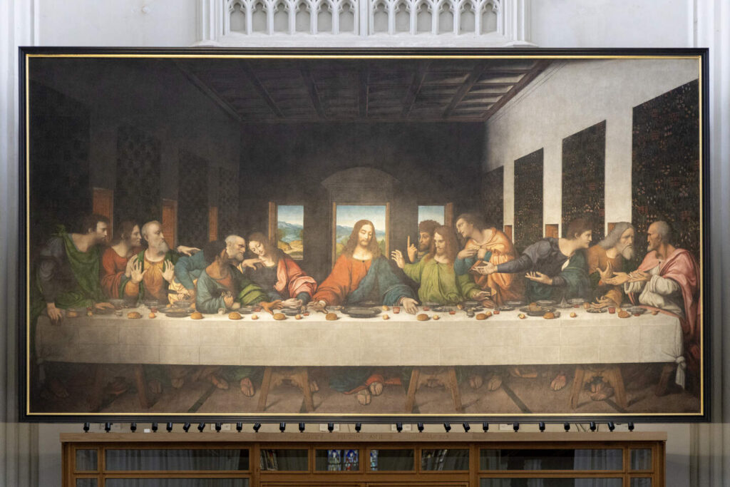
Leonardo’s Last Supper,
the splendor of the copy of Tongerlo
by Karel Vereycken
In 1495, Leonardo da Vinci, tasked by Ludovico Sforza, the duke of Milan, started painting his fresco The Last Supper, in the refectory of the Dominican Cloister of Milan. It took him three years. Taking a huge risk, the master tested an experimental technique by using an oily tempera paint on a dry chalk wall, rather than using the traditional fresco technique.
While Leonardo’s composition is fantastic, his technical experiment failed. Rapidly the paint started to flake off from a wet wall, with the image increasingly fading away. Today, before restoration, only 20 % of the original paint has survived.
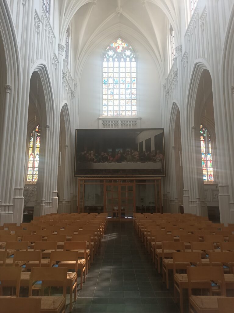
The Italian restorer, the now deceased professor Madame Penin Brambilla, who spent 20 years restoring the original in Milan, stated that “If you want to taste the full splendor of the Last Supper, you have to see the life size copy painted before 1508 by Leonardo himself and a team of pupils, hanging in the Church of the Norbertine Abbey of Tongerlo, Belgium.”
That is where I stand right now. Since people are praying, I taped this audio in the adjacent building, where visitors can see an excellent documentary about the history of this copy.
I have discussed the content of this painting in an article many years ago and for reasons of time, I will not list here the series of dramatic accidents (fires, accidents, thefts) that mark the history of this copy once it was finished.
I will only will try to answer one question : who made this copy ?
Recent research has discovered crucial historical documents. The first indicates that the French King Louis XII, once his army took Milan, fell in love with Leonardo’s fresco. Consequently, he asked his engineers to take the entire wall and ship it to France ! Once the kings engineers showed him this was impossible, the only remaining option was to ask Leonardo to make a copy on canvas.
In fact, as soon as Leonardo finished his fresco, copies were made of it. Making copies of your own artistic production was not unusual at that time since by far the best way to get visibility for your works, especially before the printing industry flourished. Hence, Leonardo made or had copies made of several of his own works, including the Mona Lisa, the Virgin on the Rocks and Saint Anne and the Virgin.
About the copies of the Last Supper, the following:
–One was made by Marco d’Oggiono (1470-1549), one of Leonardo’s pupils. It is a lot smaller and hangs in the Musée de la Renaissance in Ecouen in France.
–Another one was made by another pupil, Giampietrino. It hangs today in the Royal Academy of the Arts in London which acquired it in the 19th century.
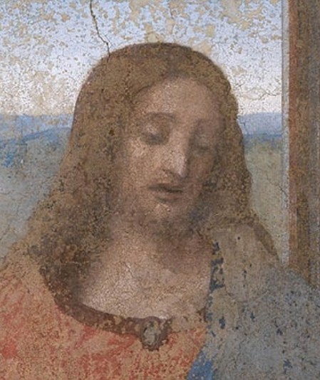
–But the copy bought in Antwerp in 1545 by the Abbey of Tongerlo is considered the most exact and most delicious. It’s origin is known, since it is mentioned in the inventory of the castle of Gaillon, which was property of cardinal Georges d’Amboise, archbishop of Rouen and minister of king Louis XII.
Technical features indicate that the copy (on hemp and not on linen) was made in Italy before 1508 by three pupils working under Leonardo’s direct, active personal leadership: Andrea Solario (1465-1524), Giampietrino (1495-1549) and Marco d’Oggiono. Each would have painted a particular group of apostles. For example, Gianpietrino would have painted five of them starting from the left.
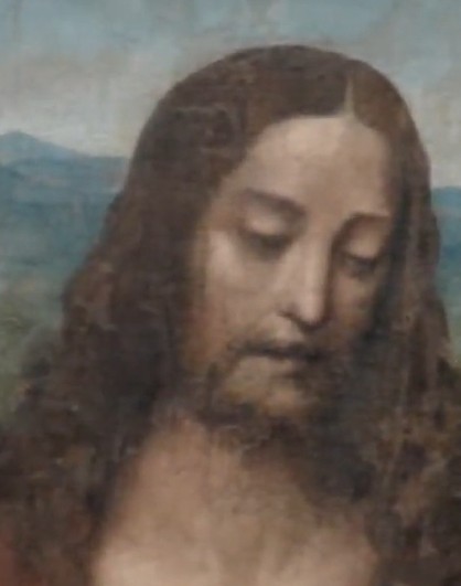
The American professor Jean-Paul Isbouts, who examined the work with the most advanced state of the art technology, noted that while under-drawings exists for nearly the entire painting, they lack for the head of Christ and that of John the apostle, whose face is very feminine and reminds viewers of Leonardo’s “Virgin on the Rocks.” (Louvre, Paris).
With still other investigative techniques, the Russian Professor Vadim Parfenov of the University of Saint Petersburg, came to the conclusion that those faces (Christ and Saint John) were painted by a left-handed artist, most likely Leonardo who we know was left-handed.
All this new research blew my mind, since I thought it was a late copy and didn’t suspect to see Leonardo at work in producing copies himself of his own works.
Reflect for a second. Imagine Leonardo’s Milan fresco of his Last Supper totally disappearing by the failure of his technical experiment, a highly predictable outcome in that time. Humanity would have lost the entire achievement. Only a good copy, such as that of Tongerlo, would have preserved Leonardo’s genius for the next generations, and in a sense, it did. For example, the landscape in the background, only survives visually thanks to the Tongerloo copy !
So if you are a brilliant painter, feel free to produce handmade copies or have your pupils make them! It is a joy for all of us and hopefully for a long time!
The Cenacle of Meaux and Christian Humanism in the Renaissance

“Everything that happens daily in this country stems from a government that calls itself ‘Christian.’ For weeks, not only Jews but also thousands of faithful Catholics in Germany—and I think throughout the world—have been waiting and hoping that the Church of Christ [the Roman Catholic Church] will raise its voice to put an end to this abuse of Christ’s name. Is not this idolatry of race and state power, hammered into the masses daily by radio, a blatant heresy? Is not all of this in total contradiction with the attitude of our Lord and Savior, who, even on the cross, prayed for those who persecuted him?” 1
This quote is similar in many ways to what many Christians feel today in the face of the abuse of « religion » to justify rapacious and bloody wars presented as « just wars, » especially by prominent members of the Trump Administration, notably its Secretary of War, Pete Hegseth.
History tragically repeats itself, for this quote is not new. It comes from a letter sent to the Pope in 1933 by Edith Stein, a philosopher of Jewish origin who became a Carmelite nun, when German Catholics, a minority in this Protestant country, signed a Concordat with Hitler. The common enemy to be fought was now Bolshevism. In exchange for their silence in the face of Nazi barbarity, Hitler offered them his gracious protection.
In France, at the same time, big business, Europeanists before their time, were proclaiming: « Better Hitler than the Popular Front! »
Our good fortune today is to have a pope who raises his voice for peace and justice for all. And one can hope that his voice can give everyone the courage to stop the mad march towards war.
On Palm Sunday, Leo XIV forcefully reiterated that no one can justify war in the name of the Lord:
God « does not listen to the prayers of those who wage war. » « On the contrary, he who has turned his back on the living God, making himself and his own power a mute, blind, and deaf idol, is enslaved to death. »
In addition to the thirst for power, there is also the thirst for money, which was denounced during his trip to the Principality of Monaco.
During his first year as Pope, he repeatedly called for a reconciliation that was « disarmed and disarming. » To the « warlords » who make their power « a mute, blind, and deaf idol, » he contrasted listening to a « melody greater than ourselves » —a harmony to which we can dance when the world seems to forget even « the light. »
The arrival of Pope Leo XIV in France
In a statement published on May 6, the president of the Conference of Bishops of France confirmed what many had been hoping for for a year: although it remains to be confirmed, Leo XIV could come to France at the end of September 2026, stopping in Paris and Lourdes.
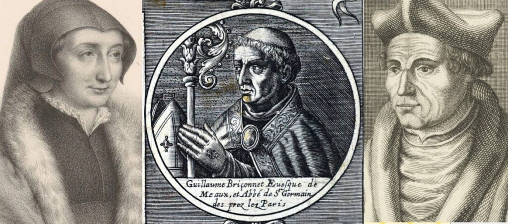
This is an opportunity for us to evoke one of the most luminous upsurges of our country, which reached its peak in 1521, with the creation of the Cenacle of Meaux by the philosopher-theologian Jacques Lefèvre d’Etaples (1450-1537) , at the request of his student Bishop Guillaume Briçonnet (1472-1534) .
It was not a philosophical or prayer circle. Its primary purpose was to read, study, translate, and print the Gospel in French and to train clergymen in preaching. The approach was so simple, honest, and innovative that it deeply disturbed the established political and religious powers. The Cenacle was closed after only four years, its leaders were persecuted, and forced into exile. It was only thanks to the protection of Marguerite of Navarre (1492–1549) (also known as Marguerite of Angoulême or Marguerite of Valois-Angoulême), sister of king Francis I, who embraced this movement, that its leading figures were able to escape the flames of the stake.
Renaissance Evangelicalism
For Guillaume d’Alonge, Jacques Lefèvre d’Etaples is
« The intellectual leader and founder of French evangelicalism, a reform movement that developed in the early decades of the 16th century, in parallel with the Protestant Reformation, with which it had important points of contact. » 2
What some call « Renaissance evangelicalism » (not to be confused with American messianic evangelicalism, a current that animates today’s warmongers) corresponds to a movement of ideas characterized by the valorization of biblical exegesis.
Unlike evangelicalism in the most common sense of the term, it does not necessarily relate to the Protestant Reformation. On the contrary, many humanists who did not wish to break with the papacy but nevertheless declared themselves hostile to ecclesiastical abuses, such as Erasmus of Rotterdam and François Rabelais, were driven by a desire for reform without schism.
While Catholics sought to eradicate them by ignoring them, Protestants have always claimed that they were one of their own.
Like Erasmus, Jacques Lefèvre d’Étaples was certainly a reformer, but he never considered breaking with the Roman Catholic Church, as demanded by Luther, Calvin, and other figures of the Protestant Reformation. The Christian humanists of the Renaissance believed, perhaps naively, that by appealing to reason, the Roman Curia would eventually yield to their demands and agree to eradicate the corruption and abuses that severely plagued the institution.
Humanism
It was in Italy, with Petrarch (1304-1374) , that humanism was born. The poet began by collecting inscriptions on the old stones of Rome and continued his quest for the Ancients in manuscripts.
With his friend Boccaccio , he brought Byzantine scholars to Italy to revive the study of Greek and Latin. While the term humanist then referred to someone who, through the study of Greek and Latin , « cultivated the humanities » ( studia humanitatis ), Renaissance humanist thinkers did not renounce their Christian faith but rather sought to reconcile the two.
A very clear break with scholastic pessimism then took place. Conceiving of himself as « created in the living image of the Creator, » the Renaissance man, uomo universale, endowed with reason and free will, no longer blamed the devil. It was he who had to strive to overcome his evil inclinations. And if he fully developed his creative potential, it was above all to please the Creator by placing his life at the service of the public good rather than his personal glory.
In Northern Europe, the movement of the Brethren and Sisters of the Common Life and that of the Beguines stemmed from the conviction that the contemplative life and the active life should complement each other and not oppose each other. Each person should live « in imitation of Christ. » It was in Deventer, among the Brethren of the Common Life , that Erasmus, inspired by teachers like Rudolph Agricola , discovered Christian humanism and the « good literature . «
Greek and the Greeks
While the study of Greek penetrated Italy and the Netherlands from the beginning of the 15th century, in France, young elites jostled to attend, from 1476 onwards, the courses of a Greek exile, Georges Hermonyme of Sparta, a poor pedagogue, rapacious and with little mastery of his own language.
But, as Jacqueline de Romilly points out:
“Hermonymus had only one merit: that of being the first. The fact is that he had as students, (…) or simply through his advice, all those who were to become the glory of nascent humanism: Reuchlin was his student, Lefèvre d’Étaples said he benefited from his advice, Erasmus asked him for lessons, as did Beatus Rhenanus – and above all our patron saint, Guillaume Budé.” 4
Two other Greeks played a major role in the revival of Hellenic studies.
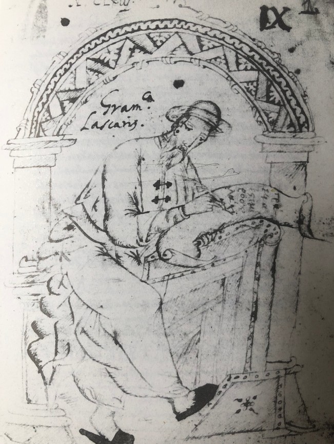
And first of all , Constantin Lascaris (1434-1501). A student of Jean Argyropoulos between 1444 and 1553, he arrived in the West around 1460, after being taken prisoner during the Turkish occupation of Constantinople in 1453.
After a few short stays between the Greek islands, he became tutor to Francesco Sforza’s daughter in Milan, where he began writing his grammar, the Erotemata .
An essential tool for learning Greek, the work was first printed in Milan, then published twice by Aldus Manutius in Venice.
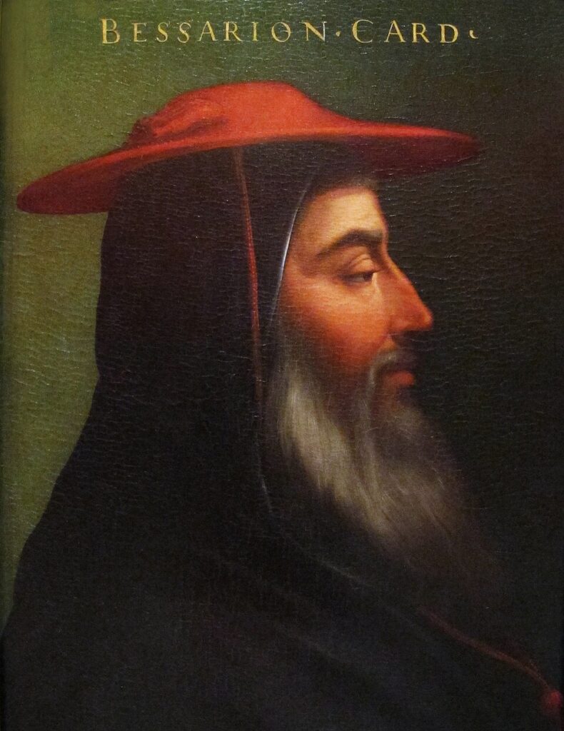
Constantin Lascaris then went to Rome where he met the greatest protector of Greek scholars in the West and of Byzantine humanism within the clergy, Cardinal Jean Bessarion (1403-1472), Latin Patriarch of Constantinople from 1463.
Bessarion was a friend of Cardinal Nicholas of Cusa (1401-1464), with whom he collaborated in particular during the Ecumenical Council of Ferrara/Florence, convened to end the schism between the Eastern and Western Churches.
Jean Lascaris
The other Greek scholar (unrelated to the first) is Jean (Janus) Lascaris (1445-1535) , also a protégé of Cardinal Jean Bessarion who entrusted him with numerous missions, notably bringing back precious manuscripts from Mount Athos in 1492.
Although born in Asia Minor and frequenting the great figures of Italy, Lascaris entered the service of France as Louis XII ‘s ambassador to Venice between 1503 and 1508. There he joined the academy of the printer Alde Manutius (1449-1515) where scholars from the East and West met to discuss and edit the classics.
When Erasmus went to Venice to the printer Alde Manutius to publish his Adages, a masterful work aimed at popularizing all ancient wisdom, Lascaris not only offered to welcome him into his home, but also contributed to the work himself.
Erasmus, writes the Belgian historian Yvonne Charlier, feverishly composed his Adages there.
« with the help of a host of distinguished scholars, including Jean-Baptiste Egnazio, a member of the Aldine Academy, and Jean Lascaris, a Greek refugee, passionate about manuscripts and ambassador of Louis XII to Venice. »
He also worked with Lascaris, the young French student Germain de Brie.
A few years later, when Erasmus and Thomas More published Utopia in 1516, a fictional account of a people (the Utopians) who attempt to create an ideal society based on the principles defined by Plato in his Republic, they argue that they must be of Greek origin, since Lascaris « was their only grammarian ».
It was in Venice that Jean Lascaris and Erasmus together conceived the idea of a College of Languages. Being able to compare the translations of the Gospel into Hebrew and Greek was the essential condition for achieving a proper understanding of its content.
Lascaris ended his life in Rome with Pope Leo X , who in 1514 commissioned him to found the « Greek College of the Quirinal. » Erasmus, against all odds, and especially against the theologians of the Brabant university town of Leuven, opened the Trilingual College there in 1517.
Lascaris also took care of the Royal Library, which was established in Blois in 1501 by Louis XII, then moved to Fontainebleau with Guillaume Budé under Francis I.
Subsequently, at Budé’s insistence, François I created in 1530, under royal patronage, the « Collège des Lecteurs royaux, » allowing the study of Greek and all subjects rejected by the Sorbonne.
Lascaris’s close relationship with Lefèvre d’Étaples may have led to the writing that the work of the great French scholars, Budé, Scaliger, Casaubon, Lambin, Cujas, Estienne, appeared
« To be a continuation of the schools of Byzantium and Alexandria, rather than an emanation of currents coming from Italy. » 5
Hidden from Europeans for centuries, this immense heritage – one could say a vast civilization that was being rediscovered – thus made its way to the kingdom of France thanks to men such as Lascaris, whose disciples like Lefèvre took over.
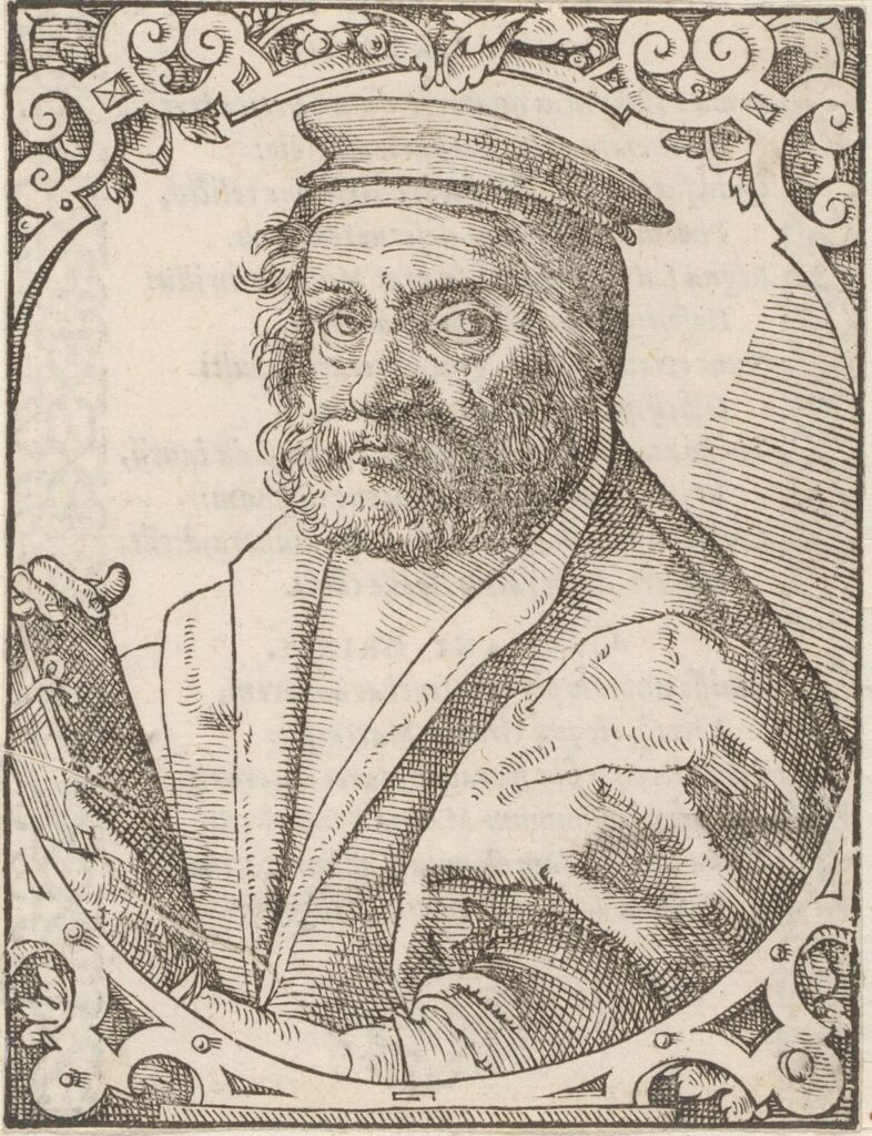
Jacques Lefèvre d’Etaples
Philosopher, mathematician, musicologist and theologian, Jacques Lefèvre was born around 1450 in Étaples, Picardy, and died in 1536 in Nérac (Lot-et-Garonne). He Latinized his name to Jacobus Faber Stupulensis, hence the nickname « Fabritists » given to those who adhere to his doctrine.
He studied in Paris, where he earned a bachelor’s degree and a master’s degree in arts. He then entered the clergy and became a priest, though it is unknown whether he actually served in this capacity. Gentle and timid by nature, of delicate constitution, and possessing a selflessness that led him to bequeath his inheritance to his brothers and nephews in order to devote himself more freely to his studies, Jacques Lefèvre primarily studied literature and philosophy.
After completing his studies and teaching literature for a time, he developed a taste for travel. He explored parts of Europe, and it is even said that his desire to broaden his knowledge led him to Asia and Africa. Drawn by the winds of renewal that the Renaissance was sweeping across Europe, Lefèvre traveled to Italy at least twice, spending extended periods in Pavia, Padua, Venice, Rome, and Florence.
With his translation of Plato and Aristotle, Leonardo Bruni (1370-1444) provided Italy, and with it the scholarly world, with a philosophical framework. Italian humanism sided with Plato.
Aristotle was attacked for « his metaphysics which puts the particular before the general, his theology which substitutes an inactive god for Plato’s creator God, his psychology which does not dare to resolutely affirm the immortality of the soul, his morality which locates virtue not in goodness, but in the golden mean between good and evil. » 6
In 1492, Lefèvre met and discussed with Florentine Platonists and Neo-Platonists, grouped around Marsilio Ficino, his student Giovanni Pico della Mirandola, Poliziano and Ermolao Barbaro.
Starting with Hermes Trismegistus, Plotinus, Iamblichus, and Cicero, this school of thought emphasized the supposed complementarity between Plato and Aristotle rather than their opposition, hoping to reconcile the doctrines of the two philosophers. Positioning himself above both camps, Giovanni Pico della Mirandola was preparing a major work, which death prevented him from completing: the Concordia Platonis et Aristoteles , which aimed to reduce all philosophies and religions to a single wisdom, naturally under the tutelage of the Vatican. Florentine Neoplatonism then exerted a significant influence on an entire generation of prelates and clergymen.
Later, in 1509, under the warrior Pope Julius II, his Neoplatonists advisors dictated to Raphael the content of the frescoes in the Stanza della Segnatura, where Pico della Mirandola features prominently. In his treatise The Ciceronians, Erasmus denounced these Neoplatonists who, instead of Christianizing Plato, used ancient philosophy to reduce Christianity to pagan barbarity.
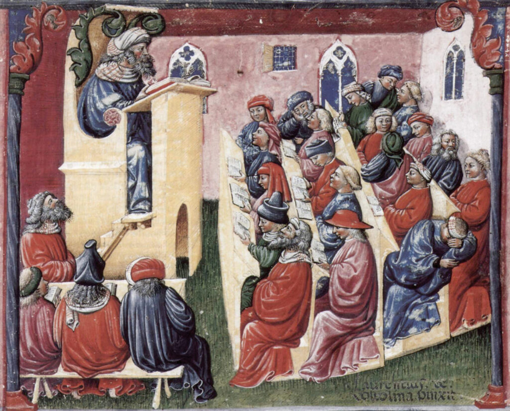
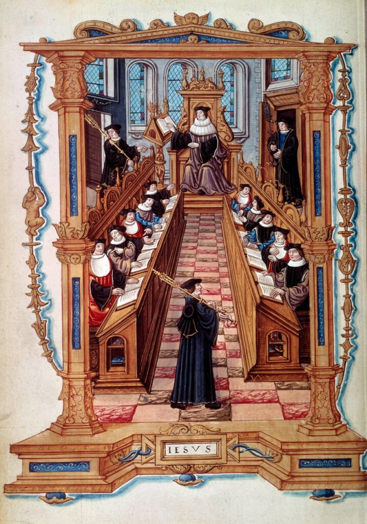
Returning to Paris in 1495, Lefèvre became a professor at the Cardinal Lemoine college where he taught, until 1507, according to the fashion of the time, philosophy, geometry, arithmetic, grammar, geography, cosmography and music.
His first works were commentaries on Aristotle, a Greek philosopher who was often quoted but rarely read. Somewhat surprisingly, it was only after his encounter with the Florentine Neoplatonists that he decided to publish Aristotle’s writings, in the versions of the Quattrocento humanists, accompanied by commentaries aimed at restoring the philosopher’s sound understanding . Ambitious, Lefèvre conceived his Aristotelian corpus as a reaction against scholastic teaching, against which he had no words harsh enough in his prefaces.
Using the partial or incomplete translations provided by Boethius and Bessarion, he attempts to rid them of what François Rabelais called « the so filthy glosses. » At the time, he still hoped to reconcile Aristotle’s thought with the message of the Gospel.
But Lefèvre did not forget Plato . In 1499, he published the works of Pseudo-Dionysius the Areopagite, a 6th-century Neoplatonist thinker who was mistakenly considered one of Christ’s disciples. He then turned his attention to John of Damascus, Nicholas of Cusa, and the Spanish mystic Raymond Lull : authors who nourished the spiritual reflection of French Christians throughout the century. Lefèvre, the mathematician, found himself aligned with the approach of Nicholas of Cusa, for whom, as for Pythagoras, mathematics was simply the science of divine proportions.
Paradoxically, it was after reading Pseudo-Dionysius that he rejected what he had once adored, and his subsequent commentaries reveal a profound distrust of Platonism. In 1506, following his Politics, he published a summary of the Republic and the Laws , entitled Hecatonomies , the margins of which are frequently annotated with « stultitia » (foolishness) or « semistultitia » (half-foolishness). In this treatise, he grouped together the Platonic principles he approved of and those he condemned.
Briçonnet
At one point, Jacques Lefèvre d’Etaples got the attention of the powerful Briçonnet family.
It was a true dynasty of diplomats, builders and great servants of the Kingdom.
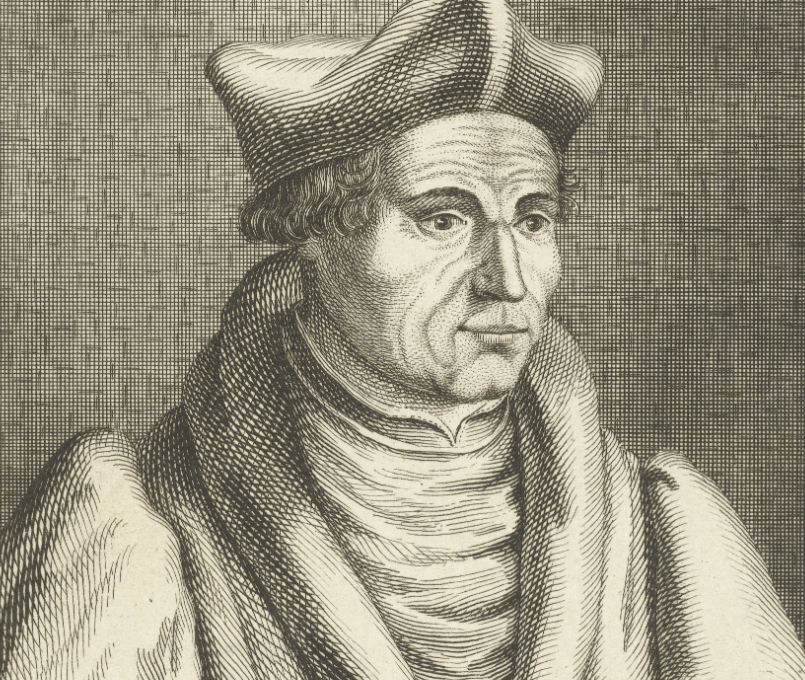
Guillaume Briçonnet (1445-1514) was a French royal officer and later a clergyman, known as the Cardinal of Saint-Malo. Initially a financier, he served as the general of finances for Languedoc under Louis XI.
After his wife’s death, he entered the clergy. Recommended by Louis XI to his successor, he was appointed Secretary of the Treasury. He served as Minister of State under Charles VIII and was created a cardinal by the Pope in 1495. On May 27, 1498, he crowned Louis XII in Reims.
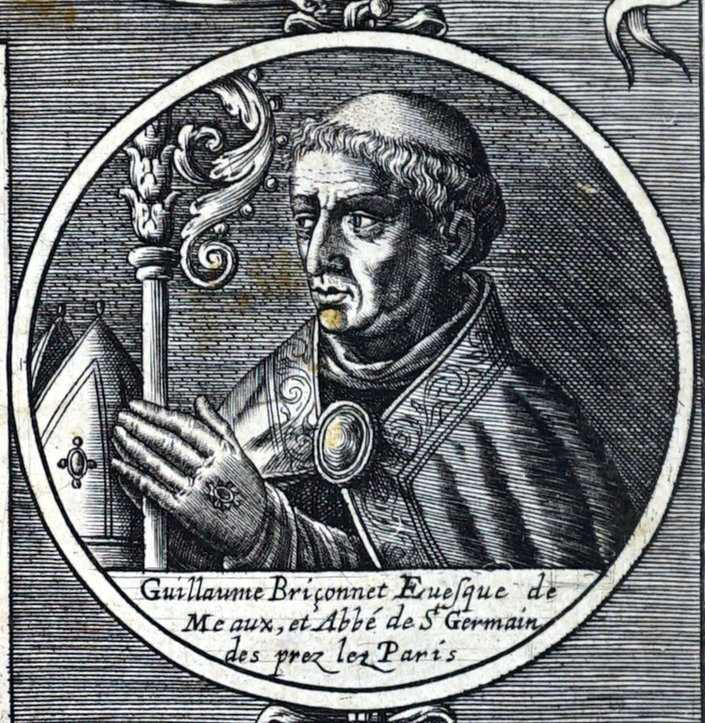
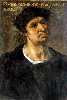
Guillaume Briçonnet (the elder) had a son of the same name, born in 1470. In 1489, while a student in Paris at the Collège de Navarre (he was only 19 years old at the time), Guillaume Briçonnet (the younger) was appointed Bishop of Lodève in Southern France. He also became Abbot of Saint-Guilhem-le-Désert in 1493, a monastry built by one of the lieutenants of Charlemagne. .
He continued to reside in Paris for a time to complete his education, under the tutelage of flemish theologian Josse Clichtove, through whom he met Lefèvre d’Étaples and his circle. In 1495, succeeding his uncle Robert, Archbishop of Reims, Guillaume Briçonnet became one of the two presidents of the Chamber of Accounts in Paris, a position he held until 1507. Having been made a canon of the Church of Paris in 1503, he had a magnificent residence built for himself in the cloister of Notre-Dame.
Appointed abbot of Saint-Germain-des-Prés in 1507, he summoned Lefebvre to his side to promote a reform of the monks’ morals. For Lefebvre, this was a moment of truth. What becomes strikingly clear is that he never practiced philosophy to distance himself from religion; on the contrary, his quest for truth was merely a step in his journey toward God. Prudent in examining the doctrines of others, he avoided taking sides while pursuing his own reflections. Far more than from Aristotle or Plato, it was from the Gospels that Lefebvre drew his inspiration. For him, the study of Holy Scripture was to be the culmination of his work, its natural endpoint.
“In the distance,” he wrote, “such a brilliant light struck my eyes that human doctrines seemed like darkness compared to divine studies, while the latter appeared to exhale a fragrance whose sweetness is unmatched on Earth.” 8
Lefèvre wanted to draw closer to the light he saw in the distance. It could be said that he was going through a « mystical crisis. » The list of « mystical » authors whose works Lefèvre published is long. From the one he considered the most ancient of all, Dionysius the Areopagite, it extends to the most recent, Nicholas of Cusa, passing through Heraclitus, Hermes Trismegistus, John Damascene, Raymond Lull, Richard of Saint Victor, and Ruysbroeck the Admirable .
In 1509, Lefèvre published a Psalter in five languages. The choice to focus first on the Psalter was primarily pastoral in nature: he wanted to offer monks an effective tool to fully understand the content of their prayers, but also to emphasize the centrality of the direct relationship between the faithful and God.
In 1511, while passing through Paris, Erasmus met Lefèvre. Although they may have criticized each other, they deeply respected one another and shared a common commitment throughout their lives.
Lefèvre continued his offensive by publishing the Epistles of Paul (1512), which we know constituted one of the battlegrounds for the Reformation in general and for Luther in particular (« faith and works » or « faith alone » as the path to salvation).
One important point clearly aligns Lefèvre with Erasmus and distinctly separates him from Luther: his interpretation of free will. For the Picard theologian, despite the state of misery and powerlessness into which original sin has plunged humanity, we retain the capacity, however diminished, to receive the gift of grace, to open ourselves to salvation, to reject evil, and to choose good. From this stems a more optimistic and serene vision of the salvation process, truly open and accessible to all, in contrast to the somber and anguished interpretation of salvation that the Reformers reserved for a select few.
Lefèvre, publisher of Nicholas of Cusa
in the 1514 edition by Jacques Lefèvre d’Etaples at Josse Bade in Paris.
Lefèvre shared his « mystical » passion with the Briçonnet family, and later with Marguerite de Navarre.
And when, in 1514, Lefèvre had the complete works of Nicholas of Cusa printed in Paris, until then only published twice in Germany, he addressed his dedicatory epistle to William’s brother, Denys Briçonnet, bishop of Toulon.
According to Noëlle Balley ,
« The most remarkable example of this cooperation between scholars is the edition of the works of Nicholas of Cusa, directed by Lefèvre, for which he had manuscripts searched for and copied by all his correspondents, thus creating a truly international collective edition. » 9
His printer was Josse Bade, a passionate Fleming from Ghent, trained by printers in Lyon. Not always rigorous, he published many humanists, including Sebastian Brant (The Ship of Fools), Erasmus (In Praise of Folly), Guillaume Budé, etc.
His son-in-law was the humanist and scholarly printer Robert Estienne (1503-1559), son of the great printer Henri Estienne (1460-1520) (the elder). Francis I appointed him, before 1539, royal printer for Hebrew and Latin, as well as for Greek from 1544.
Cenacle of Meaux
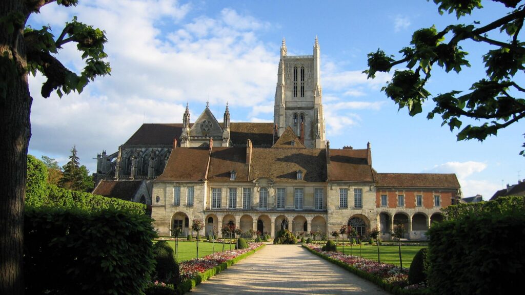
From 1518 onwards, Lefèvre’s patron, Guillaume Briçonnet, decided to take up residence in his new diocese, Meaux, 41 km from Paris. There he intended to implement a pastoral reform inspired by the theological approach outlined by the Picard humanist. At the heart of this project lay the desire, shared by humanists, to bring the essential message of the Gospel to all people, even the simplest and least educated, and thus facilitate access to the mysteries of faith, with the conviction that the intervention of the Holy Spirit could inspire the minds and hearts of the faithful.
A friend and disciple of Lefèvre, Guillaume Briçonnet resolved to promote his moral ideas in his diocese. And, unusually for that time, he abandoned court life to live there.
At Briçonnet’s request, Lefèvre then founded in 1521 the Cenacle of Meaux, a center for reflection and reform of the Church of Meaux. The aim was to return to the sources of Christianity, to the original teachings of Christ, by spreading the New Testament in French: the Gospel texts were « de-Latinized. »

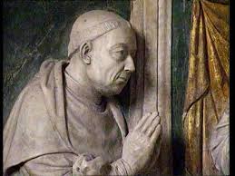
Oil on canvas, attributed to Jean Clouet.
Appointed in 1520 as vicar to Guillaume Briçonnet, who had become Bishop of Meaux, Lefèvre settled in that city. In 1521, Briçonnet became the spiritual director of the sister of the King of France, Marguerite de Navarre, who was committed to the cause.
That same year, Briçonnet and Lefèvre attracted several theologians and preachers to their circle, including the future Reformed philosopher Guillaume Farel, the tireless Gérard Roussel , the Flemish theologian Josse Clichtove, the Hebraist François Vatable, the eloquent Martial Mazurier, the intrepid Michel d’Arande, the renowned preacher Pierre Caroli , and Jean Lecomte de Lacroix.
Then others joined, expanding their circle: Pierre de Sébiville, Aimé Mégret , the Franciscan friar and friend of Rabelais, Pierre Amy, and Jacques Groslot , bailiff of Orléans. Their simple motto was also that of Marguerite de Navarre:
« To know the Gospel, to follow the Gospel, and to make the Gospel known everywhere. »
Marguerite of Navarre was close to Leonardo da Vinci during the last three years of his life (1516-1519) at the Château du Clos Lucé in Amboise. Marguerite had lived there with her husband, Charles IV of Alençon, in 1509. Subsequently, she stayed there regularly with her mother, Louise of Savoy, and her brother, Francis I, in the immediate vicinity of Leonardo da Vinci.
She was an influential patron of the arts, while Leonardo was the king’s « first painter. » In 1546, Rabelais paid tribute to her by dedicating his Third Book to her.
A recent thesis by Jonathan Reid has shown that Marguerite was already at the heart of a vast network including more than two hundred members of the court, diplomats, prelates, and men of letters. Extending well beyond Paris and Meaux, this network also encompassed Alençon, Lyon, Grenoble, Bourges, Poitiers, and Mâcon.
Printers, including Augereau and Du Bois, but also Simon de Colines, who was operating clandestinely in Lyon, were among them. In total, according to Reid, 450 editions of 200 « evangelical » works were printed in France thanks to Marguerite’s protection. 10
On the ground
After visiting his entire diocese, Briçonnet observed that most priests did not reside in their parishes and that the assistant priests had little to no theological training. Furthermore, they lacked the time to teach their parishioners because they had to work, as all parish income went to the priests. The only educated preachers were the Franciscan friars (aka Cordeliers), who often limited themselves to promising hell to wicked Christians.
As early as 1518, Briçonnet undertook to combat moral depravity and the laxity of ecclesiastical discipline by thoroughly reforming his diocese. He simplified worship, abolished the veneration of images and relics, and encouraged preaching to revive the faith. He considered his diocese a mission field and divided it into 26 stations of nine parishes each. But, year after year, he observed the inadequacy of these measures: more than half of the priests were incapable of properly carrying out their assigned duties. He decided to expel the 53 most unfit priests and to train new ones. The Cordeliers were forbidden from preaching.

In Meaux, the Cenacle ran a printing press to publish, among others, the works of Lefèvre d’Étaples: Commentary on the four gospels (in Latin) in 1522, Old Testament (in French), Homilies, Epistles, Gospels, Acts of the Apostles (1523) and Psalms (1524).
The main instruments of religious renewal were greater attention to the selection and education of the priestly body, the restoration of the bishop’s authority over competing religious orders, the control of pulpits entrusted to preachers faithful to Christocentric doctrine and firmly convinced of the principle of justification by faith alone, on which Lefèvre had insisted for years in his writings, as well as the printing and distribution of numerous writings and works intended for clerics and laity: these were devotional texts focused mainly on mental prayer and on the invitation to simplify and purify traditional rituals, as well as Latin and especially French versions of the Holy Scriptures.
Stripped of unnecessary glosses, the texts were read aloud to small groups of people with some education. Prayers in simple language were printed for the common people, as well as popular works beginning in 1525.
The sermons, which changed (no more threats of hell, no more collections at the end), were successful. Neighboring Picardy, the Thiérache region, and the monastery of Livry-en-Aulnoy followed the Fabrist approach.
Meaux served as a laboratory for other dioceses in the kingdom, where bishops close to the evangelical network attempted to implement the model of pastoral renewal developed by Lefèvre and his followers. But if evangelicalism did indeed become an influential and respected movement during the reign of Francis I, it was thanks to the support of a segment of the court which, as we have mentioned, referred to Marguerite. The political, economic, and diplomatic support of the king’s sister and her network allowed the Fabrists to have direct access to the court and to influence the crown’s decisions regarding the policy of tolerance toward « heresy » and the appointment of bishops and abbots.
The reaction
The Cenacle of Meaux immediately attracted the wrath of the Cordeliers (whom it deprived of the proceeds of their collections) and the theologians of the Sorbonne.
In April 1521, Luther’s theses, initially well received and studied, were condemned by the University of Paris.
Clichtove defected (he wrote a work on the cult of saints, proclaiming that « the intelligence of laymen will never be able to understand the sublime meaning contained in the divine books » which even the most learned struggle to understand).
Although Lefèvre’s translation of the New Testament is based on the Vulgate text, he makes about sixty corrections based on the Greek originals. The doctors of Paris are particularly irritated by the « Exhortatory Epistle » that he places at the beginning of the second part, where he recommends that all the faithful read Holy Scripture in the vernacular, that is, in French.
Eleven proposals were submitted to the faculty. The courts ordered that Lefèvre d’Étaples’s French New Testament be burned. But the king, informed of this affair, which he saw as nothing more than harassment by the dean of the Sorbonne, Noël Béda, intervened, and Lefèvre, having defended himself before the prelates and doctors whom the court had appointed as judges, emerged from this attack with his honor intact.
In October 1523, under pressure, Briçonnet banned Luther’s books in his diocese, and in 1524, he dismissed Farel, whose sermons were too provocative, in order to continue his work of spreading the Gospel. At his own expense, he organized public readings of the Bible and distributed translations, which reached Normandy, Champagne, and the Loire Valley.
This first phase of expansion of the Fabrist movement ended around 1525, when, under the regency, the conservative party imposed a repressive policy towards Lutherans and Evangelicals, without distinction.
The hour of persecutions
In 1525, geopolitical upheavals changed the situation in France. First, the trap set by the Italian Wars closed on Francis I. On February 24, 1525, the king was taken prisoner at Pavia by the troops of Charles V.
Consequently, he was no longer in a position to protect the Bishop of Meaux. Furthermore, in May, a papal bull authorized a group composed of three theologians from the Sorbonne and a priest to hunt down heresy.
While Lefèvre was publishing the Epistles and Gospels for the 52 Sundays of the coming year , his enemies were more successful with a new attack, taking advantage of the unrest stirred up in the diocese of Meaux by indiscreet preachers and turbulent monks. A trial opened before the Sorbonne at the instigation of the Cordeliers, who accused him of allowing « heresy » to spread.
That same year, the Parliament of Paris brought a case against Briçonnet. As a conciliatory measure, he again authorized the Cordeliers to preach, asked his parish priests to restore the veneration of saints and the Virgin Mary, forbade preaching to the most extreme elements, and took the statues and images of saints under his personal protection. Jean Leclerc, a wool carder converted to the new ideas, was flogged for putting up posters hostile to the Pope.
After barely four years of existence, the Meaux circle was dissolved in 1525.
For several months, in order to avoid arrest and conviction, Lefèvre and his family were forced to leave the kingdom and take refuge in Strasbourg. There, he strengthened his ties with moderate Protestants such as Capiton and Butzer, and associated with Otto Brunfels, to whom he was linked by a Nicodemite attitude, recognizing the legitimacy of religious concealment in a context of persecution.
In 1526, with the return of Francis I, negotiated with Spain by Margaret of Navarre, and thanks to her protection, they were back in France and managed to maintain some influence for a few more years at court and throughout the rest of the kingdom, through intense activity in printing and disseminating written works, as well as through systematic preaching in the heart of the capital. The king granted Lefèvre the position of personal librarian at Blois and entrusted him with the education of his two children.
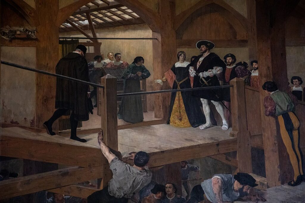
Guillaume Briçonnet, for his part, was acquitted. In 1528, he participated in the Synod of Paris that condemned Lutheranism. A year later, Francis I and Marguerite failed to save the life of preacher Louis de Berquin (1490-1529), a friend of Erasmus and also a translator of Lutheran treatises. He was burned alive in the Place de Grève in Paris.
Exile
In 1530, Lefèvre chose to leave the court to go to Nérac to be with his patroness, Marguerite de Navarre. He remained there until his death in 1536, preferring not to take sides in the disputes between Protestants and Catholics.
He cannot be accused of Protestantism, although his comments on priestly celibacy, fasting, and the sacraments are extremely harsh and pave the way for the Reformed movement. The term « evangelicalism, » recently proposed, seems, on the other hand, to be appropriate for this attitude of absolute fidelity to the spirit and the letter of Scripture.

Marguerite de Navarre , it must be emphasized, was a learned woman.
While she knew Latin and even Greek, she was far from mastering these ancient languages like Lefèvre, whose lessons she was able to attend.
For religious reasons, she even received Hebrew lessons from Paul Paradis, nicknamed Canosse, who would later become a lecturer at the Collège Royal. She was greatly influenced by the inspiration and ideas of the Cenacle of Meaux, examples of which she provides particularly in her secular comedies and poems.
And according to one historian,
« She was also familiar with Nicholas of Cusa, author of ‘De Docte Ignorance’, also edited by Lefèvre, with Saint Bonaventure, and with Pseudo-Dionysius, actually a 5th-century Syrian monk. » 11
In 1531, the Venetian scholar Jerome Aleander, former papal nuncio who had become Erasmus’s chief persecutor for the Roman Curia, proved to be very well informed about the situation. He regretted that Lefèvre remained under the influence of his former disciple Gerard Roussel, Bishop of Oloron.
The ambition of the Roman and French conservatives at that time was to convince Lefèvre to write a retraction of his errors and to go to Rome to obtain his full reintegration into the Roman Church.
This was not the case. Although Lefèvre could no longer publicly display his spiritual beliefs, he remained close to the positions of his disciples Roussel and Marguerite, who, throughout the reign of Francis I, even after the Affair of the Placards, continued to advocate a third way between Rome and Geneva. In 1534, Briçonnet died at the Château d’Esmans, near Montereau-Fault-Yonne.
Conclusion
Lefèvre’s translation of the Holy Bible , based on the Vulgate text, was printed not in France, but in Antwerp in 1530.
This was the first Bible in the vernacular language, which served as the basis for all French translations, including modern ones.
A center of preaching, this epicenter of Christian humanism, the Cenacle of Meaux , a precursor of « reformism » , had a great influence on the humanists and writers of this generation.
Marguerite protected François Rabelais (1483-1553) and encouraged him to write Gargantua and Pantagruel.
A friend of Rabelais, the famous poet Clément Marot, entered Marguerite’s service. He was soon accused of heresy and took refuge in Nérac in 1535.

Nicknamed the « mother of the Renaissance, » Marguerite de Navarre was the mother of Jeanne d’Albret and therefore the grandmother of Henri IV, the good King Henri who, knowing this intellectual and spiritual lineage, would embody this ideal in action.
It was certainly with the work of the Cenacle of Meaux in mind that he succeeded, at least in part, in putting an end to the Wars of Religion ravaging France.
The inclusive peace he organized in France, based on the coincidence of opposites theorized by Nicholas of Cusa, would be the model for the Peace of Westphalia which ended the Thirty Years’ War in 1648.
Selected Bibliography
- ALONGE, Guillaume Jacques Lefèvre d’Étaples in the religious crisis of the 16th century , nord’ 2022/2 No. 80, pages 15 to 21, Éditions Société de Littérature du Nord.
- BARNAUD, Jean
— Jacques Lefèvre d’Etaples: the preparation , Theological and religious studies, 11th year, No. 1, 1936.
— Jacques Lefèvre d’Etaples, Master of Philosophy , Theological and Religious Studies, 11th year, No. 2, 1936.
— Jacques Lefèvre d’Etaples (continued) , Theological and Religious Studies, 11th year, No. 3, 1936.
— Jacques Lefèvre d’Etaples (continued and concluded) , Theological and Religious Studies, 11th year, No. 4-5, 1936. - CHARLIER, Yvonne , Erasmus and friendship, based on his correspondence , Editions Les Belles Lettres, Paris, 1977.
- DE ROMILLY, Jacqueline, Five centuries of Hellenism in France , Bulletin of the Association Guillaume Budé, March 1977.
- EICHEL-LOJKINE, Patricia, Marguerite de Navarre, pearl of the Renaissance , Perrin, Paris, 2021.
- PERNOT, Jean-François, Jacques Lefèvre d’Etaples (1450? – 1536), Proceedings of the Etaples colloquium on November 7 and 8, 1992, Classiques Garnier, Paris, 1995.
NOTES:
- https://www.facinghistory.org/resource-library/agreement-catholic-church ↩︎
- file:///C:/Users/User/Desktop/alonge-2022-jacques-lefevre-detaples-dans-la-crise-religieuse-du-xvie-siecle.pdf ↩︎
- Christian humanism differs from « secular humanism » (anti-religious) and supposedly « scientific. » Once the spiritual dimension was eliminated, the humanist dimension also fell by the wayside. Julian Huxley, one of the great promoters of « secular humanism, » ended up inventing the term « transhumanist, » an ideology he saw as capable of replacing all religions. Millionaire Jeffrey Epstein, as well as billionaires Elon Musk, Larry Ellison, and Peter Thiel, are adherents of this ideology .
- file:///C:/Users/User/Desktop/Jacques%20LEtap/Romilly_Helle%CC%81isme-France.pdf ↩︎
- Börje Knös , An Ambassador of Hellenism: Janus Lascaris and the Greco-Byzantine Tradition in French Humanism , Uppsala, Almqvist & Wiksells, 1945 .
- Philip. Monnier , The Quattrocento . Volume II, p. 82. ↩︎
- https://www.etudesheraultaises.fr/publi/evocation-de-guillaume-briconnet-eveque-de-lodeve-de-1489-a-1519/ ↩︎
- Heminjard , Correspondence of the Reformers, vol. I, p. 4, note. ↩︎
- https://theses.chartes.psl.eu/document/ENCPOS_1991_01 ↩︎
- Jonathan Reid , King’s Sister, Queen of Dissent: Marguerite de Navarre (1492-1549) and her Evangelical Network . Leyden, Brill, 2009; 2 vol. ↩︎
- Jean-Pierre Duteil . Marguerite de Navarre . Ellipses, 2021. hal-04186835.
Le Cénacle de Meaux et l’Humanisme chrétien à la Renaissance
« Tout ce qui se déroule quotidiennement dans ce pays vient d’un gouvernement qui se déclare ‘chrétien’. Depuis des semaines, non seulement les Juifs mais aussi des milliers de catholiques fidèles en Allemagne – et je pense dans le monde entier – attendent et espèrent que l’Eglise du Christ [l’Eglise catholique romaine] fasse entendre sa voix pour mettre un terme à cet abus du nom du Christ. Cette idolâtrie de la race et du pouvoir étatique, martelée chaque jour aux masses par la radio, n’est-elle pas une hérésie patente ? Tout cela n’est-il en contradiction totale avec l’attitude de notre Seigneur et Sauveur, qui, même sur la croix, priait pour ceux qui le persécutaient ? »1
Cette citation ressemble en bien des aspects à ce que de nombreux chrétiens ressentent aujourd’hui devant l’instrumentalisation du religieux pour justifier des guerres rapaces et sanguinaires présentées en « guerres justes », en particulier par des membres éminents de l’Administration Trump, notamment son ministre de la Guerre, Pete Hegseth.
L’histoire bégaie, car cette citation n’est pas d’aujourd’hui. Elle est extraite d’une lettre envoyée au pape en 1933 par Edith Stein, philosophe d’origine juive devenue carmélite, lorsque les catholiques allemands, minoritaires dans ce pays protestant, signent un Concordat avec Hitler. L’ennemi commun à combattre est désormais le bolchevisme. En échange de leur silence devant la barbarie nazie, Hitler leur offre sa gracieuse protection.
En France, à la même époque, le grand patronat, européiste avant l’heure, clamait : « Mieux vaut Hitler que le Front populaire ! »
Notre chance, aujourd’hui, est d’avoir un pape qui élève la voix. Et cette voix peut donner à chacun le courage pour enrayer la marche folle vers la guerre.
Le Dimanche des Rameaux, Léon XIV avait répété avec force que personne ne peut justifier la guerre au nom du Seigneur :
Dieu « n’écoute pas la prière de ceux qui font la guerre ». « Au contraire, est asservi à la mort celui qui a tourné le dos au Dieu vivant, pour faire de lui-même et de son propre pouvoir l’idole muette, aveugle et sourde. »
A la soif de pouvoir s’ajoute celle de l’argent, dénoncée lors de son voyage dans la Principauté de Monaco.
Au cours de sa première année de pontificat, le Pape a appelé à maintes reprises à une réconciliation « désarmée et désarmante ». Aux « seigneurs de la guerre » qui font de leur pouvoir « une idole muette, aveugle et sourde », il a opposé l’écoute d’une « mélodie plus grande que nous ». Cette harmonie sur laquelle danser quand le monde semble oublier même « la lumière ».
La venue du Pape Léon XIV en France
Dans un communiqué publié le 6 mai, le président de la Conférence des évêques de France confirme ce que beaucoup espéraient depuis un an : bien que cela reste à confirmer, Léon XIV pourrait venir en France fin septembre 2026, en faisant étape à Paris et à Lourdes.
C’est l’occasion pour nous d’évoquer un des sursauts les plus lumineux de notre pays, qui a connu son apogée en 1521, avec la création du Cénacle de Meaux par le philosophe-théologien Jacques Lefèvre d’Etaples (1450-1537), à la demande de son élève l’évêque Guillaume Briçonnet (1472-1534).
Ce n’était pas un cercle philosophique ou de prière. Il s’agissait en premier lieu de lire, d’étudier, de traduire et d’imprimer l’évangile en français et de former les ecclésiastiques à la prédication. La démarche était si simple, honnête et novatrice qu’elle dérangea profondément le pouvoir politique et religieux en place. Le Cénacle fut fermé après seulement quatre ans, ses animateurs furent persécutés et durent s’exiler. Ce n’est que grâce à la protection de Marguerite de Navarre (1492-1549) (encore appelée Marguerite d’Angoulême ou Marguerite de Valois-Angoulême), sœur de François Ier, gagnée à ce courant, que leurs grandes figures purent échapper aux flammes du bûcher.
Evangélisme de la Renaissance
Pour Guillaume d’Alonge, Jacques Lefèvre d’Etaples est
« le leader intellectuel et le fondateur de l’évangélisme français, un mouvement réformateur qui se développa dans les premières décennies du XVIe siècle, en parallèle de la Réforme protestante, avec laquelle il eut des points de contact importants ».2
Ce que certains nomment « l’évangélisme de la Renaissance » (à ne pas confondre avec l’évangélisme messianique américain, courant qui anime les va-t’en guerre d’aujourd’hui) correspond à un mouvement d’idées caractérisé par la valorisation de l’exégèse biblique.
Par différence avec l’évangélisme au sens le plus courant du terme, il ne se rapporte pas nécessairement à la Réforme protestante. Au contraire, de nombreux humanistes qui ne souhaitent pas rompre avec la papauté mais se déclarent néanmoins hostiles aux abus ecclésiastiques, comme Erasme de Rotterdam et François Rabelais, sont animés d’un désir de réforme sans schisme.
Si les catholiques ont voulu les éradiquer en les ignorant, les protestants ont toujours prétendu qu’ils étaient des leurs.
Comme Erasme, Jacques Lefèvre d’Etaples était certes réformiste mais n’a jamais envisagé de rompre avec l’Eglise catholique romaine, ainsi que le réclamaient Luter, Calvin et autres figures de la Réforme protestante. Les humanistes chrétiens de la Renaissance croyaient, peut-être avec naïveté, qu’en appelant à la raison, la curie romaine finirait par céder à leurs exigences en acceptant d’éradiquer la corruption et les abus qui polluaient gravement l’institution.
Humanisme
C’est en Italie, avec Pétrarque (1304-1374), que naît l’humanisme. Le poète commence par recueillir les inscriptions sur les vieilles pierres de Rome et poursuit dans les manuscrits sa quête des Anciens.
Avec son ami Boccace, il fera venir en Italie les savants byzantins pour ressusciter l’étude du grec et du latin. Si le terme humaniste désigne alors celui qui, par l’étude du grec et du latin « cultive les humanités » (studia humanitatis), les penseurs humanistes de la Renaissance n’abjurent pas pour autant leur foi chrétienne mais cherchent plutôt à marier les deux.
Une rupture très nette avec le pessimisme scolastique va alors s’opérer. Se concevant comme « créé à l’image vivant du Créateur », l’homme de la Renaissance, uomo universale, doué de raison et de libre arbitre, n’accuse plus le diable. C’est lui qui doit se démener pour surmonter ses mauvais penchants. Et s’il développe pleinement son potentiel créateur, c’est avant tout pour plaire au Créateur en mettant sa vie au service du bien public plutôt qu’à sa gloire personnelle.
En Europe du Nord, le courant des Frères et Soeurs de la vie commune et celui des béguines partent de la conviction que vie contemplative et vie active doivent se compléter et non s’opposer. Chacun doit vivre « à l’imitation du Christ ». C’est à Deventer, chez les Frères de la vie commune, qu’Erasme, inspiré par des enseignants comme Rodolphe Agricola, découvrira l’humanisme chrétien et les « bonnes lettres ».3
Le grec et les Grecs
Si l’étude du grec pénètre en Italie et aux Pays-Bas dès le début du XVe siècle, en France, les jeunes élites se bousculent pour assister, à partir de 1476, aux cours d’un exilé grec, Georges Hermonyme de Sparte, piètre pédagogue, rapace et maîtrisant peu sa propre langue.
Mais, comme le précise Jacqueline de Romilly:
« Hermonyme n’eut qu’un mérite : c’est d’être le premier. Le fait est qu’il eut pour élèves, (…) ou simplement par ses conseils, tous ceux qui devaient être la gloire de l’humanisme naissant : Reuchlin fut son élève, Lefèvre d’Etaples dit avoir profité de ses conseils, Erasme lui demanda des leçons, ainsi que Beatus Rhenanus – et surtout notre patron à tous, Guillaume Budé ».4
Deux autres Grecs jouent un rôle majeur pour le renouveau des études helléniques.
Et d’abord Constantin Lascaris (1434-1501). Elève de Jean Argyropoulos entre 1444 et 1553, il arrive en Occident vers 1460, après avoir été fait prisonnier durant l’occupation turque de Constantinople en 1453.
Après quelques courts séjours entre les îles grecques, il devient précepteur de la fille de Francesco Sforza à Milan, où il commence la rédaction de sa grammaire, l’Erotemata.
Outil essentiel pour l’apprentissage du grec, l’œuvre sera d’abord imprimée à Milan, puis éditée à deux reprises par Alde Manuce à Venise.
Constantin Lascaris se rend ensuite à Rome où il rencontre le plus grand protecteur des érudits grecs en Occident et de l’humanisme byzantin au sein du clergé, le cardinal Jean Bessarion (1403-1472), patriarche latin de Constantinople à partir de 1463.
Bessarion est un ami du cardinal Nicolas de Cues (1401-1464), avec lequel il collabore en particulier lors du Concile œcuménique de Ferrare/Florence, réuni pour mettre fin au schisme entre les Eglises d’Orient et d’Occident.
Jean Lascaris
L’autre érudit grec (sans parenté avec le premier) est Jean (Janus) Lascaris (1445-1535), lui aussi un protégé du cardinal Jean Bessarion qui le chargera de nombreuses missions, notamment de ramener des manuscrits précieux du Mont Athos en 1492.
Bien que né en Asie mineure et fréquentant les grands d’Italie, Lascaris se met au service de la France en tant qu’ambassadeur de Louis XII à Venise entre 1503 et 1508. Il y rejoint l’académie de l’imprimeur Alde Manuce (1449-1515) où lettrés d’Orient et d’Occident se retrouvent pour discuter et éditer les classiques.
Lorsqu’Erasme se rend alors à Venise chez l’imprimeur Alde Manuce pour publier ses Adages, œuvre magistrale visant à populariser toute la sagesse antique, Lascaris lui propose non seulement de l’accueillir chez lui, mais contribue lui-même à l’ouvrage.
Erasme, écrit l’historienne belge Yvonne Charlier, y rédige fiévreusement ses Adages
« avec l’aide d’une pléiade de savants distingués, parmi lesquels Jean-Baptiste Egnazio, membre de l’Académie aldine, et Jean Lascaris, réfugié grec, passionné de manuscrits et ambassadeur de Louis XII à Venise ».5
Travaille également avec Lascaris le jeune étudiant français Germain de Brie.
Quelques années plus tard, lorsqu’Erasme et Thomas More publient en 1516 l’Utopie, récit fictif d’un peuple (les Utopiens) qui tente de créer une société idéale fondée sur les principes définis par Platon dans sa République, ils avancent qu’ils doivent être d’origine grecque, puisque Lascaris « était leur seul grammairien ».
C’est à Venise que Jean Lascaris et Erasme entrevoient ensemble l’idée d’un Collège de langues. Pouvoir comparer les traductions de l’Evangile en hébreu et en grec était la condition sine qua non pour aboutir à une juste compréhension de son contenu.
Lascaris finira sa vie à Rome auprès du pape Léon X, qui le charge en 1514 d’y fonder le Collège grec du Quirinal. Erasme, contre vents et marées, et surtout contre les théologiens de la ville universitaire brabançonne de Louvain, y ouvrira le Collège Trilingue en 1517.
Lascaris s’occupe également de la Bibliothèque royale, installée à Blois dès 1501 par Louis XII, puis déménagée à Fontainebleau avec Guillaume Budé sous François Ier.
Par la suite, sur l’insistance de Budé, François Ier créera en 1530, sous patronage royal, le « Collège des Lecteurs royaux », permettant d’étudier le grec et toutes les matières rejetées par la Sorbonne.
La proximité de Lascaris avec Lefèvre d’Étaples a pu faire écrire que l’œuvre des grands érudits français, Budé, Scaliger, Casaubon, Lambin, Cujas, Estienne, paraissait
« être la continuation des écoles de Byzance et d’Alexandrie, plutôt qu’une émanation des courants venant d’Italie ».6
Resté caché aux Européens pendant des siècles, cet immense patrimoine – on pourrait dire une vaste civilisation qu’on redécouvre – prit donc le chemin du royaume de France grâce à des hommes tels que Lascaris, dont des disciples comme Lefèvre prirent la relève.
Jacques Lefèvre d’Etaples
Philosophe, mathématicien, musicologue et théologien, Jacques Lefèvre naît vers 1450 à Étaples, en Picardie, et décède en 1536 à Nérac (Lot-et-Garonne). Il latinisa son nom en Jacobus Faber Stupulensis, d’où le surnom de « fabristes » donné à ceux qui adhèrent à sa doctrine.
Il fait ses études à Paris où il obtient le grade de bachelier et de maître des arts. Puis il entre dans les ordres et devient prêtre, sans que l’on sache s’il a effectivement exercé cette fonction. D’un naturel doux et timide, de constitution fragile, d’un désintéressement qui le poussa à faire don de son patrimoine à ses frères et neveux pour s’adonner plus librement à l’étude, Jacques Lefèvre étudia surtout les lettres et la philosophie.
Ses études terminées, après avoir enseigné quelque temps les belles-lettres, le goût des voyages le prend. Il parcourt une partie de l’Europe, on prétend même que le désir d’étendre ses connaissances le conduit en Asie et en Afrique. Attiré par les vents du renouveau que faisait souffler la Renaissance sur toute l’Europe, Lefèvre se rend au moins à deux reprises en Italie où il effectue des longs séjours à Pavie, Padoue, Venise, Rome et Florence.
Avec sa traduction de Platon et d’Aristote, Leonardo Bruni (1370-1444) dota l’Italie, et avec elle, le monde savant, d’un cadre philosophique. L’humanisme italien prit parti pour Platon.
On attaqua Aristote, « sa métaphysique qui met le particulier avant le général, sa théologie qui, au Dieu créateur de Platon, substitue un dieu inactif, sa psychologie qui n’ose affirmer résolument l’immortalité de l’âme, sa morale qui fait résider la vertu non dans le bien, mais dans le juste milieu entre le bien et le mal ».7
En 1492, Lefèvre rencontre et discute avec les platoniciens et néo-platoniciens florentins, regroupés autour de Marsile Ficin, de son élève Jean Pic de la Mirandole, du Politien et d’Ermolao Barbaro.
En partant d’Hermès Trismégiste, Plotin, Jamblique et Cicéron, ce courant met en avant la prétendue complémentarité entre Platon et Aristote plutôt que leur opposition, espérant pouvoir concilier les doctrines des deux philosophes. Se plaçant au-dessus des deux camps, Jean Pic de la Mirandole préparait un grand ouvrage que la mort l’empêcha d’achever, la Concordia Platonis et Aristoteles, ramenant à une seule sagesse toutes les philosophies et toutes les religions, évidemment sous la tutelle du Vatican. Le néoplatonisme florentin exerce alors une grande influence sur toute une génération de prélats et d’ecclésiastiques.
Plus tard, en 1509, sous le pape guerrier Jules II, les néoplatoniciens dicteront à Raphaël le contenu des fresques de la Chambre de la Signature, où Pic de la Mirandole figure en excellente position. Dans son traité Les Cicéroniens, Erasme dénonce ces néoplatoniciens qui, au lieu de christianiser Platon, se servent de la philosophie antique pour rabaisser le christianisme à la barbarie païenne.
De retour à Paris en 1495, Lefèvre devient professeur au collège Cardinal Lemoine où il enseigne jusqu’en 1507, selon la mode d’alors, la philosophie, la géométrie, l’arithmétique, la grammaire, la géographie, la cosmographie et la musique.
Ses premiers ouvrages sont des commentaires sur Aristote, un philosophe grec que l’on citait souvent mais qu’on lisait assez peu. De façon assez étonnante, ce n’est qu’après sa rencontre avec les néoplatoniciens florentins qu’il décide de publier des écrits d’Aristote, dans les versions des humanistes du Quattrocento, assorties de commentaires qui visent à restaurer la sana intelligentia du philosophe. Ambitieux, Lefèvre conçut son corpus aristotélicien en réaction à l’enseignement scolastique, contre lequel il n’a pas de mots assez durs dans ses préfaces.
Reprenant les traductions partielles ou incomplètes données par Boèce et Bessarion, il tente de les débarrasser de ce que François Rabelais appelait « les gloses tant sales ». A l’époque, il espère encore rendre compatible la pensée d’Aristote avec la parole de l’Evangile.
Mais Lefèvre n’oublie pas pour autant Platon. En 1499, il publie les œuvres du Pseudo-Denys l’Aréopagite, un penseur néoplatonicien du VIe siècle qui était considéré à tort comme l’un des disciples du Christ. Il s’intéresse ensuite à Jean Damascène, à Nicolas de Cues et au mystique espagnol Raymond Lulle : des auteurs qui nourrirent la réflexion spirituelle des chrétiens français tout au long du siècle. Lefèvre mathématicien se retrouve dans l’approche de Nicolas de Cues, pour qui, comme pour Pythagore, les mathématiques ne sont que la science des proportions divines.
Paradoxalement, c’est à la suite de la lecture du Pseudo-Denys qu’il rejette ce qu’il a adoré, et ses commentaires suivants témoignent d’une grande méfiance envers le platonisme. En 1506, il publie, à la suite de la Politique, un résumé de la République et des Lois, intitulé Hécatonomies, dont la marge est fréquemment annotée d’un « stultitia » (bêtise) ou « semistultitia » (demi-bêtise). Dans ce traité, il regroupe les prescriptions de Platon qu’il approuve et celles qui doivent être condamnées.
Les Briçonnet
A un moment donné, Jacques Lefèvre d’Etaples obtient la protection de la puissante famille Briçonnet.
C’est une véritable dynastie de diplomates, de bâtisseurs et de grands serviteurs du Royaume.
Guillaume Briçonnet (1445-1514) est un officier royal puis un ecclésiastique français, connu sous le nom de Cardinal de Saint-Malo. D’abord financier, il exerce la fonction de général des finances de Languedoc sous Louis XI.
A la mort de sa femme, il entre dans les ordres. Recommandé par Louis XI à son successeur, il est nommé secrétaire du Trésor. Il sera ministre d’Etat de Charles VIII et créé cardinal par le pape en 1495. Le 27 mai 1498, il couronne Louis XII à Reims.
Guillaume Briçonnet a un fils éponyme né en 1470. En 1489, alors qu’il est étudiant à Paris, au Collège de Navarre (il n’a alors que 19 ans), Guillaume Briçonnet (fils) est nommé évêque de Lodève. Il deviendra également abbé de Saint-Guilhem-le-Désert en 1493.8
Il continue cependant à résider pour un temps à Paris afin de compléter sa formation, avec pour précepteur Josse Clichtove, par qui il fait la connaissance de Lefèvre d’Étaples et de son entourage. En 1495, succédant à son oncle Robert, archevêque de Reims, Guillaume Briçonnet devient l’un des deux présidents de la Chambre des Comptes à Paris et le restera jusqu’en 1507. Reçu chanoine de l’Église de Paris en 1503, il se fait construire une très belle demeure dans le cloître de Notre-Dame.
Nommé abbé de Saint-Germain-des-Prés en 1507, il appellera Lefèvre auprès de lui afin d’y promouvoir une réforme des moeurs des moines. Pour Lefèvre, c’est un moment de vérité. Ce qui apparaît alors avec force, c’est qu’il n’a jamais pratiqué la philosophie pour s’éloigner du religieux, au contraire, sa quête de vérité ne fut qu’une étape dans son élan conduisant vers Dieu. Prudent, lorsqu’il examine les doctrines des uns et des autres, il évite de prendre parti tout en poursuivant ses propres réflexions. Bien plus que d’Aristote ou de Platon, c’est de l’Evangile que Lefèvre tire son inspiration. Pour lui, l’étude des Saintes Ecritures doit être le couronnement de ses travaux, leur point d’aboutissement naturel.
« Dans le lointain, écrit-il, une lumière si brillante a frappé mes regards, que les doctrines humaines m’ont semblé des ténèbres en comparaison des études divines, tandis que celles-ci m’ont paru exhaler un parfum dont rien sur la terre n’égale la douceur. »9
Lefèvre veut se rapprocher de cette lumière qu’il voit au loin. On dira qu’il traverse une « crise mystique ». Longue est la liste des auteurs mystiques dont Lefèvre a publié les ouvrages. Depuis celui qu’il considérait comme le plus ancien de tous, Denys l’Aréopagite, elle va jusqu’au plus récent, Nicolas de Cues, en passant par Héraclite, Hermès Trismégiste, Jean Damascène, Raymond Lulle, Richard de Saint-Victor et Ruysbroeck l’admirable.
En 1509, Lefèvre publie un Psautier en cinq langues. Le choix de s’occuper d’abord du Psautier était avant tout de nature pastorale : il veut offrir aux moines un instrument efficace pour comprendre pleinement le contenu de leurs prières, mais aussi insister sur la centralité du rapport direct entre le fidèle et Dieu.
En 1511, de passage à Paris, Erasme rencontre Lefèvre. S’ils ont pu se critiquer l’un l’autre, ils se respectent mutuellement et partageront toute leur vie un engagement commun.
Lefèvre continue son offensive en publiant les Épîtres de Paul (1512), dont on sait qu’elles ont constitué l’un des terrains de bataille pour la Réforme en général et pour Luther en particulier (« la foi et les œuvres » ou « la foi seule » comme voie de salut).
Un point important rapproche nettement Lefèvre d’Erasme et l’éloigne clairement de Luther : son interprétation du libre arbitre. Pour le théologien picard, malgré l’état de misère et d’impuissance dans lequel le péché originel a jeté l’homme, celui-ci conserve la capacité, bien que réduite, d’accueillir le don de la grâce, de s’ouvrir au salut, de rejeter le mal et de choisir le bien. Il en découle une vision plus optimiste et sereine du processus du salut, véritablement ouvert et accessible à tous les hommes, en contraste avec l’interprétation sombre et angoissée du salut, que les réformés réservaient à quelques heureux élus.
Lefèvre éditeur de Nicolas de Cues

dans l’édition de 1514 de Jacques Lefèvre d’Etaples chez Josse Bade à Paris.
Sa flamme mystique, Lefèvre la partage avec les Briçonnet, puis avec Marguerite de Navarre.
Et lorsqu’en 1514, Lefèvre fait imprimer à Paris les œuvres complètes de Nicolas de Cues, jusqu’alors uniquement publiées deux fois en Allemagne, il adresse son épître dédicatoire au frère de Guillaume, Denys Briçonnet, évêque de Toulon.
Selon Noëlle Balley,
« le plus remarquable exemple de cette coopération entre érudits est l’édition des œuvres de Nicolas de Cues, dirigée par Lefèvre, et pour laquelle il fit rechercher et copier des manuscrits par tous ses correspondants, réalisant ainsi une véritable édition collective internationale ». 10
Son imprimeur était Josse Bade, un flamand passionné originaire de Gand, formé chez les imprimeurs lyonnais. Pas toujours rigoureux, celui-ci publiait de nombreux humanistes, dont Sébastien Brant (La Nef des Fous), Erasme (Eloge de la Folie), Budé, etc.
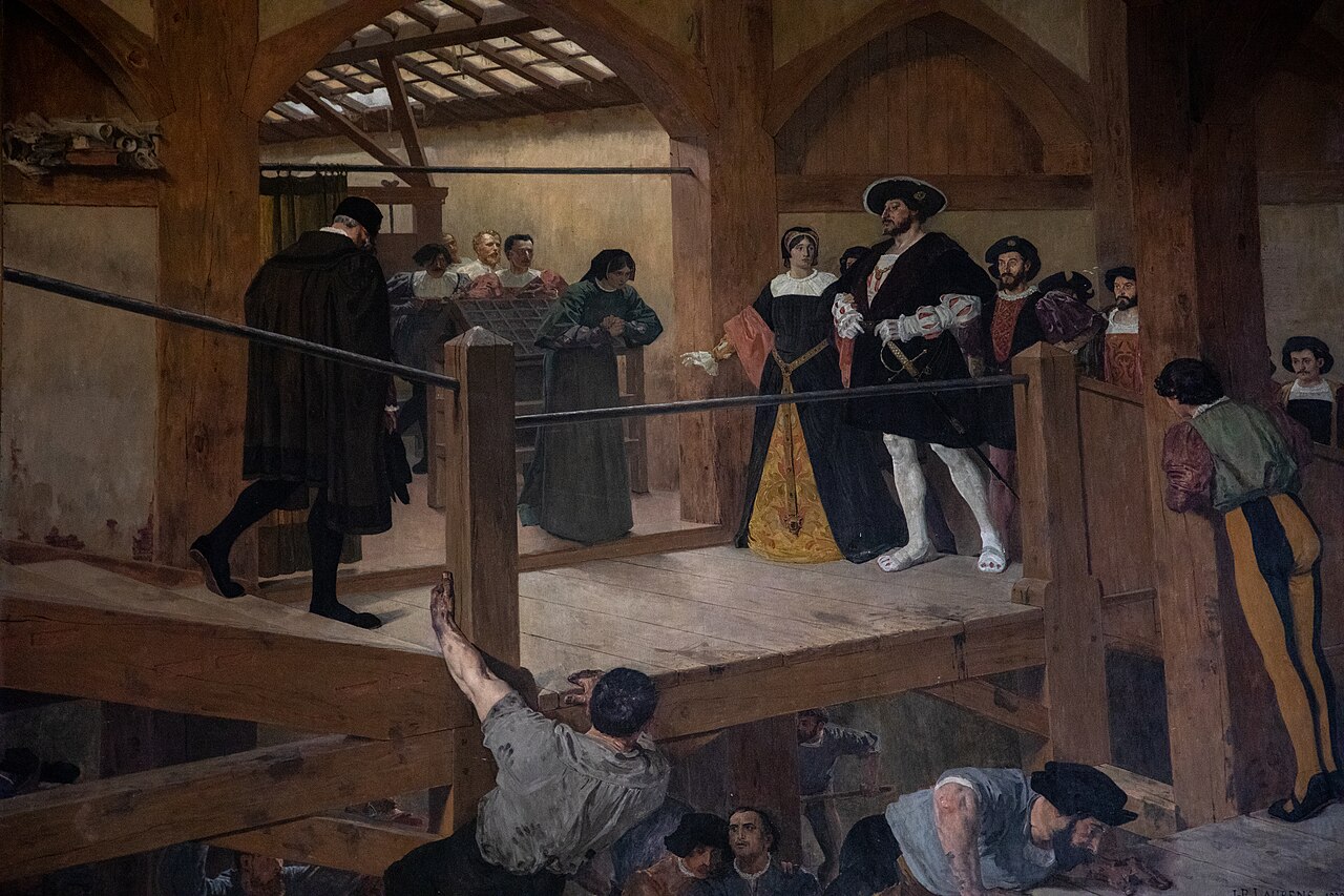
Son gendre était l’imprimeur humaniste et érudit Robert Estienne (1503-1559), fils de l’imprimeur Henri Estienne (1460-1520) (l’ancien). François Ier le nomme, avant 1539, imprimeur royal pour l’hébreu et le latin, ainsi que pour le grec à partir de 1544.
Cénacle de Meaux
À partir de 1518 le protecteur de Lefèvre, Guillaume Briçonnet, décide d’élire résidence dans son nouveau diocèse, à Meaux, où il compte mettre en œuvre une réforme pastorale inspirée de la ligne théologique esquissée par l’humaniste picard. Au cœur de ce projet se situait la volonté, qui était celle des humanistes, d’apporter le message essentiel de l’Évangile à tous les hommes, même les plus simples et les moins instruits, et de faciliter ainsi l’accès aux mystères de la foi, avec la conviction que l’intervention du Saint Esprit pouvait inspirer l’intelligence et le cœur des fidèles.
Ami et disciple de Lefèvre, Guillaume Briçonnet résout de faire prévaloir ses idées morales dans son diocèse. Et, ce qui est inhabituel à cette époque, il abandonne la vie de cour pour y vivre.
Toujours à la demande de Briçonnet, Lefèvre fonde alors le Cénacle de Meaux, foyer de réflexion et de réforme de l’Église de Meaux. Il s’agit de retourner aux sources du christianisme, vers l’enseignement originel du Christ, en répandant le Nouveau Testament en français : on « délatinise » les textes évangéliques.
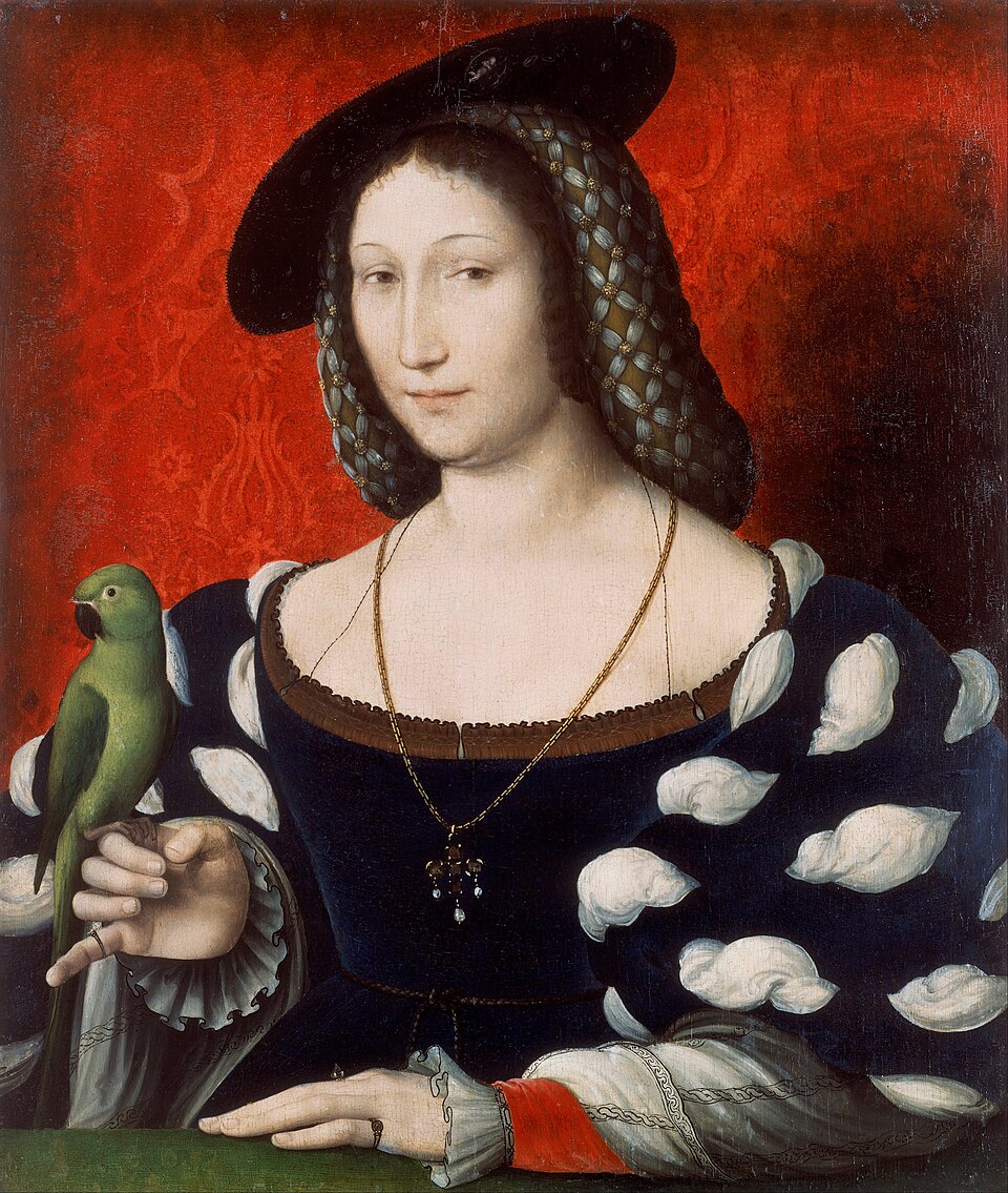
Nommé en 1520 vicaire de Guillaume Briçonnet, devenu évêque de Meaux, Lefèvre s’installe dans cette ville. En 1521, Briçonnet devient le directeur spirituel de la sœur du roi de France, Marguerite de Navarre, qui est acquise à la cause.
La même année, Briçonnet et Lefèvre attirent autour d’eux plusieurs théologiens et prédicateurs, dont le futur réformé Guillaume Farel, l’infatigable Gérard Roussel, le théologien flamand Josse Clichtove, l’hébraïsant François Vatable, l’éloquent Martial Mazurier, l’intrépide Michel d’Arande, Pierre Caroli, prédicateur célèbre, et Jean Lecomte de Lacroix. Puis d’autres viennent, élargissant le cénacle : Pierre de Sébiville, Aimé Mégret, le franciscain ami de Rabelais, Pierre Amy, et Jacques Groslot, bailli d’Orléans. Leur mot d’ordre, simple, est aussi celui de Marguerite de Navarre :
« Connaître l’Evangile, suivre l’Evangile, et faire connaître partout l’Evangile. »
Marguerite de Navarre a côtoyé Léonard de Vinci lors de ses trois dernières années de vie (1516-1519) au château du Clos Lucé, à Amboise. Marguerite y avait vécu avec son époux Charles IV d’Alençon en 1509. Par la suite, elle y séjourna régulièrement avec sa mère Louise de Savoie et son frère François Ier, dans le voisinage immédiat de Léonard de Vinci.
Elle était une protectrice influente des arts, tandis que Vinci était le « premier peintre » du roi. En 1546, Rabelais lui rend honneur en lui dédiant son Tiers Livre.
Une thèse récente, de Jonathan Reid, a montré que Marguerite était dès cette époque au cœur d’un vaste réseau incluant plus de deux cents membres de la cour, des diplomates, des prélats, des hommes de lettres. S’étendant bien au-delà de Paris et Meaux, ce réseau concernait aussi Alençon, Lyon, Grenoble, Bourges, Poitiers et Mâcon.
Les imprimeurs, parmi lesquels Augereau et Du Bois, mais aussi Simon de Colines, clandestin à Lyon, en faisaient partie. Au total, selon Reid, 450 éditions de 200 œuvres « évangéliques » seraient sorties des presses françaises grâce à la protection de Marguerite.11
Sur le terrain
Après avoir visité tout son diocèse, Briçonnet constate que la plupart des curés ne résident pas dans leur paroisse et que les desservants ne sont qu’à peine, voire pas du tout, formés en théologie. De plus, ils n’ont pas le temps d’enseigner leurs ouailles car ils doivent travailler, tous les revenus de la paroisse allant aux curés. Les seuls prêcheurs instruits sont les Cordeliers, qui se bornent souvent à promettre l’enfer aux mauvais chrétiens.
Dès 1518, Briçonnet entreprend de lutter contre la dépravation des mœurs et le relâchement de la discipline ecclésiastique en réformant en profondeur son diocèse. Il simplifie le culte, supprime l’adoration des images et des reliques et encourage les prédications pour raviver la foi. Il considère son diocèse comme une terre de mission, et le divise en 26 stations de neuf paroisses chacune. Mais, année après année, il constate l’insuffisance des mesures : plus de la moitié des desservants sont incapables d’effectuer convenablement la tâche qui leur est assignée. Il décide d’expulser les 53 plus inaptes et de former des prêtres. Les Cordeliers sont interdits de chaire.
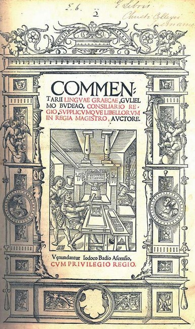
A Meaux, le Cénacle fait tourner une imprimerie pour publier, parmi d’autres, les ouvrages de Lefèvre d’Étaples : Commentaires des quatre évangiles (en latin) en 1522, Ancien Testament (en français), Homélies, Épîtres, Évangiles, Actes des Apôtres (1523) et Psaumes (1524).
Les principaux instruments du renouveau religieux furent une plus grande attention à la sélection et l’éducation du corps sacerdotal, la restauration de l’autorité de l’évêque vis-à-vis des ordres religieux concurrents, le contrôle des chaires confiées à des prédicateurs fidèles à la doctrine christocentrique et fermement convaincus du principe de la justification par la foi seule, sur lequel Lefèvre insistait depuis des années dans ses écrits, ainsi que l’impression et la distribution de nombreux écrits et ouvrages destinés aux clercs et aux laïcs : il s’agissait de textes de piété centrés principalement sur la prière mentale et sur l’invitation à simplifier et à purifier les rituels traditionnels, ainsi que de versions latines et surtout françaises des Saintes Écritures.
Débarrassés des gloses inutiles, les textes sont commentés de vive voix pour de petits groupes de personnes ayant un peu d’instruction. Des prières en langage simple sont imprimées à destination du peuple, ainsi que des ouvrages de vulgarisation à partir de 1525. Les prêches, qui changent (on ne menace plus de l’enfer, on ne quête plus à la fin), ont du succès. La Picardie voisine, la Thiérache, le monastère de Livry-en-Aulnoy suivent la démarche fabriste.
Meaux fut un laboratoire pour d’autres diocèses du royaume, dans lesquels des évêques proches du réseau évangélique tentèrent de mettre en application le modèle de renouveau pastoral élaboré par Lefèvre et les siens. Mais si effectivement l’évangélisme devint un courant influent et respecté sous le règne de François Ier, ce fut grâce au soutien d’une partie de la cour qui, comme nous l’avons mentionné, faisait référence à Marguerite. L’appui politique, économique et diplomatique de la sœur du roi et de son réseau permit aux fabristes d’avoir un accès direct à la cour et d’influencer les choix de la couronne concernant la politique de tolérance à l’égard de « l’hérésie » et les nominations des évêques et des abbés.
La réaction
Le Cénacle de Meaux attire immédiatement les foudres des Cordeliers (qu’il a privés du produit de leurs quêtes) et des théologiens de la Sorbonne.
En avril 1521, les thèses de Luther, initialement bien reçues et étudiées, sont condamnées par l’Université de Paris. Clichtove fait défection (il rédige un ouvrage sur le culte des saints, proclame que « l’intelligence des laïcs ne pourra jamais comprendre le sens sublime enfermé dans les livres divins » que les plus doctes ont peine à comprendre).
Bien que la traduction de Lefèvre du Nouveau Testament s’appuie sur le texte de la Vulgate, elle y apporte une soixantaine de corrections d’après les originaux grecs. Les docteurs de Paris sont principalement irrités de « l’Épître exhortatoire » qu’il met en tête de la deuxième partie, où il recommande à tous les fidèles de lire l’Écriture sainte en langue vernaculaire, c’est-à-dire en français.
On défère onze propositions à la faculté. Les tribunaux ordonnent que le Nouveau Testament rn français de Lefèvre d’Étaples soit brûlé. Mais le roi, instruit de cette affaire dans laquelle il ne voit qu’une tracasserie du doyen de la Sorbonne, Noël Béda, intervient et Lefèvre, s’étant justifié en présence des prélats et des docteurs que la cour lui a donnés pour juges, sort avec honneur de cette attaque.
En octobre 1523, sous la pression, Briçonnet interdit les livres de Luther dans son diocèse et en 1524, il renvoie Farel, trop provocateur dans ses prêches, afin de pouvoir continuer son travail de diffusion de l’Évangile. À ses frais, il organise des lectures publiques de la Bible et en fait distribuer des traductions, qui gagnent la Normandie, la Champagne et la vallée de la Loire.
Cette première phase d’expansion du mouvement fabriste s’acheva vers 1525, lorsque, sous la régence, le parti conservateur imposa une politique répressive à l’égard des luthériens et des évangéliques, sans distinction.
L’heure des persécutions
En 1525, les bouleversements géopolitiques changent la donne en France. En premier lieu, c’est le piège tendu par les guerres d’Italie qui se referme sur François Ier. Le 24 février 1525, le roi est fait prisonnier à Pavie par les troupes de Charles Quint.
Du coup, il n’est plus en position de protéger l’évêque de Meaux. A cela s’ajoute qu’en mai, une bulle papale autorise un groupe composé de trois théologiens de la Sorbonne et d’un curé à traquer l’hérésie.
Alors que Lefèvre publie les Épîtres et Évangiles pour les 52 dimanches de l’année à venir, ses ennemis ont plus de succès avec une nouvelle attaque, profitant du trouble attisé dans le diocèse de Meaux par des prédicateurs indiscrets et des moines turbulents. Un procès s’ouvre devant la Sorbonne à l’initiative des Cordeliers, qui l’accusent de permettre à « l’hérésie » de se répandre.
La même année, le parlement de Paris intente un procès contre Briçonnet. Par mesure d’apaisement, ce dernier autorise à nouveau les Cordeliers à prêcher, demande à ses curés de restaurer le culte des saints et de la Vierge, interdit les prêches aux plus extrêmes et prend sous sa protection personnelle les statues et images de saints. Jean Leclerc, un cardeur de laine converti aux idées nouvelles, est fouetté pour avoir placardé des affiches hostiles au pape.
Après à peine quatre ans d’existence, le cénacle de Meaux est dissous en 1525.
Pendant quelques mois, afin d’éviter les arrestations et les condamnations, Lefèvre et les siens sont contraints de quitter le royaume pour se réfugier à Strasbourg. Sur place, il renforce ses liens avec des protestants modérés tels que Capiton et Butzer, et fréquente Otto Brunfels, auquel le rattachait une attitude nicodémite, reconnaissant la légitimité de la dissimulation religieuse dans un contexte de persécution.
En 1526, avec le retour de François Ier, négocié avec l’Espagne par Marguerite de Navarre, et grâce à sa protection, ils sont de retour en France et parviennent à conserver des espaces de manœuvre pendant quelques années encore à la cour et dans le reste du royaume, par une intense activité d’impression et de diffusion d’écrits, ainsi qu’à travers une action systématique de prédication évangélique au cœur même de la capitale. Le roi accorde à Lefèvre le poste de bibliothécaire personnel à Blois et lui confie l’éducation de ses deux enfants.
Guillaume Briçonnet est pour sa part innocenté. En 1528, il participe au synode de Paris qui condamne le luthéranisme. Un an plus tard, François Ier sacrifie le prédicateur Louis de Berquin (1490-1529), un ami d’Érasme mais également traducteur de traités luthériens. Il est brûlé vif en place de Grève à Paris.
L’exil
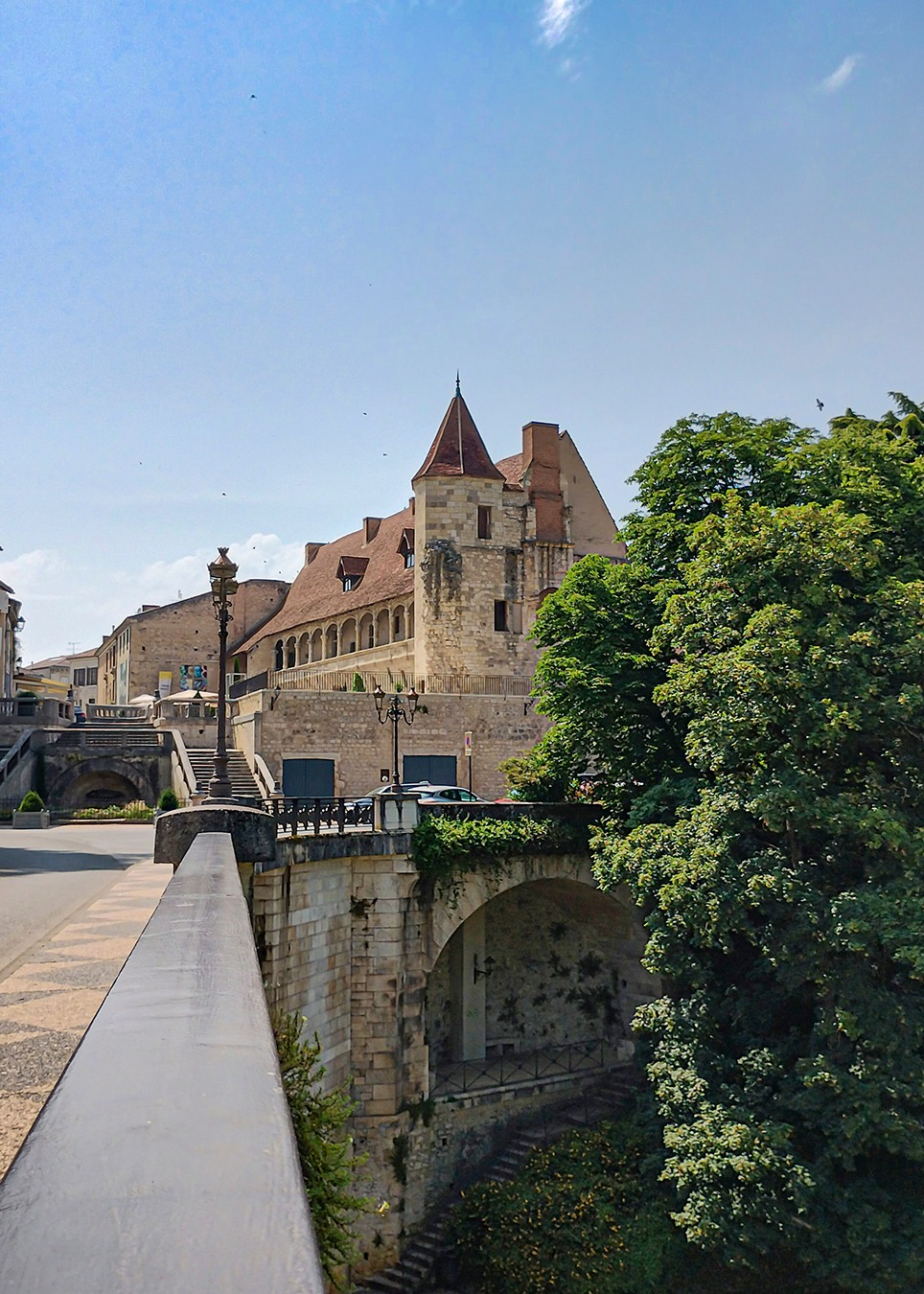
En 1530, Lefèvre choisit de quitter la cour pour se rendre auprès de sa protectrice, Marguerite de Navarre, à Nérac. Il y restera jusqu’à sa mort en 1536, préférant ne pas prendre position dans les disputes entre protestants et catholiques.
On ne peut le taxer de protestantisme, bien que ses commentaires sur le célibat des prêtres, le jeûne et les sacrements soient extrêmement sévères et préparent la voie réformée. Le terme d’« évangélisme » récemment proposé semble en revanche convenir à cette attitude de fidélité absolue à l’esprit et à la lettre des Écritures.
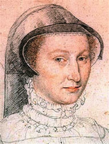
Marguerite de Navarre, il faut le souligner, est une lettrée.
Mais si elle connaît le latin et même le grec, elle est loin de maîtriser ces langues anciennes comme le fait Lefèvre, dont elle a pu suivre les leçons.
Pour des raisons religieuses, elle a même reçu des cours d’hébreu de Paul Paradis, surnommé le Canosse, qui deviendra plus tard lecteur du Collège royal. Elle fut très influencée par la pensée du Cénacle de Meaux, dont elle donne des exemples en particulier dans ses comédies profanes et ses poèmes.
Et selon un historien,
« elle a aussi connaissance de Nicolas de Cues, auteur de la Docte ignorance, édité lui aussi par Lefèvre, de Saint Bonaventure, du Pseudo-Denys, en fait un moine syrien du Ve siècle ».12
En 1531, l’érudit vénitien Jérôme Aléandre, ancien nonce devenu le persécuteur en chef d’Erasme pour la curie romaine, se montre fort bien informé sur la situation. Il regrette que Lefèvre reste sous l’influence de son ancien disciple Gérard Roussel, évêque d’Oloron.
L’ambition des conservateurs romains et français était alors de convaincre Lefèvre d’écrire une rétractation de ses erreurs et de se rendre à Rome pour obtenir sa pleine réintégration au sein de l’Église romaine.
Il n’en fut pas ainsi. Si Lefèvre ne pouvait plus afficher publiquement ses choix spirituels, il restait proche des positions de ses disciples Roussel et Marguerite qui, pendant tout le règne de François Ier, même après l’affaire des Placards, ne cessèrent de soutenir une troisième voie entre Rome et Genève. En 1534, Briçonnet meurt au château d’Esmans, près de Montereau-Fault-Yonne.
Conclusion
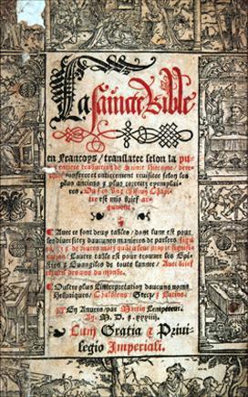
La traduction de La Sainte Bible par Lefèvre, basée sur le texte de la Vulgate, sera imprimée non pas en France, mais à Anvers en 1530.
Ce fut la première Bible en langue vernaculaire, qui servit de base à toutes les traductions françaises, modernes comprises.
Foyer de prédication, cet épicentre de l’humanisme chrétien que fut le Cénacle de Meaux, précurseur du « réformisme », eut une grande influence sur les humanistes et les écrivains de cette génération.
Marguerite protège François Rabelais (1483-1553) et l’encourage d’écrire Gargantua and Pantagruel. Ami de Rabelais, le célèbre poète Clément Marot, se met au service de Marguerite. Il est bientôt accusé d’hérésie et se réfugie à Nérac en 1535.
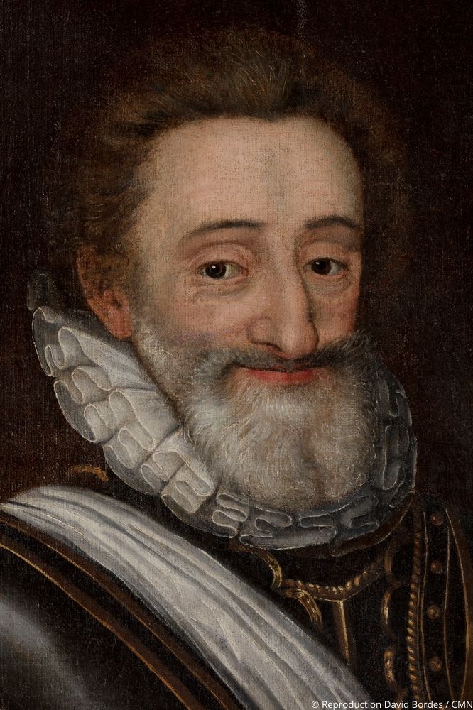
Surnommée la « mère de la Renaissance », Marguerite de Navarre fut la mère de Jeanne d’Albret et donc la grand-mère d’Henri IV, le bon roi Henri qui, connaissant cette filiation intellectuelle et spirituelle, allait incarner cet idéal dans l’action.
C’est certainement en ayant à l’esprit l’œuvre du Cénacle de Meaux qu’il réussit, du moins en partie, à mettre fin aux guerres de Religions ravageant la France.
La paix inclusive qu’il organisa en France, basée sur la coïncidence des opposés théorisée par Nicolas de Cues, sera le modèle pour la Paix de Westphalie qui mit fin à la guerre de Trente Ans en 1648.
Bibliographie sommaire
- ALONGE, Guillaume Jacques Lefèvre d’Étaples dans la crise religieuse du XVIe siècle, nord’ 2022/2 N° 80, pages 15 à 21, Éditions Société de Littérature du Nord.
- BARNAUD, Jean
— Jacques Lefèvre d’Etaples : la préparation, Etudes théologiques et religieuses, 11e année, N° 1, 1936.
— Jacques Lefèvre d’Etaples, maître de philosophie, Etudes théologiques et religieuses, 11e année, N° 2, 1936.
— Jacques Lefèvre d’Etaples (suite), Etudes théologiques et religieuses, 11e année, N° 3, 1936.
— Jacques Lefèvre d’Etaples (suite et fin), Etudes théologiques et religieuses, 11e année, N° 4-5, 1936. - CHARLIER, Yvonne, Erasme et l’amitié, d’après sa correspondance, Editions Les Belles Lettres, Paris, 1977.
- DE ROMILLY, Jacqueline, Cinq siècles d’hellénisme en France, Bulletin de l’Association Guillaume Budé, mars 1977.
- EICHEL-LOJKINE, Patricia, Marguerite de Navarre, perle de la Renaissance, Perrin, Paris, 2021.
- PERNOT, Jean-François, Jacques Lefèvre d’Etaples (1450 ? – 1536), Actes du colloque d’Etaples les 7 et 8 novembre 1992, Classiques Garnier, Paris, 1995.
NOTES:
- https://www.facinghistory.org/resource-library/agreement-catholic-church ↩︎
- file:///C:/Users/User/Desktop/alonge-2022-jacques-lefevre-detaples-dans-la-crise-religieuse-du-xvie-siecle.pdf ↩︎
- L’humanisme chrétien se différencie de « l’Humanisme séculier » (anti-religieux) et supposément « scientifique ». Une fois éliminé la dimension spirituelle, la dimension humaniste a fini également à la trappe. Julian Huxley, un des grands promoteurs de « l’humanisme séculier » a fini par inventer le terme « transhumaniste », une idéologie qu’il voyait capable de remplacer toutes les religions. Le millionnaire Jeffrey Epstein, tout comme les milliardaires Elon Musk, Larry Ellison et Peter Thiel en sont des adeptes. ↩︎
- file:///C:/Users/User/Desktop/Jacques%20LEtap/Romilly_Helle%CC%81nisme-France.pdf ↩︎
- Yvonne Charlier, Erasme et l’amitié, p. 100. https://books.openedition.org/pulg/3297 ↩︎
- Börje Knös, Un ambassadeur de l’hellénisme : Janus Lascaris et la tradition gréco-byzantine dans l’humanisme français, Uppsala, Almqvist & Wiksells, 1945. ↩︎
- Philippe. Monnier, Le Quattrocento. T. II, p. 82. ↩︎
- https://www.etudesheraultaises.fr/publi/evocation-de-guillaume-briconnet-eveque-de-lodeve-de-1489-a-1519/ ↩︎
- Heminjard, Correspondance des Réformateurs, t. I, p. 4, note. ↩︎
- https://theses.chartes.psl.eu/document/ENCPOS_1991_01 ↩︎
- Jonathan Reid, King’s Sister, Queen of Dissent : Marguerite de Navarre (1492-1549) and her Evangelical Network. Leyden, Brill, 2009 ; 2 vol. ↩︎
- Jean-Pierre Duteil. Marguerite de Navarre. Ellipses, 2021. hal-04186835. ↩︎
Cyrus le Grand, l’Iran et le dialogue des civilisations
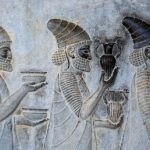
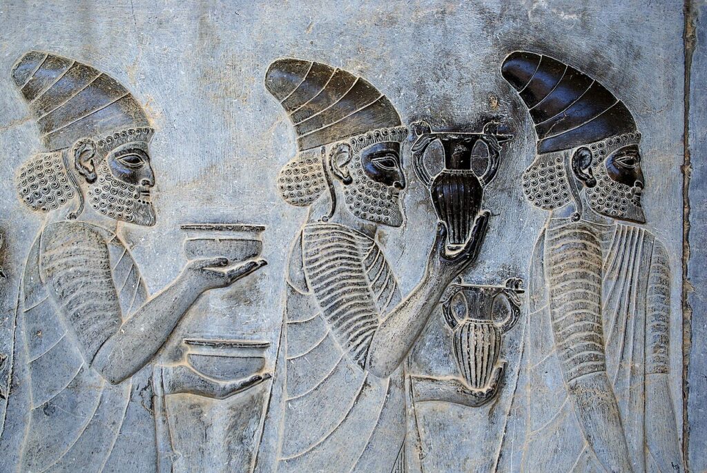
Par Karel Vereycken
En réponse au tweet publié début avril par Pete Hegseth, le secrétaire américain à la guerre, menaçant de renvoyer l’Iran « à l’âge de pierre », l’ambassade iranienne d’Afrique du Sud a répondu par ce petit commentaire très ferme mais riche en solutions diplomatiques potentielles :
« Quand vous étiez encore dans des grottes à la recherche du feu, nous inscrivions les droits de l’homme sur le cylindre de Cyrus. Nous avons enduré la tempête d’Alexandre le Grand et l’invasion des Mongols et nous avons perduré ; car l’Iran n’est pas seulement un pays, c’est une civilisation. »
Décryptons
Cyrus II (le Grand) est le fondateur de l’Empire perse achéménide, en 552 av. J.-C.
C’est sa prise de Babylone, en 539 av. J.-C., qui inaugure l’ère impériale de la Perse. En mettant fin à l’empire babylonien, jusque-là maître de l’Asie occidentale, Cyrus fonde un empire s’étendant de l’Inde à l’Est à Carthage à l’Ouest, et du Caucase et du Danube au Nord à l’Ethiopie au Sud.
Avec 5,5 millions de km2 de territoire, l’empire perse comptait environ 50 millions d’habitants, soit 40 % de la population mondiale.
L’empire perse est le premier en date des empires indo-européens. Avec ses 20 gouverneurs (satrapes) de provinces, son mode d’organisation décentralisé a parfois servi de modèle aux empires grec et romain, et évidemment à ceux des Anglo-Saxons, des Français, des Espagnols, etc.
L’acte fondateur de l’empire perse est la publication du célèbre « édit » du roi Cyrus, dont un exemplaire gravé en caractères cunéiformes sur un cylindre en terre cuite a été retrouvé à Babylone en 1879. Il est conservé au British Museum de Londres.
Cet édit est d’une valeur incomparable, puisqu’il constitue la première déclaration des droits de l’homme dans l’histoire de l’humanité. Par cet édit, Cyrus le Grand abolit le travail forcé et proclame solennellement l’égalité des droits pour tous les membres de l’empire, ainsi que la liberté de culte et de croyances pour tous les individus.
Que l’ambassade iranienne ait répondu de la sorte est donc très intéressant. Bien sûr, l’honneur de la grande civilisation iranienne se rit de l’ignorance crasse de l’administration Trump. Mais en même temps, en évoquant le cylindre de Cyrus, l’Iran, s’inspirant d’une conception supérieure, tend une perche pour une solution négociée et, implicitement, pour la possibilité d’un avenir de nouveau partagé.
Voyons pourquoi
- Bien que les archéologues et les historiens spécialistes du Proche-Orient rejettent généralement ces interprétations comme anachroniques, le cylindre fut adopté comme symbole par le shah Mohammad Reza Pahlavi, qui l’a présenté comme la « première charte des droits de l’homme », puis exposé à Téhéran en 1971 pour célébrer le 2500e anniversaire de l’Empire iranien.
- La même année, l’ONU l’a traduit dans toutes ses langues officielles et en a fait un précurseur de la Déclaration des droits de l’homme. Son retour à l’Iran en 2010 est considéré comme un grand événement commémoré dans la république islamique d’Iran, dont le président de l’époque, Mahmoud Ahmadinejad, en fait une source d’inspiration guidant le combat pour les opprimés. Trois ans plus tard, c’est cette fois-ci aux États-Unis que le cylindre est présenté et loué comme un symbole de liberté. Plus récemment, le 6 novembre 2025, la 43e Conférence générale de l’UNESCO a officiellement reconnu, à l’unanimité de ses États membres, le Cylindre de Cyrus (toujours considéré comme la première déclaration des droits de l’homme au monde) comme symbole mondial de liberté, de justice et de respect de la diversité culturelle.
- Les relations entre Iraniens et Juifs remontent à l’Antiquité. L’un des épisodes les plus glorifiés par l’identité iranienne est la libération des Juifs de Babylone par… Cyrus II le Grand, geste consigné et gravé sur le fameux cylindre et preuve d’ouverture et de tolérance. La Bible donne d’ailleurs une interprétation très favorable du règne de Cyrus, que le livre d’Esdras présente comme celui qui a permis le « retour à Sion » du peuple juif, après sa captivité à Babylone.
La communauté juive en Iran est estimée aujourd’hui entre 8000 et 12 000 personnes, ce qui en fait la plus importante du Moyen-Orient après Israël, bien qu’en forte baisse depuis 1979 (environ 100 000 avant la révolution). Début avril, se laissant guidé par l’IA sans vérification humaine, Israël a bombardé la synagogue de Téhéran. L’armée israélienne a exprimé ses « regrets » pour les dégâts causés par cette frappe nocturne ayant visé selon elle « un haut commandant militaire » iranien.
Dialogue des civilisations
Évoquer le cylindre de Cyrus revient donc à tendre une perche : la perspective d’un dialogue inter-culturel, inter-religieux et inter-civilisationnel, posant les bases d’une solution pacifique à de nombreux conflits autrement insolubles, autant à l’intérieur du pays (avec les partisans d’un retour de la dynastie Pahlavi) qu’à l’extérieur (avec Israël, les chrétiens et l’Occident en général).
Depuis des millénaires au carrefour des Routes de la soie, l’ADN de la civilisation iranienne n’est pas le terrorisme et la déstabilisation, mais bien un combat pour la justice, le respect et l’ouverture aux autres.
Un an après les célébrations iraniennes du Cylindre de Cyrus, en 1971, le professeur autrichien Hans Köchler, président de l’International Progress Organization (IPO), fidèle ami et collaborateur de l’Institut Schiller et de sa fondatrice Helga Zepp-LaRouche, a pris sa plume pour proposer à l’UNESCO d’organiser
« un congrès international au sujet des problèmes résultant du dialogue entre les différentes civilisations. »
Durant des années, Hans Köchler, par d’innombrables présentations, conférences et colloques dans le monde entier, notamment en Iran, fera un travail exceptionnel pour populariser le concept, avant d’être repris et soutenu par l’Institut Schiller. Sous les auspices de la présidence autrichienne et sénégalaise, un grand colloque a eu lieu en 1974 à Innsbruck, en Autriche.
En 1997, en opposition à la théorie du « choc des civilisations », la thèse du géopoliticien Bernard Lewis vulgarisée par Samuel P. Huntington, le président iranien Mohammad Khatami placera le dialogue entre les civilisations au cœur de son mandat. C’est sur sa suggestion que l’ONU, en 1998, déclara l’année 2001 comme « l’année du Dialogue entre civilisations ».
Le concept revient aujourd’hui sur la table. Saurons-nous nous mettre au diapason de l’ADN iranien ou resterons-nous à « l’âge de pierre » moral ?
Cyrus the Great, Iran and the Dialogue of Civilizations
Responding to a tweet posted in early April by Pete Hegseth, the US « Secretary of War », threatening to send Iran « back to the Stone Age, » the Iranian embassy in South Africa replied with this short but firm comment, rich in potential diplomatic solutions:
“At a time when you where still in caves searching for fire, we were inscribing human rights on the Cyrus Cylinder. We endured the storm of Alexander the Great and the Mongol invasions and remained; because Iran is not just a country, it is a civilization.«
History
Cyrus II (the Great) was the founder of the Achaemenid Persian Empire in 552 BC. It was his capture of Babylon in 539 BC that inaugurated the imperial era of Persia. By ending the Babylonian empire, which had until then ruled Western Asia, Cyrus founded an empire stretching from India in the East to Carthage in the West, and from the Caucasus and the Danube in the North to Ethiopia in the South.
With 5.5 million km² of territory, the Persian Empire had approximately 50 million inhabitants, representing 40% of the world’s population. The Persian Empire is the earliest of the Indo-European empires.
With its 20 provincial governors (satraps), its decentralized mode of organization sometimes served as a model for the Greek and Roman empires, and obviously for those of the Anglo-Saxons, the French, the Spanish, etc.
The founding act of the Persian Empire was the publication of the famous « edict » of King Cyrus, a copy of which, engraved in cuneiform characters on a terracotta cylinder, was found in Babylon in 1879. It is kept in the British Museum in London.
This edict is of unparalleled value, as it constitutes the first declaration of human rights in human history. Through this edict, Cyrus the Great abolished forced labor and solemnly proclaimed equal rights for all members of the empire, as well as freedom of worship and belief for all individuals. The fact that the Iranian embassy responded in this way is therefore very interesting. Of course, the honor of Iran’s great civilization scoffs at the Trump administration’s blatant ignorance.
But at the same time, by invoking the Cyrus cylinder, Iran, drawing on a higher concept, extends an olive branch for a negotiated solution and, implicitly, for the possibility of a shared future once again.
Let’s see why
- Although archaeologists and historians specializing in the Near East generally reject these interpretations as anachronistic, the cylinder was adopted as a symbol by Shah Mohammad Reza Pahlavi, who presented it as the « first charter of human rights, » and then exhibited in Tehran in 1971 to celebrate the 2500th anniversary of the Iranian Empire.
- That same year, the UN translated it into all its official languages and recognized it as a precursor to the Universal Declaration of Human Rights. Its return to Iran in 2010 was a major event commemorated in the Islamic Republic of Iran, where then-President Mahmoud Ahmadinejad cited it as a source of inspiration guiding the struggle for the oppressed. Three years later, the cylinder was presented and praised in the United States as a symbol of freedom. More recently, on November 6, 2025, the 43rd UNESCO General Conference unanimously recognized the Cyrus Cylinder (still considered the world’s first declaration of human rights) as a global symbol of freedom, justice, and respect for cultural diversity.
- Relations between Iranians and Jews date back to antiquity. One of the episodes most celebrated in Iranian identity is the liberation of the Jews from Babylon by Cyrus the Great, an act recorded and engraved on the famous cylinder seal, a testament to openness and tolerance. The Bible, moreover, offers a very favorable interpretation of Cyrus’s reign, which the Book of Ezra presents as the one that enabled the Jewish people’s « return to Zion » after their captivity in Babylon. The Jewish community in Iran is estimated today to number between 8,000 and 12,000 people, making it the largest in the Middle East after Israel, although its numbers have declined sharply since 1979 (around 100,000 before the revolution). In early April, guided by AI without human verification, Israel bombed the Tehran synagogue. The Israeli army expressed its « regret » for the damage caused by this nighttime strike, which it claimed targeted a « senior Iranian military commander. »
Dialogue of Civilizations
To evoke the Cyrus cylinder is therefore to extend, from a higher standpoint, an olive branch: the prospect of an intercultural, inter-religious and inter-civilizational dialogue, laying the foundations for a peaceful solution to many otherwise insoluble conflicts, both within the country (with the supporters of a return of the Pahlavi dynasty) and outside (with Israel, Christians and the West in general).
For millennia at the crossroads of the Silk Roads, the DNA of Iranian civilization has not been terrorism and destabilization, but rather a fight for justice, respect and openness to others.
One year after the Iranian celebrations of the Cyrus Cylinder, in 1971, the Austrian professor Hans Köchler, president of the International Progress Organization (IPO), a close friend and collaborator of the Schiller Institute and its founder Helga Zepp-LaRouche, took up his pen to propose to UNESCO the organization of
« an international congress on the subject of the problems arising from the dialogue between different civilizations. »
For years, Hans Köchler, through countless presentations, lectures, and symposia worldwide, particularly in Iran, did exceptional work to popularize the concept, before it was taken up and supported by the Schiller Institute.
Under the auspices of the Austrian and Senegalese presidencies, a major symposium was held in 1974 in Innsbruck, Austria. In 1997, in opposition to the « Clash of Civilizations » theory, the thesis of geopolitician Bernard Lewis popularized by Samuel P. Huntington, Iranian President Mohammad Khatami placed dialogue between civilizations at the heart of his mandate. It was at his suggestion that the UN, in 1998, declared 2001 the « Year of Dialogue Among Civilizations. »
The concept is back on the table today. Will we be able to adapt to the Iranian DNA or will we remain in the moral « Stone Age »?
AUDIO : Raphael’s cartoon for « The School of Athens » in Milan
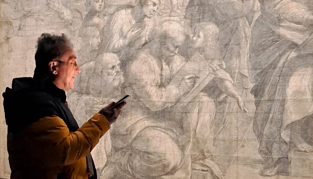
AUDIO:
from the pdf file, click on this LINK
Audio recorded during my visit at the Pinacoteca Ambrosiana in Milan, on March 20, 2026. For my full, in depth analysis of Raphael and his « School of Athens », see my article.
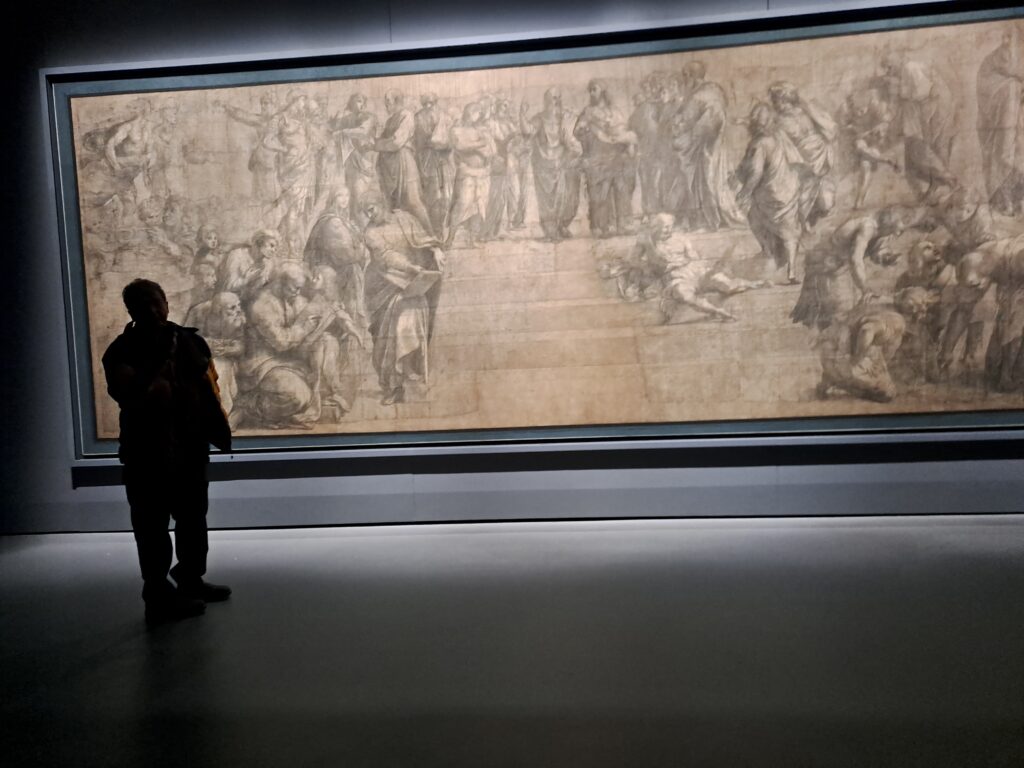
L’ombre de Vernadski dans la Sainte Anne de Léonard de Vinci
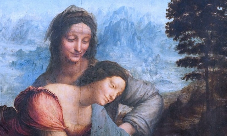
Par Karel Vereycken
En mars 1821, le poète anglais Percy Bysshe Shelley concluait son poème « Défense de la poésie » par ce concept visionnaire :
« Les poètes sont les hiérophantes d’une inspiration insoupçonnée, les miroirs des ombres gigantesques que l’avenir projette sur le présent, les mots qui expriment ce qu’ils ne comprennent pas, les trompettes qui sonnent pour la bataille, sans ressentir ce qu’elles inspirent, l’influence qui ne se laisse pas émouvoir, mais qui émeut. Les poètes sont les législateurs méconnus du monde. »
Nous vous proposons d’examiner ici, de ce point de vue, le chef-d’œuvre de Léonard de Vinci (1452-1519), « La Vierge à l’Enfant avec sainte Anne », actuellement au Louvre.
On ne se lasse jamais de contempler ce chef-d’œuvre. Le tableau représente sainte Anne, sa fille Marie et l’Enfant Jésus enlaçant un agneau sacrificiel, symbole de sa mission : libérer l’humanité du péché originel.
Léonard de Vinci n’a pas réalisé ce tableau pour un prince, un duc, un cardinal ou un pape, mais pour lui-même, et à ce titre, l’a légué en héritage à l’humanité.
Après avoir passé en revue les dernières recherches, Vincent Delieuvin, l’historien français du Louvre, est arrivé en 2000 à cette conclusion étonnante : Léonard salue le retour du régime républicain à Florence, dont Sainte-Anne était la protectrice.1
Si l’œuvre resta quasiment inachevée à sa mort, en 1519, on sait que Léonard de Vinci commença à y travailler en 1503 (il avait 51 ans), alors qu’il vivait à Florence. Le roi François Ier ne vola pas le tableau, mais en vola l’auteur, qui l’emporta avec lui en France pour le terminer.
Le spectateur est immédiatement saisi par un sens puissant de mouvement presque troublant, un sentiment d’amour suprême et de grande beauté. Si elle met en scène des figures des Saintes Écritures (sainte Anne, la Vierge Marie, le Christ) plutôt que d’illustrer une séquence liturgique particulière (par ailleurs inexistante), l’œuvre elle-même jaillit manifestement d’une profonde conception philosophique.
Je vais tenter de vous convaincre qu’il existe un « long arc de l’histoire », une cohérence intellectuelle entre des personnes et des esprits qui ne se sont jamais croisés et ne se sont jamais parlé, mais dont les intuitions et les avancées épistémologiques s’accordent.
Le chef-d’œuvre de Léonard de Vinci apparaît, à mon sens, comme une sorte de chaînon manquant entre la vision de Dieu et de la création de Nicolas de Cues (Cusanus) et le concept de « noosphère » de Vladimir Vernadski, en passant par l’idée de « cosmos » d’Alexander von Humboldt. De prime abord, cela peut paraître farfelu, mais permettez-moi de développer.
Une unité
Qu’est-ce qui peut donc unir ces quatre intellectuels de génie, Cusanus, Léonard de Vinci, Alexander von Humboldt et Vernadski ? Tous quatre étaient convaincus que l’univers est un ensemble vivant, un et harmonieux.
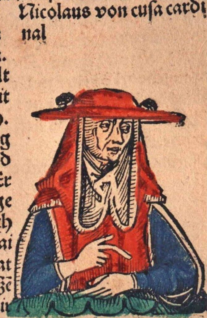
Dans son traité De la docte ignorance (1440), le cardinal allemand Nicolas de Cues (1401-1464), penseur et acteur majeur des grands conciles œcuméniques ainsi que de la Renaissance italienne et européenne, part de ce symbole : Dieu est le « maximum absolu » et l’unité parfaite (unio). Dans cette unité, toutes les distances, divisions et contradictions se changent et se fondent en union. L’Univers est l’image contractée de cette unité et de ce maximum absolu. Comme un miroir, il est le maximum « contracté » car il ne comprend pas toutes choses, mais seulement toutes choses hors de Dieu, toutes choses créées. Le philosophe emploie les termes complicatio (enveloppement) et explicatio (déploiement) pour expliquer que toutes choses sont enveloppées en Dieu (la source) et déployées dans le monde. Le monde, le cosmos et le temps géologique sont le déploiement de l’unité de Dieu.
S’engageant sur la voie ouverte par Cues, Léonard de Vinci (1452-1519) affirme avec force : « Comprenez que tout est lié à tout. » Pour lui, progresser signifie unifier différents domaines comme l’art, l’anatomie et l’ingénierie en une compréhension globale et cohérente. L’artiste-ingénieur invite ses contemporains à apprendre à percevoir les liens qui unissent la nature, l’art, la science et l’âme humaine. L’observation permet à Léonard de découvrir les causes invisibles au-delà des effets visibles, et d’imaginer et tester des hypothèses créatives. Il postule notamment que le corps humain pourrait être une version miniature (microcosme) de la Terre (macrocosme), en observant que la ramification des vaisseaux sanguins chez l’homme reflète les affluents des rivières, tout comme les mouvements du corps imitent les marées. À ses yeux, la Terre est un organisme vivant doté d’une « chair » (le sol), d’« os » (les strates rocheuses) et de « sang » (les veines d’eau). Il étudie le vol des oiseaux et les mouvements de l’eau, convaincu que les deux obéissent à une même physique des fluides. L’art est une science et la science est un art, tous deux étant des outils pour comprendre les lois fondamentales du monde. Pour Léonard de Vinci, les peintres doivent posséder le cosmos tout entier dans leur esprit et leurs mains pour refléter véritablement la beauté, l’harmonie et la complexité de la nature. Pour lui, le mouvement est l’essence même d’un univers vivant en pleine expansion. Il étudie les motifs en spirale présents dans toute chose, des fleurs aux boucles des cheveux en passant par les tourbillons de l’eau, pour tenter de comprendre comment la force vitale engendre les différentes formes. Enfin, il considère la stagnation comme une forme de déclin, notant que « le fer rouille par manque d’usage » et que « l’inaction sape la vigueur de l’esprit ».
Le naturaliste et révolutionnaire allemand Alexander von Humboldt (1769-1859) s’est lui aussi efforcé de comprendre comment divers phénomènes naturels, malgré leur apparente indépendance, forment un système harmonieux et unifié. Il évoque un « système terrestre » où le climat, la flore, la faune et la vie humaine sont interdépendants. Humboldt croit qu’il existe un « lien intrinsèque » entre le général et le particulier, ce qui lui permet de percevoir l’interconnexion entre les différentes régions et les climats. Dans son œuvre ultime en cinq volumes, Cosmos (1845-1858), il décrit la nature comme un « souffle de vie » et un « tout organique », et voit l’univers entier – physique et céleste – comme un « système magnifiquement ordonné et harmonieux ». À l’instar de Cusanus et de Léonard de Vinci, il soutient qu’une compréhension scientifique des processus naturels accroît notre appréciation de leur beauté.
Pour le géophysicien russo-ukrainien Vladimir Vernadski (1863-1945), la vie est éternelle et indissociable du cosmos, et non de la seule Terre. Il voit la matière vivante comme un « phénomène cosmique » apparu ailleurs ou ayant toujours existé, façonnant l’environnement chimique des planètes. La biosphère entoure la Terre comme une « enveloppe saturée de vie », où organismes vivants et matière inerte interagissent constamment, indissociablement et de manière dynamique. L’étape suivante de l’évolution est décrite comme la transition de la biosphère à la « noosphère », où l’activité rationnelle humaine, la science et la technologie deviennent la principale force géologique qui façonne la planète. Vernadski était convaincu que l’avenir de l’humanité dépendait de la reconnaissance de cette unité, suggérant que la pensée humaine était un prolongement naturel des processus géologiques et cosmiques.
Regardons maintenant le tableau
C’est avec ce « long arc de l’histoire » à l’esprit que le spectateur attentif peut déceler l’ombre de Vernadski dans la Sainte Anne de Léonard.
Décryptage
- L’arrière-plan du tableau montre des crêtes abruptes à l’aspect préhistorique, inspirées des études de Léonard sur les Dolomites et les Alpes. Ce paysage aride et rocailleux, presque lunaire, a été qualifié par les historiens de « fantastique » ou de « métaphysique ». Comme en témoignent ses carnets, Léonard s’attachait à représenter les mouvements « invisibles », non seulement des âmes, mais aussi des phénomènes physiques tels que le temps, et plus particulièrement le temps géologique. Comment les montagnes se sont-elles formées, par exemple ? Pour d’autres, ce paysage « mort », ou lunaire, de l’arrière-plan – ce que Vernadski appellerait la « lithosphère » – servirait uniquement à mettre en valeur les autres éléments de la composition.
- Devant ce paysage, à droite, se dresse un arbre, premier indice de la biosphère mais simple étape d’un processus évolutif de développement accéléré du cosmos.
- En-dessous, l’agneau (symbole religieux du sacrifice du Christ) représenterait une forme supérieure de conscience de cette biosphère.
- Apparaît alors Jésus qui, dans son incarnation d’enfant humain, ne représente qu’une sorte de conscience naïve, simple potentiel de son développement ultérieur.
- La Vierge Marie est peinte dans une position paradoxale, illustrant parfaitement ce que le penseur américain Lyndon LaRouche appelait « mid-motion-change », c’est-à-dire un instant ambigu d’indécision entre des mouvements d’apparence contraires. Le geste majestueux, aimant et protecteur de Marie, et son étreinte de Jésus coïncident avec son désir profond de lui accorder toute la liberté de mouvement nécessaire à l’accomplissement de sa mission sacrée.
- Sainte Anne, au sommet, animée d’une joie divine, contemple en souriant le geste gracieux de sa fille Marie et l’amour qu’elle porte au Christ. Elle se réjouit d’être en quelque sorte l’âme « noosphérique » consciente d’un Cosmos divin et vivant, où le créateur conçoit sans cesse des formes nouvelles pour sa création et des degrés de conscience toujours plus élevés de sa propre nature créatrice. Les alignements circulaires des chaînes de montagne lunaires résonnent visuellement avec les anneaux harmonieux dessinés par les bras et les vêtements dans une spirale en cascade.
Même des auteurs comme Viviane Forrester, dont l’œuvre2 est polluée par de pernicieuses interprétations modernistes et freudiennes, et qui prétendent à tort que nous sommes leurrés par la mansuétude « bébête » de Marie (p. 19), reconnaissent néanmoins intuitivement qu’il y a quelque chose de très particulier dans cette œuvre, une sorte d’unité que l’écrivaine qualifie, faute de trouver un mot plus adéquat, d’« organique ».
Lorsqu’on découvre ces figures, écrit-elle, « on perçoit bien qu’il s’agit d’organismes vivants au sein d’un paysage, organisme vivant. Dee l’organique dans de l’organique. » (p. 12)
Ce moment organique, observe-t-elle, apparaît ici au spectateur comme un « moment figé » d’un « mouvement transitoire ».
« Leur prochaine respiration, celle qui suivre, semble plus importante, vitale, plus en suspens que toute intrigue, tout récit. Et leur présence tangible, fragile, s’apparente à celle des montagnes, qui respirent aussi. » (p. 13)
La naissance d’un génie
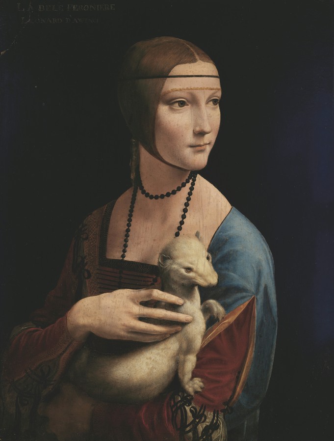
dite La Dame à l’hermine (1489).
En insistant excessivement sur le fait que Léonard de Vinci était un génie « autodidacte », on a en quelque sorte négligé les recherches sur les influences intellectuelles qu’il a subies.
Sa première expérience fut son apprentissage chez Andrea del Verrocchio (1435-1488), dont l’atelier florentin était calqué sur celui de son tuteur, le sculpteur érudit Lorenzo Ghiberti (1378-1455), où les élèves étudiaient l’astronomie, la poésie, l’architecture, la sculpture, la peinture, la fonte du bronze, la métallurgie, la chimie, l’anatomie et lisaient les classiques.
Puis, à Milan, en tant que peintre de cour, Léonard fut « adopté » par la jeune Cecilia Gallerani (1473-1536), maîtresse favorite (mais non la dernière) du duc Ludovico Sforza, connu sous le nom de Lodovico Il Moro, duc de Milan.
Elle naquit dans une famille nombreuse de Sienne, dont le père, Fazio Gallerani, n’était pas noble mais occupa plusieurs postes importants à la cour de Milan, notamment celui d’ambassadeur auprès des républiques de Florence et de Lucques.
Cécilia reçut, avec ses six frères, une éducation en latin et en littérature. Elle est surtout connue pour avoir inspiré à Léonard de Vinci le tableau « La Dame à l’hermine » (vers 1489), une œuvre où le sens de mouvement prime déjà sur la représentation statique. On raconte que, lors d’une séance de pose, elle invita Léonard à rejoindre le cercle littéraire qu’elle animait au Palazzo Carmagnola, où elle présidait des débats intellectuels avec des philosophes, des poètes et des musiciens.
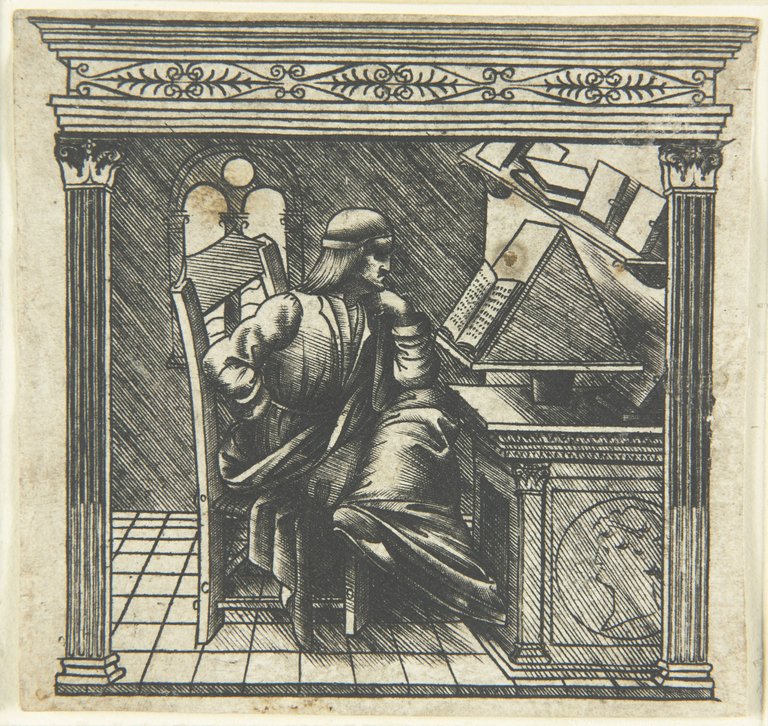
supposé être un portrait de Bernardo Bellincioni.
Composant elle-même des œuvres musicales et poétiques, prononçant des discours en latin et en italien dès l’âge de 16 ans, réputée pour son esprit et son érudition, elle est considérée comme l’une des femmes les plus cultivées de la Renaissance italienne.
Bien que la quasi-totalité de son œuvre ait disparu, elle reste dans les mémoires comme une figure majeure de la langue italienne, grâce à sa maîtrise de la littérature et de la poésie. Le poète de cour Bernardo Bellincioni (1452-1492), ami de Léonard, loua son talent littéraire, allant jusqu’à la comparer à la célèbre poétesse grecque antique Sappho, qui aurait inspiré Platon.
La Cour de Milan et ses mécènes ont également attiré et favorisé d’autres artistes et scientifiques, parmi lesquels l’architecte Donato Bramante, le mathématicien et ami de Léonard de Vinci, Luca Pacioli, la duchesse lettrée Béatrice d’Este, le poète Bernardo Bellincioni et l’éducateur humaniste Francesco Filelfo.
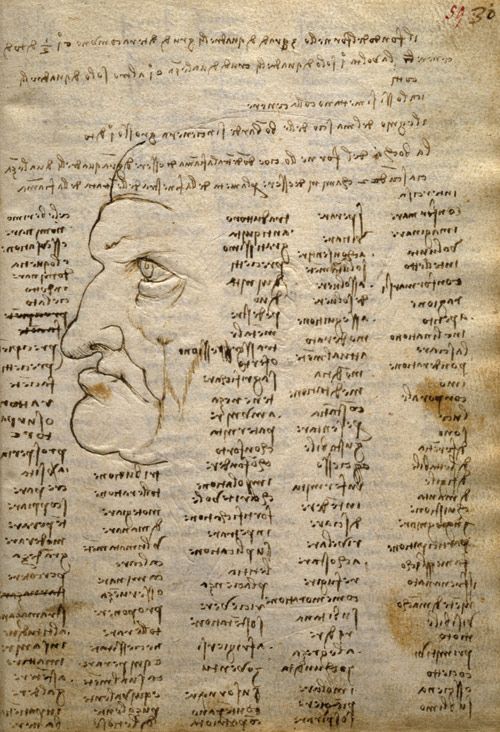
Cecilia Gallerani a-t-elle initié Léonard de Vinci aux idées de Cusanus ? Nous l’ignorons, mais elle en avait indubitablement aussi bien les capacités que l’opportunité.
Le {Codex Trivulzianus} de Léonard (1487-1490), compilé à Milan à cette époque, marque un tournant. Jusqu’à là, l’artiste avait souvent soutenu avec véhémence que l’art de la peinture était supérieur à la celui de la poésie. Or, après avoir fréquenté Cecilia, le {Codex Trivulzianus} témoigne du fait qu’il souhaitait améliorer drastiquement sa capacité littéraire, jusqu’à là plutôt modeste, en dressant de longues listes de mots savants, y compris de termes latins, tirés de sources lexicales et grammaticales faisant autorité. Il aurait considéré cela comme une condition préalable qui lui permettrait de décrire avec une précision scientifique les phénomènes qu’il allait découvrir par la suite.
Une vingtaine d’années après la mort de Léonard de Vinci, l’orfèvre et sculpteur Benvenuto Cellini (1500-1571) aurait déclaré :
« Je ne voudrais manquer de rapporter les paroles que j’entendis dire au roi à son propos. Le roi dit qu’il ne pensait pas qu’il eût existé un homme qui en sût tant que Léonard, non seulement en sculpture, peinture et architecture, mais aussi en philosophie où il excellait. »3
Comme le conclut un chercheur :
« L’unité épistémologique de Léonard de Vinci permet d’accéder à une perspective supérieure. Elle accroît non seulement notre propension à une véritable empathie et à une compréhension profonde (essentielles dans la société pluraliste actuelle), mais aussi notre accès à une forme de liberté sociale et intellectuelle. C’est une méthode pour acquérir une compréhension plus globale de la condition humaine ; en bref, pour recevoir une véritable éducation. »
Le monde a besoin de nouvelles Cécilia Gallerani et de nouveaux Léonard de Vinci. Êtes-vous prêt à relever ce défi ?
- Vincent Delieuvin, La Vierge, l’Enfant Jésus et sainte Anne, dit La Sainte Anne, site internet du Louvre.
https://collections.louvre.fr/ark:/53355/cl010066107 ↩︎ - Au Louvre avec Viviane Forrester, La Vierge et l’Enfant avec sainte Anne, dossier établi par Cécile Scailliérez, Service culturel du Louvre, Symogy, Editions d’Art, Paris, 2000. ↩︎
- Marianne Tregouët, {Cellini à la cour de François Ier (1540-1545) : les mécanismes d’une disgrâce}, Déc. 2024, HAL Id: dumas-04797814 https://dumas.ccsd.cnrs.fr/dumas-04797814v1 ↩︎
The Shadow of Vernadsky in Leonardo’s Virgin and Child with Saint Anne
In march 1821, the English poet Percy Bysshe Shelley, concluded his poem « A defense of Poetry » with a visionary concept:
« Poets are the hierophants of an unapprehended inspiration; the mirrors of the gigantic shadows which futurity casts upon the present; the words which express what they understand not; the trumpets which sing to battle, and feel not what they inspire; the influence which is moved not, but moves. Poets are the unacknowledged legislators of the world. »
We examine here, from that standpoint, Leonardo da Vinci‘s masterwork The Virgin and Child with Saint Anne.
One never gets tired of looking at “The Virgin and Child with Saint Anne”, Leonardo’s superb masterpiece in the Louvre. Formally, the painting depicts Saint Anne, her daughter the Virgin Mary and the infant Jesus. Christ is shown embracing a sacrificial lamb symbolizing the mission he took on to liberate mankind from the original sin.
Remarkably, Leonardo didn’t make this painting for a Prince, not for a Duke, not for a Cardinal, nor for a Pope, but for himself, and as such, as a legacy for humanity.
Vincent Delieuvin, the French historian of the Louvre who cross-checked all the available documentation and hypothesis, arrives at the interesting but paradoxical conclusion that with this painting Leonardo wanted to give tribute to the return of the Florentine Republic:
« Since the Florentines rose up against Gautier de Brienne, Duke of Athens, on July 26, 1343, the feast day of Saint Anne, the city had devoted particular worship to the mother of the Virgin Mary, who was considered the protector of the Republic.
After the Medici were exiled in 1494, the honors bestowed upon the saint increased once again. Leonardo’s work fits perfectly into this context of the restoration of republican government, in which the artist participated with the execution of The Battle of Anghiari in 1503. »1
When the painting was finished is not known. In general, it is thought that Leonardo da Vinci (1454-1519) started working on it in 1503 when he lived in Florence at the age of 51. The French King Frances I, who bought the panel in 1518, didn’t steal the panel, just its author who brought it with him to France to finish it.
The viewer is immediately overwhelmed by a powerful and nearly disturbing sense of motion, supreme love and beauty. The scene itself, if it shows figures from the Holy scriptures (Anne, the Virgin Mary, Christ), rather than illustrating a given liturgical sequence, manifestly springs from a well of profound philosophical reflections.
I will try to convince you here there exists a “Long arch of History” of thinking and coherence between persons and minds that never met or spoke to each other, but whose intuitions and mindsets werecongruent and oriented in the same directions. Leonardo’s masterpiece appears (in my view) as a sort of “missing link” between Nicolaus Cusanus’ vision of God and nature and Vladimir Vernadsky’s concept of the Noosphere, eventually via Alexander von Humboldt’s idea of the “Cosmos”. That might look wild and even silly at first glance, but please allow me to elaborate.
A Single Harmonic One
What unites the four towering intellectuals named Cusanus, Leonardo, Alexander von Humboldt and Vernadsky? All four were convinced that the universe is a single harmonic One.
The German cardinal Nicolas of Cusa (1401-1464), a thinker and major figure in the great ecumenical councils and the Italian and European Renaissance, begins his treatise On Learned Ignorance (1440) with a symbol. God is the “absolute maximum” and perfect unity (unio); in this unity, all distances, all divisions, all contradictions are transformed and merge into union. The universe is the contracted image of this absolute maximum and this absolute unity; it is not the absolute maximum, but, as in a mirror, the “contracted” maximum, for it does not comprise all things, but only all things outside of God, all created things. The thinker uses the terms complicatio (envelopment) and explicatio (unfolding or development) to explain that all things are enveloped in God (the source) and unfolded in the world. The world, the cosmos, and geological time are the unfolding of God’s unity.
Leonardo da Vinci (1452-1519), following in the footsteps of Cues, emphatically stated: “Understand that everything is connected to everything else.” For him, progress meant unifying different fields such as art, anatomy, and engineering into a comprehensive and coherent understanding. The artist-engineer invited his contemporaries to learn to perceive the links that unite nature, art, science, and the human soul. Observation allowed Leonardo to discover invisible causes rather than visible effects, and to imagine and test creative hypotheses. In particular, he postulated that the human body could be a miniature version (microcosm) of the Earth (macrocosm), observing that the branching of blood vessels in humans mirrors the tributaries of rivers, just as the movements of the body mimic the tides. In his view, the Earth is a living organism with “flesh” (the soil), ‘bones’ (rock strata), and “blood” (water veins). He studied the flight of birds and the movement of water, convinced that both obeyed the same fluid physics. Art is science, and science is art; both are tools for understanding the fundamental laws of the world. For Leonardo da Vinci, painters must possess the entire cosmos in their minds and hands in order to truly reflect the beauty, harmony, and complexity of nature. For the artist, movement is the very essence of a living, expanding universe. He studied the spiral patterns found in everything from flowers to curls of hair to whirlpools in water in order to understand how the life force generates different forms. Finally, he considered stagnation to be a form of decline, writing that “iron rusts from lack of use” and “inaction saps the vigor of the mind.”
The German naturalist and revolutionary Alexander von Humboldt (1769-1859) also sought to understand how various natural phenomena, despite their apparent independence, form a harmonious and unified system. He refers to an “earth system” in which climate, flora, fauna, and human life are interdependent. Humboldt believed in studying the “intrinsic link” between the general and the particular, which allowed him to perceive the interconnectedness of different regions and climates. In his ultimate multi-volume work, Cosmos (1845-1858), he described nature as a “breath of life” and an “organic whole,” and sought to describe the entire universe—physical and celestial—as a “magnificently ordered and harmonious system.” Like Cusanus and Leonardo da Vinci, he argued that a scientific understanding of natural processes increases our appreciation of their beauty.
Ukrainian-Russian geophysicist Vladimir Vernadsky (1863–1945) viewed life as eternal and inseparable from the cosmos, not just from Earth. He proposed that living matter was a “cosmic phenomenon” that had appeared elsewhere or had always existed, shaping the chemical environment of planets. He defined the “Biosphere” as a “life-saturated envelope” around the Earth, where living organisms and inert matter interact constantly, inseparably, and dynamically. Vernadsky described the transition from the biosphere to the “Noosphere” as the next stage of evolution, where rational human activity, science, and technology become the main geological force shaping the planet. He was convinced that the future of humanity depended on recognizing this unity, suggesting that human thought was a natural extension of geological and cosmic processes.
What do we see?
It is with this “Long arch of History” in mind, that the viewer can discover the “Shadow of Vernadsky » in Leonardo’s Saint Anne. Because, what does the viewer see?
- The background of the painting features sharp, prehistoric-looking crags inspired by Leonardo’s studies of the Dolomites and the Alps. This barren, rocky terrain, nearly lunar, has been described by historians as “fantastical” or “metaphysical”. As we know from his notebooks, Leonardo was interested in painting “invisible” movements, not only those of the souls, but also universal phenomena such as “time”, especially “geological” time. How did mountains arise, etc.? Others, correctly argue that the « dead » or lunar landscape of the background, what Vernadsky would call the “Lithosphere” serves to highlight the other elements of the composition.
- On the right, one could see the tree (the “biosphere”) as representing a step in an evolutionary process of the development of the cosmos.
- Beneath the tree, the lamb (in religious terms a symbol of Christ’s sacrifice to free mankind) also represents a higher form of conscience of that same “biosphere”
- Then appears Jesus, who, represented in his human incarnation, that of a child, represents only a sort of naive conscience, merely the potential for his further development.
- The Virgin Mary, is represented in a paradoxical position which is a perfect example of what the late Lyndon LaRouche identified as “mid-motion-change”, meaning an ambiguous instant of indecision between two or more contrary movements. Her majestic, loving and protecting gesture and embrace of Jesus coincides with her vivid desire to induce the boy all the freedom of movement he needs to fulfill his sacred mission.
- Saint Anne, on top, as a sort of self-conscious form of agapic love, looks down and smiles seeing the majestic gesture and love for Christ of her daughter Mary. She is happy to be the self-conscious “noospheric” soul of a divine and living Cosmos, where the creator permanently creates ever higher forms of creation and of consciousness of its own creative nature. The rings of lunar mountain chains resemble and resonate visually with the harmonic rings formed by arms and clothes in a cascade of aesthetic spiral action.
Even authors polluted by nasty modernist and Freudian misinterpretations such as Viviane Forrester2 who wrongly pretend we are mislead by an overwhelming sentiment of mildness of Mary, nevertheless acknowledge intuitively there is something very special in this work, a sort of unity Forrester brands, not finding a better name, “organic”. When we discover these figures, she writes:
“one clearly sees they are living organisms in the midst of a landscape, a living organism. Organic inside Organic.” (p. 12)
That organic moment, she observes, appears here to the viewer as a “frozen moment” of a “transitory movement”.
Their “next respiration, the one that will follow, seems more important, vital, more suspended than any intrigue, any narrative. And their [the figures] tangible presence, fragile, matches that of the mountains, who respire as well.” (p. 13)
The making of a genius
By over-emphasizing that Leonardo was a “self-taught” genius, research on the intellectual influences he underwent was somehow neglected.
The first chance he had, was to be an apprentice of Andrea del Verrocchio (1435-1488), whose Florence workshop was modeled on that of his tutor, the Florentine erudite sculptor Lorenzo Ghiberti (1378-1455) where pupils studied astronomy, poetry, architecture, sculpture, painting, bronze-casting, metal-works, chemistry, anatomy and read the Classics.
Then, in Milan, as a court painter, Leonardo was “adopted” by the young Cecilia Gallerani (1473 – 1536), the favorite (but not the last) mistress of the Duke Ludovico Sforza, known as Lodovico Il Moro, Duke of Milan.
She was born into a large family from Siena. Her father’s name was Fazio Gallerani. He was not a member of the nobility, but he occupied several important posts at the Milanese court, including the position of ambassador to the Republic of Florence and Republic of Lucca. Cecilia was educated alongside her six brothers in Latin and literature.
She is best known as the subject of Leonardo da Vinci’s painting Lady with an Ermine (c. 1489), already a painting where movement prevails over static representation. It is said that while posing for the painting, she invited Leonardo to be part of the literary circle she hosted at her residence in the Palazzo Carmagnola, where she engaged in intellectual debates with philosophers, poets, and musicians. Gallerani herself presided over these discussions.
Composing music, poetry and delivering orations in both Latin and Italian at the age of 16, renowned for her wit and scholarship, she was considered one of the most cultured women of the Italian Renaissance.
While nearly all of her works were lost, she is remembered as a “great light of the Italian language” due to her mastery of literature and verse. The court poet Bernardo Bellincioni (1452-1492) highly praised her literary talents, even comparing her to the famous Ancient Greek poetess Sappho which allegedly inspired Plato.
The Court of Milan and its patrons also attracted and protected other artists and scientists, among which the architect Donato Bramante, the mathematician and friend of Leonardo, Luca Pacioli, the duchess Beatrice d’Este, the poet Bernardo Bellincioni and the humanist educator Francesco Filelfo.
Did Cecilia Gallerani introduce Leonardo to the ideas of Cusanus? We don’t know, but she certainly had both the knowledge and ability to do so.
Leonardo’s Codex Trivulzianus (1487-1490), shows he was working hard to improve his modest literary education, through long lists of learned words, including Latin words, copied from authoritative lexical and grammatical sources.
The scientist reportedly saw this as a precondition that was going to allow him to describe with scientific precision the phenomena he was going to discover in the future.
About twenty years after Leonardo da Vinci’s death, the goldsmith and sculptor Benvenuto Cellini (1500–1571) is said to have remarked:
“I would not want to fail to repeat the words I heard the king say about him. The king said that he did not believe there had ever been a man who knew as much as Leonardo, not only in sculpture, painting, and architecture, but also in philosophy, in which he excelled.”
As one scholar concludes:
Leonardo’s “epistemological unity allows one to be elevated to a higher perspective. It not only increases our propensity for genuine empathy and understanding (much needed in today’s pluralistic society), but also for a kind of social and intellectual freedom. It is a method of acquiring a more holistic understanding of the human condition; or in short, of getting a real education.”
The world needs new Cecilia Gallerani’s and new Leonardo da Vinci’s. Are you ready to go there?
NOTES:
- Vincent Delievin, La Vierge, l’Enfant Jésus et sainte Anne, dit La Sainte Anne, website of the Louvre; ↩︎
- Au Louvre avec Viviane Forrester, La Vierge et l’Enfant avec sainte Anne, Léonard de Vinci, dossier établi par Cécile Scailliérez, Service Culturel du Louvre, Symogy, Editions d’Art, Paris, 2000. ↩︎
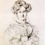
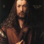
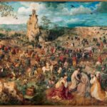


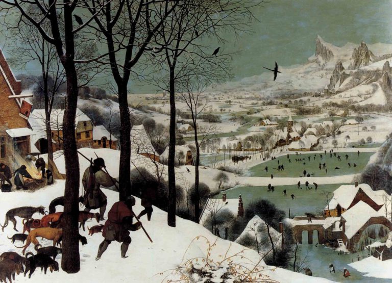