Étiquette : China
Karel Vereycken:以悖论式隐喻,显现无形之物


Posted on by Jonathan Hale
Also available in: EN ES FR DE IT
在一个充斥着浮光掠影与浅显直白的世界里,有这样一位艺术家,他致力于挖掘更深层的真理,将无形之物引入可见之境。Karel Vereycken 正是这样一位艺术家。他是一位版画家,其艺术之旅始于比利时的历史名城安特卫普,如今在法国的阿尔让特伊绽放光彩。他的作品超越了单纯的再现,通过精心构建的悖论式隐喻,深入探究人类经验的复杂织锦。Vereycken 的艺术不仅供人观赏,更是一场深刻对话的邀约,一场对塑造我们生活的无形力量的沉思。
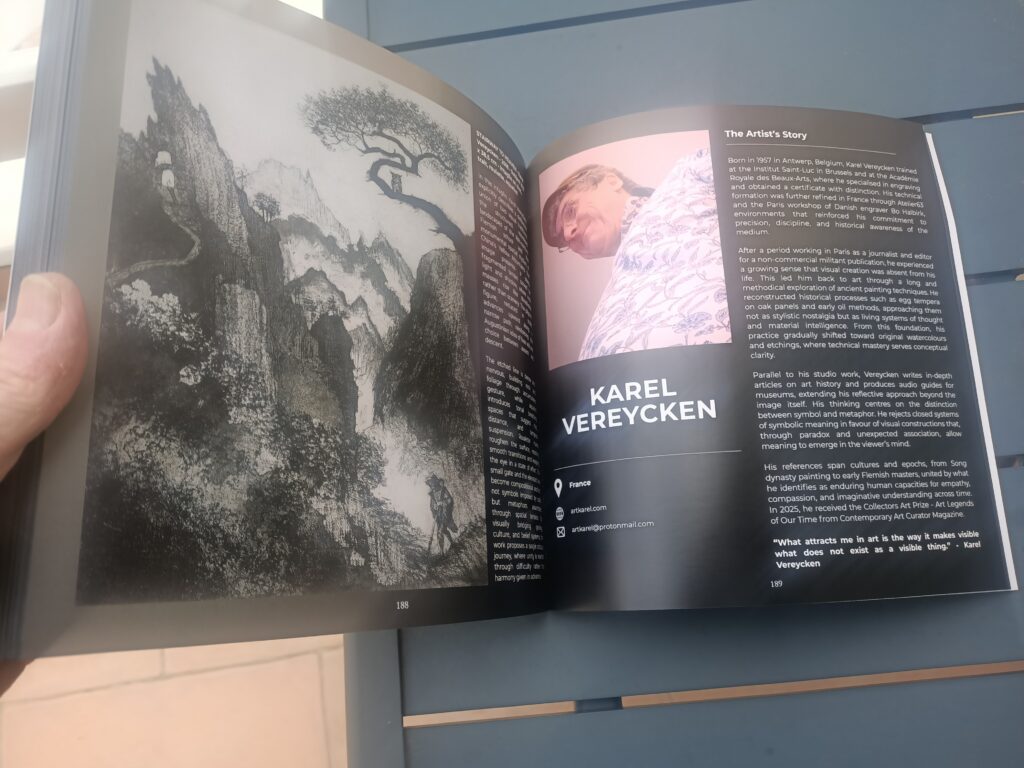
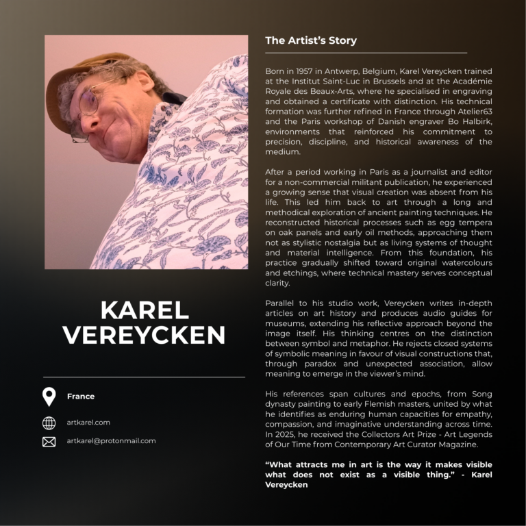
Karel Vereycken 于1957年出生于安特卫普,他的艺术之路并非坦途,而是一场由际遇和内在驱动力共同塑造的丰富探索。他的父母在港口与船舶维修行业的背景下艰难谋生,但他们认识到文化熏陶对孩子成长的重要性。Vereycken 早年曾短暂学习音乐,后因刻板的教学方法而中断,转而进入一所社区绘画学校,正是这里为他未来的艺术生涯播下了种子。在雕塑家 Herman Cornelis 的指导下,他学会了观察与复制的力量,这位老师采用的是一种亲身实践、凭直觉教学的方式。十二岁时,他迎来了人生的一个关键时刻——赢得了他的第一个艺术奖项。这份认可,加上老师对他“宝贵天赋”的肯定,促使他接受更正规的训练。在母亲的鼓励下,他进入布鲁塞尔的圣卢克学院,沉浸在造型艺术的学习中。在这里,通过对解剖学以及达芬奇和阿尔布雷希特·丢勒等大师作品的严谨研究,他为理解形式与表达奠定了坚实的基础。随后,他在皇家美术学院继续深造,以“优异”的成绩获得了铜版画专业的结业证书,进一步巩固了他对技艺掌握的执着追求。
之后移居巴黎的时期,Vereycken 参与了多样的活动。他最初为一家非商业出版物从事新闻和编辑工作,但艺术的呼唤始终萦绕心头。他回归其艺术本源,起初探索古代绘画技术,使用手工制作的蛋彩和传统的油画技法重现古典大师的作品。这段时期虽然在技术探索上收获颇丰,但在展览方面却充满挑战,因为这些作品在他有机会展出之前就已被人收藏。这促使他重新将注意力转向水彩和精细的蚀刻版画工艺,这些媒介后来成为他创作实践的核心。
他持续参与法国的蚀刻版画社群,这体现了他对磨练技艺的不懈追求。作为法国国家版画联合会的成员,Vereycken 在 Atelier63 工作室提升了他的技术实力,并在丹麦版画家 Bo Halbirk 创立的蒙特勒伊印刷工作坊进一步完善了他的工艺。这段从安特卫普充满活力的街道到布鲁塞尔和巴黎艺术中心的旅程,彰显了他对卓越的终生追求,以及对艺术创作不朽力量的根深蒂固的热情。
“Sublimart”:悖论式隐喻的艺术
Vereycken 的艺术创作可以用他自创的术语“sublimart”来最好地描述——一个融合了“sublime”(崇高)与“art”(艺术)的词。这个新词概括了他独特的创作手法:运用悖论式隐喻,将灵魂提升至崇高境界的具象艺术。他的作品无关乎肤浅的美或直白的叙事,而是构建视觉上的悖论,以此作为通往更深层次理解的大门。正如他言简意赅地指出的,“让无形可见”是他创作背后的驱动力。他实现这一目标并非通过传统的象征主义或直接的描绘,而是将迥异的元素编织在一起,以此挑战观者的感知,激发深入的思考。
他主要运用的材料和技术——蚀刻、绘画、油画和水彩——都经过了审慎的选择。蚀刻版画,凭借其固有的精确性与错综复杂的线条表现力,尤其适合他探索层层递进的意义。蚀刻的过程需要耐心与审慎的行动,这与其观念性隐喻的深思熟虑的构建过程如出一辙。他对古典技术的执着,结合现代的感性,使其具象作品充满了深刻的情感与智识共鸣。每一件作品都是形式与观念之间精心编排的对话,邀请观者踏上一段个人的发现之旅。
Vereycken 作品的主题基础并非刻意为之,而是从他与世界的互动及艺术探索中自然生发。他希望“通过向人们展示,没有什么比‘古典’艺术更‘现代’、更‘革命’,从而震撼他们”。然而,他对古典艺术的定义远非僵化或学院派。对 Vereycken 而言,它代表着一种“基于非犬儒、具解放性、充满反讽与诗意隐喻的构图科学”。他相信,这些隐喻是所有艺术形式(无论是视觉艺术还是音乐)的根本关键。他的方法植根于这样一种理解:艺术是艺术家赠予观者的深刻“礼物”,是一种促进联结和共享体验的爱的行动。
艺术启迪的愿景
Karel Vereycken 的艺术事业充满了深刻的使命感,远不止于创作赏心悦目的物品。他将自己的工作视为一种“教学活动”,一场“人文主义思想游击战”,旨在唤醒观者,让他们感知到新的维度。虽然他承认销售对于推进其艺术事业的重要性,但他最终的动机并非迎合大众品味,而是促进与观者更深层次的联结。他努力使艺术成为一扇“窗户”,通往人们凭直觉认为重要却往往无法触及的领域。
他致力于分享自己的知识和热情,这充分体现了他对这一愿景的承诺。他曾在巴黎卢浮宫、安特卫普、布鲁塞尔或法兰克福的博物馆、米兰的布雷拉美术馆、柏林的画廊以及纽约大都会艺术博物馆等主要艺术机构举办过多次导览。这些沉浸式体验已被记录下来,部分录音可在他的网站上获取,让更广泛的受众能从他的见解中受益。他收到的由衷感谢,许多人表示惊讶于思想竟能通过绘画如此深刻地传达,这突显了他教学方法的影响力。
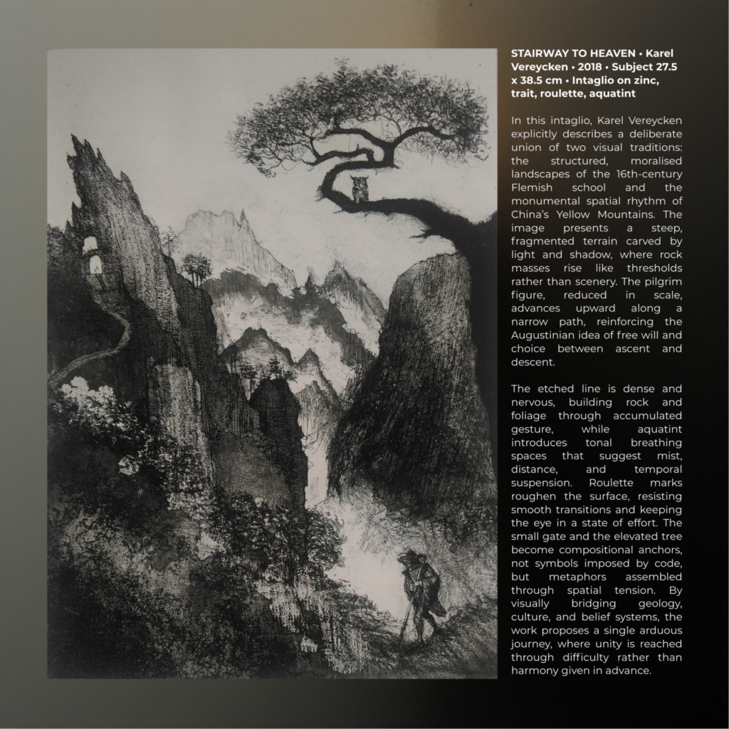
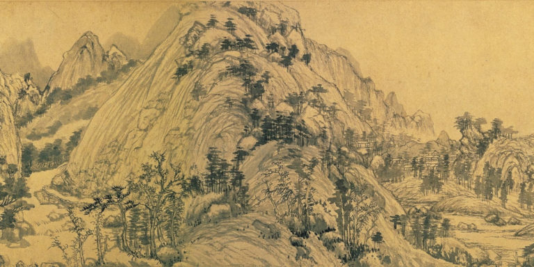
展望未来,Vereycken 的发展轨迹依然以积极参与和扩大其影响力的愿望为标志。他的作品曾在纽约的 ARTEXPO 和巴黎卢浮宫卡鲁塞尔厅的 ARTSHOPPING 以数字形式展出,他持续活跃于当代艺术平台。在赢得“蒙娜丽莎奖”并随后在巴黎的 Galerie Mona Lisa 举办展览之后,他的重心仍然是分享他那具有变革力量的艺术。即将在萨尔瓦多为 SUMARTE 2026 举办展览的计划,标志着他的国际抱负以及让全球观众接触到他独特视角的持续承诺。他正在进行的作品,如概念丰富的《天堂阶梯》,展示了他对融合多元视觉灵感——在此例中是中国黄山的风光与佛兰德的风景画传统——的持续探索,旨在为人类旅程打造强有力的隐喻。
Karel Vereycken 的艺术证明了求知欲、精湛技艺以及对艺术启迪人类精神能力的深刻信念所具有的持久力量。通过创造悖论式的隐喻,他邀请我们超越表象,去探寻塑造我们存在的无形意义之流。他的作品有力地提醒我们,真正的艺术性不仅在于所见之物,更在于所感、所悟,并最终被揭示的一切。
欲联系 Karel Vereycken 并探索其引人入胜的作品,请访问他的网站及社交媒体平台:
- 网站: https://artkarel.com/
- Instagram: https://www.instagram.com/karelvereycken/
- Facebook: https://www.facebook.com/karel.vereycken/
- Manifestampe 个人资料: https://www.manifestampe.org/utilisateur/karel-vereycken/profil
- 《当代艺术策展人杂志》访谈: https://www.contemporaryartcuratormagazine.com/home-2/karel-vereycken-interview
Karel Vereycken Celebrated in « 100 Artists of Europe » Book

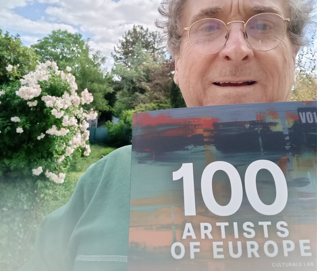
The art work of Franco-Belgian painter engraver Karel Vereycken is featured in the just released book « 100 Artists of Europe » published by Culturale Lab. The artist is honored to be part of this initiative celebrating creativity across our continent ! #100ArtistsOfEurope #EuropeanArt #CultureAndArt
Contemporary Art Curator Magazine interviews Karel Vereycken on what went wrong with Modern Art

On December 1, the United Arab Emirates based Contemporary Art Curator Magazine published a long, in depth interview with Karel Vereycken, his creative methods and his view on what went wrong with Modern and Contemporary Art.
Contemporary Art Curator Magazine is a leading contemporary art magazine, available in both online and print formats, dedicated to promoting and supporting contemporary artists. It has built a reputation for curating exceptional contemporary art from around the globe.
Founded in 2014, the magazine has consistently supported emerging and established artists, highlighting their work and contributions to the art world.
Karel Vereycken’s work selected by Divide Magazine


On November 9, 2025, Karel Vereycken was informed by the leading London-based contemporary Art Magazine Divide :
« We’re excited to let you know that your work has officially been selected and published in Divide Magazine Issue 16! » (p. 91)
« This round was an especially hard decision — we received an incredible number of strong submissions, so making final selections wasn’t easy. That’s why we’re extra thrilled to include your work in this issue. »
You can view and download your free digital copy at: https://issuu.com/divideartmagazine/docs/divide_magazine_-_issue_16
Divide is « an international, independent, bimonthly contemporary art publication based in London, England. It is known for featuring emerging and established visual artists from around the globe, showcasing diverse mediums including photography, mixed media, and installation art. » The magazine is available in print and online versions.
Empathy, sympathy, compassion – Humanity’s cultural heritage, key to world peace

Dieses artikel in gutes Deutsch PDF
Cet article en français en ligne

Empathy, sympathy, compassion – Humanity’s cultural heritage, key to world peace. Speech by Karel Vereycken, painter-engraver, at the Schiller Institute’s international conference on 15 and 16 June 2024.

Before talking about World Cultural Heritage, two words about the notions of “sympathy”, “empathy” and “compassion,” three words constructed with the word “pathos”, the Greek word for “suffering” or “affection”.
Today, the word “empathy” is often used interchangeably with the words “sympathy” and “compassion,” but they aren’t really the same thing. All three refer to a caring response to someone else’s distress (pathos).
–Sympathy is a feeling of sincere concern for and share the feelings of someone who is experiencing something difficult or painful (pathos).
—Empathy was a word coined in the early 20th century as a translation of the German Einfühlung, it means feeling with people, not just feeling for them. When you’re empathetic, you’re right there with them, feeling it too, because you put yourself, in a sense, “in the shoes of the other person.”
–Compassion goes of course beyond empathy and means action. Compassion goes with altruism, or “a desire to act on that person’s behalf.” Put simply: you relate to someone’s situation, and you want to help them.
But empathy is particularly key for our subject here, that of “peace building” because it can build a bridge between persons considering each other as “enemies”. We can show empathy for persons we don’t consider sympathetic at all. We don’t share their feelings, but we go beyond mere affection and engage in what is called “cognitive empathy”: we know enough about the other person’s background and culture to understand his motivations. As a byproduct, empathy can help us to forgive and pardon as requested by the Peace of Westphalia.
Today, if we want to make peace a reality, we have to mobilize ourselves to raise the level of empathy. Empathy is under massive attack:
- –by the promotion of brutal competition (that’s why professionnal sports are allowed)
- –a culture of screens and
- –the breakdown of person to person dialogue.
There was a campaign to increase empathy in Europe after the bloody wars between France and Germany, when the Goethe Institute opened in France and the Alliance Française in Germany. There was also a movement of “sister” cities allowing people from one village to visit a “sister” village in the other country. They would talk, laugh with their prejudices and celebrate together, have inter personal dialogue and learn to read on the faces the emotions standing “behind” the words.
Now, the knowledge one can acquire of each other culture, language and history, are of course a fundamental tools to develop this “cognitive empathy” which allows you to see persons as “products” of a history, a culture and a civilization, rather then as atomized little entities.
For example, after I discovered the philosophy of mutazalism of the Baghdad Abassides Califate, my entire vision of Islam changed. I know exactly what happened to their civilization, their frustrations and hopes.
Today, China is currently heavily involved and mobilized to protect especially the pre-islamic cultural heritage of Afghanistan and other countries of Central Asia. It is in its own interest. One leading Chinese archaeologist which I met, rightly said that the beauty and intellectual challenge of this art is “the best way to fight terrorism.” Not weapons and drones but culture!
It it was in Afghanistan that the silk road players met when the Greek culture walked towards the East and the Chinese culture walked towards the West.
The Buddhists that prospered in this area were very active over both the maritime and terrestrial silk roads, reaching into Pakistan, India, Sri Lanka, Xinjiang and China. They paid huge attention to metallurgy, architecture, painting, sculpture, poetry, and literature. The first printed text known today is a Buddhist text of 868 AD.
Added to this, the birth of a very agapic form of Mahayana buddhism in the region of Gandhara (now mainly in Pakistan). Its followers, in stead of pursuing a purely personal goal of nirwana (enlightenment), rather took pleasure to free all of humanity from suffering !
Empathy, compassion and mercy were the supreme qualities to be glorified in Gandhara art especially in the form of what are called Bodhisattva’s, that is ordinary persons that are set to become enlightened but elect instead to remain in this world, easing the suffering of all beings and helping others attain enlightenment.
Two examples:


The one who understood that this revolutionary form of Buddhism could pacify the region was the Indian Prime minister Nehru who named his daughter Indira Priyadashini (the future Prime Minister Indira Gandhi), because « Priyadarshi » was the name adopted by the great emperor Ashoka the great (304 – 232 BC) after he converted and became a Buddhist prince of peace!
In 1956, just before the creation of the non-aligned movement and the Bandung conference, Nehru orchestrated a year-long celebration honorifying “2,500 years of Buddhism”, not to resurrect an ancient faith per se, but to claim for India the status as the birthplace of Buddhism: an ancient belief advocating non-violence, pacifism and that calls for ending the disgraceful “caste system” the British worsened and wanted to maintain worldwide.
Mes Aynak
Today, with the Ibn Sina Research & Development Center in Kaboul, we of the Schiller Institute are working day and night to save the archaeological site of Mes Aynak which we want to have classified by UNESCO as a world heritage site.
Mes Aynak is the world’s second largest copper reserve and Afghanistan needs the mining activity to get revenues to complete its urgent reconstruction. But on top of the mine stands the ruins of a vast monastic Buddhist complex that was a key trading post of the silk road between the 1st and the 8th century.
After our campaign and forth and back discussions between the afghan government, China and the Chinese mining company, all actors agreed that the entire cultural heritage on the surface will be protected and mining will only take place with underground mining techniques.
We won a fight, now we have to win the peace.
Full study:
Thanks to WEST’s new record, world’s nuclear fusion community moving forward

On Monday May 27, 2024, Karel Vereycken talked to physicist and nuclear fusion specialist Alain Bécoulet for Nouvelle Solidarité. He has been in charge of the ITER project’s engineering department since February 2020.
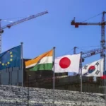
ITER is a large-scale scientific experiment intended to prove the viability of fusion as an energy source. ITER is currently under construction in the south of France. In an unprecedented international effort, seven partners—China, the European Union, India, Japan, Korea, Russia and the United States—have pooled their financial and scientific resources to build the biggest fusion reactor in history.
Alain Bécoulet is a former research director at the French Alternative Energies and Atomic Energy Commission (CEA), and in particular director of the IRFM, the Institut de recherche sur la fusion par confinement magnétique (Institute for Research on Fusion by Magnetic Confinement).
Karel Vereycken: Mr. Bécoulet, good morning, it’s great to have you on the phone.
Alain Bécoulet: Hello Mr. Vereycken, if I’ve understood correctly, you’re interested in what happened at WEST, in connection with the press releases that went out just about everywhere around May 15. (more below)
That’s right; I’ll give you my impressions and you can correct me. I understand that the Tore SUPRA Tokamak (in southern France)1, who with six minutes held a world record in duration till 2021, was a bit like your baby.
To tell the truth, I was director of the IRFM2, in charge of Tore SUPRA. If it can be considered “my baby”, it’s because under my governance it was radically modified and upgraded, and renamed “WEST”. Before me, it was Robert Aymar‘s baby3.

Right! But in WEST, it’s the W that does it all. And it’s a W for tungsten, a very heat resisting material that absorbs less than graphite and makes the machine more efficient?

Yes, it does. The major change we made with WEST, is that we went from a circular-limiter machine 4 to a “divertor” machine.5
On Tore SUPRA, the vertical plasma action was a circle resting on a graphite limiter and the plasma simply touched it.
For some years now, we’ve discovered that making a plasma in the shape of a D, or in the shape of a fish with an X point — called a “divertor” — produces much better results in terms of confining heat and impurities, particles, etc. So it was time for Tore SUPRA to go there.
At the same time, Tore SUPRA itself made it clear for us, that for ITER, it was not possible to continue with carbon – which was ITER’s original intention – and so ITER switched and was reconfigured to tungsten.

That’s when we took the opportunity to install a cooled tungsten divertor in Tore SUPRA. What’s more, Tore SUPRA’s mission has always been, even before ITER – we’ve been talking about it for a very long time now – the development and integration of technological solutions, and not so much performance-fusion.
If you put tritium in Tore SUPRA, you’re not going to get much in the way of power: it’s too small and not powerful enough in any ways to make fusion reactions of any note; but on the other hand, it’s perfectly relevant for all technological developments – it was on Tore SUPRA, it has to be recalled, that the first successful full-scale test of the superconducting coils now used in ITER took place!
I’m fully aware of that.
It was also Tore SUPRA that supplied all the rules for actively cooling all the components in front of the plasma, including diagnostics [i.e. measuring instruments], etc.; not forgetting solutions for continuous additional heating, in short a huge amount of technology.
So the idea, in the transition from Tore SUPRA to WEST, was to continue along the path of the “actively cooled tungsten divertor”.

I think the Koreans, too, with KSTAR, had already.…
There are several superconducting machines that have made equivalent advances –more successive than simultaneous– and that have inspired others; in this case, before talking about KSTAR, the machine that is closest to WEST, its little sister – you’re going to smile, but I didn’t call it WEST for nothing — is a machine that started up when Tore SUPRA was already operating, in Hefei, China, called EAST — with which we have cooperated enormously, both on coils and on plasma components, etc.

So the two laboratories have cooperated enormously; I chose the name WEST because we wanted to change the name of Tore SUPRA, to rejuvenate it and mark the fact that we were making this technology; so we called it WEST, a sort of sister machine to EAST, and the two machines really work together (EAST has now installed a tungsten divertor, etc.). ); even some of the modifications we made to WEST were made in cooperation, in partnership with the EAST machine, with the Chinese Academy of Sciences, which supplied us with components, in particular the power supplies for the divertor coils, the new ICRH antennas, etc.; we had all this done by the Chinese.6
It’s extraordinary that this kind of cooperation can still take place in this world of conflict…
It really is! As for KSTAR, it’s quite a similar machine too, but I’d call it less pioneering. It’s only now arriving in this kind of world; it’s a long way behind –not that I’m blaming them, because since the teams are smaller, it’s more difficult– but that doesn’t stop us from cooperating a lot with KSTAR.
The only real difference with WEST lies in the coils, which are all inside a single cryostat (refrigeration system) – as with ITER, whereas in Tore SUPRA, when we built it, the coils were each in a separate cryostat.
To sum up: today, the large superconducting machines accompanying the ITER project are WEST, EAST, KSTAR and now the new JT60SA tokamak which has just gone into operation in Japan. It’s the size of the JET (at Culham in the UK) in superconductor, but doesn’t yet have a tungsten environment, and won’t for several years yet; so it’s not yet fully in a world as relevant, but it’s coming! And because it’s larger, it’ll probably outperform those EAST, WEST, etc. machines.
The press, and the official press release, reports a 15% gain in energy produced – which is still less than the energy spent on the reaction – and at the same time, they talk of a doubling of plasma density.
Please note: machines like WEST, EAST and KSTAR will never produce power fusion, for at least two good reasons:
- they’re too small;
- they’re not designed to hold tritium.
So there’s no fusion in these machines. Also, beware of energy gains and the like: these are gains in energy stored inside the machine, but not at all in energy supplied, in energy produced by fusion energy.
It’s not yet “break-even” (when the energy produced exceeds that of the reaction).
In fact, we improve confinement and increase confinement time. This improves the possibility of fusion, but we don’t enjoy fusion in these machines, which are too small and not powerful enough for that, particularly in terms of core plasma.
On the other hand, they are used because their edge plasma, i.e. the plasma inside the plasma interacting with structures such as tungsten, etc., is very similar to ITER’s. That’s why they’re so interesting, and as they can produce very long-lasting plasmas, the tests carried out in these machines are perfectly relevant to ITER.
So I’d like to come back to one of your questions, namely how this advances the promises of ITER. ITER is being built, and things are being manufactured, but ITER is a kind of big eater, constantly asking: “Can you continue the research?”

Obviously, we’re into things we’ve never tested, so anything we can test, anything that can debug things for us, is very welcome. So these machines, in particular WEST, EAST, etc., are helping us to consolidate our position, both in terms of design and in terms of manufacturing solutions –a divertor like the tungsten divertor currently cooled, it works!
And what WEST has just demonstrated– compared with the last time, when it achieved very high performance, particularly in terms of duration, with the Tore SUPRA configuration, on a carbon limiter, etc. — it did so in even more relevant conditions, thanks to a tungsten divertor.
The result of WEST was 364 seconds, or 6 minutes and 4 seconds, with an injected energy of 1.15 GJ, a stationary temperature of 50 million°C (4 keV) and an electron density twice that of the discharges obtained in the previous tokamak configuration, that of Tore SUPRA.
However, what’s really new and very important for ITER is that when these machines do this, it’s with components facing the plasma that are the same as ITER’s. We’ve taken great care to ensure that the WEST divertor has exactly the same technology as the ITER divertor. That’s how we test this technology, over timescales and with power flows arriving on these components that are highly relevant, as they are representative of the conditions in which they will live in ITER.

So ITER has become a globalized scientific experiment, decentralized and centralized at the same time.
ITER is the place where all the world’s fusion knowledge is being synthesized; but this process didn’t stop the day we signed the treaty, it’s being synthesized every day!
We continue to feed ITER with scientific and technical results. For example, if a machine says to us “wait a minute, you’ve done that, but we’ve found results that are different now that we’ve done more work”, we look at that very carefully, to find out whether or not there are any impacts. We’re in constant contact with all these people, to find out what’s coming out of the labs, experiments and simulations, and to find out whether or not there’s an impact on ITER, in which case we’re able to rectify the situation according to the scale of things
This sharing of cooperative data takes place in conditions of great trust?
It’s a scientific community that works like a scientific community, with no preconceptions, no ulterior motives, nothing at all.
A bit like the astronauts on the international space station?
Absolutely. We used to say “in the old days, it was taken for granted”, but now it’s true that it’s become almost surprising. If there’s a result in a Russian or Chinese machine, we have access to it and then we understand, we work, we discuss with them, it’s really very open.
That’s very promising.
We have to fight against the journalists who love to wonder whether there’s competition, whether someone has won or whatever…. That’s not what we’re about at all; we’re about cooperative scientific development. Everyone works in their own corner, of course, but for everyone! There’s no such thing as “I know, I know”, no, none of that exists in the world of fusion.
In the article I’m preparing, I’ll conclude by saying that the big problem with ITER is that there’s only one problem!
In a way, it’s almost true, it’s not the “big problem”, but it’s something that doesn’t encourage acceleration; competition encourages acceleration, we agree on that.
After all, the Chinese have 6 fusion reactors…
Be careful, they’re not “reactors”, beware of the vocabulary. They’re experiments, Tokamaks, plasma experiments, all much smaller. The biggest one I mentioned, in Japan, is ten times smaller than ITER!
Now there are start-ups and others, which we’re hosting here (at the CEA center in Cadarache, France) for three days; 50 start-ups are here, downstairs in the amphitheater, chatting with us; they’re all convinced they’re making reactors, but no! They’re just doing experiments, manips, experimental prototypes. Yes, even ITER isn’t a reactor. Mind you, the meaning of the word “reactor” is to produce electricity or energy, and we’re not there yet!
If someone tells you he is selling you a reactor, you can laugh in his face, because it’s not true, and it will remain so for a long time, unfortunately or fortunately, I don’t know. As far as the reactor phase is concerned, we’ve only just begun, with ITER, the transition to industry. That’s what we’re also doing these days, looking at how to transfer knowledge from laboratories – and ITER is THE world laboratory, in the true sense of the word, in the sense of a public research laboratory. How do we begin to transfer this to the industrialists who will have to build the reactors? But the time scale here isn’t next week!
Wouldn’t your real competitor be the National Ignition Facility (NIF)?7
Not even close! Because with the Americans, it’s in a way even worse, because they’re even less developed in their public research, it’s a long way from maturity. They once did a demonstration in a machine that wasn’t designed for it, and so on.
So if we wanted to go from the NIF to the reactor, we’d already have to make up all the ground we’ve accumulated since the state of magnetic fusion with the big JET experiments in 1997. So we’re almost 30 years away from reaching the levels of technological maturity, integration and overall maturity needed to move towards a reactor. And we, too, are still a long way from moving towards the reactor.
As far as competitors are concerned, to be honest, no one feels like a competitor today, and this is no joke: may the best man win! The problem is so complicated, and the stakes so high, that whoever comes up with the solution will have us all on our feet! There’s no such thing as competition.
We’re starting to see, with these new start-ups, people saying “yes, but we’re moving towards industrial solutions, etc., so we may develop patents that we obviously don’t want to reveal or sell”. Fair enough!
But hey, if they know how to make one of the “technological bricks” and it has a patent, good for them. But that’s not even going to stop us talking. A patent, once you’ve registered it, isn’t a secret, it’s simply something that belongs to you and that you can put on the public square; whoever uses it is just going to have to pay for it, that’s all. So it’s not a war or anything.
The problem is really extremely complicated, and we’re now entering the pre-industrial world of the thing, which is very exciting, isn’t it! I started my career as a theoretician 35 years ago, and I can tell you that we were really on the calculator and not even on the computer yet. Now we’re in: 1/ a complete demonstration of the feasibility of the whole system with ITER, which is in a way the end (the objective) of fundamental public research; 2/ the moment when we’ll say “here’s the great recipe, now it’s up to you to industrialize it, improve it, make it economically viable, etc.”. But ITER still has to show that we can do it, and I believe we can, even though we’re still building the machine and haven’t yet made plasma! But then again, on paper it’s always beautiful…
What do you see as the final hurdles? What more can the public authorities in the various countries do?
I’d encourage you to keep an eye on things until October-November, when the International Atomic Energy Agency (IAEA) will issue a strategic document, prepared by all of us –and I’m one of its key authors. It’s a global strategy document on the development of fusion energy, i.e. the production of energy through fusion.
It’s a very interesting document which, in around twenty pages, covers all the regulatory, technological, scientific and industrial aspects – everything you could possibly dream of: it’s got it all!
And it gives a great deal of information on the challenges facing this community – which is in the process of moving from a purely public research community to a mixed public-private community, moving towards industry, etc. – and on what remains to be done by this community, in terms of nuclear regulations, industrialization, work on the overall efficiency of all sub-systems, and availability (a reactor can’t just run for three minutes every day, it has to work 24 hours a day for 40 years).
This strategic document, which will be issued by the International Agency, should enable all players – I’d almost say “outsiders”: investors, the press, politicians, etc. – to understand where the merger stands and what remains to be done. So it’s a fairly ambitious document, with such a lofty goal, but one that has been made simple and readable for once; we’ve put a lot of effort into it, and I think we’ve succeeded.
It’s really condensed: each paragraph covers 40 or 50 years of research (!), but I think it’s understandable; at the moment it’s being edited by the IAEA, and will be published in early autumn.
Ok, we’ll watch that.
And finally, here are my thoughts on what remains to be done for fusion:
- New technological building blocks. There are things that even ITER won’t be able to do, such as fully demonstrating the closure of the tritium cycle – how to make tritium, and how to really burn it in situ; we’re going to do a few demonstrations, but we don’t yet have the complete cycle, and we won’t have it just with ITER.
- Materials. Since magnetic fusion generates very energetic neutrons, and lots of them – a machine like ITER is designed to live for a certain time with a certain plasma rhythm, so it has no problem surviving these neutrons. But if we built the same ITER and ran it for 40 years, 24 hours a day, it wouldn’t last; its materials wouldn’t stand up to the shock. So we need other materials, and materials research and development.
- This brings us to maintenance: how can we learn to intervene in these kinds of objects without disturbing them too much, working with robotics and appropriate intelligence to understand these extremely complex systems? So we also need to model them; some elements are very difficult to manufacture, so we need to think about how to work on the design so that manufacturers have less difficulty in doing what they’re asked to do, etc.
- There are also nuclear regulations.
Is this new measuring device just demonstrated on WEST really a breakthrough?
The first to communicate this WEST result were the Americans, which surprised me, but hey, why not?
Yes, it surprised me too.
Because of an unfortunate sentence at the beginning of their article, we got the impression that WEST was a machine from the Princeton laboratory!
Yes, that’s right!
International Cooperation
I spoke to you about the collaboration with China; when I created WEST, we set up a collaborative, partnership-based process that is almost even more ambitious than ITER. We partnered some thirty laboratories around the world to help us build WEST. It thus became a kind of international machine, operated by the CEA without any problems, but an international machine, and we played the same role as ITER: we tried to do what we call supply in kind –I mentioned the Chinese, who gave us power supplies, heating antennas, etc., but there are many countries like that: the Indians have manufactured and supplied us with things, and in this case the Princeton laboratory has designed, manufactured and installed a diagnostic: what you call a measuring instrument is in fact an advance that we test on the machine, and the Americans, or the Princeton people now, can now say “there, we know how to do that, and the proof: we tested it there and there, etc.”. You can think of these major research instruments (like WEST, EAST, etc.), particularly in the field of fusion, as test benches for all kinds of things.
Do we have a machine that actually makes plasma? It’s a bit like CERN (Geneva based particle accellerator), where you’ve got a device that accelerates particles, and then you’ve got lots of people who come to watch, put particles together, make them collide like this, put them in this detector, make them do something, and exploit the science that goes with it.
A Tokamak is also a test bench somewhere, for testing components with plasma, diagnostics, heating systems and so on. So it lends itself well to partnership, because you’ve got a central unit, a central operator who’s going to do the bulk of the machine, who’s going to rectify the coils or the enclosures, etc.; and then afterwards, you can have a huge number of people who are going to come and contribute to a brick that we’re going to put into this machine.
And WEST works with China, with Korea, with many French laboratories –CNRS laboratories and universities that simply bring us diagnostics or simulations – with the United States, with India and with many other countries. And we have a steering committee; for this machine, it’s not just the CEA that decides on its experimental plan: once a year, people from all these labs get together to examine what we’ve done and what we want to do with this machine. Remember that these are always integrated contributions, mixing technology and physics.
It’s wonderful! Thank you for your answers, which have shown us the global, shared process towards a more peaceful world.
We’re trying… We believe in scientific diplomacy here. It’s not easy, it’s no easier than normal diplomacy, but scientific diplomacy does exist, it’s an aspect we believe in and demonstrate every day, we show that it exists and that it also contributes, effectively, to the planet’s progress, even if sometimes it’s more difficult… I’m used to comparing it to sports or artistic diplomacy; the Olympic Games shouldn’t turn as sour as it’s turning, it doesn’t make sense.
Thank you, congratulations, we’re proud of you and your teams, keep up the good work!
Thank you very much. See you soon.
- With a major radius of 2.25m (machine centre to plasma centre) and a minor radius of 0,70m, Tore Supra (before it was reconfigured as WEST) was one of the largest tokamaks in the world. Its main feature was the superconducting toroidal magnets which enabled generation of a permanent toroidal magnetic field. Tore Supra was also the only tokamak with plasma facing components actively cooled. Theses two features allow the study of plasma with long pulse duration. ↩︎
- Institut de recherche sur la fusion par confinement magnétique (Institute for Research on Fusion by Magnetic Confinement. ↩︎
- Robert Aymar was the Director General of CERN (2004–2008), serving a five-year term in that role. In 1977, Robert Aymar was appointed Head of the Tore Supra Project, to be constructed at Cadarache (France). In 1990, he was appointed Director of the Direction des Sciences de la Matière of the CEA, where he directed a wide range of basic research programmes, both experimental and theoretical. ↩︎
- The “Limiter” of the Tore SUPRA tokamak (made of graphite), was the element that extracted most of the energy contained in the plasma (in the shape of a flat circular ring located in the lower part of the donut shaped machine).
↩︎ - In WEST, the actively cooled 456-component divertor at the bottom of the vacuum vessel extracts the heat and ash produced by the fusion reaction, minimizes plasma contamination and protects the surrounding walls from thermal and neutron loads. ↩︎
- Most of this industrial production (i.e. 16,000 blocks of tungsten), was carried out by AT&M (China), with the support of the Chinese laboratory ASIPP as part of the joint CEA-China collaboration (SIFFER, SIno French Fusion Energy centeR). Already, in 2016, the Institute of Plasma Physics (ASIPP) of the Chinese Academy of Sciences (CAS), had supplied ICRH (Ion Cyclotron Resonant Heating) antennas for Tore SUPRA. ↩︎
- In December 2022, an NIF experiment used 2.05 megajoules of laser energy to produce 3.15 megajoules of fusion energy.
↩︎
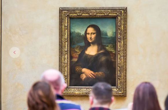
LOUVRE AUDIO GUIDE: Mona Lisa made in China?

Listen?
Audio on this website
Read?
- La Cène de Léonard, une leçon de métaphysique (FR en ligne) + EN pdf (Fidelio).
- Léonard de Vinci : peintre de mouvement (FR en ligne) + EN pdf (Fidelio).
- La Vierge aux rochers, l’erreur fantastique de Léonard (FR en ligne).
- Romorantin et Léonard ou l’invention de la ville moderne (FR en ligne) + EN pdf (Executive Intelligence Review) + DE pdf (Neue Solidarität) + IT pdf (Movisol website).
- L’Homme de Vitruve de Léonard de Vinci (FR en ligne) + EN online.
- Léonard en résonance avec la peinture traditionnelle chinoise — entretien avec Le Quotidien du Peuple. (en ligne: texte chinois suivi des traductions FR + EN).
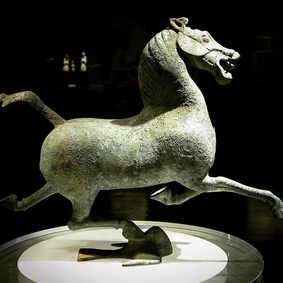
Horse-power, the Earthly Science behind China’s “Heavenly Horses”

Indicating the major role horses have played in the history of mankind, the fact that still today, when people talk about the engine of their cars, they use the term “horsepower” (hp) to indicate how much “work” the engine is capable of.
In a lecture on hydro-infrastructure in Kabul, Afghanistan, I recently used the domestication of the horse as an example of what one should understand when we talk about moving from a “lower” to a “higher infrastructure platform”.
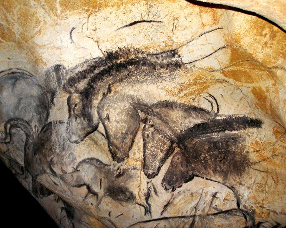
The history of mankind completely changed with the domestication of the horse. Things considered “impossible” before the domestication of the horse became the “new normal”. How and when horses became domesticated has been disputed. Although horses appear in Paleolithic cave art as early as 36,000 BC (Chauvet cave, France), these were wild horses and were probably hunted for meat.
Zoologists define « domestication » as human control over breeding, which can be detected in ancient skeletal samples by changes in the size and variability of ancient horse populations. Other researchers look at the broader evidence, including skeletal and dental evidence of working activity; weapons, art, and spiritual artifacts; and lifestyle patterns of human cultures. There is evidence that horses were kept as a source of meat and milk before they were trained as working animals.
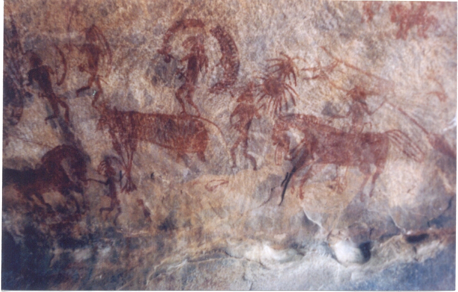
In India, close to Bopal, the “Bhimbetka rock shelters”, which are the oldest known rock art of the country, figures dance and hunting scenes from the Stone Age as well as of warriors on horseback from a later time (10 000 BC).
Horses were a late addition to the barnyard. Dogs were domesticated 15,000 years ago; sheep, pigs and cattle, about 8,000 to 11,000 years ago. But clear evidence of horse domestication doesn’t appear in the archaeological record until about 5,500 years ago.
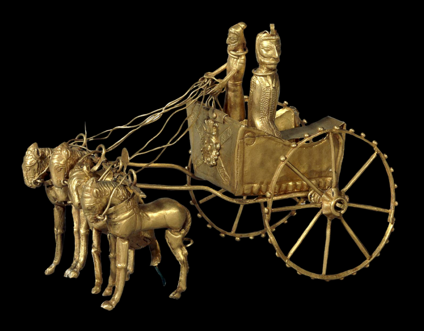
The clearest evidence of early use of the horse as a means of transport is from chariot burials. The earliest true chariots known are from around 2,000 BC, in burials of the Sintashta-Petrovka culture in modern Russia in a cluster along the upper Tobol river, southeast of Magnitogorsk.
They contain spoke-wheeled chariots drawn by teams of two horses.
Kazakhstan and Ukraine
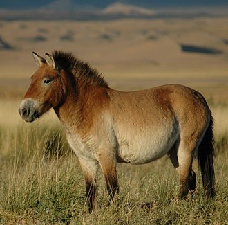
Up till recently, it was thought that the most common horse used today was a descendant of the horses domesticated by the Botai culture living in the steppes of the Akmola Province of Kazakhstan, around 3500 BC.
Recent genetic research points to the fact that the Botai horses were the forefathers of the Przewalski horse, a species that nearly disappeared.
Our common horse, the Equus ferus caballus, genetic research says, has been domesticated 4,200 years ago in Ukraine, in an area known as the Volga-Don, in the Pontic-Caspian steppe region of Western Eurasia, around 2,200 BC.
As these horses were domesticated, they were regularly interbred with wild horses.
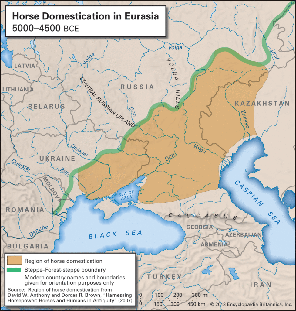
Interesting in this respect, is the fact that according to the “Kurgan” or “steppe hypothesis”, most Indo-European languages spread from the same region throughout Europe and parts of Asia.
It postulates that the people of a Kurgan culture in the Pontic steppe north of the Black Sea were the most likely speakers of what some call the Proto-Indo-European language (PIE).
The term is derived from the Turkic word kurgan, meaning tumulus or burial mound.
Tea Road, Horse Road or Silk Road?
As a matter of fact, the main commodities traded on the “Silk Road” (a term only coined in 1877 by the German geographer Ferdinand Von Richthofen), were… horses, mules, camels, donkeys and onagers.
Silk and tea were of course traded, but appeared mainly as a means… to pay for horses. People “paid” with silk, gold, porcelain and tea, the animals they needed to secure the survival of their society!
What was known as the « Tea-Horse Road » (Southern Silk Road) extended from the city of Chengdu in Sichuan Province, China, south through Yunnan into India and the Indochina Peninsula, and extended westwards into Tibet. It was an important route for the tea trade throughout South China and Southeast Asia and contributed to the spread of religions like Taoism and Buddhism across the region.
Eurasian Steppe
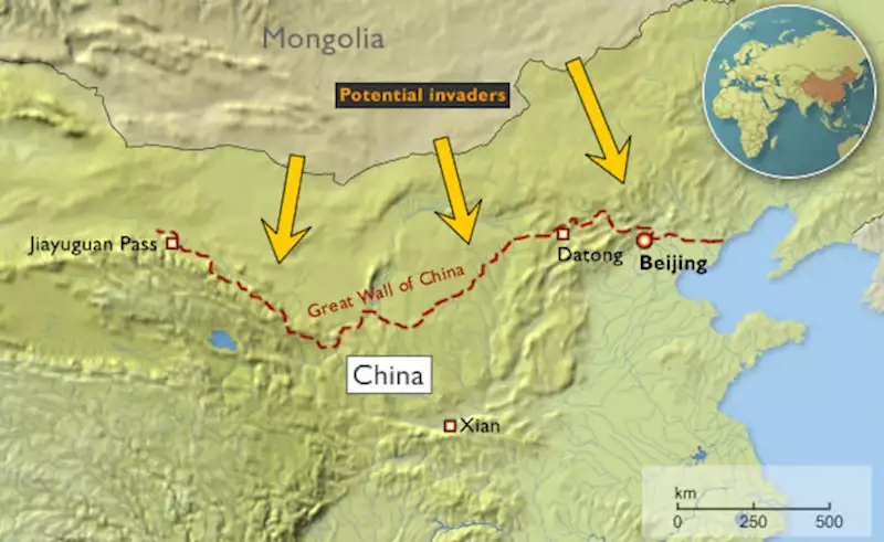
China, feeling itself under constant threat from the nomadic steppe people from the North, started building the first parts of its “Great Wall” as early as the VIIth Century BC, with selective stretches joined by Qin Shi Huang (220–206 BC), the first emperor of China and completed under the Ming dynasty (1368–1644) to become one of the most impressive feats in history.
The Eurasian nomads were groups of nomadic peoples living throughout the Eurasian Steppe. The generic title encompasses the varied ethnic groups who have at times inhabited the steppes of Kazakhstan, Kyrgyzstan, Tajikistan, Turkmenistan, Uzbekistan, Mongolia, Russia, and Ukraine.
By the domestication of the horse around 2,200 BC (i.e. 4,200 years ago), they vastly increased the possibilities of nomadic life and subsequently their economy and culture emphasized horse breeding, horse riding, and nomadic pastoralism, usually engaging in trade with settled peoples around the steppe edges, be it in Europe, Asia or Central Asia.

Nomads, by definition, don’t create empires. It is thought they operated often as confederations. But it was them who developed the chariot, wagon, cavalry, and horseback archery and introduced innovations such as the bridle, bit, stirrup, and saddle and the very rapid rate at which innovations crossed the steppe-lands spread these widely, to be copied by settled peoples bordering the steppes.
During the Iron Age, Scythian (Persian) culture emerged among the Eurasian nomads, which was characterized by a distinct Scythian art.
China and the Horse
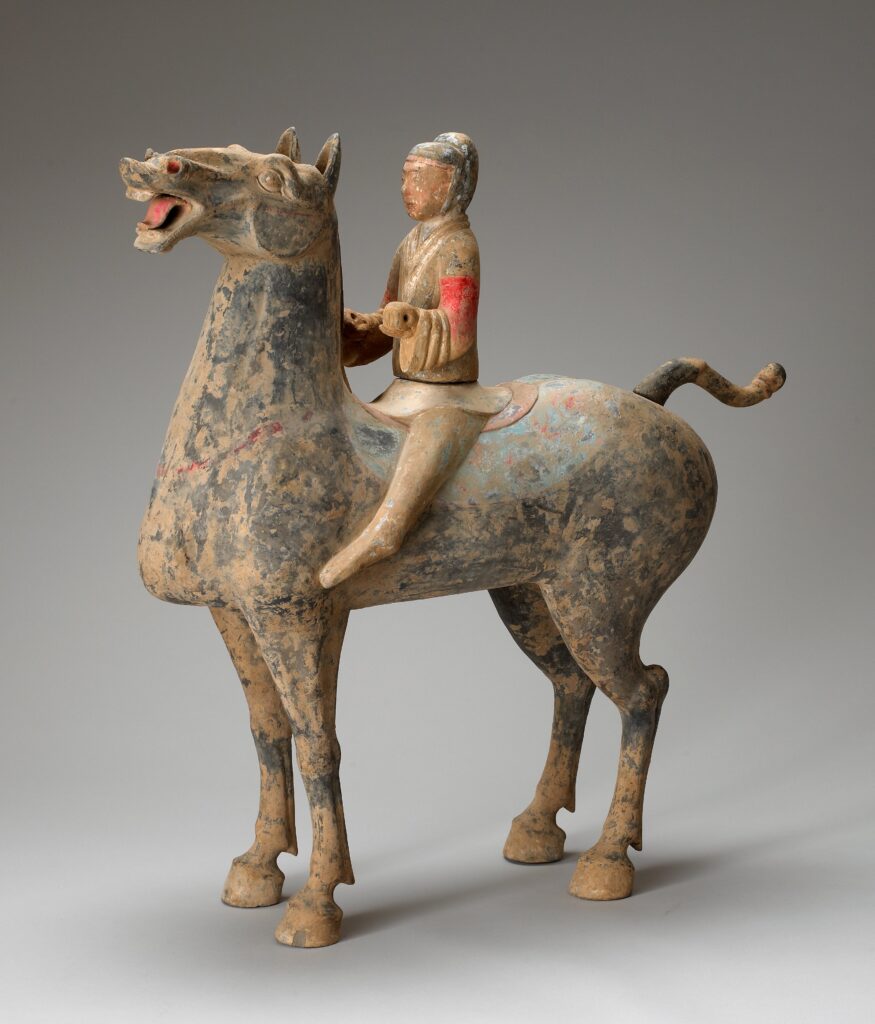
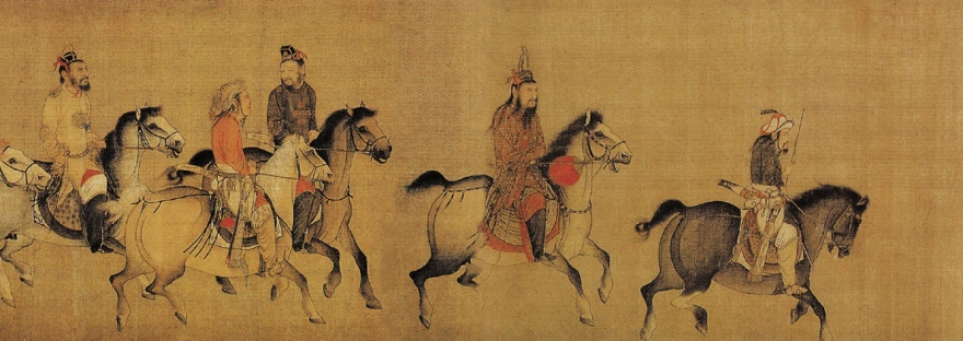
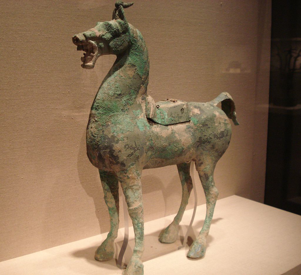
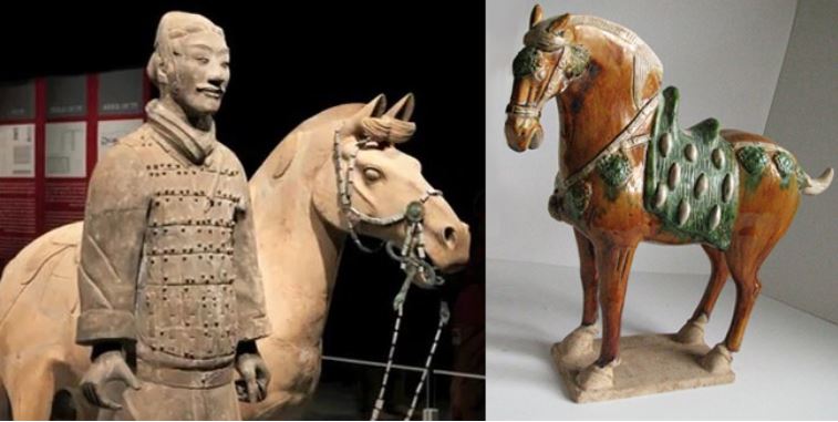
Throughout China’s long and storied past, no animal has impacted its history as greatly as the horse. Its significance was such that as early as the Shang dynasty (ca.1600-1100 BC), military might was measured by the number of the war chariots available to a particular kingdom.
The mounted cavalery, which emerged in the IIIrd century BC grew rapidly during the IInd century BC to meet the challenge of horse-riding peoples threatening China along the northern frontier.
Their large, powerful, horses were very new to China. As said before, traded for luxurious silk, they were the first major import to China from the “Silk Road.”
Chinese grave goods provide extraordinary amounts of information about how the ancient Chinese lived. Archaeological evidence shows that within a few years, the marvelous Arabian steeds had become immensely popular with military and aristocracy alike and upper-class tombs began to be filled with images of these great horses for use in the afterlife. But horses were hard to find in China.
Chinese diplomats and the Kingdom of Dayuan (Ferghana)
Something had to be done. In the late IInd Century BC, Zhang Qian, a Han dynasty diplomat and explorer, travels to Central Asia and discovers three sophisticated urban civilizations created by Greek settlers he named « Ionians ». The account of his visit to Bactria, including his recollection of his amazement at finding Chinese goods in the markets (acquired via India), as well as his travels to Parthia and Ferghana, are preserved in the works of the early Han historian Sima Qian.
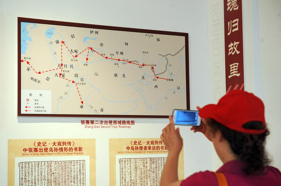
Upon returning to China, his account prompts the Emperor to dispatch Chinese envoys across Central Asia to negotiate and encourage trade with China. Some historians say that this dicision gave « birth of the Silk Road.«
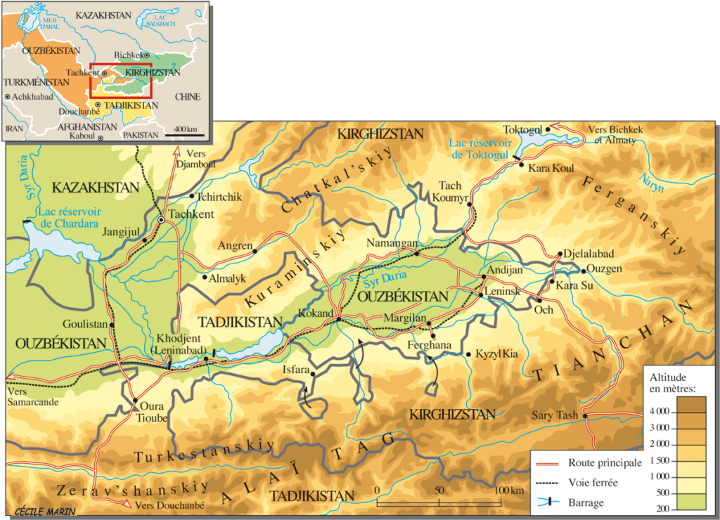
Besides Parthia and Bactria, where Chinese goods were being traded via Indian imports, Zhang Qian visited, in the fertile Ferghana valley (today essentially in Tajikistan), a State the Chinese called the “Kingdom of Dayuan” (“Da” meaning “great”, and “Yuan” being the transliteration of Sanskrit Yavana or Pali Yona, used throughout antiquity in Asia to designate « Ionians », i.e. Greek settlers).
The Records of the Grand Historian and the Book of Han describe the Dayuan as numbering several hundred thousand people living in 70 walled cities of varying size. They grew rice and wheat, and made wine from grapes. They had Caucasian features and “customs identical to those of Bactria” (the most Hellenistic state of the region since Alexander the Great) which is today’s northern Afghanistan.
The Chinese diplomat reported something of great strategic interest: unbelievable, fast and powerful horses raised by these Ionians in the Ferghana Valley!
Now, as said before, China felt under permanent threat by the nomadic people from the steppes and was in the process of building the “Great Wall”. China also was acutely aware that the nomadic steppe people derived their military superiority from something dramatically lacking at home: powerful horses !
Added to that, the fact that in terms of China’s scale of values, horses where nearly of the same mythological nature as dragons: they could fly and represented the divine, creative spirit of the universe itself, something essential for any Chinese emperor eager to acquire both military security for his Empire and for his personal immortality.
In short, having good horses became an issue of national security. So much, that in 100 BC, the Han dynasty started what is known as the “War of the Heavenly Horses” with Dayuan, when its ruler refused to provide high quality horses to China !
The War of the Heavenly Horses
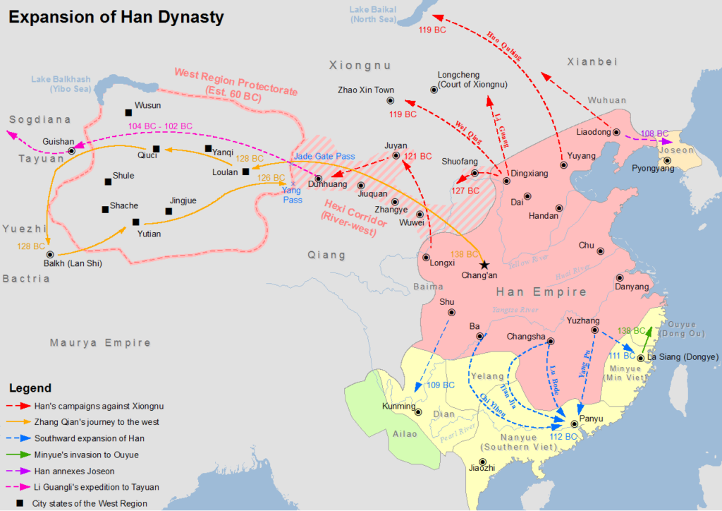
The War of the Heavenly Horses was a military conflict fought in 104 BC and 102 BC between China and a part of the Saka-ruled (Scythian) Greco-Bactrian kingdom known to the Chinese as Dayuan, in the Ferghana Valley (between modern-day Uzbekistan, Kyrgyzstan and Tajikistan).
First, Emperor Wu decided to defeat the nomadic steppe Xiongnu, who had harassed the Han dynasty for decades.
As said earlier, in 139 BC, the emperor sent diplomat Zhang Qian to survey the west and forge a military alliance with the Yuezhi nomads against another group of nomads, the Xiongnu. On the way to Central Asia through the Gobi desert, Zhang was captured twice. On his return, he impressed the emperor with his description of the « Heavenly Horses » of Dayuan, that could greatly improve the quality of Han cavalry mounts when fighting the Xiongnu.
The Han court sent at least five or six, and perhaps as many as ten diplomatic groups annually to Central Asia during this period to get a hold on these “Heavenly Horses”.
A trade mission arrived in Dayuan with 1000 pieces of gold and a golden horse to purchase these precious animals.
Dayuan, who was one of the furthest western states to send envoys to the Han court at that point, had already been trading with the Han for quite some time and benefited greatly from it. Not only were they overflowed by eastern goods, they also learned from Han soldiers how to cast metal into coins and weapons. However unlike the other envoys to the Han court, the ones from Dayuan did not conform to the proper Han rituals and behaved with great arrogance and self-assurance, believing they were too far away to be in any danger of invasion.
Hence, in a stroke of folly and taken by pure arrogance, the Dayuan king not only refused the deal, but confiscated the payment in gold. The Han envoys cursed the men of Dayuan and smashed the golden horse they had brought. Enraged by this act of contempt, the nobles of Dayuan ordered Yucheng, which lay on their eastern borders, to attack and kill the envoys and seize their goods.
Upon receiving word of the trade mission’s demise, humiliated and enraged, the Han court sent an army led by General Li Guangli to subdue Dayuan, but their first incursion was poorly organized and under-supplied.
A second, larger and much better provisioned expedition was sent two years later and successfully laid siege to the Dayuan capital at Alexandria Eschate, and forced Dayuan to surrender unconditionally.
The Han expeditionary forces installed a pro-Han regime in Dayuan and left with 3,000 horses, although only 1,000 remained by the time they reached China in 101 BCE.
The Ferghana also agreed to send two Heavenly horses each year to the Emperor, and lucerne seed was brought back to China providing superior pasture for raising fine horses in China, to provide cavalry which could cope with the Xiongnu who threatened China.
The horses have since captured the popular imagination of China, leading to horse carvings, breeding grounds in Gansu, and up to 430,000 such horses in the cavalry during the Tang dynasty.
China and the agricultural revolution
After imposing its role in military strategy for the next centuries, horsepower, together with water management, became a crucial factor to raise the productivity of the world’s food production.
First, contrary to the Romans, who preferred to use “human cattle” (slaves) rather than animals (which they raised for race contests), the Chinese greatly contributed to the survival of mankind with two crucial innovations respecting a more efficient use of horse power.
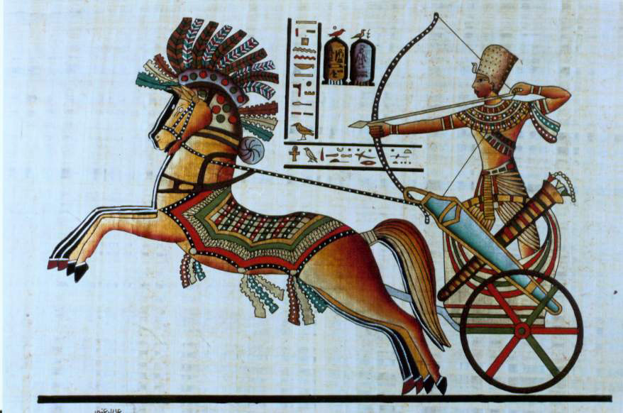
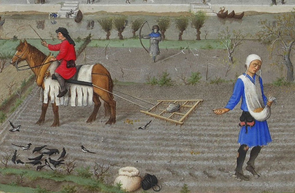
As can be seen in murals and paintings, through the ancient world, be it in Egypt or Greece, plows and carts were pulled using animal harnesses that had flat straps across the neck of the horse, with the load attached at the top of the collar, above the neck, in a manner similar to a yoke used for oxen.
In reality, this greatly limited a horse’s ability to exert itself as it was constantly choked at the neck. The harder the horse pulled, the harder it became to breathe.
Due to this physical limitation, oxen remained the preferred animal to do heavy work such as plowing. Yet oxen are hard to maneuver, are slow, and lack the quality of horses, whose power is equivalent but whose endurance is twice that of oxen.
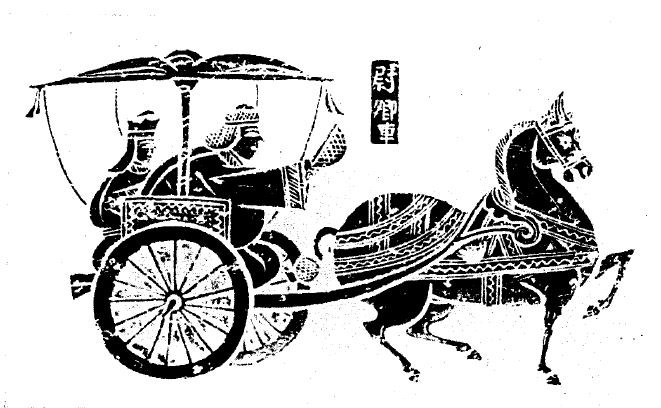
China reportedly first invented the “breast strap” which was the first step in the right direction.
Then, in the Vth Century, China also invented what is called the “rigid horse collar”, designed as an oval that fits around the neck and shoulders of the horse.
It has the following advantages:
–First, it relieved the pressure of the horse’s windpipes. It left the airway of the horse free from constriction improving massively the animal’s energy through-put.
–Second, the traces could be attached to the sides of the collar. This allowed the horse to push forward with its more powerful hind-legs rather than pulling with the weaker front legs.
Now you can argue that this is anecdotal. It is NOT, because what appears as only a slight change had absolutely monumental consequences.
European Renaissance
In a strategic alliance and cooperation with the humanist Baghdad Abbasid caliphate, Charlemagne and his successors introduced the “rigid horse collar” in Europe.
With that new, far more efficient tool, European farmers finally could take full advantage of a horse’s strength. The horse was able to pull another recent innovation, the heavy plow. This became particularly important in areas where the soil was hard and clay-like. This opened up new plots of lands to agriculture. The rigid horse collar, the heavy plow, and horseshoes helped usher in a period of increased agricultural production.
As a result, between 1000 CE and 1300 CE, it is estimated that in Europe, crop yields increased by threefold, allowing to feed a rising number of citizens in the urban cities appearing in the XVth century and kick starting the global “Golden” European Renaissance. Thank you, China!
Some numbers are nevertheless disturbing:
–it took humanity thousands of years to finally domesticate the horse (long after the cow), in 3200 BC.
–it took humanity another 3700 years to learn how to find out, in the Vth century AD, the most efficient way to use horse-power…
Shifting from a “lower” infrastructure platform to a “higher” infrastructure platform might take some time. Today’s new “higher” platforms are called “space data” and “fusion power.” Let’s not wait another century to find out how to use them correctly!
The Maritime Silk Road, a history of 1001 Cooperations

Today, it’s fashionable to present maritime issues in the context of a moribund British geopolitical ideology that pits countries and peoples against each other. However, as this brief history of the Maritime Silk Road, drawn mainly from a document by the International Tourism Organization, demonstrates, the ocean has above all been a fantastic place for fertile encounters, cultural cross-fertilization and mutually beneficial cooperation.
The ancient Chinese invented many of the things we use today, including paper, matches, wheelbarrows, gunpowder, the noria (water elevator), sluice locks, the sundial, astronomy, porcelain, lacquer paint, the potter’s wheel, fireworks, paper money, the compass, the stern rudder, the tangram, the seismograph, dominoes, skipping rope, kites, the tea ceremony, the folding umbrella, ink, calligraphy, animal harnesses, card games, printing, the abacus, wallpaper, the crossbow, ice cream, and especially silk, which we’ll be talking about here.
The Origins of Silk
Before we talk about silk « routes », a few words about the origins of sericulture, i.e. the rearing of silkworms.
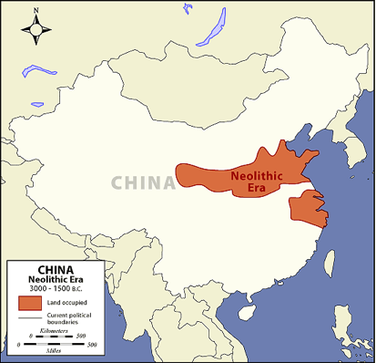
As recent archaeological discoveries confirm, silk production is an age-old skill. The presence of the mulberry tree for silkworm rearing was noted in China around the Yellow River by the Yangshao culture during the Middle Neolithic period in China, from 4500 to 3000 BC.
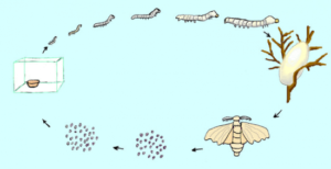
In general, we prefer to retain the legend that silk was discovered around 2500 BC, by the Chinese princess Si Ling-chi, when a cocoon accidentally fell into her tea bowl. When she tried to remove it, she discovered that the cocoon, softened by the hot water, had a delicate, soft and strong thread that could be unwound and assembled. Thus was born the idea of making cloth. The princess then decided to plant a number of white mulberry trees in her garden to raise silkworms.
The silkworms (or bombyx) and mulberry trees were divinely cared for by the princess (silkworms feed solely on the leaves of white mulberry trees).
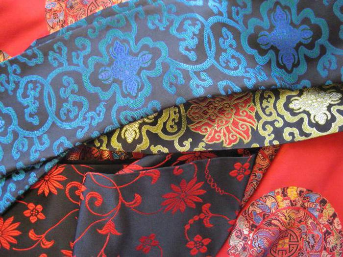
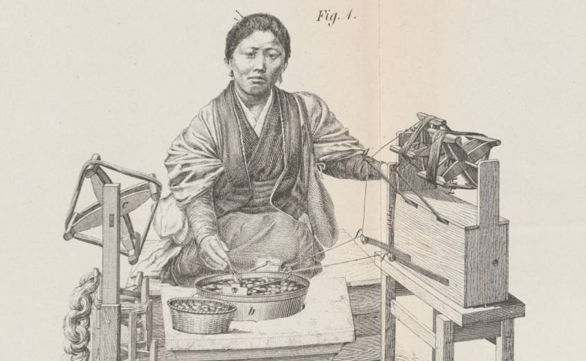
Silk production is a time-consuming process that requires careful monitoring. Silk moths lay around 500 eggs during their lives, which last from 4 to 6 days. After the eggs hatch, the baby worms feed on mulberry leaves in a controlled environment. They have a ferocious appetite and their weight can increase considerably. Once they’ve stored up enough energy, the worms secrete a white jelly from their silk glands and use it to build a cocoon around themselves. After eight or nine days, the worms are killed and the cocoons are immersed in boiling water to soften the protective filaments, which are wound onto a spool. These filaments can be 600 to 900 meters long. Several filaments are assembled to form a thread. The silk threads are then woven into a fabric or used for fine embroidery or brocade, a rich silk fabric embellished with brocaded designs in gold and silver thread.
The Early Silk Trade
Under threat of capital punishment, sericulture remained a well-kept secret, and China retained its monopoly on manufacturing for millennia.
It wasn’t until the Zhou dynasty (1112 BC) that a maritime Silk Road was established from China to Japan and Korea, as the government decided to send Chinese from the port in Bohai Bay (on the Shandong Peninsula) to train local inhabitants in sericulture and agriculture. The techniques of silkworm rearing, reeling and weaving were gradually introduced to Korea via the Yellow Sea.
When Emperor Qin Shi Huang unified China (221 BC), many people from the states of Qi, Yan and Zhao fled to Korea, taking with them silkworms and their rearing techniques. This accelerated the development of silk spinning in Korea.
Korea played a central role in China’s international relations, particularly as an intellectual bridge between China and Japan. Its trade with China also enabled the spread of Buddhism and porcelain-making methods. Although initially reserved for the imperial court, silk spread throughout Asian culture, both geographically and socially. Silk quickly became the luxury fabric par excellence that the whole world craved.
During the Han dynasties (206 BC to 220), a dense network of trade routes exploded cultural and commercial exchanges across Central Asia, profoundly impacting civilizational dynamics. The Han dynasty continued to build the Great Wall, notably creating the commandery of Dunhuang (Gansu), a key post on the Silk Road. Over two centuries B.C., its trade extended to Greece and Rome, where silk was reserved for the elite.
In the IIIrd century, India, Japan and Persia (Iran) unlocked the secret of silk manufacture and became major producers.
Silk Reaches Europe
According to a story by Procopius, it was not until 552 AD that the Byzantine emperor Justinian obtained the first silkworm eggs. He had sent two Nestorian monks to Central Asia, and they were able to smuggle silkworm eggs to him hidden in rods of bamboo. While under the monks’ care, the eggs hatched, though they did not cocoon before arrival.
A church manufacture in the Byzantine Empire was thus able to make fabrics for the emperor. Later emerged the intention of developing a large silk industry in the Eastern Roman Empire, using techniques copied from the Persian Sassanids.
Another version claims that it was the Han emperor Wu (IInd century) who sent ambassadors, bearing gifts such as silk, to the West.
In the VIIth century, sericulture spread to Africa and Sicily, from where, under the impetus of Roger I of Sicily (c. 1034-1101) and his son Roger II (1093-1154), the silkworm and mulberry were introduced to the ancient Peloponnese.
In the Xth century, Andalusia became the epicenter of silk manufacturing with Granada, Toledo and Seville. With the Arab conquest, sericulture spread to the rest of Spain, Italy (Venice, Florence and Milan) and France. The earliest French traces of sericulture date back to the 13th century, notably in the Gard (1234) and Paris (1290).
In the XVth century, faced with the ruinous import of Italian silk (raw or manufactured), Louis XI tried to set up silk factories, first in Tours on the Loire, then in Lyon, a city at the crossroads of north-south routes where Italian emigrants were already trading in silks.
In the XIXth century, silk production was industrialized in Japan, but in the XXth century, China regained its place as the world’s largest producer. Today, India, Japan, the Republic of Korea, Thailand, Vietnam, Uzbekistan and Brazil all have large production capacities.
Cultural Melting Pot
As much as silk itself, the transportation of silk by sea dates back to time immemorial.
For the Chinese, there are two main routes: the East China Silk Road (to Korea and Japan) and the South China Silk Road (via the Strait of Malacca to India, the Persian Gulf, Africa and Europe).
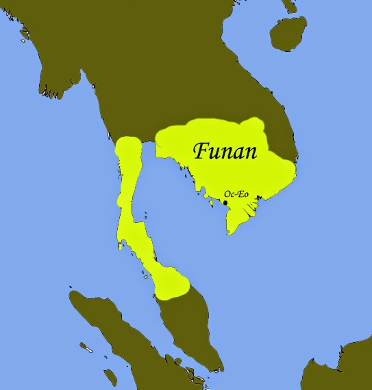
In Vietnam, the Hanoi Museum holds a coin dating back to the year 152, bearing the effigy of the Roman emperor Antoninus the Pious. The coin was discovered in the remains of Oc Eo, a Vietnamese town south of the Mekong Delta, thought to have been the main port of the Funan Kingdom (Ist to IXth centuries).
This kingdom, which covered the territory of present-day Cambodia and the Mekong Delta administrative region of Vietnam, flourished from the 1st to the 9th century. The first mention of the Fou-nan kingdom appears in the report of a Chinese mission that visited the area in the 3rd century.
The Founamians were at the height of their power when Hinduism and Buddhism were introduced to Southeast Asia.
Then, from Egypt, Greek merchants reached the Bay of Bengal. Considerable quantities of pepper then reached Ostia, Rome’s port of entry. All the historical evidence shows that East-West trade was flourishing as early as the first millennium.
Persians and Arabs in India, China and Asia
On the western side, at the entrance to Kuwait Bay, 20 kilometers off the coast of Kuwait City, not far from the mouth of the shared estuary of the Tigris and Euphrates rivers in the Persian Gulf, the island of Failaka was one of the meeting places where Greece, Rome and China exchanged goods.
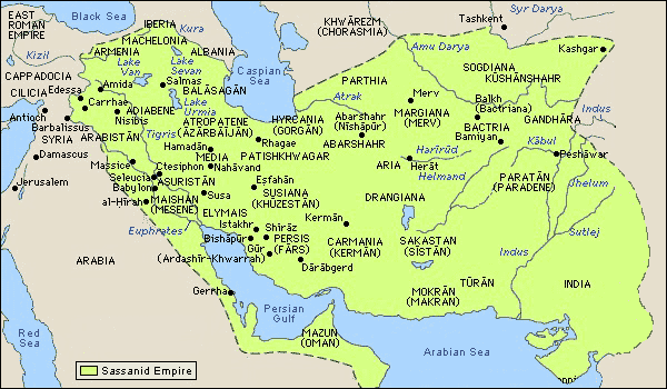
Under the Sassanid dynasty (226-651), the Persians developed their trade routes all the way to Southeast Asia, via India and Sri Lanka.
This trading infrastructure was later taken over by the Arabs when, in 762, they moved to Baghdad.

From the IXth century onwards, the city of Quilon (Kollam), the capital of Kerala in India, was home to colonies of Arab, Christian, Jewish and Chinese merchants.
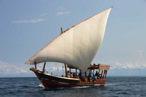
On the western side, Persian and then Arab navigators played a central role in the birth of the maritime Silk Road. Following the Sassanid routes, the Arabs pushed their dhows, or traditional Arab sailing ships, from the Red Sea to the Chinese coast and as far as Malaysia and Indonesia.
These sailors brought with them a new religion, Islam, which spread throughout Southeast Asia. While the traditional pilgrimage (the hajj) to Mecca was initially only an aspiration for many Muslims, it became increasingly possible for them to make it.
During the monsoon season, when winds were favorable for sailing to India in the Indian Ocean, the twice-yearly trade missions were transformed into veritable international fairs, offering an opportunity to transport large quantities of goods by sea in conditions (apart from pirates and unpredictable weather) relatively less exposed to the dangers of overland transport.
The Maritime Silk Road under the Sui, Tang and Song Dynasties
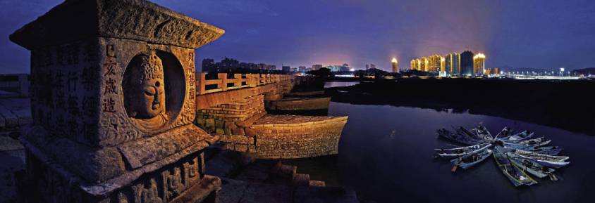
It was under the Sui dynasty (581-618) that the Maritime Silk Road set out from Quanzhou, a coastal city in Fujian province in south-east China, on its first trade routes.
With its wealth of scenic spots and historic sites, Quanzhou has been proclaimed « the starting point of the Maritime Silk Road » by UNESCO.
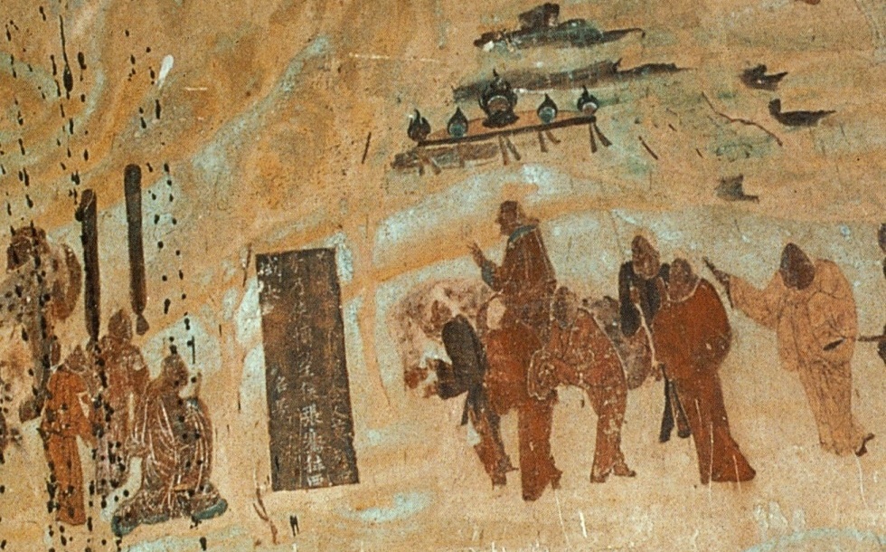
It was at this time that the first printing methods appeared in China. Wooden blocks were used to print on textiles. In 593, the Sui emperor Wen-ti ordered the printing of Buddhist images and writings. One of the earliest printed texts is a Buddhist script dating from 868, found in a cave near Dunhuang, a stopover town on the Silk Road.
Under the Tang dynasty (618-907), the Kingdom’s military expansion brought security, trade and new ideas. The fact that the stability of Tang China coincided with that of Sassanid Persia enabled the land and sea Silk Roads to flourish. The great transformation of the maritime Silk Road began in the 7th century, when China opened up to international trade. The first Arab ambassador took up his post in 651.
The Tang Dynasty chose Chang’an (now Xi’an) as its capital. It adopted an open attitude towards different beliefs. Buddhist, Taoist and Confucian temples coexisted peacefully with mosques, synagogues and Nestorian Christian churches. As the terminus of the Silk Road, Chang’an’s western market is becoming the center of world trade. According to the Tang Authority Six register, over 300 nations and regions had trade relations with Chang’an.
Almost 10,000 foreign families from the west lived in the city, especially in the area around the western market. There were many foreign inns staffed by foreign maids chosen for their beauty. The most famous poet in Chinese history, Li Bai, often strolled among them. Foreign food, costumes and music were the fashion of Chang’an.
After the fall of the Tang dynasty, the Five Dynasties and the Ten Kingdoms (907-960), the arrival of the Song dynasty (960-1279) ushered in a new period of prosperity, characterized by increased centralization and economic and cultural renewal. The maritime silk route regained its momentum. In 1168, a synagogue was built in Kaifeng, capital of the Southern Song dynasty, to serve merchants on the Silk Road.
During the same period, as Islam expanded, trading posts sprang up all around the Indian Ocean and the rest of Southeast Asia.
China encouraged its merchants to seize the opportunities offered by maritime traffic, in particular the sale of camphor, a highly sought-after medicinal plant. A veritable trade network developed in the East Indies under the auspices of the Kingdom of Sriwijaya, a city-state in southern Sumatra, Indonesia (see below), which for nearly six centuries served as a link between Chinese merchants on the one hand, and Indians and Malays on the other. A trade route truly emerged, deserving the name of the maritime « Silk Road ».
Increasing quantities of spices passed through India, the Red Sea and Alexandria in Egypt, before reaching the merchants of Genoa, Venice and other Western ports. From there, they moved on to the northern European markets of Lübeck (Germany), Riga (Lithuania) and Tallinn (Estonia), which from the 12th century onwards became important cities in the Hanseatic League.
In China, during the reign of the Song emperor Renzong (1022-1063), a great deal of money and energy was spent on bringing together knowledge and know-how. The economy was the first to benefit.
Drawing on the know-how of Arab and Indian sailors, Chinese ships became the most advanced in the world.
The Chinese, who had invented the compass (at least by 1119), quickly surpassed their competitors in cartography and the art of navigation, as the Chinese junk became the bulk carrier par excellence.
In his geographical treatise, Zhou Qufei, in 1178, reports:
« The big ships that cruise the South Sea are like houses. When they unfold their sails, they look like huge clouds. Their rudders are dozens of feet long. A single ship can house several hundred men. On board, there’s enough food to last a year.«
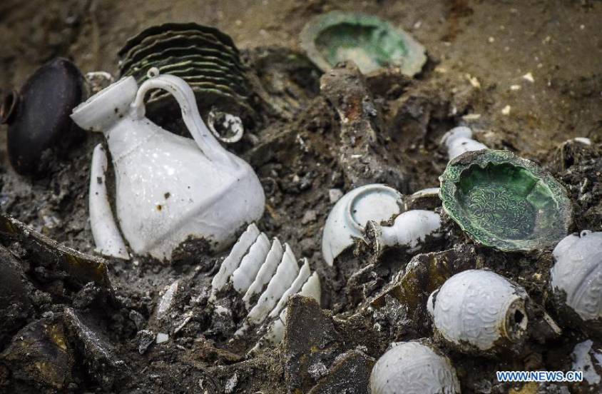
Archaeological digs confirm this reality, such as the wreck of a XIVth-century junk found off the coast of Korea, in which over 10,000 pieces of ceramic were discovered.
During this period, coastal trade gradually shifted from the hands of Arab traders to those of Chinese merchants. Trade expanded, notably with the inclusion of Korea and the integration of Japan, the Malabar coast of India, the Persian Gulf and the Red Sea into existing trade networks.
China exported tea, silk, cotton, porcelain, lacquers, copper, dyes, books and paper. In return, it imported luxury goods and raw materials, including rare woods, precious metals, precious and semi-precious stones, spices and ivory.
Copper coins from the Song period have been discovered in Sri Lanka, and porcelain from this period has been found in East Africa, Egypt, Turkey, some Gulf states and Iran, as well as in India and Southeast Asia.
The Importance of Korea and the Kingdom of Silla
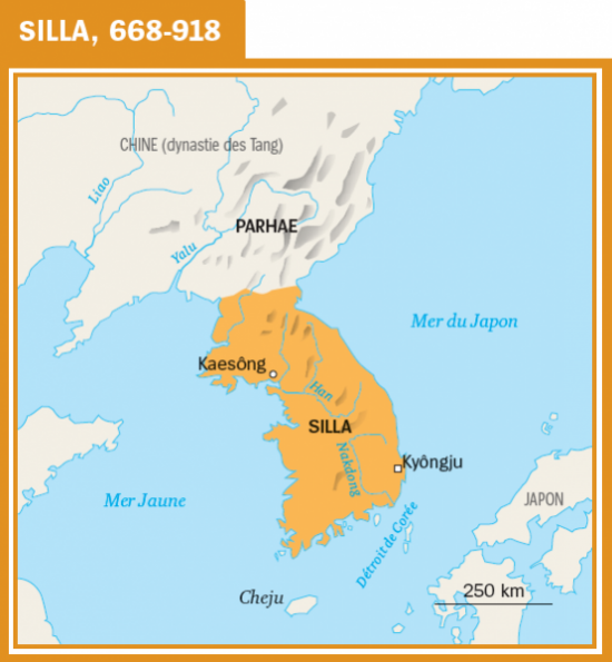
During the first millennium, culture and philosophy flourished on the Korean peninsula. A well-organized and well-protected trading network with China and Japan operated there.
On the Japanese island of Okino-shima, numerous historical traces bear witness to the intense exchanges between the Japanese archipelago, Korea and the Asian continent.
Excavations carried out in ancient tombs in Gyeongju, today a South Korean city of 264,000 inhabitants and capital of the ancient Kingdom of Silla (from 57 BC to 935), which controlled most of the peninsula from the VIIth to the IXth century, demonstrate the intensity of this kingdom’s exchanges with the rest of the world, via the Silk Road.
Indonesia, a Major Maritime Power at the Heart of the Maritime Silk Road
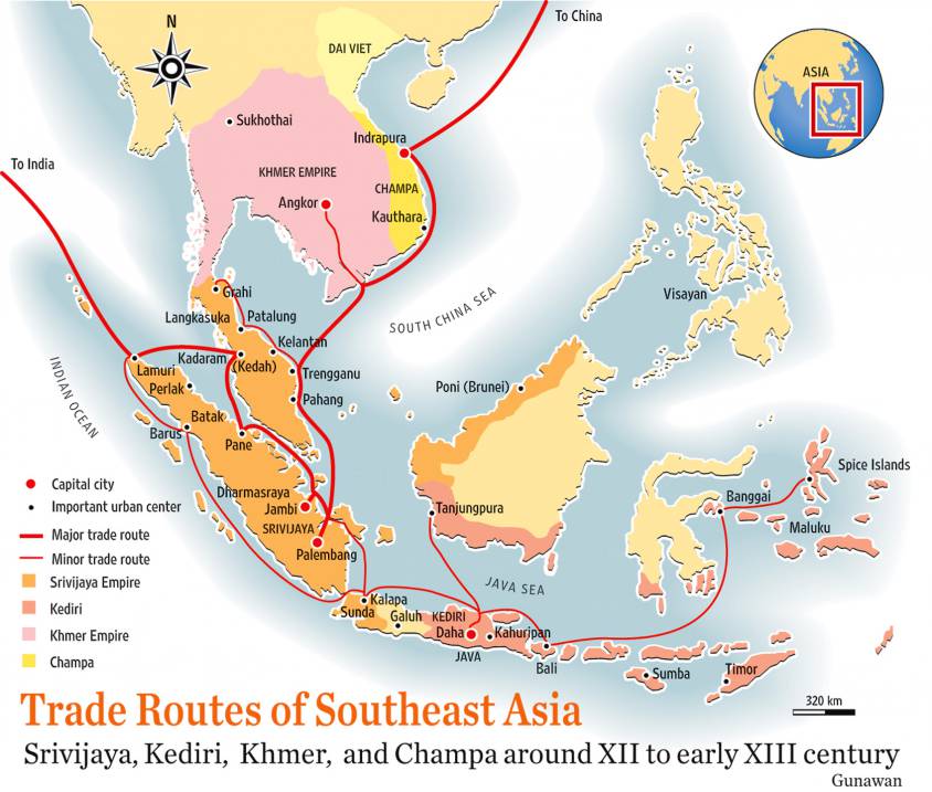
In Indonesia, Malaysia and southern Thailand, the Kingdom of Sriwijaya (VIIth to XIIIth centuries) played a major role as a maritime trading post, storing high-value goods from the region and beyond for later sale by sea. In particular, Sriwijaya controlled the Strait of Malacca, the essential sea passage between India and China.
At the height of its power in the XIth century, Sriwijaya’s network of ports and trading posts traded a vast array of products and commodities: rice, cotton, indigo and silver from Java, aloe (a succulent plant of African origin), vegetable resins, camphor, ivory and rhinoceros horns, tin and gold from Sumatra, rattan, redwoods and other rare woods, gems from Borneo, rare birds and exotic animals, iron, sandalwood and spices from East Indonesia, India and Southeast Asia, and porcelain, lacquer, brocade, textiles and silk from China.
With its capital at Palembang (population 1.7 million) on the Musi River in what is now the southern province of Sumatra, this Hindu-Buddhist-inspired kingdom, which flourished from the VIIIth to the XIIIth century, was the first major Indonesian kingdom and the country’s first maritime power.
By the VIIth century, it ruled a large part of Sumatra, the western part of Java and a significant part of the Malay Peninsula. It extended as far north as Thailand, where archaeological remains of Sriwijaya cities still exist.
Buddhism on the Maritime Silk Road
The museum in Palembang (today Indonesia) – a town where Chinese, Indian, Arab and Yemeni communities, each with their own particular institutions, have co-prospered for generations – tells a wonderful story of how the Maritime Silk Road generated exemplary mutual cultural enrichment.
Buddhism was closely tied to international or cross-boundary trade. Early inscriptions indicate it was common for seafarers to pray to the Buddha for a safe voyage.
The maritime routes were very challenging as they were often beset with cyclones and typhoons, and piracy was an ever-present danger.
As a consequence, merchant support for Buddhism along these travel routes helped to establish monastic life far beyond India. Monks and nuns also took passage on these trading ships, and the merchants sought good karma by helping them travel to spread the teachings of the Buddha.
Madagascar, Sanskrit and the Cinnamon Road
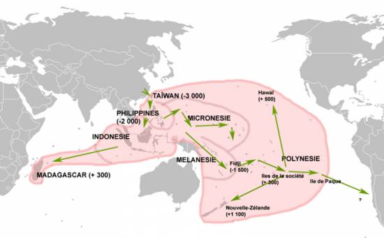
Map of the expansion of Austronesian languages.
Today, Madagascar is inhabited by Blacks and Asians. DNA tests have confirmed what has long been known: many of the island’s inhabitants are descended from Malay and Indonesian sailors who set foot on the island around the year 830, when the Sriwijaya Empire extended its maritime influence towards Africa.
Further evidence of this presence is the fact that the language spoken on the island borrows Sanskrit and Indonesian words.
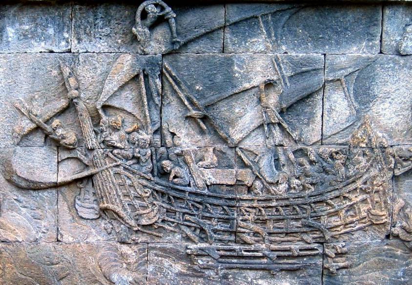
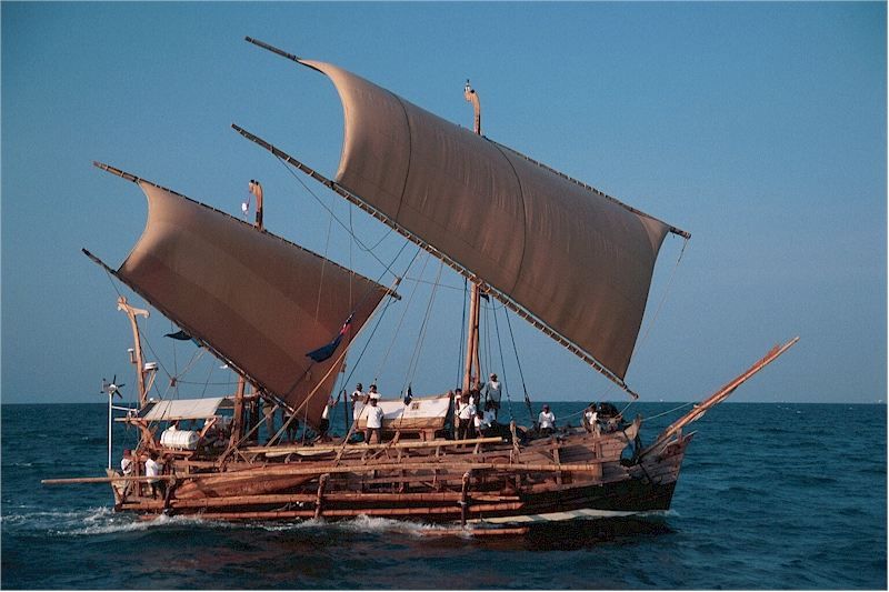
To demonstrate the feasibility of such sea voyages, in 2003 a team of researchers sailed from Indonesia to Ghana via Madagascar aboard the Borobudur, a reconstruction of one of the sailing ships featured in many of the 1,300 bas-reliefs decorating the 8th-century Buddhist temple of Borobudur on the island of Java in Indonesia.
Many believe that this vessel is a representation of those once used by Indonesian merchants to cross the ocean to Africa. Indonesian navigators usually used relatively small boats. To ensure balance, they fitted them with outriggers, both double (ngalawa) and single.
Their boats, whose hulls were carved from a single tree trunk, were called sanggara. Merchants from the Indonesian archipelago could reach as far east as Hawaii and New Zealand, a distance of over 7,000 km.
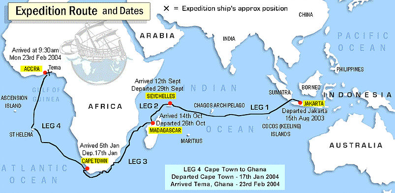
In any case, the researchers’ boat, equipped with an 18-meter-high mast, managed to cover the Jakarta – Maldives – Cape of Good Hope – Ghana route, a distance of 27,750 kilometers, or more than half the circumference of the Earth!
The expedition aimed to retrace a very specific route: the cinnamon route, which took Indonesian merchants all the way to Africa to sell spices, including cinnamon, a highly sought-after commodity at the time. Cinnamon was already highly prized in the Mediterranean basin long before the Christian era.
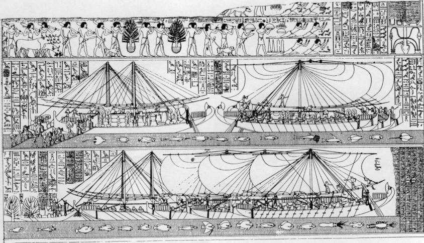
On the walls of the Egyptian temple at Deir el-Bahari (Luksor), a painting depicts a major naval expedition said to have been ordered by Queen Hatshepsut, who reigned from 1503 to 1482 BC. Around the painting, hieroglyphs explain that these ships carried various species of plants and fragrant essences destined for the cult. One of these was cinnamon. Rich in aroma, it was an important component of ritual ceremonies in the kingdoms of Egypt.
Cinnamon originally grew in Central Asia, the eastern Himalayas and northern Vietnam. The southern Chinese transplanted it from these regions to their own country and cultivated it under the name gui zhi.
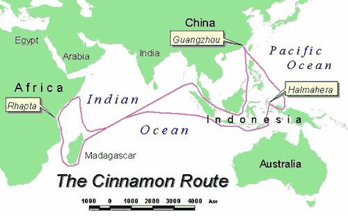
From China, gui zhi spread throughout the Indonesian archipelago, finding a very fertile home there, particularly in the Moluccas. In fact, the international cinnamon trade was a monopoly held by Indonesian merchants. Indonesian cinnamon was prized for its excellent quality and highly competitive price.
The Indonesians sailed great distances, up to 8,000 km, across the Indian Ocean to Madagascar and northeast Africa. From Madagascar, products were transported to Rhapta, in a coastal region that later became known as Somalia. From there, Arab merchants shipped them north to the Red Sea.
The Strait of Malacca
For China, the Strait of Malacca has always represented a major strategic interest. When the great Chinese admiral Zheng He led the first of his expeditions to India, the Near East and East Africa between 1405 and 1433, a Chinese pirate by the name of Chen Zuyi took control of Palembang.
Zheng He defeated Chen’s fleet and captured the survivors. As a result, the strait once again became a safe shipping route.
According to tradition, a prince of Sriwijaya, Parameswara, took refuge on the island of Temasek (present-day Singapore), but eventually settled on the west coast of the Malay Peninsula around 1400 and founded the city of Malacca, which would become the largest port in Southeast Asia, both successor to Sriwijaya and precursor to Singapore.
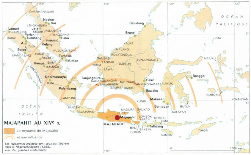
Following the decline of Sriwijaya, the Kingdom of Majapahit (1292-1527), founded at the end of the XIIIth century on the island of Java, came to dominate most of present-day Indonesia.
This was the period when Arab sailors began to settle in the region.
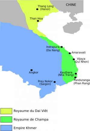
The Majapahit kingdom established relations with the Kingdom of Champa (192-1145; 1147-1190; 1220-1832) (South Vietnam), Cambodia, Siam (Thailand) and southern Myanmar.
The Majapahit kingdom also sent missions to China. As its rulers extended their power to other islands and sacked neighboring kingdoms, they sought above all to increase their share and control of the trade in goods passing through the archipelago.
The island of Singapore and the southernmost part of the Malay Peninsula was a key crossroads on the ancient maritime Silk Road.
Archaeological excavations in the Kallang estuary and along the Singapore River have uncovered thousands of shards of glass, natural and gold beads, ceramics and Chinese coins from the Northern Song period (960-1127).
The rise of the Mongol Empire in the middle of the XIIIth century led to an increase in seaborne trade and contributed to the vitality of the Maritime Silk Road.
Marco Polo, after a 17-year overland journey to China, returned by ship. After witnessing a shipwreck, he sailed from China to Sumatra in Indonesia, before setting foot on land again at Hormuz in Persia (Iran).
Under the Yuan and Ming Dynasties
Under the Song dynasty, large quantities of silk goods were exported to Japan. Under the Yuan dynasty (1271-1368), the government set up the Shi Bo Si, a trade office, in a number of ports, including Ningbo, Canton, Shanghai, Ganpu, Wenzhou and Hangzhou, enabling silk exports to Japan.
During the Tang, Song and Yuan dynasties, and at the beginning of the Ming dynasty, each port set up an oceanic trading department to manage all foreign maritime trade.
Maritime travel was dependent on the seasonal winds: the summer monsoons blow from the south-west (May to September) and reverse direction in the winter (October to April). As a result, seafaring merchants developed sailing circuits that allowed them to use the monsoon winds to travel long distances, then return home when the wind patterns shifted.
Trade with southern India and the Persian Gulf flourished. Trade with East Africa also developed with the monsoon season, bringing ivory, gold and slaves. In India, guilds began to control Chinese trade on the Malabar coast and in Sri Lanka.
Trade relations became more formalized, while remaining highly competitive. Cochin and Kozhikode (Calicut), two major cities in the Indian state of Kerala, competed to dominate this trade.
Admiral Zheng He’s Maritime Explorations
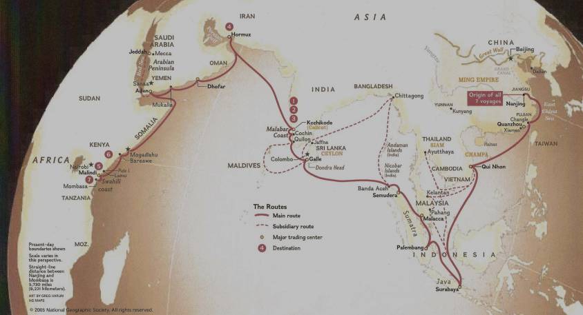
Chinese maritime exploration reached its apogee in the early XVth century under the Ming dynasty (1368-1644), which chose a Muslim court eunuch, Admiral Zheng He, to lead seven diplomatic naval expeditions.
Financed by Emperor Ming Yongle, these peaceful missions to Southeast Asia, East Africa, the Indian Ocean, the Persian Gulf and the Red Sea were intended above all to demonstrate the prestige and grandeur of China and its Emperor. The aim was also to recognize some thirty states and establish political and commercial relations with them.
In 1409, prior to one of these expeditions, the Chinese admiral Zheng He asked craftsmen to make a carved stone stele in Nanjing, the present-day capital of Jiangsu province (eastern China). The stele traveled with the flotilla and was left in Sri Lanka as a gift to a local Buddhist temple. Prayers to the deities in three languages – Chinese, Persian and Tamil – were engraved on the stele. It was found in 1911 in the town of Galle, in south-west Sri Lanka, and a replica is now in China.
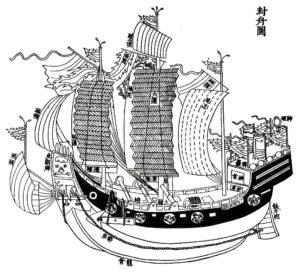
Zheng’s armada was made up of armed bulk carriers, the most modest being larger than Columbus’ caravels. The largest were 100 meters long and 50 meters wide. According to Ming chronicles of the time, an expedition could comprise 62 ships, each carrying 500 people. Some carried military cavalry, others tanks of drinking water. Chinese shipbuilding was ahead of its time. The technique of hermetic bulkheads, imitating the internal structure of bamboo, offered incomparable safety. It became the standard for the Chinese fleet before being copied by the Europeans 250 years later. Compasses and celestial maps painted on silk were also used.
The synergy that may have existed between Arab, Indian and Chinese sailors, all men of the sea who fraternized in the face of ocean adversity, was impressive. For example, some historians believe that the name « Sindbad the Sailor », which appears in the Persian tale of a sailor’s adventures from the time of the Abbasid dynasty (VIIIth century) and was included in the Tales of the One Thousand and One Nights, derives from the word Sanbao, the honorary nickname given by the Chinese Emperor to Admiral Zheng He, literally meaning « The Three Jewels », i.e. the three indissociable capital virtues: essence, breath, and spirit.

Maritime museums in China (Hong Kong, Macau, Fuzhou, Tianjin and Nanjing), Singapore, Malaysia and Indonesia showcase Admiral Zheng’s expeditions.
However, at least twelve other admirals carried out similar expeditions to Southeast Asia and the Indian Ocean.
In 1403, Admiral Ma Pi led an expedition to Indonesia and India. Wu Bin, Zhang Koqing and Hou Xian made others. After lightning caused a fire in the Forbidden City, a dispute broke out between the eunuch class, supporters of the expeditions, and the learned mandarins, who obtained the cessation of expeditions deemed too costly. The last voyage took place between 1430 and 1433, 64 years before the Portuguese explorer Vasco da Gama arrived in 1497.
Japan, for its part, similarly restricted its contacts with the outside world during the Tokugawa period (1600-1868), although its trade with China was never suspended. It was only after the Meiji Restoration in 1868 that a Japan open to the world re-emerged.
Withdrawing into themselves, trade with both China and Japan fell into the hands of maritime trading posts such as Malacca in Malaysia or Hi An in Vietnam, two cities now recognized by Unesco as world heritage sites. H?i An was a major stopover port on the sea route linking Europe and Japan via India and China. In the shipwrecks found at Hi An, researchers have discovered ceramics awaiting their departure for Sinai in Egypt.
History of Chinese Ports
Over the years, the main ports on the Maritime Silk Road have changed. From the 330s onwards, Canton and Hepu were the two most important ports. However, Quanzhou replaced Canton from the end of the Song to the end of the Yuan dynasty. At that time, Quanzhou in Fujian province and Alexandria in Egypt were considered the world’s largest ports. Due to the policy of closure to the outside world imposed from 1435 and the influence of war, Quanzhou was gradually replaced by the ports of Yuegang, Zhangzhou and Fujian.
From the beginning of the IVth century, Canton was an important port on the Silk Road. Gradually, under the Tang and Song dynasties, it became not only the largest, but also the most renowned port of the Orient worldwide. During this period, the sea route linking Canton to the Persian Gulf via the South China Sea and the Indian Ocean was the longest in the world.
Although later supplanted by Quanzhou under the Yuan dynasty, Canton remained China’s second-largest commercial port. Compared with the others, it is considered to have been a consistently prosperous port over the 2,000-year history of the Maritime Silk Road.
The Tributary System of 1368
China’s last imperial dynasty, the Qing, reigned from 1644 to 1912.
Since the arrival of the Ming dynasty, maritime trade with China proceded in two different ways:
- The Chinese « tributary system » ;
- The Canton system (1757-1842).
Born under the Ming in 1368, the « tributary system » reached its apogee under the Qing. It took the refined form of a mutually beneficial, inclusive hierarchy.
States adhering to it showed respect and gratitude by regularly presenting the Emperor with tribute made up of local products and performing certain ritual ceremonies, notably the « kowtow » (three genuflections and nine prostrations). They also demanded the Emperor’s investiture of their leaders and adopted the Chinese calendar. In addition to China, they included Japan, Korea, Vietnam, Thailand, Indonesia, the Ryükyü Islands, Laos, Myanmar and Malaysia.
Paradoxically, while occupying a central cultural status, the tributary system offered its vassals the status of sovereign entities, enabling them to exercise authority over a given geographical area.
The Emperor won their submission by showing virtuous concern for their welfare and promoting a doctrine of non-intervention and non-exploitation. Indeed, according to historians, in financial terms, China was never directly enriched by the tributary system. In general, all travel and subsistence expenses for tributary missions were covered by the Chinese government. In addition to the costs of running the system, the gifts offered by the Emperor were generally far more valuable than the tributes he received. Each tributary mission was entitled to be accompanied by a large number of merchants, and once the tribute had been presented to the Emperor, trade could begin.
It should be noted that when a country lost its status as a tributary state as a result of a disagreement, it would try at all costs, and sometimes violently, to be allowed to pay tribute again.
The Canton System of 1757
The second system concerned foreign, mainly European, powers wishing to trade with China. This involved the port of Guangzhou (then called Canton), the only port accessible to Westerners.
This meant that merchants, notably those of the British East India Company, could dock not in the port but off the coast of Canton, from October to March, during the trading season. It was in Macao, then a Portuguese possession, that the Chinese provided them with permission to do so. The Emperor’s representatives would then authorize Chinese merchants (hongs) to go on board to trade with foreign ships, while instructing them to collect customs duties before they left.
This way of trading expanded at the end of the XVIIIth century, particularly with the strong English demand for tea.
In fact, it was Chinese tea from Fujian that American « insurgents » threw into the sea during the famous « Boston Tea Party » in December 1773, one of the first events against the British Empire that sparked off the American Revolution.
Products from India, particularly cotton and opium, were exchanged by the East India Company for tea, porcelain and silk.
The customs duties collected by the Canton system were a major source of revenue for the Qing dynasty, even though it banned the purchase of opium from India. This restriction imposed by the Chinese Emperor in 1796 led to the outbreak of the Opium Wars, the first as early as 1839.
At the same time, rebellions broke out in the 1850-60s against the weakened Qing reign, coupled with further wars against hostile European powers.
In 1860, the former Summer Palace (Yuanming Park), with its collection of pavilions, temples, pagodas and libraries – the residence of the Qing dynasty emperors 15 kilometers northwest of Beijing’s Forbidden City – was ravaged by British and French troops during the Second Opium War.
This assault goes down in history as one of the worst acts of cultural vandalism of the XIXth century. The Palace was sacked a second time in 1900 by an eight-nation alliance against China.
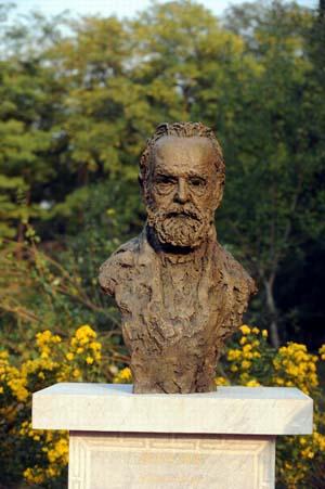
Today, a statue of Victor Hugo and a text he wrote against Napoleon III and the destruction of French imperialism can be admired there, as a reminder that this was not the work of a nation, but of a government.
By the end of the First World War, China had 48 open ports where foreigners could trade according to their own jurisdictions.
The 20th century was an era of revolution and social change. The founding of the People’s Republic of China in 1949 led to inward-looking attitudes.
It wasn’t until 1978 that Deng Xiaoping announced a policy of opening up to the outside world in order to modernize the country.

In the XXIst century, thanks to the One Belt (economic) One Road (maritime) Initiative launched by President Xi Jingping, China is re-emerging as a major world power offering mutually beneficial cooperation in the service of a better shared future for mankind.
The republican struggle of David d’Angers and the statue of Gutenberg in Strasbourg

In the heart of downtown Strasbourg, a stone’s throw from the cathedral and with its back to the 1585 Chamber of Commerce, stands the beautiful bronze statue of the German printer Johannes Gutenberg, holding a barely-printed page from his Bible, which reads: « And there was light » (NOTE 1).
Evoking the emancipation of peoples thanks to the spread of knowledge through the development of printing, the statue, erected in 1840, came at a time when supporters of the Republic were up in arms against the press censorship imposed by Louis-Philippe under the July Monarchy.
Strasbourg, Mainz and China
Born around 1400 in Mainz, Johannes Gutenberg, with money lent to him by the merchant and banker Johann Fust, carried out his first experiments with movable metal type in Strasbourg between 1434 and 1445, before perfecting his process in Mainz, notably by printing his famous 42-line Bible from 1452.
On his death (in Mainz) in 1468, Gutenberg bequeathed his process to humanity, enabling printing to take off in Europe. Chroniclers also mention the work of Laurens Janszoon Coster in Harlem, and the Italian printer Panfilo Castaldi, who is said to have brought Chinese know-how to Europe. It should be noted that the « civilized » world of the time refused to acknowledge that printing had originated in Asia with the famous « movable type » (made of porcelain and metal) developed several centuries earlier in China and Korea (NOTE 2).
In Europe, Mainz and Strasbourg vie for pride of place. On August 14, 1837, to celebrate the 400th anniversary of the « invention » of printing, Mainz inaugurated its statue of Gutenberg, erected by sculptor Bertel Thorvaldsenalors, while in Strasbourg, a local committee had already commissioned sculptor David d’Angers to create a similar monument in 1835.
This little-known sculptor was both a great sculptor and close friend of Victor Hugo, and a fervent republican in personal contact with the finest humanist elite of his time in France, Germany and the United States. He was also a tireless campaigner for the abolition of the slave trade and slavery.
The sculptor’s life
French sculptor Pierre-Jean David, known as « David d’Angers » (1788-1856) was the son of master sculptor Pierre Louis David. Pierre-Jean was influenced by the republican spirit of his father, who trained him in sculpture from an early age. At the age of twelve, his father enrolled him in the drawing class at the École Centrale de Nantes. In Paris, he was commissioned to create the ornamentation for the Arc de Triomphe du Carrousel and the south facade of the Louvre Palace. Finally, he entered the Beaux-arts.
David d’Angers possessed a keen sense of interpretation of the human figure and an ability to penetrate the secrets of his models. He excelled in portraiture, whether in bust or medallion form. He is the author of at least sixty-eight statues and statuettes, some fifty bas-reliefs, a hundred busts and over five hundred medallions. Victor Hugo told his friend David: « This is the bronze coin by which you pay your toll to posterity. »
He traveled all over Europe, painting busts in Berlin, London, Dresden and Munich.
Around 1825, when he was commissioned to paint the funeral monument that the Nation was raising by public subscription in honor of General Foy, a tribune of the parliamentary opposition, he underwent an ideological and artistic transformation. He frequented the progressive intellectual circles of the « 1820 generation » and joined the international republican movement. He then turned his attention to the political and social problems of France and Europe. In later years, he remained faithful to his convictions, refusing, for example, the prestigious commission to design Napoleon’s tomb.
Artistic production
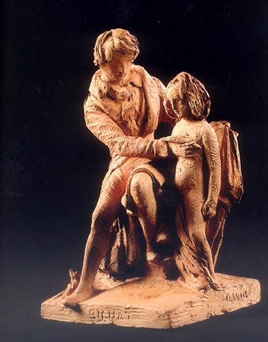
David’s art was thus influenced by a naturalism whose iconography and expression are in stark contrast to that of his academic colleagues and the dissident sculptors known as « romantics » at the time. For David, no mythological sensualism, obscure allegories or historical picturesqueness. On the contrary, sculpture, according to David, must generalize and transpose what the artist observes, so as to ensure the survival of ideas and destinies in a timeless posterity.
David adhered to this particular, limited conception of sculpture, adopting the Enlightenment view that the art of sculpture is « the lasting repository of the virtues of men », perpetuating the memory of the exploits of exceptional beings.
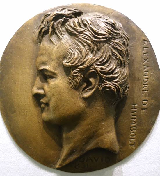
The somewhat austere image of « great men » prevailed, best known thanks to some 600 medallions depicting famous men and women from several countries, most of them contemporaries. Added to this are some one hundred busts, mostly of his friends, poets, writers, musicians, songwriters, scientists and politicians with whom he shared the republican ideal.
Among the most enlightened of his time were: Victor Hugo, Marquis de Lafayette, Wolfgang Goethe, Alfred de Vigny, Alphonse Lamartine, Pierre-Jean de Béranger, Alfred de Musset, François Arago, Alexander von Humboldt, Honoré de Balzac, Lady Morgan, James Fenimore Cooper, Armand Carrel, François Chateaubriand, Ennius Quirinus Visconti and Niccolo Paganini.
To magnify his models and visually render the qualities of each one’s genius, David d’Angers invented a mode of idealization no longer based on antique-style classicism, but on a grammar of forms derived from a new science, the phrenology of Doctor Gall, who believed that the cranial « humps » of an individual reflected his intellectual aptitudes and passions. For the sculptor, it was a matter of transcending the model’s physiognomy, so that the greatness of the soul radiated from his forehead.
In 1826, he was elected member of the Institut de France and, the same year, professor at the Beaux-Arts. In 1828, David d’Angers was the victim of his first unsolved assassination attempt. Wounded in the head, he was confined to bed for three months. However, in 1830, still loyal to republican ideas, he took part in the revolutionary days and fought on the barricades.
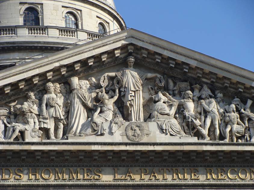
In 1830, David d’Angers found himself ideally placed to carry out the most significant political sculpture commission of the July monarchy and perhaps of 19th century France: the new decoration of the pediment of the church of Sainte-Geneviève, which had been converted into the Pantheon in July.
As a historiographer, he wanted to depict the civilians and men of war who built Republican France. In 1837, the execution of the figures he had chosen and arranged in a sketch that was first approved, then suspended, was bound to lead to conflict with the high clergy and the government. On the left, we see Bichat, Voltaire and Jean-Jacques Rousseau, David, Cuvier, Lafayette, Manuel, Carnot, Berthollet, Laplace, Malesherbes, Mirabeau, Monge and Fénelon. While the government tried to have Lafayette’s effigy removed, which David d’Angers stubbornly refused, with the support of the liberal press, the pediment was unveiled without official ceremony in September 1837, without the presence of the artist, who had not been invited.
Entering politics
During the 1848 Revolution, he was appointed mayor of the 11th arrondissement of Paris, entered the National Constituent Assembly and then the National Legislative Assembly, where he voted with the Montagne (revolutionary left). He defended the existence of the Ecole des Beaux-arts and the Académie de France in Rome. He opposed the destruction of the Chapelle Expiatoire and the removal of two statues from the Arc de Triomphe (Resistance and Peace by sculptor Antoine Etex).
He also voted against the prosecution of Louis Blanc (1811-1882) (another republican statesman and intellectual condemned to exile), against the credits for Napoleon III’s Roman expedition, for the abolition of the death penalty, for the right to work, and for a general amnesty.
Exile

He was not re-elected deputy in 1849 and withdrew from political life. In 1851, with the advent of Napoleon III, David d’Angers was arrested and also sentenced to exile. He chose Belgium, then traveled to Greece (his old project). He wanted to revisit his Greek Maiden on the tomb of the Greek republican patriot Markos Botzaris (1788-1823), which he found mutilated and abandoned (he had it repatriated to France and restored).
Disappointed by Greece, he returned to France in 1852. With the help of his friend de Béranger, he was allowed to stay in Paris, where he resumed his work. In September 1855, he suffered a stroke which forced him to cease his activities. He died in January 1856.
Friendships with Lafayette, Abbé Grégoire and Pierre-Jean de Béranger
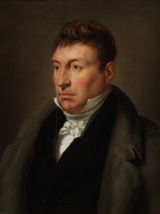
David d’Angers was a real link between 18th and 19th century republicans, and a living bridge between those of Europe and America.
Born in 1788, he had the good fortune to associate at an early age with some of the great revolutionary figures of the time, before becoming personally involved in the revolutions of 1830 and 1848.
Towards the end of the 1820s, David attended the Tuesday salon meetings of Madame de Lafayette, wife of Gilbert du Motier, Marquis de La Fayette (1757-1834).
While General Lafayette stood upright like « a venerable oak », this salon, notes the sculptor,
« has a clear-cut physiognomy, » he writes. The men talk about serious matters, especially politics, and even the young men look serious: there’s something decided, energetic and courageous in their eyes and in their posture (…) All the ladies and also the demoiselles look calm and thoughtful; they look as if they’ve come to see or attend important deliberations, rather than to be seen. »
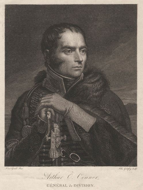
David met Lafayette’s comrade-in-arms, General Arthur O’Connor (1763-1852), a former Irish republican MP of the United Irishmen who had joined Lafayette’s volunteer General Staff in 1792.
Accused of stirring up trouble against the British Empire and in contact with General Lazare Hoche (1768-1797), O’Connor fled to France in 1796 and took part in the Irish Expedition. In 1807, O’Connor married the daughter of philosopher and mathematician Nicolas de Condorcet (1743-1794) and became a naturalized French citizen in 1818.
Lafayette and David d’Angers often got together with a small group of friends, a few « brothers » who were members of Masonic lodges: such as the chansonnier Pierre-Jean de Béranger, François Chateaubriand, Benjamin Constant, Alexandre Dumas (who corresponded with Edgar Allan Poe), Alphonse Lamartine, Henri Beyle dit Stendhal and the painters François Gérard and Horace Vernet.
In these same circles, David also became acquainted with Henri (Abbé) Grégoire (1750-1831), and the issue of the abolition of slavery, which Grégoire had pushed through on February 4, 1794, was often raised. In their exchanges, Lafayette liked to recall the words of his youthful friend Nicolas de Condorcet:
« Slavery is a horrible barbarism, if we can only eat sugar at this price, we must know how to renounce a commodity stained with the blood of our brothers. »
For Abbé Gregoire, the problem went much deeper:
« As long as men are thirsty for blood, or rather, as long as most governments have no morals, as long as politics is the art of deceit, as long as people, unaware of their true interests, attach silly importance to the job of spadassin, and will allow themselves to be led blindly to the slaughter with sheep-like resignation, almost always to serve as a pedestal for vanity, almost never to avenge the rights of humanity, and to take a step towards happiness and virtue, the most flourishing nation will be the one that has the greatest facility for slitting the throats of others. »
(Essay on the physical, moral and political regeneration of the Jews)
Napoleon and slavery
The first abolition of slavery was, alas, short-lived. In 1802, Napoleon Bonaparte, short of the money needed to finance his wars, reintroduced slavery, and nine days later excluded colored officers from the French army.
Finally, he outlawed marriages between « fiancés whose skin color is different ». David d’Angers remained very sensitive to this issue, having as a comrade a very young writer, Alexandre Dumas, whose father had been born a slave in Haiti.
As early as 1781, under the pseudonym Schwarz (black in German), Condorcet had published a manifesto advocating the gradual disappearance of slavery over a period of 60 to 70 years, a view quickly shared by Lafayette. A fervent supporter of the abolitionist cause, Condorcet condemned slavery as a crime, but also denounced its economic uselessness: slave labor, with its low productivity, was an obstacle to the establishment of a market economy.
And even before the signing of the peace treaty between France and the United States, Lafayette wrote to his friend George Washington on February 3, 1783, proposing to join him in setting in motion a process of gradual emancipation of the slaves. He suggested a plan that would « frankly become beneficial to the black portion of mankind ».
The idea was to buy a small state in which to experiment with freeing slaves and putting them to work as farmers. Such an example, he explained, « could become a school and thus a general practice ». (NOTE 3)
Washington replied that he personally would have liked to support such a step, but that the American Congress (already) was totally hostile.
From the Society of Black Friends to the French Society for the Abolition of Slavery
In Paris, on February 19, 1788, Abbé Grégoire and Jacques Pierre Brissot (1754-1793) founded « La Société des amis des Noirs », whose rules were drawn up by Condorcet, and of which the Lafayette couple were also members.
The society’s aim was the equality of free whites and blacks in the colonies, the immediate prohibition of the black slave trade and the gradual abolition of slavery; on the one hand, to maintain the economy of the French colonies, and on the other, in the belief that before blacks could achieve freedom, they had to be prepared for it, and therefore educated.
After the virtual disappearance of the « Amis des Noirs », the offensive was renewed, with the founding in 1821 of the « Société de la Morale chrétienne », which in 1822 set up a « Comité pour l’abolition de la traite des Noirs », some of whose members went on to found the « Société française pour l’abolition de l’esclavage (SFAE) » in 1834.
Initially in favor of gradual abolition, the SFAE later favored immediate abolition. Prohibited from holding meetings, the SFAE decided to create abolitionist committees throughout the country to relay the desire to put an end to slavery, both locally and nationally.
Goethe and Schiller
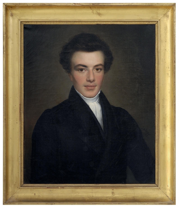
In the summer of 1829, David d’Angers made his first trip to Germany and met Goethe (1749-1832), the poet and philosopher who had retired to Weimar. Several posing sessions enabled the sculptor to complete his portrait.
Writer and poet Victor Pavie (1808-1886), a friend of Victor Hugo and one of the founders of the « Cercles catholiques ouvriers » (Catholic Workers Circle), accompagnied him on the trip and recounts some of the pictoresques anecdotes of their travel in his « Goethe and David, memories of a voyage to Weimar » (1874).
In 1827, the French newspaper Globe published two letters recounting two visits to Goethe, in 1817 and 1825, by an anonymous « friend » (Victor Cousin), as well as a letter from Ampère on his return from the « Athens of Germany ». In these letters, the young scientist expressed his admiration, and gave numerous details that whetted the interest of his compatriots. During his stay in Weimar, Ampère added to his host’s knowledge of Romantic authors, particularly Mérimée, Vigny, Deschamps and Delphine Gay. Goethe already had a (positive) opinion of Victor Hugo, Lamartine and Casimir Delavigne, and of all they owed to Chateaubriand.
A subscriber to the Globe since its foundation in 1824, Goethe had at his disposal a marvellous instrument of French information. In any case, he had little left to learn about France when David and Pavie visited him in August 1829. On the strength of his unhappy experience with Walter Scott in London, David d’Angers had taken precautions this time, and had a number of letters of recommendation for the people of Weimar, as well as two letters of introduction to Goethe, signed by Abbé Grégoire and Victor Cousin. To show the illustrious writer what he could do, he had placed some of his finest medallions in a crate.
Once in Weimar, David d’Angers and Victor Pavie encountered great difficulties in their quest, especially as the recipients of the letters of recommendation were all absent. Stricken with despair and fearing failure, David blamed his young friend Victor Pavie:
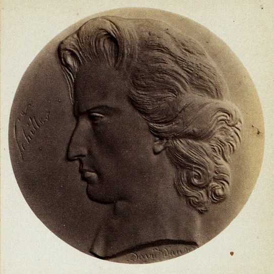
« Yes, you jumped in with the optimism of a young man, without giving me time to think and get out of the way. It wasn’t as a coward or under the patronage of an adventurer, it was head-on and resolutely that we had to tackle the character. (…) You’re only as good as what you are, it’s a yes or no question. You know me, on my knees before genius, and imployable before power. Ah! court poets, great or small, everywhere the same!
(…) And with a leap from the chair where he had insensitively let himself fall: Where’s Schiller? I’d like to kiss him! His grave, where I will strike, will not remain sealed for me; I will take him there, and bring him back glorious. What does it matter? Have I seen Corneille, have I seen Racine? The bust I’m planning for him will look all the better for it; the flash of his genius will gleam on his forehead. I’ll make him as I love and admire him, not with the pinched nose that Dannecker (image below) gave him, but with nostrils swollen with patriotism and freedom.
Victor Pavie’s account reveals the republican fervor animating the sculptor who, faithful to the ideals of Abbé Grégoire, was already thinking about the great anti-slavery sculpture he planned to create:
« At that moment, the half-open window of our bedroom, yielding to the evening breeze, opened wide. The sky was superb; the Milky Way unfurled with such brilliance that one could have counted the stars. He (David) remained silent for some time, dazzled; then, with that suddenness of impression that incessantly renewed the realm of feelings and ideas around him:
‘What a work, what a masterpiece! How poor we are compared to this!Would all your geniuses in one, writers, artists, poets, ever reach this incomparable poem whose tasks are splendors? Yet God knows your insatiable pretensions; we flay you in praise… And light! Remember this (and his presentiments in this regard were nothing less than a chimera), that such a one as received a marble bust from me as a token of my admiration, will one day literally lose the memory of it. – No, there is nothing more noble and great in humanity than that which suffers. I still have in my head, or rather in my heart, this protest of the human conscience against the most execrable iniquity of our times, the slave trade: after ten years of silence and suffering, it must burst forth with the voice of brass. You can see the group from here: the garroted slave, his eye on the sky, protector and avenger of the weak; next to him, lying broken, his wife, in whose bosom a frail creature is sucking blood instead of milk; at their feet, detached from the negro’s broken collar, the crucifix, the Man-God who died for his brothers, black or white. Yes, the monument will be made of bronze, and when the wind blows, you will hear the chain beating, and the rings ringing' ».
Finally, Goethe met the two Frenchmen, and David d’Angers succeeded in making his bust of the German poet. Victor Pavie:
« Goethe bowed politely to us, spoke the French language with ease from the start, and made us sit down with that calm, resigned air that astonished me, as if it were a simple thing to find oneself standing at eighty, face to face with a third generation, to which he had passed on through the second, like a living tradition.
(…) David carried with him, as the saying goes, a sample of his skills.He presented the old man with a few of his lively profiles, so morally expressive, so nervously and intimately executed, part of a great whole that is becoming more complete with our age, and which reserves for the centuries to come the monumental physiognomy of the 19th century. Goethe took them in his hand, considered them mute, with scrupulous attention, as if to extract some hidden harmony, and let out a muffled, equivocal exclamation that I later recognized as a mark of genuine satisfaction.Then, by a more intelligible and flattering transition, of which he was perhaps unaware, walking to his library, he charmingly showed us a rich collection of medals from the Middle Ages, rare and precious relics of an art that could be said to have been lost, and of which our great sculptor David has nowadays been able to recover and re-immerse the secret.
(…) The bust project did not have to languish for long: the very next day, one of the apartments in the poet’s immense house was transformed into a workshop, and a shapeless mound lay on the parquet floor, awaiting the first breath of existence. As soon as it slowly shifted into a human form, Goethe’s hitherto calm and impassive figure moved with it. Gradually, as if a secret, sympathetic alliance had developed between portrait and model, as the one moved towards life, the other blossomed into confidence and abandonment: we soon came to those artist’s confidences, that confluence of poetry, where the ideas of the poet and the sculptor come together in a common mold. He would come and go, prowling around this growing mass, (to use a trivial comparison) with the anxious solicitude of a landowner building a house. He asked us many questions about France, whose progress he was following with a youthful and active curiosity; and frolicking at leisure about modern literature, he reviewed Chateaubriand, Lamartine, Nodier, Alfred de Vigny, Victor Hugo, whose manner he had seriously pondered in Cromwell.

(…) David’s bust, writes Pavie, was as beautiful as Chateaubriand’s, Lamartine’s, Cooper’s, as any application of genius to genius, as the work of a chisel fit and powerful to reproduce one of those types created expressly by nature for the habitation of a great thought. Of all the likenesses attempted, with greater or lesser success, in all the ages of this long glory, from his youth of twenty to Rauch’s bust, the last and best understood of all, it is no prevention to say that David’s is the best, or, to put it even more bluntly, the only realization of that ideal likeness which is not the thing, but is more than the thing, nature taken within and turned inside out, the outward manifestation of a divine intelligence passed into human bark. And there are few occasions like this one, when colossal execution seems no more than a powerless indication of real effect. An immense forehead, on which rises, like clouds, a thick tuft of silver hair; a downward gaze, hollow and motionless, a look of Olympian Jupiter; a nose of broad proportion and antique style, in the line of the forehead ; then that singular mouth we were talking about earlier, with the lower lip a little forward, that mouth, all examination, questioning and finesse, completing the top with the bottom, genius with reason; with no other pedestal than its muscular neck, this head leans as if veiled, towards the earth:it’s the hour when the setting genius lowers his gaze to this world, which he still lights with a farewell ray. Such is David’s crude description of Goethe’s statue.- What a pity that in his bust of Schiller, so famous and so praised, the sculptor Dannecker prepared such a miserable counterpart!
When Goethe received his bust, he warmly thanked David for the exchange of letters, books and medallions… but made no mention of the bust ! For one simple reason: he didn’t recognize himself at all in the work, which he didn’t even keep at home… The German poet was depicted with an oversized forehead, to reflect his great intelligence. And his tousled hair symbolized the torments of his soul…
David d’Angers and Hippolyte Carnot
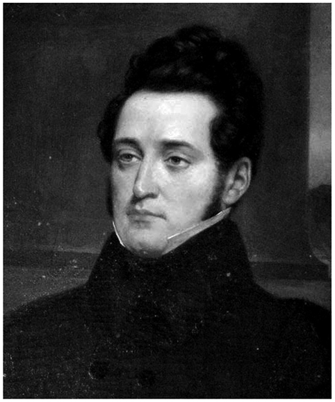
Among the founders of the SFAE (see earlier chapter on Abbé Grégoire) was Hippolyte Carnot (1801-1888), younger brother of Nicolas Sadi Carnot (1796-1832), pioneer of thermodynamics and son of « the organizer of victory », the military and scientific genius Lazare Carnot (1753-1823), whose work and struggle he recounted in his 1869 biography Mémoires sur Lazare Carnot 1753-1823 by his son Hippolyte.
In 1888, with the title Henri Grégoire, évêque (bishop) républicain, Hippolyte published the Mémoires of Grégoire the defender of all the oppressed of the time (negroes and Jews alike), a great friend of his father’s who had retained this friendship.
For the former bishop of Blois, « we must enlighten the ignorance that does not know and the poverty that does not have the means to know. »
Grégoire had been one of the Convention’s great « educators », and it was on his report that the Conservatoire des Arts-et-Métiers was founded on September 29, 1794, notably for the instruction of craftsmen. Grégoire also contributed to the creation of the Bureau des Longitudes on June 25, 1795 and the Institut de France on October 25, 1795.
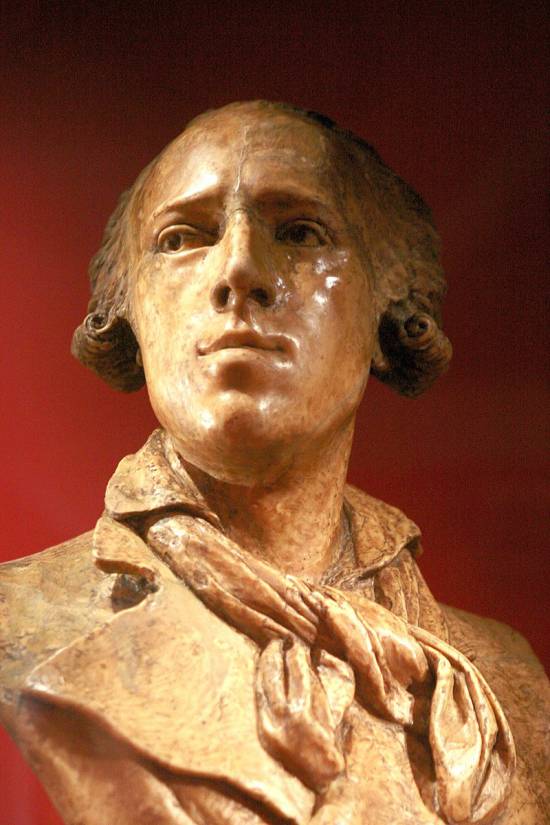
Hippolyte Carnot and David d’Angers, who were friends, co-authored the Memoirs of Bertrand Barère de Vieuzac (1755-1841), who acted as a sort of Minister of Information on the Comité de Salut Public, responsible for announcing the victories of the Republican armies to the Convention as soon as they arrived.
It was also Abbé Grégoire who, in 1826, commissioned David d’Angers, with the help of his friend Béranger, to bring some material and financial comfort to Rouget de Lisle (1860-1836), the legendary author of La Marseillaise, composed in Strasbourg when, in his old age, the composer was languishing in prison for debt.
Overcoming the sectarianism of their time, here are three fervent republicans full of compassion and gratitude for a musical genius who never wanted to renounce his royalist convictions, but whose patriotic creation would become the national anthem of the young French Republic.
Provisional Government
of the Second Republic
All these battles, initiatives and mobilizations culminated in 1848, when, for two months and 15 days (from February 24 to May 9), a handful of genuine republicans became part of the « provisional government » of the Second Republic.
In such a short space of time, so many good measures were taken or launched! Hippolyte Carnot was the Minister of Public Instruction, determined to create a high level of education for all, including women, following the models set by his father for Polytechnique and Grégoire for Arts et Métiers.
Article 13 of the 1848 Constitution « guarantees citizens (…) free primary education ».
On June 30, 1848, the Minister of Public Instruction, Lazare Hippolyte Carnot, submitted a bill to the Assembly that fully anticipated the Ferry laws, by providing for compulsory elementary education for both sexes, free and secular, while guaranteeing freedom of teaching. It also provided for three years’ free training at a teacher training college, in return for an obligation to teach for at least ten years, a system that was to remain in force for a long time. He proposed a clear improvement in their salaries. He also urged teachers « to teach a republican catechism ».
A member of the provisional government, the great astronomer and scientist François Arago (1886-1853) was Minister for the Colonies, having been appointed by Gaspard Monge to succeed him at the Ecole Polytechnique, where he taught projective geometry. His closest friend was none other than Alexander von Humboldt, friend of Johann Wolfgang Goethe and Friedrich Schiller.
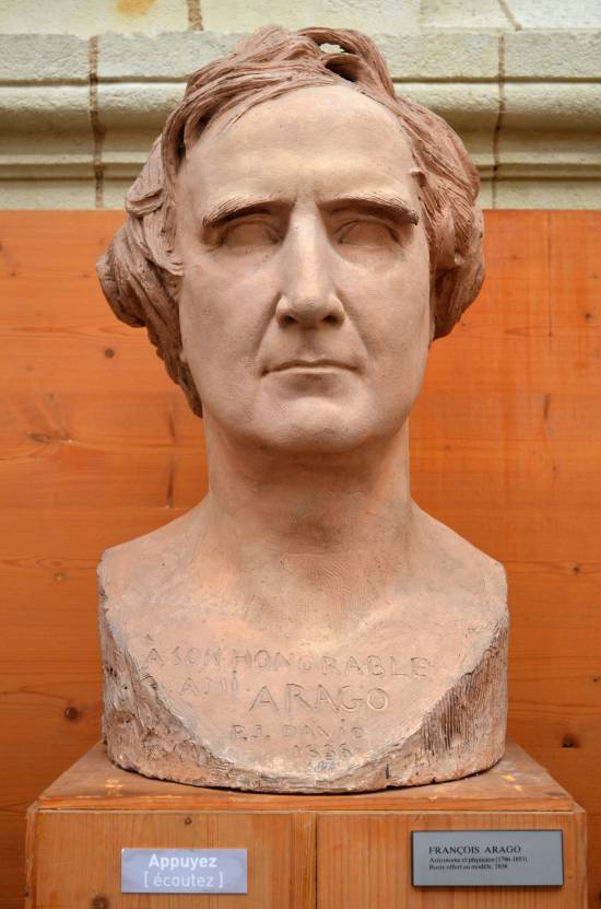
He was another abolitionist activist who spent much of his adult life in Paris. Humboldt was a member of the Société d’Arcueil, formed around the chemist Claude-Louis Berthollet, where he also met, besides François Arago, Jean-Baptiste Biot and Louis-Joseph Gay-Lussac, with whom Humboldt became friends. They published several scientific articles together.
Humboldt and Gay-Lussac conducted joint experiments on the composition of the atmosphere, terrestrial magnetism and light diffraction, research that would later bear fruit for the great Louis Pasteur.
Napoleon, who initially wanted to expel Humboldt, eventually tolerated his presence. The Paris Geographical Society, founded in 1821, chose him as its president.
Humboldt, Arago, Schoelcher, David d’Angers and Hugo
Humboldt made no secret of his republican ideals. His Political Essay on the Island of Cuba (1825) was a bombshell. Too hostile to slavery practices, the work was banned from publication in Spain. London went so far as to refuse him access to its Empire.
Even more deplorably, John S. Trasher, who published an English-language version in 1856, removed the chapter devoted to slaves and the slave trade altogether! Humboldt protested vigorously against this politically motivated mutilation. Trasher was a slaveholder, and his redacted translation was intended to counter the arguments of North American abolitionists, who subsequently published the retracted chapter in the New York Herald and the US Courrier. Victor Schoelcher and the decree abolishing slavery in the French colonies.
In France, under Arago, the Under-Secretary of State for the Navy and the Colonies was Victor Schoelcher. He didn’t need much convincing to convince the astronomer that all the planets were aligned for him to act.
A Freemason, Schoelcher was a brother of David d’Angers’s lodge, « Les amis de la Vérité » (The Friends of Truth), also known as the Cercle social, in reality « a mixture of revolutionary political club, Masonic lodge and literary salon ».
On March 4, a commission was set up to resolve the problem of slavery in the French colonies. It was chaired by Victor de Broglie, president of the SFAE, to which five of the commission’s twelve members belonged. Thanks to the efforts of François Arago, Henri Wallon and above all Victor Schoelcher, its work led to the abolition of slavery on April 27.
Victor Hugo the abolitionist
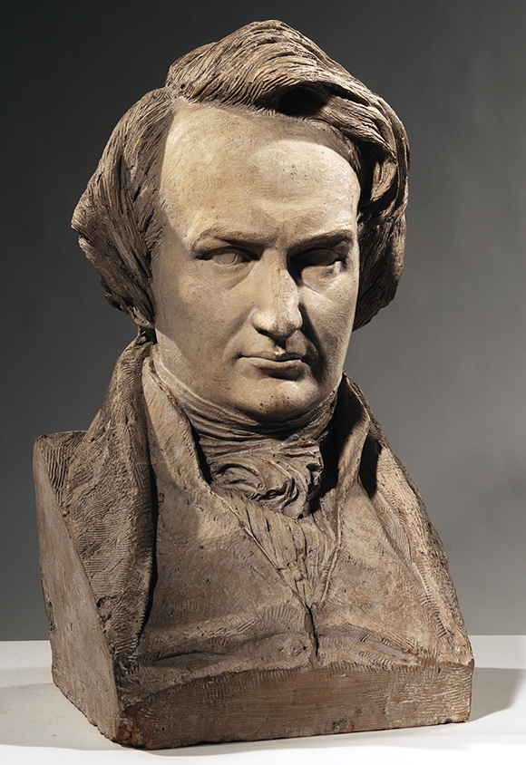
Victor Hugo was one of the advocates of the abolition of slavery in France, but also of equality between what were still referred to as « the races » in the 19th century. « The white republic and the black republic are sisters, just as the black man and the white man are brothers », Hugo asserted as early as 1859. For him, as all men were creations of God, brotherhood was the order of the day.
When Maria Chapman, an anti-slavery campaigner, wrote to Hugo on April 27, 1851, asking him to support the abolitionist cause, Hugo replied: « Slavery in the United States! » he exclaimed on May 12, « is there any more monstrous misinterpretation? » How could a republic with such a fine constitution preserve such a barbaric practice?
Eight years later, on December 2, 1859, he wrote an open letter to the United States of America, published by the free newspapers of Europe, in defense of the abolitionist John Brown, condemned to death.
Starting from the fact that « there are slaves in the Southern states, which indignifies, like the most monstrous counter-sense, the logical and pure conscience of the Northern states », he recounts Brown’s struggle, his trial and his announced execution, and concludes: « there is something more frightening than Cain killing Abel, it is Washington killing Spartacus ».
A journalist from Port-au-Prince, Exilien Heurtelou, thanked him on February 4, 1860. Hugo replied on March 31:
« Hauteville-House, March 31, 1860.
You are, sir, a noble sample of this black humanity so long oppressed and misunderstood.
From one end of the earth to the other, the same flame is in man; and blacks like you prove it. Was there more than one Adam? Naturalists can debate the question, but what is certain is that there is only one God.
Since there is only one Father, we are brothers.
It is for this truth that John Brown died; it is for this truth that I fight. You thank me for this, and I can’t tell you how much your beautiful words touch me.
There are neither whites nor blacks on earth, there are spirits; you are one of them. Before God, all souls are white.
I love your country, your race, your freedom, your revolution, your republic. Your magnificent, gentle island pleases free souls at this hour; it has just set a great example; it has broken despotism. It will help us break slavery. »
Also in 1860, the American Abolitionist Society, mobilized behind Lincoln, published a collection of speeches. The booklet opens with three texts by Hugo, followed by those by Carnot, Humboldt and Lafayette.
On May 18, 1879, Hugo agreed to preside over a commemoration of the abolition of slavery in the presence of Victor Schoelcher, principal author of the 1848 emancipation decree, who hailed Hugo as « the powerful defender of all the underprivileged, all the weak, all the oppressed of this world » and declared:
« The cause of the Negroes whom we support, and towards whom the Christian nations have so much to reproach, must have had your sympathy; we are grateful to you for attesting to it by your presence in our midst. »
A start for the better
Another measure taken by the provisional government of this short-lived Second Republic was the abolition of the death penalty in the political sphere, and the abolition of corporal punishment on March 12, as well as imprisonment for debt on March 19.
In the political sphere, freedom of the press and freedom of assembly were proclaimed on March 4. On March 5, the government instituted universal male suffrage, replacing the censal suffrage in force since 1815. At a stroke, the electorate grew from 250,000 to 9 million. This democratic measure placed the rural world, home to three quarters of the population, at the heart of political life for many decades to come. This mass of new voters, lacking any real civic training, saw in him a protector, and voted en masse for Napoleon III in 1851, 1860 and 1870.
Victor Hugo

To return to David d’Angers, a lasting friendship united him with Victor Hugo (1802-1885). Recently married, Hugo and David would meet to draw. The poet and the sculptor enjoyed drawing together, making caricatures, painting landscapes or « architectures » that inspired them.
A shared ideal united them, and with the arrival of Napoleon III, both men went into political exile.
Out of friendship, David d’Angers made several busts of his friend. Hugo is shown wearing an elegant contemporary suit.
His broad forehead and slightly frowning eyebrows express the poet’s greatness, yet to come. Refraining from detailing the pupils, David lends this gaze an inward, pensive dimension that prompted Hugo to write: « my friend, you are sending me immortality. »
In 1842, David d’Angers produced another bust of Victor Hugo, crowned with laurel, where this time it was not Hugo the close friend who was evoked, but rather the genius and great man.
Finally, for Hugo’s funeral in 1885, the Republic of Haiti wished to show its gratitude to the poet by sending a delegation to represent it. Emmanuel-Edouard, a Haitian writer, presided over the delegation, and made the following statement at the Pantheon:
The Republic of Haiti has the right to speak on behalf of the black race; the black race, through me, thanks Victor Hugo for having loved and honored it so much, for having strengthened and comforted it.
The four bas-reliefs
of the Gutenberg statue
Once the reader has identified this « great arch » that runs through history, and the ideas and convictions that inspired David d’Angers, he will grasp the beautiful unity underlying the four bas-reliefs on the base of the statue commemorating Gutenberg in Strasbourg.
What stands out is the very optimistic idea that the human race, in all its great and magnificent diversity, is one and fraternal. Once freed from all forms of oppression (ignorance, slavery, etc.), they can live together in peace and harmony.
These bronze bas-reliefs were added in 1844. After bitter debate and contestation, they replaced the original 1840 painted plaster models affixed at the inauguration. They represent the benefits of printing in America, Africa, Asia and Europe. At the center of each relief is a printing press surrounded by characters identified by inscriptions, as well as schoolteachers, teachers and children.
To conclude, here’s an extract from the inauguration report describing the bas-reliefs. Without falling into wokism (for whom any idea of a « great man » is necessarily to be fought), let’s point out that it is written in the terms of the time and therefore open to discussion:

Plaster model for the base of the statue of Gutenberg, David d’Angers.
« Europe
is represented by a bas-relief featuring René Descartes in a meditative attitude, beneath Francis Bacon and Herman Boerhaave. On the left are William Shakespeare, Pierre Corneille, Molière and Racine. One row below, Voltaire, Buffon, Albrecht Dürer, John Milton and Cimarosa, Poussin, Calderone, Camoëns and Puget. On the right, Martin Luther, Wilhelm Gottfried Leibniz, Immanuel Kant, Copernicus, Wolfgang Goethe, Friedrich Schiller, Hegel, Richter, Klopstock. Rejected on the side are Linné and Ambroise Parée. Near the press, above the figure of Martin Luther, Erasmus of Rotterdam, Rousseau and Lessing. Below the tier, Volta, Galileo, Isaac Newton, James Watt, Denis Papin and Raphaël. A small group of children study, including one African and one Asian.«
Plaster model for the base of the statue of Gutenberg, David d’Angers.
« Asia.
A printing press is shown again, with William Jones and Abraham Hyacinthe Anquetil-Duperron offering books to Brahmins, who give them manuscripts in return. Near Jones, Sultan Mahmoud II is reading the Monitor in modern clothes, his old turban lies at his feet, and nearby a Turk is reading a book. One step below, a Chinese emperor surrounded by a Persian and a Chinese man is reading the Book of Confucius. A European instructs children, while a group of Indian women stand by an idol and the Indian philosopher Rammonhun-Roy.«

« Africa.
Leaning on a press, William Wilberforce hugs an African holding a book, while Europeans distribute books to other Africans and are busy teaching children. On the right, Thomas Clarkson can be seen breaking the shackles of a slave. Behind him, Abbé Grégoire helps a black man to his feet and holds his hand over his heart. A group of women raise their recovered children to the sky, which will now see only free men, while on the ground lie broken whips and irons. This is the end of slavery.«
« America.
The Act of Independence of the United States, fresh from the press, is in the hands of Benjamin Franklin. Next to him stand Washington and Lafayette, who holds the sword given to him by his adopted homeland to his chest. Jefferson and all the signatories of the Act of Independence are assembled. On the right, Bolivar shakes hands with an Indian. »
America
We can better understand the words spoken by Victor Hugo on November 29, 1884, shortly before his death, during his visit to the workshop of sculptor Frédéric-Auguste Bartholdi, where the poet was invited to admire the giant statue bearing the symbolic name « Liberty Enlightening the World », built with the help of Gustave Eiffel and ready to leave for the United States by ship. A gift from France to America, it will commemorate the active part played by Lafayette’s country in the Revolutionary War.
Initially, Hugo was most interested in American heroes and statesmen: William Penn, Benjamin Franklin, John Brown and Abraham Lincoln. Role models, according to Hugo, who enabled the people to progress. For the French politician who became a Republican in 1847, America was the example to follow. Even if he was very disappointed by the American position on the death penalty and slavery.
After 1830, the writer abandoned this somewhat idyllic vision of the New World and attacked the white « civilizers » who hunted down Indians:
« You think you civilize a world, when you inflame it with some foul fever [4], when you disturb its lakes, mirrors of a secret god, when you rape its virgin, the forest. When you drive out of the wood, out of the den, out of the shore, your naive and dark brother, the savage… And when throwing out this useless Adam, you populate the desert with a man more reptilian… Idolater of the dollar god, madman who palpitates, no longer for a sun, but for a nugget, who calls himself free and shows the appalled world the astonished slavery serving freedom!«
(NOTE 5)
Overcoming his fatigue, in front of the Statue of Liberty, Hugo improvised what he knew would be his last speech:
« This beautiful work tends towards what I have always loved, called: peace between America and France – France which is Europe – This pledge of peace will remain permanent. It was good that it was done!«
NOTES:
1. If the phrase appears in the Book of Genesis, it could also refer to Notre-Dame de Paris (1831) a novel by Victor Hugo, a great friend of the statue’s sculptor, David d’Angers. We know from a letter Hugo wrote in August 1832 that the poet brought David d’Angers the eighth edition of the book. The scene most directly embodied in the statue is the one in which the character of Frollo converses with two scholars (one being Louis XI in disguise) while pointing with one finger to a book and with the other to the cathedral, remarking: « Ceci tuera cela » (This will kill that), i.e. that one power (the printed press), democracy, will supplant the other (the Church), theocracy, a historical evolution Hugo thought ineluctable.
2. It was the encounter with Asia that brought countless technical know-how and scientific discoveries from the East to Europe, the best-known being the compass and gunpowder. Just as essential to printing as movable type was paper, the manufacture of which was perfected in China at the end of the Eastern Han Dynasty (around the year 185). As for printing, the oldest printed book we have to date is the Diamond Sutra, a Chinese Buddhist scripture dating from 868. Finally, it was in the mid-11th century, under the Song dynasty, that Bi Sheng (990-1051) invented movable type. Engraved in porcelain, a viscous clay ceramic, hardened in fire and assembled in resin, they revolutionized printing. As documented by the Gutenberg Museum in Mainz, it was the Korean Choe Yun-ui (1102-1162) who improved this technique in the 12th century by using metal (less fragile), a process later adopted by Gutenberg and his associates. The Anthology of Zen Teachings of Buddhist High Priests (1377), also known as the Jikji, was printed in Korea 78 years before the Gutenberg Bible, and is recognized as the world’s oldest book with movable metal type.
3. Etienne Taillemite, Lafayette and the abolition of slavery.
4. Victor Hugo undoubtedly wanted to rebound on the news that reached him from America. The Pacific Northwest smallpox epidemic of 1862, which was brought from San Francisco to Victoria, devastated the indigenous peoples of the Pacific Northwest coast, with a mortality rate of over 50% along the entire coast from Puget Sound to southeast Alaska. Some historians have described the epidemic as a deliberate genocide, as the colony of Vancouver Island and the colony of British Columbia could have prevented it, but chose not to, and in a way facilitated it.
5. Victor Hugo, La civilisation from Toute la lyre (1888 and 1893).
The challenging modernity of the Indus Valley Civilization

Get an easy-to-print pdf file of this article
Karel Vereycken, Paris, France, January 2023
A major archaeological discovery has just been made in Israel in 2022: the first evidence of the use of cotton fibers in the Near East and among the oldest in the world, dating back nearly 7,000 years, was discovered by Israeli, American and German archaeologists during an archaeological excavation at Tel Tsaf, southeast of Beit She'an, in the Jordan Valley of Israel.

So far, the earliest available evidence of cotton fibers in the area was dated to a few hundred years later, to the late Chalcolithic (Copper Age) and Early Bronze Age (about 5,000 to 6,500 BCE) from the archaeological site of Dhuweila in eastern Jordan.
Discovered in 1940, the site of Tel Tsaf reveals its secrets. « Tsaf is characterized by an amazing preservation of organic materials, » said Professor Danny Rosenberg of the Zinman Institute of Archaeology at the University of Haifa. « Tel Tsaf was a kind of pole that concentrated important commercial activities and had established contacts with many other peoples, » Rosenberg believes. « There was massive storage capacity there to accommodate grain, enormous capacity if you compare it to other sites.
For example, the earliest evidence of the social use of beer drinking and ritual food storage has been found there. Rosenberg and the other researchers also found beads from contemporary Anatolia, Romania, Egypt and other parts of Africa; pottery from Iraq, Syria and Armenia; and the earliest copper and other metals found in the world.
“Wool Tree” and “Cotton Roads”
The cotton found in Israel, probably came from the Indus region—modern Pakistan/India—which was the only place in the world that had begun to domesticate cotton at that time before its cultivation appeared in Africa thousands of years later.
« What’s interesting about this early evidence of a link to such a distant region is that it comes from fibers – microscopic pieces of ancient yarn. We assume that these cotton fibers, found along with wool fibers and plant fibers, arrived at the site as part of fabrics or clothing, i.e., ancient textiles, » Rosenberg says.
In addition, cotton was not only used for clothing: « In the prehistoric era, textiles were involved in many areas of life, not only in clothing but also in hunting, fishing … This is much more important than just saying that what we found are pieces of clothing that were worn by the inhabitants of the area. This discovery tells us a lot about the economic practices of the area, » says Rosenberg.
Since cotton had never been grown in Tel Tsaf, it was a surprise for the researchers to find it, and they felt that its presence underscored the city’s importance as a global trading hub at the heart of what could be called, the « Cotton Roads » of those days.
Growing cotton poses major challenges: a moderate to tropical climate and vast amounts of water. Just to produce a single T-shirt and a pair of jeans (representing about 1 kg of cotton), no less than 20,000 liters of water are required! Which civilization can afford such a performance at the beginning of the 7th millennium BC?
The Indus Valley civilization (IVC)
The term « Indus Valley Civilization » (IVC) refers to a vast cultural and political entity that flourished in the northern region of the Indian subcontinent between about 8000 and about 1900 BCE., a region that stretched from Baluchistan (Pakistan) in the west to Uttar Pradesh (India) in the east and from northeastern Afghanistan in the north to Gujarat (India) in the south.
In the absence of both literary sources and remnants of palaces and temples to confirm it, one cannot qualify this entity as a “Kingdom” or an “Empire”. Its modern name (IVC) derives simply from its location in the Indus Valley, but also goes under the name of the « Indus-Sarasvati civilization » or « Harappan civilization ». These last designations come from the river Sarasvati, mentioned in the Vedic sources, which flowed next to the Indus and which would have disappeared, and from the ancient city of Harappa (Punjab, Pakistan), discovered by the British in 1829, but deliberately left unexplored.
The rise of a great urban civilization in the Indus Valley, which reached its maturity around 2500-2400 BCE, was long considered a sudden and mysterious phenomenon. Today, a series of discoveries allows us to follow, from 7000 to 2500 BCE, a series of transformations and innovations whose cumulative effects, stimulated by the enlargement of the network of exchanges from 3000 BCE onwards, created the conditions for the development of an incredibly modern and prosperous urban civilization.
Enter Mehrgarh, the light of the world!
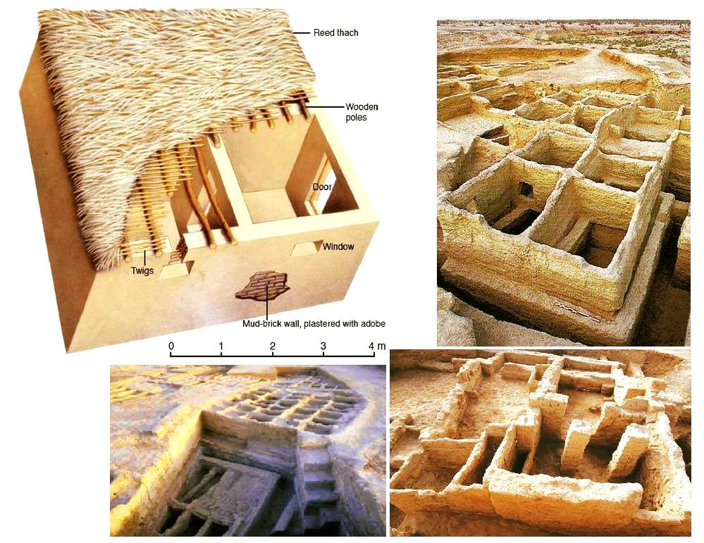
Since prehistoric times, the Indus region has been pioneering and rich in discoveries. As an example, for the Guinness Book of Records, although a case apart, the farming village of Mehrgarh (Baluchistan, Pakistan) which dates from the Neolithic (using only stones as tools) but can be considered as the key culture and city that lead humanity, as early as in the 8th millennia BCE, from the Stone Age into the Age of Copper.
The site is located on the principal route between what is now Afghanistan and the Indus Valley: this route was also undoubtedly part of a trading connection established quite early between the Near East and the Indian subcontinent.
Excavations in Mes Aynak (Afghanistan), where archaeologists are only beginning to find remnants of a 5,000-year-old Bronze Age site beneath the Buddhist level, including an ancient copper smelter, will undoubtedly shed new light on these relationships.
On the basis of a variety of well-documented archaeological finds, it has been established that “pre-Harrapan” Mehrgarh, made several historical breakthroughs for the benefit of humanity as a whole.
Mehrgarh gave the world:
- among the oldest traces of agriculture (wheat and barley) and breeding (cattle, sheep and goats) in South Asia ;
- the first breweries (with wheat and barley);
- the oldest reservoirs for irrigated agriculture and flood prevention;
- the oldest traces of cotton culture (6th millennium BCE);
- the oldest jewel, called the « Mehrgarh amulet » (6th millennium BCE), produced with the « lost wax » bronze casting technique ;
- the oldest bow drills (in green jasper) allowing to drill holes in lapis lazuli and carnelian;
- the very first traces of successfull dentistry practices (!) (9th millennium BCE); The inhabitants of Mehrgarh appeared to have developed an understanding of surgery and dentistry, as evidenced by the drilled teeth of some of the skeletons found at the site. Analysis of the teeth shows that prehistoric dentists worked to treat toothaches with drills made from flint heads. The work was so elaborate that even modern dentists are surprised at the efficiency with which the Mehrgarh « dentists » removed decaying tooth tissue. Among the remains, a total of eleven drilled crowns were found, with one example showing evidence of a complex procedure involving the removal of tooth enamel followed by carving of the cavity wall. Four of the teeth show evidence of decay associated with the drilled hole. None of the individuals with drilled teeth appear to have come from a special tomb or shrine, indicating that the oral health care they received was available to all.

Densely populated
Originally, the IVC was built around the fishy meanders of the Indus, a river nearly 3200 kilometers long that flows from the Himalayan mountains towards the Arabian Sea. Like the populations of other great river valleys, this society was seduced by the fertility of the land as well as by the possibility of using the Indus as a transportation route.
The IVC, whose prosperity rests largely on the increasingly systematic exploitation of the rich silt of the Indus, spread over an immense territory encompassing the entire Indus Valley and part of Indian Gujarat. It is necessary to add to the vast zone of distribution of the Indus civilization some Harappan « colonies » or outposts like Sutkagan Dor (Ballochistan, Pakistan), close to Gwadar on the edges of the sea of Oman, at the Iranian-Pakistani border, and the lapus lazuli mining town of Shortugai, close to Amu Darya river, at the Afghan-Tajik border, at nearly 1,200 kilometers of Mohenjo-daro, by far the largest IVC urban concentration.
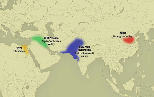
At its peak, this civilization was twice as large as the Old Kingdom of Egypt. With an area of 2.5 million square kilometers, it was at the time the largest civilization in the world: it included 5 million people, or 10 % of the world population at the time, much more than less older civilizations as Sumer (0.8 to 1.5 million people) or ancient Egypt (2 to 3 million).
To date, about 2,000 sites have been discovered in India, Pakistan and Afghanistan. Because of various wars and conflicts, only 10 % of the territory of these sites has been excavated and scientifically investigated. On the Indian subcontinent, the main centers of this civilization are Harappa (estimated 23,500 inhabitants) and Mohenjo-daro (est. 40,000 inhabitants) in Pakistan and Lothal, Dholavira and Kalibangan in India. In addition to trade relations with Mesopotamia and Iran, the Harappan city-states also maintained active trade relations with the peoples of Central Asia.
Agriculture, crafts and industry
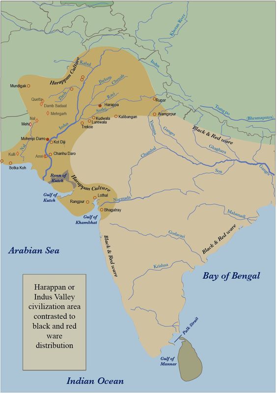
Agriculture, animal husbandry, industry, trade and commerce were the main source of income.
Agriculture was the main occupation of the people of the Indus Valley. They cultivated barley and wheat on a large scale (and made beer) but also other crops such as legumes, cotton, cereals, sesame, dates, mustard, melons, peas, etc.
There is no real evidence of rice, but a few grains of rice have been found in Rangpur and Lothal.
In the towns of Mehrgarh, Harappa, and Mohenjo-daro, there are remains of large granaries, suggesting that they produced more than they needed and physically stocked cereals and other food products in case of crop failure.
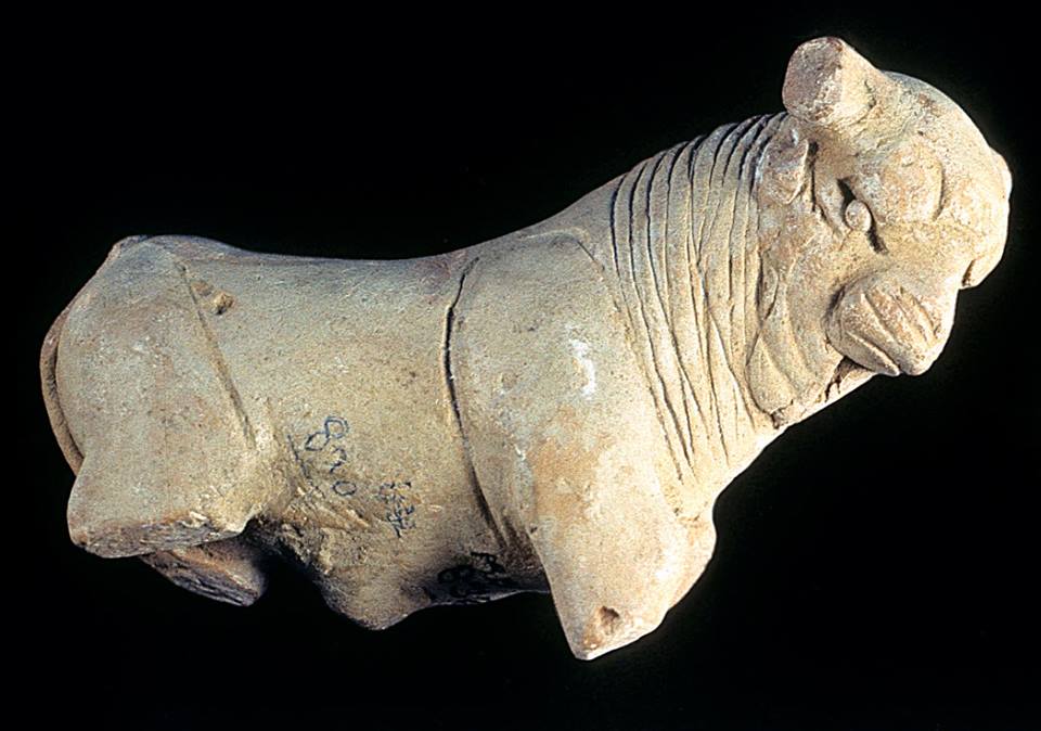
Animal husbandry was another major occupation. Seals suggest that they domesticated cows, buffalos, goats, sheep, pigs, etc. Camels and bullocks were also domesticated and used as beasts of burden. Camel bones have been found in large numbers at many sites, but there is no trace of them on the seals. During the excavation of Surkotado in Gujarat, India, the jawbone of a horse was found. Terracotta figurines representing a horse were found in Nausharo and Lothal.
The inhabitants of the Indus Valley were very skillful. They made ceramics, metal vessels, tools and weapons, weaved and spun, dyed and practiced other crafts with potter’s wheels. The weavers wore clothes made of cotton and wool. They knew leather, but there is no record of silk production.
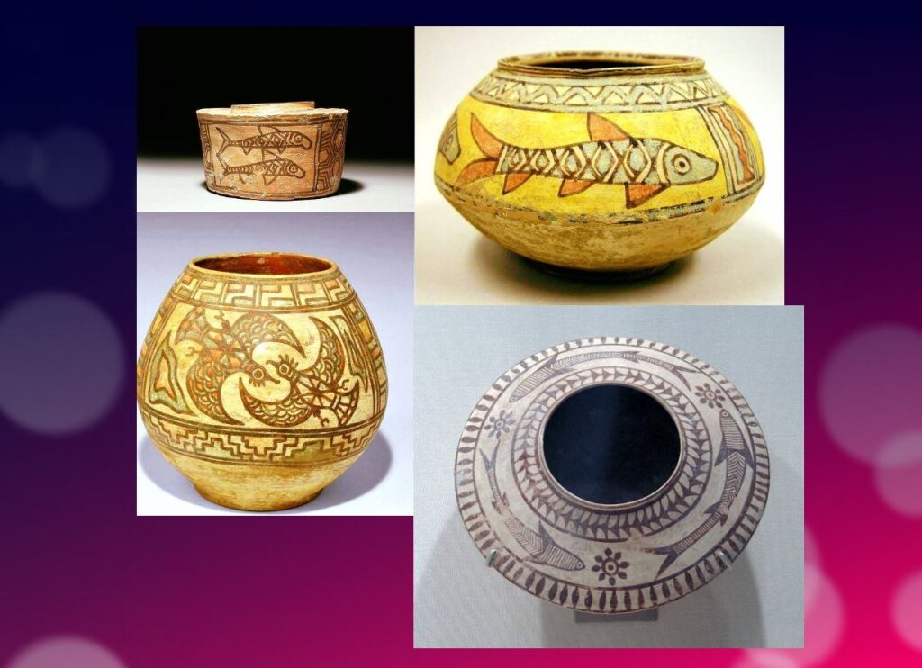
The inhabitants of this civilization originally came from the Bronze Age and used stone tools, but they soon excelled in the manufacture and processing of gold, silver, copper, lead and bronze, especially for artistic ornaments of great finesse.
Artisans made jewelry in Mohenjo-daro, Chanho-daro and Lothal. They used ivory and various precious stones such as carnelian, lapis lazulite, agate and jasper to make them. Shell work was also a thriving industry. Craftsmen in the coastal colonies used shells to make buttons for shirts, pendants, rings, bracelets, beads, etc.
To supply the production of these craft professions, they needed to import various raw materials. To produce bricks and ceramics, clay was available locally, but for metal they had to acquire it from abroad. Trade focused on importing raw materials to be used in Harappan city workshops, including minerals from Iran and Afghanistan, lead and copper from other parts of India, jade from China, and cedar wood floated down rivers from the Himalayas and Kashmir. Other trade goods included terracotta pots, gold, silver, metals, beads, flints for making tools, seashells, pearls, and colored gemstones, such as lapis lazuli and turquoise.
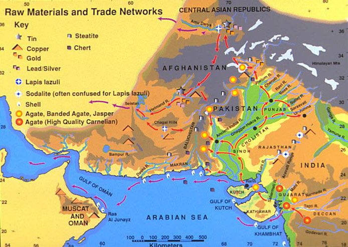
Ox carts were used to transport goods from one place to another. They also constructed barges used on the waterways along the Indus and its tributaries for transportation.
One of the ways historians know about the maritime trade network operating between the Harappan and Mesopotamian civilizations is the discovery of Harappan seals and jewelry at archaeological sites in regions of Mesopotamia, which includes most of modern-day Iraq, Kuwait, and parts of Syria. Long-distance sea trade over bodies of water—such as the Arabian Sea, Red Sea and the Persian Gulf—may have become feasible with the development of plank watercraft that were each equipped with a single central mast supporting a sail of woven rushes or cloth.
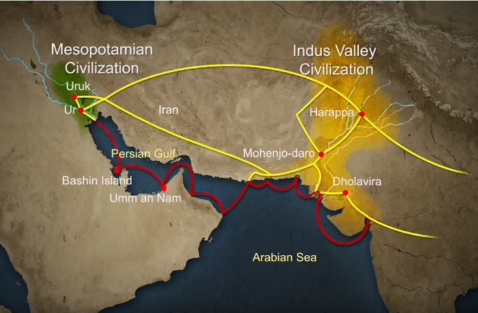
Historians have also made inferences about networks of exchange based on similarities between artifacts across civilizations.
Between 4300 and 3200 BCE, ceramics from the Indus Valley Civilization area show similarities with southern Turkmenistan and northern Iran. During the Early Harappan period—about 3200 to 2600 BCE—there are cultural similarities in pottery, seals, figurines, and ornaments that document caravan trade with Central Asia and the Iranian plateau.
The wonders of Mohenjo-daro
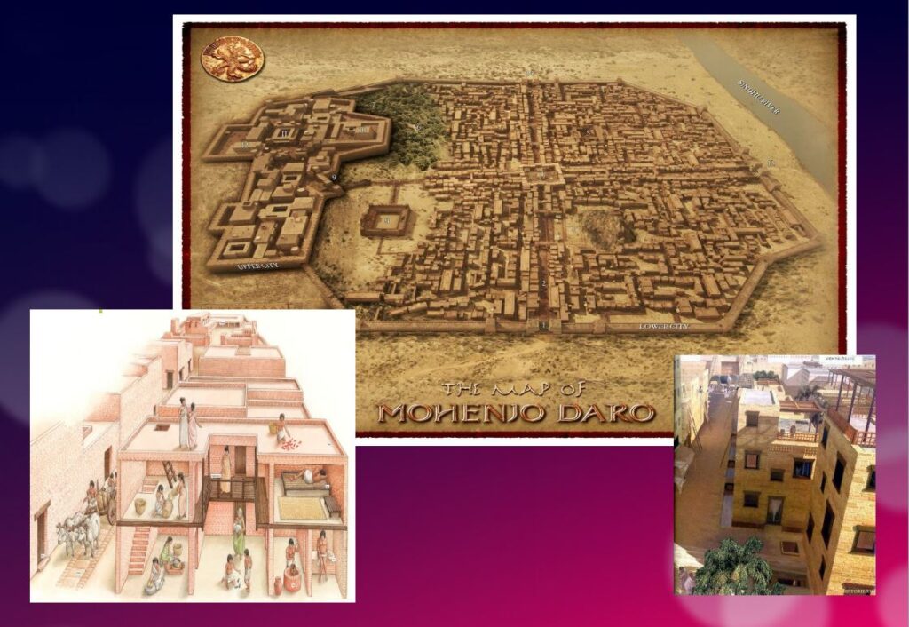
Sometimes referred to as the « Manhattan of the Bronze Age » for the grid pattern of the city plan, Mohenjo-daro (Sind, Pakistan) remained buried under meters of alluvial sediment until 1922.
A real metropolis made of baked bricks, it covers more than 200 hectares. Strictly squared, cut in two by a street of ten meters wide, divided from north to south by a dozen arteries drawn with the cord, and crossed from east to west by paved streets, Mohenjo-daro represents, by its strictly reflected urban framework, the model city of the Indus civilization. It could have accommodated up to 40,000 people!
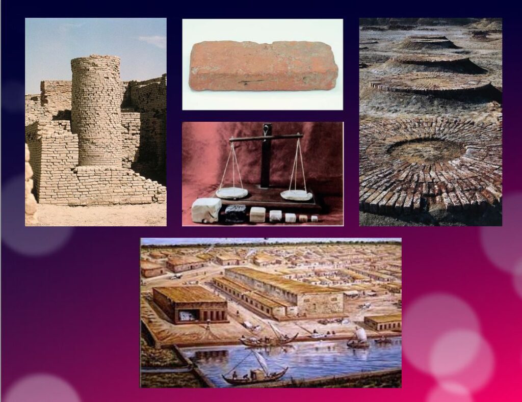
The Harappans were masters of hydraulic engineering, a “riparian” people working in river corridors practicing irrigated agriculture. They mastered both the shaduf (an irrigation tool used to draw water from a well), and windmills.
In the Harappan cities, the domestic and manufacturing areas were separated from each other.
The inhabitants, living in one-, two-, and sometimes three-story dwellings, seem to have been mainly artisans, farmers, and merchants. The people had developed the wheel, cattle-drawn carts, flat-bottomed boats large enough to carry goods, and perhaps also sailing. In the field of agriculture, they had understood and used irrigation techniques and canals, various agricultural implements, and had established different areas for livestock grazing and cultivation.
Seals and harrapan script
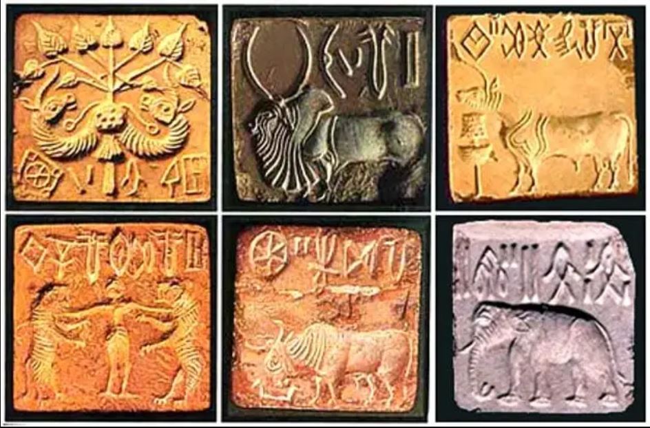
Among the thousands of artifacts found at the various sites are small soapstone seals just over one inch (3 cm) in diameter, used to sign contracts, authorize land sales, and authenticate the point of origin, shipment, and receipt of goods in long-distance trade. On each seal is a small text in Harappan, a language yet to be deciphered.
Among the thousands of artifacts found at the various sites are small soapstone seals just over one inch (3 cm) in diameter, used to sign contracts, authorize land sales, and authenticate the point of origin, shipment, and receipt of goods in long-distance trade.
Commercial contacts between the Indus and Sumer populations are well documented. Numerous seals from the Indus Valley have been discovered in Mesopotamia. On each seal, a small text in Harappean, a language that remains to be deciphered.
If 4,200 texts reached us, 60 % of them are seals or mini-tablets of stone or copper, engraved, and they comprise on average… only five signs! The longest text has 26 signs. The texts are always accompanied by the image of an animal, often a unicorn or a majestic buffalo. They were intended to mark goods, probably indicating the name of the owner or the recipient and a quantity or a year. Trying to decipher the Indus language is a bit like trying to learn French only from the labels on the food shelf of a supermarket!
The invention of sanitation
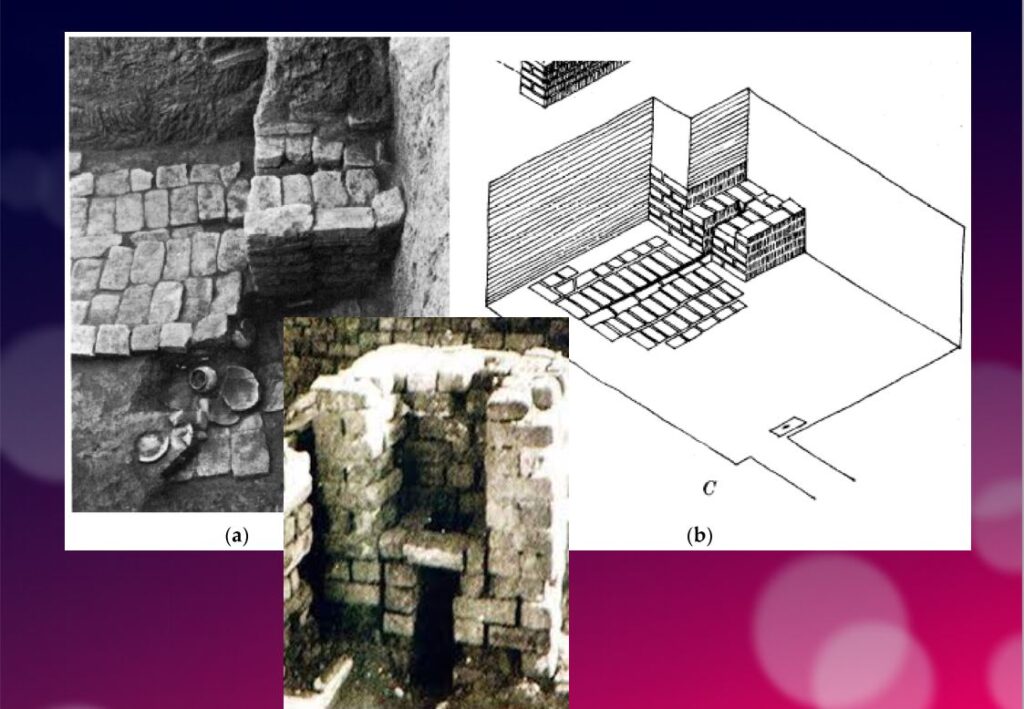
In addition to this particular attention that they paid to urban planning, the members of the Indus civilization also seem to have been pioneers of modern hygiene. Some cities, notably Mohenjo-daro, were equipped with small containers (dustbins) in which the inhabitants could deposit their household waste.
Anticipating our « all to the sewer » systems imagined in the 16th century by Leonardo da Vinci for the project envisaged by François I for the new French capital Romarantin, many cities had already public water supply and an ingenious sanitation system.
In many cities, including Mohenjo-daro, Harappa, Lothal and Rakhigari, individual houses or groups of houses were supplied with water from wells. This quality fresh water was used as much for food and personal hygiene (baths, toilets) as for the economic activities of the inhabitants.
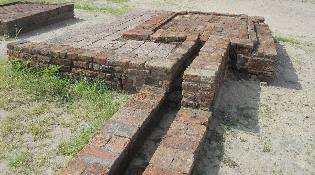
As an example, the sanitation system of the port city of Lothal (Gujarat, India) where many houses had a bathroom and private brick latrines. The wastewater was evacuated through a communal sewer system that led either to a canal in the port, or to a soaking pit outside the city walls, or to buried urns equipped with a hole allowing the evacuation of liquids, which were regularly emptied and cleaned.
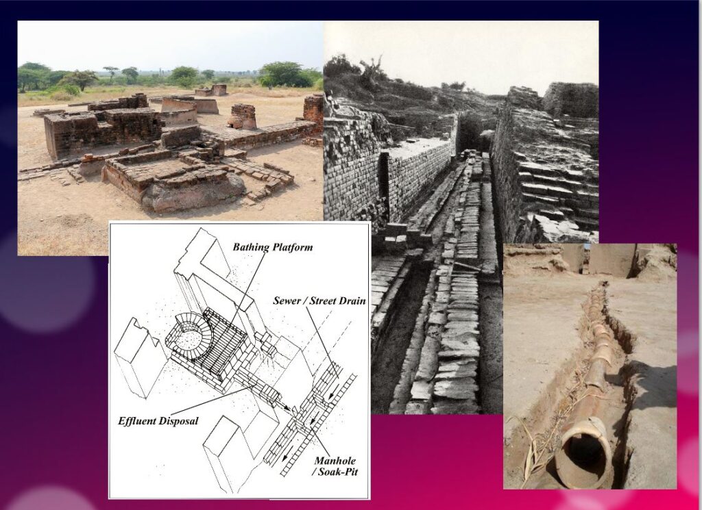
Excavations at the Mohenjo-daro site have also revealed the existence of no less than 700 brick water wells, houses equipped with bathrooms and individual and collective latrines. Toilets were an essential element. However, early archaeologists erroneously identified most toilets as post-cremation burial urns or simple cesspools. Many buildings in the city were two or more stories high. Water from the roof and bathrooms of the upper floors was channeled through closed clay pipes or open troughs that emptied, if necessary via the toilets, into the covered sewers underneath the paved street.
This extraordinary achievement is confirmed by a 2016 scientific study, entitled « The Evolution of Toilets Around the World Across the Millennia, » which reports that,
The earliest multi-flush toilets connected to a sophisticated sewage system that have been identified so far were found in the ancient cities of Harappa and Mohenjo-Daro in the Indus Valley, dating from the middle of the third millennium BC. Nearly every dwelling unit in Harappa, Mohenjo-Daro, and Lothal was equipped with a private bath-toilet area with drains to carry dirty water into a larger drain that emptied into the sewer and drainage system.
Till now, it are the Minoan (Crete) civilization and China that have been credited for the first use of underground clay pipes for sanitation and water supply. In the Cretan capital Knossos, there was a well-organized water system to bring in clean water, to evacuate wastewater and to provide storm sewers for overflow in case of heavy rains.
In Knossos existed also one of the earliest uses of flush toilets, dating back to the 18th century BCE. The Minoan civilization had stone sewers that were periodically cleaned with clean water. Crete, of course, was a large provider of Copper ore for the entire world in Antiquity and had vast international trade connections.
Religious and cultural worldview
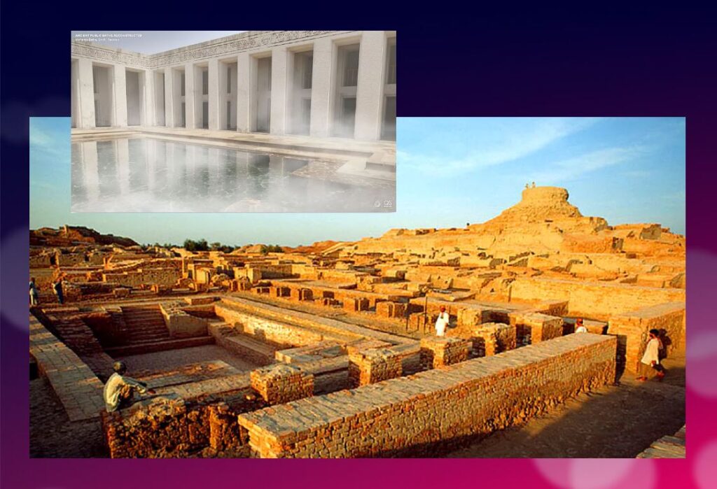
In the IVC, fertility rituals were probably observed in order to promote a full harvest as well as for women’s pregnancies, as evidenced by a number of figurines, amulets and statuettes with female form.
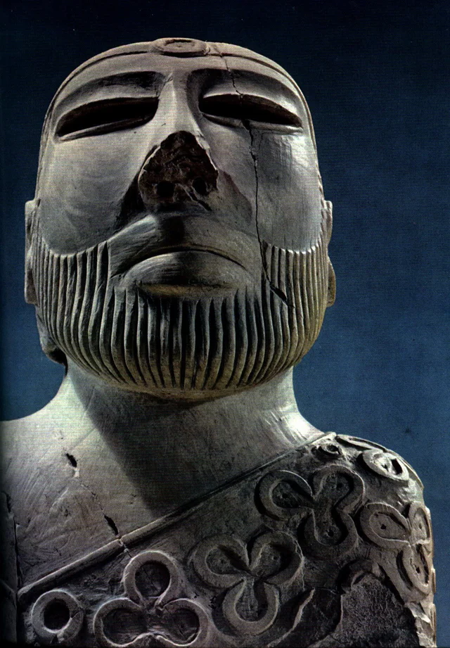
It is thought that the people, like the Dravidians who some believe were the origin of the Indus Civilization, worshiped a “mother goddess” and possibly a male companion represented as a horned figure in the company of wild animals.
The « Great Bath » at Mohenjo-daro would have been used for purification rites related to religious belief, but it could just as easily have been a public pool for recreation. Our knowledge of the religious beliefs of this culture remains in the realm of mere hypothesis.
The title of the famous statue of the « Priest-King » found at Mohenjo-daro is misleading, as there is no evidence that it is a king or a priest, and it may be a simple cotton trader…
Apart from pottery, certain types of elementary weapons (spearheads, axes, arrows, etc.) and certain tools for practical purposes, two types of artifacts give us cultural clues about Harappean society.
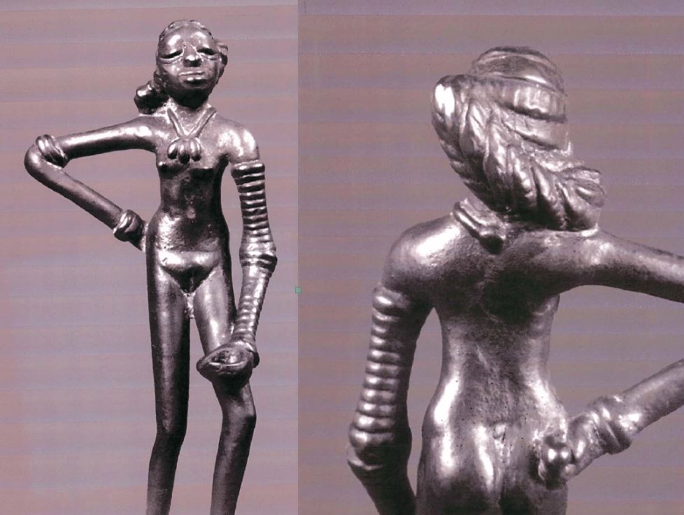
First, some figurines, which we try to interpret as devotional objects, seem to be simple toys. For others, they are clearly toys, notably animals (oxen, buffaloes, elephants, goats and even a simple hen), made of bronze or terracotta, mounted on small carts with wheels.
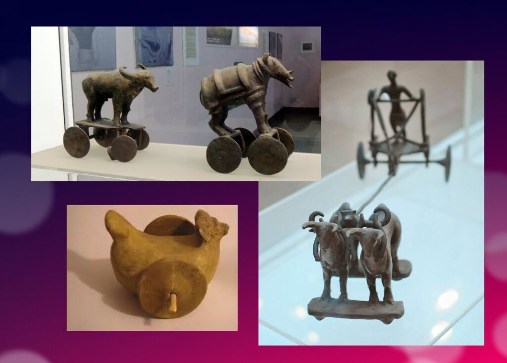
Second, among other objects expressing a high level of sensitivity and consciousness, a series of masks, some of which seem inspired by Mongolian masks.
These masks are clearly intended to serve comic or tragic representations and remind us of the ancient masks that have come down to us from classical Greece.
Older than Sumer and Egypt?
Archaeological excavations of the IVC got off to a late start, and it is now believed that some of the achievements and « firsts » attributed to Egypt ( – 3150 BC) and Mesopotamia ( – 4500 BC) may in fact belong to the inhabitants of the Indus Valley civilization.
In May 2016, the report published by a team of researchers from IIT Kharagpur, Institute of Archaeology, Deccan College Pune, Physical Research Laboratory and Archaeological survey of India (ASI), published by the journal Nature, shattered a number of “facts” that were considered unshakeable certainties.
Until now, the 900 years of the « mature » phase of the IVC was dated as ranging from 2800 to 1900 BCE. However, the aforementioned Indian study indicates that this civilization was much older than previously thought – it is at least 8,000 years old!
To determine the age of this civilization, researchers dated pottery using a technique called optically stimulated luminescence (OSL) – and found it to be nearly 6,000 years old, the oldest pottery known to date.
Other artifacts have been dated to 8,000 years ago. The results come from a major site excavated at Bhirrana (Haryana, India) that shows the preservation of all cultural levels of this ancient civilization, from the pre-Harappan phase through the Early Harappan to the Mature Harappan period. Bhirrana was part of a high concentration of sites along the mythical Vedic river « Saraswati », now dried up, an extension of the Harki-Ghaggar River in the Thar Desert.
The submerged cities of the Gulf of Khambhat
These new dates converge with the discovery, in January 2002, of ruins of submerged cities in the Gulf of Khambhat (formerly Cambay), off the coast of the state of Gujarat in northwest India.
It is the oceanographers of the National Institute of Ocean Technology (NIOT) of Madras who made this discovery. The team was surveying the muddy sea 30 km off the coast of the state of Gujarat, in the Gulf of Khambhat, to measure the levels of marine pollution. As a routine measure, they recorded acoustic images of the ocean floor.

It was only several months later, while analyzing the data, that the team realized that they had, without knowing it, obtained images of the ruins of a huge city, sunken 40 meters below sea level. And, at the end of January 2002, after having spent weeks to dredge the site and to bring up more than 2 000 objects, the team of the NIOT was able to make extraordinary revelations.
The ruins stretch for 9 km along the banks of an ancient river, and the remains of a dam can be distinguished. The sunken city shares striking similarities with the sites of the Indus civilization. One of the buildings, the size of an Olympic swimming pool, with collapsed steps, recalls the Great Bath of Mohenjo-daro. Another rectangular monument, 200 m long and 45 m wide, is as large as the acropolis discovered at Harappa. The team of NIOT also glimpsed another building, a kind of granary, made of mud bricks, 183 m long. Near these monumental installations, rows of rectangular buildings that resemble the foundations of ruined houses can be seen, and even a drainage system and roads. On another visit to the site, the team recovered polished stone tools, ornaments and figurines, pottery debris, semi-precious stones, ivory and the fossilized remains of a human spine, jaw and tooth. But the team was not at the end of its surprises.
It sent samples of a fossilized log to two major Indian laboratories specializing in dating methods: the Birbal Sbahni Institute of Paleobotany (BSIP) in Lucknow and the National Geophysical Research Institute (NGRI) in Hyderabad. The BSIP dated it to 5500 BCE, while the NGRI dated the sample much earlier, probably to 7500 BCE.
This dating would make Khambhat the oldest site discovered in India. According to some, this discovery could mark the end of the theory according to which urbanization spreads from Asia from the west towards the Indus. This dating caused intense controversy. Archaeologist G. Possehl points out that there is no reason to believe that the fossilized piece of wood belongs to the ruins of the ancient city, given the strong sea currents in the region, it could have come from elsewhere. NIOT’s team acknowledged the validity of these criticisms and assured that other objects would be subjected to dating methods. It is also a question of understanding how this city was sunk and how it ended up 30 km from the coast.
Harsh Gupta, geologist, thinks that it is a gigantic earthquake which caused the destruction of the city. We are in a high seismic risk area, and the 2001 Bhuj earthquake showed the vulnerability of the region to such phenomena. However, the priority is to definitively establish the age of the sunken city and prove it to be the most exciting discovery of this century.
Historical cradle of textiles

In his book Empire of Cotton, A Global History (2015) Sven Beckert traces in depth the development of what the ancients, intrigued by its resemblance to the feel of wool, called the « wool tree. » While this plant grows in both temperate and tropical climates, it needs an abundance of moisture to thrive fully, which consigns its cultivation to naturally and then artificially irrigated river valleys.
According to the author, « The farmers of the Indus Valley were the first to spin and weave cotton. In 1929, archaeologists found fragments of cotton textiles at Mohenjo-Daro, in present-day Pakistan, dating from 3250 to 2750 BCE. Cotton seeds found in nearby Mehrgarh have been dated to 5000 BCE. Literary references also attest to the antiquity of the cotton industry in the subcontinent. The Vedic scriptures, composed between 1500 and 1200 BCE., allude to the spinning and weaving of cotton…”
Historically, the discovery of the first cotton fragments was made at Mohenjo-daro during an expedition led by Sir John Marshall, Director General of the Archaeological Survey of India from 1902 to 1928. In his book on Mohenjo-daro and the Indus Civilization, Sir Marshall relates that fragments of cloth were wrapped around a silver perfume pot and a salt shaker.
Early forms of Self-government?
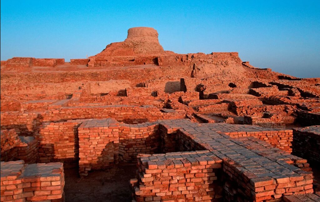
The fact remains that the political organization of the Indus cities escapes the experts. Because contrary to the Mesopotamian and Egyptian civilizations, the researches realized on the sites of the valley of the Indus did not bring to light any temple or palace of scale. There is no proof either of the existence of a permanent army…
Of what to wonder about the presence or not of a political power. Panic among British archaeologists and geopoliticians always inclined to project their own colonial ideology of aristocratic castes on the rest of the world.
In reality, each city seems to have had its own governor, or citizen council coordinating with other urban areas, all adhering to a number of common principles considered mutually beneficial.
This “Coincidence of Opposites”, of great diversity with perfect similarity, intrigues expert John Keay:
What amazed all those pioneers, and what remains the distinguishing characteristic of the several hundred Harappan sites now known, is their apparent similarity: ‘Our overriding impression is of cultural uniformity, both throughout the several centuries during which Harappan civilization flourished, and over the vast area it occupied.’ The ubiquitous bricks, for example, all have standardized dimensions, just as the stone cubes used by the Harappans to measure weight are also standardized and based on the modular system. The width of roads conforms to a similar module; thus, streets are generally twice as wide as side streets, while main arteries are two or one and a half times as wide as streets. Most of the streets excavated so far are straight and run north to south or east to west. The city plans thus conform to a regular grid pattern and seem to have retained this arrangement through several phases of construction.
Hence, given the existence of a unified system of weights and measures; given the similarity of urban organization as well as the standardization of the size of terracotta bricks for hundreds of cities, it is therefore simply impossible that the every man for himself reigned supreme.
Cradle of democracy?
In 1993, in an article entitled « The Indus Valley Civilization, Cradle of Democracy? », published by the UNESCO Courier, the internationally renowned Pakistani archaeologist and museologist, Syed A. Naqv, who has been fighting for the preservation of the Mohenjo-daro site, attempted to answer the question.
In all the highly developed civilizations of the past – Mesopotamia, the Nile Valley, Anatolia, China – the pervasive influence of an imperial authority can be felt, providing patronage for the arts and directing the evolution of society. A close examination of such an imperial authority over this civilization, which flourished some 5,000 years ago and covered almost twice the area of the civilizations of Mesopotamia and the Nile combined seems to belie the presence of an authoritarian regime, the Indus civilization had a well-disciplined way of life, civic controls and organizational system which could only have stemmed from the kind of “rule by the people” that was exercised in some Greek city-State some 2,000 years later. Did Greece give birth to democracy, or did Greece simply follow a practice developed earlier?
Although there are no large structures acting as centers of authority,
the discoveries made so far suggest that the rule of law extended over an area measuring roughly 1,600 kilometers from the north to the south and more that 800 kilometers from east to west. The main argument in support of this thesis is the existence of well-established norms and standards which would have required the consensus of the people if they had not been imposed by an authoritarian regime. It is impossible to ignore the evidence furnished by the perfect planning of the great city of Mohenjo-daro and the use in its construction of standard-sized bricks 27.94 cm long, 13.96 cm wide and 5.71 cm thick.
In the two large cities of Mohenjo-daro and Harappa, about 600 km distant,
the grid pattern of the street layout uncovered by the archaeological excavations shows that great attention was paid to the security of the inhabitants and suggests the existence of a highly developed and well-monolithic system of civic control.
The same is true of the highly sophisticated sewage system and the existence of
a virtually complete series of highly polished stone weights. Their shapes are cubical, half-cubical, cylindrical and spherical, and very few of them are reported to be defective. They provide yet another proof of a civic authority maintaining consistent commercial standards.
It is not possible to conclude that such « a philosophical conception of democracy exists until the Harappan script is deciphered and written evidence is provided. But the signs are there, and further research in this direction may well establish that ‘government by the people’ originated in the Indus Valley, » the author concludes.
Finally, since this agricultural people, who knew the use of the spears and the arrows but didn’t leave any trace of a major military activity – few weapons nor fortifications with exclusively defensive purpose have been found – , many observers agree to say that this society could have known the longest period of peace of the history of the humanity.
Decay and fall
In two of his books, the Timaeus and the Critias, the Greek philosopher Plato tells the story « certainly true, although strange » of a maritime people with incomparable power: the Atlantes whose civilization and capital he describes in great detail.
Starting 10,000 years before our era from an island located beyond the columns of Hercules, the Atlanteans would have ended up dominating the whole of Africa and Western Europe.
In a passage which is not without recalling the type of political organization which could exist in Mohenjo-daro, Critias specifies that Atlantis was then inhabited « by the various classes of men who deal with the trades and agriculture. The warriors, separated from the beginning by divine men, lived separately, possessing all that was necessary for their existence and that of their children. Among them, there were no particular fortunes; all goods were in common: they demanded from the other citizens nothing beyond what they needed to live, and fulfilled in return all the obligations that our talk of yesterday attributed to the defenders of the fatherland as we conceive them. »
Perhaps speaking metaphorically, Plato states that initially virtuous, the Atlantis civilization would have sunk into excess, arrogance and corruption to the point of being chastised by Poseidon himself for having embarked on one war too many, this time against Athens. And « in the time lapse of a single terrible day and night (…) the island of Atlantis sank into the sea and disappeared ».
At the historical level, the sudden decline of the Indus civilization around 1900 BC remains a mystery. Historians point to aspects of Minoan civilization (Crete) showing astonishing similarities with the IVC, especially watermanagement and early sewer systems in Knossos, lost wax broze casting techniques and bull fighting.
A few traces of fire and destruction, as well as forty skeletons wounded with knives and found without burial at Morenjo-daro, first suggested an invasion by Aryan peoples from Central Asia or the Iranian plateau. « This theory has now been abandoned. We have indeed found no effective trace of massacres or violence on the sites of the Indus Valley, or furniture that could be associated with such populations, » says Aurore Didier, researcher at the CNRS and director of the Indus mission.
Another hypothesis, an inability to strengthen its resilience to climatic chaos. « The samples taken in the northwest of India have shown that the climate there has changed significantly about 2000 years before our era. It is reported that this was also the case in Mesopotamia. « It became more like the dry and arid climate of today, which disrupted the cultivation and, in fact, the trade of the Indus civilizations. The ensuing socio-economic upheaval may have led to the decline of these societies. This hypothesis is the most commonly accepted to date, » says the archaeologist.
The inhabitants would have left their valleys become infertile to migrate to the plains of the Ganges. « This was accompanied by a change in livelihood strategies. The Indus civilization gradually converted to summer cereal crops based on rice and millet, two commodities more able to withstand these new climatic conditions and requiring, for rice, the development of irrigated agriculture, » says Aurore Didier. « It has also forged links with new trading partners.”
So there is no reason to talk about the « collapse » of a society in the sense of collapsologists. It is rather a gradual adaptation to the evolution of the environment, spread over several centuries.
As the excavations of the sites of the Indus Valley civilization continue, new information will undoubtedly contribute to a better understanding of its history and development. Any additional knowledge of this common civilizational legacy will serve in the future as a basis for fraternal cooperation between Pakistan, India and Afghanistan and others.
In the meantime, instead of trying to copy the barbaric « models » of the Mongolian Empire, the Roman Empire or the British Empire, the « elites » of the transatlantic world would do better to draw inspiration from a magnificent civilization that seems to have prospered for 5,000 years without perpetual wars and massacres, but simply thanks to a good mutual understanding, at the national level, between citizens, and thanks to mutually beneficial cooperation with the overriding majority of its distant partners.
The Indus Valley Civilization’s modernity, capable of offering food, shelter, water and sanitation to all, in a mirror image, shows all of us living in the present, how backwards we became.
Rembrandt’s oil painting is back… in China?

While in the West, “modern” artistic expression has degenerated into vibrant eulogies on the “Eros/Thanatos” theme (sex/death), Chinese artists have been encouraged to revive the most uplifting forms of art, often combining classical universal geniuses with their own historic traditions.
A case in point is Wang Shaolun (born 1968), whose “realistic” paintings, including beautiful portraits of women, are rejected by western critiques as remnants of “social realism”. It is true that, even when the country is rapidly becoming an industrial giant and urban residents become richer and richer, this young artist continues depicting farmers.
Following his graduation from the Beijing Central Academy of Fine Arts, Shaolin, sponsored by the Chinese government, could finish his training at the world famous Repin Art Academy of Saint-Petersburg. Recently, Shaolin was commissioned by the Chinese government to paint several life-size oil paintings for museums in major cities, as well as for national celebratory events.
On Nov. 18, CGTN, presented Shaolun’s 1999 work titled: « Xiaogang, The Night Of November 24, 1978 » depicting a night scene in a rural farming village in Anhui Province. “That evening, 18 farmers signed an agreement that would change the course of agriculture in China.” writes CGTN. Before 1978, China practiced collective farming. But food shortages due to drought, lack of incentives and other challenges were persistent.
The historical accord was called « The Household Responsibility System (HRS)” and for the first time all allowed individual households to contract land and machinery to produce their own yields. With this new procedure, “Each household sold the government their grain at an official price. But any leftover grain could be sold on the open market at a much higher price.” The new system was one of the key reforms of Deng Xiaoping and a key step of pulling millions out of extreme poverty. As a result, between 1978 and 1984, agricultural output in China almost doubled. The HRS resolved the food scarcity crisis and elevated incomes.
The painting is clearly inspired by Rembrandt’s 1661 oil painting called the “Conspiracy of Claudius Civilis” with the light literately emanating out of the table and illuminating a group of peasants intensively concentrating on accomplishing an act that’s going to change the course of history.
Persian Qanâts and the Civilization of Hidden Waters

By Karel Vereycken, July 2021.

By Karel Vereycken, July 2021.
At a time when old diseases make their return and new ones emerge worldwide, the tragic vulnerability of much of humanity poses an immense challenge.
One wonders whether to laugh or cry when international authorities trumpet without further clarification that to stop the Covid-19 pandemic, “all you have to do” is “wash your hands with soap and water”!
They forget one small detail: 3 billion people do not have facilities to wash their hands at home and 1.4 billion have no access to either water or soap!
Yet, since the dawn of time, mankind has demonstrated its capacity to mobilize its creative genius to make water available in the most remote places.
Here is a short presentation of a marvel of such human genius, the “qanâts”, an underground water conveyance system dating from the Iron Age. Probably of Egyptian origin, it was deployed on a large scale in Persia from the beginning of the 1st millennium BC.

The qanât or underground aqueduct

Sometimes called “horizontal drilling”, the qanât is an underground aqueduct employed to draw water from a water table and convey it by simple gravitational effect to urban settlements and farmland. The word qanât is an old Semitic word, probably Accadian, derived from a root qanat (reed) from which come canna and canal.
This “drainage gallery”, cut into the rock or built by man, is certainly one of the earliest and most ingenious inventions for irrigation in arid and semi-arid regions. The technique offers a significant advantage: by conveying water through an underground conduit, contrary to open air canals, not a single drop of water is wasted by evaporation.
Oases’ are NOT natural phenomena. All known oases are man-made. It is the qanât technique that allows man, in a given geographic configuration, to create oases in the middle of the desert, when a water table is close enough to the ground level or at a site close to the bed of a river lost in the sands of the desert.
Copied and expanded by the Romans, the qanât technique was carried across the Atlantic to the New World by the Spaniards, where many such underground canals still function in Peru and Chile. In fact, there are even Persian qanâts in western Mexico.
While today this three thousand year old technique may not be appropriate everywhere to solve current water scarcity problems in arid and semi-arid regions, it has much to inspire us as a demonstration of human genius at its best, that is, capable of doing a lot with a little.
The oases of Egypt
Today, 95% of the Egyptian population prospers on only 5% of its territory, mainly around the Nile delta. Hence, from the earliest days of Egyptian civilization, irrigation and water storage techniques for the Nile floods were developed in order to conserve this silty, nutrient-rich water for use throughout the year.
The river water was diverted and transported by canals to the fields by gravity. Since water from the Nile did not reach the oases, the Egyptians used the gushing water from the springs, which came from the large aquifer reserves of the western desert, and conveyed it to the fields by irrigation canals.
One of the fruits of this attempt to “conquer the desert” was a sustained habitation of the Dakhleh oasis throughout the Pharaonic period, explicable not only by a commercial interest on the part of the Egyptian state, but also by the new agricultural perspectives it offered.
Roman aqueducts
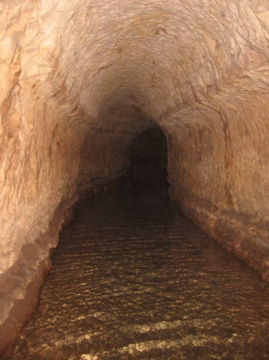
Closer to us in time, the Qanât Fir’aun (The Watercourse of the Pharaoh) also known as the aqueduct of Gadara, a city today in Jordan. As far as we know, this 170 km long structure, depending on the geography, combines several bridge-aqueducts (of the same type as the Gard aqueduct in France) and 106 km of underground canals using the Persian qanât technique. It is not only the longest but also the most sophisticated aqueduct of antiquity, and the fruit of a years of hydraulic engineering.
In reality, the Romans, hiring persian water experts, did nothing more than terminate in the 2nd century an ancient project designed to supply water to the “Decapolis”, a collaborative group of ten cities founded by Greek and Macedonian settlers under the Seleucid king Antiochos III (223 – 187 BC), one of the successors of Alexander the Great.
These ten cities were located on the eastern border of the Roman Empire (now in Syria, Jordan and Israel), united by language, culture and political status, each with a degree of autonomy and self-rule. Its capital, Gadara, was home to more than 50,000 people and known for its cosmopolitan atmosphere, its own university attracting scholars, writers, artists, philosophers and poets. But this rich city lacked something existential : an abundance of water.
The Gadara qanat made the difference. “In the capital alone, there were thousands of fountains, watering holes and baths. Wealthy senators cooled themselves in private pools and decorated their gardens with cooling caves. The result was a record daily consumption of more than 500 liters of water per capita,” explains Matthias Schulz, author of a report on the aqueduct in Spiegel Online.
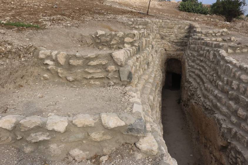
Persia
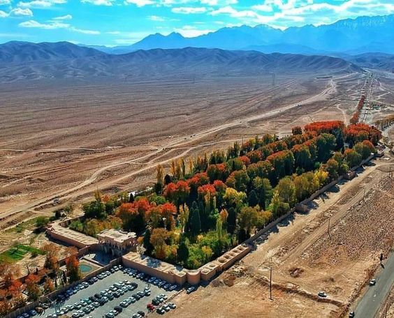
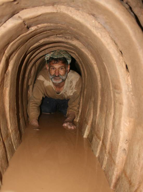
We all admire the roman aqueducts. But few of us are aware that the Romans only adapted the technique of the qanâts developed much earlier in Persia.
Indeed, it was under the Achaemenid Empire (around 559 – 330 BC.), that this technique spread slowly from Persia to the east and the west. Many qanâts can be found in North Africa (Morocco, Algeria, Libya), in the South East Asia (Iran, Oman, Iraq) and further east, in Central Asia, from Afghanistan to China (Xinjiang), via India.
The development of these “draining galleries” is attested in different regions of the world under various names: qanât and kareez in Iran, Syria and Egypt, kariz, kehriz in Pakistan and Afghanistan, aflaj in Oman, galeria in Spain, kahn in Balochistan, kanerjing in China, foggara in North Africa, khettara in Morocco, ngruttati in Sicily, bottini of Siena, etc.
Historically, the majority of the populations of Iran and other arid regions of Asia or North Africa depended on the water provided by the qanâts; their construction lifted entire areas to a higher “economic platform”, made deserts habitable and opened new land for agriculture. The map of demographic expansion followed the trail of the development of this new higher platform.
In his article « Du rythme naturel au rythme humain : vie et mort d’une technique traditionnelle, le qanât » (From natural rhythm to human rhythm: the life and death of a traditional technique, the qanât), Pierre Lombard, a researcher at the French CNRS, points out that this is not an artisanal and marginal process:
“Until a few years ago, the importance of the ancestral technique of qanât was sometimes ignored in Central Asia, Iran, Syria, and even in the countries of the Arabian Peninsula. For example, the Public Authority for Water Resources of the Sultanate of Oman estimated in 1982 that all the qanâts still in operation conveyed more than 70 % of the total water used in that country and irrigated nearly 55% of the cereal lands. Oman was still one of the few states in the Middle East to maintain and sometimes even develop its qanât network; this situation, apart from its longevity, does not appear to be exceptional. If one turns to the edges of the Iranian Plateau, one can note with Wulff (1968) the obvious discrepancy between the relative aridity of this area (between 100 and 250 mm of annual precipitation) and its non-negligible agricultural production, and explain it by one of the densest networks of qanâts in the Middle East. It can also be recalled that until the construction of the Karaj dam in the early 1960s, the two million inhabitants of Tehran at that time consumed exclusively the water brought from the Elbourz foothills by several dozen regularly maintained qanâts. Finally, we can mention the case of some major oases in the Near and Middle East (Kharga in Egypt, Layla in Saudi Arabia, Al Ain in the United Arab Emirates, etc.) or in Central Asia (Turfan, in Chinese Turkestan) that owe their vast development, if not their very existence, to this remarkable technique.”
On the website ArchéOrient, the French archaeologist Rémy Boucharlat, Director of Research Emeritus at the CNRS, an Iran expert, explains:
“Whatever the origin of the water, deep or not, the technique of construction of the gallery is the same. First, the issue is to identify the presence of water, either its going underground near a river, or the presence of a water table under a foothill, which requires the science and experience of specialists. A motherwell will be dug to reach the top of the water table, indicating at which depth the [horizontal] gallery should be drilled. It’s slope must be very small, less than 2‰, so that the flow of water is calm and regular, and conduct the water gradually to the surface area, according to a gradient much lower than the slope of the foothill.
“The gallery is then dug, not starting from the mother well because it would be immediately flooded, but from downstream, from the point of arrival. The conduct is first dug in an open trench, then covered, and finally gradually sinks into the ground in a tunnel. For the evacuation of soil and ventilation during excavation, as well as to identify the direction of the gallery, shafts are dug from the surface at regular intervals, between 5 and 30 m depending on the nature of the land ».
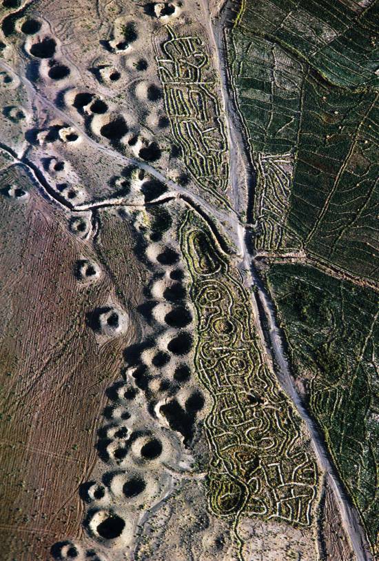
In April 1973, Lyndon LaRouche’s friend, the French-Iranian professor and historian Aly Mazahéri (1914-1991), published his translation from Arab into French of “The Civilization of Hidden Waters”, a treatise on the exploitation of underground waters composed in the year 1017 by the Persian hydrologist Mohammed Al-Karaji, who lived in Baghdad. (Translated in English in 2011)
After an introduction and general considerations on geography, natural phenomena, the water cycle, the study of terrain and the instruments of the hydrologist, Al-Karaji gives a highly precise technical outline of the construction and maintenance of qanâts, as well as legal considerations respecting their management and maintenance.
In his introduction to Al-Karji’s treatise, Professor Mazaheri emphasizes the role of the Iranian city of Merv (now in Turkmenistan). This ancient city, he says, was part of
“the long series of oases extending at the foot of the northern slope of the Iranian plateau, from the Caspian to the first foothills of the Pamirs. There, between the geological extension of the Caspian towards the East, there is a strip of arable land, more or less wide, but very fertile. Now, to exploit it, a lot of ingenuity is needed: where, for example in Merv, a big river, such as the Marghab, coming from the glaciers of the central East-Iranian massif, crosses the chain, it is necessary to establish dams, above the strip of arable land, without which, the ‘river’, divided into several dozens of arms, rushes under the sands. Elsewhere, and it is almost all along the northern slope of the chain, one can create artificial oases, by bringing the water by underground aqueducts.” (p. 44)
“The construction of dams and underground aqueducts are among the most interesting legacies of their (the ancient Persians) irrigation techniques (…) Long before Islam, the Persian hydrologists had built thousands of aqueducts, allowing the creation of hundreds of villages, dozens of cities previously unknown. And very often, even where there was a river, because of the insufficiency of this one, the hydronomists had brought to light many aqueducts allowing the extension of the culture and the development of the city. Naishabur was such a city. Under the Sassanids, and later under the Caliphs, an important network of aqueducts had been created there, so that the inhabitants could afford the luxury of owning a ‘’bathing room’ in the basement, at the level of the aqueduct serving the house.”

Let us recall that most Persian scholars, including the famous mathematician Al-Khwarizmi, not suffering from today’s hyper-specialization that tends to curb creative thinking, excelled in mathematics, geometry, astronomy and medicine as well as in hydrology.
Mazaheri confirms that this “civilization of underground waters” spread well beyond the Iranian borders:
“Already, under the [Umayyad] Caliph Hisham (723-42), Persian hydronomists built aqueducts between Damascus and Mecca (…) Later, Mecca suffering from lack of water, Zubayda, the wife of Hâroun Al-Rachîd, sent Persian hydronomists there who endowed the city with a large underground aqueduct. And each time the latter was silted up, a new team left Persia to restore the network: such repairs took place periodically under Al-Muqtadir (908-32), under Al-Qa’im (1031-1075), under Al-Naçir (1180-1226) and, at the beginning of the fourteenth century, under the Mongol prince Emir Tchoban. We would say the same of Medina and the stages on the pilgrimage route, between Baghdad and Mecca, wherever it was possible to do so, hydronomic works were undertaken and ‘underground aqueducts’ were created.
“Hydronomy is a highly demanding skill. To practice it, it is not enough to have mathematical knowledge: decadal calculus, algebra, trigonometry, etc., it is necessary to spend long hours in the galleries at the risk of dying by flooding, landslide or lack of air. It is necessary to have an ancestral instinct of ‘dowser’.”
The annual rainfall in Iran is 273 mm, which is less than one third of the world’s average annual precipitation.
The temporal and spatial distribution of precipitation is not uniform; about 75% occurs in a small area, mainly on the southern coast of the Caspian Sea, while the rest of the country does not receive sufficient rainfall. On the temporal scale, only 25% of the precipitation occurs during the plant growing season.
7,7 x the circonférence of the Earth

Still in use today in Iran, qanâts currently supply about 7.6 billion m3 of water, close to 15% of the country’s total water needs.
Considering that the average length of each qanât is 6 km in most parts of the country, the total length of the 30,000 qanât systems (potentially exploitable today) is about 310,800 km, which is about 7.7 times the circumference of the Earth or 6/7th of the Earth-Moon distance!
This shows the enormous amount of work and energy applied to build the qanâts. In fact, while more than 38,000 qanâts were in operation in Iran till 1966, its number dropped to 20,000 in 1998 and is currently estimated at 18,000. According to the Iranian daily Tehran Times, historically, over 120,000 qanat sites are documented.
Moreover, while in 1965, 30-50% of Iran’s total water needs were met by qanats, this figure has dropped to 15% in recent decades.
According to the Face Iran website:
“The water flow of qanâts is estimated between 500 and 750 cubic meters per second. As land aridity tends to vary according to the abundance of rains in each region, this quantity of water is used as a more or less important supplement. This makes it possible to use good land that would otherwise be barren. The importance of the impact on the desert can be summarized in one figure: about 3 million hectares. In seven centuries of hard work, the Dutch conquered 1.5 million hectares from the marshes or the sea. In three millennia, the Iranians have conquered twice as much on the desert.
Indeed, to each new qanât corresponded a new village, new lands. From where a new human group absorbed the demographic surplus. Little by little the Iranian landscape was constituted. At the end of the qanat, is the house of the chief, often with one floor. It is surrounded by the villagers’ houses, animal shelters, gardens and market gardens.
The distribution of land and the days of irrigation of the plots were regulated by the chief of the villages. Thus, a qanat imposed a solidarity between the inhabitants.”
If each qanât is “invented” and supervised by a mirab (dowser-hydrologist and discoverer), the realization of a qanât is a collective task that requires several months or years, even for medium-sized qanâts, not to mention works of record dimensions (a 300 m deep mother-well, a 70 km long gallery classified in 2016 as a World Heritage Site by UNESCO, in northeast Iran).
Each undertaking is carried out by a village or a group of villages. The absolute necessity of a collective investment in the infrastructure and its maintenance requires a higher notion of the common good, an indispensable complement to the notion of private property that rains and rivers do not take in account.
In the Maghreb, the management of water distributed by a khettara (the local name for qanâts) follows traditional distribution norms called “water rights”. Originally, the volume of water granted per user was proportional to the work contributed to build the khettara, translated into an irrigation time during which the beneficiary had access to the entire flow of the khettara for his fields. Even today, when the khettara has not dried up, this rule of the right to water persists and a share can be sold or bought. Because it is also necessary to take into account the surface area of the fields to be irrigated by each family.
The causes of the decline of the qanâts are numerous. Without endorsing the catastrophist theses of an anti-human ecology, it must be noted that in the face of the increasing urban population, the random construction of dams and the digging of deep wells equipped with electric pumps have disturbed and often depleted the aquifers and water tables.
A neoliberal ideology, falsely described as “modern”, also prefers the individualistic “manager” of a well to a collective management organized among neighbors and villages. A passive State authority has done the rest. In the absence of more thoughtful reflection on its future, the age-old system of qanâts is on the verge of extinction as a result.
In the meantime, the Iranian population has grown from 40 to over 82 million in 40 years. Instead of living off oil, the country is seeking to prosper through agriculture and industry. As a result, the need for water has increased substantially. To cope with rising demands, Iran is desalinating sea water at great cost. Its civilian nuclear program will be the key factor to provide water at a reasonable cost.
Beyond political and religious divisions, closer cooperation between all the countries in the region (Turkey, Syria, Iraq, Israel, Egypt, Jordan, etc.) with a perspective to improve, develop, manage and share water resources, will be beneficial to each and all.
Presented as an “Oasis Plan” and promoted for decades by the American thinker and economist Lyndon LaRouche, such a policy, translating word into action, is the only basis of a true peace policy.
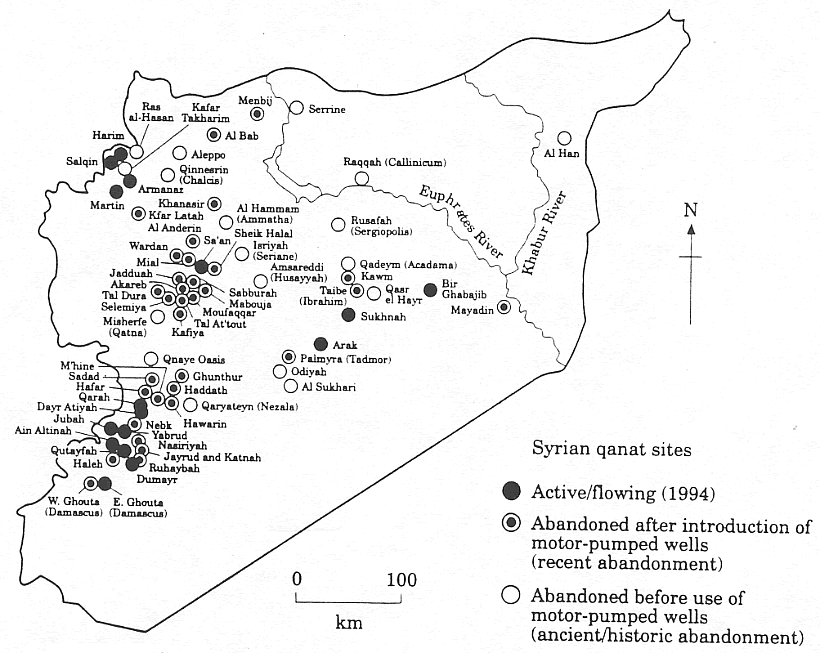
Bibliography :
- Remy Boucharlat, The falaj or qanât, a polycentric and multi-period invention, ArcheOrient – Le Blog, September 2015 ;
- Pierre Lombard, Du rythme naturel au rythme humain : vie et mort d’une technique traditionnelle, le qanat, Persée, 1991 ;
- Aly Mazaheri, La civilisation des eaux cachées, un traité de l’exploitation des eaux souterraines composé en 1017 par l’hydrologue perse Mohammed Al-Karaji, Persée, 1973 ;
- Hassan Ahmadi, Arash Malekian, Aliakbar Nazari Samani, The Qanat: A Living History in Iran, January 2010;
- Evelyne Ferron, Egyptians, Persians and Romans: the interests and stakes of the development of Egyptian oasis environments.
NOTE:
[1] The ten cities forming the Decapolis were: 1) Damascus in Syria, much further north, sometimes considered an honorary member of the Decapolis; 2) Philadelphia (Amman in Jordan); 3) Rhaphana (Capitolias, Bayt Ras in Jordan); 4) Scythopolis (Baysan or Beit-Shean in Israel), which is said to be its capital; It is the only city west of the Jordan River; 5) Gadara (Umm Qeis in Jordan); 6) Hippos (Hippus or Sussita, in Israel); 7) Dion (Tell al-Ashari in Syria); 8) Pella (Tabaqat Fahil in Jordan); 9) Gerasa (Jerash in Jordan) and 10) Canatha (Qanawat in Syria)
Mutazilism and Arab astronomy, two bright stars in our firmament

By Karel Vereycken
(texte original en français)
“The ink of the scholar is holier than the blood of the martyr.”
Sayings (Hadith) most often attributed to the Prophet.
“Seek knowledge from the Cradle to the Grave.”
“Seek knowledge even as far as China.”
PROLOGUE
We live in a time of cruel stupidity. While the history of civilization is characterized by multiple cultural contributions allowing an infinite and magnificent mutual enrichment, everything is done to dehumanize us.
By dint of media coverage of the most extreme crimes, notably by claiming that such and such an abject or barbaric act has been committed « in the name » of such and such a belief or religion, everything is done to set us against each other. If we do not react, the famous thesis of a « Clash of Civilizations », concocted by the British Islamologist Bernard Lewis (Henry Kissinger’s, Zbigniew Brzezinski’s and Samuel Huntington’s mentor) as an evil tool of geopolitical manipulation, will become a self-fulfilling prophecy.
INTRODUCTION
In order to combat prejudices and dangerous misunderstandings about “Islam” (with 1.6 billion believers a non-negligible part of the world’s population), here follows a brief overview of the major contributions of the Arab-Muslim civilization.
By recalling two major contributions of the “Golden Age” of Islam, notably Arab astronomy and mutazilism, what is at stake here is the recognition that –just like Memphis, Thebes, Alexandria, Athens and Rome– Baghdad, Damascus and Cordoba were major crucibles of a universal civilization which is ours today.
While Europe has come to recognize that the invention of printing took place in China long before Gutenberg, and that America was visited way before Christopher Columbus, consensus and group think keeps repeating that the Arabs contributed nothing to the progress of science.
In the 1300 years separating the Greek astronomer from Alexandria, Claudius Ptolemy (ca. 100-178 AD) from the Polish Nicolaus Copernicus (1473-1543), they pretend, nothing but “a black hole”.
In 1958, in his book The Sleepwalkers, British Hungarian writer Alfred Koestler, who helped Sydney Hook to co-found the CIA’s cultural cold war front, the Congress for Cultural Freedom, epitomized western arrogance, writing:
the Arabs had merely been the go-betweens, preservers and transmitters of the heritage. They had little scientific originality and creativeness of their own. During the centuries when they were the sole keepers of the treasure, they did little to put it to use. (…) and by the fifteenth century, the scientific heritage of Islam had largely been taken over by the Portuguese Jews. But the Jews, too, were no more than go-betweens, a branch of the devious Gulf-stream which brought back to Europe its Greek and Alexandrine heritage, enriched by Indian and Persian additions.
Nothing is more false. Definitely, one must be born on the right spot to be allowed to have a seat in the train of history…
Copernicus himself, unlike Koestler, was perfectly familiar with Arab astronomy. In 1543, in his De Revolutionibus, he quotes several Arab scientists, more precisely Al-Battani, al-Bitruji, al-Zarqallu, Ibn Rushd (Averroes) and Thabit ibn Qurra. Copernicus also refers to al-Battani in his Commentariolus, a manuscript published posthumously. Later, the great Johannes Kepler (1571-1630) would also refer to Ibn Al-Haytam in his work on optics.
In reality, Copernicus and even more Kepler, whose creative genius cannot be overrated, came up with answers to questions raised by several generations of Arab astronomers preceding them and whose contribution remains largely ignored and even worse, unexplored. To this day, with about 10,000 manuscripts preserved throughout the world, a large part of which has still not been the subject of a bibliographic inventory, the Arab astronomical corpus constitutes one of the best preserved components of medieval scientific literature waiting to be rediscovered.
Science and religion versus slavery
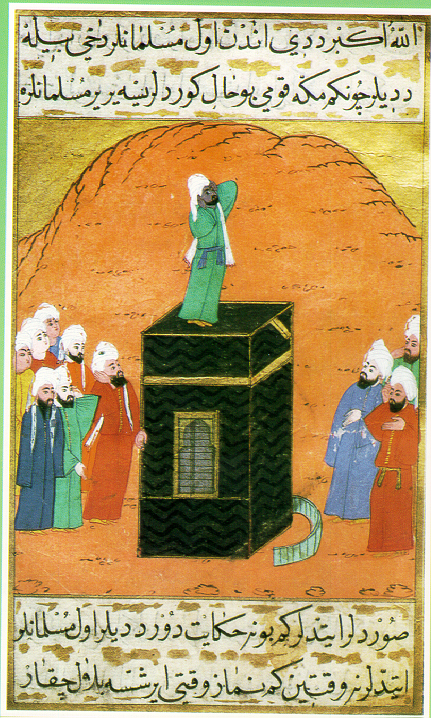
Before examining the contributions of Arab astronomy, a few words about the intimate link between Islam and the development of science.
According to tradition, it was in 622 AD that the Prophet Muhammad and his companions left Mecca and set out for a simple oasis that would become the city of Medina.
If this event is known as the “Hegira”, an Arabic word for emigration, break-up or exile, it is also because Mohammad broke with a societal model based on blood ties (clan organization), in favor of a model of a shared destiny based on belief. In this new religious and societal model, where each person is supposed to be a “brother,” it is no longer permissible to abandon the poor or the weak as was the case before.
The powerful clans in Mecca did everything they could to eliminate this new form of society, which diminished their influence.
The “Medina Constitution” allegedly proclaimed equality among all believers, whether they were free men or slaves, Arabs or non-Arabs.
The Koran advocates strict equality between Arabs and non-Arabs in accordance with the Prophet, who said, in his farewell address:
“There is no superiority of an Arab over a non-Arab, or of a non-Arab over an Arab, and no superiority of a white person over a black person or of a black person over a white person, except on the basis of personal piety and righteousness.”
(Reported by Al-Bayhaqi and authenticated by Shaykh Albani in Silsila Sahiha no. 2700).
Hence, if after the Prophet’s passing away, slavery and slave trade became a common practice in close to all Muslim countries, he cannot be held accountable. Zayd Ibn Harithah, according to tradition, after having been the slave of Khadija, Muhammad’s wife, was freed and even adopted by Muhammad as his own son.
For his part, Abu Bakr, Muhammad’s companion and successor as the first Caliph (Arab word for “successor”), also freed Bilal ibn-Raba, the son of a former Abyssinian princess who had been enslaved. Bilal, who had a magnificent voice, was even appointed the first muezzin, that is to say the one who calls for prayer five times a day from the top of one of the mosque’s minarets.
Among the first verses revealed to the Prophet Muhammad one finds :
“Read! And your Lord is the Most Generous,
(Surat 96).
Who taught by the pen — Taught man that which he knew not.”
The Prophet also states,
“The best among you (Muslims) are those who learn the Koran and teach it.”
Other sayings, often attributed to the Prophet, clearly invite Muslims to seek knowledge and cherish science :
“The ink of the scholar is more sacred than the blood of the martyr”.
“Seek knowledge from the Cradle to the Grave”.
“Seek knowledge even as far as China”.

The mosque is therefore much more than a place of worship, it is a school of all sciences, where scholars are trained. It serves as a social and educational institution: it may be completed with a madrassa (Koranic school), a library, a training center, or even a university.
As in most religions, in Islam, practices and rituals are punctuated by astronomical events (years, seasons, months, days, hours). Every worshipper must pray five times a day at times that vary depending on where he or she is on Earth: at sunrise (Ajr), when the sun is at its zenith (Dhohr), in the afternoon (Asr), at sunset (Magrib) and at the beginning of the night (Icha). Astronomy, as a spiritual occasion to fine-tune one’s earthly existence according to the harmony of the Heavens, is omnipresent.
As an example, to underscore its importance, July 16, 622 AD, the first day of the lunar year, was declared the first day of the Hegira calendar. And during the eclipse of the sun, mosques host a special prayer.
Islam encourages Muslims to guide themselves by the stars. The Koran states :
“And He is the One who made the stars for you
to guide you with them in darkness of the land and the sea”.
With such an incentive, early Muslims could not but feel compelled to perfect astronomical and navigational instruments. As a result, today more than half of the stars used for navigation bear Arabic names. It was only natural that the faithful constantly tried to improve astronomical calculations and observations.
The first reason to do so is that during the Muslim prayer, the worshipper has to prostrate himself in the direction of the Kaaba in Mecca, so he has to know how to find this direction wherever he is on Earth. And the construction of a mosque will be decided according to the same data.
The second reason is the Muslim calendar. The Koran states :
“The number of months in the sight of Allah is twelve (in a year)-
so ordained by Him the day He created the heavens and the earth;
of them four are sacred: that is the straight usage.”
Clearly, the Muslim calendar is based on the lunar months, which are approximately 29.5 days long. But 12 times 29.5 days is only 345 days in the year. This is far from the 365 days, 6 hours, 9 minutes and 4 seconds that measure the duration of the rotation of the Earth around the Sun…
Finally, a last challenge was posed by the interpretation of the lunar movement. The months, in the Muslim religion, do not begin with the astronomical new moon, defined as the moment when the moon has the same ecliptic longitude as the sun (it is therefore invisible, drowned in the solar albedo); the months begin when the lunar crescent starts to appear at dusk.
The Koran says: “(Muhammad), they ask you about the different phases of the moon. Tell them that they are there to indicate to people the phases of time and the pilgrimage season.”
For all these reasons, the Muslims could not be satisfied with either the Christian or the Hebrew calendar, and had to create a new one.
Spherical geometry
In order to forecast the phases of the moon, new methods of calculation and new instruments capable of observing them were required. The calculation of the day when the crescent moon starts to become visible again was a formidable challenge for the Arab scholars. To predict this day, it was necessary to be able to describe its movement in relation to the horizon, a problem whose resolution belongs to a rather sophisticated spherical geometry.
It was the determination of the direction of Mecca from a given location and the time of prayers that led the Muslims to develop such geometry. To solve these problems, it is necessary to know how to calculate the side of a spherical triangle of the celestial sphere from its three angles and the other two sides; to find the exact time, for example, it is necessary to know how to construct the triangle whose vertices are the zenith, the north pole, and the position of the Sun.
The field of astronomy has strongly stimulated the birth of other sciences, in particular geometry, mathematics, geography and cartography. Some people like to recall that Platonists and Aristotelians were arguing about rather abstract concepts, each of them believing that reason was sufficient to understand nature. Arab astronomy, on the other hand, played a decisive role in the emergence of a true scientific method by verifying the various hypotheses, by building measuring instruments and astronomical observatories and by rigorously recording observations over many years.
MUTAZILISM
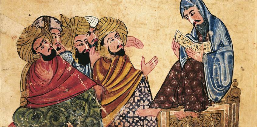
Arabic miniature from a manuscript, Turkey 13th Century.
The question then arises as to where this infatuation with science and astronomy could have come from, in a culture essentially centered on religion?
A first answer comes from the fact that in the 8th century, shortly after the birth of Sunnism (656), Kharidjism (657) and Shi’ism (660), but independently of these currents, a school of Muslim theological and philosophical thought appeared, founded by the revolutionary theologian Wasil ibn Ata (700-748), a current known as “mutazilism” (or motazilism), branded in the West as “the rationalists” of Islam. One explanation of its name came from the fact that the mutazili refused to take part in the internal strife inside factions using theological interpretations for earthly power, the arab word iʿtazala meaning “to withdraw”.
Wasil was born in Medina in the Arabian Peninsula and moved to Basra, now in Iraq. From there he formed an intellectual movement that spread all over the Arab-Muslim world. Many of his followers were merchants and non-Arabs (mawâlî) from Iranian or Aramaic “converted” families, victims of the Omayyad dynasty’s discriminating policies between Arabs and non-Arabs. This hypothesis is sufficient to back the claim of a Mutazilite participation in the overthrow of the Omayyad and that dynasty’s replacement with the Abbasid.
In a clear break with dualistic cosmology (Mazdeism, Zoroastrianism, Manichaeism, etc.), Mutazilism insists on the absolute unity of God, conceived as an entity outside time and space. For them, there is a close relationship between the unity of the Muslim community (Ummah) and the worship of the Lord. The Mutazilites are closely inspired by the Koran, and it is quite wrong to present them as the “free thinkers” of Islam.
However, “we reject faith as the only way to religion if it rejects reason,” the Mutazilite saying goes. Relying on reason (the logos dear to the Greek thinkers Socrates and Plato), which it considers compatible with Islamic doctrines, Mutazilism affirms that man can, outside of any divine revelation, access knowledge.
Just as Augustine, a christian, emphasized man can advance on the path of truth, not only through the Gospel (revelation), but by reading “the Book of Nature”, a reflection and foretaste of divine wisdom. One book of the Bible, The Book of Wisdom, recognizes that
For from the greatness and the beauty of created things
(Book of Wisdom, 13:5)
their original author,
by analogy, is seen.
The Mutazilites differed from their opponents in their teaching that God has endowed man with reason specifically so that he can come to know the moral order in creation and its Creator; that is what reason is for. Reason is central to man’s relationship to God.
In the Fundamentals, the great Mutazilite theologian Abdel al Jabbar Ibn Ahmad (935-1025), whose texts were discovered only in the 1950’s by Egyptian scholars in a mosque in Yemen, begins by positing the primary duty to reason: « If it is asked: What is the first duty that God imposes you? Say to him: Speculative reasoning which leads to knowledge of God, because He is not known intuitively or by the senses. Thus, He must be known by reflection and speculation ».
Therefore, Reason logically precedes revelation. Reason first needs to establish the existence of God before undertaking the question as to whether God has spoken to man. Natural theology mus be antecedent to theology.
Al Jabbar says: « The stipulates of revelation concerning what we should say and do are no good until after there is knowledge of God, » which knowledge comes from reason. « Therefore, » he concludes, « it is incumbent on me to establish His existence and to know Him so that I can worship Him, give Him thanks and do what satisfies Him and avoid disobedience toward Him ».
How does Reason lead man to the conclusion of God’s existance? It is through the observation of the ordered universe that man first comes to know that God exists, says Al Jabbar. As he sees hat nothing in the world is its own cause, but is caused by something else, man arrives at the contingent nature of creation. From there, man reasons to the necessity of a Creator, an uncaused cause.
The concept of an inherent nature in things (tab’) means that God, though he is the First Cause, acts indirectly through secondary causes, such as the physical law of gravity. In other words, God does not immediately or directly do everything. He does not make a rock fall; gravity does. God allows some autonomy in his creation, which has its own set of rules, according to how it was made.
As Mutazilite writer and theologian Uthman al-Jahiz (765-869) stated, every material element has it own nature. God created each thing with a nature according to which it consistently behaves. The unsupported rock will always fall where there is gravitational pull. These laws of nature, then, are not an imposition of order from without by a commander-in-chief, but an expression of it from within the very essence of things, which have their own integrity. Creation is possessed of an intrinsic rationality from the Creator. That is why and how man is able to understand God’s Reason as manifested in his creation (This does not discount God’s ability to supercede natural laws in the case of a miracle). From that standpoint, the act of discovery of the nature and beauty of things, by each human individual, brings him closer to God.
Hence, Muzatilism gives human reason (the faculty of thinking) and freedom (the faculty of acting) a place and importance not only unknown in other trends of Islam but even in most philosophical and religious currents of the time. Against fatalism (“mektoub!” = it was written!), which was the dominant tendency in Islam, mutazilism affirms that the human being is responsible for his acts.
More than five centuries before Erasmus, Mutazilite faith and philosophy offered already the foundations to solve most of the sterile theological disputes that would destroy the Renaissance and throw Europe in the abyss of self-destruction known as the “wars of religion”.
Here are the five Fundamentals (Principles), described by Abdel al Jabbar and summarized in 2015 by economist Nadim Michel Kalife:
—Monotheism (Al Tawhid) whose concept of God is beyond the simple intellect of the human mind. That is why the verses of the Koran describing God “sitting” on a throne should be interpreted only allegorically and not literally. Hence the Mutazilites called their opponents anthropomorphists who sought to reduce God who is unknowable to a human appearance. And they concluded that this one detail (!) of the Koran is sufficient to prove that the Koran is not “uncreated” but “created” by Allah, via man, to make it accessible to the believer, and therefore, that it can and should evolve and adapt according to the times and circumstances ;
—Divine justice (Adl) is about the origin of evil in our world where God is all-powerful. Mutazilism proclaims free will, where evil is man’s doing and not God’s will, because God is perfect and therefore cannot do evil or determine man to do it. And, if human wrongdoings were the will of God, punishment would lose all meaning since man would be doing nothing but respecting the divine will. This unquestionable logic allowed Mutazilism to refute predestination and the « mektoub » of the Sunni schools;
—Promise and threat (al-Wa’d wa al-Wa’id): this principle concerns the judgment of man at his death and that of the last judgment where God will reward the obedient in the heavenly paradise, and punish those who disobeyed him by damning them eternally in the fires of hell;
—The intermediate degree (al-manzilatu bayn al-manzilatayn), the first principle opposing Mutazilism to the Sunni schools. A great sinner (murder, theft, fornication, false accusation of fornication, drinking alcohol, etc. ) should be judged neither as a Muslim (as Sunnism thinks) nor as a disbeliever or kâfir (as the Kharidjites think), but considered in an intermediate degree from which, when he dies, he will go to hell if he failed to be redeemed by God’s mercy ;
—To order the good and blame the blameworthy (al-amr bil ma’ruf wa al-nahy ‘an al munkar): this principle authorizes even rebellion against authority when it is unjust and illegitimate, to prevent the victory of evil over all. This principle attracted the hatred of the ulama (theologians) and imams (predicators) who saw it as a manouver to weaken their own authority over the faithful. And the Seljuk Turks considered it a serious danger since it called into question their power… over the Arabs.
Mutazilism under the Abbasid
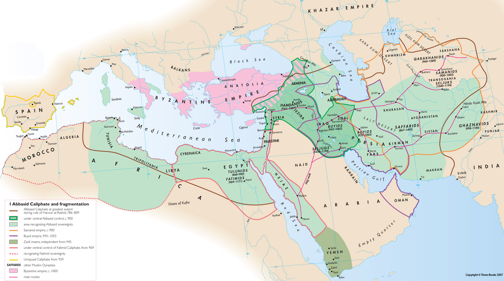
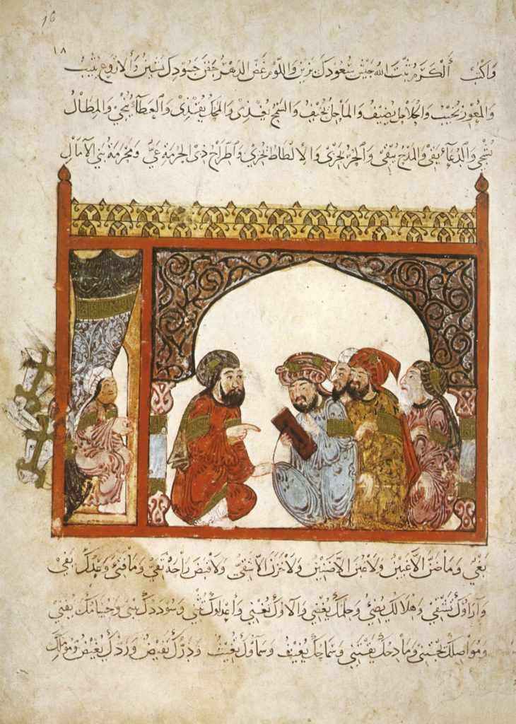
In Baghdad, it was with the rise of the Abbasid Caliphate in 749 that Mutazilism gained influence, first under the Caliph Hâroun al-Rachîd (765-809) (“Aaron the Well-Guided”) and then under his son, Al-Ma’mûn (786-833) (“The one to be trusted”). Shortly before his death in 833, the latter made Mutazilism the official doctrine of the Abbasid Empire.
This was too much for the conservative ulama and imams who rebelled against the Caliph’s enlightened vision that created a space for secular society and limited their grip over society. Faced with the revolt, the Abbasid administration (made up largely of Persians), which was won over to Mutazilism, carried out a ruthless crackdown on Sunni (Arab) clerics for fifteen years, from 833 to 848. This bloody persecution left an increasingly bitter taste in people’s minds, especially when the Abbasid power refused to release Muslim prisoners in the hands of the Byzantines if they did not renounce the dogma of the “uncreated” nature of the Koran…
Finally, in 848, Caliph Jafar al-Mutawakkil (847-861), changed course completely and asked the traditionalists to preach hadiths according to which Muhammad had condemned the Mutazilites and their supporters.
Dialectical theology (Kalâm) was banned and the Mutazilites were not any longer welcome at the Baghdad court. This was also the end of the spirit of tolerance and the return of persecution against Christians and Jews. If the craze for science continued, Mutazilism disappeared with the fall of the Abbasids and the destruction of Baghdad by the Mongols in the 13th century.
Mutazilism also influenced Judaism. The Kitab Al-Amanat Wa’l-I’tiqadat – that is, the Book of Beliefs and Opinions – by the tenth-century Jewish rabbinic scholar Saadia Gaon (882-942), who lived in Baghdad, draws its inspiration from Christian theological literature as well as from Islamic models. The Kitab al-Tawhid, the Book of Divine Unity, by Saadia’s Karaite contemporary, Jacob Qirqisani (d. 930), is unfortunately lost.
This makes the German Islamologist Sabine Schmidtke say:
The new tradition of Jewish rational thought that emerged in the course of the ninth century was, in its initial phase, mainly informed by Christian theological literature, both in its content and methodology. Increasingly, specifically Mutazilite Islamic ideas, such as theodicy [*1] and human free will, as well as the emphasis on the oneness of God (tawhid), resonated among Jewish thinkers, many of whom eventually adopted the entire doctrinal system of the Mutazila. The now emerging ‘Jewish Mutazila’ dominated Jewish theological thought for centuries to come.
Brothers in Purity
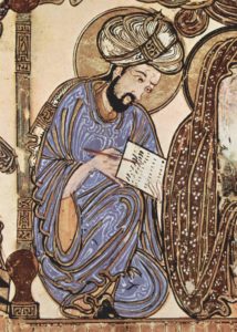
Also worth mentioning in this context, are the Epistles of the Brothers in Purity (Ikwân al-Safâ), an encyclopedia of 52 epistles (dealing with mathematics, natural sciences, rational sciences and theological sciences), composed between the beginning of the ninth and the end of the tenth century and containing common knowledge. The text will be promoted by the Ismailis, an esoteric branch of shiite islam strongly contesting the ruling powers of that time. Produced in Basra, in present-day Iraq, the book, neo-platonic in character, is a collective work. As for the authors, designated under the mysterious name of Brothers of Purity, they belonged to a brotherhood of sages and intellectuals who met regularly to organize sessions of discussion, readings and recitation. Its followers considered that knowledge was an indispensable condition for any spiritual and mystical elevation. Its avant-garde character is apparent in its hymn to tolerance advocating a plurality of paths to salvation. Some experts believe that the Epistles of the Brothers in Purity are the work of a high-level Pythagorean philosopher, a disciple of the mutazilist platonic, al-Kindi.
Leaving aside, therefore, the errors that were very real, it has to be recognized and underscored that the optimistic philosophical vision of Mutazilism (reason, free will, responsibility, perfectibility of man) strongly contributed to the emergence of a true « golden age » of Arab culture and sciences.
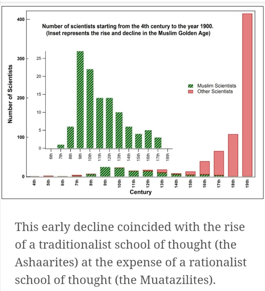
Finally, it is not uninteresting to note that today, “neo-Mutazilite” currents are appearing in reaction to obscurantist doctrines and the barbaric acts they provoke. For the Egyptian reformist thinker Ahmad Amin, “the death of mutazilism was the greatest misfortune that befell Muslims; they committed a crime against themselves.”
Bagdad
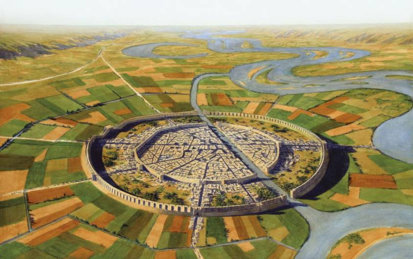
In 762, the second Abbasid caliph Al-Mansur (714-775) (“the victorious”) began construction of a new capital, Baghdad. Called Madinat-As-Salam (City of Peace), it houses the court palace, the mosque and the administrative buildings. Built on a circular plan, it is inspired by previous traditions, notably the one that gave birth to the Iranian city of Gur (current name: Firouzabad).
We are in the heart of fertile Mesopotamia, the “land between the rivers”, essentially the Euphrates and the Tigris, both of which have their source in Turkey. It is here that the Sumerians invented irrigation, agriculture (cereals and livestock) [*2], and writing (3400 years BC), starting in the 10th millennium BC.
Baghdad, a powerful and refined city, reigned over the entire East and became the capital of the Arab world. Crossed by the Tigris River, populated today by some 10 million inhabitants, it remains the largest city in Iraq as well as the second most populated city in the Arab world (behind Cairo in Egypt).
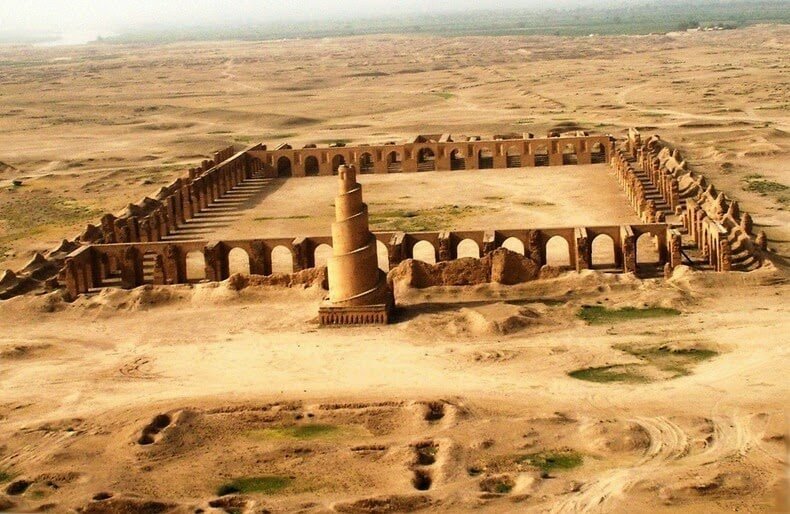
The Abbasid cities were built on huge sites. The palaces and mosques of Samarra, the new capital from 836, stretch along the banks of the Tigris for 40 kilometers. To match the scale of the sites, monumental buildings were erected, such as the Abu Dulaf Mosque or the Great Mosque of Samarra, which had no equivalent elsewhere. Its curious spiral minaret (52 meters high) inspired in the following centuries the Western representations of the Tower of Babel.
Moreover, by relying on an extremely disciplined and obedient army from Khorassan (a region in north-eastern Iran) [*3], as well as on an elaborate system of stagecoaches and mail distribution, the Abbasid rulers managed to increase their hold on the provincial governors. The latter, who in the time of the Omayyad caliphs paid little tax on the pretext that they had to spend locally for the defense of the caliphate’s borders, now had to pay the taxes imposed by the ruler.
The New “Paper” Road
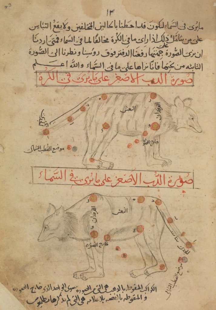
After the military victory against the Chinese in the battle of Talas (a city in present-day Kyrgyzstan) in 751, the year that marked the most eastern advance of the Abbasid armies, Baghdad opened up to Chinese and Indian cultures.
The Abbasid quickly assimilated a number of Chinese techniques, in particular paper-making, an art developed in Samarkand (capital of Sogdiana, now in Uzbekistan), another stopover city on the Silk Roads. The craftsmen of this city smoothed the paper with an agate stone. The resulting extremely smooth and shiny surface absorbed less ink and as a result, both sides of the same sheet became usable. The Chinese, who had invented silk paper, did not need to smooth their paper because they wrote with brushes and not with pens.
Hâroun al-Rachîd was very interested in the industrial production of paper. He ordered the use of paper in all the administrations of the Empire: it is easier to manufacture, less expensive and more secure than silk, because one cannot easily erase what is written on it. He developed the paper factories of Samarkand and established similar ones in Baghdad, Damascus and Tiberias around 1046 – the paper of Tripoli or Damascus was then referred to, and its quality was considered better than that of Samarkand – in Cairo before 1199, where it was used as a packaging for goods, and in Yemen at the beginning of the 13th century. At the same time, several paper factories were established in North Africa. There were 104 paper factories in Fez, Morocco, before 1106, and 400 paper mills between 1221 and 1240. They will emerge in Andalusia, Spain, in Jativa near Valencia in 1054 and in Toledo in 1085.
Agro-industrial revolution
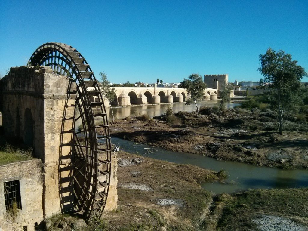
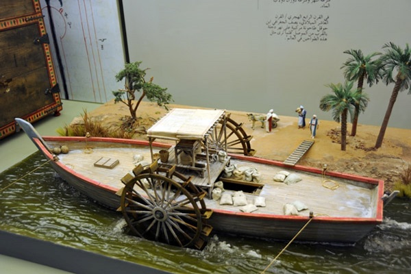
The first Abbasid caliphs led the economic transition from the Umayyad model of tribute, booty or the sale of slaves to an economy based on agriculture, manufacturing, trade and taxes. The introduction of more energy dense modes of technologies modes of energy (compared to the former ones), will revolutionize irrigation and agriculture:
–Construction of canals ensuring irrigation and limiting flooding;
–Construction of dams and the exploitation of the mechanical energy they produce;
–Construction of water mills;
–Use of tidal energy;
–Construction of windmills;
–Distillation of kerosene used as fuel for lamps and used since. [*4]
Industrial uses of water mills in the Islamic world date back to the 7th century. During the time of the Crusades, all provinces of the Islamic world had operating mills, from al-Andalus and North Africa to the Middle East and Central Asia.
These mills performed various agricultural and industrial tasks.
When Erasmus’ follower Cervantes’ Don Quichote starts attacking the windmills of La Mancha, a Spanish region where Arab influence was notable, he not only ironially mocks the cult of chivalry, but also the insane undertaking called the crusades.
Irrigation, inherited from the ancient world (floods of the Nile in Egypt, canals in Mesopotamia, pendulum wells (shadoof), water wheels used to raise water (noria), dams in Transoxiana, Khuzistan and Yemen, underground galleries at the foot of the mountains in Iran (qanat) or in the Maghreb (khettara), is organized thanks to a solid community organization and the intervention of the State.
Abbasid artisans and engineers will develop machines (such as pumps) incorporating crankshafts and use gears in mills and water-lifting machines. They will also use the dams to provide additional power to watermills and water-lifting machines. Such advances will allow the mechanization of many agricultural and industrial tasks and free up the workforce for more creative occupations.
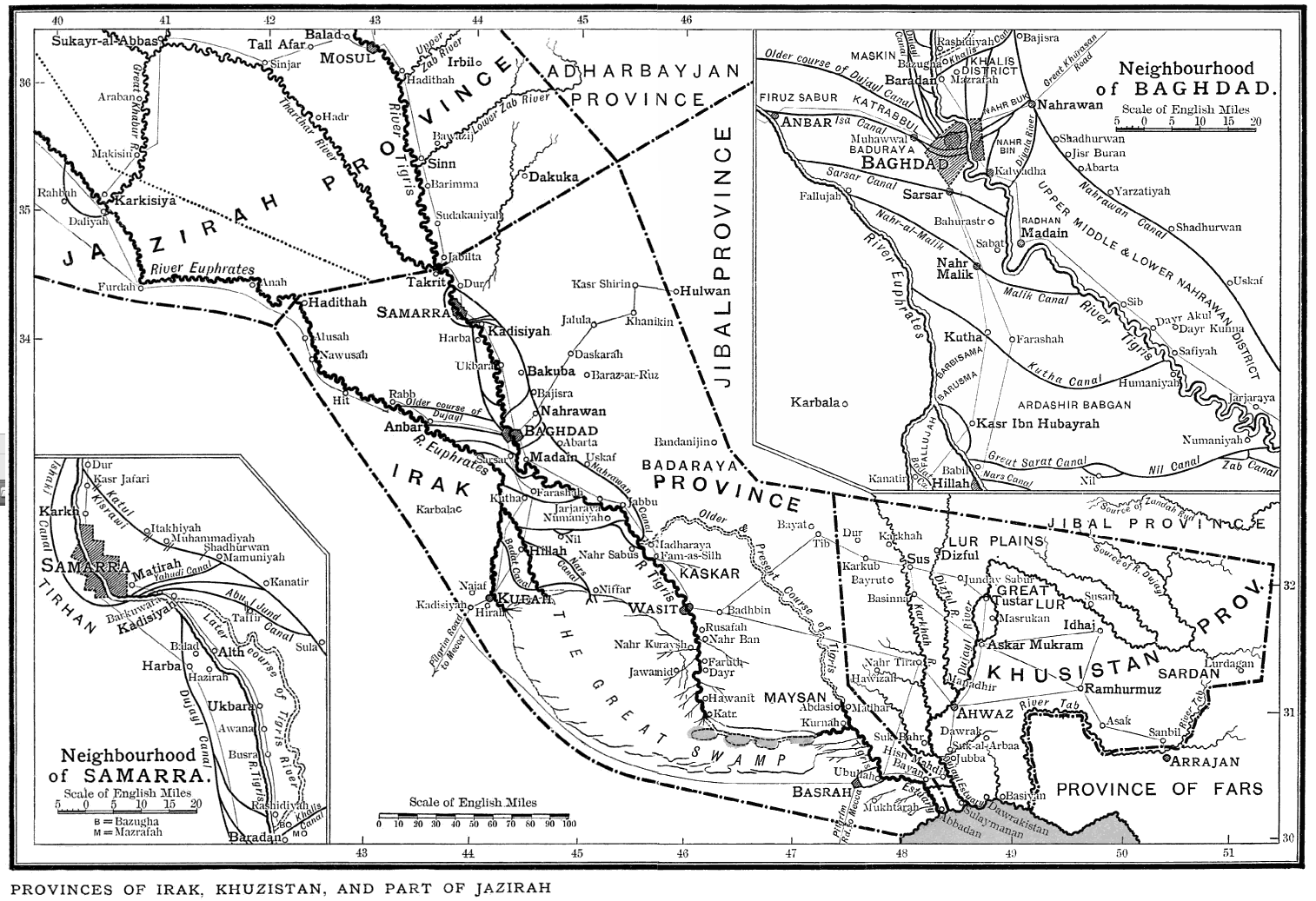
Agricultural production gains in diversity : cereals (wheat, rice), fruits (apricots, citrus fruits), vegetables, olive oil (Syria and Palestine), sesame (Iraq), roe, rapeseed, flax or castor oil (Egypt), wine production (Syria, Palestine, Egypt), dates, bananas (Egypt), sugar cane.
Breeding remains important for food, for the supply of raw materials (wool, leather) and for transport (camels, dromedaries, horses). Sheep are present everywhere but buffalo farming is developing (marshes of lower Iraq or Orontes). Small poultry, pigeon and bee farms are in high demand. The people’s diet is predominantly vegetarian (rice cake, wheat porridge, vegetables and fruits).
A number of industries will emerge from this agro-industrial revolution, including the first textile factories, the production of ropes, silk and, as noted above, the manufacture of paper. Finally, metalworking, glassware, ceramics, tooling and crafts also experience high levels of growth during this period.
Charlemagne, Baghdad and China

Finally, in the eighth and ninth centuries, seeking to counter the Omayyad and the Byzantine Empire, Abbasid and Carolingian Franks conclude several agreements and alliances.
Three diplomatic missions were sent by Charlemagne to the court of Hâroun al-Rachîd and the latter sent at least two embassies to Charlemagne. The caliph sent him many gifts, such as spices, fabrics, an elephant and an automatic clock, described in the Frankish Royal Annals of 807. It marked the 12 hours with copper balls falling on a plate at each hour, and also had twelve horsemen who appeared in turn at the same intervals.
The same caliph sent a diplomatic mission to Chang’an (now called Xi’an), capital of the Tang dynasty. Chang’an being the eastern terminus of the Silk Road, the western market of Chang’an became the center of world trade. According to the record of the Tang Six Authority, more than 300 nations and regions had trade relations with Chang’an.
Maritime Silk Road
These diplomatic relations with China were contemporary with the maritime expansion of the Muslim world into the Indian Ocean and the Far East. Apart from the Nile, Tigris and Euphrates, navigable rivers were uncommon, so transport by sea was very important. The ships of the caliphate began to sail from Siraf, the port of Basra, to India, the Straits of Malacca and Southeast Asia.
Arab merchants dominated trade in the Indian Ocean until the arrival of the Portuguese in the 16th century. Hormuz was an important center for this trade. There was also a dense network of trade routes in the Mediterranean, along which Muslim countries traded with each other and with European powers such as Venice or Genoa.
The Silk Road crossing Central Asia passed through the Abbasid caliphate between China and Europe. At that time, Canton, or Khanfu in Arabic, a port of 200,000 people in southern China, had a large community of traders from Muslim countries. And when the Chinese Emperor Yongle decided to send his famous flotilla of ships to Africa, he chose Admiral Zheng He (1371-1433), a court eunuch who was born a Muslim. And when in 1497 the Portuguese captain Vasco da Gama reached the Kenyan city of Malindi, he was able to obtain an Arab pilot who took him directly to Kozhikode (Calicut) in India. In short, a sailor who knew how to navigate on the stars.
Scientific and cultural renaissance
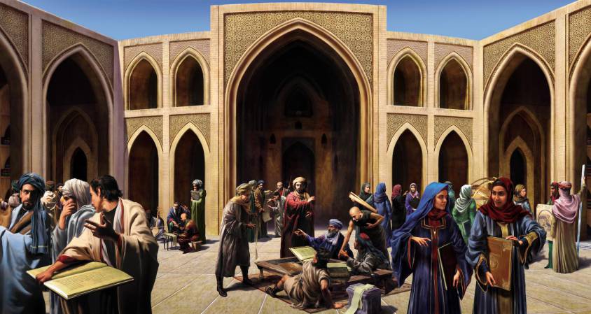
Thus, it is under the caliphate of Hâroun al-Rachîd and his son Al-Ma’mûn, that Baghdad and the Abbasids will experience a real golden age, both in the sciences (philosophy, astronomy, mathematics, medicine, etc.) and in the arts (architecture, poetry, music, painting, etc.). For the British writer Jim Al-Khalili, “the fusion of Greek rationalism and Mutazilite Islam will give rise to a humanist movement of a type that will hardly be seen before 15th century Italy.”
In the field of sciences, an assimilation of Hellenistic, Indian and Persian astronomical doctrines took place very early. Several Sanskrit [*5] and Pehlevi [*6] writings were translated into Arabic.
Indian works by the astronomer Aryabhata (476-560), a prominent scientist of the Indian Gupta Renaissance, and the mathematician Brahmagupta (590-668) were cited early on by their Arabic counterparts. A famous translation into Arabic appeared around 777 under the title Zij al-Sindhind (or Indian Astronomical Tables). Sources indicate that this text was translated after the trip of an Indian astronomer invited to the court of the Abbasid caliph Al-Mansur in 770. The Arabs also adopted the sines (inherited from Indian mathematics) which they preferred to the chords used by Greek astronomers. From the same period, a collection of astronomical chronicles compiled over two centuries in Sassanid Persia and known in Arabic as the Zij al-Shah (or Royal Tables).
In the field of music, the Persian-born Arab musician Ishaq al-Mawsili (767-850), among others, can be mentioned. A composer of about two hundred songs, he was also a virtuoso on the oud (a kind of lute with a short neck but no frets). He is credited with the first system of codification of learned Arabic music.

Respecting the visual arts, let us first stress that, contrary to the prevailing opinion, the Koran does not prohibit figurative images. There is no explicitly stated and universally accepted “ban” on images of living figures in Islamic legal texts. On the other hand, Islam, like other major religions, condemns the worship of idols.
From the eighth to the fifteenth century, numerous historical and poetic texts, both Sunni and Shi’a, many of which appeared in Turkish and Persian contexts, include admirable depictions of the Prophet Muhammad. The purpose of these images was not only to praise and pay homage to the Prophet, but represent occasions and central elements for the practice of Muslim faith.
In this respect, the book by the German art historian Hans Belting with the catchy title Florence & Baghdad, Renaissance Art and Arab Science (2011) is not only misleading but downright outrageous. Belting presents “Islam” as an aniconic faith (banning all human and animal representations), while in reality, besides exquisite calligraphy and geometric patterns in search for the infinite, representations of men and animals are an essential part of Islamic artistic expression.
In addition, other religions have experienced strong outbreaks of iconoclasm. For example, and this is one of the reasons why so little is known about ancient Greek painting, between 726 and 843, the Byzantine Empire ordered the systematic destruction of images representing Christ or the saints, whether they were mosaics adorning church walls, painted images or book illuminations.
From there on, Belting, for whom Islam is in essence an aniconic civilization, has great difficulty in demonstrating what he announces in the title: the influence of Arab science (notably Ibn al-Haytam work on human vision) on the Renaissance in Florence (in particular its definition of “geometric perspective”). In fact, presenting himself as an erudite, peaceful and “objective” scholar, Belting’s book feeds into the bellicose thesis of a supposed “Clash” of civilizations, while claiming the opposite.
The first manifestations of pictorial art in the Arab-Muslim world date back to the Omayyad period (660-750). It is from this period that date the famous “desert castles”, such as Qusayr ‘Amra, in Eastern Jordan. Covered with wall paintings, these palaces reflect a contribution of the Byzantine, but also Persian Sassanid modes of representation. Thus, in the palace of Qusayr ‘Amra, used as a resort by the Caliph or his princes for sport and pleasure, the frescoes depict constellations of the zodiac, hunting scenes, fruits and women in the bath.
In the field of literature, Al-Rashid built up a vast library including a collection of rare books as well as thousands of books that kings and princes of the ancient world offered him.
For example, Kalila and Dimna, also known as the Indian Fables of Bidpaï, one of the most popular works of world literature. Compiled in Sanskrit nearly two thousand years ago, these animal fables, from which Aesop and La Fontaine drew, were translated from China to Ethiopia. Translated into Arabic around 750 by Ibn al-Muqaffa, they were richly illustrated in the Arab, Persian and Turkish worlds. The oldest illustrated Arabic version was probably produced in Syria in the 1200s. The landscape is symbolized by a few elements: a strip of grass, shrubs with stylized leaves and flowers. Men and animals are represented with bright colors and simplified lines.
A true manual for the education for kings, one of the fables evokes the idea,
of creating a university dedicated to the study of languages,
ancient and modern, and to the preservation,
in renewed forms, of the heritage of the human species…
And at the end of his story, the wise Bidpaï warns the young king Dabschelim:
“I must emphasize this last point: my stories require, at this stage, no extra commentary, wretched imaginings, or vapid guesswork by you, me, or anyone else. The very worst habit would be that of moralizing away the effective substance. Thus the urge to tag tidy little rationalizations, persuasive formulas, intellectual summaries, symbolical labels, or nay other convenient pigeon-holing device, mus be steadfastly resisted. Mental encapsulation perverts the medecine, rendering it impotent. It amount to a bypass around the story’s true destination; to explain away is to forget. It is also a type of hypocrisy – poisonous, an antidote to truth. Thus, let the stories which you can remember do their own work by their very diversity. Familiarize yourself with them, but fiddle with them not.”
Also noteworthy is The Sessions of the poet and man of letters Al-Hariri (1054-1122) [*7], written at the end of the tenth century and which had a tremendous diffusion throughout the Arab world. The text, which recounts the adventures of the brigand Abu Zayd, is particularly suitable for illustration.
Al-Ma’mûn and the Houses of Wisdom (Bayt al-Hikma)
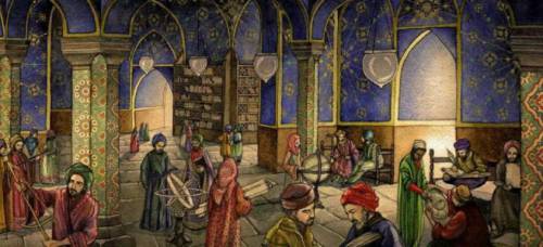
After a violent dispute with his brother who sought to remove him from power, Al-Ma’mûn, the youngest son of Al-Rashid, became the eighth Abbasid caliph in 813. He was particularly interested in the work of scholars, especially those who knew Greek. He gathered in Baghdad thinkers of all beliefs, whom he treated magnificently and with the greatest tolerance. They all wrote in Arabic, a language that allowed them to understand each other. He brought manuscripts from Byzantium to enrich the vast library of his father. Open to scholars, translators, poets, historians, physicians, astronomers, scientists and philosophers, this first public library became the basis of the Bayt Al-Hikma (the “Houses of Wisdom”) combining translation, teaching, research and even public health activities, long before the Western universities. It was here that all known scientific manuscripts of the time, especially Greek writings, were gathered for study.
In Baghdad, this cultural bubbling will not remain confined to the Court but will go down to the street as this description of Baghdad by Ibn Aqul (died in 1119) testifies:
“First there is the large space called the Bridge Square. Then the Birds’ Market, a market where one can find all kinds of flowers and on the sides of which are the elegant stores of the money changers. (…) Then the caterers’ market, the bakers’ market, the butchers’ market, the goldsmiths’ market, unrivaled for the beauty of its architecture: high buildings with teak beams, supporting corbelled rooms. Then there is the huge booksellers’ market, which is also the gathering place for scholars and poets, and the Rusafa market. In the markets of Karkh and the Gate of the Ark, the perfumers do not mix with the merchants of grease and products with unpleasant smells; in the same way the merchants of new objects do not mix with the merchants of used objects.”
Persia, the Nestorians and medicine
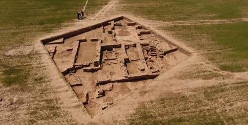
As a model for the Houses of Wisdom, the Persian influence and precedents are often mentioned. It is true that the Barmakids, a family of Persian origin [*8], had a great influence on the first Abbasid caliphs.
In fact, al-Ma’mûn’s tutor was Jafar ben Yahya Barmaki (767-803), a member of the family of the Armenians and the son of the Persian vizier of his father Al-Rashid. The Persian elite who advised the Abbasid caliphs took a keen interest in the works of the Greeks, whose translation had begun during the reign of the Sassanid king Khosro I Anushirvan (531-579).
The latter founded the Academy of Medicine in Gondichapur. Many Nestorian (Christian) scribes and scholars had taken refuge there after the Council of Ephesus in 431. [*9]
The liturgical language of the Nestorians was Syriac, a Semitic dialect [*10].
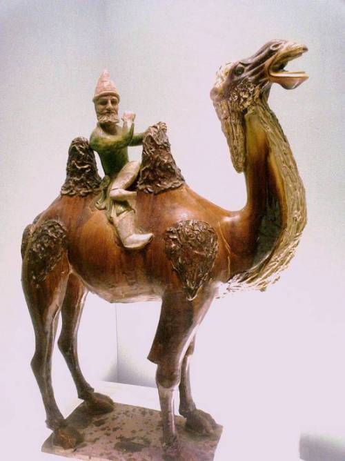
Like the Jews, these Nestorian Christians possessed a cosmopolitan culture and a knowledge of languages (Syriac and Persian) that enabled them to act as intermediaries between Iran and its neighbors. And thanks to their access to the wisdom of ancient Greece, they were often employed as physicians. [*11]
The Academy of Medicine of Gondichapur [*12] had reached its peak in the 5th century thanks to the Syriac scholars expelled from Edessa. In this school, medicine was taught based on the translations of the Greek scholar and physician Claudius Galen. These teachings were put into practice in a large hospital, a tradition taken up in the Muslim world. This school was a meeting place for Greek, Syriac, Persian and Indian scholars, whose scientific influence was mutual. Heir to the Greek medical knowledge of Alexandria, the school of Gondichapur trained several generations of physicians at the court of the Sassanid and later at that of the Muslim Abbasid. As early as 765, the Abbasid caliph Al-Mansur, who reigned from 754 to 775, consulted the head of the Gondichapur hospital, Georgios ben Bakhtichou, and invited him to Baghdad. His descendants will work and teach medicine there. Long after the establishment of Islam, the Arab elites sent their sons to this Nestorian Christian school.
Timothy I (727-823) was the Christian patriarch of the Church of the East (“Nestorian”) between 780 and 823. His first decision was to establish the seat of his church in Baghdad, where it was to remain until the end of the thirteenth century, thus forging privileged links between the Nestorians and the Abbasid caliphs. A man with a good command of Syriac, Arabic, Greek and eventually Pehlevi, Timothy enjoyed the consideration of the Abbasid caliphs Al-Mahdi, Al-Rashid and Al-Ma’mûn.
During his forty-three years of pontificate, the Eastern Church lived in peace. Moreover, the Nestorians played a major role in the spread of Christianity in Central Asia as far as China via the Silk Road. In Central Asia, before the arrival of Islam, it was Sogdian, (the Iranian language of Sogdia and its capital Samarkand) that served as the lingua franca on the Silk Road. [*13]
Translating, understanding, teaching, improving
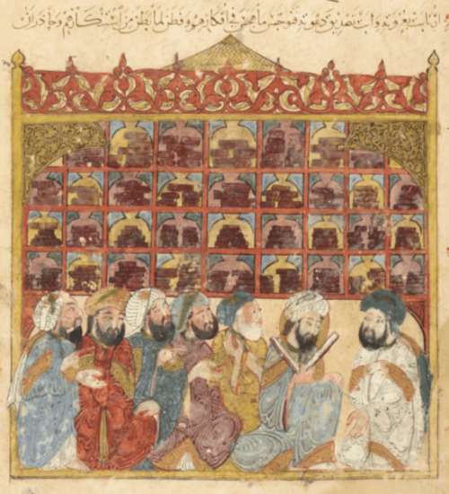
In Baghdad and Basra, in the Houses of Wisdom, the histories and texts collected after the collapse of the empire of Alexander the Great were translated and made available to scholars, texts initially collated and translated from Syriac into Persian under the aegis of the Sassanid emperors.
The Arab historian and economist Ibn Khaldun (1332-1406), who came from a large Andalusian family of Yemeni origin, paid tribute to this effort to preserve and disseminate the Greek heritage: “What happened to the sciences of the Persians whose writings, at the time of the conquest, were annihilated by order of Omar? Where are the sciences of the Chaldeans, the Assyrians, the inhabitants of Babylon? Where are the sciences that reigned among the Copts in the past? There is only one nation, that of the Greeks, whose scientific productions we possess exclusively, and that is thanks to the care that Al-Ma’mûn took in translating these works.”
These first translations into Arabic made available to the Arab-Muslim world hundreds of texts on philosophy, medicine, logic, mathematics, astronomy, music, etc., from Greek, Pehlevi, Syriac, Hebrew, Sanskrit, etc, including those of Plato, Aristotle, Pythagoras, Sushruta, Hippocrates, Euclid, Charaka, Ptolemy, Claudius Galen, Plotinus, Aryabhata and Brahmagupta.
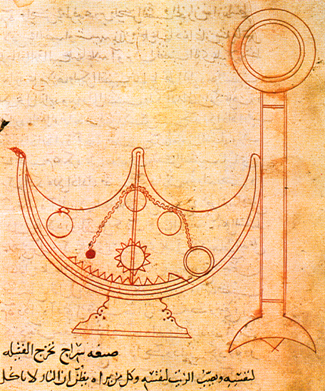
They were accompanied by reflections, commentaries, translations of commentaries, etc. and gave rise to a new form of literature. According to the Nestorian patriarch Timothy I, it was at the request of the Caliph Al-Mahdi that he translated Aristotle’s Topics from Syriac into Arabic. He also wrote a treatise on astronomy entitled The Book of Stars, now lost.
An astrology and astronomy enthusiast, Al-Ma’mûn once made it a condition of peace with the Byzantine Empire to hand over a copy of the Almagest, Ptolemy’s main work, which was supposed to summarize all Greek astronomical knowledge. In 829, in the upper district of Baghdad, he built the first permanent observatory in the world, the Baghdad Observatory, allowing his astronomers, who had translated the Astronomical Treatise of the Greek Hipparchus of Nicaea (190-120 B.C.), as well as his star register, to methodically monitor the movement of the planets.
Here is what Sâ’id al-Andalusî (1029-1070) tells us about Al-Ma’mûn’s interest in astronomy and his efforts to advance it:
“As soon as Al-Ma’mûn became caliph, his noble soul made every effort to attain wisdom, and to this end he was particularly concerned with philosophy; moreover, the scholars of his time studied in depth a book by Ptolemy and understood the diagrams of a telescope that was drawn therein. So Al-Ma’mûn gathered all the great scholars present throughout the regions of the caliphate, and he asked them to build the same kind of instrument so that they could observe the planets in the same way as Ptolemy had done and those who had preceded him. The object was built and the scholars brought it to the city of al-Shamâsiyya in the region of Damascus in the Sham in the year 214 AH (829 AD). Through their observations they determined the exact duration of a solar year as well as the inclination of the sun, the exit of its center and the situation of its various faces, which allowed them to know the state and positions of the other planets. Then the death of the caliph al-Ma’mûn in 218 A.H. (833) put an end to this project, but they nevertheless completed the astronomical telescope and named it ‘the Ma’mûn telescope’”
Now, let me present you a short list of the main astronomers, mathematicians, thinkers, scholars and translators who frequented the Houses of Wisdom:
—Al-Jahiz (776-867). The encyclopedic approach of this Mutazilite is conceived as « a necklace gathering pearls » or as a garden which, with its plants, its harmonious organization and its fountains, represents in miniature the whole universe. He sketches the principle of the evolution of species;
—Al-Khwarizmi (780-850), (in Latin Algorithmus). This Persian mathematician and astronomer, according to some a Zoroastrian converted to Islam, would have been a follower of mutazilism. He is best known for having invented the method of solving mathematical problems, which is still used today and which is called algorithm. He studied for some time in Baghdad but it is also reported that he made a trip to India. Al Khawarizmi invented the word algebra (from the Arabic word j-b-r, meaning force, beat or multiply), introduced the Indian numerical system to the Muslim world, institutionalized the decimal system in mathematics, and formalized the testing of scientific hypotheses based on observations;
—Sahl Rabban al-Tabari (786-845), a Jewish astronomer and physician whose name means “The son of the rabbi of Tabaristan”. His son Ali was the tutor of al-Razi (865-925). An alchemist who became a physician, he is said to have isolated sulfuric acid and ethanol and was among the first to advocate their medical use. He greatly influenced the conception of hospital organization in connection with the training of future doctors. He was the object of much criticism for his opposition to Aristotelianism;
—Al-Hajjaj (786-823) made the first Arabic translation of Euclid’s Elements from Greek. He also translated Ptolemy’s Almagest;
—Al-Kindi (801-873) (known as Alkindus), considered the father of Arab philosophy, was a mutazilist. He was a prolific author (about 260 books) and explored all fields: geometry, philosophy, medicine, astronomy, physics, arithmetic, logic, music and psychology. Along with his colleagues, Al-Kindi was entrusted with the translation of the manuscripts of Greek scholars. After the death of Al-Ma’mun in 833, he was considered too much of a mutazilist, fell into disgrace and his library was confiscated;
—The Banu Musa (“children of Moses”) brothers, three brilliant sons of a deceased astrologer, friend of the Caliph. Mohammed will work on astronomy; Ahmed and Hassan on the canals linking the Euphrates to the Tigris, a guarantee of the control and optimization of their respective floods. They published the Book of Ingenious Mechanisms, an inventory of new techniques and machines [*14];
—Hunayn ibn Ishâk (808-873) (known as Iohannitius). This Nestorian Christian was entrusted by Al-Ma’mun with the task of overseeing the quality of translations; a physician, he translated some of the works of the Greek physician Claudius Galen;
—Thabit ibn Qurra (836-901), a Syrian astronomer, mathematician, philosopher and musicologist;
—Qusta ibn Luqa (820-912), a Greek Byzantine physician, also a philosopher, mathematician, astronomer, naturalist and translator. A Christian of the Melkite Church, he spoke both Greek (his mother tongue) and Arabic, as well as Syriac. Considered, along with Hunayn ibn Ishaq, as one of the key figures in the transmission of Greek knowledge from Antiquity to the Arab-Muslim world. He was the translator of Aristarchus of Samos for whom the Earth revolved around the Sun and the author of a treatise on the astrolabe;
—Ibn Sahl (940-1000), in the footsteps of Al-Kindi, wrote a treatise on burning mirrors and lenses around 984, explaining how they can focus light on a point. His work was perfected by Ibn Al-Haytam (965-1040) (Latin name: Alhazen), whose writings reached as far as Leonardo da Vinci, via the Commentaries of Ghiberti. In Ibn-Sahl, we find the first mention of the law of refraction, later rediscovered in Europe as the law of Snell-Descartes.
Drawn into Bagdad for the opportunities it offered, these scholars generally worked in teams in a totally interdisciplinary spirit. Al-Ma’mûn, monitoring the science projets and noting the contradictions that arose from the translations of Greek, Persian and Indian sources, fixed with the scholars the next great scientific challenges to be met:
–To obtain, thanks to more efficient astronomical observatories, tables of astronomical ephemerides [*15] of greater precision than those of Ptolemy;
–To calculate with precision the circumference of the Earth with more advanced methods than those of the Greek astronomer Eratosthenes (3rd century BC);
–Produce a world map integrating the latest geographical knowledge concerning the distances between cities and the size of the continents;
–Deciphering the Egyptian hieroglyphs that Al-Ma’mûn had discovered during his trip to Egypt.
Translations of Plato

By asserting that what had advanced science at this period was the rediscovery of Aristotle and his purely empiricist method, one forgets the rediscovery of Plato, whose dialectical and hypothetical method has often done more for science than blind empiricism.
Al-Kindi’s intense involvement in the Platonic tradition is reflected in his summaries of the Apology and the Crito, and in his own works that paraphrase the Phaedo or are inspired by the Meno and the Symposium. The Syrian scientist Ibn al-Bitriq, a member of Al-Kindi’s “circle” in Bagdad, translated the Timaeus.
Otherwise, the House of Wisdom’s top translator, Hunayn ibn Ishaq and his circle translated the Greek physician Claudius Galen’s commentaries on the Timaeus, especially his On what Plato said in the Timaeus in a medical way and his On the doctrines of Hippocrates and Plato. And from Hunayn’s own works, we know that some of his students translated Galen’s lost Greek summaries of Plato’s Cratylus, Sophist, Parmenides, Euthydemus, Republic and Laws. Finally, the physician al-Razi presented and commented on Plutarch’s treatise On the Generation of the Soul in the Timaeus.
Inter-religious dialogue:
possible for some, complicated for others
In the West, the name of Al-Kindi is best known in association with The Apology of Al-Kindi, an anonymous text of the time. It is probably a fictitious dialogue between two believers, one Muslim (Abdallah Al-Hashimi), the other Christian (Al-Kindi), both criticizing the other’s and praising one’s own religion and inviting the other to join him! This dialogue supposedly took place at the time of the caliph Al-Ma’mûn. What we know about the open-mindedness of the Caliph does not contradict this assertion. The earliest known mention of the existence of this Apology came to us from Al-Biruni (973-1048).
The manuscript of Al-Kindi’s Apology was translated into Latin in 1142 at the request of Peter the Venerable (1092-1156), grand abbot of the abbey of Cluny, the most powerful and important in Latin Europe. That same year, after visiting Toledo, he conceived the idea of a systematic refutation of the Muslim religion, which he considered heretical and errant.
Here is how he explains the translation he has just ordered of the Koran (the Lex Mahumet pseudoprophete) by a team of translators (including an Arab) brought together for the occasion:
“Whether one gives the Mohammedan error the shameful name of heresy or the infamous one of paganism, one must act against it, that is, write. But the Latins and especially the moderns, the ancient culture perishing, according to the word of the Jews who once admired the polyglot apostles, do not know any other language than that of their native land. So they could neither recognize the enormity of this error nor stop it. So my heart was inflamed and a fire burned in my meditation. I was indignant that the Latins did not know the cause of such a perdition and their ignorance robbed them of the power to resist it; for no one answered, for no one knew. So I went to find specialists in the Arabic language which has allowed this deadly poison to infest more than half the globe. I persuaded them, by dint of prayers and money, to translate from Arabic into Latin the history and doctrine of this wretched man and his very law, which is called Koran”.
Accused hence “the Arabic language which allowed this deadly poison (Islam) to infest more than half of the globe”…
This declaration of war was undoubtedly required to motivate his troops. Let us recall that Eudes de Châtillon, the grand prior of the abbey of Cluny, who will become Pope Urban II in 1088, will be, in 1095, at the origin of the first crusade sending the bandits who ravaged France, to go and wage war elsewhere.
The decline and Al-Ghazali
Let us return to the Abbasids. As we have said, with the arrival in power of Al-Mutawakkil in 847, mutazilism was removed from power and the Houses of Wisdom were reduced to simple libraries. This did not prevent a traveller, describing his visit to Baghdad in 891, from reporting that the city contained more than one hundred public libraries. Following the Bayt Al-Hikma model, small libraries were founded on every street corner of the city…
Entangled in endless theological debates between experts and won by sectarianism, the mutazilist elite cut itself off from a people who were losing confidence and eventually welcomed with a sense of relief the obscurantist doctrine of Al-Ghâzalî (1058-1111) (Latin name: Algazel), the worst enemy of the mutazilites.
Al-Ghâzalî proposed a radical solution: philosophy is only right when it agrees with religion – which, according to Al-Ghâzalî, is rare. This leads him to radicalize his position, and to attack more and more the Greco-Arab philosophy, guilty, in his eyes, of blasphemy.
Where someone like the Persian Ibn Sina (980-1037) (Latin name: Avicenna), author of the Canons or Precepts of Medicine (around 1020), crossed Greek philosophy and Muslim religion, Al-Ghazali wanted to filter the first through the second.
Hence his most famous and important work, The Incoherence of the Philosophers, written in 1095. In it, he denounces the “pride” of the philosophers who claim to “rewrite the Koran” through Plato and Aristotle. Their error is above all a logical one, as the title of the book itself indicates, which underlines their “incoherence”: they want to complete the Koran with Greek philosophy, whereas the Koran comes later in history and therefore does not need to be completed. He therefore promotes a much more literal approach to the Koranic text, whereas Ibn Sina defended, cautiously it is true, a metaphorical approach. In truth, it is Aristotelianism and nominalism that triumph. The doctrine opposing Mutazilism became known as Ash’arism.
For Ascharites, to speak of God’s justice and rationality is a double blasphemy, because it amounts to limiting his omnipotence. If God were, as the Mutazilites say, compelled to will what is good, then he would be … compelled, which the Ascharites find theologically unacceptable. Therefore, believers should not admit the idea that God wills good, but submit to the principle that whatever he wills is good because he wills it.
Similarly, it is blasphemous to look for « second causes » in nature, i.e. scientific laws. The world exists because God, at every moment, wants it to exist. Any scientific research, any attempt to apply reason and analysis, is an offense to the divine omnipotence.
For Sébastien Castellion, the rejection of reason by the Ascharite school – and subsequently by much of Muslim civilization – was not an implicit and subterranean process, but an explicit decision based on theological principles. The great jurist Ibn Hanbal, whose school is predominant in Saudi Arabia today, said that « all those who indulge in reasoning by analogy and personal opinions are heretics (…). Accept only, without asking why and without making comparisons. »
The fall of Bagdad
From the eleventh century onward, the Abbasid, whose Empire was fragmenting, called upon the Turkish Seljuk princes to protect them against the Shiites, supported by the Fatimid caliphate of Cairo. Gradually, the Turkish and Mongol troops, coming from Central Asia, ended up governing the security of the Abbasid caliph while letting him exercise his religious power.
Then, in 1258, they deposed the last caliph and confiscated his title of successor of the Prophet, which gave them religious power over the four schools of Sunnism. In order to subdue the Arab and Persian populations, the Seljuk Turks created the madrasa (Koranic school) where the conservative doctrine of Acharite Sunnism was taught to the exclusion of the dialectical Mutazilite theology, considered an ideological threat to Turkish authority over the Arabs.
The Abbasid Empire declined as a result of administrative negligence, abandonment of canal maintenance, flood-induced famine, social injustice, slave revolts, and religious tensions between Shiites and Sunnis. At the end of the 9th century, the Zendj, black slaves (from Zanzibar) who worked in the marshes of the lower Iraq, revolted several times, even occupying Basra and threatening Baghdad. The Caliph restored order at the cost of an unprecedentedly violent repression. The rebels were only crushed in 883 at the cost of many victims. The empire did not recover.
In 1019, the Caliph forbade any new interpretation of the Koran, radically opposing the Mutazilite school. This is a brutal stop to the development of critical thinking and intellectual and scientific innovations in the Arab Empire, the consequences of which are still felt today.
ASTRONOMY
Since the dawn of time (it is the case to say it), man has tried to understand the organization of the stars in the environment near the Earth.
Installations such as Stonehenge (2800 BC) in England allowed the first observers to identify the cycles that determine the place and the exact day when certain stars rise. All these observations posed paradoxes: around us, the earth appears relatively flat, but the Moon or the Sun that we perceive with the same eyes seem spherical. The Sun « rises » and « sets », our senses tell us, but where is the reality?
It seems that Thales of Miletus (625-547 BC) was the first to have really wondered about the shape of the Earth. He thought that the Earth was shaped like a flat disk on a vast expanse of water. Then Pythagoras and Plato imagined a spherical shape, which they considered more beautiful and rational. Finally Aristotle reported some observational evidence such as the rounded shape of the Earth’s shadow on the Moon during eclipses.
The Greek scientist Eratosthenes (276 BC- 194 BC), chief librarian of the Alexandria library, then calculated the Earth’s circumference. He had noticed that at noon, on the day of the summer solstice, there was no shadow on the side of Aswan. By measuring the shadow of a stick planted in Alexandria at the same time and knowing the distance between the two cities, he deduced the circumference of the Earth with a rather astonishing accuracy: 39,375 kilometers against some 40,000 kilometers for current estimates.
Between Ptolemy’s Almagest and Copernicus’ De Revolutionibus, as we have said, Arabic astronomy constitutes “the missing link”.
The original title of Ptolemy’s work is The Mathematical Composition. The Arabs, very impressed by this work, called it “megiste”, from the Greek meaning “very great”, to which they added the Arabic article “al”, to give “al megiste” which became Almageste.
It is important to know that Ptolemy never had the opportunity to re-read his treatise as a whole. After writing the first of the thirteen books of his work, the one on “The Fundamental Postulates of Astronomy”, Ptolemy passed it on to copyists who reproduced it and distributed it widely without waiting for the completion of the other twelve books…

In the end, confronted with observations that called into question his own observations and in order to rectify his errors, Ptolemy wrote another work, after the Almagest, entitled Planetary Hypotheses. The author returned to the models presented in the Almagest while making modifications to the average motions (of the planets) to take into account the latest observations. However, his Planetary Hypotheses went beyond the mathematical model of the Almagest to present a physical realization of the universe as a set of nested spheres, in which he used the epicycles of his planetary model to calculate the dimensions of the universe. Finally, the Almagest also contains a description of 1022 stars grouped into 48 constellations.
Ptolemy also presents stereographic projection invented by Hipparchus, the theoretical basis for the construction of the astrolabe by Arab astronomers.
In the ninth century, when the Arabs became interested in astronomy, knowledge was based on the following principles summarized in the work of Ptolemy:
–Ignoring the assertions of Aristarchus of Samos (310-230 BC) for whom the Earth revolved around the Sun, Ptolemy resumed in the second century AD the thesis of Eudoxus of Cnidus (approx. 400-355 BC) and especially Hipparchus (180 to 125 BC) to assert that the Earth is a motionless sphere placed at the center of the world (geocentrism);
–Ptolemy agreed with Plato, who was inspired by Pythagoras, that the circle was the only perfect form, and that the other bodies turning around the Earth did so according to circular and uniform trajectories (without acceleration or deceleration);
–Yet everyone knew that some planets do not follow these perfect rules. In the 6th century, the neo-Platonic philosopher Simplicius, in his Commentary on Aristotle’s Physics, wrote: “Plato then poses this problem to the mathematicians: what are the uniform and perfectly regular circular motions that should be taken as hypotheses, so that we can save the appearances that the wandering stars present?” ;
–In order to account for the « apparent retrograde motion » of Mars, Hipparchus will introduce other secondary perfect figures, again circles. The articulation and interaction of these “epicycles” gave the appearance of sticking with the observed facts. Ptolemy took up this approach;
–However, the more the precision of astronomical measurements improved, the more anomalies were discovered and the more it was necessary to multiply these interlocking “epicycles”. It quickly became very complicated and inextricable;
–The universe is divided into a sub-lunar region where everything is created and therefore perishable, and the rest of the universe, supra-lunar, which is imperishable and eternal.
Hipparchus of Nicea
The Arab astronomers, for both religious and intellectual reasons that we mentioned at the beginning of this article, initially discovered and then, on the basis of increasingly detailed observations, challenged Hipparchus’ hypotheses, which were the basis of the Ptolemaic model.
Hipparchus imagined a system of coordinates for the stars based on longitudes and latitudes. We also owe him the use of parallels and meridians to locate the Earth as well as the division of the circumference into 360° inherited from the sexagesimal calculation (base 60) of the Babylonians.
In astronomy, his works on the rotation of the Earth and the planets are numerous. Hipparchus explains the mechanism of the seasons by noting the obliquity of the ecliptic: the inclination of the Earth’s axis of rotation. By comparing his observations with older ones, he discovered the precession of the equinoxes due to this tilt: the Earth’s axis of rotation makes a conical movement from East to West and of revolution 26,000 years. Thus in a few millennia, the North Pole will no longer be found with the North Star (Polaris) but with another star, Vega.
Based on Hipparchus, the Arabs perfected and fabricated an important instrument for measuring positions: the astrolabe. This “mathematical jewel” allows to measure the position of stars, planets, to know the time on Earth. Later, the astrolabe was replaced by more precise and easier to use instruments, such as the quadrant, the sextant or the octant.
With the manuscripts at their disposal in the Houses of Wisdom and the observatories of Baghdad and Damascus, the Arab astronomers had texts of an incredible richness but often in flagrant contradiction with their own observations of the movements of the Moon and the Sun. It is from this confrontation that later discoveries were born. The Arabs introduced a lot of mathematics to solve problems, especially trigonometry and algebra.
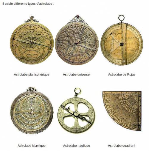
The Arab astronomers
In order to present the main Arab astronomers and their contributions, here is an excerpt from J. P. Maratray’s remarkable article L’astronomie arabe.
—Al-Khwarizmi (783-850) called Algorithmi.
A mathematician, geographer and astronomer of Persian origin, he was a member of the « House of Wisdom ». He is one of the founders of Arab mathematics, inspired by Indian knowledge, in particular the decimal system, fractions, square roots… He is credited with the term “algorithm”. Algorithms are known since antiquity, and the name of Al-Khwarizmi (Algorithmi in Latin) will be given to these sequences of repeated elementary operations. He is also the author of the term “algebra”, which is the title of one of his works on the subject. He was also the first to use the letter x to designate an unknown in an equation. He wrote the first book of algebra (al-jabr) in which he described a systematic method of solving second degree equations and proposed a classification of these equations. He introduced the use of numbers that we still use today. These “Arabic” numbers are in fact of Indian origin, but were used mathematically by Al-Khwarizmi. He adopted the use of the zero, invented by the Indians in the 5th century, and adopted by the Arabs through him. The Arabs will translate the Indian word “sunya” by “as-sifr”, which becomes “ziffer” and “zephiro”. Ziffer will give “number”, and zephiro, “zero”. Al-Khwarizmi established astronomical tables (position of the five planets, the Sun and the Moon) based on Hindu and Greek astronomy. He studied the position and visibility of the Moon and its eclipses, the Sun and the planets. It is the first completely Arabic astronomical work. A crater of the Moon bears his name.
—Al-Farghani (805-880) called Alfraganus (mentioned in Dante’s Commedia).
Born in Ferghana in present-day Uzbekistan, he wrote in 833 the Elements of Astronomy, based on the Greek knowledge of Ptolemy. He was one of the most remarkable astronomers in the service of Al-Ma’mûn, and a member of the House of Wisdom. He introduced new ideas, such as the fact that the precession of the equinoxes must affect the position of the planets, and not only that of the stars. His work was translated into Latin in the 12th century, and had a great impact on the very closed circles of Western European astronomers. He determined the diameter of the Earth, which he estimated at 10500 km. We also owe him a work on sundials and another on the astrolabe.
—Al-Battani (850-929) called Albatenius.
He observed the sky from Syria. He is sometimes called “the Ptolemy of the Arabs”. His measurements are remarkably accurate. He determined the length of the solar year, the value of the precession of the equinoxes, the inclination of the ecliptic. He noted that the eccentricity of the Sun is variable, without going so far as to interpret this phenomenon as an elliptical trajectory. He wrote a catalog of 489 stars. We owe him the first use of trigonometry in the study of the sky. It is a much more powerful method than the geometrical one of Ptolemy. His main work is The Book of Tables. It is composed of 57 chapters. Translated into Latin in 1116 by Plato of Tivoli, it will greatly influence the European astronomers of the Renaissance.
—Al-Soufi (903-986) known as Azophi.
Persian astronomer, he translated Greek works including the Almagest and improved the estimates of the magnitudes of stars. In 964, he published « The Book of Fixed Stars », where he drew constellations. He seems to have been the first to report an observation of the large Magellanic cloud (a nebula), visible in Yemen, but not in Isfahan. Similarly, we owe him a first representation of the Andromeda galaxy, probably already observed before him. He described it as « a small cloud » in the mouth of the Arabian constellation of the Great Fish. Its name (Azophi) was given to a crater on the Moon.
—Al-Khujandi (circa 940- circa 1000).
He was a Persian astronomer and mathematician. He built an observatory in Ray, near Tehran, with a huge sextant, constructed in 994. It is the first instrument able to measure angles more precise than the minute of angle. He measures with this instrument the obliquity of the ecliptic, by observing the meridian passages of the Sun. He found 23° 32′ 19 ». Ptolemy found 23° 51′, and the Indians, much earlier, 24°. The idea of the natural variation of this angle never occurred to the Arabs. They discussed for a long time about the accuracy of the measurements, which made their science advance.
—Ibn Al-Haytam (965-1039) called Alhazen.
A mathematician and optician born in Basra in present-day Iraq, he was asked by the Egyptian authorities to solve the problem of the Nile floods. His solution was the construction of a dam towards Aswan. He gave up in front of the enormity of the task (the dam was finally built in 1970!). Faced with this “failure”, he feigned madness until the death of his boss. He made a critical assessment of Ptolemy’s theses and those of his predecessors, and wrote Doubts on Ptolemy. He draws up a catalog of the inconsistencies, without however proposing an alternative solution. Among the inconsistencies he noted were the variation in the apparent diameter of the Moon and the Sun, the non-uniformity of the allegedly circular motions, the variation in the position of the planets in latitude, the organization of the Greek spheres. Observing that the Milky Way has no parallax, he placed it very far from the Earth, in any case further away than Aristotle’s sub-lunar sphere. Despite his doubts, he maintains the central place of the Earth in the universe. Ibn Al-Haytam takes up the work of Greek scholars, from Euclid to Ptolemy, for whom the notion of light is closely linked to the notion of vision: the main question being whether the eye has a passive role in this process or whether it sends a kind of fluid to “interrogate” the object. Through his studies of the mechanism of vision, Ibn Al-Haytam showed that the two eyes were an optical instrument, and that they actually saw two separate images. If the eye sent this fluid, one could see at night, he speculated. He understood that the sunlight reflected off the objects and then entered the eye. But for him, the image is formed on the lens… He took up Ptolemy’s ideas on the rectilinear propagation of light, accepted the laws of reflection on a mirror, and sensed that light has a finite, but very great speed. He studied refraction, the deviation of a light ray as it passes from one medium to another, and predicted a change in the speed of light as it passes. But he could never calculate the angle of refraction. He found that the phenomenon of twilight is related to the refraction of sunlight in the atmosphere, which he tried to measure the height, without success. Already known in antiquity, we owe him a very precise description and the use for experimental purposes of the dark room (camera obscura), a black room that projects an image on a wall through a small hole drilled in the opposite wall. The result of all this optical research is recorded in his Treatise on Optics, which took him six years to write and was translated into Latin in 1270. [*16] In mechanics, he asserted that an object in motion continues to move as long as no force stops it. This is the principle of inertia before the letter. An asteroid bears his name: 59239 Alhazen.
—Al-Biruni (973-1048).
Certainly one of the greatest scholars of medieval Islam, originally from Persia, he was interested in astronomy, geography, history, medicine and mathematics, and philosophy in general. He wrote more than 100 works. He was also a tax collector and a great traveler, especially in India, where he studied language, religion and science. At the age of 17, he calculated the latitude of his native town of Kath (in Persia, now in Uzbekistan). At the age of 22, he had already written several short works, including one on cartography. In astronomy, he observed the eclipses of the Moon and the Sun. He is one of the first to evaluate the errors on his measurements and those of his predecessors. He noticed a difference between the average speed and the apparent speed of a star. He measured the radius of the Earth at 6339.6 km (the correct figure is 6378 km), a result used in Europe in the 16th century. During his travels, he met Indian astronomers who supported heliocentrism and the rotation of the Earth on its axis. He will always be skeptical, because this theory implies the movement of the Earth. But he will ask himself the question: « Here is a problem difficult to solve and to refute ». He believes that this theory does not lead to any mathematical problems. He refuted astrology, arguing that this discipline is more conjectural than experimental. In mathematics, he developed the calculation of proportions (rule of three), demonstrated that the ratio of the circumference of a circle to its diameter is irrational (future number Pi), calculated trigonometric tables, and developed methods of geodesic triangulations.
—Ali Ibn Ridwan (988-1061).
Egyptian astronomer and astrologer, he wrote several astronomical and astrological works, including a commentary on another book of Claudius Ptolemy, the Tetrabible. He observed and commented on a supernova (SN 1006), probably the brightest in history. Its magnitude is estimated today, according to the testimonies that have come down to us, at -7.5! It remained visible for more than a year. He explains that this new star had two to three times the apparent diameter of Venus, a quarter of the brightness of the Moon, and that it was low on the southern horizon. Other western observations corroborate this description, and place it in the constellation of the Wolf.
—From the 11th to the 16th century.
After a first phase, more important observatories were built. The first of them, model of the following ones, is that of Maragheh, in the current Iran. Their purpose was to establish planetary models and to understand the movement of the stars. (…) The school thus constituted will have its apogee with Ibn Al-Shâtir (1304-1375). Other observatories will follow, such as the one in Samarkand in the 15th century, Istanbul in the early 16th century, and, in the West, the one of Tycho Brahe in Uraniborg (Denmark at that time) at the end of the 16th century. The new models were no longer Ptolemaic inspired, but remained geocentric. The physics of the time still refused to put the Earth in motion and to remove it from the center of the world. These models were inspired by the Greek epicycles, keeping the circles, but simplifying them. For example, Al-Tûsî proposes a system comprising a circle rolling inside another circle of double radius. This system transforms two circular motions into an alternating rectilinear motion, and explains the variations of the latitude of the planets. Moreover, it accounts for the variations of the apparent diameters of the stars. But to go further, it will be necessary to change the reference system, which the Arabs refused to do. This change will occur with the Copernican revolution, during the Renaissance, in which the Earth loses its status as the center of the world.
—Al-Zarqali (1029-1087) said Arzachel.
Mathematician, astronomer and geographer born in Toledo, Spain, he discussed the possibility of the movement of the Earth. Like others, his writings will be known to Europeans of the sixteenth and seventeenth century. He designed astrolabes, and established the Toledo Tables, which were used by the great Western navigators such as Christopher Columbus, and served as a basis for the Alphonsine Tables. He established that the eccentricity of the Sun varies, more precisely that the center of the circle on which the Sun rotates moves periodically away from or towards the Earth. A crater of the Moon bears his name, as well as a bridge of Toledo on the Tagus.
—Omar Al-Khayyam (1048-1131).
Known for his poetry, he was also interested in astronomy and mathematics. He became director of the Isfahan observatory in 1074. He created new astronomical tables even more precise, and determined the duration of the solar year with great accuracy, given the instruments used. It is more accurate than the Gregorian year, created five centuries later in Europe. He reformed the Persian calendar by introducing a leap year (Djelalean reform). In mathematics, he was interested in third degree equations by demonstrating that they can have several solutions (he found some of them geometrically). He wrote several texts on the extraction of the cubic roots, and a treaty of algebra.
—Al-Tûsî (1201-1274).
Astronomer and mathematician, born in the city of Tus in present-day Iran, he built and directed the observatory of Maragheh. He studied the works of Al-Khayyam on proportions, and was interested in geometry. On the astronomical side, he commented on the Almagest and completed it, like several astronomers (Al-Battani…) before him. He estimates the obliquity of the ecliptic at 23°30′.
—Al-Kashi (1380-1439).
Persian mathematician and astronomer, he witnessed a lunar eclipse in 1406 and wrote several astronomical works afterwards. He spent the rest of his life in Samarkand, under the protection of Prince Ulugh Beg (1394-1449) who founded a university there. He became the first director of the new observatory of Samarkand. His astronomical tables propose values with 4 (5 according to the sources) digits in sexagesimal notation of the sine function. He gives the way to pass from a system of coordinates to another. His catalog contains 1018 stars. He improves the tables of eclipses and visibility of the Moon. In his treatise on the circle, he obtained an approximate value of Pi with 9 exact positions in sexagesimal notation, that is to say 16 exact decimals! A record, since the next improvement of the estimation of Pi dates from the 16th century with 20 decimals. He leaves his name to a generalization of the Pythagorean theorem to any triangles. This is the Al-Kashi theorem. He introduced the decimal fractions, and acquired a great reputation which made him the last great Arab mathematician astronomer, before the West took over.
—Ulugh Beg (1394-1449).
Grandson of Tamerlan, prince of the Timurid (descendants of Tamerlan). Viceroy from 1410, he acceded to the throne in 1447. He was a remarkable scholar and a poor politician, a position he delegated to devote himself to science. His teacher was Qadi Zada al-Rumi (1364-1436) who developed in him a taste for mathematics and astronomy. He built several schools, including one in Samarkand in 1420 where he taught, and an observatory in 1429. He worked there with some 70 mathematicians and astronomers (including Al-Kashi) to write the Sultanian Tables published in 1437 and improved by Ulugh Beg himself shortly before his death in 1449. The accuracy of these tables will remain unequaled for more than 200 years, and they were used in the West. They contain the positions of more than 1000 stars. Their first translation dates from around 1500, and was made in Venice.
—Taqi Al-Din (1526-1585).
After a period as a theologian, he became the official astronomer of the Sultan in Istanbul. He built an observatory there with the aim of competing with those of European countries, including that of Tycho Brahe. The observatory was opened in 1577. He drew up the Zij tables (“the unbroken pearl”). He was the first to use comma notation, rather than the traditional sexagesimal fractions in use. He observed and described a comet, and predicted that it was a sign of victory for the Ottoman army. This forecast turns out to be erronous, and the observatory is destroyed in 1580… He then devotes himself to mechanics, and describes the functioning of a rudimentary steam engine, invents a water pump, and is fascinated by clocks and optics.
The destruction of the observatory of Istanbul marks the end of the Arab astronomical activity of the Middle Ages. It was not until the Copernican revolution that new progress was made, and what progress! Copernicus and his successors were certainly strongly inspired by the results of the Arabs through their works. Travel and direct contact between scientists of the time were rare. Since Westerners did not understand Arabic, Latin translations probably influenced the West, along with the works of some Greek philosophers who had questioned the central position of the Earth, as Aristarchus of Samos had proposed around 280 BC.
Arab observatories
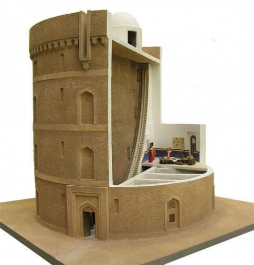
The modern observatory, in its conception, is a worthy successor of the Arab observatories of the late Middle Ages. Unlike the private observatories of the Greek philosophers, the Islamic observatory is a specialized astronomical institution, with its own premises, scientific staff, teamwork with observers and theoreticians, a director and study programs. They have recourse, as today, to increasingly large instruments, in order to constantly improve the accuracy of measurements.
The first of these observatories was built during the reign of Al-Ma’mûn in Bagdad in the 9th century. We have already mentioned the observatory of Ray, near Tehran and second city of the Abbasid Empire after Baghdad, with its monumental wall sextant dating from 994. To these must be added the observatories of Toledo and Cordoba in Spain, Baghdad and Isfahan.
Finally, the one in Maragheh in the north of present-day Iran, built in 1259 with funds collected to maintain hospitals and mosques. Al-Tusi worked there. Then came the era of the observatory of Samarkand, built in 1420 by the astronomer Ulugh Beg (1394-1449), whose remains were found in 1908 by a Russian team.
Conclusion
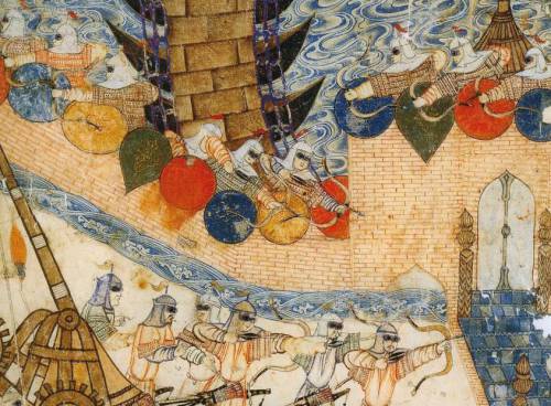
Much more than the crusades, it will be the Mongol offensives that will devastate entire sections of the Arab-Muslim civilization. Genghis Khan (1155-1227), to the great pleasure of some Westerners, will destroy the Muslim kingdoms of Khwarezm (1218) and Sogdia with Bukhara and Samarkand (1220). The great city of Merv in 1221. In 1238, his son will seize Moscow, then Kiev. In 1240, Poland and Hungary will be invaded. In 1241, Vienna was threatened.
Before bringing down the Song Dynasty in China in 1273, the Mongols turned against the Abbassid.
Hence, the Houses of Wisdom came to a brutal end on February 12, 1258 with the Mongol invasion of Baghdad led by Hulagu (Genghis Khan’s grandson), who killed the last Abbasid caliph Al-Mu’tassim (despite his surrender) and destroyed the city of Baghdad and its cultural heritage. Hulagu also ordered the massacre of the caliph’s entire family and entourage.
Mutazilism was banned and the magnificent collection of books and manuscripts in the House of Wisdom in Baghdad was thrown into the muddy water of the Tigris, which turned brown for a few days because of the inked papers of the books and manuscripts.
One report says that the Mongols exterminated twenty-four thousand scholars and an incalculable number of books were lost. Of Mutazilism, its doctrine was only known through the texts of the traditionalist theologians who had attacked it. It was only the discovery of the voluminous works of Abdel al Jabbar Ibn Ahmad in the 19th century that made it possible to understand the key role played my this current of thought in the Arab renaissance and the formation of current Muslim theology, whether Sunni or Shiite.
Closer to home, the Iraq war of 2003: until then, Iraq was the world’s largest publisher of scientific publications in Arabic. As a result of the chaos caused by a war waged in the name of “democracy” and “the war on terror”, both the National Library and the National Archives were looted and burned. The same happened to the Central Library of Pious Legacies, the Library of the Iraqi University of Sciences, as well as many public libraries in Baghdad, Mosul and Basra. The same was true for the archaeological treasures of the Iraqi Museum and its library. It seems that some people have declared war on civilization.
NOTES:
- A theodicy or « righteousness of God ») is an explanation of the apparent contradiction between the existence of evil and two characteristics peculiar to God: his omnipotence and his goodness.
- Sumer. The natural environment of the Sumerian country was not really favorable to the development of a productive agriculture: poor soils with a high content of salts harmful to the growth of plants, very high average temperatures, insignificant rainfall, and flooding of rivers coming in the spring, at harvest time, and not in the fall when the seeds need them to germinate, as is the case in Egypt. It was therefore the ingenuity and relentless labor of Mesopotamian farmers that enabled this country to become one of the granaries of the ancient Middle East. From the 6th millennium BC, the peasant communities developed an irrigation system which gradually branched out to cover a large area, thereby taking advantage of the advantage offered to them by the extremely flat relief of the Mesopotamian delta, where there was no no natural obstacle to the extension of the irrigation canals over tens of kilometers. By regulating the level of water derived from natural watercourses to adapt it to the needs of crops, and by developing techniques aimed at limiting soil salinization (leaching of fields, practice of fallow), it was possible to obtain very high cereal yields.
- Khorassan is a region located in northeastern Iran. The name comes from the Persian and means « where does the sun come from ». It was given to the eastern part of the Sassanid Empire. Khorassan is also considered the medieval name of Afghanistan by Afghans. Indeed, this territory included present-day Afghanistan, as well as southern Turkmenistan, Uzbekistan and Tajikistan.
- In the 10th century, the Persian medical scholar Mohammad Al-Razi describes the distillation of petroleum to obtain kerosene or « illuminating petroleum » in his Book of Secrets.
- Sanskrit is a language of India, among the oldest known Indo-European languages (older even than Latin and Greek). It is notably the language of Hindu religious texts and, as such, it continues to be used as a cultural language, like Latin in centuries past in the West.
- Peshlevi or Middle Persian is an Iranian language that was spoken during the Sassanid era. She descends from Old Persian. Middle Persian was usually written using the Pahlevi script. The language was also written using the Manichean script by the Manichaeans of Persia.
- Abu Muhammad al – Qasim ibn ’Ali al – Hariri (1054–1122), Arab man of letters, poet and philologist, was born near Basra, in present-day Iraq. He is known for his Oaths and his maqâmât (literally fashions, often translated as assemblies or sessions), a collection of 50 short stories combining social and moral commentary with the brilliant expressions of the Arabic language. If the genre of maqâma was created by Badi’al – Zaman al – Hamadhani (969–1008), it is the sessions of al – Hariri that best define it. Written in a rhyming prose style called saj ’and interwoven with exquisite verse, the stories are meant to be entertaining and educational. Each of the anecdotes takes place in a different city in the Muslim world during the time of al – Hariri. They tell of an encounter, usually at a gathering of townspeople, between two fictional characters: the narrator al – Harith ibn Hammam and the protagonist Abu Zayd al-Saruji. Over the centuries, the work has been copied and commented on many times, but only 13 copies still in existence today have illuminations illustrating scenes from the stories. The manuscript presented here, executed in 1237, was both copied and illustrated by Yahya ibn Mahmud al-Wasiti, often considered the first Arab artist. It contains 99 miniatures of exceptional quality. No other known copy contains so much. The miniatures, recognized for their striking depiction of Muslim life in the 13th century, are considered to be the earliest Arab paintings created by an artist whose identity is known. Al – Wasiti, founder of the Baghdad School of Illumination, was also a remarkable calligrapher, as evidenced by his fine Naskhi style. The almost immediate popularity of the maqâmât reached Arab Spain, where Rabbi Judah al-Harizi (1165-c. 1225) translated the sessions into Hebrew under the title Mahberoth Itiel and subsequently composed his own Tahkemoni, or Hebrew sessions. . The work was also translated into many modern languages.
- The Barmecids or Barmakids are members of a Persian nobility family originally from Balkh in Bactria (north of Afghanistan). This family of Buddhist religious (paramaka means in Sanskrit the superior of a Buddhist monastery) who became Zoroastrians and then converted to Islam provided many viziers to the Abbasid caliphs. The Barmakids had acquired a remarkable reputation as patrons and are regarded as the main instigators of the brilliant culture which then developed in Baghdad.
- The Christological thesis of Nestorius (born c. 381 – died 451), Patriarch of Constantinople (428-431), was declared a heretic and condemned by the Council of Ephesus. For Nestorius, two hypostases, one divine, the other human, coexist in Jesus Christ. From the Eastern Church, Nestorianism was one of the historically most influential forms of Christianity in the world throughout late Antiquity and the Middle Ages, to India, China and Mongolia.
- Syriac (a form of Aramaic, the language of Christ) is alongside Latin and Greek the third component of ancient Christianity, rooted in Hellenism but also descended from Near Eastern and Semitic antiquity. From the first centuries, in a movement symmetrical to that of the Greco-Latin Christian tradition towards the west, Syriac Christianity developed towards the east, as far as India and China. Syriac is still today the liturgical and classical language (a bit like Latin in Europe) of the Syriac Orthodox, Syriac Catholic, Assyrian, Chaldean and Maronite Churches in Lebanon, Syria, Iraq and South India. Where is. Finally, it is the branch of Christianity most in contact with Islam in which he continued to live.
- In South-West Asia, the Greek influence remained alive in several cities under Christian influence: Edessa (now Urfa in Turkey), at the time capital of the county of Edessa, one of the first Eastern Latin states, the closest to the Islamic world; Antioch (now Antakya in Turkey); Nisibe (now Nusaybin in Turkey); Al-Mada’in (ie “The Cities”), an Iraqi metropolis on the Tigris, between the royal cities of Ctesiphon and Seleucia on the Tigris and Gondichapour (now in Iran) whose ruins remain. To this must be added the cities of Latakia (in Syria) and Amed (today Diyarbakir in Turkey) where there were Jacobite centers (Christians of the East, but members of the Syriac Orthodox Church, not to be confused with the Nestorians).
- The Gondishapour Academy was located in present-day Khuzestan province in southwestern Iran, near the Karoun River. It offered the teaching of medicine, philosophy, theology and science. The faculty was well versed not only in Zoroastrian and Persian traditions, but also taught Greek and Indian languages. The Academy included a library, an observatory, and the oldest known teaching hospital. According to historians, the Cambridge of Iran was the most important medical center in the Old World (defined as the territory of Europe, the Mediterranean and the Near East) during the 6th and 7th centuries.
- Sogdian is a middle Iranian language spoken in the Middle Ages by the Sogdians, a trading people who resided in Sogdiana, the historic region encompassing Samarkand and Bukhara and covering more or less present-day Uzbekistan, Tajikistan and northern Afghanistan. Before the arrival of Arabic, Sogdian was the lingua franca of the Silk Road. Sogdian traders settled in China and Sogdian monks were among the first to spread Buddhism there. As early as the 6th century, Chinese rulers appealed to the Sogdian elite to resolve diplomatic, commercial, military and even cultural issues, prompting many Sogdians to migrate from Central Asia and China’s border regions to major Chinese political centers.
- The Book of Ingenious Machines contains a hundred machines or objects, most of them due to the Banou Moussa brothers or adapted by them: funnel, crankshaft, conical ball valves, float valve and other hydraulic regulation systems, mask gas and ventilation bellows for mines; dredge, variable jet fountains, hurricane lamp, auto-off light, auto-powered; automatic musical instruments including a programmable flute.
- Astronomical ephemeris: registers of the positions of stars at regular intervals.
- Ibn Al-Haytam. In 2007, during a conference at the Sorbonne, I explored the use, by the Flemish painter Jan Van Eyck (early 15th century), of a bifocal geometric perspective, wrongly qualified as « primitive », erroneous and intuitive, actually inspired by the work and binocular experiences of the Arab scholar Ibn Al-Haytam (Alhazen). The latter drew on the work of his predecessors Al-Kindi, Ibn Luca and Ibn Sahl. Alhazen was widely known in the West thanks to the translations of the Franciscans of the University of Oxford (Grosseteste, Bacon, etc.). See summary biography.
SUMMARY CHRONOLOGY:
- 310-230 BC.: Life of the Greek astronomer Aristarchus of Samos;
- 190-120 BC.: life of the Greek astronomer Hipparchus of Nicaea;
- v. 100-160 : life of Roman astronomer Claudius Ptolemy;
- 700-748: life of Wasil ibn Ata, intellectual founder of Mutazilism;
- 750: beginning of the Abbasid dynasty;
- 751: Abbasid victory against the Chinese at the battle of Talas (Kyrgyzstan);
- 763: founding of Baghdad by Caliph Al-Mansur;
- 780: Timothy I, patriarch of the Nestorian Christian church in Baghdad;
- 780-850: life of the Arab mathematician al-Kwarizmi;
- 786 to 809: caliphate for 23 years of Haroun al-Rachîd, legendary hero of the Thousand and One Nights tales. Development of mutazilism;
- 801-873: life of the mutazilist and Platonic philosopher Al-Kindi;
- 805-880: life of Al-Farghani, treatise on the Astrolabe;
- 813-833: caliphate of Al-Ma’mûn (20 years);
- 829: creation of the first permanent astronomical observatory in Baghdad followed by that of Damascus;
- 832: creation of the public library and creation of the Maisons de la Sagesse;
- 833: shortly before his death, Al-Ma’mûn decrees the created Koran and has mutazilism adopted as the official doctrine of the Abbasids;
- 836: transfer from the capital to Samarra;
- 848: the mutazilites removed from the Baghdad court;
- 858-930: life of Al-Battani, known as Albatenius;
- 865-925: life of translator and doctor Sahl Rabban al-Tabari;
- 869-883: revolt of the Zanj (black slaves from Zanzibar);
- 892: return from the capital of the Abbasids to Baghdad;
- 965-1039: life of Ibn Al-Haytam, known as Alhazen;
- 973-1048: life of Al-Biruni;
- 1095: first crusade;
- 1258: Baghdad sacked by the Mongols;
- 1259: creation of the Maragheh Astronomical Observatory (Iran);
- 1304-1375: life of Ibn Al-Shâtir;
- 1422: creation of the Astronomical Observatory of Samarkand, capital of Sogdiana;
- 1543: Polish astronomer Nicolas Copernicus publishes his De Revolutionibus;
- 1917: British troops enter Baghdad;
- 2003: looting and destruction by systematic arson of libraries and museums during the Iraq war.
BIBLIOGRAPHY:
- Mutazilism, website of the Association for the Renaissance of Mutazilite Islam (ARIM);
- Antoine Le Bail, Who are the mutazilites, sometimes called the « rationalists » of Islam ?, website of the Institut du Monde Arabe (IMA), Paris;
- Richard C. Martin, Mark R. Woodward with Dwi S. Atmaja, Defenders of Reason in Islam, Mu’tazilism from Medieval School to Modern Symbol, Oneworld, Oxford, 1997;
- Rober R. Reilly, The Closing of the Muslim Mind, How Intellectual Suicide Created the Modern Islamist Crisis, ISI, Wilmington, 2011;
- Nadim Michel Kalife, The Lights of the First Centuries of Islam, on financialafrik.com, 2019;
- Mahmoud Azab, A Vision of the Universality of Arab-Islamic Civilization, Oberta de Catalunya University, www.uoc.edu;
- Sabine Schmidke, The People of Monotheism and Justice: Mutazilism in Islam and Judaism, Institute for Advanced Study, 2017;
- Malek Chebel, Slavery in the Land of Islam, Fayard, Paris 2012;
- Jacques Cheminade, Sublime words and idiocy by Nasr Eddin Hodja;
- Jacques Cheminade, Proposals for an inter-religious dialogue;
- Hussein Askary: Baghdad 767-1258 A.D., Melting Pot for a Universal Renaissance, Executive Intelligence Review, 2013;
- Hussein Askary: The Beauty of the Islamic Renaissance, the Elephant Clock, S&P website;
- Dr Subhi Al-Azzawi, The House of Wisdom of the Abbasids in Baghdad or the beginnings of the University, pdf on the internet;
- Dimitri Gutas, Greek Thought, Arab Culture. The movement of Greco-Arabic translation in Baghdad and primitive Abbasid society (2nd-4th / 8th-10th centuries), Aubier, Paris 2005;
- Jim Al-Khalili, The House of Wisdom, How Arab Science Saved Ancient Knowledge and Gave Us the Renaissance, Pinguin, London 2010;
- Jonathan Lyons, The House of Wisdom, How the Arabs Transformed Western Civilization, Bloomsbury, London 2009;
- Pastor Georges Tartar, Islamo-Christian Dialogue under Caliph Al-Ma’mûn, Les épitres d’Al-Hashimi and d’Al-Kindî, Nouvelles Editions Latines, Paris, 1985;
- Al-Kindî, On First Philosophy, State University of New York Press, Albany, 1974;
- Marie Thérèse d´Alverny, The transmission of philosophical and scientific texts in the Middle Ages, Variorum, Aldershot 1994;
- Danielle Jacquart, Françoise Micheau, Arab medicine and the medieval West, Maisonneuve, Paris 1990;
- Juan Vernet Gines, What culture owes to the Arabs of Spain, Sindbad, Actes Sud, Paris, 2000;
- Karen Armstrong, Islam, A Short History, Phoenix, London, 2002;
- Muriel Mirak Weisbach, Andalusia, a gateway to the Renaissance;
- Régis Morelon, Eastern Arab Astronomy between the 8th and 11th Century, in History of Arab Sciences, edited by Roshdi Rashed, Vol. 1, Astronomy, Theoretical and Applied, Seuil, Paris, 1997;
- George Saliba, Planetary Theories in Arab Astronomy after the 11th Century, in History of Arab Sciences, edited by Roshdi Rashed, Vol. 1, Astronomy, Theoretical and Applied, Seuil, Paris, 1997;
- Roshi Rashed, Geometric Optics, in History of Arab Sciences, edited by Roshdi Rashed, Vol. 2, Mathematics and physics, Seuil, Paris, 1997;
- Jean-Pierre Verdet, A History of Astronomy, Seuil, Paris, 1990;
- J. P. Maratray, Arab Astronomy, on the Astrosurf.com website;
- Jean-Pierre Luminet, Ulugh Beg – The Astronomer of Samarkand, 2018;
- Kitty Ferguson, Pythagoras, His Lives and the Legacy of a Rational Universe, Walker publishing Company, New York, 2008;
- Sir Thomas Heath, Aristarchus of Samos, The Ancient Copernicus, Dover, New York, 1981:
- A. T. Papadopoulo, Islam and Muslim Art, The Art of Great Civilizations, Mazenod, Paris, 1976;
- Olag Grabar, Art and Culture in the Islamic World, Arts & Civilizations of Islam, Köneman, Cologne, 2000;
- Christiane Gruber, Images of Muhammad in Islam, Afkar / Ideas, Spring 2015;
- Hans Belting, Florence & Baghdad, Renaissance art and Arab science, Harvard University Press, 2011;
- Dominique Raynaud, Ibn al-Haytham on binocular vision: a precursor of physiological optics, Arabic Sciences and Philosophy, Cambridge University Press (CUP), 2003, 13, pp. 79-99;
- Jonathan M. Bloom, Paper Before Print: The History and Impact of Paper in the Islamic World, Yale University Press, 2001;
- Karel Vereycken, Jan Van Eyck, a Flemish painter in Arabic optics, S&P website;
Krsta Paskovic: canal building from China to Serbia

In 2013, at the World Canal Conference in Toulouse, France, Karel Vereycken interviews Serbian, Chinese and Italian experts and historians on the important role of canals.