Étiquette : Afghanistan


La défense du patrimoine culturel de l’humanité, clé d’une paix mondiale

Dieses artikel in Deutsch PDF
This article in English online
Empathie, sympathie, compassion – La défense du patrimoine culturel de l’humanité, clé d’une paix mondiale.
Intervention de Karel Vereycken, peintre-graveur, chercheur de l’Institut Schiller, lors de la conférence internationale de l’Institut Schiller, le 15 et 16 juin 2024.
Avant de parler du patrimoine culturel mondial, quelques mots sur les notions de « sympathie », d’« empathie » et de « compassion », trois mots construits à partir du mot pathos, qui signifie en grec « souffrance » ou « affection ».
Aujourd’hui, on emploie souvent « empathie » à la place de « sympathie » et de « compassion », mais il ne s’agit pas vraiment de la même chose, bien que tous trois renvoient à une réponse bienveillante à la détresse d’autrui (pathos).
- La sympathie est un sentiment de préoccupation sincère et de partage des sentiments de quelqu’un qui vit un épisode difficile ou douloureux.
- Le terme empathie a été inventé au début du XXe siècle pour traduire l’allemand Einfühlung, qui signifiere sentir avec les gens, et pas seulement pour eux. Lorsque vous faites preuve d’empathie à l’égard d’autrui, vous ressentez ce qu’il ressent car vous vous mettez, en quelque sorte, « à la place de l’autre ».
- La compassion va au-delà de l’empathie et se traduit par une action. Elle va de pair avec l’altruisme, ou « le désir d’agir en faveur de l’autre ». En d’autres termes, on se sent concerné par sa souffrance et poussé à y remédier.
L’empathie est particulièrement importante pour notre sujet, à savoir comment construire la paix et une culture de paix, car elle permet de jeter un pont entre des personnes qui se considèrent mutuellement comme des ennemis. On peut faire preuve d’empathie à l’égard de quelqu’un que l’on ne considère pas du tout comme sympathique. Sans partager ses sentiments, nous nous engageons néanmoins dans ce que l’on appelle l’« empathie cognitive » : nous en savons suffisamment sur le passé et la culture de l’autre pour comprendre ses motivations. En conséquence, l’empathie peut nous aider à pardonner, comme le stipulait le traité de Westphalie qui mit fin à la Guerre de Trente ans en 1648.
Aujourd’hui, si nous voulons faire de la paix une réalité, nous devons nous mobiliser pour promouvoir et élever le niveau d’empathie parmi nos concitoyens.
L’empathie fait l’objet d’attaques massives :
- par la promotion de la notion de compétition brutale (c’est pourquoi le sport professionnel est promue au détriment du sport amateur) ;
- par les écrans qui promeuvent la recherche du plaisir immédiat et la violence gratuite ;
- par l’effondrement du dialogue de personne à personne.
Après les terribles guerres entre la France et l’Allemagne, une campagne a été menée pour accroître l’empathie en Europe, avec l’ouverture de l’Institut Goethe en France et de l’Alliance française en Allemagne. On a également organisé un mouvement de jumelage entre villes, permettant aux habitants de visiter leur commune « sœur » dans l’autre pays. Ils discutaient, fraternisaient, riaient de leurs préjugés et faisaient la fête ensemble, ils cultivaient un dialogue interpersonnel et apprenaient à lire sur les visages les émotions cachées derrière les mots.
Or, la connaissance que l’on peut acquérir de la culture, de la langue et de l’histoire de l’autre est bien sûr un outil fondamental pour développer cette « empathie cognitive » qui permet de voir les personnes comme issus d’une histoire, d’une culture et d’une civilisation, plutôt que comme de petites entités atomisées.
C’est ainsi qu’après avoir découvert la philosophie du mutazilisme des Abbassides de Bagdad, toute ma vision de l’Islam a changé. J’ai appris ce qui était arrivé à leur civilisation, leurs frustrations et leurs espoirs.
Aujourd’hui, la Chine est fortement impliquée et mobilisée pour protéger notamment le patrimoine culturel pré-islamique de l’Afghanistan et d’autres pays d’Asie centrale, qu’elle considère comme dans son propre intérêt. Un éminent archéologue chinois m’a déclaré à juste titre que la beauté et le défi intellectuel de cet art étaient « le meilleur moyen de lutter contre le terrorisme » — non pas les armes et les drones, mais la culture !
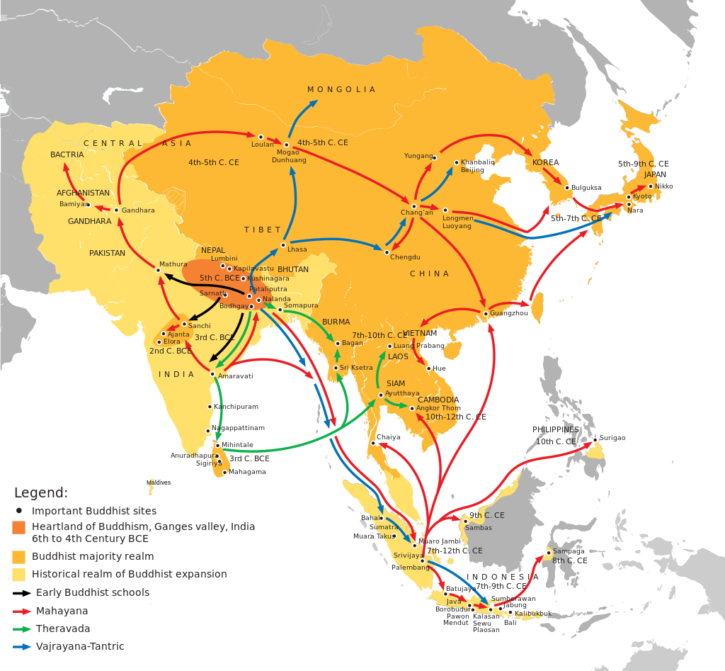
C’est en Afghanistan que se sont rencontrés les acteurs de la Route de la soie, lorsque la culture grecque faisait route vers l’Est et la culture chinoise vers l’Ouest.
Les bouddhistes qui ont prospéré dans cette région furent très actifs sur les Routes de la soie maritimes et terrestres, atteignant le Pakistan, l’Inde, le Sri Lanka, le Xinjiang et la Chine. Ils accordaient une grande attention à la métallurgie, l’architecture, la peinture, la sculpture, la poésie et la littérature. Le plus ancien livre imprimé connu est un texte bouddhiste datant de 868 après JC.
A cela s’ajoute l’apparition d’une forme très agapique du bouddhisme Mahayana dans la région du Gandhara (aujourd’hui situé principalement au Pakistan et en Afghanistan). Ses adeptes, au lieu de poursuivre un but purement personnel de nirvana (illumination), se réjouissaient avant tout de libérer l’humanité entière de la souffrance.
Dans l’art du Gandhara, l’empathie, la compassion et la miséricorde étaient les qualités suprêmes à glorifier, en particulier pour les « Bodhisattvas », ces individus ayant fait le vœu d’atteindre l’état d’éveil, ou illumination, mais préférant retarder leur propre « libération » et soulager d’abord la souffrance des autres pour les aider à l’atteindre à leur tour.
Celui qui comprit comment cette forme révolutionnaire de bouddhisme pouvait pacifier la région fut le Premier ministre indien Nehru, qui nomma sa fille Indira (la future Première ministre Indira Gandhi) « Priyadarshini », le nom adopté par l’empereur Ashoka le Grand (304-232 av. J.-C.) après sa conversion, faisant de lui un prince bouddhiste de la paix.
En 1956, juste avant la création du mouvement des non-alignés et la conférence de Bandung, Nehru orchestra toute une année de célébration honorant « 2500 ans de bouddhisme », non pas pour ressusciter une croyance ancienne en tant que telle, mais pour revendiquer pour l’Inde le statut de berceau du bouddhisme : une religion-philosophie prônant la non-violence et la paix, tout en appelant à mettre fin au honteux système de castes que les Britanniques avaient encouragé et cherché à maintenir dans le monde entier.
Mes Aynak
Aujourd’hui, l’Institut Schiller, avec le Centre de recherche et de développement Ibn Sina à Kaboul, travaille sans relâche pour sauver le site archéologique de Mes Aynak, que nous souhaitons inscrire sur la liste de l’UNESCO comme patrimoine mondial à préserver.
La mine de Mes Aynak est le deuxième gisement mondial de cuivre, et l’Afghanistan a grand besoin des revenus de cette activité minière pour mener à bien sa reconstruction urgente.
Or, au-dessus de ce site se trouvent les ruines d’un vaste complexe monastique bouddhiste, qui fut un comptoir commercial clé de la Route de la soie entre le Ier et le VIIIe siècle.
Grâce à notre campagne, et à l’issue d’intenses discussions entre le gouvernement afghan, la Chine et la compagnie minière chinoise, un accord fut trouvé pour préserver l’intégrité du patrimoine culturel situé en surface, en ne recourant qu’à des techniques souterraines pour l’exploitation minière.
Nous avons gagné une bataille, il nous reste maintenant à gagner la paix.
PS: N’hésitez pas à me contacter si vous désirer prendre part à ce combat.
Le « miracle » du Gandhara : quand Bouddha s’est fait homme

This article in EN online
This article in RU (pdf)
C’est lors de mon voyage en Afghanistan, en novembre 2023, que j’ai réalisé à quel point j’ignorais tout de cette partie du monde. Si aujourd’hui l’islam prévaut en Afghanistan et au Pakistan, on oublie souvent qu’une région commune à ces deux pays, historiquement connue sous le nom de Gandhara, a joué, du Ier au IIIe siècle de notre ère, un rôle majeur dans l’épopée du bouddhisme, une spiritualité qui, en refusant toute idée de caste, va bousculer l’ordre du monde.
Carrefour obligé sur les Routes de la soie reliant l’Europe à l’Inde et à la Chine, c’est au Gandhara, qu’a eu lieu un véritable dialogue entre les cultures eurasiatiques, perses, turques, grecques, chinoises et indiennes.
Bouddha. C’est par le volontarisme de deux grands rois d’Asie centrale (Ashoka et Kanishka) que le bouddhisme, né au Népal, trouvera l’énergie et la détermination pour gagner les esprits et les cœurs du monde.
Enfin, c’est au Gandhara que l’art bouddhique, en rupture avec les consignes du maître, va s’approprier les plus belles formes de diverses cultures artistiques grecques, indiennes, perses et autres, pour présenter bouddha sous une forme humaine aux fidèles, un homme éclairé, plein de sagesse et animé de compassion.
En offrant fraîcheur, poésie et un sens du mouvement spectaculairement moderne, les premiers artistes bouddhistes du Gandhara nous invitent à identifier en nous-mêmes, un saut vers l’auto-perfectionnement. A ce titre, ils sont les précurseurs de l’humanisme classique et de bien des Renaissances.
N’est-il pas temps de reconnaître la juste place que mérite leur contribution à la civilisation universelle ?
Enfin, vu la situation actuelle du monde, je tiens à citer le Premier Ministre indien Nehru, qui, le 3 octobre 1960 s’adressait à l’Assemblée générale des Nations unies avec des paroles qui n’ont cessé de gagner en pertinence : « Dans un passé lointain, un grand fils de l’Inde, le Bouddha, a dit que la seule vraie victoire était celle où tous étaient également victorieux et où personne n’était vaincu. Dans le monde d’aujourd’hui, c’est la seule victoire concrète ; toute autre voie mène au désastre. »
- Introduction
- Bouddha, bio-express
- Les quatre vérités et l’octuple sentier
- Réincarnation
- Les Aryens et le védisme
- Les Brahmanes et le système des castes
- L’Inde avant le Bouddhisme
- Les grands conciles bouddhistes
- L’arrivée des Grecs
- L’Empire Maurya
- Le règne d’Ashoka le Grand
- Edits d’Ashoka
- Contenu des édits
- L’Empire Kouchan
- Le miracle de Gandhara
a) La poésie
b) La littérature
c) L’urbanisme
d) L’architecture, l’invention des stupa
e) Sculpture
–Aniconisme
–Fin de l’aniconisme
–Différence de forme, différence de contenu
1) Ecole greco-bouddhique de Gandhara
2) Ecole de Mathura
3) Ecole d’Andrah Pradesh
4) Ecole de la période Gupta. - Lorsque l’Asie rencontre la Grèce
a) Pièces de monnaies kouchanes
b) Reliquaire bimaran
c) Triade de Harra
d) Prendre la terre à témoin
e) Tous Bodhisattva - Le Bouddhisme aujourd’hui, l’exemple de Nehru
- Science et religion, Albert Einstein et Buddha.
Introduction
Les Ve et IVe siècles avant J.-C. furent une période d’effervescence intellectuelle mondiale. C’est l’époque des grands penseurs, tels que Socrate, Platon et Confucius, mais aussi Panini et Bouddha.
Dans le nord de l’Inde, c’est l’âge du Bouddha, après la mort duquel émerge une foi non théiste (Bouddha n’est qu’un homme…), qui se répand bien au-delà de sa région d’origine. Avec entre 500 millions et un milliard de croyants, le bouddhisme constitue aujourd’hui l’une des principales croyances religieuses et philosophiques du monde et sans doute une force potentielle redoutable pour la paix.
Bouddha, bio-express

« Le bouddha » (l’éveillé) est le nom donné à un homme appelé Siddhartha Gautama Shakyamuni (le muni ou sage du clan des Shakya). Il aurait atteint l’âge d’environ quatre-vingts an. Craignant l’idolâtrie, il refuse toute représentation de sa personne sous forme d’image.
Les traditions divergent sur les dates exactes de sa vie que la recherche moderne tend à situer de plus en plus tard : vers 623-543 av. J.-C. selon la tradition theravâda, vers 563-483 av. J.-C. selon la majorité des spécialistes du début du XXe siècle, tandis que d’autres le situent aujourd’hui entre 420 et 380 av. J.-C. (sa vie n’aurait pas dépassé les 40 ans).
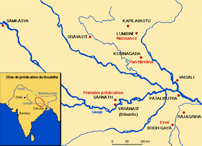
Selon la tradition, Siddhartha Gautama est né à Lumbini (dans l’actuel Népal) en tant que prince de la famille royale de la ville de Kapilavastu, un petit royaume situé dans les contreforts de l’Himalaya, dans l’actuel Népal.
Un astrologue aurait mis en garde le père du garçon, le roi Suddhodana : lorsque l’enfant grandirait, il deviendrait soit un brillant souverain, soit un moine influent, en fonction de sa lecture du monde. Farouchement déterminé à en faire son successeur, le père de Siddhartha ne le laissa donc jamais voir le monde en dehors des murs du palais. Tout en lui offrant tous les plaisirs et distractions possibles, il en fait un prisonnier virtuel jusqu’à l’âge de 29 ans.
Lorsque le jeune homme s’échappe de sa cage dorée, il découvre l’existence de personnes affectées par leur grand âge, la maladie et la mort. Bouleversé par la souffrance des gens ordinaires qu’il rencontre, Siddhartha abandonne les plaisirs éphémères du palais pour rechercher un but plus élevé dans la vie. Il se soumet d’abord à un ascétisme draconien, qu’il abandonne six ans plus tard, estimant qu’il s’agissait d’un exercice futile.
Il s’assoit alors sous un grand figuier pour méditer et y fait l’expérience du nirvana (la bodhi : libération ou, en sanskrit, extinction). On le désigne désormais sous le nom de « Bouddha » (l’éveillé ou l’éclairé).
Les « quatre vérités » et « l’octuple sentier »
Avant d’en esquisser le développement politique, quelques mots sur la philosophie sous-jacente au bouddhisme.
A ses jeunes disciples, Bouddha enseigne la « Voie du milieu », entre les deux extrêmes de la mortification et de la satisfaction des désirs.
Et il énonce les Quatre nobles vérités :
- La noble vérité de la souffrance.
- La noble vérité de l’origine de la souffrance.
- La noble vérité de la cessation de la souffrance.
- La noble vérité de la voie menant à la cessation de la souffrance, celle du Noble Chemin octuple.
Ainsi que le feront Augustin et plus encore les Frères de la Vie commune dans le monde chrétien, le bouddhisme insiste sur le fait que notre attachement à l’existence terrestre implique la souffrance.
Chez les chrétiens, c’est ce qui conduirait au « péché », notion inexistante dans le bouddhisme, pour qui l’errance vient de l’ignorance du bon chemin.
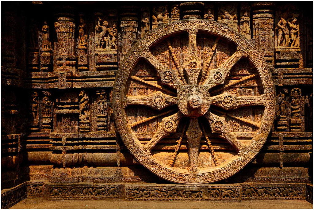
Pour Bouddha, il faut combattre, voire éteindre tout sens démesuré du moi (on dirait ego aujourd’hui). Il est possible de mettre fin à notre souffrance en transcendant ce fort sentiment de « moi », afin d’entrer dans une plus grande harmonie avec les choses en général. Les moyens d’y parvenir sont résumés dans le Noble Chemin octuple, parfois représenté par les huit rayons d’une Roue de la Loi (dharmachakra) que Bouddha mettra en marche, la Loi signifiant ici le dharma, un ensemble de préceptes moraux et philosophiques.
Ces huit points du Noble Chemin octuple sont :
- la vue juste
- la pensée juste
- la parole juste
- l’action juste
- les moyens d’existence justes
- l’effort juste
- la pleine conscience
- la concentration juste
– La vision juste est importante dès le départ, car sans cela, on ne peut pas voir la vérité des quatre nobles vérités.
– La pensée juste en découle naturellement. Le terme « juste » signifie ici « en accord avec les faits », c’est-à-dire avec la façon dont les choses sont (qui peut être différente de la façon dont je voudrais qu’elles soient).
– La pensée juste, la parole juste, l’action juste et les moyens d’existence justes impliquent une retenue morale – s’abstenir de mentir, de voler, de commettre des actes violents et gagner sa vie d’une manière qui ne soit pas préjudiciable aux autres. La retenue morale ne contribue pas seulement à l’harmonie sociale générale, elle nous aide aussi à contrôler et à diminuer le sentiment démesuré du « moi ». Comme un enfant gâté, le « moi » grandit et devient indiscipliné à mesure que nous le laissons agir à sa guise.
– Ensuite, l’effort juste est important parce que le « moi » prospère dans l’oisiveté et le mauvais effort ; certains des plus grands criminels sont les personnes les plus énergiques, donc l’effort doit être approprié à la diminution du « moi » (son ego, dirait-on aujourd’hui). Dans tous les cas, si nous ne sommes pas prêts à faire des efforts, nous ne pouvons pas espérer obtenir quoi que ce soit, ni dans le sens spirituel ni dans la vie. Les deux dernières étapes de la voie, la pleine conscience et la concentration ou absorption, représentent la première étape permettant de nous libérer de la souffrance.
Les ascètes qui avaient écouté le premier discours du Bouddha devinrent le noyau d’un sangha (communauté, mouvement) d’hommes (les femmes devaient entrer plus tard) qui suivaient la voie décrite par le Bouddha dans sa Quatrième noble vérité, celle précisant le Noble Chemin octuple.
Pour rendre le nirvana bouddhiste accessible au citoyen ordinaire, l’imagination bouddhiste a inventé le concept très intéressant de bodhisattva, mot dont le sens varie selon le contexte. Il peut aussi bien désigner l’état dans lequel se trouvait Bouddha lui-même avant son « éveil », qu’un homme ordinaire ayant pris la résolution de devenir un bouddha et ayant reçu d’un bouddha vivant la confirmation ou la prédiction qu’il en serait ainsi.
Dans le bouddhisme theravâda (l’école ancienne), seules quelques personnes choisies peuvent devenir des bodhisattvas, comme Maitreya, présenté comme le « Bouddha à venir ».
Mais dans le bouddhisme mahâyâna (Grand Véhicule), un bodhisattva désigne toute personne qui a généré la bodhicitta, un souhait spontané et un esprit compatissant visant à atteindre l’état de bouddha pour le bien de « tous les êtres sensibles », hommes aussi bien qu’animaux. Etant donné qu’une personne peut, dans une vie future, se réincarner dans un animal, le respect des animaux s’impose.
Réincarnation
Tout en voulant construire sa propre vision sur certains fondements de l’hindouisme, l’une des plus anciennes religions du monde, Siddhartha introduisit néanmoins des changements révolutionnaires aux implications politiques importantes.
Dans la plupart des croyances impliquant la réincarnation (hindouisme, jaïnisme, sikhisme), l’âme humaine est immortelle et ne se disperse pas après la disparition du corps physique. Après la mort, l’âme transmigre simplement (métempsychose) dans un nouveau-né ou un animal pour poursuivre son immortalité. La croyance en la renaissance de l’âme a été exprimée par les penseurs grecs anciens, à commencer par Pythagore, Socrate et Platon.
Le but du bouddhisme est d’apporter un bonheur durable et inconditionnel. Celui de l’hindouisme est de se libérer du cycle de naissance et de renaissance (samsara) pour atteindre, finalement, le moksha, qui en est la libération.
Le bouddhisme et l’hindouisme s’accordent sur le karma, le dharma, le moksha et la réincarnation. Mais ils diffèrent politiquement dans la mesure où le bouddhisme se concentre sur l’effort personnel de chacun et accorde par conséquent une moindre importance aux prêtres et aux rituels formels que l’hindouisme. Enfin, le bouddhisme ne reconnaît pas la notion de caste et prône donc une société plus égalitaire.
Alors que l’hindouisme soutient que l’on ne peut atteindre le nirvana que dans une vie ultérieure, le bouddhisme, plus volontariste et optimiste, soutient qu’une fois qu’on a réalisé que la vie est souffrance, on peut mettre un terme à cette souffrance dans sa vie présente.
Les bouddhistes décrivent leur renaissance comme une bougie vacillante qui vient en allumer une autre, plutôt que comme une âme immortelle ou un « moi » passant d’un corps à un autre, ainsi que le croient les hindous. Pour les bouddhistes, il s’agit d’une renaissance sans « soi », et ils considèrent la réalisation du non-soi ou du vide comme le nirvana (extinction), alors que pour les hindous, l’âme, une fois libérée du cycle des renaissances, ne s’éteint pas, mais s’unit à l’Être suprême et entre dans un éternel état de félicité divine.
Les Aryens et le védisme
L’une des grandes traditions ayant façonné l’hindouisme est la religion védique (védisme), qui s’est épanouie chez les peuples indo-aryens du nord-ouest du sous-continent indien (Pendjab et plaine occidentale du Gange) au cours de la période védique (1500-500 av. J.-C.).
Au cours de cette période, des peuples nomades venus du Caucase et se désignant eux-mêmes comme « Aryens » (« noble », « civilisé » et « honorable ») pénétrèrent en Inde par la frontière nord-ouest.

Le terme « aryen » a une très mauvaise connotation historique, en particulier depuis le XIXe siècle, lorsque plusieurs antisémites virulents, tels qu’Arthur de Gobineau, Richard Wagner et Houston Chamberlain, ont commencé à promouvoir le mythe d’une « race aryenne », soutenant l’idéologie suprémaciste blanche de l’aryanisme qui dépeint la race aryenne comme une « race des seigneurs », les non-aryens étant considérés non seulement comme génétiquement inférieurs (Untermensch, ou sous-homme) mais surtout comme une menace existentielle à exterminer.
D’un point de vue purement scientifique, dans son livre The Arctic Home (1903), le patriote indien Bal Gangadhar Tilak (1856-1920), s’appuyant sur son analyse des observations astronomiques contenues dans les hymnes védiques, émet l’hypothèse selon laquelle le pôle Nord aurait été le lieu de vie originel des Aryens pendant la période préglaciaire, région qu’ils auraient quittée vers 8000 avant J.-C. à cause de changements climatiques, migrant vers les parties septentrionales de l’Europe et de l’Asie. Gandhi disait de Tilak, l’un des pères du mouvement de l’indépendance du pays, qu’il était « l’artisan de l’Inde moderne ».
Les Aryens arrivant du Nord étaient probablement moins barbares qu’on ne l’a suggéré jusqu’à présent. Grâce à leur supériorité militaire et culturelle, ils conquirent toute la plaine du Gange, avant d’étendre leur domination sur les plateaux du Deccan.
Cette conquête a laissé des traces jusqu’à nos jours, puisque les régions occupées par ces envahisseurs parlent des langues indo-européennes issues du sanskrit. (*1)
En réalité, la culture védique est profondément enracinée dans la culture eurasienne des steppes Sintashta (2200-1800 avant notre ère) du sud de l’Oural, dans la culture Andronovo d’Asie centrale (2000-900 avant notre ère), qui s’étend du sud de l’Oural au cours supérieur de l’Ienisseï en Sibérie centrale, et enfin dans la Civilisation de la vallée de l’Indus (Harappa) (4000-1500 avant notre ère).
Cette culture védique se fonde sur les fameux Védas (savoirs), quatre textes religieux consignant la liturgie des rituels et des sacrifices et les plus anciennes écritures de l’hindouisme. La partie la plus ancienne du Rig-Veda a été composée oralement dans le nord-ouest de l’Inde (Pendjab) entre 1500 et 1200 av. JC., c’est-à-dire peu après l’effondrement de la Civilisation de la vallée de l’Indus.
Le philologue, grammairien et érudit sanskrit Panini, qu’on croit être un contemporain de Bouddha, est connu pour son traité de grammaire sanskrite en forme de sutra, qui a suscité de nombreux commentaires de la part d’érudits d’autres religions indiennes, notamment bouddhistes.
Les Brahmanes et le système des castes
Cependant, avec l’émergence de cette culture aryenne apparut ce que l’on appelle le « brahmanisme », c’est-à-dire la naissance d’une caste toute puissante de grands prêtres.
« De nombreuses études linguistiques et historiques font état de troubles socioculturels résultant de cette migration et de la pénétration de la culture brahmanique dans diverses régions, de l’ouest de l’Asie du Sud vers l’Inde du Nord, l’Inde du Sud et l’Asie du Sud-Est », constate aujourd’hui Gajendran Ayyathurai, un anthropologue indien de l’Université de Göttingen en Allemagne.
Le brahman, littéralement « supérieur », est un membre de la caste sacerdotale la plus élevée (à ne pas confondre avec les adorateurs du dieu hindou Brahma). Bien que le terme apparaisse dans les Védas, les chercheurs modernes tempèrent ce fait et soulignent qu’il « n’existe aucune preuve dans le Rig-Veda d’un système de castes élaboré, très subdivisé et très important ».
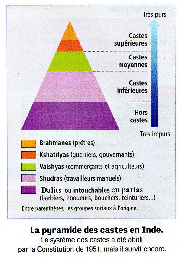
Mais avec l’émergence d’une classe dirigeante de brahmanes, devenus banquiers et propriétaires terriens, notamment sous la période Gupta (de 319 à 515 après J.-C.), un redoutable système de castes se met graduellement en place. La classe dirigeante féodale, ainsi que les prêtres, vivant des recettes des sacrifices, mettront l’accent sur des dieux locaux qu’ils intégreront progressivement au brahmanisme afin de séduire les masses. Même parmi les souverains, le choix des divinités indiquait des positions divergentes : une partie de la dynastie Gupta soutenait traditionnellement le dieu Vishnou, tandis qu’une autre soutenait le dieu Shiva.
Ce système déshumanisant des castes fut ensuite amplifié et utilisé à outrance par la Compagnie britannique des Indes orientales, une entreprise et une armée privée à la tête de l’Empire britannique, pour imposer son pouvoir aristocratique et colonial sur les Indes, une politique qui perdure encore aujourd’hui, surtout dans les esprits.
Le système hindou des castes s’articule autour de deux concepts clés permettant de catégoriser les membres de la société : le varṇa et la jati. Le varna (littéralement « couleur ») divise la société en une hiérarchie de quatre grandes classes sociales :
- Brahmanes (la classe sacerdotale)
- Kshatriyas (guerriers et dirigeants)
- Vaishyas (marchands)
- Shudras (travailleurs manuels)
En outre, la jati fait référence à plus de 3000 classifications hiérarchiques, à l’intérieur des quatre varnas, entre les groupes sociaux en fonction de la profession, du statut social, de l’ascendance commune et de la localité…
La justification de cette stratification sociale est intimement liée à la vision hindouiste du karma. Car la naissance de chacun est directement liée au karma, véritable bilan de sa vie précédente. Ainsi, la naissance dans le varna brahmanique est le résultat d’un bon karma…
« Ceux qui ont eu une bonne conduite ici auront rapidement une bonne naissance – naissance en tant que brahmane, kshatriya ou vaishya. Mais ceux dont la conduite ici a été mauvaise obtiendront rapidement une mauvaise naissance – naissance en tant que chien, porc ou chandala (bandit). »
(Chandogya Upanishad 5.10.7)
Selon cette théorie, le karma détermine la naissance de l’individu dans une classe, ce qui définit son statut social et religieux, qui fixe à son tour ses devoirs et obligations au regard de ce statut spécifique.
En 2021, une enquête a révélé que trois Indiens sur dix (30 %) s’identifient comme membres des quatre varnas et seulement 4,3 % des Indiens (60,5 millions) comme des brahmanes.
Certains d’entre eux sont prêtres, d’autres exercent des professions telles qu’éducateurs, législateurs, érudits, médecins, écrivains, poètes, propriétaires terriens et politiciens. Au fur et à mesure de l’évolution de ce système de castes, les brahmanes ont acquis une forte influence en Inde et ont exercé une discrimination à l’encontre des autres castes « inférieures ».
L’immense partie restante des Indiens (70 %), y compris parmi les hindous, déclare faire partie des dalits, encore appelés intouchables, des individus considérés, du point de vue du système des castes, comme hors castes et affectés à des fonctions ou métiers jugés impurs. Présents en Inde, mais également dans toute l’Asie du Sud, les dalits sont victimes de fortes discriminations. En Inde, une écrasante majorité de bouddhistes se déclarent dalits.
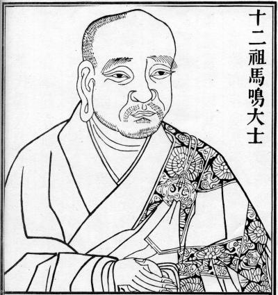
Dès le Ier siècle, le philosophe bouddhiste, dramaturge, poète, musicien et orateur indien Asvaghosa (v. 80 – v. 150 ap. J.-C.) a élevé la voix pour condamner ce système des castes, avec des arguments empruntés pour certains aux textes les plus vénérés des brahmanes eux-mêmes, et pour d’autres, fondés sur le principe de l’égalité naturelle entre tous les hommes.
Selon Asvaghosa,
« la qualité de brahmane n’est inhérente ni au principe qui vit en nous, ni au corps dans lequel réside ce principe, et elle ne résulte ni de la naissance, ni de la science, ni des pratiques religieuses, ni de l’observation des devoirs moraux, ni de la connaissance des Védas. Puisque cette qualité n’est ni inhérente ni acquise, elle n’existe pas, ou plutôt tous les hommes peuvent la posséder. »
Une allégorie bouddhiste rejette clairement et se moque de l’idée même du système de castes:
« De même que le sable ne devient pas de la nourriture simplement parce qu’un enfant le dit, lorsque de jeunes enfants jouant sur une route principale construisent des pâtés de sable et leur donnent des noms, en disant ‘Celui-ci est du lait, celui-ci de la viande et celui-ci du lait caillé’, il en va de même pour les quatre varnas, tels que vous, les brahmanes, les décrivez. »
L’Inde avant le bouddhisme
L’époque du Bouddha est celle de la deuxième urbanisation de l’Inde et d’une grande contestation sociale.
L’essor des shramaṇas, des philosophes ou moines errants ayant rejeté l’autorité des Védas et des brahmanes, était nouveau. Bouddha n’était pas le seul à explorer les moyens d’obtenir la libération (moksha) du cycle éternel des renaissances (saṃsara).
Le constat que les rituels védiques ne menaient pas à une libération éternelle conduisit à la recherche d’autres moyens. Le bouddhisme primitif, le yoga et des courants similaires de l’hindouisme, jaïnisme, ajivika, ajnana et chârvaka, étaient les shramanas les plus importants.
Malgré le succès obtenu en diffusant des idées et des concepts qui allaient bientôt être acceptés par toutes les religions de l’Inde, les écoles orthodoxes de philosophie hindoue (astika) s’opposaient aux écoles de pensée shramaṇiques et réfutèrent leurs doctrines en les qualifiant d’hétérodoxes (nastika), parce qu’elles refusaient d’accepter l’autorité épistémique des Védas.
Pendant plus de quarante ans, le Bouddha sillonna l’Inde à pied pour diffuser son dharma, un ensemble de préceptes et de lois sur le comportement de ses disciples. À sa mort, son corps fut incinéré, comme c’était la coutume en Inde, et ses cendres furent réparties dans plusieurs reliquaires, enterrés dans de grands monticules hémisphériques connus sous le nom de stupas. Alors déjà, sa religion était répandue dans tout le centre de l’Inde et dans de grandes villes indiennes comme Vaishali, Shravasti et Rajagriha.
Les grands conciles bouddhistes
Quatre grands conciles bouddhistes furent organisés, à l’instigation de différents rois qui cherchaient en réalité à briser l’omnipuissante caste des brahmanes.
Le premier eut lieu en 483 avant J.-C., juste après la mort du Bouddha, sous le patronage du roi Ajatasatru (492-460 av. J.-C.) du Royaume du Magadha, le plus grand des seize royaumes de l’Inde ancienne, afin de préserver les enseignements du Bouddha et de parvenir à un consensus sur la manière de les diffuser.
Le deuxième intervint en 383 avant J.-C., soit cent ans après la mort du Bouddha, sous le règne du roi Kalashoka. Des divergences d’interprétation s’installant sur des points de discipline au fur et à mesure que les adeptes s’éloignaient les uns des autres, un schisme menaçait de diviser ceux qui voulaient préserver l’esprit originel et ceux qui défendaient une interprétation plus large.
Le premier groupe, appelé Thera (signifiant « ancien » en pâli), est à l’origine du bouddhisme theravâda, engagé à préserver les enseignements du Bouddha dans l’esprit originel.
L’autre groupe était appelé Mahasanghika (Grande Communauté). Ils interprétaient les enseignements du Bouddha de manière plus libérale et nous ont donné le bouddhisme Mahâyâna.
Les participants au concile tentèrent d’aplanir leurs divergences, sans grande unité mais sans animosité non plus. L’une des principales difficultés venait du fait qu’avant d’être consignés dans des textes, les enseignements du Bouddha n’avaient été transmis qu’oralement pendant trois à quatre siècles. (*2)
L’arrivée des Grecs
Ainsi que nous l’avons documenté par ailleurs, l’Asie centrale, et l’Afghanistan en particulier, furent le lieu de rencontre entre les civilisations perses, chinoises, grecques et indiennes.
C’est au Gandhara, région à cheval entre le Pakistan et l’Afghanistan, au cœur des Routes de la soie, que le bouddhisme prendra à deux reprises un envol majeur, donnant naissance à un art dit « gréco-bouddhiste », qui parviendra à faire la synthèse entre plusieurs cultures à travers des œuvres d’une beauté incomparable.
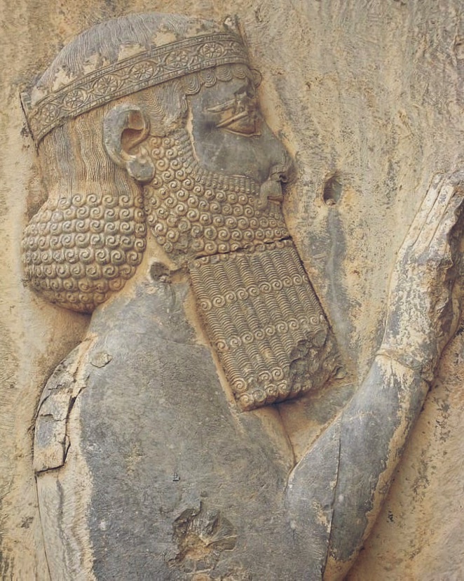
Les premiers Grecs commencèrent à s’installer dans la partie nord-ouest du sous-continent indien à l’époque de l’Empire perse achéménide. Après avoir conquis la région, le roi perse Darius le Grand (521 – 486 av. J.-C.) colonisa également une grande partie du monde grec, qui comprenait à l’époque toute la péninsule anatolienne occidentale.
Lorsque des villages grecs se rebellaient sous le joug perse, ils faisaient parfois l’objet d’un nettoyage ethnique et leurs populations étaient déportées à l’autre bout de l’empire.
C’est ainsi que de nombreuses communautés grecques virent le jour dans les régions indiennes les plus reculées de l’empire perse.
Au IVe siècle avant J.-C., Alexandre le Grand (356 – 323 av. J.-C.) vainquit et conquit l’empire perse. En 326 avant J.-C., cet empire comprenait la partie nord-ouest du sous-continent indien jusqu’à la rivière Beas (que les Grecs nommaient l’Hyphase). Alexandre établit des satrapies et fonde plusieurs colonies. Il se tourne vers le sud lorsque ses troupes, conscientes de l’immensité de l’Inde, refusent de pousser plus loin encore vers l’est.
Après sa mort, son empire se délite. De 180 av. J.-C. à environ l’an 10 de notre ère, plus de trente rois hellénistiques se succèdent, souvent en conflit entre eux. Cette époque est connue dans l’histoire sous le nom des « Royaumes indo-grecs ».
L’un d’eux a été fondé lorsque le roi gréco-bactrien Démétrius envahit l’Inde en 180 avant notre ère, créant ainsi une entité faisant sécession avec le puissant royaume gréco-bactrien, la Bactriane (comprenant notamment le nord de l’Afghanistan, une partie de l’Ouzbékistan, etc.).
Pendant les deux siècles de leur règne, ces rois indo-grecs intégrèrent dans une seule culture des langues et des symboles grecs et indiens, comme en témoignent leurs pièces de monnaie, et mêlèrent les anciennes pratiques religieuses grecques, hindoues et bouddhistes, comme le montrent les vestiges archéologiques de leurs villes et les signes de leur soutien au bouddhisme.
L’Empire Maurya
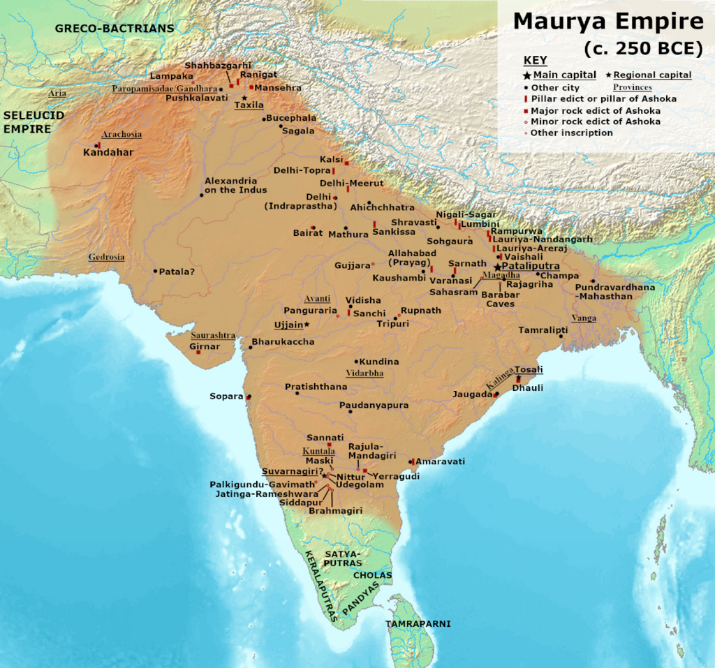
Vers 322 avant J.-C., les Grecs appelés Yona (Ioniens) ou Yavana dans les sources indiennes, participent, avec d’autres populations, au soulèvement de Chandragupta Maurya (né v. -340 et mort v. – 297), le fondateur de l’Empire maurya.
Le règne de Chandragupta ouvre une ère de prospérité économique, de réformes, d’expansion des infrastructures et de tolérance. De nombreuses religions ont ainsi prospéré dans son royaume et dans l’empire de ses descendants. Bouddhisme, jaïnisme et ajivika prennent de l’importance aux côtés des traditions védiques et brahmaniques, tout en respectant les religions minoritaires telles que le zoroastrisme et le panthéon grec.
Le règne d’Ashoka le Grand
(de 268 à 231 av. JC)
L’Empire Maurya atteint son apogée sous le règne du petit-fils de Chandragupta, Ashoka le Grand, de 268 à 231 av. J.-C. (parfois écrit Asoka).
Huit ans après sa prise de pouvoir, Ashoka mène une campagne militaire pour conquérir le Kalinga, un vaste royaume côtier du centre-est de l’Inde. Sa victoire lui permet de conquérir un territoire plus vaste que celui de tous ses prédécesseurs. Grâce aux conquêtes d’Ashoka, l’Empire Maurya devient une puissance centralisée couvrant une grande partie du sous-continent indien, s’étendant de l’actuel Afghanistan à l’ouest à l’actuel Bangladesh à l’est, avec sa capitale à Pataliputra (proche de l’actuelle Patna en Inde).
Alors que l’Empire Maurya avait existé dans un certain désordre jusqu’en 185 av. J.-C., Ashoka va transformer le royaume en recourant à une violence extrême qui caractérise le début de son règne. On parle de 100 000 à 300 000 morts, rien que lors de la conquête du Kalinga !
Mais le poids d’un tel carnage plonge le roi dans une grave crise personnelle. Ashoka est gravement choqué par la multitude de vies arrachées par ses armées. L’édit N° 13 d’Ashoka reflète le profond remords ressenti par le roi après avoir observé la destruction de Kalinga :
« Sa Majesté a éprouvé des remords à cause de la conquête de Kalinga car, lors de l’assujettissement d’un pays non conquis auparavant, il y a nécessairement des massacres, des morts et des captifs, et Sa Majesté en éprouve une profonde tristesse et un grand regret. »
Ashoka renonce alors aux démonstrations de force militaires et autres formes de violence, y compris la cruauté envers les animaux. Conquis par le bouddhisme, il se consacre alors à répandre sa vision du dharma, une conduite juste et morale. Il va encourager la diffusion du bouddhisme dans toute l’Inde. Selon l’archéologue et érudit français François Foucher, même si les cas de mauvais traitements envers les animaux ne disparurent pas du jour au lendemain, la croyance en la fraternité de tous les êtres vivants est plus florissante en Inde que partout ailleurs.
En 250 avant J.-C., Ashoka convoque le troisième concile bouddhique. Les sources theravâda mentionnent qu’en plus de régler les différends intérieurs, la principale fonction du concile était de planifier l’envoi de missionnaires bouddhistes dans différents pays afin d’y répandre la doctrine.
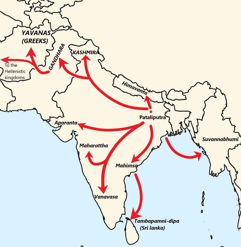
Ces missionnaires allèrent jusqu’aux royaumes hellénistiques de l’ouest, en commençant par la Bactriane voisine. Des missionnaires furent également envoyés en Inde du sud, au Sri Lanka et en Asie du Sud-Est (peut-être en Birmanie).
La forte implication de ces missions dans l’éclosion du bouddhisme en Asie à l’époque d’Ashoka est solidement étayée par des preuves archéologiques. Le bouddhisme ne s’est pas répandu par pur hasard, mais dans le cadre d’une opération politique créative, stimulante et bien planifiée, tout au long des Routes de la soie.
Le Mahavamsa ou Grande chronique (XII, 1er paragraphe), relatant l’histoire des rois cinghalais et tamouls de Ceylan (aujourd’hui Sri Lanka), donne la liste des missionnaires bouddhistes envoyés par le Concile et Ashoka :
- Le vieux Majjhantika prit la tête de la mission au Cachemire et au Gandhara (aujourd’hui le nord-ouest du Pakistan et l’Afghanistan) ;
- L’aîné Mahadeva dirigea la mission dans le sud-ouest de l’Inde (Mysore, Karnataka) ;
- Rakkhita, celle du sud-est de l’Inde (Tamil Nadu) ;
- Le vieux Yona (Ionien, Grec) Dharmaraksita partit vers Aparantaka (« frontière occidentale », comprenant le nord du Gujarat, le Kathiawar, le Kachch et le Sindh, toutes des parties de l’Inde à l’époque) ;
- L’aîné Mahadharmaraksita dirigea la mission de Maharattha (région péninsulaire occidentale de l’Inde) ;
- Maharakkhita (Maharaksita Thera) fut envoyé au pays des Yona (Ioniens), probablement la Bactriane et peut-être le royaume séleucide ;
- Majjhima Thera conduisit la mission dans la région d’Himavant (nord du Népal, contreforts de l’Himalaya) ;
- Sona Thera et Uttara Thera, celles de Suvannabhumi (quelque part en Asie du Sud-Est, peut-être au Myanmar ou en Thaïlande) ;
- Enfin, Mahinda, fils aîné d’Ashoka et donc le Prince de son royaume, accompagné de ses disciples Utthiya, Ittiya, Sambala et Bhaddasala, se rendit à Lankadipa (Sri Lanka).
Certaines de ces missions furent couronnées de succès, permettant d’implanter le bouddhisme en Afghanistan, au Gandhara et au Sri Lanka, par exemple.
Le bouddhisme gandharien, le gréco-bouddhisme et le bouddhisme cinghalais ont puissamment inspiré le développement du bouddhisme dans le reste de l’Asie, notamment en Chine, et ceci pendant des générations.
Si les missions dans les royaumes hellénistiques méditerranéens semblent avoir été moins fructueuses, il est possible que des communautés bouddhistes se soient établies pendant une période limitée dans l’Alexandrie égyptienne, ce qui pourrait être à l’origine de la secte dite des Therapeutae, mentionnée dans certaines sources anciennes comme Philon d’Alexandrie (v. 20 av. J.-C. – 50 apr. J.-C.).
Le courant juif des Esséniens et les Thérapeutes d’Alexandrie seraient des communautés fondées sur le modèle du monachisme bouddhique. « C’est l’Inde qui serait, selon nous, au départ de ce vaste courant monastique qui brilla d’un vif éclat durant environ trois siècles dans le judaïsme même », affirme l’historien français André Dupont-Sommer, et cette influence aurait même contribué, selon lui, à l’émergence du christianisme.
Edits d’Ashoka

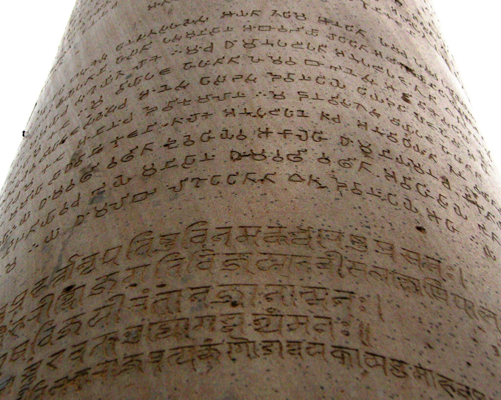
Ashoka transmettait ses messages par le biais d’édits gravés sur des piliers et des rochers en divers lieux du royaume, proches des stupas, sur des lieux de pèlerinage et le long de routes commerciales très fréquentées.
Une trentaine d’entre eux ont été conservés. Ils sont souvent rédigés non pas en sanskrit, mais en grec (la langue du royaume gréco-bactrien voisin et des communautés grecques du royaume d’Ashoka), en araméen (langue officielle de l’ancien empire achéménide) ou en divers dialectes du prâkrit (une langue indo-aryenne moyenne), y compris le gândhârî ancien, langue parlée au Gandhara. (*3)
Ces édits utilisaient la langue pertinente pour la région. Par exemple, en Bactriane, ou les Grecs dominaient, on trouve près de l’actuelle Kandahar un édit rédigé uniquement en grec et en araméen.
Contenu des édits
Certains d’entre eux reflètent l’adhésion profonde d’Ashoka aux préceptes du bouddhisme et ses relations étroites avec le Sangha, l’ordre monastique bouddhiste. Il utilise également le terme spécifiquement bouddhiste de dharma pour désigner les qualités du cœur qui sous-tendent l’action morale.
Dans son édit mineur sur rocher N° 1, le roi se déclare « adepte laïc de l’enseignement du Bouddha depuis plus de deux ans et demi », mais avoue que jusqu’ici, il n’a « pas fait grand progrès ». « Depuis un peu plus d’un an, je me suis rapproché de l’Ordre », ajoute-t-il.
Dans l’édit mineur sur rocher N° 3 de Calcutta-Bairat, il affirme : « Tout ce qui a été dit par le Bouddha a été bien dit », décrivant les enseignements du Bouddha comme le véritable dharma.
Ashoka a reconnu les liens étroits entre l’individu, la société, le roi et l’État. Son dharma peut être compris comme la moralité, la bonté ou la vertu, et l’impératif de le poursuivre lui a donné le sens du devoir. Les inscriptions expliquent que le dharma intègre la maîtrise de soi, la pureté de la pensée, la libéralité, la gratitude, la dévotion ferme, la véracité, la protection de la parole et la modération dans les dépenses et les possessions.
Le dharma a également un aspect social. Il comprend l’obéissance aux parents, le respect des aînés, la courtoisie et la libéralité envers les adorateurs de Brahma, la courtoisie envers les esclaves et les serviteurs, et la libéralité envers les amis, les connaissances et les parents.
La non-violence, qui consiste à s’abstenir de blesser ou de tuer tout être vivant, était un aspect important du dharma d’Ashoka. Ne tuer aucun être vivant est décrit comme faisant partie du bien (Édit mineur sur rocher N° 11), de même que la douceur à leur égard (Édit mineur sur rocher N° 9). L’accent mis sur la non-violence s’accompagne de l’incitation à une attitude positive d’attention, de douceur et de compassion.
Ashoka adopte et préconise une politique fondée sur le respect et la tolérance des autres religions. L’un de ses édits préconise :
« Tous les hommes sont mes enfants. A mes enfants, je souhaite prospérité et bonheur dans ce monde et dans l’autre ; mes vœux sont les mêmes pour tous les hommes. »
Loin d’être sectaire, Ashoka, s’appuyant sur la conviction que toutes les religions partagent une essence commune et positive, encourage la tolérance et la compréhension des autres religions :
« Le bien-aimé des dieux, le roi Piyadassi (c’est-à-dire Ashoka), souhaite que toutes les sectes puissent habiter en tous lieux, car toutes recherchent la maîtrise de soi et la pureté de l’esprit. » (Édit majeur sur rocher N° 7)
Et il précise :
« Car quiconque loue sa propre secte ou blâme les autres sectes, –par pure dévotion à sa propre secte, dans le simple but de la glorifier, – en agissant ainsi, il porte au contraire gravement préjudice à sa propre secte. Mais la concorde est méritoire, (c’est-à-dire) que tous doivent écouter et obéir à la morale de l’autre. » (Édit majeur sur rocher N° 12)
Ashoka avait l’idée d’un empire politique et d’un empire moral, le second englobant le premier. Sa conception de sa circonscription s’étendait au-delà de ses sujets politiques pour inclure tous les êtres vivants, humains et animaux, vivant à l’intérieur comme à l’extérieur de son domaine politique. Ses inscriptions expriment sa conception paternelle de la royauté et décrivent ses mesures d’aide sociale, notamment la fourniture de traitements médicaux, la plantation d’herbes, d’arbres et de racines pour les hommes et les animaux, et le creusement de puits le long des routes (Edit majeur sur rocher N°2). Les efforts du roi pour propager son dharma ne se limitaient pas à son propre domaine politique, mais s’étendaient aux royaumes des autres souverains.
L’empereur est devenu un sage. Il dirige un gouvernement centralisé depuis Pataliputra, capitale de l’Empire Maurya. Son administration perçoit des impôts et il demande à ses inspecteurs de lui rendre des comptes. L’agriculture se développe grâce à des canaux d’irrigation. Il fait construire des routes de qualité pour relier les points stratégiques et les centres politiques, exigeant, des siècles avant notre grand Sully en France, qu’elles soient bordées d’arbres d’ombrage, de puits et d’auberges.
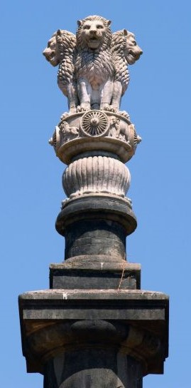
Si l’existence même d’Ashoka en tant que personnage historique a été quasiment oubliée, depuis le déchiffrement de sources écrites en brahmi au XIXe siècle, il est désormais considéré comme l’un des plus grands empereurs indiens. La roue bouddhiste d’Ashoka figure d’ailleurs sur le drapeau indien.
Comme nous l’avons déjà dit, Ashoka et ses descendants ont utilisé leur pouvoir pour construire des monastères et répandre l’influence bouddhiste en Afghanistan, dans de vastes régions de l’Asie centrale, au Sri Lanka et, au-delà, en Thaïlande, Birmanie, Indonésie, puis en Chine, en Corée et au Japon.
Des statues en bronze de son époque ont été déterrées dans les jungles d’Annam, de Bornéo et des Célèbes. La culture bouddhiste s’est implantée dans l’ensemble de l’Asie du Sud-Est, même si chaque région a su conserver une partie de sa personnalité et de son caractère propres.
L’Empire Kouchan
(du Ier siècle av. JC au IIIe siècle)
L’Empire Maurya, qui régnait sur la Bactriane et d’autres anciennes satrapies grecques, s’effondra en 185 avant J.-C., à peine cinq décennies après la mort d’Ashoka, accusé d’avoir trop dépensé pour les temples et les missions bouddhistes. Les mafias brahmaniques, qui avaient abhorré son règne, revinrent immédiatement au pouvoir.
Mais la période est turbulente. Au premier siècle avant J.C., les Kouchans, l’une des cinq branches de la confédération nomade chinoise Yuezhi, émigrent du nord-ouest de la Chine (Xinjiang et Gansu) et s’emparent, après les nomades iraniens Saka, de l’ancienne Bactriane.
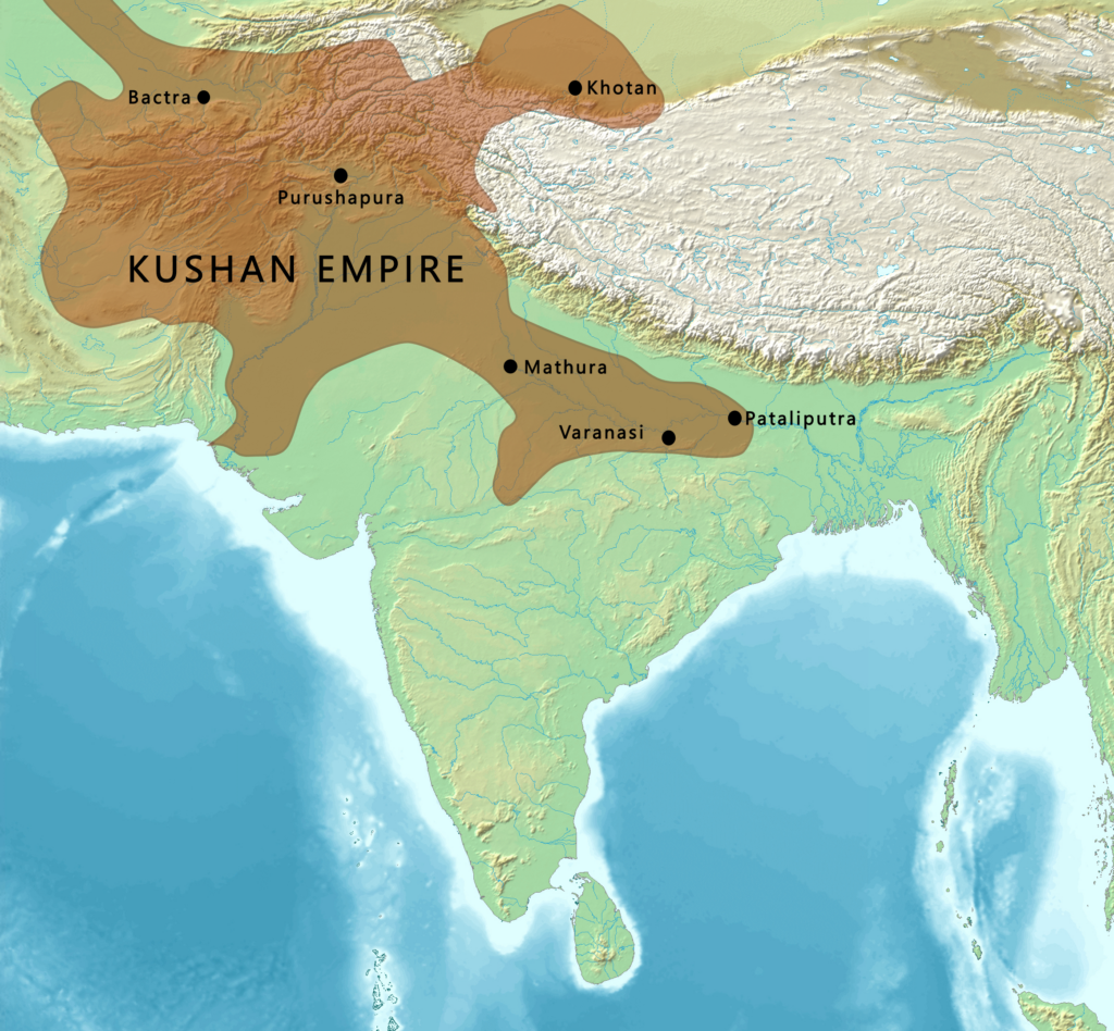
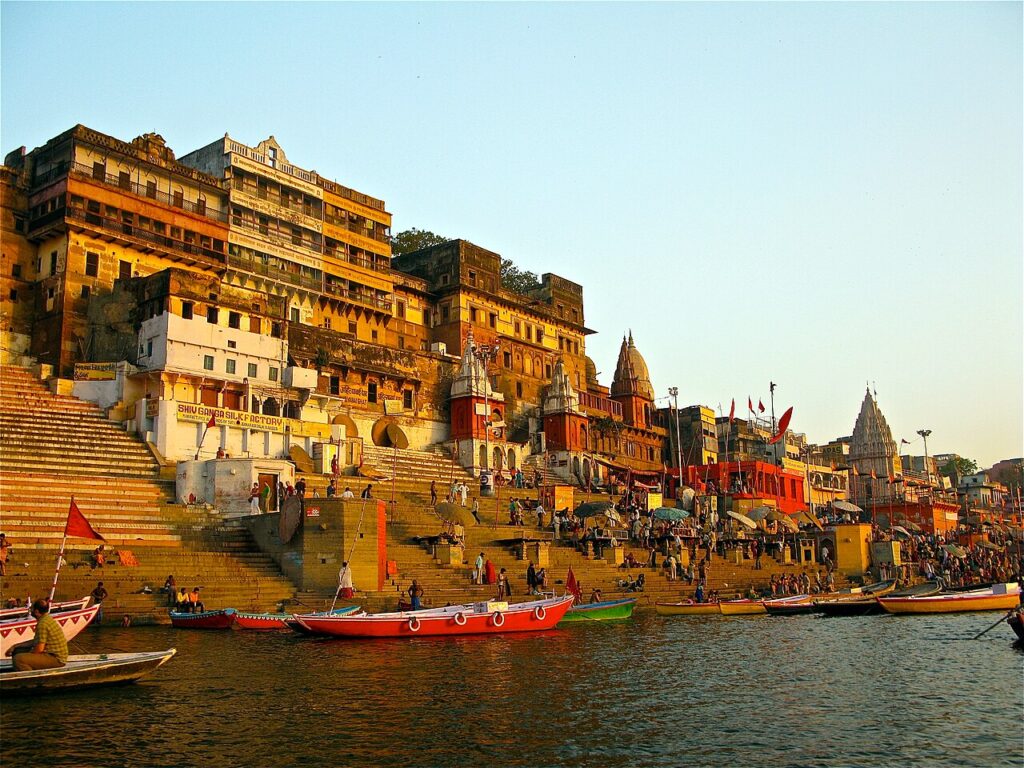
Ils forment l’Empire kouchan dans les territoires de la Bactriane. Cet empire s’étend assez vite à une grande partie de ce qui est aujourd’hui l’Ouzbékistan, l’Afghanistan, le Pakistan et le nord de l’Inde, au moins jusqu’à Saketa et Sarnath, près de la ville de Varanasi (Bénarès).
Le fondateur de la dynastie kouchane, Kujula Kadphisès, qui suit les idées culturelles et l’iconographie grecques après la tradition gréco-bactrienne, est un adepte de la secte shivaïte de l’hindouisme. Deux rois kouchans ultérieurs, Vima Kadphisès et Vasudeva II, furent également des mécènes de l’hindouisme et du bouddhisme. La patrie de leur empire se trouvait en Bactriane, où le grec était initialement la langue administrative, avant d’être remplacé par le bactrien écrit en caractères grecs jusqu’au VIIIe siècle, lorsque l’islam le remplace par l’arabe.
Les Kouchans devinrent également de grands mécènes du bouddhisme, en particulier l’empereur Kanishka le Grand (78-144 après J.-C.), qui joua un rôle important dans sa diffusion, via les Routes de la soie, vers l’Asie centrale et la Chine, inaugurant une période de paix relative de 200 ans, parfois décrite comme la « Pax Kouchana ».
Il semble également que dès ses débuts, le bouddhisme ait prospéré dans la classe des marchands, à qui la naissance interdisait l’accès aux ordres religieux de l’Inde et de l’Himalaya. La pensée et l’art bouddhistes se développèrent grâce aux routes commerciales entre l’Inde, l’Himalaya, l’Asie centrale, la Chine, la Perse, l’Asie du Sud-Est et l’Occident. Les voyageurs recherchaient la protection des images bouddhistes et faisaient des offrandes aux sanctuaires le long de la route, ramassant des objets et des sanctuaires portables pour leur usage personnel.
Le terme quatrième concile bouddhiste désigne deux évènements différents selon les écoles theravâda et mahâyâna.
1) La tradition theravâda : afin d’éviter que ne se perde l’enseignement du Bouddha, qui se serait jusqu’alors transmis oralement, cinq cents moines menés par le Vénérable Maharakkhita se réunirent à Tambapanni (Sri Lanka), sous le patronage du roi Vattagamani (r. 103 – 77 av. J.-C.) afin de coucher par écrit sur des feuilles de palme le Canon pâli. (*4)
Le travail, qui aurait duré trois ans, se serait déroulé dans la grotte Aloka lena, près de l’actuel Matale.
2) Selon la tradition mahâyâna, c’est 400 ans après l’extinction du Bouddha que cinq cents moines sarvastivadin se réunirent en 72 après J.-C. au Cachemire pour compiler et clarifier leurs doctrines sous la direction de Vasumitra et sous le patronage personnel de l’empereur Kanishka. Ils auraient ainsi produit le Mahavibhasa (Grande exégèse) en sanskrit.
Selon plusieurs sources, le moine bouddhiste indien Asvaghosa, considéré comme le premier dramaturge classique sanskrit et dont nous avons évoqué plus haut les attaques contre le système des castes, était le conseiller spirituel du roi Kanishka dans les dernières années de sa vie.
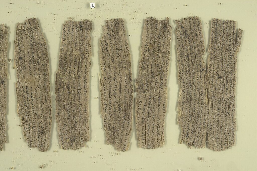
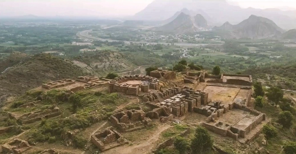
A noter que les plus anciens manuscrits bouddhiques découverts à ce jour, tels que les vingt-sept rouleaux d’écorce de bouleau acquis par la British Library en 1994 et datant du Ier siècle, ont été trouvés, non pas en Inde, mais enterrés dans les anciens monastères du Gandhara, la région centrale de l’empire maurya et kouchan, qui comprend les vallées de Peshawar et de Swat (Pakistan) et s’étend vers l’ouest jusqu’à la vallée de Kaboul en Afghanistan et vers le nord jusqu’à la chaîne du Karakoram
Ainsi, après le grand élan donné par le roi Ashoka le Grand, la culture du Gandhara connaîtra un second souffle sous le règne du roi kouchan Kanishka Ier.
Les villes de Begram, Taxila, Purushapura (aujourd’hui Peshawar) et Surkh Kotal atteignent alors des sommets de développement et de prospérité.
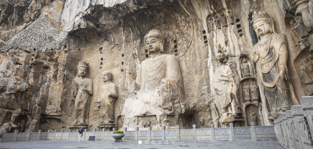
Le miracle de Gandhara
C’est peu dire que le Gandhara, surtout à l’époque kouchane, fut au cœur d’une véritable renaissance de la civilisation, avec une incroyable concentration de productions artistiques et une inventivité sans pareil. Si l’art bouddhiste était principalement centré sur les temples et les monastères, les objets de dévotion personnelle étaient très courants.
Grâce à l’art du Gandhara, le bouddhisme se mua en une grande force de beauté, d’harmonie et de paix, conquérant le monde.
Il favorisa alors une création artistique qui élève la pensée et la moralité en faisant appel à des paradoxes métaphoriques.
Les médiums et supports qui prévalent sont la peinture sur soie, les fresques, les livres illustrés et gravures, la broderie et autres arts du tissu, la sculpture (bois, métal, ivoire, pierre, jade) et l’architecture. Quelques exemples :
A. La poésie
Pour la plupart des Occidentaux, le bouddhisme est une émanation typique de la culture asiatique, généralement associée à l’Inde, au Tibet, au Népal, mais aussi à la Chine et à l’Indonésie.
Peu de gens savent que les plus anciens manuscrits bouddhistes connus à ce jour (Ier siècle de notre ère) ont été découverts, non pas en Asie, mais en Asie centrale, dans d’anciens monastères bouddhistes du Gandhara.
A l’origine, avant leur transcription en sanskrit (pendant longtemps la langue des élites), ils étaient écrits en gândhârî, une langue indo-aryenne du groupe prâkrit, transcrit avec l’alphabet kharosthi (une ancienne écriture indo-iranienne). Le gândhârî était la lingua franca de la pensée bouddhiste à ses débuts. Preuve en est, les manuscrits bouddhistes écrits en gândhârî qui ont voyagé jusqu’en Chine orientale pour se retrouver dans les inscriptions de Luoyang et d’Anyang.
Afin de préserver leurs écrits, les bouddhistes étaient à l’avant-garde de l’adoption des technologies chinoises liées à la fabrication de livres, notamment le papier et la xylographie. Cette technique d’impression consiste à reproduire le texte à imprimer sur une feuille de papier transparente qui est retournée et gravée sur une planche de bois tendre. L’encrage des parties saillantes permet ensuite des tirages multiples. C’est ce qui explique que le premier livre entièrement imprimé est le Sutra du diamant bouddhique (vers 868) réalisé par ce procédé
Le Khaggavisana Sutta, littéralement « la corne du rhinocéros », est une expression authentique de la poésie religieuse bouddhiste originale. Connu sous le nom de Sutra du rhinocéros, cette œuvre poétique fait partie du recueil pâli de textes courts Kuddhhaka Nikava, la cinquième partie du Sutta Pitaka, écrit au Ier siècle de notre ère.
Parce que la tradition accorde au rhinocéros asiatique une vie solitaire dans la forêt, l’animal n’aime pas les troupeaux, ce sutra (enseignement) porte le titre approprié d’essai « sur la valeur de la vie solitaire et errante ». L’allégorie du rhinocéros permet de communiquer aux dévots un sens aigu de la souveraineté individuelle que requièrent les engagements moraux prescrits par le Bouddha pour mettre fin à la souffrance en se déconnectant des plaisirs et des douleurs terrestres.

Extrait :
Refuser la violence à l’égard de tous les êtres,
ne jamais faire de mal à un seul d’entre eux,
aider avec compassion et un cœur aimant ;
erre seul comme un rhinocéros.
Celui qui tient compagnie nourrit l’affection
et de l’affection naît la souffrance.
Réalisant le danger qui découle de l’affection,
erre seul comme un rhinocéros.
En sympathisant avec les amis et les compagnons,
l’esprit se fixe sur eux et perd son chemin.
Percevoir ce danger, c’est la familiarité,
erre seul comme un rhinocéros.
Les préoccupations que l’on a pour ses fils et ses femmes
sont comme une pensée et un bambou enchevêtré.
Reste démêlé comme un jeune bambou,
erre seul comme un rhinocéros.
Comme un cerf qui erre librement dans la forêt,
va où il veut en broutant,
un homme sage, qui chérit sa liberté,
erre seul comme le rhinocéros.
Laissez derrière vous vos fils, vos femmes et votre argent,
tous vos biens, vos parents et vos amis.
Abandonnez tous vos désirs, quels qu’ils soient,
erre seul comme le rhinocéros. (…)
B. La littérature
Deux autres chefs-d’œuvre tirés du même recueil sont d’une part les célèbres Jataka (Récits des vies antérieures du Bouddha), et d’autre part, le Milindapanha (Les questions du roi Milinda).
Les Jataka, qui mettent en scène de nombreux animaux, montrent comment, avant la dernière incarnation humaine au cours de laquelle il atteignit le nirvana, le Bouddha lui-même s’était réincarné d’innombrables fois en animal (en diverses sortes de poissons, en crabe, coq, pivert, perdrix, francolin, caille, oie, pigeon, corbeau, zèbre, buffle, plusieurs fois en singe ou en éléphant, en antilope, cerf et cheval).
Et puisque c’est Bouddha qui est incarné dans cet animal, celui-ci a soudainement des propos d’une grande sagesse.
Mais en d’autres occasions, ce sont des personnages qui sont des animaux alors que notre Bodhisattva apparaît sous forme humaine. Ces contes sont souvent pimentés d’un humour piquant. On sait d’ailleurs qu’elles ont inspiré La Fontaine, qui a dû les entendre du docteur François Bernier, qui les avait lui-même apprises alors qu’il était médecin en Inde pendant huit ans.
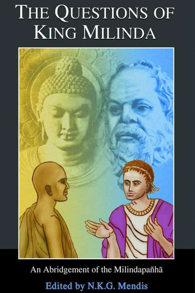
Les questions du roi Milinda est un compte-rendu imagé, véritable dialogue platonicien entre le roi grec de Bactriane, Milinda (le Grec, Ménandre), qui régnait au Pendjab, et le sage bouddhiste Bhante Nagasena. Leur dialogue animé, dramatique et spirituel, éloquent et inspiré, explore les divers problèmes de la pensée et de la pratique bouddhistes du point de vue d’un intellectuel grec perspicace, à la fois perplexe et fasciné par la religion étrangement rationnelle qu’il découvre sur le sous-continent indien.
Par le biais de paradoxes, Nagasena amène le « rationaliste » grec à s’élever jusqu’à la dimension spirituelle, au-delà de la logique et de la simple rationalité. Car le nirvana, tout comme l’espace, n’a « pas de cause » formelle et, bien qu’il peut se produire, « ne peut pas être causé ». Mince, comment faire alors pour y aboutir ?
Et à l’un de ses disciples qui un jour lui posa la question de savoir si l’univers était fini ou infini, éternel ou non, si l’âme était distincte du corps, ce que devenait l’homme après la mort, le Bouddha répondit par une parabole :
« Supposons qu’un homme soit gravement atteint d’une flèche, que l’on l’amène chez un médecin, et que l’homme dise : “Je ne laisserai pas retirer cette flèche, avant de savoir qui m’a blessé, de quel caste il est, de quel village il est né, de quel arc il s’est servi, de quelle matière a été faite la flèche, de quelle direction elle a été tirée…” Alors cet homme mourrait certainement avant d’avoir les réponses. »
C. Urbanisme
Taxila ou Takshashila (aujourd’hui au Pendjab), l’un des grands centres urbains et, pendant un certain temps, la capitale du Gandhara, fut fondée vers 1000 avant J.-C. sur les ruines d’une cité datant de la période Harappa et située sur la rive orientale de l’Indus, point de jonction entre le sous-continent indien et l’Asie centrale.
Certaines ruines de Taxila datent de l’époque de l’empire perse achéménide, suivi successivement par l’Empire Maurya, le royaume indo-grec, les Indo-Scythes et l’empire kouchan.
D’après certains témoignages, l’université de l’ancienne Taxila (des siècles avant l’université bouddhiste résidentielle de Nalanda fondée en 427 après J.-C.) peut être considérée comme l’un des premiers centres d’enseignement d’Asie du Sud. Dès 800 av. J.-C., la ville fonctionnait en grande partie comme une université, offrant des études supérieures. Avant d’y être admis, les étudiants devaient avoir terminé ailleurs leurs études primaires et secondaires. L’âge minimum requis était de seize ans. Non seulement les Indiens, mais aussi les étudiants de contrées voisines comme la Chine, la Grèce et l’Arabie affluaient dans cette ville d’apprentissage.
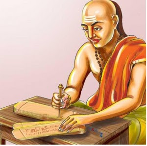
Vers 321 avant J.-C., c’est le grand philosophe, enseignant et économiste du Gandhara, Chanakya (375 à 283 av. J.-C.) qui aida le premier empereur maurya, Chandragupta, à accéder au pouvoir.
Sous la tutelle de Chanakya, Chandragupta avait reçu une éducation complète à Taxila, englobant les différents arts de l’époque, y compris l’art de la guerre, pendant sept à huit ans.
En 303 avant J.-C., Taxila tomba entre leurs mains et sous Ashoka le Grand, le petit-fils de Chandragupta, la ville devint un grand centre de l’enseignement et de l’art bouddhiste.
Chanakya, dont les écrits n’ont été redécouverts qu’au début du XXe siècle et qui fut le principal conseiller des deux empereurs Chandragupta et de son fils Bindusara, est considéré comme ayant joué un rôle majeur dans l’établissement de l’Empire Maurya.
Également connu sous les noms de Kauṭilya et Vishnugupta, Chanakya est l’auteur de l’Arthashastra, un traité politique sanskrit sur l’art de gouverner, la science politique, la politique économique et la stratégie militaire. L’Arthashastra aborde également la question d’une éthique collective assurant la cohésion de la société.
Il conseille au roi de lancer de grands projets de travaux publics dans les régions dévastées par la famine, les épidémies et autres catastrophes naturelles, ou par la guerre, tels que la création de voies d’irrigation et la construction de forts autour des principaux centres de production et villes stratégiques, et d’exonérer d’impôts les personnes touchées par ces catastrophes.
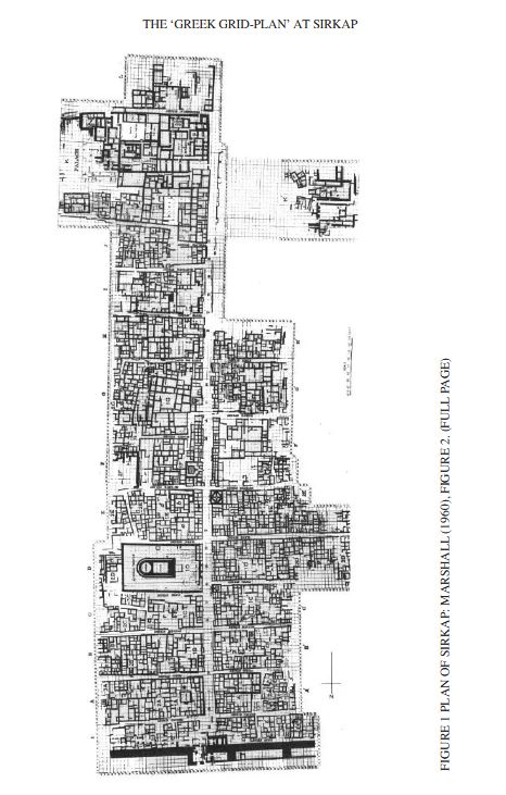
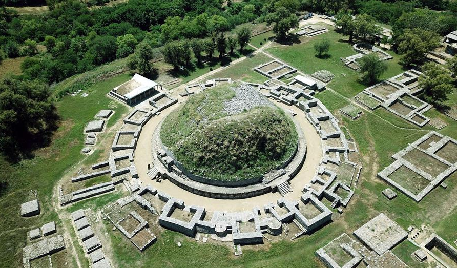
Au IIe siècle avant notre ère, Taxila fut annexée par le royaume indo-grec de Bactriane qui y érigea une nouvelle capitale nommée Sirkap, où des temples bouddhistes côtoyaient des temples hindous et grecs, signe de tolérance religieuse et de syncrétisme. Sirkap fut construite selon le plan quadrillé hippodamien (*5) caractéristique des villes grecques
Elle s’organise autour d’une avenue principale et de quinze rues perpendiculaires, couvrant une surface d’environ 1200 mètres sur 400, avec un mur d’enceinte de 5 à 7 mètres de large et de 4,8 kilomètres de long.
Après sa construction par les Grecs, la ville fut reconstruite lors des incursions des Indo-Scythes, puis par les Indo-Parthiens, après un tremblement de terre en l’an 30 de notre ère.
Certaines parties de la ville, notamment le stupa (reliquaire) bouddhiste de l’aigle bicéphale et le temple du dieu Soleil, furent construites par Gondophares, le premier roi du royaume indo-parthien. Enfin, des inscriptions datant de l’an 76 de notre ère démontrent que la ville était déjà passée sous la domination des Kouchans. Le souverain kouchan Kanishka érigera Sirsukh, à environ 1,5 km au nord-est de l’ancienne Taxila.
Des sutras bouddhistes de la région du Gandhara sont étudiés en Chine dès 147 de notre ère, lorsque le moine kouchan Lokakṣema (né en 147) commença à traduire en chinois certains des premiers sutras bouddhistes. Les plus anciennes de ces traductions montrent qu’elles ont été faites à partir de la langue
D. Architecture, l’invention des stupas
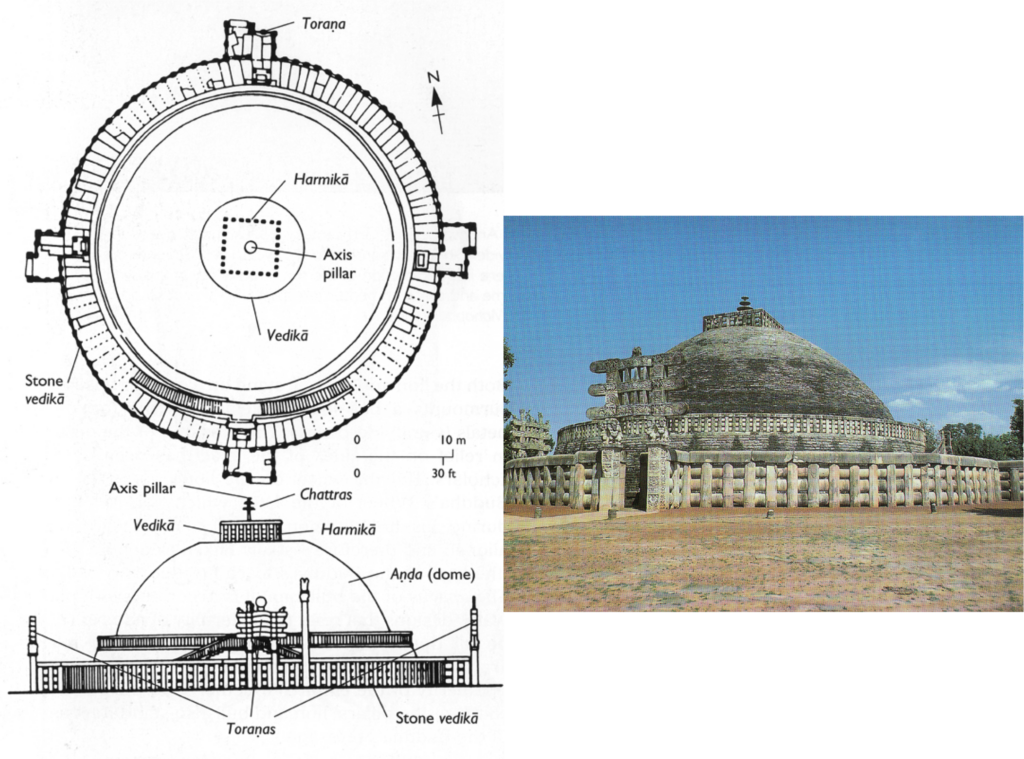
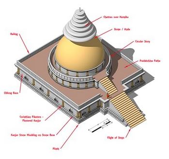
A l’origine, les édifices religieux sous forme de stupa (reliquaire) ont été érigés en Inde comme monuments commémoratifs associés à la conservation des reliques sacrées du Bouddha.
Construits en forme de dôme, ils sont entourés d’une balustrade qui sert de rampe pour la circumambulation rituelle. On accède à la zone sacrée par des portes situées aux quatre points cardinaux. Les stupas se situent souvent à proximité de sites funéraires préhistoriques beaucoup plus anciens, associés notamment à la Civilisation de la vallée de l’Indus.
Des grilles et des portails en pierre, recouverts de sculptures, leur ont été ajoutés. Les thèmes favoris sont les événements de la vie historique du Bouddha, ainsi que de ses vies antérieures, au nombre de 550, décrites avec beaucoup d’ironie dans les Jatakas. (Voir B)
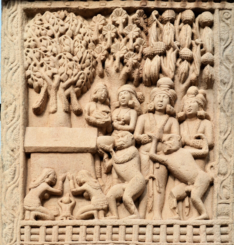
Les bas-reliefs des stupas sont comme des bandes dessinées qui nous racontent la vie quotidienne et religieuse du Gandhara : amphores, coupes à vin (kantaros), bacchanales, instruments de musique, vêtements grecs ou indiens, ornements, coiffures arrangées à la grecque, artisans, leurs outils, etc.
Sur un vase trouvé à l’intérieur d’un stupa, on trouve l’inscription d’un Grec, Théodore, gouverneur civil d’une province au Ier siècle avant J.-C., expliquant en alphabet kharosthi comment les reliques ont été déposées dans le stupa.
On pense que de nombreux stupas datent de l’époque d’Ashoka, comme celui de Sanchi (Inde centrale) ou de Kesariya (Inde de l’Est), où il a également érigé des piliers avec ses édits, et peut-être ceux de Bharhut (Inde centrale), Amaravati (sud-est de l’Inde) ou Dharmarajika (Taxila) dans le Gandhara (Pakistan).
Selon la tradition bouddhiste, l’empereur Ashoka aurait récupéré les reliques du Bouddha dans des stupas plus anciens et en aurait fait ériger 84 000 pour répartir l’ensemble de ces reliques sur tout le territoire indien.
Marchant dans les pas d’Ashoka, Kanishka ordonna la construction à Purushapura (Peshawar) du grand stupa de 400 pieds qui figure parmi les plus hauts édifices du monde antique.
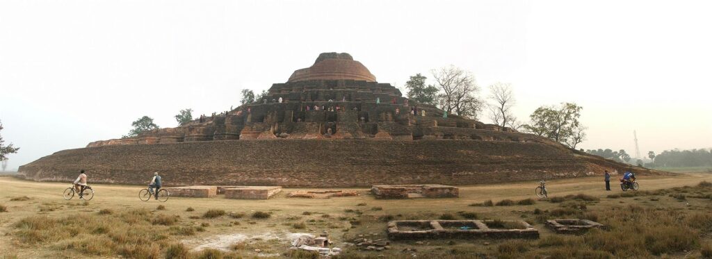
Les archéologues qui en ont redécouvert la base en 1908-1909 ont estimé que ce stupa avait un diamètre de 87 mètres. Selon les rapports de pèlerins chinois tels que Xuanzang, il faisait environ 200 mètres de haut et était recouvert de pierres précieuses. Sous les Kouchans également, d’immenses statues du Bouddha furent érigées dans les monastères ou sculptées à flanc de colline.
E. Sculpture
—PERIODE ANICONIQUE
Il est important de rappeler que dans les premiers temps, Bouddha n’était jamais représenté sous forme humaine.
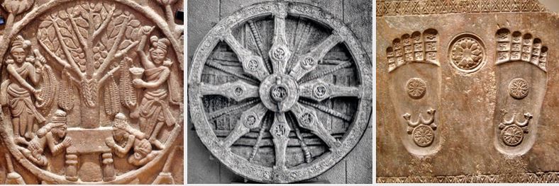
Pendant plus de quatre siècles, sa présence est simplement suggérée par des éléments symboliques tel qu’une empreinte de pieds, une fleur de lotus (indiquant la pureté de sa naissance), une roue à huit rayons (symbolisant la dharma), un trône vide, un espace inoccupé sous un parasol, un cheval sans cavalier ou encore le figuier sous lequel il a atteint le nirvana.
–FIN DE L’ANICONISME
Ce qui a conduit les bouddhistes à renoncer aux représentations aniconiques reste un vaste mystère. Un tel développement est assez unique dans l’histoire des religions. Imaginons soudainement les musulmans promouvant des statues du prophète Mohammed !
Les explications avancées jusqu’ici nous laissent sur la faim.
Pour les uns, les bouddhistes auraient voulu séduire une clientèle grecque, mais aussi bien les populations grecques que le bouddhisme était au Gandhara bien avant la révolution iconographique en question.
Pour les autres, les pratiquants, en l’absence de Bouddha lui-même, auraient cherché désespérément un centre d’intérêt visuel, soit une statue, une peinture ou mêmes quelques cheveux… Ces représentations symboliques, on l’a vu, répondaient à cette demande.
« Le Jataka de Kalingabodhi (écrit majeur sur les vies multiples de Bouddha) relate la frustration des habitants de Sravasti, en découvrant un jour qu’ils n’ont personne à vénérer lorsqu’ils se rendent au Jetavana et trouvent le Bouddha ‘absent’, parti en voyage. Pour remédier à cette situation, à son retour, le Bouddha permet à [son disciple] Ananda de planter un figuier Bodhi devant le [monastère de] Jetavana (…) qui sert de centre de substitution pour les dévotions des gens, chaque fois que le Bouddha n’est pas en résidence », écrit John Strong, dans Reliques du Bouddha.
Bouddha, rapporte-t-on, aurait refusé qu’il soit représenté d’aucune façon, craignant de voir prospérer l’idolâtrie.
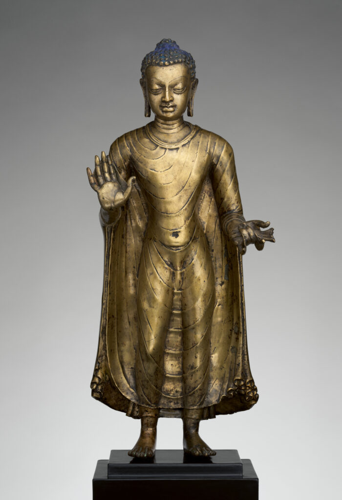
Avec le temps, le bouddhisme va évoluer. Au Gandhara, c’est le bouddhisme mahâyâna (Grand Véhicule) qui s’épanouit. Pour ce courant, l’objectif ne se limite plus à atteindre le nirvana à titre personnel mais de libérer toute l’humanité de la souffrance.
Si pour le bouddhisme theravâda, Siddhartha Gautama n’était qu’un homme éclairé donnant l’exemple, pour le bouddhisme mahâyâna, il s’agit indubitablement, avec Bouddha, d’une tentative (réussie) de personnifier le dharma (la force spirituelle omniprésente, le principe ultime et suprême de la vie) dans la conception du premier de tous les bouddhas. Une sorte de Jésus, un dieu devenu homme pour ainsi dire…
Comme plus tard Jésus dans le christianisme à partir du Ve siècle, Bouddha pouvait dès lors être représenté sous une forme humaine.
Certains bouddhas du Gandhara représentent également des états d’âme spécifiques, tels que la sagesse, la tendresse et la compassion.
Contrairement à de nombreux artistes chrétiens chez nous, qui, conformément à la doxa, ont représenté le Christ souffrant sur la Croix (événement fondamental de la foi chrétienne), les artistes du Gandhara présentent Bouddha comme un être totalement détaché de la douleur humaine, regardant avec compassion l’humanité tout entière.
Le but étant d’éliminer la souffrance chez tous les hommes, la compassion n’est pas une notion passive chez les bouddhistes. Ce n’est pas seulement de l’empathie, mais plutôt un altruisme empathique qui s’efforce activement de libérer les autres de la souffrance, un acte de bienveillance empreinte à la fois de sagesse et d’amour.
DIFFERENCES DE FORME, DIFFERENCE DE CONTENU
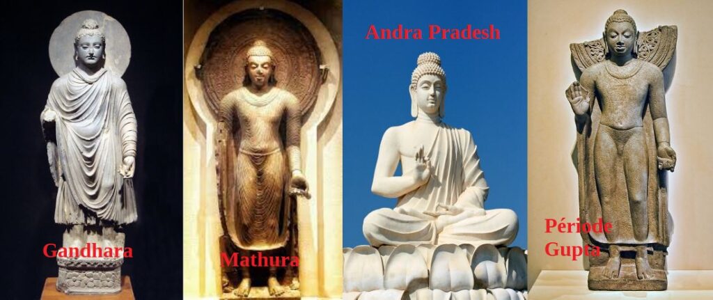
Avant de discuter de leurs différences, pour faire simple, distinguons ici, parmi tant d’autres, quatre types de représentations de bouddha:
- L’école dite « greco-bouddhique » de Gandhara produite dans la région qui va de Hadda (Afghanistan) à Taxila (Pundjab) en passant par Peshawar (Pakistan);
- L’école dite « indo-bouddhique » de Mathura;
- L’école d’Andra Pradesh, au sud de l’Inde;
- L’école de la période Gupta (3e au 5e siècle).
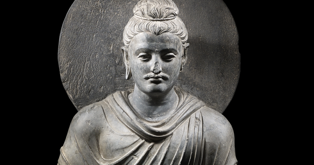
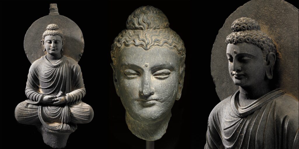
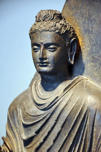
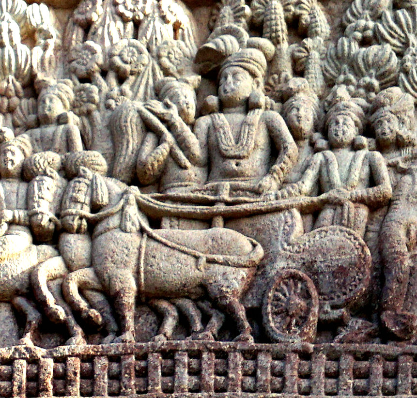
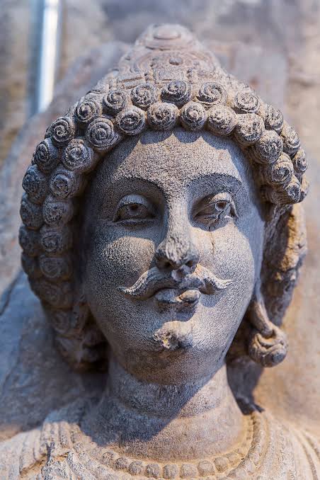
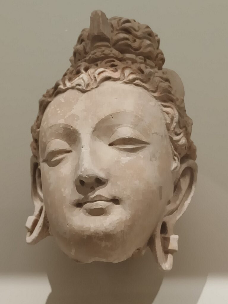
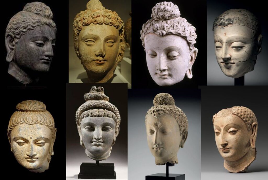
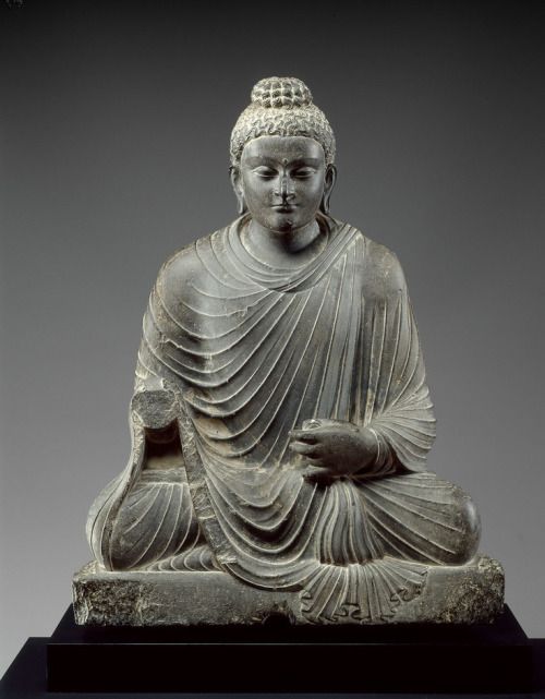
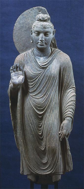
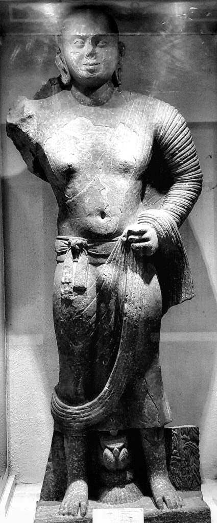
1. Greco-Bouddhique au Gandhara
Le terme « greco-bouddhique », renvoie à la thèse de l’archéologue Alfred Foucher (1865-1952) soutenue à la Sorbonne en 1905 sur l’art du Gandhara.
Comme l’écrivait André Malraux (1901-1976) dans les « Voix du silence », en 1951, l’art gréco-bouddhique est cette rencontre entre hellénisme et bouddhisme. Au lieu de dire que l’art venu de Grèce s’était métamorphosé en art bouddhique comme le disait Malraux, je pense plutot qu’au Gandhara, c’est l’art bouddhique qui s’est approprié le meilleur de l’esthétique indienne, grecque et des steppes.
Cependant, Foucher avait raison d’insister, contre ses amis anglais, qu’il s’agit bien d’une influence hellénique et non pas romaine. De leur coté, avec l’Inde s’émancipant de l’Empire britannique, les savants indiens ont tenté de valider la thèse d’une création autochtone de l’image de Buddha, opposant au style du Gandhara, que Foucher voulait gréco-bouddhique, le style de Mathura, dans la région de Delhi, lui aussi englobé dans l’empire des Kouchans, et vu par certains comme contemporain, même s’il est beaucoup moins prolixe que l’art du Gandhara.
L’art du Gandhara prit véritablement son essor à l’époque kouchane, et plus particulièrement sous le règne du roi Kanishka.
Des milliers d’images furent produites et répandues dans tous les coins de la région, depuis les bouddhas portatifs jusqu’aux statues monumentales des lieux de culte sacrés.
Au Gandhara, pour figurer Bouddha, on représente d’une façon très réaliste une belle personne, souvent un jeune homme, voire une femme. La charge spirituelle est telle que le genre n’est plus essentiel. On ne sait pas s’il s’agit de beaux portraits pris sur le vif, ou de purs fruits de l’imagination des artistes.
Bouddha y est souvent montré en posture méditative afin d’évoquer le moment où il atteint le nirvana.
Couronné d’une auréole, le visage grave ou souriant, les yeux mi-clos, il irradie la lumière. Plein de sérénité, il incarne le détachement, la concentration, la sagesse et la bienveillance.
Ses cheveux en chignon (l’ushnisha) au sommet du crâne indiquent qu’il est doué d’une connaissance supramondaine. Le point noire entre les deux yeux symbolise le troisième œil, celui de l’éveil.
Dans certaines sculptures, cette cavité contient une perle de cristal, symbole de lumière irradiante. Les lobes d’oreilles sont allongés et servent à accueillir les lourds bijoux que portait autrefois le jeune prince Siddhartha, durant sa jeunesse princière.
Le positionnement des mains, comme dans le reste de l’art indien, répond à des codes. Il peut s’agir de « l’abhayamudra », le geste qui rassure, la paume de la main tournée vers l’extérieur ; de la « varamudra », qui symbolise le don, la main pendante et ouverte avec le bras à demi plié, ou encore de la « vitarkamudra », qui symbolise l’argumentation, la main levée à hauteur de la poitrine, à demi fermée, paume en avant, l’index recourbé vers le pouce.
Au Gandhara, Bouddha est vêtu d’un manteau monastique qui lui couvre les deux épaules. L’étoffe n’est ni taillée, ni cousue, mais simplement drapée à la grecque autour du corps. Les plis à peine stylisés suivent les volumes naturels.
Le roi Kanitscha encouragea à la fois l’école d’art gréco-bouddhique du Gandhara (à Taxila, Peshawar et Hadda) et l’école indo-bouddhique (à Mathura, plus proche de l’Inde).
2. Ecole de Mathura
A Mathura, les artistes ont produit un Bouddha très différent. Son corps est dilaté par le souffle sacré (prana) et sa robe monastique est drapée à l’indienne de manière à laisser l’épaule droite dénudée.
On pense que les artistes, pour plaire à un public local, se sont inspirés des statues de yaksha, des esprits de la nature.
Dans les mythologies hindoue, jaïne et bouddhiste, le yakṣha a une double personnalité.
D’un côté, ce peut être une fée de nature inoffensive, associée aux forêts et aux montagnes ; mais il existe une version beaucoup plus sombre du yakṣa, qui est une sorte d’ogre, de fantôme ou de démon anthropophage qui harcèle et dévore les voyageurs.
3. Ecole d’Andrah Pradesh

Un troisième type de bouddha influent s’est développé dans l’Andhra Pradesh, au sud de l’Inde, où des représentations aux proportions imposantes, au visage grave, sans sourire, sont vêtues de robes qui laissent également apparaître l’épaule droite.
Ces sites méridionaux ont servi d’inspiration artistique à la terre bouddhiste du Sri Lanka, à la pointe sud de l’Inde, et les moines sri-lankais s’y rendaient régulièrement. Un certain nombre de statues de ce style se sont également répandues dans toute l’Asie du Sud-Est.
4. Ecole Gupta
La période Gupta, du IVe au VIe siècle de notre ère, dans le nord de l’Inde, souvent qualifiée d’âge d’or, est supposée avoir synthétisé les deux courants. En réalité, en cherchant une image idéale, elle a sombré dans le maniérisme. Les bouddhas gupta ont les cheveux disposés en petites boucles individuelles et leur tunique arbore un réseau de cordelettes suggérant les plis des draperies (comme à Mathura).
Avec leurs yeux baissés et leur aura spirituelle, les bouddhas gupta deviendront le modèle des futures générations d’artistes, que ce soit dans l’Inde post-Gupta et Pala ou au Népal, en Thaïlande et en Indonésie.
Des statues métalliques gupta du Bouddha, emportées par les pèlerins, ont également été disséminées le long de la Route de la soie jusqu’en Chine.
Mais les Bouddhas du Gandhara sont uniques et vraiment à part. Ce sont de véritables individualités échappant à toute codification et aux normes. Ils ont été fabriqués par des artistes habités d’une spiritualité élevée, explorant de nouvelles frontières de la beauté, du mouvement et de la liberté, et non produisant des objets pour satisfaire un marché émergent.
Aujourd’hui, Pakistanais, Indiens, Afghans et Européens aiment à se quereller. Tous prétendent avoir été les principaux parrains et auteurs du « miracle de Gandhara », mais peu se demandent comment il s’est produit.
Dès le Ier siècle avant J.-C., les artistes locaux délaissent les matériaux périssables avec lesquels ils travaillaient, comme la brique, le bois, le chaume et le bambou, pour adopter la pierre. Le nouveau matériau utilisé était principalement une pierre de schiste allant du gris clair au gris foncé (dans la vallée de la rivière Kaboul et la région de Peshawar). Les périodes ultérieures se caractérisent par l’utilisation du stuc et de l’argile (spécialité de Hadda).
Les techniques utilisées pour les sculptures et les pièces de monnaie du Gandhara sont très proches de celles de la Grèce. Ont-elles été créées par des sculpteurs grecs itinérants ou par des artistes locaux qu’ils ont formés ? Rien n’a été prouvé, mais est-ce vraiment important ?
Lorsque l’Asie rencontre la Grèce
Examinons maintenant des expressions artistiques attestant la belle rencontre entre la culture hellénique et les cultures indiennes et locales.
A. Pièces de monnaie kouchanes
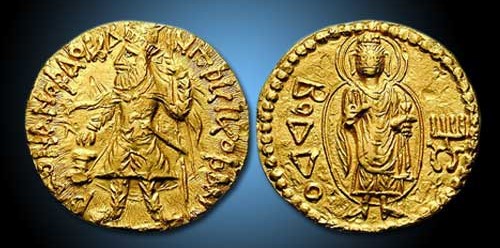
Tout en soutenant toutes les religions qu’il jugeait dignes, Kanishka ne cachait pas sa préférence pour le bouddhisme.
Une pièce d’or datant de 120 après J.-C. montre le roi vêtu d’un lourd manteau kouchan et de longues bottes, des flammes sortant de ses épaules, un étendard dans la main gauche et faisant un sacrifice sur un autel, avec cette légende en caractères grecs : « Roi des rois, Kanishka le Kouchan. » Le revers de la même pièce représente un bouddha debout, en costume grec, faisant de la main droite le geste « ne craignez rien » (abhaya mudra) et tenant un pli de sa robe dans la main gauche. La légende en caractères grecs se lit désormais ΒΟΔΔΟ (Boddo), pour Bouddha.
B. Reliquaire bimaran
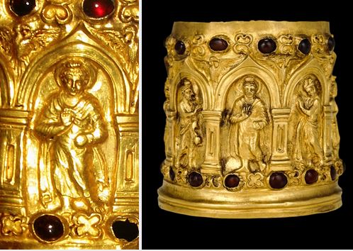
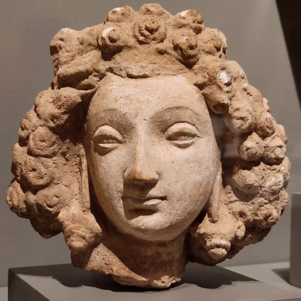
Un véritable thème classique du répertoire de tout artiste de l’époque consiste à montrer Bouddha entouré, accueilli et protégé des divinités d’autres croyances et de religions plus anciennes. La plus ancienne représentation de ce type connue à ce jour figure sur un reliquaire trouvé dans le stupa de Bimaran, au nord-ouest du Gandhara.
Sur cette petite urne en or, généralement datée de 50-60 après J.-C., figure, à l’intérieur de niches voûtées d’architecture gréco-romaine, une représentation hellénistique du Bouddha (coiffure, contrapposto, himation d’élite, etc.), entourée des divinités indiennes Brahma et Sakra.
Tout comme Ashoka, Kanishka, presque laïque, entendait régner, non pas contre mais avec, et surtout au-dessus de toutes les religions. Ainsi, à l’occasion, les divinités grecques, représentées sur les pièces de monnaie (Zeus, Apollon, Héraclès, Athéna, etc.), côtoient les divinités du védisme, du zoroastrisme et du bouddhisme.
Autre exemple, à Ellora, au centre de l’Inde, la grotte et le temple taillés dans le roc où se côtoient les représentants des trois religions (bouddhisme, hindouisme et jaïnisme).
C. Triade de Hadda


Un autre exemple exquis de cet art gandharien est un groupe sculptural connu sous le nom de Triade de Hadda, excavé à Tapa Shotor, un grand monastère sarvastivadin près de Hadda en Afghanistan, datant du IIe siècle après J.-C.
Pour donner une idée de son activité, ce sont quelque 23 000 sculptures gréco-bouddhiques, en argile et en plâtre, qui ont été mises au jour rien qu’à Hadda, entre les années 1930 et 1970.
Le site, fortement endommagé lors des dernières guerres, possédait de belles statues, notamment un bouddha assis, vêtu d’une chlamyde grecque (manteau blanc), les cheveux bouclés, accompagné d’Héraclès et de Tyché (déesse grecque de la fortune et de la prospérité), vêtue d’un chiton (robe à la grecque) et tenant une corne d’abondance.
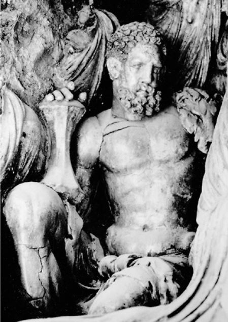
Seule adaptation aux traditions locales de l’iconographie grecque, Héraclès tient en main, non plus son habituelle massue, mais la foudre de Vajrapani (du sanskrit vajra, signifiant « foudre », et pani « en main »), l’une des trois premières divinités protectrices entourant le Bouddha.
C’est un bodhisattva. Il apparaît dès le IIe siècle dans l’iconographie mahāyāna comme doué d’une grande force et comme protecteur du Bouddha. Dans l’art gréco-bouddhique il ressemble à Héraclès ou Zeus, tenant en main une courte massue en forme de vajra, un foudre stylisé. On l’identifie au protecteur, « puissant comme un éléphant », qui aurait veillé sur Bouddha à sa naissance.
Une autre statue rappelle le portrait d’Alexandre le Grand.
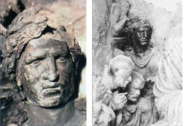
De cet ensemble sculptural, il ne reste malheureusement que des photographies.
Selon l’archéologue afghan Zemaryalai Tarzi, le monastère de Tapa Shotor, avec ses sculptures en argile datées du IIe siècle de notre ère, représente le « chaînon manquant » entre l’art hellénistique de Bactriane et les sculptures en stuc plus tardives trouvées à Hadda, généralement datées du IIIe-IVe siècle de notre ère.
Traditionnellement, l’afflux d’artistes, maître de l’art hellénistique, a été attribué à la migration des populations grecques des villes gréco-bactriennes d’Aî-Khanoum et de Takht-I-Sangin (Nord de l’Afghanistan).
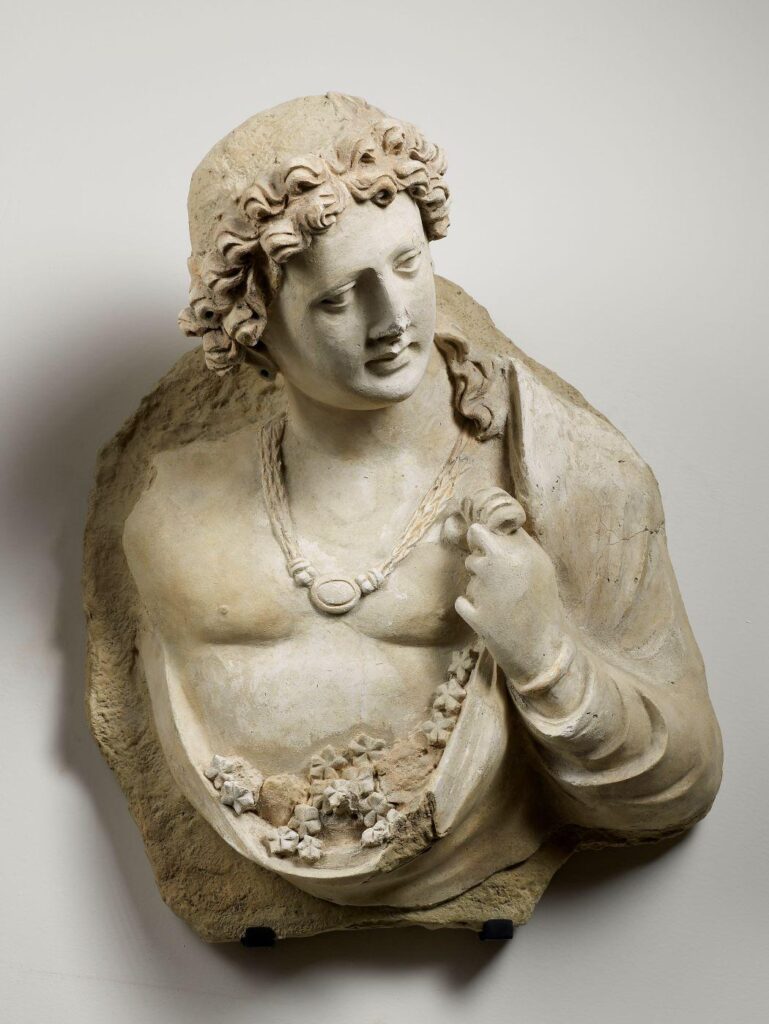
Tarzi suggère que les populations grecques se sont établies dans les plaines de Jalalabad, qui comprennent Hadda, autour de la ville hellénistique de Dionysopolis, et qu’elles sont à l’origine des créations bouddhistes de Tapa Shotor, au IIe siècle de notre ère.
Les colons grecs restés au Gandhara (les Yavanas) après le départ d’Alexandre, soit par choix, soit en tant que populations condamnées à l’exil par Athènes, ont grandement embelli les expressions artistiques de leur nouvelle spiritualité.
Offrant fraîcheur, poésie et un sens du mouvement spectaculairement moderne, les premiers artistes bouddhistes du Gandhara, saisissant des instants de « mouvement-changement » permettant à l’esprit humain d’appréhender un saut vers la perfection, sont une contribution inestimable à la culture de l’humanité tout entière. N’est-il pas temps de reconnaître ce magnifique travail ?
D. Prendre la terre à témoin
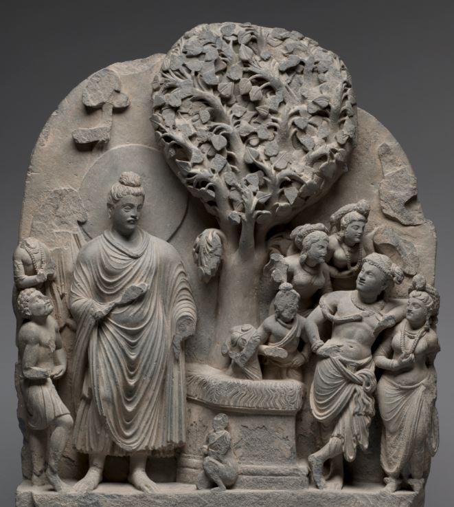
Parmi les autres types productions artistiques de Gandhara, ce magnifique bas-relief, aujourd’hui conservée au musée de Cleveland, illustre la lutte du Bouddha pour atteindre le nirvana.
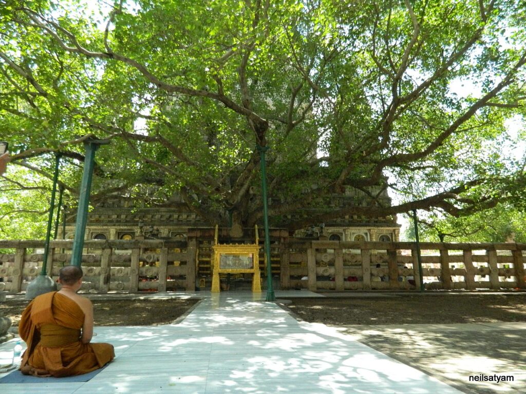
Au centre de la composition se trouve l’arbre de la Bodhi, sous lequel le Bouddha atteignit l’illumination. Ce figuier sacré est vénéré depuis des temps ancestraux par les villageois locaux, car il passe pour être la résidence d’une divinité de la nature. L’autel lui-même est recouvert de kusha, herbe utilisée pour des offrandes sacrificielles.
Il y a environ 2500 ans, après être resté en méditation pendant 49 jours, assis sous cet arbre, le Bouddha est défié par des démons cauchemardesques qui remettent en cause l’authenticité de son illumination.
Leur chef Mara (littéralement, la mort), qui se tient à droite dans une posture arrogante, entouré de ses filles, fait tout pour empêcher Bouddha d’atteindre le nirvana (l’éveil).
Il le menace et encourage ses propres filles à le séduire. Innocemment, il lui demande s’il est sûr de pouvoir trouver quelqu’un pour témoigner qu’il a véritablement atteint le nirvana. En réponse à ce défi, le Bouddha touche alors la terre et la prend à témoin.
Selon la mythologie, la jeune déesse de la Terre surgit alors du sol et commença à essorer les eaux déferlant de ses cheveux pour noyer Mara. Sur la sculpture, on peut la voir, toute petite, au pied de l’autel, agenouillée devant Bouddha en signe de révérence. Elle a également pris forme humaine en sortant de terre. Les anciennes religions interviennent ici pour défendre et protéger la nouvelle, celle de Bouddha.
Semblant, eux aussi, regretter les anciens dieux et déesses de leur panthéon, les Indiens convertis au bouddhisme les ajoutent au-dessus de la tête de Bouddha ou à côté, comme, par exemple, le dieu védique Indra.
E. Tous bodhisattva ?
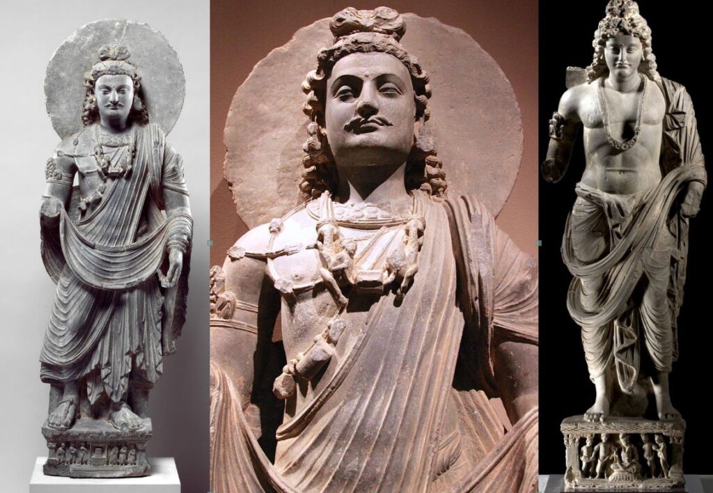
Enfin, pour conlure cette section sur la sculpture, deux mots sur le bodhisattva, figure très intéressante sortie de l’imaginaire bouddhiste pour rendre la spiritualité bouddhiste accessible au citoyen ordinaire.
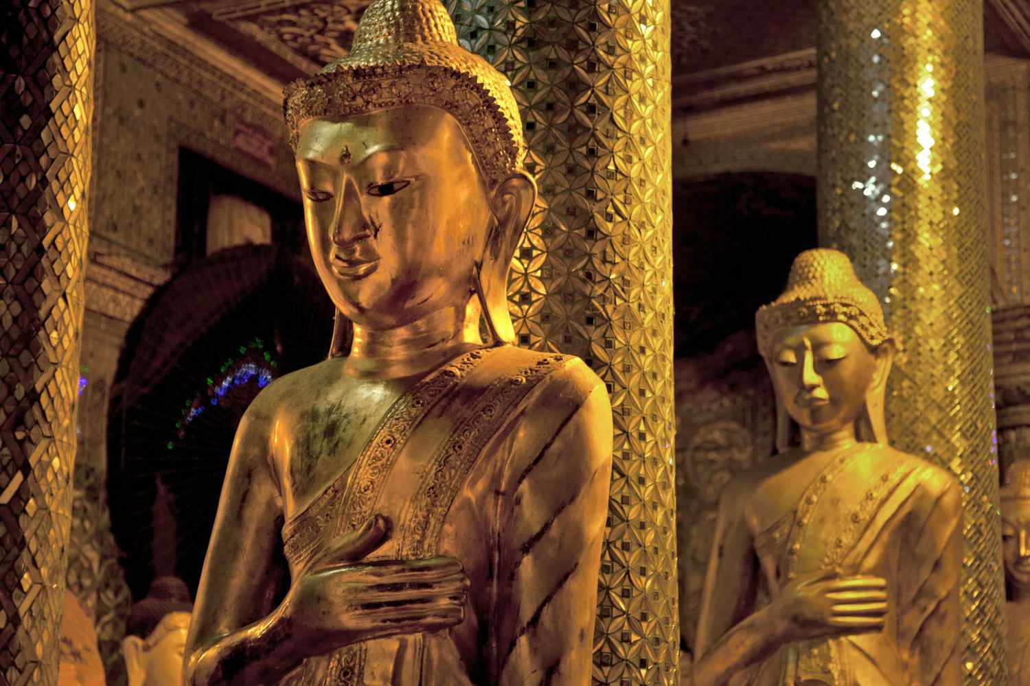
Il peut s’agir soit d’une représentation de Bouddha en personnage princier orné de bijoux, avant son renoncement à la vie de palais, soit d’un humain ordinaire, déjà conscient qu’il est sur la voie de l’illumination et qu’il est devenu un outil au service du bien.
Animé d’altruisme et obéissant les disciplines destinées aux bodhisattvas, il doit aider par compassion d’abord les autres êtres sensibles à s’éveiller, y compris en retardant sa propre libération !
Les bodhisattvas se distinguent par de grandes qualités spirituelles telles que les « quatre demeures divines » que sont:
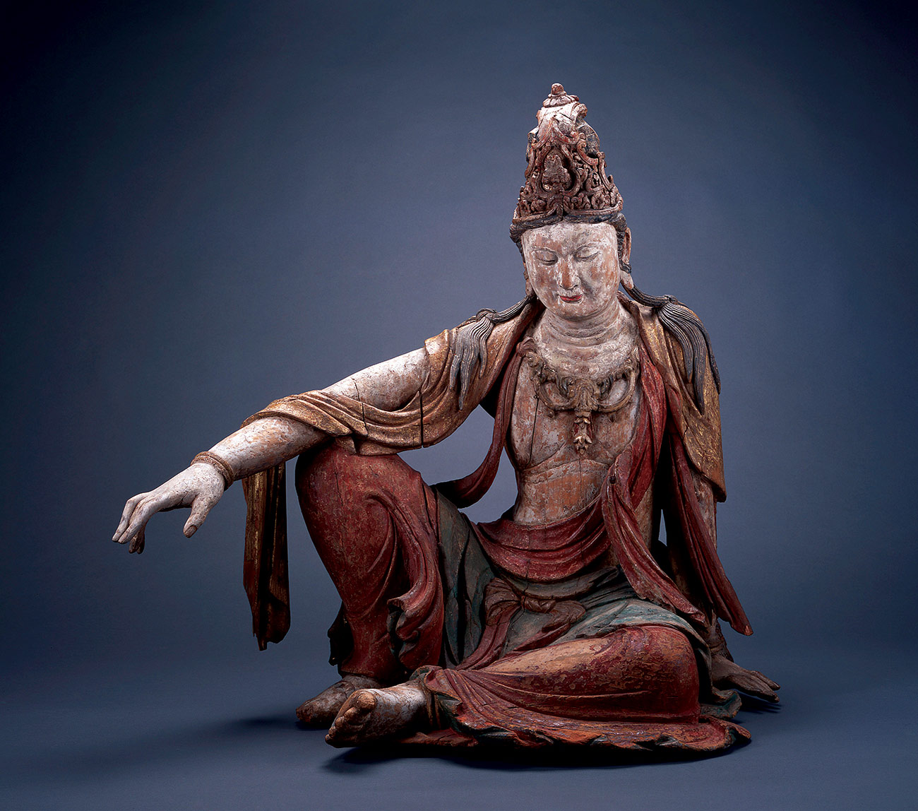
- l’amour bienveillant (maitri),
- la compassion (karuna),
- la joie empathique (mudita) et
- l’équanimité (upekṣa),
ainsi que les diverses perfections (paramitas), qui comprennent la prajnaparamita (« connaissance transcendante » ou « perfection de la sagesse ») et les moyens habiles (upaya).
Des bodhisattvas spirituellement avancés tels qu’Avalokiteshvara (ci-dessus), Maitreya et Manjushri, largement vénérés dans le monde bouddhiste mahâyâna, sont censés posséder un grand pouvoir, qu’ils utilisent pour aider tous les êtres vivants.
Pour certains courants bouddhistes, seul Maitreya mérite le titre de « Bouddha du futur ». Dans l’art on le représente à la fois comme un bouddha vêtu d’une robe monastique et comme un bodhisattva princier avant l’illumination.
Un magnifique bodhisattva de Gandhara peut être admiré au Dallas Museum of Art (ci-dessous).
Cette sculpture en terre cuite représente un « Bodhisattva pensant » de la région de Hadda en Afghanistan, une production typique du Gandhara.
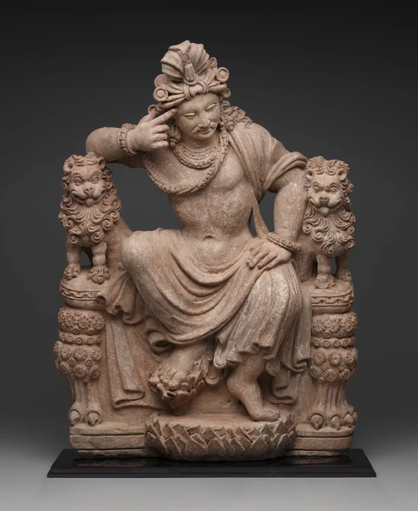
Avec très peu d’éléments visuels, l’artiste réussit un travail gigantesque. Les piliers de sa large chaise sont des lions au regard un peu fou, représentation allégorique de ces passions qui nous font souffrir et qui sont maintenues sous un sage contrôle par l’effort hautement réflexif du Bodhisattva héroïque au centre de l’œuvre.
Le bouddhisme aujourd’hui, l’exemple de Nehru

Paradoxalement, le bouddhisme, en tant que religion, a presque cessé d’exister dans son propre berceau, l’Inde, depuis le XIIe siècle de notre ère.
Bel exemple de la lutte incessante des meilleurs esprits indiens pour l’émancipation, en 1956, près d’un demi-million « d’intouchables » se sont convertis au bouddhisme sous l’impulsion du dirigeant politique à la tête du comité chargé de rédiger la Constitution de l’Inde, le réformateur social B. R. Ambedkar (1891-1956), et du Premier ministre indien et chef du Parti du Congrès Jawaharlal Nehru (1889-1964), lui-même issu d’une famille de brahmanes.
En juin de la même année, le Courrier de l’UNESCO consacrait son édition à « 25 siècles d’art et de culture bouddhistes ».
En Inde, les deux hommes d’État ont orchestré une année de célébration en l’honneur de « 2500 ans de bouddhisme », non pas pour ressusciter une ancienne religion en soi, mais pour s’approprier le statut de berceau de cette vieille religion et renvoyer au monde une image de champion de la non-violence et du pacifisme.
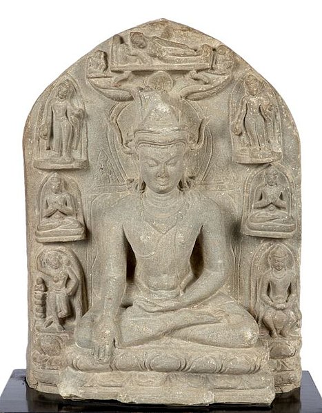
Quelques années plus tard, lors de sa visite d’État à la Maison Blanche, le 9 novembre 1961, le Premier ministre indien Nehru offrit une sculpture bouddhiste au président John F. Kennedy
Comme beaucoup d’hindous, Mahatma Gandhi vénérait Bouddha. Pour lui, le bouddhisme n’était qu’une « autre forme d’hindouisme » et sa critique venait donc « de l’intérieur de l’hindouisme ».
Un point de vue que ne partageait pas le Premier ministre indien Jawaharlal Nehru. Profondément troublé par certaines caractéristiques intrinsèques à l’hindouisme, telles que le ritualisme et les castes, Nehru ne pouvait pas placer le bouddhisme, qui abhorrait ces institutions, dans la même rubrique…
Nehru fut fortement influencé par le bouddhisme. C’est ainsi qu’il appela sa fille (la future Première ministre Indira Gandhi) Indira Priyadarshini, du nom de « Priyadarshi » adopté par le grand empereur Ashoka, après être devenu un prince bouddhiste de la paix !

Par ailleurs, Nehru contribua à faire de l’Ashoka Chakra (la Roue bouddhiste intégrée au drapeau national) le symbole de l’Inde. Chaque fois qu’il se rendait au Sri Lanka, il visitait la statue du Bouddha à Anuradhapura.
Le dirigeant indien, qui ne cessait d’exhorter les Indiens superstitieux et ritualistes à cultiver un « tempérament scientifique » et à faire entrer l’Inde dans l’ère de l’âge atomique, était naturellement attiré par le rationalisme prôné par le Bouddha.
« Bouddha ne demandait à personne de croire en quoi que ce soit d’autre que ce qui pouvait être prouvé par l’expérience et l’essai. Tout ce qu’il voulait, c’était que les hommes recherchent la vérité et n’acceptent rien sur la foi d’un autre homme, même s’il s’agissait du Bouddha lui-même. Il me semble que c’est là l’essence de son message », alléguait Nehru.
Et d’ajouter :
« Lui-même a eu le courage d’accepter la vérité et de ne rien accepter sur la foi d’un autre (…) Bouddha a eu le courage de s’attaquer à la religion populaire, à la superstition, au cérémonial et à la prêtrise, ainsi qu’à tous les intérêts qui s’y rattachent. Il a également condamné les perspectives métaphysiques et théologiques, les miracles, les révélations et les relations avec le surnaturel. Il fait appel à la logique, à la raison et à l’expérience ; il met l’accent sur l’éthique (…) Toute son approche est comme le souffle du vent frais des montagnes après l’air vicié de la spéculation métaphysique (…) Bouddha n’a pas attaqué directement les castes, mais dans son propre ordre, il ne les a pas reconnues, et il ne fait aucun doute que toute son attitude et son activité ont affaibli le système des castes. »
L’influence du Bouddha s’est manifestée dans la politique étrangère de Nehru. Cette politique était motivée par un désir de paix, d’harmonie internationale et de respect mutuel. Elle visait à résoudre les conflits par des méthodes pacifiques. Le 28 novembre 1956, Nehru déclare :
« C’est essentiellement grâce au message du Bouddha que nous pouvons envisager nos problèmes dans la bonne perspective et nous éloigner des conflits et de la concurrence dans le domaine des conflits, de la violence et de la haine. »
Visiblement inspirés par les préceptes bouddhistes, les concepts de non-alignement et le Traité de Panchsheel de Nehru, communément appelé « Traité des cinq principes de coexistence pacifique », ont été formellement énoncés pour la première fois dans l’Accord sur le commerce et les relations entre le Tibet chinois et l’Inde, signé le 29 avril 1954.
Cet accord stipulait, dans son préambule, que les deux gouvernements,
« ont décidé de conclure le présent accord sur la base des principes suivants :
1) respect mutuel de l’intégrité territoriale et de la souveraineté de l’autre,
2) non-agression mutuelle,
3) non-ingérence mutuelle,
4) égalité et avantage mutuel,
5) coexistence pacifique. »
Le 29 novembre 1952, lors de la Conférence culturelle bouddhiste internationale à Sanchi, où Kanitscha avait entamé la construction du plus haut stupa de l’Antiquité, Nehru précisait :
« Le message que Bouddha a transmis il y a 2500 ans a éclairé non seulement l’Inde et l’Asie, mais le monde entier. La question qui se pose inévitablement est la suivante : le grand message du Bouddha peut-il s’appliquer au monde d’aujourd’hui ? Peut-être que oui, peut-être que non, mais je sais que si nous suivons les principes énoncés par le Bouddha, nous gagnerons la paix et la tranquillité pour le monde. »
Le 3 octobre 1960, Nehru s’adressait à l’Assemblée générale des Nations unies :
« Dans un passé lointain, un grand fils de l’Inde, le Bouddha, a dit que la seule vraie victoire était celle où tous étaient également victorieux et où personne n’était vaincu. Dans le monde d’aujourd’hui, c’est la seule victoire concrète ; toute autre voie mène au désastre. »
Nehru a fait de son mieux pour appliquer les enseignements du Bouddha dans la gestion des affaires intérieures de l’Inde. Sa conviction que le changement social ne peut être obtenu que par le consensus social le plus large découle de l’influence du Bouddha, d’Ashoka et de Gandhi.
Dans son discours du 15 août 1956 à l’occasion de la fête de l’indépendance, Nehru fixe les défis à relever :
« Nous sommes fiers que le sol sur lequel nous sommes nés ait produit de grandes âmes comme le Bouddha Gautama et Gandhi. Rafraîchissons-nous la mémoire une fois de plus et rendons hommage à Gautama Bouddha et à Gandhi, ainsi qu’aux grandes âmes qui, comme eux, ont façonné ce pays. Suivons la voie qu’ils nous ont montrée avec force, détermination et coopération. »
Science et religion, Albert Einstein et Bouddha
Pour conclure, je vous invite à méditer quelques citations d’Albert Einstein discutant les rapports entre la science et la religion où il évoque l’importance de Bouddha :

Le sentiment religieux cosmique
« Il existe un troisième état d’expérience religieuse… que j’appellerai le sentiment religieux cosmique. Il est très difficile d’expliquer ce sentiment à quelqu’un qui en est totalement dépourvu, d’autant plus qu’il n’y a pas de conception anthropomorphique de Dieu qui lui corresponde. L’individu ressent le néant des désirs et des objectifs humains, ainsi que la sublimité et l’ordre merveilleux qui se révèlent tant dans la nature que dans le monde de la pensée. Il considère l’existence individuelle comme une sorte de prison et veut faire l’expérience de l’univers comme un tout unique et significatif. Les prémices d’un sentiment religieux cosmique apparaissent déjà à un stade précoce du développement, par exemple dans de nombreux Psaumes de David et dans certains Prophètes.
Le bouddhisme, comme nous l’ont appris les merveilleux écrits de Schopenhauer en particulier, en contient un élément beaucoup plus fort. Les génies religieux de tous les temps se sont distingués par ce type de sentiment religieux, qui ne connaît ni dogme, ni Dieu conçu à l’image de l’homme, de sorte qu’il ne peut y avoir d’Église dont l’enseignement central se fonde sur lui.
C’est donc précisément parmi les hérétiques de toutes les époques que l’on trouve des hommes animés du sentiment religieux le plus élevé et qui, dans bien des cas, étaient considérés par leurs contemporains comme des athées, parfois même comme des saints. Vu sous cet angle, des hommes comme Démocrite, François d’Assise et Spinoza sont très proches les uns des autres. Comment le sentiment religieux cosmique peut-il se transmettre d’une personne à l’autre, s’il ne peut donner lieu à aucune notion précise de Dieu et à aucune théologie ? À mon avis, c’est la fonction la plus importante de l’art et de la science que d’éveiller ce sentiment et de le maintenir en vie chez ceux qui en sont capables ».
—Einstein, Albert. Le monde tel que je le vois. (Secaucus, NJ : Carol Publishing Group, 1999). p. 26.
Libéré des entraves et de ses désirs égoïstes
« Une personne religieusement éclairée me semble être celle qui, au mieux de ses capacités, s’est libérée des entraves de ses désirs égoïstes et se préoccupe de pensées, de sentiments et d’aspirations auxquels elle s’accroche en raison de leur valeur supra-personnelle. Il me semble que ce qui est important, c’est la force de ce contenu supra-personnel et la profondeur de la conviction concernant son sens impérieux, indépendamment de toute tentative d’unir ce contenu à un Être divin, car sinon il ne serait pas possible de considérer Bouddha et Spinoza comme des personnalités religieuses.
Par conséquent, une personne religieuse est pieuse dans le sens où elle ne doute pas de la signification et de la hauteur de ces objets et objectifs supra-personnels qui ne nécessitent ni ne peuvent être fondés rationnellement. Ils existent avec la même nécessité et la même évidence que lui. En ce sens, la religion est l’effort séculaire de l’humanité pour devenir clairement et complètement consciente de ces valeurs et de ces objectifs et pour renforcer et étendre constamment leur effet.«
—Einstein, Albert. Einstein, Science, Philosophy and Religion, A Symposium, publié par la Conference on Science, Philosophy and Religion in Their Relation to the Democratic Way of Life, Inc, New York, 1941.
Bouddha, Moïse et Jésus
« Ce que l’humanité doit à des personnalités comme Bouddha, Moïse et Jésus est pour moi plus important que toutes les réalisations de l’esprit curieux et constructif. Ce que ces hommes bénis nous ont donné, nous devons le garder et essayer de le maintenir en vie de toutes nos forces si l’humanité ne veut pas perdre sa dignité, la sécurité de son existence et sa joie de vivre ».
—Einstein, Albert. Déclaration écrite (septembre 1937), p. 70
Commencer par le coeur de l’homme
« Si nous voulons améliorer le monde, nous ne pouvons pas le faire avec des connaissances scientifiques, mais avec des idéaux. Confucius, Bouddha, Jésus et Gandhi ont fait plus pour l’humanité que la science. Nous devons commencer par le cœur de l’homme, par sa conscience, et les valeurs de la conscience ne peuvent se manifester que par un service désintéressé à l’humanité ».
—Einstein, Albert. Einstein et le poète (1983), p. 92
L’illusion optique de la conscience
L’un des échanges les plus poignants de son rôle de philosophe a eu lieu alors qu’il avait 70 ans et vivait à Princeton. Un rabbin ordonné lui avait écrit pour lui dire qu’il avait cherché en vain à réconforter sa fille de 19 ans après la mort de sa sœur, « une belle enfant de 16 ans, sans péché ».
L’être humain », écrit Einstein en réponse, « est une partie du tout, que nous appelons « Univers », une partie limitée dans le temps et l’espace. Il fait l’expérience de lui-même, de ses pensées et de ses sentiments comme quelque chose de séparé du reste – une sorte d’illusion d’optique de sa conscience. Cette illusion est une sorte de prison pour nous, nous limitant à nos désirs personnels et à l’affection pour quelques personnes qui nous sont proches. Notre tâche doit être de nous libérer de cette prison en élargissant notre cercle de compassion à toutes les créatures vivantes et à toute la nature dans sa beauté. Personne n’est en mesure d’y parvenir complètement, mais le fait de s’efforcer d’y parvenir est en soi une partie de la libération et un fondement de la sécurité intérieure ».
— Walter Sullivan, “The Einstein Papers: A Man of Many Parts,” New York Times, 29 mars 1972.
NOTES :
*1. Les langues indo-aryennes. Il existe plus de 200 langues indo-aryennes connues, parlées par environ 1 milliard de personnes. Leurs formes modernes descendent des langues indo-aryennes anciennes, telles que le sanskrit védique primitif, en passant par les langues indo-aryennes moyennes (ou prakrits). Les langues indo-aryennes les plus importantes en termes de premiers locuteurs sont l’hindi-ourdou (c. 330 millions), le bengali (242 millions), le pendjabi (environ 120 millions), le marathi (112 millions), le gujarati (60 millions), le rajasthani (58 millions), le bhojpuri (51 millions), l’odia (35 millions), le maithili (environ 34 millions), le sindhi (25 millions), le népali (16 millions), l’assamais (15 millions), le chhattisgarhi (18 millions), le cinghalais (17 millions) et le romani (environ 3,5 millions). Le sud de l’Inde compte des langues dravidiennes (telugu, tamil, kannada et malayalam). En Europe, les principales langues indo-européennes sont l’anglais, le français, le portugais, le russe, le néerlandais et l’espagnol.
*2. Discords. Dès le IIIe siècle avant J.-C., pas moins de dix-huit écoles bouddhistes distinctes sont à l’œuvre en Inde, mais toutes se reconnaissent mutuellement comme des adeptes de la philosophie du Bouddha. Enfin, le bouddhisme du Véhicule du Diamant, dit Vajrayâna, dont les textes et les rituels complexes ont été élaborés dans les universités du nord-est de l’Inde vers le VIIe et VIIIe siècles.
*3. Le prâkrit est un terme qui désigne une langue indo-aryenne dérivée du sanskrit classique. Le mot lui-même a une définition assez souple, car il a parfois le sens de « originel, naturel, sans artifices, normal, ordinaire, usuel, ou encore, local », contrastant ainsi avec la forme littéraire et religieuse du sanskrit ; mais parfois, on peut aussi comprendre prâkrit comme signifiant « dérivé d’une langue originelle », c’est-à-dire dérivé du sanskrit. On peut donc dire que le prâkrit, comme toute langue vulgaire et vernaculaire de l’Inde, est issu du sanskrit. En fait, on peut comparer les prâkrits au latin vulgaire, tandis que le sanskrit serait le latin classique. L’usage le plus ancien que l’on connaisse du prâkrit est formé par l’ensemble d’inscriptions de l’empereur indien Ashoka (IIIe siècle av. J.-C.). L’un des prâkrits les plus célèbres est le pâli, qui a accédé au statut de langue littéraire et intellectuelle en devenant celle des textes du bouddhisme theravâda.
*4. Le pâli est une langue indo-européenne de la famille indo-aryenne. C’est un prâkrit moyen indien proche du sanskrit et remontant vraisemblablement au IIIe siècle av. J.-C. Le pâḷi est utilisé comme langue liturgique bouddhiste au Sri Lanka, en Birmanie, au Laos, en Thaïlande et au Cambodge. Son statut de langue liturgique l’a rendu, à l’instar du sanskrit, figé et normalisé.
*5. Hippodamos de Milet (né en 498 av. J.-C. et mort en 408 av. J.-C.) est un géomètre et ingénieur du Ve siècle av. J.-C., qui fut aussi architecte urbaniste, physicien, mathématicien, météorologiste et philosophe pythagoricien. La tradition a retenu de lui ses grands travaux de planification urbaine. Bien que ces travaux se caractérisent par l’utilisation systématique du plan en damier, il n’en est pas l’inventeur, de très anciennes colonies grecques nous fournissant déjà des exemples de cette structure urbaine.
Commentaires:
8 mars 2024, Bernard C.
Je continue la lecture du long texte illustré sur le « miracle du Gandhara ». Décidemment, tu as toujours l’art –et ce n’est pas un vain mot chez toi ! – de nous surprendre ! Quel bonheur ce doit être ! Merci Karel. Belle soirée à vous.
8 mars 2024, Bernard C., suite
J’espère qu’on reconnaitra un jour (ou l’autre) la beauté de ce travail (artkarel) dans son envergure, car tu ne cesses de nous renvoyer au moyen d’hyperliens (mots en bleu), à travers les âges, d’un bout à l’autre des continents, d’Ashoka à Sully – de véritables efforts intercontinentaux échafaudent, à grands traits pour ne pas dire à grandes enjambées, devant nos yeux surpris (encore une fois, c’est le mot!), une œuvre d’art illustrant qu’il n’est de richesse que d’hommes, et où se meuvent, d’un bord à l’autre de l’histoire de la civilisation, correspondances d’idées majeures qu’on aurait pu croire isolément réservées à leurs temps. Chapeau !
Paris Schiller Institute stages Afghan civil society protest against UNESCO

This call in russian (pdf)

Paris, Feb. 2024 – On Thursday February 22, between 10:00 am and 1:00 pm CET, members and supporters of the International Schiller Institute, founded and presided by Helga Zepp-LaRouche, gathered peacefully in front of one of the main buildings of the headquarters of UNESCO in Paris (1, rue Miollis, Paris 75015). An appeal (see below), endorsed by both Afghans and respected personalities of four continents, was presented to the Secretary General and other officials of UNESCO.
How it started
Following a highly successful conference in Kabul last November by the Ibn-e-Sina Research & Development Center on the reconstruction of Afghanistan, a group of senior archaeologists of the Afghan Academy of Sciences (ASA), in discussion with the organizers and the invited experts of the Schiller Institute, suggested to launch a common appeal to UNESCO and Western governments to “lift the sanctions against cultural heritage cooperation.”
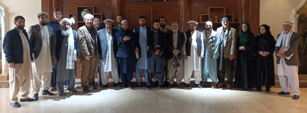
The Call
“We regret profoundly, says the call, that the Collective West, while weeping crocodile tears over destruction of the world’s cultural heritage, has imposed a selective ban of scientific cooperation on nations mistakenly considered as “opposed to its rules and values.” The complete freeze of all cooperation in the field of archaeology between France and both Syria and Afghanistan, is just one example of this tragedy.”
“The dramatic neglect of international cultural institutions and donors to Afghanistan, the lack of sufficient funds in the field of cultural heritage protection, and the political treatment of international cultural heritage institutions have seriously endangered Afghanistan,” underscores the petition.
Specifically, “UNESCO, which should raise its voice against any new form of ‘cultural and scientific apartheid,’ has repeatedly worsened the situation by politicizing issues beyond its prerogatives.”
To conclude, the signers call
“on the international community to immediately end this form of ‘collective punishment,’ which creates suffering and injustice, promotes ignorance, and endangers humanity’s capacity for mutual respect and understanding.”
Living Spirit of Afghanistan
To date, over 550 signatures have been collected, mainly from both Afghan male (370) and female (140) citizens, whose socio-professional profiles indicates they truly represent the « living spirit of the nation ».
Among the signatories: 62 university lecturers, 27 doctors, 25 teachers, 25 members of the Afghan Academy of Sciences, 23 merchants, 16 civil and women’s rights activists, 16 engineers, 10 directors and deans of private and public universities, 7 political analysts, 6 journalists, 5 prosecutors, several business leaders and dozens of qualified professionals from various sectors.
International support
On four continents (Europe, Asia, America, Africa), senior archaeologists, scientists, researchers, members of the Academy of Sciences, historians and musicians from over 20 countries have welcomed and signed this appeal.
Italian Professor Pino Arlacchi, a former member of the European Parliament and the former head of United Nations Office on Drugs and Crime (UNODC) was the first to sign. Award-winning American filmmaker Oliver Stone, is a more recent signer.
In France, Syria, Italy, the UK and Russia, among the signers one finds senior researchers suffering the consequences of what some have identified as a « New Cultural Cold War. » Superseding the very different opinions they have on many questions, the signatories stand united on the core issue of this appeal: for science to progress, all players, beyond ideological, political and religious differences, and far from the geopolitical logic of ‘blocs’, must be able to exchange freely and cooperate, in particular to protect mankind’s historical and cultural heritage.
Testifying to the firm commitment of the Afghan authorities, the petition has also been endorsed by the Deputy Minister of Foreign Affairs, the Minister of Culture and Arts, and the Minister of Agriculture, as well as senior officials from the Ministries of Higher Education, Water and Energy, Mines, Finance, and others.
“The 46th session of UNESCO’s World Heritage Committee, to be held in New Delhi in July this year, offers UNESCO the opportunity to announce Afghanistan’s full return into world heritage cooperation, if we can have our voice heard,” says Karel Vereycken of the Paris Schiller Institute. “We certainly will not miss transmitting this appeal to HE Vishal V Sharma, India’s permanent representative to UNESCO, recently nominated to make the Delhi 46th session a success.”
For all information, interview requests in EN, FR and NL:
Karel Vereycken, Schiller Institute Paris
00 33 (0)6 19 26 69 38
Full text of the appeal
International Call to Lift Sanctions Against Cultural Heritage Cooperation
Following the international conference, organized by the Ibn-e-Sina Research & Development Center’s in Kabul in early November 2023, on the reconstruction of Afghanistan, a group of researchers launched the following petition:
We, the undersigned, researchers and experts in the domains of the history of civilizations, cultural heritage, archaeology, anthropology, sociology, and many other fields, and other enlightened citizens of the world, in Afghanistan, Syria, Russia, China, and many other countries, launch the following call.
1) We regret profoundly that the “Collective West”, while weeping crocodile tears over destruction of the world’s cultural heritage, has imposed a selective ban of scientific cooperation on nations mistakenly considered as “opposed to its rules and values.” The complete freeze of all cooperation in the field of archaeology between France and both Syria and Afghanistan, is just one example of this tragedy.
2) We request particular attention to the case of Afghanistan. Its neighboring countries, national and international institutions, and countries involved in international conventions for the protection of cultural and natural heritage are committed to cooperation in the field of guarding cultural heritage sites and artifacts and preventing their smuggling and destruction. Therefore, it is expected that in the current situation, they will fully play their role in the protection of Afghanistan’s cultural heritage in accordance with international laws and conventions. However, the dramatic neglect of international cultural institutions and donors to Afghanistan, the lack of sufficient funds in the field of cultural heritage protection, and the political treatment of international cultural heritage institutions have seriously endangered Afghanistan. Undoubtedly, the non-recognition of the Afghan government has dimmed the attention of cultural institutions. Considering the above, we expect these international institutions to renew their full support to protect both the tangible and the intangible cultural heritage of Afghanistan.
3) We regret that UNESCO, which should raise its voice against any new form of “cultural and scientific apartheid,” has repeatedly worsened the situation by politicizing issues beyond its prerogatives.
4) Therefore, we call on the international community to immediately end this form of “collective punishment,” which creates suffering and injustice, promotes ignorance, and endangers humanity’s capacity for mutual respect and understanding.
The progress of scientific knowledge, in a positive climate permitting all to share it, is by its very nature beneficial to each and to all and to the very foundation of a true peace.
SIGNERS:
A. FROM AFGHAN CIVIL SOCIETY:
– Hussain Burhani, Archaeologist, Numismatist, Afghanistan ;
– Ketab Khan Faizi, Archaeologist, Director of the Academy of Sciences at the International Centre for Kushan Studies in Kabul, Afghanistan;
– Stora Ishams Mayar, Archaeologist, member of the Academy of Sciences at the International Centre for Kushan Studies in Kabul, editor in chief of the journal of this mentioned center, Afghanistan;
– Mahmood Jan Drost, Senior Architect, head of protection of old cities of Afghanistan, Ministry of Urban Development and Housing, Afghanistan;
– Ghulam Haidar Kushkaky, Archaeologist, associate professor, Archaeology Investigation Center, Afghanistan ;
— Laieq Ahmadi, Archeologist, Former head, Archeology department of Bamiyan University, Afghanistan;
– Shawkatullah Abed, Chief of staff, Afghan Science Academy, Afghanistan;
– Sardar Ghulam Ali Balouch, Head of Afghanistan Balochs Union, Afghanistan;
– Daud Azimi Shinwari, Ibn-e-Sina Research & Development Center, Germany;
– Abdul Fatah Raufi, Ibn-e-Sina Research & Development Center, Kabul, Afghanistan;
– Mirwais Popal, Dip, Master, Ibn-e-Sina Research & Development Center, Germany;
B. FROM ABROAD:
(Russia, China, USA, Indonesia, France, Angola, Germany, Turkiye, Italy, UK, Mexico, Sweden, Iran, Belgium, Argentina, Czech Republic, Syria, Congo Brazzaville, Yemen, Venezuela, Pakistan, Spain, Canada, Democratic Republic of Congo.)
– H.E. Mr Mohammad Homayoon Azizi, Afghanistan’s Ambassador to Paris, UNESCO and ICESCO, France;
— Julio Bendezu-Sarmiento, Researcher at the National Scientific Research Centre (CNRS), Archaeologist specializing in Central Asia; Former director of the Delegation of French Archaeologists in Afghanistan (DAFA) (2014-2018), France;
– Inès Safi, CNRS, Researcher in Theoretical Nanophysics, France;
– Pierre Leriche, Archeologist, Director of Research Emeritus at CNRS-AOROC, Scientific Director of the Urban Archaeology of the Hellenized Orient research program, France;
– Nadezhda A. Dubova, Institute of Ethnology and Anthropology, Dr. in Biology, Prof. in History. Head of the Russian-Turkmen Margiana archaeological expedition, Russian Academy of Science (RAS), Russia;
— Alexandra Vanleene, Archaeologist, specialist in Gandhara Buddhist Art, Researcher, Independant Academic Advisor Harvard FAS CAMLab, France;
– Raffaele Biscione, retired, associate Researcher, Consiglio Nazionale delle Recerche (CNR); former first researcher of CNR, former director of the CNR archaeological mission in Eastern Iran (2009-2022), Italy;
— Sandra Jaeggi-Richoz, Professor, Historian and archaeologist of the Antiquity, France;
– Dr. Razia Sultanova, Professor, Cambridge University, UK;
– Dr. Houmam Saad, Archaeologist, Directorate General of Antiquities and Museums, Syria;
– Estelle Ottenwelter, Institute of Archaeology, Czech Academy of Sciences, Natural Sciences and Archaeometry, Post-Doc, Czech Republic;
– Didier Destremau, author, diplomat, former French Ambassador, President of the Franco-Syrian Friendship Association (AFS), France ;
– Wang Feng, Professor, South-West Asia Department of Chinese Academy of Social Sciences (CASS), China;
– Dr. Engin Beksaç, Professor, Trakya University, Department of Art History, Turkiye;
– Bruno Drweski, Professor, National Institute of Oriental Languages and Civilizations (INALCO), France;
– Maurizio Abbate, National President of National Agency of Cultural Activities (ENAC), Italy;
– Patricia Lalonde, Former Member of the European Parliament, vice-president of Geopragma, author of several books on Afghanistan, France;
– Pino Arlacchi, Professor of sociology, Former Member of the European Parliament, former head of United Nations Office on Drugs and Crime (UNODC), Italy;
– Oliver Stone, Academy Award-winning Film director, Producer, and Screenwriter;
– Graham E. Fuller, Author, former Station chief for the CIA in Kabul until 1978, former Vice-Chair of the National Intelligence Council (1986), USA;
– Prof. H.C. Fouad Al Ghaffari, Advisor to Prime Minister of Yemen for BRICS Countries affairs, Yemen;
– Farhat Asif, President of Institute of Peace and Diplomatic Studies (IPDS), Pakistan;
— Dursun Yildiz, Director, Hydropolitics Association, Türkiye;
– Irène Neto, president, Fundacao Dr. Antonio Agostinho Neto (FAAN), Angola;
– Luc Reychler, Professor international politics, University of Leuven, Belgium;
– Pierre-Emmanuel Dupont, Expert and Consultant in public International Law, Senior Lecturer at the Institut Catholique de Vendée, France;
— Irene Rodríguez, Departamento de Historia, Facultad de Filosofía y Letras, Universidad de Buenos Aires, Argentina;
– Dr. Ririn Tri Ratnasari, Professor, Head of Center for Halal Industry and Digitalization, Advisory Board at Journal of Islamic Accounting and Business Research, Faculty of Economics and Business, Universitas Airlangga, Indonesia;
– Dr. Clifford A. Kiracofe, Author, retired Professor of International Relations, USA;
– Bernard Bourdin, Dominican priest, Philosophy and Theology teacher, Institut Catholique de Paris (ICP), France;
– Dr. jur. Wolfgang Bittner, Author, Göttingen, Germany;
– Annie Lacroix-Riz, Professor Emeritus of Contemporary History, Université Paris-Cité, France;
– Mohammad Abdo Al-Ibrahim, Ph.D in Philology and Literature, University Lecturer and former editor in chief of the Syria Times, Syria;
– Jean Bricmont, Author, retired Physics Professor, Belgium;
– Syed Mohsin Abbas, Journalist, Broadcaster, Political Analyst and Political Justice activist, Pakistan;
– Eduardo D. Greaves PhD, Professor of Physics, Universidad Simón Bolívar, Caracas, Venezuela;
– Dora Muanda, Scientific Director, Kinshasa Science and Technology Week, Democratic Republic of Congo;
– Dr. Christian Parenti, Professor of Political Economy, John Jay College CUNY, New York, USA;
– Diogène Senny, President of the Panafrican Ligue UMOJA, Congo Brazzaville;
– Waheed Seyed Hasan, Journalist based in Qatar, former Special correspondent of IRNA in New Delhi, former collaborator of Tehran Times, Iran;
– Alain Corvez, Colonel (retired), Consultant International Strategy consultant, France;
– Stefano Citati, Journalist, Italy;
– Gaston Pardo, Journalist, graduate of the National University of Mexico. Co-founder of the daily Liberacion, Mexico;
– Jan Oberg, PhD, Peace and Future Research, Art Photographer, Lund, Sweden.
– Julie Péréa, City Councilor for the town of Poussan (Hérault), delegate for gender equality and the fight against domestic violence, member of the Sète Agglopole Méditerranée gender equality committee, France;
– Helga Zepp-LaRouche, Founder and International President of the Schiller Institute, Germany;
– Abid Hussein, independent journalist, Pakistan;
– Anne Lettrée, Founder and President of the Garden of Titans, Cultural Relations Ambassador between France and China for the Greater Paris region, France;
– Karel Vereycken, Painter-engraver, amateur Art Historian, Schiller Institute, France;
– Carlo Levi Minzi, Pianist, Musician, Italy;
– Leena Malkki Brobjerg, Opera singer, Sweden;
– Georges Bériachvili, Pianist, Musicologist, France;
– Jacques Pauwels, Historian, Canada;
C. FROM AFGHAN AUTHORITIES
– Sher Mohammad Abbas Stanikzai, Deputy Foreign Minister, Islamic Emirate of Afghanistan (IEA);
– Mawlawi Muhibullah Wasiq, Head of Foreign Minister’s Office, IEA;
– Waliwullah Shahin, Member of Ministry of Foreign Affairs, IEA;
– Sayedull Afghani, Member of Ministry of Foreign Affairs, IEA;
– Hekmatullah Zaland, Member of Ministry of Foreign Affairs, IEA;
– Shafi Azam, Ministry of Foreign Affairs, IEA;
– Atiqullah Azizi, Deputy Minister of Culture and Art, Ministry of Information and Culture, IEA;
– Ghorzang Farhand, Ministry of Information and Culture, IEA;
– Ghulam Dastgir Khawari, Advisor of Ministry of Higher Education, IEA;
– Mawlawi Rahmat Kaka Zadah, Member of ministry of Interior Affairs, IEA;
– Mawlawi Arefullah, Member of Interior Affairs, IEA;
– Ataullah Omari, Acting Agriculture Minister, IEA;
– Mawlawi Hussain Ahmad, Head of office in Ministry of Agriculture, IEA:
– Musa Noorzai, Member of Ministry of Agriculture, IEA;
– Mawlawi Hussain Ahmad, Head of office, Ministry of Agriculture, IEA;
– Mawlawi Shar Aqa, Head of Kunar Agriculture Administration, IEA;
– Matiulah Mujadidi, Head of Communication of Ministry of Finance, IEA;
– Zabiullah Noori, Executive Manager, Ministry of Finance, IEA;
– Akbar Wazizi, Member of Ministry of Finance, IEA;
– Nasrullah Ebrahimi, Auditor, Ministry of Finance, IEA;
– Mir M. Haroon Noori, Representative, Ministry of Economy, IEA;
– Abdul Qahar Mahmodi, Ministry of Commerce, IEA;
– Dr. Ghulam Farooq Azam, Adviser, Ministry of Water & Energy (MoWE), IEA;
– Faisal Mahmoodi, Investment Facilitation Expert, Ministry of Mines and Petroleum, IEA;
– Rustam Hafiz Yar, Ministry of Transportation, IEA;
– Qudratullah Abu Hamza, Governor of Kunar, IEA;
– Mansor Faryabi, Member of Kabul Municipality, IEA;
– Mohammad Sediq Patman, Former Deputy Minister of Education for Academic Affairs, IEA;
COMPLEMENTARY LIST
A. FROM AFGHANS
- Jawad Nikzad, Ibn-e-Sina R&D Centre, Kabul, Afghanistan ;
- Dr. Akram Azimi, Ibn-e-Sina R&D Centre, Kabul, Afghanistan ;
- Najibullah Totakhel, Ibn-e-Sina R&D Centre, Germany
- Ghulam Farooq Ansari, Professor, Ibn-e-Sina R&D Centre, Kabul, Afghanistan ;
- Imran Zakeria, Researcher at Regional Studies Center, Academy of Sciences of Afghanistan, Ibn Sina R&D Centre, Kabul, Afghanistan ;
- Subhanullah Obaidi, Doctor, Ibn-e-Sina R&D Centre, Germany ;
- Ali Shabeez, Ibn-e-Sina R&D Centre, Kabul, Germany ;
- Mawlawi Wahid Ameen, Ibn-e-Sina R&D Centre, Kabul, Afghanistan ;
- Shar M. Amir Zadah, Ibne-eSina R&D Centre, Kabul, Afghanistan ;
- Sayed Rafiullah Halim, Professor, Ibn-e-Sina R&D Centre, Kabul Afghanistan ;
- Nazar Mohmmad Ragheb, Ibn-e-Sina R&D Centre, Kabul, Afghanistan ;
- Ali Sina Masoumi, Ibn-e-Sina R&D Centre Kabul, Afghanistan ;
- Faisal Mahmoodi, Ibn-e-Sina R&D Centre, Kabul, Afghanistan ;
- Fatima Basir, Ibn-e-Sina R&D Centre, Kabul, Afghanistan ;
- Muneera Aman, Ibn-e-Sina R&D Centre, Kabul, Afghanistan ;
- Abdul Shakoor, Ibn-e-Sina R&D Centre, Kabul, Afghanistan ;
- Abdul Waris Ebad, Employee of Ministry of Foreign Affairs, Afghanistan ;
- Waisullah Sediqi, Ibn-e-Sina R&D Centre, Kabul, Afghanistan ;
- Sayed Hakim Aria, Employee of Ministry of Information and Culture, Afghanistan ;
- Nayebuddin Ekrami, Employee of Ministry of information and Culture, Afghanistan ;
- Latifa Azimi, Former Employee of Ministry of Education, Afghanistan ;
- Latifa Noori, Former Employee of Ministry of Education, Afghanistan ;
- Habibullah Haqani, Employee of Kabul Municipality, Afghanistan ;
- Shafiqullah Baburzai, Cultural Heritage, Afghanistan ;
- Abdullah Kamawal, Cultural Heritage, Afghanistan ;
- Abdul Rashid Lodin, Cultural Heritage, Afghanistan ;
- Asef Nang, Cultural Heritage, Afghanistan ;
- Awal Khan Shekib, Member of Afghanistan Regional Studies Center, Afghanistan ;
- Mohammad Anwar Fayaz, Lecturer, Afghanistan Science Academy, Afghanistan ;
- Farhad Ahmadi, Lecturer, Afghanistan Science Academy, Afghanistan ;
- Fayqa Lahza Faizi, Lecturer, Afghanistan Science Academy, Afghanistan ;
- Dr. Hakim Haidar, Lecturer, Afghanistan Science Academy, Afghanistan ;
- Rahimullah Harifal, Lecturer, Afghanistan Science Academy, Afghanistan ;
- Sharifullah Dost, Lecturer, Afghanistan Science Academy, Afghanistan ;
- Eshaq Momand, Lecturer, Afghanistan Science Academy, Afghanistan ;
- Khalil Rahman Barekzal, Lecturer, Afghanistan Science Academy, Afghanistan ;
- Ghulam Haidar Kushkaki, Lecturer, Afghanistan Science Academy, Afghanistan ;
- Ghulam Nabi Hanifi, Lecturer, Afghanistan Science Academy, Afghanistan ;
- Marina Bahar, Lecturer, Afghanistan Science Academy, Afghanistan ;
- Sayed Muhaidin Hashimi, Lecturer, Afghanistan Science Academy, Afghanistan ;
- Abdul Majid Nadim, Lecturer, Afghanistan Science Academy, Afghanistan ;
- Elaha Maqsoodi, Lecturer, Afghanistan Science Academy, Afghanistan ;
- Khadim Ahmad Haqiqi, Lecturer, Afghanistan Science Academy, Afghanistan ;
- Shahidullah Safi, Member, Afghanistan Science Academy, Afghanistan ;
- Abdul Wahab Hamdard, Member, Afghanistan Science Academy, Afghanistan ;
- Burhanullah Niazi, Member, Afghanistan Science Academy, Afghanistan ;
- M. Alam Eshaq Zai, Member, Afghanistan Science Academy, Afghanistan ;
- Ghulam Hasan Farmand, Member, Afghanistan Science Academy, Afghanistan ;
- Zalmai Hewad Mal, Member, Afghanistan Science Academy, Afghanistan ;
- Abdul Rahman Atash, Head of Afghanistan National Development Company (NDC), Afghanistan ;
- Obaidullah, Head of Public Library, Afghanistan ;
- Sayed Abdul Maqdam, Head of Khawar construction company, Afghanistan ;
- Zaki Zarifi, Head of Zarifi company, Afghanistan ;
- Jamshid Faizi, Head of Faizi company, Afghanistan ;
- M. Yasin Farahman, Head of Agriculture Center, Afghanistan ;
- Mawlawi Nik M. Nikmal, Head of Planning in Technical Administration, Afghanistan ;
- Abdul Wahid Rahimi, Member of Bashtani Bank, Afghanistan ;
- M. Daud Mangal, Head of Ariana Afghan Airlines, Afghanistan ;
- Mostafa Yari, entrepreneur, Afghanistan;
- Gharwal Roshan, Head of Kabul International Airfield, Afghanistan ;
- Eqbal Mirzad, Head of New Kabul City Project, Afghanistan ;
- Najibullah Sadiq, Vice-president of Afghan Chamber of Commerce and Indunstry (ACCI), Afghanistan;
- M. Yunis Mohmand, Vice-president of ACCI, Afghanistan;
- Khanjan Alikozai, Member of ACCI, Afghanistan;
- Mawlawi Abdul Rashid, Kabul Municipality, Afghanistan ;
- Atiqullah Safi, Employee of Kabul Municipality, Afghanistan ;
- Abdul Jalil Safi, Employee of Kabul Municipality, Afghanistan ;
- Hujat Fazli, Head of Harakat, Afghanistan Investment Climate Facility Afghanistan ;
- Dr. Mehrab Hamidi, Member of Economical Commission, Afghanistan;
- Hamid Pazhwak, Economist, Afghanistan ;
- M. Awaz Ali Alizai, Economist, Afghanistan ;
- Shamshad Omar, Economist, Afghanistan ;
- Helai Fahang, Economy Specialist, Afghanistan ;
- Maryam Alikozai, Economy Specialist, Afghanistan ;
- Dunya Farooz, Economy Specialist, Afghanistan ;
- Soman Khamoosh, Economy Specialist, Afghanistan ;
- Drs. Shokoria Yousofi, Bachelor of Economy, Afghanistan;
- Sharifa Wardak, Specialist of Agriculture, Afghanistan;
- M. Asef Dawlat Shahi, Specialist of Chemistry, Afghanistan;
- Pashtana Hamami, Specialist of Statistics, Afghanistan;
- Asma Karimi, Master of Management, Afghanistan;
- Dr. Ahmad Zaki Afghanyar, Vice-President of Herat Health committee, Afghanistan ;
- Dr. Hashem Mudaber, Medical Doctor, Afghanistan ;
- Dr. Hekmatullah Arian, Medical Doctor, Afghanistan ;
- Dr. Abdul Wahab Rahmani, Medical Doctor, Afghanistan ;
- Dr. Karima Rahimyar, Medical Doctor, Afghanistan ;
- Dr. Sayeeda Basiri, Medical Doctor, Afghanistan ;
- Dr. Emran Sayeedi, Medical Doctor, Afghanistan ;
- Dr. Abdul Hadi Dawlatzai, Medical Doctor, Afghanistan ;
- Dr. Ghani Naseri, Medical Doctor, Afghanistan ;
- Dr. Nafisa Naseri, Medical Doctor, Afghanistan ;
- Dr. Abdul Ghani Naseri, Medical Doctor, Afghanistan;
- Dr. Mohammad Younis Shouaib, Medical Doctor, Afghanistan ;
- Dr. Halima Akbari, Medical Doctor, Afghanistan;
- Dr. Manizha Emaq, Medical Doctor, Afghanistan;
- Dr. Shafiq Shinwari, Medical Doctor, Afghanistan ;
- Dr. Akbar Jan Foolad, Medical Doctor, Afghanistan ;
- Dr. Haidar Omar, Medical Doctor, Afghanistan ;
- Dr. Ehsanuddin Ehsan, Medical Doctor, Afghanistan ;
- Dr. Abdul Wakil Matin, Medical Doctor, Afghanistan ;
- Dr. Abdul Matalib, Medical Doctor, Afghanistan ;
- Dr. Azizi Amer, Medical Doctor, Afghanistan ;
- Dr. Nasr Sajar, Medical Doctor, Afghanistan ;
- Dr. Humayon Hemat, Medical Doctor, Afghanistan ;
- Dr. Humaira Fayaq, Medical Doctor, Afghanistan ;
- Dr. Sadruddin Tajik, Medical Doctor, Afghanistan ;
- Dr. Abdul Baqi Ahmad Zai, Surgery Specialist, Afghanistan ;
- Dr. Beqis Kohistani, Medical Doctor, Afghanistan;
- Dr. Nafisa Nasiri, Medical Doctor, Afghanistan;
- Dr. Aziza Yousuf, Head of Malalai Hospital, Afghanistan;
- Dr. Yasamin Hashimi, Medical Doctor, Afghanistan;
- Dr. Zuhal Najimi, Medical Doctor, Afghanistan;
- Dr. Ahmad Salem Sedeqi, Medical Doctor, Afghanistan;
- Dr. Fazel Raman, veterinary, Afghanistan;
- Khatera Anwary, Health, Afghanistan;
- Rajina Noori, Member of Afghanistan Journalists Union, Afghanistan ;
- Sajad Nikzad, Journalist, Afghanistan ;
- Ahmad Suhaib Hasrat, Journalist, Afghanistan ;
- Shar Aqa Karimi, Journalist, Afghanistan ;
- Sayed Mohammad Suhrabi , Journalist, Afghanistan ;
- Mohammad Nasir Kuhzad, Journalist and Political Analyst, Afghanistan ;
- Fazel Menallah, Political Analyst, Afghanistan;
- M. Wahid Benish, Political Analyst, Afghanistan ;
- Mahmood Jan Shafizada, Political Analyst, Afghanistan ;
- Fazel Rahman Orya, Political Analyst, Afghanistan ;
- Zarghon Shah Shinwari, Political Analyst, Afghanistan ;
- Abdul Ghafor Shinwari, Political Analyst, Afghanistan ;
- Dr. Ahmad Yousufi, Dean, Kateb University, Afghanistan ;
- Dr. Yayia Balaghat, Scientific Vice-President, Kateb University, Afghanistan ;
- Chaman Shah Etemadi, Head of Gharjistan University, Afghanistan;
- Dr. Mesbah, Head of Salam University, Afghanistan;
- Dr. Pirzad Ahmad Fawad, Kabul University;
- Dr. Nasir Nawidi, Dean of a Private University, Afghanistan;
- Zabiullah Fazli, Dean of a Private University, Afghanistan;
- Ramish Adib, Vice of a Private University, Afghanistan;
- M. Taloot Muahid, Dean of a Private University, Afghanistan;
- Ebrahim Ansari, School Manager, Afghanistan;
- Abas Ali Zimozai, Univ. Lecturer, Afghanistan ;
- Arshad Rahimi, Univ. Lecturer, Afghanistan ;
- Fasihuddin Fasihi, Univ. Lecturer, Afghanistan ;
- Waisuddin Jawad, Univ. Lecturer, Afghanistan ;
- M. Murtaza Sharzoi, Univ. Lecturer, Afghanistan ;
- M. Matin Monis, Univ. Lecturer, Afghanistan ;
- Mohammad Wahid Benish, Univ. Lecturer, Afghanistan ;
- Hussian Iqbal, Univ. Lecturer, Afghanistan ;
- Muhsin Reshad, Univ. Lecturer, Afghanistan ;
- Mohammad Sadiq Baqori, Univ. Lecturer, Afghanistan ;
- Mohammad Zahir Halimi, Univ. Lecturer , Afghanistan ;
- Rohla Qurbani, Univ. Lecturer, Afghanistan ;
- Murtaza Rezaee, Univ. Lecturer, Afghanistan ;
- Ghulam Rasoul Qarluq, Univ. Lecturer, Afghanistan ;
- Najim Wahidi, Univ. Lecturer, Afghanistan ;
- M. Rashid Iqbal, Univ. Lecturer, Afghanistan ;
- Abdul Rahman Matin, Univ. Lecturer, Afghanistan ;
- M. Mujtaba Amin, Univ. Lecturer, Afghanistan ;
- Amanullah Faqiri, Univ. Lecturer, Afghanistan ;
- Abuzar Khpelwak Zazai, Univ. Lecturer, Afghanistan ;
- Belal Tayab, Univ. Lecturer, Afghanistan ;
- M. Adel Hakimi, Univ. Lecturer, Afghanistan ;
- Wasiqullah Ghyas, Univ. Lecturer, Afghanistan ;
- Faridduin Atar, Univ. Lecturer, Afghanistan ;
- Safiullah Jawhar, Univ. Lecturer, Afghanistan ;
- Amir Jan Saqib, Univ. Lecturer, Afghanistan ;
- Ahmad Shekib Rahmani, Univ. Lecturer, Afghanistan ;
- M. Gulzar Hashimi, Univ. Lecturer, Afghanistan ;
- Taj Mohammad, Univ. Lecturer, Afghanistan;
- Hekmatullah Mirzad, Univ. Lecturer, Afghanistan;
- Abdul Haq Atid, Univ. Lecturer, Afghanistan ;
- M. Fahim Momand, Univ. Lecturer, Afghanistan;
- Ahmad Fawad Ehsas, Univ. Lecturer, Afghanistan;
- Naqibullah Sediqi, Univ. Lecturer, Afghanistan;
- Maiwand Wahidi, Univ. Lecturer, Afghanistan;
- M. Nazir Hayati, Univ. Lecturer, Afghanistan;
- Najiba Rahmani, Univ. Lecturer, Afghanistan;
- Abeda Baba Karkhil, Univ. Lecturer, Afghanistan;
- Dr. M. Qayoum Karim, Univ. Lecturer, Afghanistan;
- Sayed Sharif Shabir, Univ. Lecturer, Afghanistan;
- Ahmad Walid Howaida, Univ. Lecturer, Afghanistan;
- Zalmai Rahib, Univ. Lecturer, Afghanistan;
- Dr. Sadiq Baqori, Univ. Lecturer, Afghanistan;
- Mir Zafaruddin Ansari, Univ. Lecturer, Afghanistan;
- Atta Mohammad Alwak, Univ. Lecturer, Afghanistan;
- Dr. Zabiullah Iqbal, Univ. Lecturer, Afghanistan;
- Dr. Hasan Fazaili, Univ. Lecturer, Afghanistan;
- M. Jawad Jalili, Univ. Lecturer, Afghanistan;
- Mukhtar Ali Nasto, Univ. Lecturer, Afghanistan;
- Namatullah Nabawi, Univ. Lecturer, Afghanistan;
- Ghulam Abas Noori, Univ. Lecturer, Afghanistan;
- Mustafa Anwari, Univ. Lecturer, Afghanistan;
- Fakhria Popal, Univ. Lecturer, Afghanistan;
- Shiba Sharzai, Univ. Lecturer, Afghanistan;
- Marya Hashimi, Univ. Lecturer, Afghanistan;
- Nilofar Hashimi, Univ. Lecturer, Afghanistan;
- Munisa Hasan, Univ. Lecturer, Afghanistan;
- Nazifa Azimi, Univ. Lecturer, Afghanistan;
- Sweeta Sharify, Lecturer; Afghanistan;
- Fayaz Gul, Lecturer, Afghanistan;
- Zakia Ahmad Zai, Lecturer, Afghanistan;
- Nigani Barati, Education Specialist, Afghanistan ;
- Azeeta Nazhand, Teacher, Afghanistan ;
- Sughra, Teacher, Afghanistan;
- Nadia Sharif, Teacher, Afghanistan;
- Maryam Omari, Teacher, Afghanistan;
- Masoud, Teacher, Afghanistan;
- Zubair Ahmad, Teacher, Afghanistan;
- Khalil Ahmad, Teacher, Afghanistan;
- Khadija Omid, Teacher, Afghanistan;
- Haida Rasouli, Teacher, Afghanistan;
- Hemat Hamad, Teacher, Afghanistan ;
- Wazir Safi, Teacher, Afghanistan ;
- Mohammad Qasim, Teacher, Afghanistan ;
- Zamin Shah, Teacher, Afghanistan ;
- Sayed Qayas, Teacher, Afghanistan ;
- Mehrabuddin, Teacher, Afghanistan ;
- Zahidullah Zahid, Teacher, Afghanistan ;
- Akmal Mahros, Teacher, Afghanistan ;
- Sadia Mohammadi, Teacher, Afghanistan;
- Mina Amiri, Teacher, Afghanistan;
- M. Sajad Nikzad, Teacher, Afghanistan ;
- Mursal Nikzad, Teacher, Afghanistan ;
- Abdul Qadir Shahab, Teacher, Afghanistan;
- M. Hasan Sahi, Teacher, Afghanistan ;
- Mirwais Haqmal, Teacher, Afghanistan ;
- Leeda Khurasai, Teacher, Afghanistan ;
- Karishma Hashimi, Instructor, Afghanistan;
- Majeed Shams, Architect, Afghanistan;
- Azimullah Esmati, Master of Civil Engineering, Afghanistan;
- Najibullah Hussaini, Engineer, Afghanistan ;
- Burhanuddin Nezami, Engineer, Afghanistan ;
- Abdul Hafiz Hafizi, Engineer, Afghanistan ;
- Bahir, Engineer, Afghanistan;
- Wali Bayan, Engineer, Afghanistan;
- Abdul Khaliq Najir, Engineer, Afghanistan;
- Diana Niazi, Engineer, Afghanistan;
- Imam Jan, Engineer, Afghanistan ;
- Khalil Ahmad Nadem, Engineer, Afghanistan;
- Sayeed Aqa, Engineer, Afghanistan ;
- Edris Rasouli, Engineer, Afghanistan ;
- Raz Mohammad, Engineer of Mines, Afghanistan ;
- Nasrullah Rahimi, Technical Engineer, Afghanistan ;
- Ehsanullah, Helmand, Construction Engineer, Netherlands;
- Ahmad Hamad, Technologist, Afghanistan ;
- Akmal Ahmadi, Technologist, Afghanistan ;
- Ershad Hurmati, Technologist, Afghanistan ;
- M. Akram Shafim, Technologist, Afghanistan ;
- M. Akbar Ehsan, Technologist, Afghanistan ;
- Raziullah, Technologist, Afghanistan ;
- Zaki Khorrami, IT Officer, Afghanistan ;
- Osman Nikzad, Graphic Designer, Afghanistan ;
- Maryam Ayani, Carpet Weaver, Afghanistan ;
- Be be sima Hashimi, Tailor, Afghanistan ;
- Maryam Masoumi, Tailor, Afghanistan ;
- Roya Mohammadi, Craftsman, Afghanistan ;
- Nadia Sayes, Craftsman, Afghanistan ;
- Nazdana Ebad, Craftsman, Afghanistan ;
- Sima Ahmadi , Bachelor of Biology, Afghanistan;
- Sima Rasouli, Merchant, Afghanistan ;
- Khatera Nawabi, Merchant, Afghanistan ;
- Haji Noor Agha Haqyar, Merchant, Afghanstan;
- Husna Anwari, Merchant, Afghanistan ;
- Nargis Hashimi, Merchant, Afghanistan ;
- Shakira Barish, Merchant, Afghanistan ;
- Nasima Darwish, Merchant, Afghanistan ;
- Wajiha Haidari, Merchant of Jawzjan, Afghanistan ;
- Shagul, Merchant, Afghanistan ;
- Fatima Nik Rasoul, Merchant, Afghanistan ;
- Haji Farid Alikozai, Merchant, Afghanistan;
- Nigina Nawabi, Merchant, Afghanistan ;
- Masouda Nazimi, Merchant, Afghanistan ;
- Najla Kohistani, Merchant, Afghanistan ;
- Kerisma Jawhari, Merchant, Afghanistan ;
- Hasina Hashimi, Merchant, Afghanistan ;
- Husna Anwari, Merchant, Afghanistan ;
- Maaz Baburzai, Merchant, Afghanistan ;
- Freshta Safari, Merchant, Afghanistan;
- Yalda Azimi, Merchant, Afghanistan ;
- Azim Jan Baba Karkhil, Merchant, Afghanistan ;
- Akhtar Mohammad, Merchant, Afghanistan ;
- M. Haroon Ahmadzai, Merchant, Afghanistan ;
- Azizullah Faizi, Former head of Afghanistan Cricket Board, Afghanistan ;
- Wakil Akhar, Prosecutor, Afghanistan ;
- Akhtar M. Azimi, Prosecutor, Afghanistan;
- Shabnam Noori, Prosecutor, Afghanistan;
- Be be Abeda Wayar, Prosecutor, Afghanistan;
- Madina Ahmad Zai, Prosecutor, Afghanistan;
- Shakila Joya, Former Employee of Attorney General, Afghanistan;
- Sardar M. Akbar Bashash, Member, Afghanistan Balochs Union, Afghanistan ;
- Eng. Abdul Dayan Balouch, Spokesperson of Afghanistan Balochs Union, Afghanistan ;
- Shah Mahmood Lahoti, Member of Afghanistan Balochs Union, Afghanistan ;
- Abdul Khaliq Barekzai, Advisor, Afghanistan Balochs Union, Afghanistan ;
- Salahuddin Ayoubi Balouch, Advisor, Afghanistan Balochs Union, Afghanistan ;
- Faizuddin Lashkari Balouch, Member, Afghanistan Balochs Union, Afghanistan ;
- Sayed Ishaq Gilani, head of the National Solidarity Movement of Afghanistan, IEA;
- Haji Zalmai Latifi, Representative, Qizilbash tribes, Afghanistan ;
- Gul Nabi Ahmad Zai, Former Commander of Kabul Garrison, Afghanistan ;
- Ghulam Hussain Rezaee, Member, Habitat Organization, Afghanistan ;
- Dr. Amani Adiba, Doctor of Liberal Arts in Architecture and Urban Planning, Afghanistan;
- Ismael Paienda, Afghan Peace Activist, France;
- Mohammad Belal Rahimi, Head of Peace institution, Afghanistan ;
- M. Mushtaq Hanafi, Head of Sayadan council, Afghanistan ;
- Sabira Waizi, Founder of T.W.P.S., Afghanistan ;
- Majabin Sharifi, Member of Women Network Organization, Afghanistan;
- Shekiba Saadat, Former head of women affairs, Afghanistan ;
- Atya Salik, Women rights activist, Afghanistan ;
- Fatima Mahmoodi, Women rights activist, Afghanistan;
- Diana Rohin, Women rights activist , Afghanistan;
- Amena Hashimi, Head of Women Organization, Afghanistan;
- Fatanh Sharif, Former employee of Gender equality, Afghanistan;
- Sediq Mansour Ansari, Civil Activist, Afghanistan ;
- Sebghatullah Najibi, Civil Activist, Afghanistan ;
- Naemullah Nasiri, Civil Activist, Afghanistan;
- Reha Ramazani, Civil Activist, Afghanistan ;
- Lia Jawad, Civil Activist, Afghanistan;
- Arezo Khurasani, Social Activist, Afghanistan ;
- Beheshta Bairn, Social Activist, Afghanistan;
- Samsama Haidari, Social Activist, Afghanistan;
- Shabnam Nikzad, Humans Rights Activist, Afghanistan;
- Mliha Sadiqi, Head of Young Development Organization, Afghanistan;
- Mehria, Sharify, University Student;
- Shiba Azimi, Member of IPSO Organization, Afghanistan;
- Nadira Rashidi, Master of Management, Afghanistan;
- Sefatullah Atayee, Banking, Afghanistan;
- Khatira Yousufi, Employee of RTA, Afghanistan;
- Yalda Mirzad , Employee of Breshna Company, Afghanistan;
- Izzatullah Sherzad, Employee, Afghanistan;
- Erfanullah Salamzai , Afghanistan;
- Naser Abdul Rahim Khil, Afghanistan;
- Ghulam Rasoul Faizi, Afghanistan;
- Dr. Mir Agha Hasan Khil, Afghanistan;
- Abdul Ghafor Muradi, Afghanistan;
- Gul M. Azhir, Afghanistan;
- Gul Ahmad Zahiryan, Afghanistan;
- Shamsul Rahman Shams, Afghanistan;
- Khaliq Stanekzai, Afghanistan;
- M. Daud Haidari, Afghanistan;
- Marhaba Subhani, Afghanistan;
- Maazullah Nasim, Afghanistan;
- Haji Mohammad Tayeb, Afghanistan;
- Ali Sina Masoumi, Afghanistan ;
- Sweeta Sadiqi Hotak, Afghanistan ;
- Khatira Anwari, Afghanistan ;
- Fatima Sharzad, Afghanistan ; Momen Shah Kakar, Afghanistan ;
- Shah Rukh Raufi, Afghanistan ;
- Hanifa Rasouli, Kabul, Afghanistan ;
- Qudsia Ebrahimi, Afghanistan ;
- Mahmood Haqiqat, Afghanistan ;
- Nasir Abdul Rahim Khan, Kabul, Afghanistan ;
- Abdul Hamid Ahmadzai, Afghanistan ;
- Sardar Khan Sirat, Afghanistan ;
- Zurmatullah Ahmadi, Afghanistan ;
- Yasar Khogyani, Afghanistan ;
- Shar Sha Lodi, Afghanistan ;
- Ahmad Shah Omar, Afghanistan ;
- M. Azam Khan Ahmad Zai, Afghanistan;
- Nadia Farooq Sharzoi, Afghanistan;
- Shar Ali Tazari, Afghanistan ;
- Mayel Aqa Hakim, Afghanistan ;
- Khatira Hesar, Afghanistan ;
- Tamim Mehraban, Afghanistan ;
- Lina Noori, Afghanistan ;
- Khubaib Ghufran, Afghanistan ;
- M. Yasin Farahmand, Afghanistan ;
- Dr. Mir M. Ayoubi, Afghanistan ;
- Dr. Namatullah Nabawi, Afghanistan ;
- Abozar Zazai, Afghanistan ;
- Atiqullah Rahimi, Afghanistan ;
- Fahim Ahmad Sultan, Afghanistan ;
- Humaira Farhangyar, Afghanistan ;
- Imam M. Wrimaj, Afghanistan ;
- Masoud Ashna, Afghanistan ;
- Dr. Yahia Baiza, Afghanistan ;
- Dr. Besmila, Afghanistan ;
- Ehsan Shorish, Germany;
- Irshad, Omer, Afghanistan;
- Musa Noorzai, Afghanistan;
- Lida Noori Nazhand, Afghanistan;
- Dr. Abdul Masood Panah, Afghanistan;
- Gholam Sachi Hassanzadah, Afghanistan;
- Dr. Sayed Ali Eqbal, Afghanistan;
- Hashmatullah Atmar, Afghanistan;
- Ahmad Matin Safi, Afghanistan;
- Ahmad Helmand, Afghanistan;
- Ehsanullah Helmand, Afghanistan;
- Izazatullah Sherzad, Afghanistan;
- Hafizullah Omarzai, Afghanistan;
- Hedayatullah Hilal, Afghanistan;
- Edris Ramez, student, Afghanistan;
- Amina Saadaty, Afghanistan;
- Muska Hamidi, Afghanistan;
- Raihana Ahmadi, Afghanistan;
- Zuhal Sherzad, Afghanistan;
- Meelad Ahmad, Afghanistan;
- Devah Kubra Falcone, Germany;
- Maryam Baburi, Germany;
- Suraya Paikan, Afghanistan;
- Abdul Fatah Ahmadzai, Afghanistan ;
- Dr. Mohammad Zalmai, Afghanistan ;
- Hashmatullah Parwarni, Afghanistan ;
- Asadullah, Afghanistan;
- Hedayat ullah Hillal, Afghanistan;
- Najibullah Zazai, Afghanistan;
- M. Yousuf Ahmadi, Afghanistan;
- Ahmad Reshad Reka, Afghanistan;
- Sayed Ahmad Arghandiwal, Afghanistan;
- Nooria Noozai, Afghanistan;
- Eng. Fahim Osmani, Afghanistan;
- Wafiullah Maaraj, Afghanistan;
- Roya Shujaee, Afghanistan;
- Shakira Shujaee, Afghanistan ;
- Adina Ranjbar, Afghanistan;
- Ayesha Shafiq, Afghanistan;
- Hajira Mujadidi, Afghanistan ;
- Abdul Zahir Shekib, Afghanistan;
- Zuhra Mohammad Zai, Afghanistan;
- Razia Ghaws, Afghanistan;
- Abdul Sabor Mubariz, Afghanistan;
- Abdul Khaliq Ferdows, Afghanistan;
- Abdul Shakoor Salangi, Afghanistan;
- Nasir Ahmad Basharyar, Afghanistan;
- Mohammad Mukhtar Sharifi, Afghanistan;
- Mukhtar Ahmad Haqtash, Afghanistan;
- Yousuf Amin Zazai, Afghanistan;
- Zakiri Sahib, Afghanistan;
- Mirwais Ghafori, Afghanistan;
- Nesar Rahmani, Afghanistan;
- Shar M. Amir Zadah, Afghanistan;
- Yasin Farahmand, Afghanistan;
- Faizul Haq Faizan, Afghanistan;
- Khaibar Sarwary, Afghanistan;
- Ali Sina Masoumi, Afghanistan;
- Hamidullah Akhund Zadah, Afghanistan;
- Dr. Benish, Afghanistan;
- Hayatullah Fazel, Afghanistan;
- Faizullah Habibi, Afghanistan;
- Abdul Hamid Lyan, Afghanistan;
- Abdul Qayoum Qayoum Zadah, Afghanistan;
- Qazi Qudratullah Safi, Afghanistan;
- Noor Agha Haqyar, Afghanistan;
- Maryan Aiany, Afghanistan;
B. FROM ABROAD
- Odile Mojon, Schiller Institute, Paris, France ;
- Johanna Clerc, Choir Conductor, Schiller Institute Chorus, France ;
- Sébastien Perimony, Africa Department, Schiller Institute, France ;
- Christine Bierre, Journalist, Chief Editor of Nouvelle Solidarité, monthly, France ;
- Marcia Merry Baker, agriculture expert, EIR, Co-Editor, USA ;
- Bob Van Hee,Redwood County Minnesota Commissioner, USA ;
- Dr. Tarik Vardag, Doctor in Natural Sciences (RER), Business Owner, Germany;
- Richard Freeman, Department of Physical Economy, Schiller Institute, USA ;
- Liliana Gorini, chairwoman of Movisol and singer, Italy;
- Ulrike Lillge,Editor Ibykus Magazine, Berlin, Germany ;
- Michelle Rasmussen, Vice President, Schiller Institute in Denmark, amateur musician;
- Feride Istogu Gillesberg, Vice President, Schiller Institute in Denmark;
- Jason Ross, Science Department, Schiller Institute, USA ;
- Dennis Small, Director of the Economic Department, Schiller Institute, USA ;
- Robert “Bob” Baker, Agriculture Commission, Schiller Institute, USA ;
- Dr. Wolfgang Lillge, Medical Doctor, Editor, Fusion Magazine, Berlin, Germany ;
- Ulf Sandmark, Vice-Chairman of the Belt and Road Institute, Sweden ;
- Mary Jane Freeman, Schiller Institute, USA ;
- Hussein Askary, South West Asia Coordinator, Schiller Institute, Sweden ;
- David Dobrodt, EIR News, USA ;
- Klaus Fimmen, 2nd Vice-Chairman of the Bürgerrechtsbewegung Solidarität (Büso) party, Germany;
- Christophe Lamotte, Consulting Engineer, France ;
- Richard Burden, EIR production staff, USA ;
- Rolf Gerdes, Electronic Engineer, Germany;
- Marcella Skinner, USA ;
- Delaveau Mathieu, Farm Worker, France ;
- Shekeba Jentsch, StayIN, Board, Germany;
- Bernard Carail, retired Postal Worker, France ;
- Etienne Dreyfus, Social Activist, France ;
- Harrison Elfrink, Social Activist, USA ;
- Jason Seidmann,USA ;
Letter of the minister of Information and Culture
Since Western researchers, based on what happened in the past, wondered about the current Afghan government’s actual policy on the issue of preservation of cultural and historical heritage, the Ibn-e-Sina Research and Development Center questioned the relevant authorities in Kabul.
At the end of January 2024, the Minister of Arts and Culture, in an hand-signed letter, provided them (and the world) with the following response, which completely clarifies the matter.
Transcript below, bold as in the original.
Islamic Emirate of Afghanistan
Ministry of Information and Culture
Letter N° 220, Jan. 31, 2024
To the attention of Ibn-e-Sina R&D Centre, International experts and cultural organizations and to those it concerns:
The ministry of Information and culture of the Emirate of Afghanistan (IEA) has, among others, the following tasks in its portfolio:
–To establish a suitable environment for the growth of genuine Afghan culture;
–To protect national identity, cultural diversity, and national unity;
–To preserve tangible and intangible cultural heritage;
–To support the development of creativities, initiatives and activities of various segments of the society in general and of the Afghan youth in particular;
–To support the freedom of speech;
–Development of tourism industry;
–Introduction and presentation of Afghan culture regionally and internationally, to transform Afghanistan into an important cultural hub and crossroads in the near future.
We would like to confirm that with preservation of tangible and intangible cultural heritage we mean all Afghan cultural heritage belonging to all periods of history, whether it belongs to Islamic or non/pre-Islamic periods of history.
This ministry expresses its concerns that due to insufficient means it is not able to preserve the Afghan cultural heritage sufficiently.
Therefore this ministry asks UNESCO and other international organizations, working on preservation of the world’s tangible and intangible cultural heritage, to support Afghanistan in preservation of its tangible and intangible cultural heritage, including the ones belonging to Islamic and non/pre-Islamic periods of its history. The cultural heritage of Afghanistan does deserve to be preserved without any political motivations.
Besides, this ministry also confirms it is ready for all kind of cooperation with all national and international organizations, working on preservation of world cultural heritage.
The ministry of Information and culture of the Islamic Emirate of Afghanistan (IEA) supports and appreciates all efforts of the Ibn-e-Sina R&D centre and their international experts in appealing for urgent attention of national and international organizations and experts to resume their support and cooperation with Afghanistan to preserve its cultural heritage, an important part of world cultural and historical heritage.
Sincerely,
Mowlavi Atiqullah Azizi
Deputy Minister of Culture and Art
moicdocymentsliaison@gmail.com
Afghanistan: Qosh Tepa canal and prospects of Aral Sea basin water management

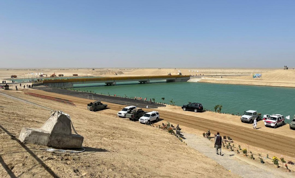
Presentation of Karel Vereycken at the second panel discussion of the « Water for Peace » seminar organized by the Schiller Institute on January 9, 2024 in Paris.
Let’s start with current events. In August 2021, faced with the Taliban takeover, the United States hastily withdrew from Afghanistan, one of the world’s poorest countries, whose population has doubled in 20 years to 39.5 million.
While the UN acknowledged that the country was facing « the worst humanitarian crisis » in the post-war era, overnight all international aid, which represented more than half of the Afghan budget, was suspended. At the same time, $9.5 billion of the country’s central bank assets, held in accounts at the US Federal Reserve and a number of European banks, were frozen.
Qosh Tepa canal
Despite these dramatic conditions, the Afghan government, via its state construction group, the National Development Company (NDC), committed $684 million to a major river infrastructure project, the Qosh Tepa Canal, which had been suspended since the Soviet invasion.
In less than a week, over 7,000 drivers flocked from the four corners of the country to work day and night on the first section of the canal, the first phase of which was completed in record time.
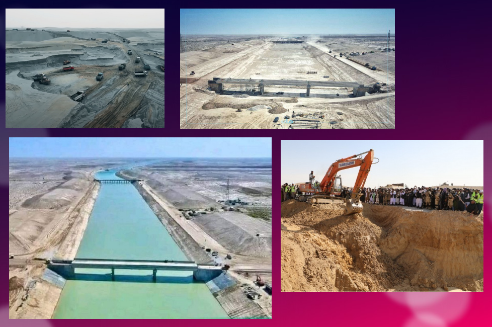
Politically, the canal project is a clear expression of the re-birth of an inclusive Afghanistan, as the region is mainly inhabited by Turkmen and Tajik populations, whereas the government is exclusively in the hands of the Pashtuns. The latter represent 57% rather than 37% of the country.
According to the FAO, 62.5% of the Abu Darya’s water comes from Tajikistan, 27.5% from Afghanistan (22 million m3), 6.3% from Uzbekistan, 1.9% from Kyrgyzstan and 1.9% from Turkmenistan.

The river irrigates 469,000 ha of farmland in Tajikistan, 2,000,000 ha in Turkmenistan and 2,321,000 ha in Uzbekistan.
So it’s only natural that Afghanistan should harness some of the river’s waters (10 million m³ out of a total of 61.5 to 80 million m³ per year) to irrigate its territory and boost its ailing agricultural production
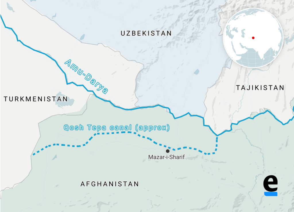
By harnessing part of the waters of the Amu Daria river, the new 285 km-long canal will eventually irrigate 550,000 ha of arid land in ancient Bactria to the north, the « Land of a 1000 Cities » and« The Land of Oases » whose incomparable fertility was already praised by the 1st-century Greek historian Strabo.
In October 2023, the first 108 km section was impounded.
Agricultural production has been kick-started to consolidate the riverbanks, and 250,000 jobs are being created.
While opium poppy cultivation has been virtually eradicated in the Helmhand, the aim is to double the country’s wheat production and to become a grain net exporter.
Today, whatever one may think of the regime, the Afghans, who for 40 years have been self-destructing in proxy wars in the service of the Soviets and Americans, have decided to take their destiny into their own hands. Putting an end to the systemic corruption that has enriched an international oligarchy, they are determined to build their country and give their children a future, notably by making water available for irrigation, for health and for the inhabitants.
How did the world react?
On November 7, in The Guardian, Daanish Mustafa, a professor of « critical geography », explains that Pakistan must rid itself of the colonial spirit of water.
In his view, the floods that hit Pakistan in 2010 and 2022 demonstrate that « colonial » river and canal development is a recipe for disaster. It’s time, he concludes, to « decolonize » our imaginations on the subject of water by abandoning all our vanitous desires to manage water.
On November 9, the Khaama Press News agency reported:

« Tensions have risen between the de facto authorities of Afghanistan and Pakistan due to the ongoing deportation of Afghan migrants. Most recently, Pakistan has called for a halt to the Qush Tepa project. Abdul Haq Hamad, former head of media publications supervision, said in a televised debate that the Pakistani authorities had made it explicitly known at an official meeting with Taliban administration leaders that they must ‘stop operations on the Qush Tepa channel’.
« According to him, the Pakistani authorities are not satisfied with the completion of the Qosh Tepa Canal, as Afghanistan gains autonomy through this canal in managing its waters. »
Two days earlier, on November 7, Cédric Gras, Le Figaro‘s correspondent in Tashkent, published an article entitled:
« En Afghanistan, les Talibans creusent le canal de la discorde » (« In Afghanistan, the Taliban are digging the canal of discord »):
« The Afghanistan of the Taliban is in the process of digging a gigantic irrigation canal upstream from the Amou-Daria river. To the detriment of downstream countries and the Aral Sea, whose water supply and agricultural crops are threatened ».
Obviously, the aim is to create scare. But if the accusation is hasty, it touches on a fundamental issue that deserves explanation.
Endoreic basin
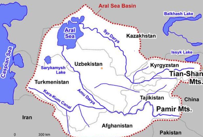
The Amu Daria, the 2539 km long river that the Greeks called the Oxus, and its brother, the 2212 km long Syr Daria, feed, or rather used to feed, the Aral Sea, which straddles the border between Uzbekistan and Kazakhstan. The water of both rivers were increasingly redirected by soviet experts to irrigate mainly cotton cultivation causing the Aral Sea to disappear.
I won’t go into detail here on the history of the ecological disaster that everyone has heard about but I am ready to answer your questions on that later;
The « Aral Sea Basin » essentially covers five Central Asian « stan » countries. To the North, these are Kazakhstan, followed by Kyrgyzstan, Tajikistan, Uzbekistan and Turkmenistan.
In fact, Afghanistan, whose border with the latter three countries is formed by sections of the Amu Darya, is geologically and geographically part of the « Aral Sea Basin ».
This is a so-called « endoreic basin ». (endo = inside; rhein = carried).
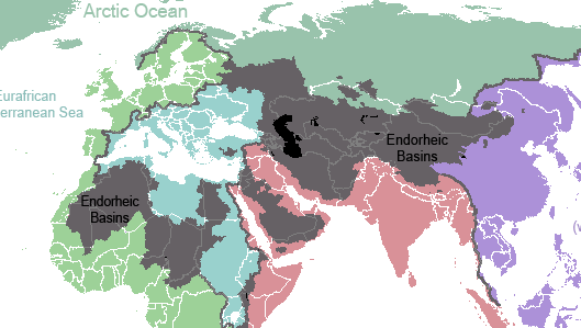

In Europe, we see falling rain and snowmelt flowing into rivers that discharge it into the sea. Not so in Central Asia. Rainwater, or water from melting snow, flows down mountain ranges. They eventually form rivers that either disappear under the sands, or form « inland seas » having no connection whatever to a larger sea and no outlet to the oceans. 18% of the world’s emerged surface is endoreic.
Among the best-known endoreic basins are the Dead Sea in Israel and Lake Chad in Africa.
In Asia, there are plenty of them. Just think of the Tarim Basin, the world’s largest endoreic river basin in Qinjiang, covering over 400,000 km². Then there’s the vast Caspian Sea, the Balkhach and Alakoll lakes in Kazakhstan, the Yssyk Kul in Kyrgyzstan and, as we’ve just said, the Aral Sea.
The very nature of an endoreic basin strongly reinforces the fear that water is a scarce limited source. That realty can either bolster the conviction that problems cannot but be solved true cooperation and discussion, or push countries to go to war one against the other. Democraphic growth, economic progress and climate/meteorogical chaos can worsen that perception and make water issues appear as a « time-bomb ».
The early Soviet planners started with a strict quota system laid down in 1987 by Protocol 566 of the Scientific and Technical Council of the Soviet Ministry of Water Resources. The system fixed quotas for all countries, both in percentage and in BCM (Billions of Cubic Meters).
That simple quota system looks 100 % functional on paper. However, nations are not abstractions.
First, this system created quite rigid procedures and even would forbid some upstream countries to invest in their own agriculture since they had to deliver the water to their neighbors.
Second, conflict arose about dissymetric seasonal use of the water. The use of the water was completely different between « Upstream countries » such as Kyrgyzstan and Tajikistan and « Downstream countries » such as Uzbekistan and Turkmenistan.
Upstream countries could accept releasing their water resources in autumn and winter since the release of the water provides them up to 90 % of their electricity via hydrodams.
Downstream countries however don’t need the water at that time but in spring and summer when their farmland needs to be irrigated.
However, in Central Asia, their seems to exist some sort of « geological justice » since downstream countries lacking water (Kazakhstan, Uzbekhistan and Turkmenistan) have vast hydrocarbon energy reserves such as coal, oil and gaz.
Therefore, not always stupid, Soviet planners, which realized that a simple quota system was insufficient to prevent conflict, created a compensation mechanism. Downstream nations, in exchange for water, would supply parts of their oil and gas to upstream nations to compensate the loss of potential energy that water represents.
However imperfect that mechanism, for want of a better one, it remained in place after the collapse of the Soviet Union in 1991.
It can be said that by appealing to an external factor of a given problem, in this case to bring energy in the equation to solve the water problem, soviet planners conceived in a rudimentary form what became known as the « Water, Energy, Food Nexus ». One cannot deal with theses factors as separate factors. They have to be conceived as part of a single, dynamic Monad.
Today, we should avoid the geopolitical trap. If we consider the water resources to be shared between the states of Central Asia and Afghanistan to be « limited », or even « declining » due to meteorological phenomena such as El Nino, we might hastily and geopolitically conclude that, with the construction of the Qosh Tepa canal, which will tap water from the Amu Daria, the « water time bomb » cannot but explode.
Solutions
So we need to be creative. We don’t have all the solutions but some ideas about where to find them:
- In Central Asia, especially in Turkmenistan but also Uzbekistan, huge quantities of water from the Abu Daria water basin are wasted. In 2021, Chinese researchers, looking at Central Asia’s potential in terms of food production, estimated that with improvements in irrigation, better seeds and other « agricultural technology », 56 % of the water can be saved farming the same crops, meaning that today, about half of the water is simply wasted.
- The lack of investment into new water infrastructure and maintenance cannot but lead to the kind of disasters the world has seen in Libya or Pakistan where, predictably, systems collapsed for lack of mere maintenance;
- Uncontrolled and controlled flooding are very primitive and inefficient forms of irrigation and should be outphased and replaced by modern irrigation techniques;
- Therefore, a water emergency should be declared and a vast international effort should assist all the countries of the Abu Daria basin, including Afghanistan, to modernize and improve the efficiency of their water infrastructure, be it lakes, canals, rivers and irrigation systems.
- Such and effort can best organized within the framework of the « One Belt, One Road » initiative and the Shanghai Cooperation Organization. BRICS countries such as China, Russia and India could help Afghanistan with data from their satellites and space programs.
- By improving the efficiency of water use, notably through targeted irrigation using « drip irrigation » as seen in the case of the Tarim basin in Xinjiang, it is possible to reduce the total amount of water used to obtain an even higher yield of agriculture production, while considerably increasing the availability of the water to be shared among neighbors. The know how and experience of African, South American, Israeli and Chinese agronomists, specialized in food production in arid countries, can play a key role.
- In the near future, Pumped Hydro Energy Storage (PHES), which means storing water in high altitude reservoirs for a later use, can massively increase the independance and autonomy of countries such as Afghanistan and others. Having sufficient water at hand at any time means also having the water security required to operate mining activities and handle thermal and nuclear electricity production units. PHES infrastructure would be greatly efficient on both sides of the Abu Daria and jointly operated among friendly nations.

Over the past 1,200 years, nations bordering waterways have concluded 3,600 treaties on the sharing of river usufructs, whether for fishing, river transport or the sharing of water for domestic, agricultural and industrial uses.
Afghanistan’s Qosh Tepa canal project is a laudable and legitimate initiative. But it is true that by breaking the status quo, it obliges a new dialogue among nations allowing each and all of them to rise to a higher level, a willing to live together increasingly the opposite to the dominant paradigm in the Anglosphere and its european followers.
It’s up to all of us to make sure it works out fine.
The science of Oases, from the Indus Valley to Persian qanats

Presentation of Karel Vereycken at the first panel discussion of the « Water for Peace » seminar organized by the Schiller Institute on January 9, 2024 in Paris.
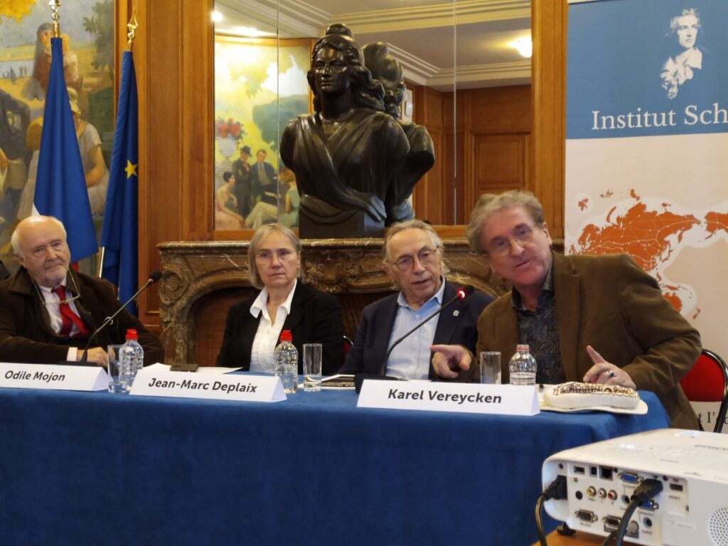
While the dog was domesticated as early as 15,000 years BC, we associate the first human activities aimed at managing water with the Neolithic period, which began around 10,000 BC.
It is thought to be the moment at which mankind moved from a « tribal subsistence economy of hunter-gatherers » to agriculture and animal husbandry, giving rise to villages and cities, where pottery, weaving, metallurgy and the arts would start blooming.
Key to this, the domestication of animals. The goat was domesticated around 11,000 BC, the cow around 9,000 BC, the sheep around -8,000 BC, and finally the horse around 2,200 BC in the steppes of Ukraine.
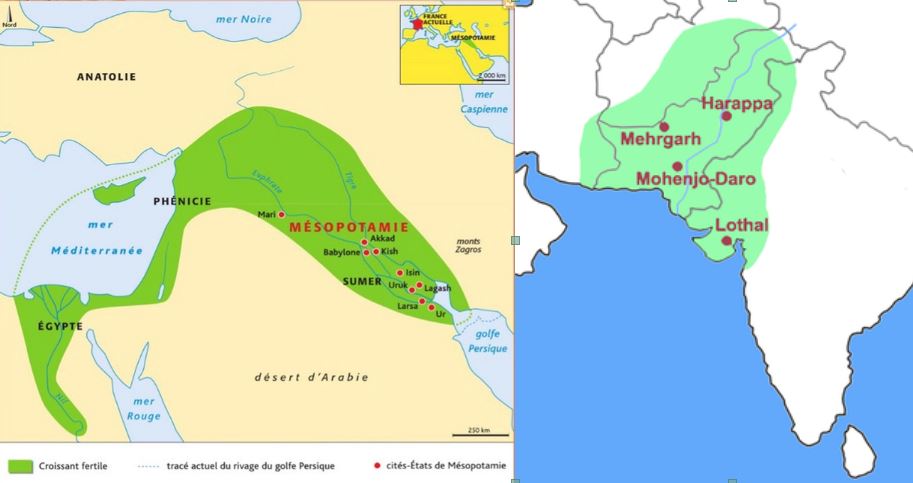
The oldest archaeological sites showing agricultural activities and irrigation techniques were discovered in the Indus Valley and the « Fertile Crescent ».
The site of Mehrgarh, in the Indus Valley, now Pakistan Balochistan, discovered in 1974 by François and Cathérine Jarrige, two French archaeologists, demonstrates important agricultural practices from 7000 BC onward.
Cotton, wheat and barley were grown, and beer was brewed. Cattle, sheep and goats were raised. But Mehrgarh was much more than that.
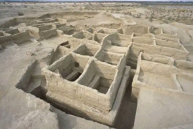
Contradicting the linear « developmental » schema, since we’re in the middle of the Neolithic, Mehrgarh is also home to the oldest pottery in South Asia and, above all, to the “Mehrgahr amulet”, the oldest bronze object casted with the « lost-wax » method.
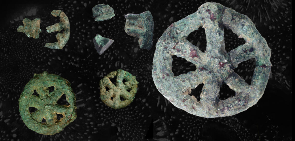
The first seals made of terracotta or bone and decorated with geometric motifs were found here.
On the technological side, tiny bow drills were used, possibly for dental treatment, as evidenced by the pierced teeth of some skeletons found on site.
At the same time, or shortly afterwards, around 6000 B.C., Mesopotamia, between the Tigris and Euphrates rivers, witnessed rapid urban development in terms of demographics, institutions, agriculture, techniques and trade.
A veritable « fertile crescent » emerged in the region stretching from Sumer to Egypt, passing through the whole of Mesopotamia and the Levant, i.e. Syria and the Jordan Valley.
Irrigation
Whether in the Indus Valley, Mesopotamia or Egypt, the earliest irrigation techniques are nothing but retaining as much water as possible when Mother Nature has the sweet kindness to offer it to mankind.
Rainwater was collected in cisterns and, as much as possible, when snowmelt or monsoon rains swell the rivers, the objective was to amplify and steer seasonal « flooding » by canals and trenches carrying the water as far away as possible to areas to be cultivated, while at the same time protecting crops.
In Egypt, for example, where the Nile rises by around 8 meters, the water brings not only moisture but also silt to the soil near the river, providing crops with the nutrients they need to grow and thus maintain the soil’s fertility.
While the Egyptians complained about the harsh labor condition of their farmers, for the Greek historian Herodotus, this was the place in the world where work was least arduous. Of Egypt he says:
“Its soil is black and crumbly, made of silt and alluvium brought from Ethiopia by the river. Certainly, these people are today, of all the human race in Egypt as elsewhere, those who go to the least trouble to obtain their crops.
« They don’t bother to plough and weed. When the river has come of its own accord to water their fields and, its task done, has withdrawn, each man sows his land and lets the pigs loose: by trampling, the beasts sink the seeds into the earth, and the man has only to wait for the harvest.”
In Mehrgarh, where agriculture was born from 7000 BC, the work was indeed far more demanding.
However, the drainage system around the village and the rudimentary dams to control water-logging indicate that the inhabitants understood most of the basic principles involved. The cultivation of cotton, wheat and barley, as well as the domestication of animals, show that they were also familiar with canals and irrigation systems.
Constantly refined, this know-how enabled the civilization of the Indus Valley to create great cities that impress us by their modernity, notably Harappa and Mohenjo Daro, a city of 40,000 inhabitants with a public bath in its center, not a palace.
Pioneers of modern hygiene, these towns were equipped with small containers where residents could deposit their household waste.
Anticipating our « all-to-the-sewer » systems imagined in the early XVIth century by Leonardo da Vinci, for example in his plans for the new french capital of Romorantin, many towns had public water supplies as well as an ingenious sewage system.
In the port city of Lothal (now India), for example, many homes had private brick bathrooms and latrines. Wastewater was evacuated via a communal sewage system leading either to a canal in the port, or to a soaking pit outside the city walls, or to buried urns equipped with a hole for the evacuation of liquids, which were regularly emptied and cleaned.
Excavations at the Mohenjo Daro site reveal the existence of no fewer than 700 brick wells, houses equipped with bathrooms and individual and collective latrines.

Many of the city’s buildings had two floors or more. Water trickled down from cisterns installed on the roofs was channeled through closed clay pipes or open gutters that emptied into the covered sewers beneath the street.
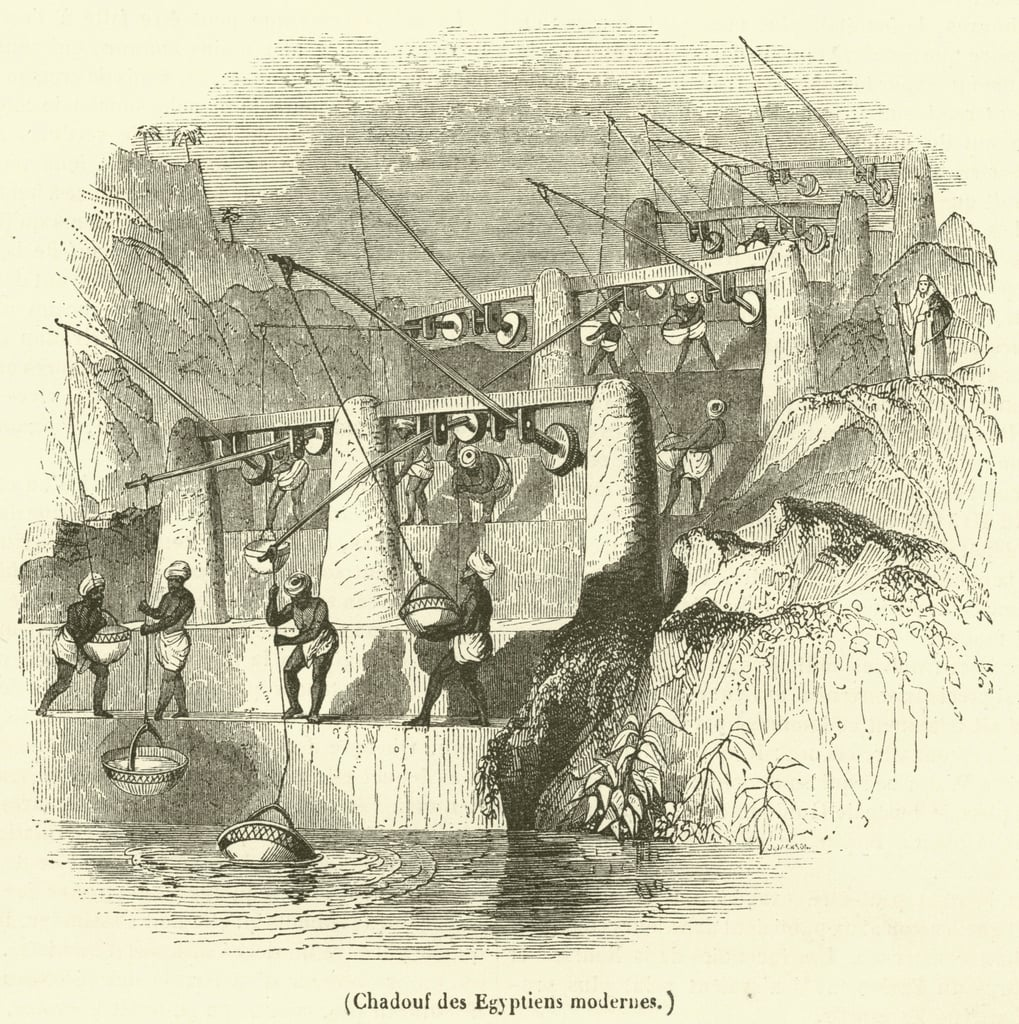
This hydraulic and sanitary know-how was passed on to the civilization of Crete, the mother of Greece, before being implemented on a large scale by the Romans.
It was forgotten with the collapse of the Roman Empire, only to return during the Renaissance.
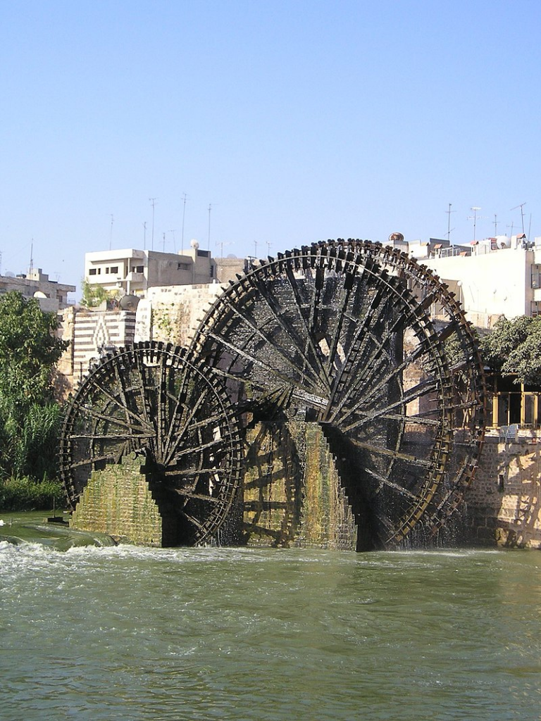
The first human contributions were aimed at maximizing water reservoirs and their gravity-flow capacity. To achieve this, it was necessary to transfer water from a lower level to higher ground and build « water towers ».
To this end, the Mesopotamian « chadouf » was widely used in Egypt, followed by the « Archimedean screw ».
Next came the « saquia » or « Persian wheel », a geared wheel driven by animal power, and finally the « noria », the best-known water-drawing machine, powered by the river itself.
Persian qanats
Before Alexander the Great, Persia’s Achaemenid Empire (6th century BC) developed the technique of underground qanats or underground aqueducts. This « draining gallery” cut into the rock or built by man, is one of the most ingenious inventions for irrigation in arid and semi-arid regions.
Whatever displeases our environmentalist friends, it’s not nature that magically produces « oases » in the desert.
It’s a scientific man who digs a drainage gallery from a water table close enough to the ground surface, or sometimes from an aquifer that flows into the desert.
On the website of ArchéOrient, archaeologist Rémy Boucharlat, Director of Emeritus Research at the French CNRS, an expert on Iran, explains:
« Whatever the origin of the water, deep or shallow, the gallery construction technique is the same. The first step is to identify the presence of the water, either its underflow near a river, or the presence of a deeper water table on a foothill, which requires the science and experience of specialists.
A motherwell reaches the upper part of this layer or water table, which indicates the depth at which the gallery should be dug. The slope of the gallery must be very shallow, less than 2‰, to ensure a calm and regular flow of water, and to gradually lead the water to the surface, at a gradient much lower than the slope of the piedmont.
The gallery is then excavated, not from the mother well, as it would be flooded immediately, but from downstream, from the arrival point. The pipe is first dug as an open trench, then covered, and finally gradually tunnelled into the ground.
Shafts are dug from the surface at regular intervals, between 5 and 30 m depending on the nature of the terrain, to evacuate soil and provide ventilation during excavation, and to mark the direction of the tunnel.”
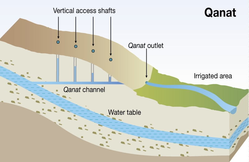
Historically, the majority of the populations of Iran and other arid regions of Asia and North Africa depended on the water supplied by qanats; settlement areas thus corresponded to the places where their construction was possible.
The technique offers a significant advantage: as the water moves through an underground conduit, not a drop of water is lost through evaporation.
This technique spread throughout the world under various names: qanat and kareez in Iran, Syria and Egypt, kariz, kehriz in Pakistan and Afghanistan, aflaj in Oman, galeria in Spain, kahn in Balochistan, kanerjing in China, foggara in North Africa, khettara in Morocco, ngruttati in Sicily, bottini in Siena, etc.).
Improved by the Greeks and amplified by the Etruscans and the Romans, the qanats technique was carried by the Spaniards across the Atlantic to the New World, where numerous underground canals of this type still operate in Peru, Chile and western Mexico.
After Alexander the Great, Bactria, covering parts of today’s Uzbekistan, Turkmenistan and the northern part of Afghanistan, was even known as the « Oasis civilization » or the “Land of a 1000 Golden Cities”.
Iran boasts it had the highest number of qanats in the world, with approximately 50,000 qanats covering a total length of 360,000 km, about 9 times the circumference of the Earth !
Thousands of them are still operational but increasingly destabilized by erratic well digging and demographic overconcentration.
Shared responsability
In 1017, the Baghdad-based hydrologist Mohammed Al-Karaji provided a detailed description of qanat construction and maintenance techniques, as well as legal considerations about the collective management of wells and pipes.
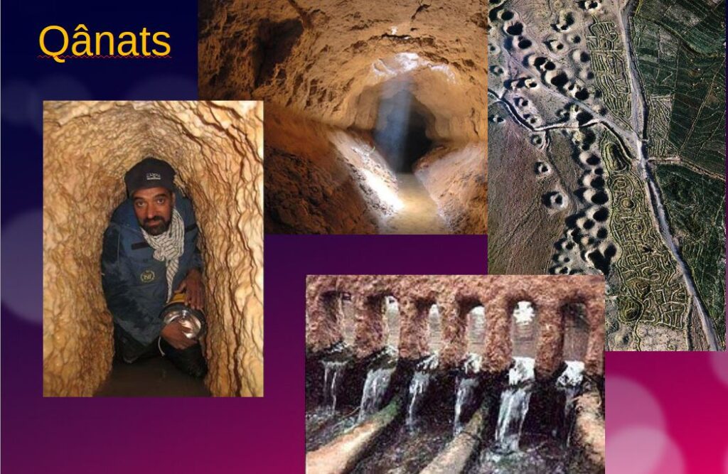
While each qanat is designed and supervised by a mirab (dowser-hydrologist and discoverer), building a qanat is a collective task that takes several months or years for a village or group of villages. The absolute necessity of collective investment in the infrastructure and its maintenance calls for a superior notion of the common good, an indispensable complement to the notion of private property that rains and rivers are not accustomed to respecting.
In North Africa, the management of water distributed by a khettara (the local name for qanâts) is governed by traditional distribution norms known as « water rights ».
Originally, the volume of water granted per user was proportional to the work involved in building the khettara, and translated into an irrigation period during which the beneficiary could use all the khettara’s flow for his or her fields. Even today, when the khettara has not dried up, this rule of water rights still applies, and a share can be bought or sold. The size of each family’s fields to be irrigated must also be taken into account
All of this demonstrates that good cooperation between man and nature can do miracles if man decides so.
Thank you for your attention and questions welcome!
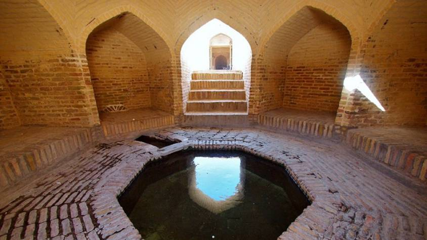
Derrière les « chevaux célestes » chinois, la science terrestre

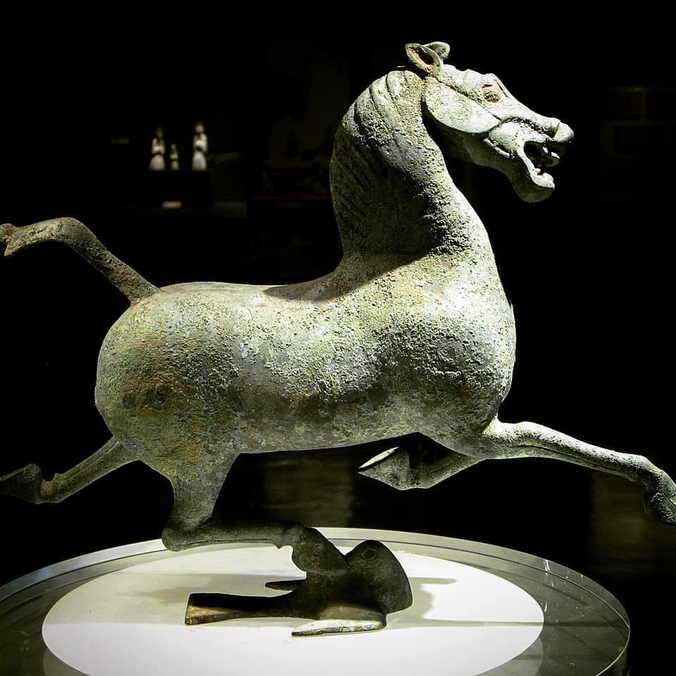
Le fait qu’aujourd’hui encore, en parlant d’une voiture, on utilise l’unité « cheval » (CV) pour indiquer la puissance et donc le « travail » que le moteur peut fournir, en dit long sur le rôle majeur que les chevaux ont joué dans l’histoire de l’humanité.
Récemment invité à une conférence à Kaboul, en Afghanistan, j’ai évoqué à propos du besoin d’investissement en infrastructures hydrauliques, la domestication du cheval comme un bel exemple du passage d’une « plateforme infrastructurelle donnée » à une « plateforme supérieure », le terme plateforme faisant référence ici non pas à l’impact direct de l’infrastructure en question, mais à l’effet beaucoup plus large induit dans l’ensemble de l’économie d’un pays.
Nul besoin d’être anthropologue pour comprendre que l’histoire de l’humanité a radicalement changé avec la domestication du cheval, certaines choses considérées comme impossibles auparavant devenant, du jour au lendemain, la normalité.
La question de savoir quand et comment l’animal a été domestiqué reste sujet à controverse. Bien que des chevaux apparaissent dans l’art rupestre du paléolithique dès 36 000 ans avant notre ère (grotte Chauvet, France), il s’agissait alors de chevaux sauvages sans doute chassés pour leur viande.
Pour les zoologistes, la domestication se définit comme la maîtrise de l’élevage, pratique confirmée par des restes de squelettes anciens indiquant des changements dans la taille et la variabilité des populations de chevaux anciens.
D’autres chercheurs s’intéressent à des éléments plus généraux de la relation homme-cheval, notamment les preuves squelettiques et dentaires de l’activité professionnelle, les armes, l’art et les artefacts spirituels, ainsi que les modes de vie. Il est prouvé que les chevaux furent une source de viande et de lait avant d’être dressés comme animaux de travail.
En Inde, près de Bhopal, les abris-sous-roche du Bhimbetka, qui constituent le plus ancien art rupestre connu du pays (100 000 av. JC)), représentent des scènes de danse et de chasse de l’âge de pierre ainsi que des guerriers à cheval d’une époque plus tardive (10 000 av. JC).
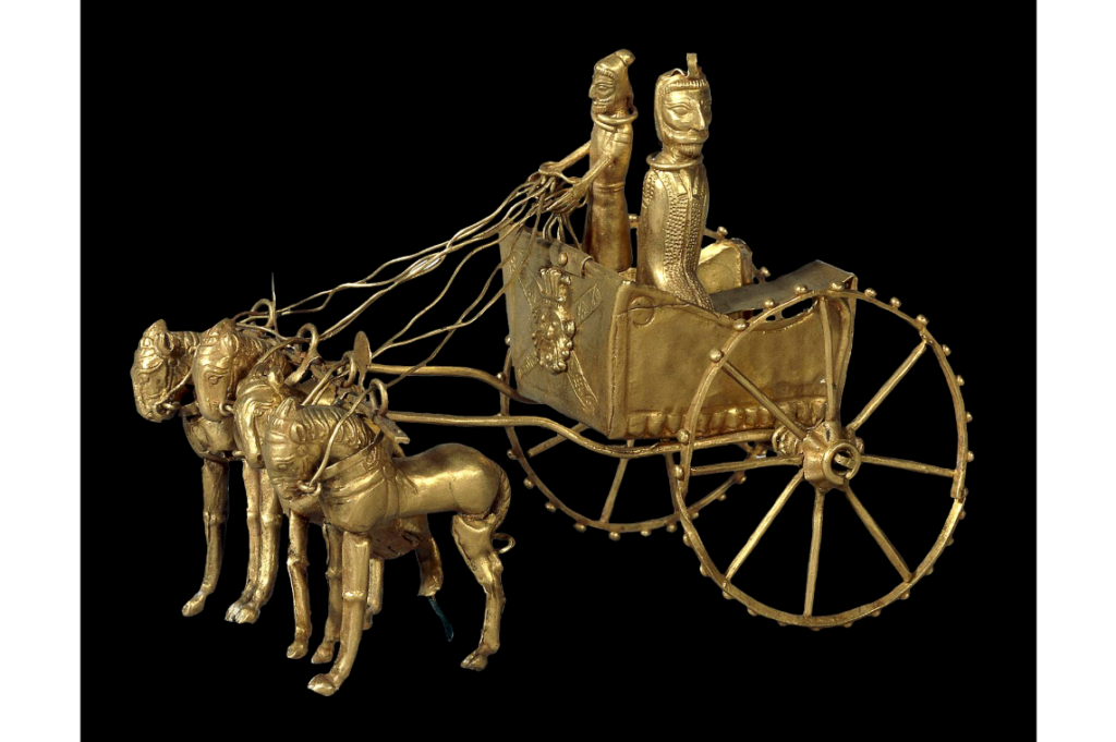
Les preuves les plus évidentes de l’utilisation précoce du cheval comme moyen de transport sont les sépultures présentant des chevaux avec leurs chars. Les plus anciens vrais chars, datant d’environ 2000 av. JC, ont été retrouvés dans des tombeaux de la culture de Sintachta, dans des sites archéologiques situés le long du cours supérieur de la rivière Tobol, au sud-est de Magnitogorsk en Russie. Il s’agit de chars à roues à rayons tirés par deux chevaux.
Kazakhstan et Ukraine
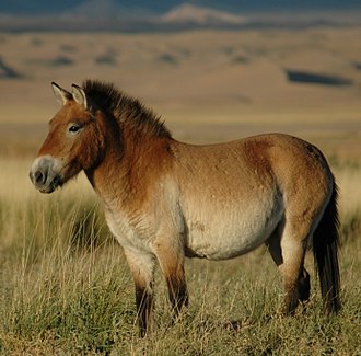
Jusqu’à récemment, on pensait que le cheval le plus communément utilisé aujourd’hui était un descendant des chevaux domestiqués par la culture de Botaï, vivant dans les steppes de la province d’Akmola au Kazakhstan.
Cependant, des recherches génétiques récentes (2021) indiquent que les chevaux de Botaï ne sont que les ancêtres du cheval de Przewalski, une espèce qui a failli disparaître.
Selon les chercheurs, notre cheval commun, Equus ferus caballus, aurait été domestiqué il y a 4200 ans en Ukraine, dans la région du Don-Volga, c’est-à-dire la steppe pontique-caspienne de l’Eurasie occidentale, vers 2200 av. JC. Au fur et à mesure de leur domestication, ces chevaux ont été régulièrement croisés avec des chevaux sauvages.
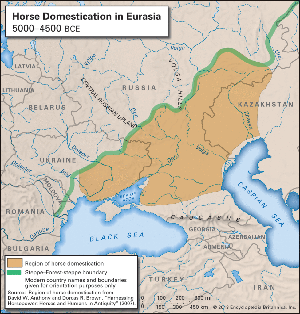
Il est intéressant de noter à cet égard que, selon « l’hypothèse kourgane » formulée par Marija Gimbutas en 1956, c’est depuis cette région que la plupart des langues indo-européennes se sont répandues dans toute l’Europe et certaines parties de l’Asie.
Le nom vient du terme russe d’origine turque, « kourgane », qui désigne les tumuli caractéristiques de ces peuples et qui marquent leur expansion en Europe.
La Route du thé, du cheval ou de la soie?
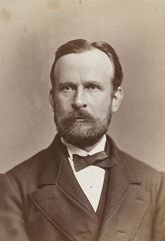
La description des échanges commerciaux, culturels et humains tout au long des « Routes de la soie » a fait couler beaucoup d’encre. Or, ce terme est récent. Ce n’est qu’en 1877 que le géographe allemand Ferdinand von Richthofen l’utilise pour la première fois afin de désigner ces axes Est-Ouest structurant les échanges mondiaux.
En réalité, il s’avère que l’une des principales marchandises échangées sur ladite Route de la soie était… les chevaux et autres animaux de labour (mules, chameaux, ânes et onagres).
Si l’on y échangeait effectivement la soie et le thé, ces produits constituaient, comme la porcelaine et l’or, un moyen pour régler d’autres achats, notamment les chevaux que les Chinois cherchaient à acquérir.
Ce que l’on appelait la « Route du thé et du cheval » (route de la soie du sud) partait de la ville de Chengdu, dans la province du Sichuan, en Chine, traversait le Yunnan vers le sud, jusqu’en Inde et dans la péninsule indochinoise, et s’étendait vers l’ouest jusqu’au Tibet.
C’était une route importante pour le commerce du thé en Chine du Sud et en Asie du Sud-Est, et elle a contribué à la diffusion de religions comme le taoïsme et le bouddhisme dans la région. Il est vrai que « Route de la soie » est plus poétique que « route du crottin » !
La Steppe et ses nomades
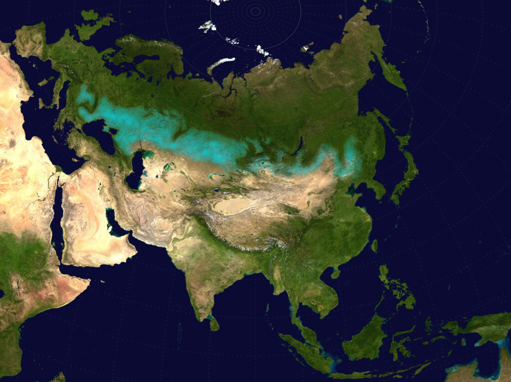
Constamment harcelée par les peuples nomades des steppes du Nord, la Chine entreprit la construction de sa Grande Muraille dès le VIIe siècle av. JC.
La liaison entre les premiers éléments fut réalisée par Qin Shi Huang (220-206 avant JC.), le premier empereur de Chine, et l’ensemble du mur, achevé sous la dynastie des Ming (1368-1644), est devenu l’un des exploits les plus remarquables de l’histoire humaine.
Le terme générique de « nomades eurasiens » englobe les divers groupes ethniques peuplant la steppe eurasienne, se déplaçant à travers les steppes du Kazakhstan, du Kirghizistan, du Tadjikistan, du Turkménistan, d’Ouzbékistan, de Mongolie, de Russie et d’Ukraine.
En domestiquant le cheval vers 2200 av. JC., ces peuples augmentèrent considérablement les possibilités de vie nomade.

Par la suite, leur économie et leur culture se concentrèrent sur l’élevage de chevaux, l’équitation et le pastoralisme nomade, permettant de riches échanges commerciaux avec les peuples sédentaires vivant en bordure de la steppe, que ce soit en Europe, en Asie ou en Asie centrale.
On pense qu’ils opéraient souvent sous forme de confédérations. Par définition, les nomades ne créent pas d’empires. Sans forcément les occuper, en contrôlant les points névralgiques, ils règnent en maître sur d’immenses territoires.
Ce sont eux qui développèrent le char, le chariot, la cavalerie et le tir à l’arc à cheval, introduisant des innovations telles que la bride, le mors, l’étrier et la selle, qui traversèrent rapidement toute l’Eurasie et furent copiées par leurs voisins sédentaires.
Durant l’âge du fer, des cultures scythes (iraniennes) apparurent parmi les nomades eurasiens, caractérisées par un art distinct, dont la joaillerie en or force l’admiration.
Le cheval en Chine
Les objets funéraires chinois fournissent une quantité extraordinaire d’informations sur le mode de vie des Chinois de l’Antiquité. La cavalerie militaire, mise sur pied dès le IIIe siècle avant J.C., s’y développe afin de faire face aux guerriers nomades et archers à cheval qui menacent la Chine le long de sa frontière septentrionale. Leurs grands et puissants chevaux étaient nouveaux pour les Chinois.
Échangés contre de la soie de luxe, comme nous l’avons dit, ils sont la première importation majeure en Chine depuis la Route de la soie. Des vestiges archéologiques montrent qu’en l’espace de quelques années, les merveilleux destriers arabes deviennent extrêmement populaires auprès des militaires et des aristocrates chinois, et les tombes des classes supérieures sont remplies de représentations de ces grands chevaux destinés à être utilisés dans l’au-delà. Ils restent cependant difficiles à trouver sur place…
Les diplomates chinois et le royaume de Dayuan (Ferghana)
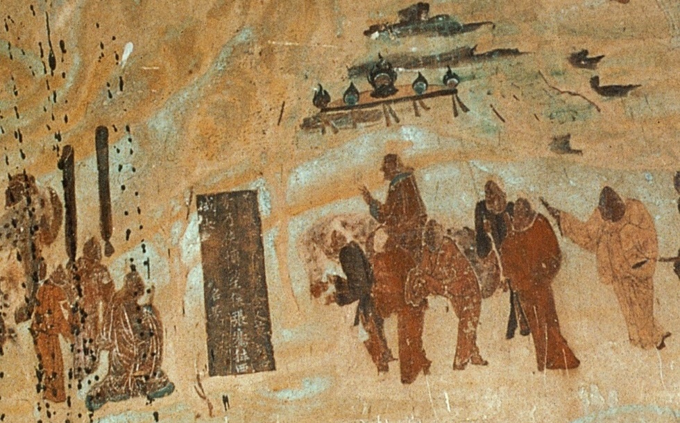
À la fin du IIe siècle av. JC., Zhang Qian, diplomate et explorateur de la dynastie Han, se rend en Asie centrale et découvre trois civilisations urbaines sophistiquées créées par des colons grecs appelés Ioniens.
Le récit de sa visite en Bactriane, et son étonnement d’y trouver des marchandises chinoises sur les marchés (acquises via l’Inde), ainsi que ses voyages en Parthie et au Ferghana, sont conservés dans les œuvres de Sima Qian, l’historien des premiers Han.
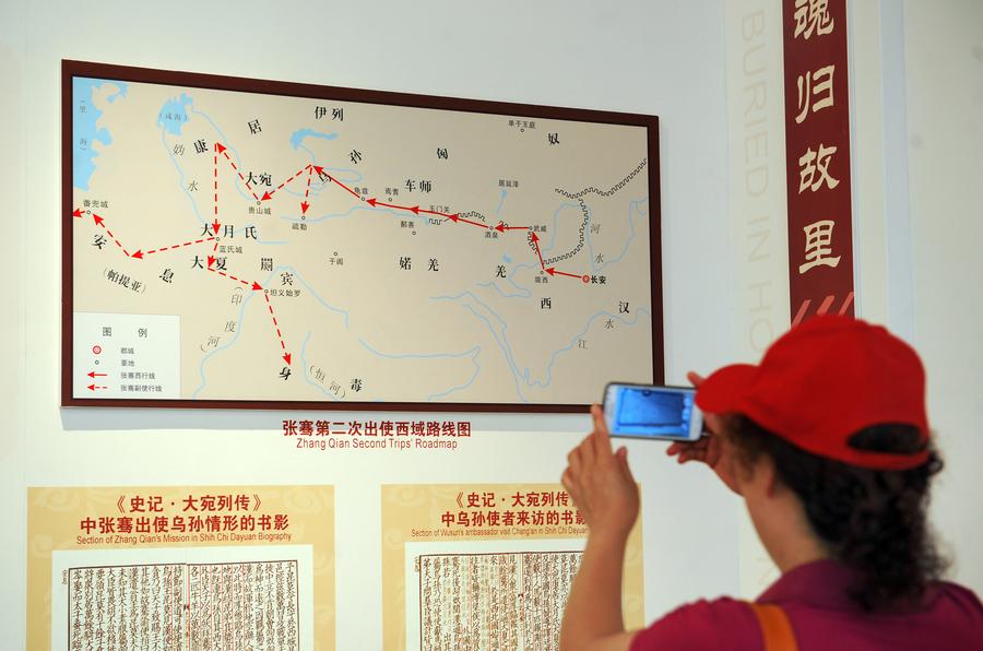
À son retour, son récit incite l’empereur chinois à envoyer des émissaires à travers l’Asie centrale pour négocier et encourager le commerce avec son pays. « Et c’est ainsi que naquit la route de la soie », affirment certains historiens.
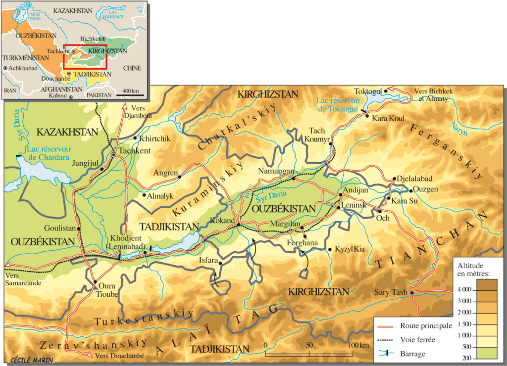
Outre la Parthie et la Bactriane, Zhang Qian visite, dans la fertile vallée de Ferghana (aujourd’hui essentiellement au Tadjikistan), un État que les Chinois baptisèrent le royaume de Dayuan (« Da » signifiant « grand » et « Yuan » étant la translittération du sanskrit Yavana ou du pali Yona, utilisé dans toute l’Antiquité en Asie pour désigner les Ioniens, ou colons grecs).
Les Actes du grand historien et le Livre des Han décrivent Dayuan comme un pays de plusieurs centaines de milliers d’habitants, vivant dans 70 villes fortifiées de taille variable.
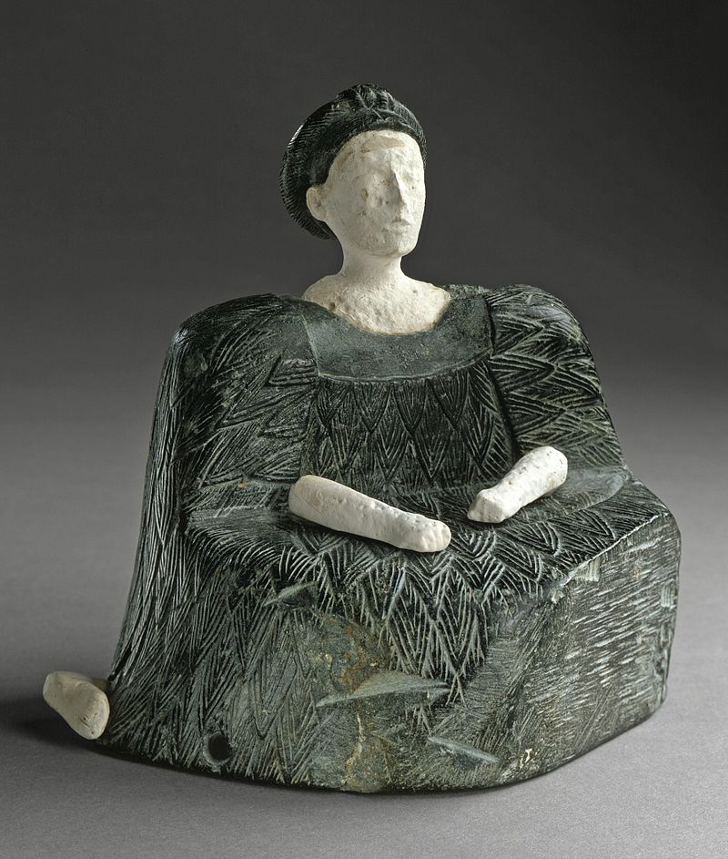
Ils cultivent le riz et le blé et produisent du vin à partir de leurs vignes. Ils avaient des traits caucasiens et des « coutumes identiques à celles de la Bactriane » (l’État le plus hellénistique de la région depuis Alexandre le Grand), dont l’épicentre se trouve alors au nord de l’Afghanistan. (voir notre article)
En outre, le diplomate chinois rapporte un fait d’un grand intérêt stratégique : la présence, dans la vallée de la Ferghana, de chevaux incroyables, rapides et puissants, élevés par ces Ioniens !
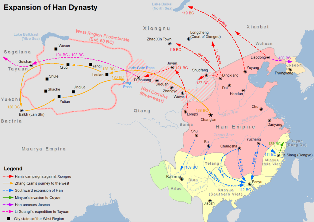
Or, comme nous l’avons déjà dit, la Chine, se sentant menacée en permanence par les peuples nomades des steppes, était en train de construire sa Grande Muraille. Elle avait également conscience de son infériorité militaire par rapport aux nomades des steppes et déplorait son manque cruel de puissants chevaux.
Sans oublier que, dans l’échelle des valeurs chinoises, le cheval possédait une valeur spirituelle et symbolique presque aussi forte que le dragon : il pouvait voler et représentait l’esprit divin et créatif de l’univers lui-même, chose essentielle pour tout empereur désireux d’acquérir aussi bien la sécurité militaire pour son empire que son immortalité personnelle.
Bref, posséder de bons chevaux est alors une question allant au-delà de la sécurité nationale, tout en l’incluant. À tel point qu’en 100 av. JC., lorsque le souverain de la vallée de Ferghana refuse de lui fournir des chevaux de qualité, la dynastie Han déclenche contre Dayuan la « guerre des chevaux célestes ».
Guerre des chevaux célestes
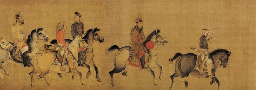
C’est un conflit militaire qui se déroule entre 104 et 102 av. JC. entre la Chine et Dayuan, Etat peuplé d’Ioniens (entre l’Ouzbékistan, le Kirghizstan et le Tadjikistan actuels
Tout d’abord, l’empereur Wu décide d’infliger une défaite décisive aux nomades des steppes, les Xiongnu, qui harcèlent la dynastie Han depuis des décennies.
Pour les faire plier, en 139 av. JC, il envoie le diplomate Zhang Qian avec pour mission d’arpenter l’ouest et d’y forger une alliance militaire avec les nomades chinois Yuezhi contre les Xiongnu.
Zhang Qian, comme nous l’avons dit, se rend en Parthie, en Bactriane et à Dayuan. À son retour, il impressionne l’empereur en lui décrivant les « chevaux célestes » de la vallée de Ferghana, qui pourraient grandement améliorer la qualité des montures de la cavalerie Han lors des combats contre les Xiongnu.
La cour des Han envoie alors jusqu’à dix groupes de diplomates pour acquérir ces « chevaux célestes ».
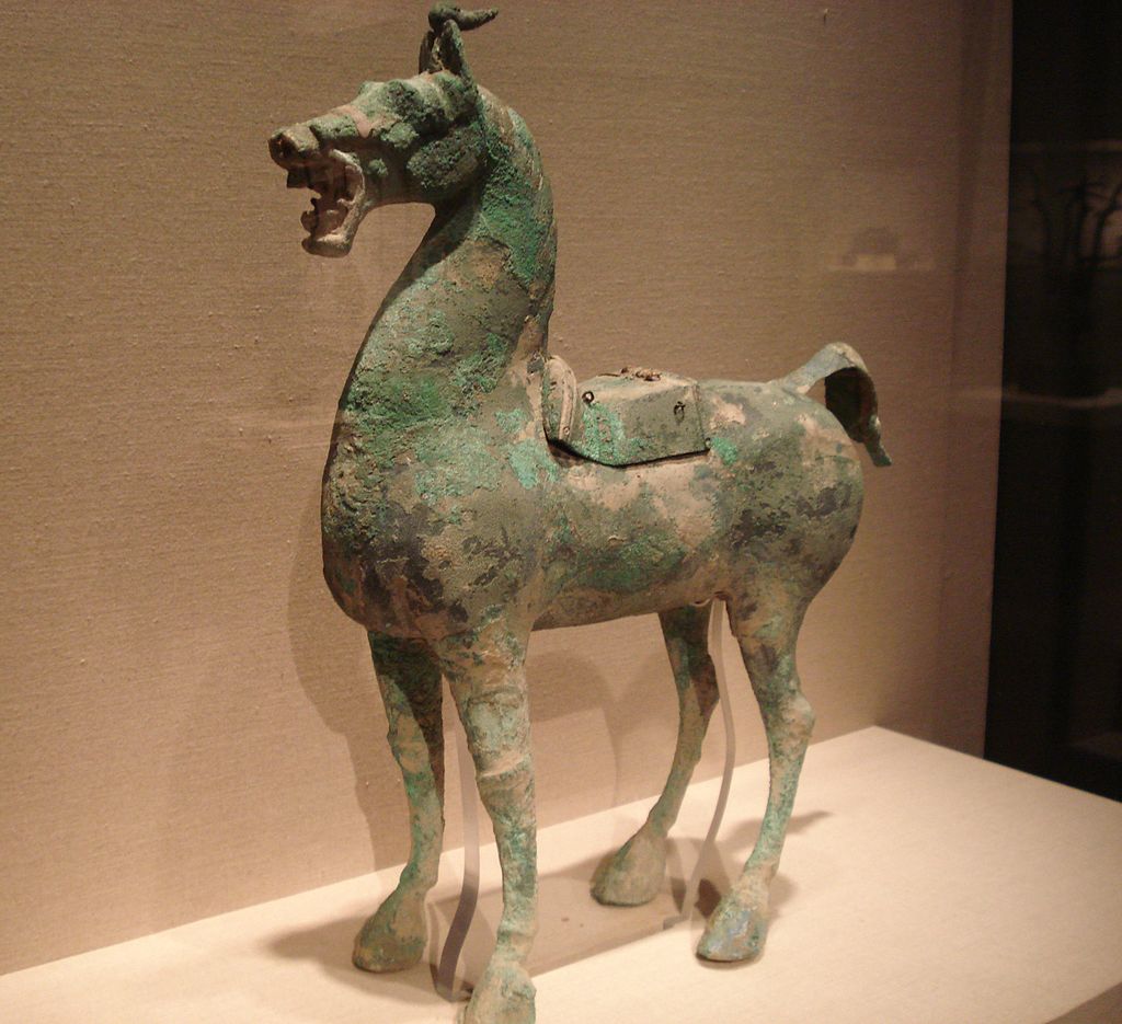
Une mission commerciale et diplomatique arrive donc à Dayuan avec 1000 pièces d’or et un cheval d’or pour acheter les précieux animaux. Dayuan, qui était à cette époque l’un des États les plus occidentaux à avoir des émissaires à la cour des Han, commerce déjà avec eux depuis un certain temps à son grand avantage. Non seulement sa population accède aux marchandises orientales, mais apprend des soldats Han la fonte des métaux pour fabriquer des pièces et des armes. Cependant, contrairement aux autres envoyés à la cour des Han, ceux de Dayuan ne se conforment pas aux rituels des Han et se montrent arrogants, pensant que leur pays est trop éloigné pour avoir à craindre une invasion.
Dès lors, dans un élan de folie et par pure arrogance, le roi du Dayuan non seulement refuse le marché, mais confisque l’or. Les envoyés des Han maudissent les hommes de Dayuan et brisent le cheval d’or qu’ils avaient amené. Furieux de cet acte de mépris, les nobles de Dayuan ordonnent aux militaires de Yucheng, qui se trouvent à leur frontière orientale, d’attaquer les envoyés, de les tuer et de s’emparer de leurs marchandises.
Humiliée et furieuse, la cour des Han envoie alors une armée dirigée par le général Li Guangli pour soumettre Dayuan, mais leur première incursion s’avère mal organisée et insuffisamment approvisionnée.
Deux ans plus tard, une seconde expédition, plus importante et mieux approvisionnée, parvient à assiéger la capitale des Dayuan, « Alexandria Eschate » (aujourd’hui proche de Khodjent, au Tadjikistan), forçant les Dayuan à se rendre sans condition.
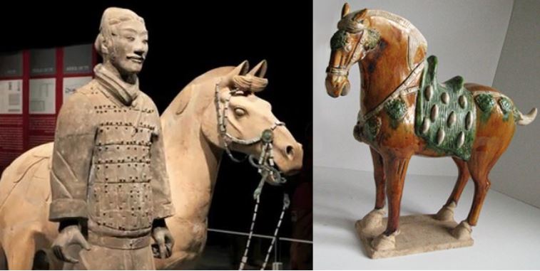
Les forces expéditionnaires y installent alors un régime pro-Han et repartent avec 3000 chevaux. Il n’en restera que 1000 à leur arrivée en Chine, en 101 av. JC.
Le Dayuan accepte également d’envoyer chaque année deux chevaux célestes à l’empereur et des semences de luzerne sont ramenées en Chine, fournissant des pâturages de qualité supérieure pour élever de beaux chevaux afin de fournir une cavalerie capable de faire face aux Xiongnu qui menacent le pays.
Les chevaux ont depuis lors captivé l’imagination populaire en Chine, inspirant des sculptures, faisant l’objet d’élevage dans le Gansu et dotant la cavalerie de 430 000 chevaux de ce type sous la dynastie des Tang.
La Chine et la Révolution agricole
Après avoir imposé son rôle dans la stratégie militaire pour les siècles à venir, le cheval devient, avec la maîtrise de l’eau, le facteur clé permettant d’accroître la productivité agricole.
Contrairement aux Romains, qui préféraient utiliser du « bétail humain » (esclaves) plutôt que des animaux (qu’ils élevaient pour les courses), les Chinois ont contribué de façon décisive à la survie de l’humanité avec deux innovations cruciales concernant l’attelage des chevaux.
Rappelons que pendant toute l’Antiquité, que ce soit en Égypte ou en Grèce, charrues et chariots sont tirés à l’aide d’une bande de cuir encerclant le cou de l’animal.
Cet attelage s’apparente au joug utilisé pour les bœufs, la charge étant attachée au sommet du collier, au-dessus du cou. Le cheval se trouvant ainsi constamment étranglé, ce système réduit considérablement sa capacité à travailler, et plus il tire, plus il a du mal à respirer.
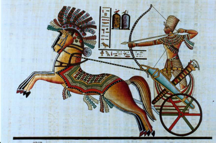
En raison de cette contrainte physique, le bœuf restera l’animal préféré pour les travaux lourds tels que le labourage. Cependant, il est lent, difficile à manœuvrer et n’a pas l’endurance du cheval, qui est deux fois supérieure pour une puissance équivalente.
La Chine aurait d’abord inventé la « bricole », large courroie de cuir enserrant le poitrail du cheval, ce qui était un premier pas dans la bonne direction.
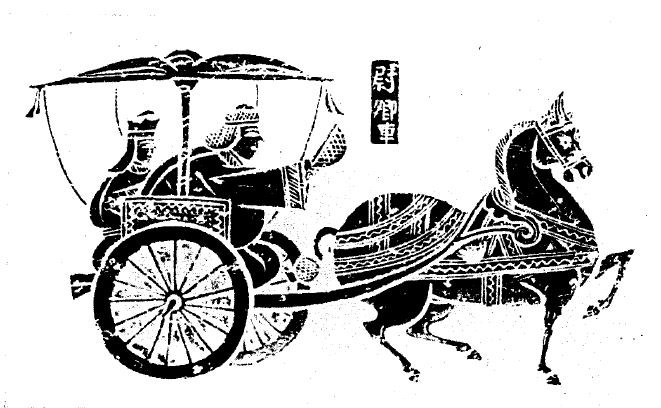
Au Ve siècle, la Chine invente « le collier d’épaule », conçu comme un ovale rigide qui s’adapte au cou et aux épaules du cheval sans lui couper le souffle.
Il présente les avantages suivants :
— Il soulage la pression exercée sur la gorge du cheval, libérant les voies respiratoires de toute constriction, ce qui améliore considérablement le débit d’énergie de l’animal.
— Les traits peuvent être attachés de chaque côté du collier, ce qui permet au cheval de pousser sur ses pattes postérieures, plus puissantes, au lieu de tirer avec celles de devant, plus faibles.
Vous me direz qu’il s’agit là d’une simple anecdote. Vous avez tort, car ce qui semble n’être qu’un changement mineur aura des conséquences gigantesques.
La Renaissance européenne
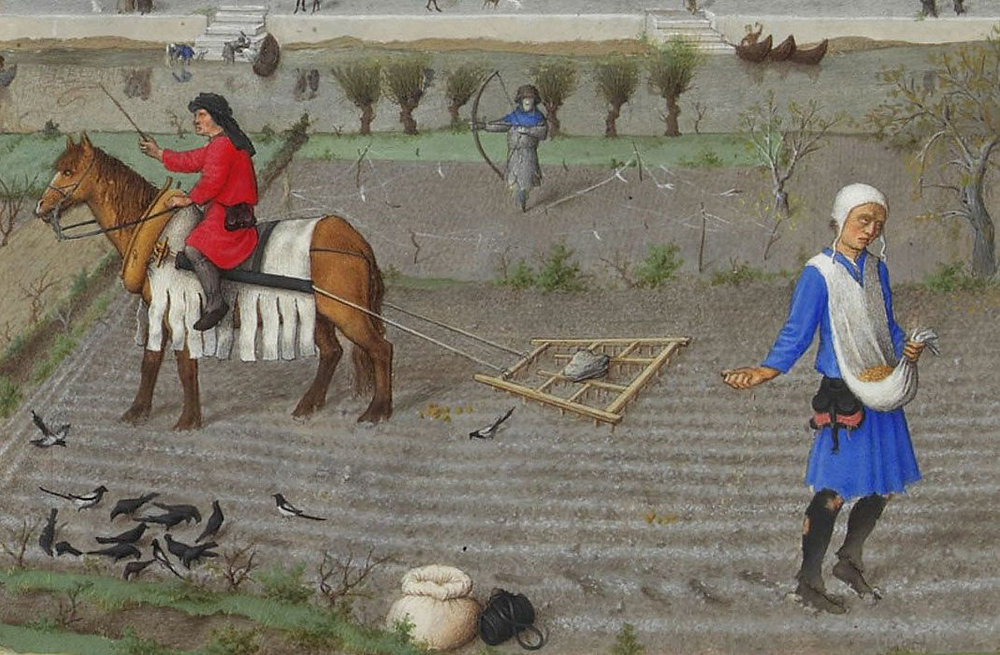
Dans le cadre d’une alliance stratégique et d’une coopération avec le califat humaniste des Abbassides de Bagdad (voir notre article), Charlemagne et ses successeurs ont défriché de vastes terrains pour l’agriculture, amélioré l’usage de l’eau et généralisé le collier d’épaule pour les chevaux de trait.
Grâce à ce nouvel outil beaucoup plus efficace, les agriculteurs européens ont pu tirer pleinement parti de la force du cheval, qui sera alors capable de tirer une autre innovation récente, la lourde charrue. Cela s’est avéré particulièrement appréciable pour les sols durs et argileux, ouvrant de nouvelles terres à l’agriculture.
Le collier, la charrue lourde et le fer à cheval ont contribué à l’essor de la production agricole.
Ainsi, entre l’an 1000 et l’an 1300, on estime qu’en Europe, les rendements agricoles ont triplé, permettant de nourrir un nombre croissant de citoyens dans les villes urbaines apparues au XVe siècle et de donner le coup d’envoi à la Renaissance européenne. Merci la Chine !
Certains chiffres laissent néanmoins perplexes :
–Il aura fallu des milliers d’années à l’humanité pour domestiquer le cheval, en 2200 av. JC. (bien après la vache).
— Il faudra encore 2700 ans à l’humanité pour trouver, au Ve siècle de notre ère, la façon la plus efficace d’utiliser sa force motrice…
Le passage d’une plateforme d’infrastructure inférieure à une plate-forme d’infrastructure supérieure peut certes prendre un certain temps. Les nouvelles plateformes supérieures d’aujourd’hui s’appellent l’espace et l’énergie de fusion.
N’attendons pas encore un millénaire pour savoir comment les utiliser correctement !
Horse-power, the Earthly Science behind China’s “Heavenly Horses”
Indicating the major role horses have played in the history of mankind, the fact that still today, when people talk about the engine of their cars, they use the term “horsepower” (hp) to indicate how much “work” the engine is capable of.
In a lecture on hydro-infrastructure in Kabul, Afghanistan, I recently used the domestication of the horse as an example of what one should understand when we talk about moving from a “lower” to a “higher infrastructure platform”.
The history of mankind completely changed with the domestication of the horse. Things considered “impossible” before the domestication of the horse became the “new normal”. How and when horses became domesticated has been disputed. Although horses appear in Paleolithic cave art as early as 36,000 BC (Chauvet cave, France), these were wild horses and were probably hunted for meat.
Zoologists define « domestication » as human control over breeding, which can be detected in ancient skeletal samples by changes in the size and variability of ancient horse populations. Other researchers look at the broader evidence, including skeletal and dental evidence of working activity; weapons, art, and spiritual artifacts; and lifestyle patterns of human cultures. There is evidence that horses were kept as a source of meat and milk before they were trained as working animals.
In India, close to Bopal, the “Bhimbetka rock shelters”, which are the oldest known rock art of the country, figures dance and hunting scenes from the Stone Age as well as of warriors on horseback from a later time (10 000 BC).
Horses were a late addition to the barnyard. Dogs were domesticated 15,000 years ago; sheep, pigs and cattle, about 8,000 to 11,000 years ago. But clear evidence of horse domestication doesn’t appear in the archaeological record until about 5,500 years ago.
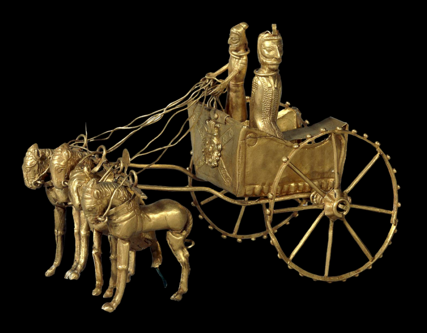
The clearest evidence of early use of the horse as a means of transport is from chariot burials. The earliest true chariots known are from around 2,000 BC, in burials of the Sintashta-Petrovka culture in modern Russia in a cluster along the upper Tobol river, southeast of Magnitogorsk.
They contain spoke-wheeled chariots drawn by teams of two horses.
Kazakhstan and Ukraine
Up till recently, it was thought that the most common horse used today was a descendant of the horses domesticated by the Botai culture living in the steppes of the Akmola Province of Kazakhstan, around 3500 BC.
Recent genetic research points to the fact that the Botai horses were the forefathers of the Przewalski horse, a species that nearly disappeared.
Our common horse, the Equus ferus caballus, genetic research says, has been domesticated 4,200 years ago in Ukraine, in an area known as the Volga-Don, in the Pontic-Caspian steppe region of Western Eurasia, around 2,200 BC.
As these horses were domesticated, they were regularly interbred with wild horses.
Interesting in this respect, is the fact that according to the “Kurgan” or “steppe hypothesis”, most Indo-European languages spread from the same region throughout Europe and parts of Asia.
It postulates that the people of a Kurgan culture in the Pontic steppe north of the Black Sea were the most likely speakers of what some call the Proto-Indo-European language (PIE).
The term is derived from the Turkic word kurgan, meaning tumulus or burial mound.
Tea Road, Horse Road or Silk Road?
As a matter of fact, the main commodities traded on the “Silk Road” (a term only coined in 1877 by the German geographer Ferdinand Von Richthofen), were… horses, mules, camels, donkeys and onagers.
Silk and tea were of course traded, but appeared mainly as a means… to pay for horses. People “paid” with silk, gold, porcelain and tea, the animals they needed to secure the survival of their society!
What was known as the « Tea-Horse Road » (Southern Silk Road) extended from the city of Chengdu in Sichuan Province, China, south through Yunnan into India and the Indochina Peninsula, and extended westwards into Tibet. It was an important route for the tea trade throughout South China and Southeast Asia and contributed to the spread of religions like Taoism and Buddhism across the region.
Eurasian Steppe
China, feeling itself under constant threat from the nomadic steppe people from the North, started building the first parts of its “Great Wall” as early as the VIIth Century BC, with selective stretches joined by Qin Shi Huang (220–206 BC), the first emperor of China and completed under the Ming dynasty (1368–1644) to become one of the most impressive feats in history.
The Eurasian nomads were groups of nomadic peoples living throughout the Eurasian Steppe. The generic title encompasses the varied ethnic groups who have at times inhabited the steppes of Kazakhstan, Kyrgyzstan, Tajikistan, Turkmenistan, Uzbekistan, Mongolia, Russia, and Ukraine.
By the domestication of the horse around 2,200 BC (i.e. 4,200 years ago), they vastly increased the possibilities of nomadic life and subsequently their economy and culture emphasized horse breeding, horse riding, and nomadic pastoralism, usually engaging in trade with settled peoples around the steppe edges, be it in Europe, Asia or Central Asia.
Nomads, by definition, don’t create empires. It is thought they operated often as confederations. But it was them who developed the chariot, wagon, cavalry, and horseback archery and introduced innovations such as the bridle, bit, stirrup, and saddle and the very rapid rate at which innovations crossed the steppe-lands spread these widely, to be copied by settled peoples bordering the steppes.
During the Iron Age, Scythian (Persian) culture emerged among the Eurasian nomads, which was characterized by a distinct Scythian art.
China and the Horse
Throughout China’s long and storied past, no animal has impacted its history as greatly as the horse. Its significance was such that as early as the Shang dynasty (ca.1600-1100 BC), military might was measured by the number of the war chariots available to a particular kingdom.
The mounted cavalery, which emerged in the IIIrd century BC grew rapidly during the IInd century BC to meet the challenge of horse-riding peoples threatening China along the northern frontier.
Their large, powerful, horses were very new to China. As said before, traded for luxurious silk, they were the first major import to China from the “Silk Road.”
Chinese grave goods provide extraordinary amounts of information about how the ancient Chinese lived. Archaeological evidence shows that within a few years, the marvelous Arabian steeds had become immensely popular with military and aristocracy alike and upper-class tombs began to be filled with images of these great horses for use in the afterlife. But horses were hard to find in China.
Chinese diplomats and the Kingdom of Dayuan (Ferghana)
Something had to be done. In the late IInd Century BC, Zhang Qian, a Han dynasty diplomat and explorer, travels to Central Asia and discovers three sophisticated urban civilizations created by Greek settlers he named « Ionians ». The account of his visit to Bactria, including his recollection of his amazement at finding Chinese goods in the markets (acquired via India), as well as his travels to Parthia and Ferghana, are preserved in the works of the early Han historian Sima Qian.
Upon returning to China, his account prompts the Emperor to dispatch Chinese envoys across Central Asia to negotiate and encourage trade with China. Some historians say that this dicision gave « birth of the Silk Road.«
Besides Parthia and Bactria, where Chinese goods were being traded via Indian imports, Zhang Qian visited, in the fertile Ferghana valley (today essentially in Tajikistan), a State the Chinese called the “Kingdom of Dayuan” (“Da” meaning “great”, and “Yuan” being the transliteration of Sanskrit Yavana or Pali Yona, used throughout antiquity in Asia to designate « Ionians », i.e. Greek settlers).
The Records of the Grand Historian and the Book of Han describe the Dayuan as numbering several hundred thousand people living in 70 walled cities of varying size. They grew rice and wheat, and made wine from grapes. They had Caucasian features and “customs identical to those of Bactria” (the most Hellenistic state of the region since Alexander the Great) which is today’s northern Afghanistan.
The Chinese diplomat reported something of great strategic interest: unbelievable, fast and powerful horses raised by these Ionians in the Ferghana Valley!
Now, as said before, China felt under permanent threat by the nomadic people from the steppes and was in the process of building the “Great Wall”. China also was acutely aware that the nomadic steppe people derived their military superiority from something dramatically lacking at home: powerful horses !
Added to that, the fact that in terms of China’s scale of values, horses where nearly of the same mythological nature as dragons: they could fly and represented the divine, creative spirit of the universe itself, something essential for any Chinese emperor eager to acquire both military security for his Empire and for his personal immortality.
In short, having good horses became an issue of national security. So much, that in 100 BC, the Han dynasty started what is known as the “War of the Heavenly Horses” with Dayuan, when its ruler refused to provide high quality horses to China !
The War of the Heavenly Horses
The War of the Heavenly Horses was a military conflict fought in 104 BC and 102 BC between China and a part of the Saka-ruled (Scythian) Greco-Bactrian kingdom known to the Chinese as Dayuan, in the Ferghana Valley (between modern-day Uzbekistan, Kyrgyzstan and Tajikistan).
First, Emperor Wu decided to defeat the nomadic steppe Xiongnu, who had harassed the Han dynasty for decades.
As said earlier, in 139 BC, the emperor sent diplomat Zhang Qian to survey the west and forge a military alliance with the Yuezhi nomads against another group of nomads, the Xiongnu. On the way to Central Asia through the Gobi desert, Zhang was captured twice. On his return, he impressed the emperor with his description of the « Heavenly Horses » of Dayuan, that could greatly improve the quality of Han cavalry mounts when fighting the Xiongnu.
The Han court sent at least five or six, and perhaps as many as ten diplomatic groups annually to Central Asia during this period to get a hold on these “Heavenly Horses”.
A trade mission arrived in Dayuan with 1000 pieces of gold and a golden horse to purchase these precious animals.
Dayuan, who was one of the furthest western states to send envoys to the Han court at that point, had already been trading with the Han for quite some time and benefited greatly from it. Not only were they overflowed by eastern goods, they also learned from Han soldiers how to cast metal into coins and weapons. However unlike the other envoys to the Han court, the ones from Dayuan did not conform to the proper Han rituals and behaved with great arrogance and self-assurance, believing they were too far away to be in any danger of invasion.
Hence, in a stroke of folly and taken by pure arrogance, the Dayuan king not only refused the deal, but confiscated the payment in gold. The Han envoys cursed the men of Dayuan and smashed the golden horse they had brought. Enraged by this act of contempt, the nobles of Dayuan ordered Yucheng, which lay on their eastern borders, to attack and kill the envoys and seize their goods.
Upon receiving word of the trade mission’s demise, humiliated and enraged, the Han court sent an army led by General Li Guangli to subdue Dayuan, but their first incursion was poorly organized and under-supplied.
A second, larger and much better provisioned expedition was sent two years later and successfully laid siege to the Dayuan capital at Alexandria Eschate, and forced Dayuan to surrender unconditionally.
The Han expeditionary forces installed a pro-Han regime in Dayuan and left with 3,000 horses, although only 1,000 remained by the time they reached China in 101 BCE.
The Ferghana also agreed to send two Heavenly horses each year to the Emperor, and lucerne seed was brought back to China providing superior pasture for raising fine horses in China, to provide cavalry which could cope with the Xiongnu who threatened China.
The horses have since captured the popular imagination of China, leading to horse carvings, breeding grounds in Gansu, and up to 430,000 such horses in the cavalry during the Tang dynasty.
China and the agricultural revolution
After imposing its role in military strategy for the next centuries, horsepower, together with water management, became a crucial factor to raise the productivity of the world’s food production.
First, contrary to the Romans, who preferred to use “human cattle” (slaves) rather than animals (which they raised for race contests), the Chinese greatly contributed to the survival of mankind with two crucial innovations respecting a more efficient use of horse power.
As can be seen in murals and paintings, through the ancient world, be it in Egypt or Greece, plows and carts were pulled using animal harnesses that had flat straps across the neck of the horse, with the load attached at the top of the collar, above the neck, in a manner similar to a yoke used for oxen.
In reality, this greatly limited a horse’s ability to exert itself as it was constantly choked at the neck. The harder the horse pulled, the harder it became to breathe.
Due to this physical limitation, oxen remained the preferred animal to do heavy work such as plowing. Yet oxen are hard to maneuver, are slow, and lack the quality of horses, whose power is equivalent but whose endurance is twice that of oxen.
China reportedly first invented the “breast strap” which was the first step in the right direction.
Then, in the Vth Century, China also invented what is called the “rigid horse collar”, designed as an oval that fits around the neck and shoulders of the horse.
It has the following advantages:
–First, it relieved the pressure of the horse’s windpipes. It left the airway of the horse free from constriction improving massively the animal’s energy through-put.
–Second, the traces could be attached to the sides of the collar. This allowed the horse to push forward with its more powerful hind-legs rather than pulling with the weaker front legs.
Now you can argue that this is anecdotal. It is NOT, because what appears as only a slight change had absolutely monumental consequences.
European Renaissance
In a strategic alliance and cooperation with the humanist Baghdad Abbasid caliphate, Charlemagne and his successors introduced the “rigid horse collar” in Europe.
With that new, far more efficient tool, European farmers finally could take full advantage of a horse’s strength. The horse was able to pull another recent innovation, the heavy plow. This became particularly important in areas where the soil was hard and clay-like. This opened up new plots of lands to agriculture. The rigid horse collar, the heavy plow, and horseshoes helped usher in a period of increased agricultural production.
As a result, between 1000 CE and 1300 CE, it is estimated that in Europe, crop yields increased by threefold, allowing to feed a rising number of citizens in the urban cities appearing in the XVth century and kick starting the global “Golden” European Renaissance. Thank you, China!
Some numbers are nevertheless disturbing:
–it took humanity thousands of years to finally domesticate the horse (long after the cow), in 3200 BC.
–it took humanity another 3700 years to learn how to find out, in the Vth century AD, the most efficient way to use horse-power…
Shifting from a “lower” infrastructure platform to a “higher” infrastructure platform might take some time. Today’s new “higher” platforms are called “space data” and “fusion power.” Let’s not wait another century to find out how to use them correctly!
Afghanistan : « Le pays des 1000 cités d’or » et l’histoire d’Aï Khanoum


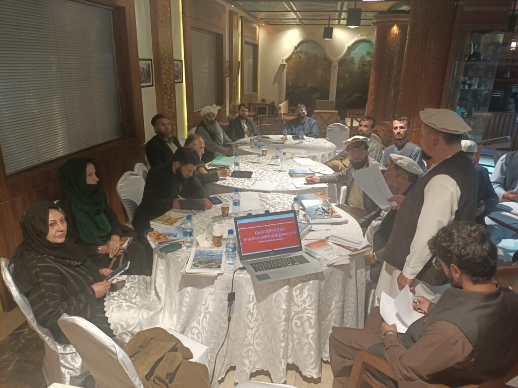
Invité par le Centre de recherche et de développement Ibn-e-Sina en tant que représentant de l’Institut Schiller, Karel Vereycken est intervenu le 7 novembre à la conférence sur la reconstruction du pays.
Son propos introductif, devant un groupe de travail composé d’historiens, d’archéologues et de membres de l’Académie des sciences d’Afghanistan, a donné lieu à une longue après-midi d’échanges sur le rôle de l’art, la méthodologie scientifique et les combats à mener pour sortir l’Afghanistan de son isolement et préserver un héritage culturel qui certes est afghan, mais appartient à toute l’humanité.
Parler de la culture d’un pays étranger est toujours une chose difficile, surtout si l’on n’en connaît pas la langue et si l’on n’a pas pu séjourner et voyager dans le pays pendant de longues périodes. Par conséquent, je ne peux que vous offrir mes impressions de l’extérieur et commenter ce que j’ai découvert dans des livres. Vous allez donc m’aider en me corrigeant et en me signalant ce qui a échappé à mon attention.
L’Afghanistan est un pays fascinant. Sa réputation de « tombeau des Empires » a capté mon imagination. Récemment, votre pays s’est émancipé de l’occupation américaine et de l’OTAN. Une poignée de combattants déterminés a mis en déroute un immense empire déjà en train de s’autodétruire. 34 ans plus tôt, le pays avait chassé l’occupant russe, après avoir résisté à l’Empire britannique au cours des trois guerres anglo-afghanes du XIXe siècle (1839-42, 1878-80 et 1919), alors que Londres, engagé dans le « Grand Jeu » (Great Game), tentait d’empêcher la Russie d’accéder aux mers chaudes.
Pour éviter d’être colonisé à la fois par la Russie et la Grande-Bretagne, l’Afghanistan a même courageusement refusé d’avoir des chemins de fer, ce qui explique qu’il n’existe aujourd’hui que 300 km de voies ferrées, une situation bien sûr inacceptable aujourd’hui.
Cette capacité de résistance et ce sentiment de dignité découlent, j’en suis convaincu, du fait que votre pays a su faire siennes les diverses influences qui s’y sont rencontrées. Voilà ce qui est devenu au fil des siècles le socle d’une forte identité afghane, totalement à l’opposé de l’étiquette tribale que les colonisateurs cherchent à lui coller.
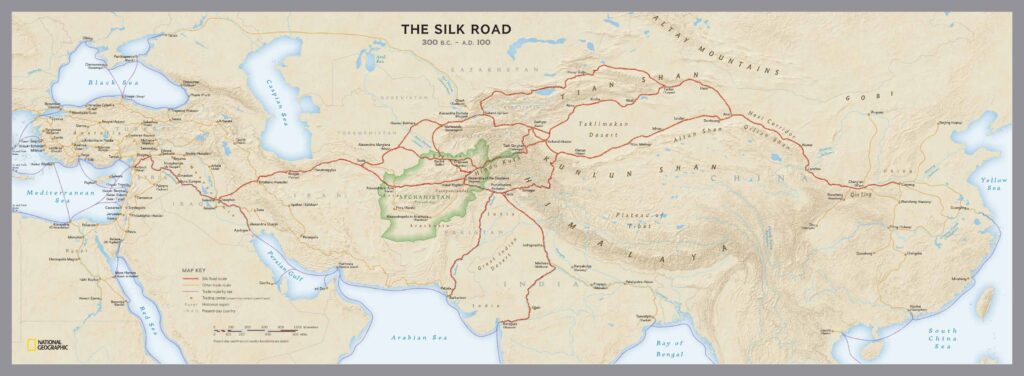
J’aborderai uniquement, aujourd’hui, l’influence grecque, qui s’est avérée majeure à partir du moment où Alexandre le Grand traverse le Hindou Kouch, en 329 av. JC.
Dès lors, des dizaines de milliers de colons grecs, appelés Ioniens, s’installent en Asie centrale.
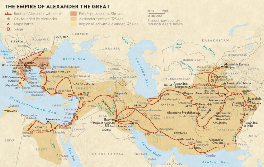
Sous le règne de ses successeurs concurrents, l’immense empire d’Alexandre le Grand se décompose en plusieurs entités et royaumes.
En 256 av. JC, Diodote Ier Soter fonde en Afghanistan le royaume gréco-bactrien, connu sous le nom de « Bactriane », dont le territoire englobe une grande partie de l’Afghanistan, de l’Ouzbékistan, du Tadjikistan et du Turkménistan actuels, ainsi que certaines parties de l’Iran et du Pakistan. L’influence grecque y perdure au moins jusqu’à l’arrivée de l’Islam au VIIIe siècle.
La Bactriane
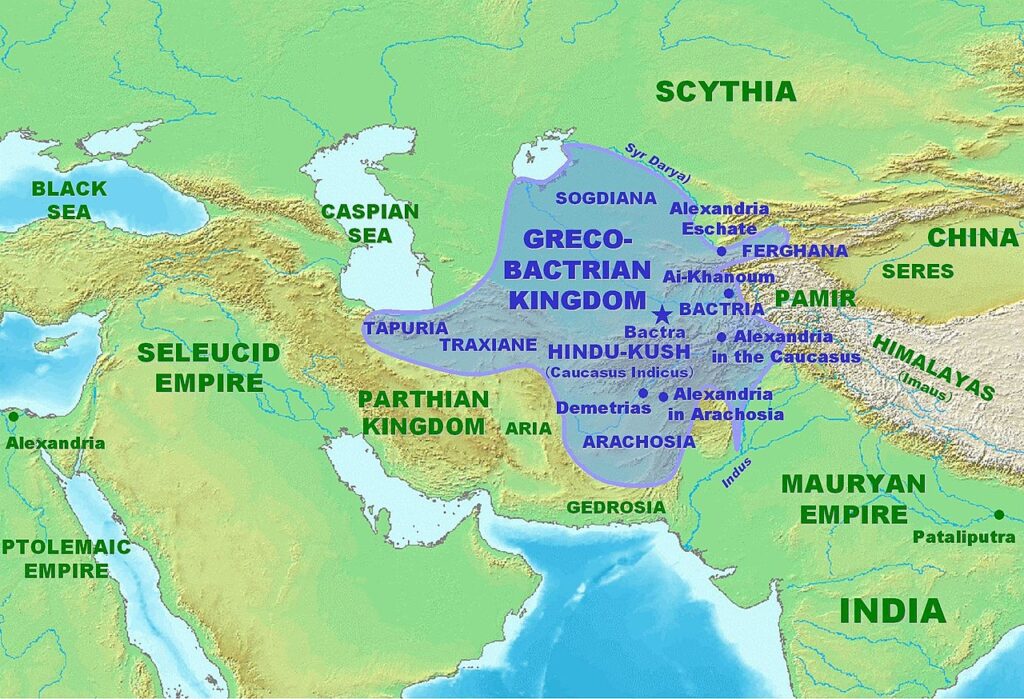
De nombreuses fouilles archéologiques confirment un développement urbain, économique, social et culturel remarquable.
Strabon (64 av. JC – 24 après JC), comme d’autres historiens grecs, qualifiait déjà la Bactriane de « Terre des mille cités », une terre que tous les écrivains, anciens et modernes, louaient pour la douceur de son climat et sa fertilité, car « la Bactriane produit tout, sauf de l’huile d’olive. »
Pour le naturaliste romain Pline l’Ancien (23 – 79 après JC), en Bactriane,
« les grains de blé poussent si gros qu’un seul grain est aussi gros que nos épis. »
Sa capitale Bactres (aujourd’hui Balkh, proche de Mazâr-e Charîf au nord de l’Afghanistan), « Mère des cités », figure parmi les villes les plus riches de l’Antiquité.
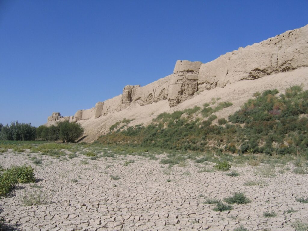
C’est là qu’Alexandre le Grand épouse Roxana (« Petite étoile ») et adopte l’habit perse pour pacifier son Empire. C’est également là que naîtra le père du grand médecin et philosophe Ibn Sina (Avicenne), avant de s’installer à Boukhara (Ouzbékistan).
Au fil du temps, la Bactriane sera le creuset de cultures et de civilisations où se mêlent, sur le plan artistique, architectural et religieux, traditions grecques et cultures locales.
Si le grec y est la langue de l’administration, les langues locales y foisonnent. Rien que les noms des villes démontrent la prédominance de la culture hellénique.
Ainsi, Ghazni s’appelle « Alexandrie en Opiana », Bagram « Alexandrie au Caucase », Kandahar « Alexandrie Arachosia », Hérat « Alexandria Ariana », etc., et la liste ne s’arrête pas là.
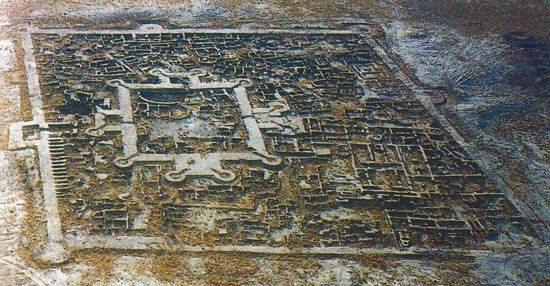
La ville de Gonur Depe (actuellement au Turkménistan, au nord de Mary, l’ancienne Merv), capitale du Royaume de Margiane, est un autre exemple de ce qu’on s’accorde maintenant à appeler la « Culture de l’Oxus »)
Aï Khanoum, la grecque

Si certaines villes ne font que changer de nom, d’autres sont construites ex nihilo. C’est le cas d’Aï Khanoum (« Dame Lune » en ouzbek), cité érigée au confluent du grand fleuve Amou Daria (l’Oxus des Grecs) et de la rivière Kokcha.
En 1961, le roi d’Afghanistan (Mohammed Zahir Shah), voulant marquer son indépendance vis-à-vis des Soviétiques et des Américains, invite la France à participer aux fouilles.
C’est le Département des archéologues français en Afghanistan (DAFA) qui met au jour les vestiges d’un immense palais dans la ville basse, ainsi qu’un grand gymnase, un théâtre pouvant accueillir 6000 spectateurs, un arsenal et deux sanctuaires.
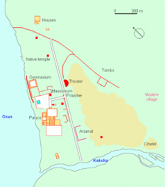
Entourée de terres agricoles bien irriguées, la ville elle-même était divisée entre une ville basse et une acropole de 60 mètres de haut.
Bien qu’elle n’est pas située sur une route commerciale majeure, Aï Khanoum commande l’accès aux mines du Hindou Koush. De vastes fortifications, continuellement entretenues et améliorées, entourent la ville.
Un monument au cœur de la ville y présente une stèle inscrite en grec avec une longue liste de maximes incarnant les idéaux de la vie grecque. Celles-ci sont copiées de Delphes et se terminent par :
« Dès l’enfance, apprends les bonnes manières ;
dans la jeunesse, maîtrise tes passions ;
dans la vieillesse, sois de bon conseil ;
dans la mort, n’aie aucun regret. »
L’architecture du site indique que les colons grecques y vivent en bonne entente avec les populations locales. Elle est très grecque mais intègre en même temps diverses influences artistiques et éléments culturels que les Ioniens ont pu observer au cours de leur voyage du bassin méditerranéen à l’Asie centrale. Par exemple, ils utilisent les styles néo-babylonien et achéménide pour la construction de leurs cours.
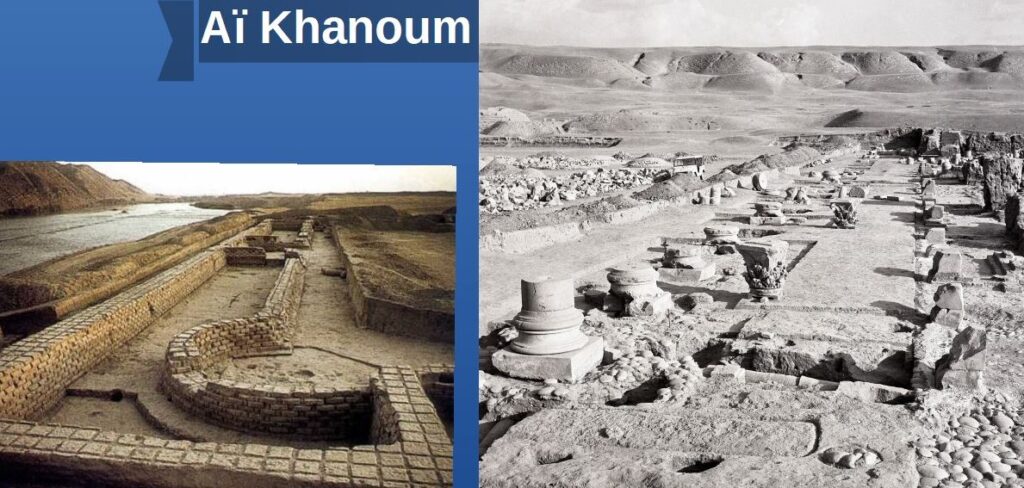
Shortugai et la Civilisation de la vallée de l’Indus
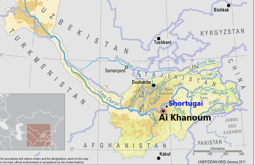
La date précise des premières fondations d’Aï Khanoum reste inconnue.
A une jetée de là, Shortugai, avant-poste commercial et minier de la fameuse civilisation de l’Indus (dite « harappéenne ») qui, au IIIe millénaire avant notre ère, était à l’avant-garde sur le plan de l’irrigation et de la maîtrise de l’eau. (voir notre article)
Des scientifiques de l’Institut indien de technologie de Kharagpur et du Service archéologique d’Inde ont publié le 25 mai 2016, dans la revue Nature, les fruits d’une recherche qui permettrait de dater la civilisation harappéenne d’au moins 8000 ans avant JC et non 5500 ans, comme on le croyait jusqu’à présent. Cette découverte majeure signifierait qu’elle serait encore plus ancienne que les civilisations mésopotamienne et égyptienne.
Shortugai est construite avec des briques standardisées typiques de la vallée de l’Indus. Des sceaux de la civilisation de la vallée de l’Indus ont également été trouvés sur d’autres sites archéologiques d’Afghanistan.
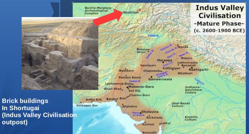
Pendant plusieurs siècles, Shortugai a fonctionné comme un site minier exceptionnel pour l’extraction de l’étain (un minerai indispensable pour la fabrication du bronze), de l’or et du fameux lapis-lazuli, cette pierre précieuse bleue qui, avec l’or, habille de sa splendeur la tombe du pharaon égyptien Toutankhamon et d’autres tombes religieuses majeures en Mésopotamie (Irak).
Les données archéologiques démontrent que Shortugai commerçait avec ses voisins d’Aï Khanoum et construisit les premiers systèmes d’irrigation de la région, une spécialité de la civilisation de la vallée de l’Indus.
Bien des sites restent inexplorés en Afghanistan, pays où les guerres, les occupations étrangères et les pillages ont perturbé ou rendu impossible les recherches archéologiques.
Voici quelques-unes des découvertes de la DAFA, dont certaines restent exposées au Musée national de Kaboul.
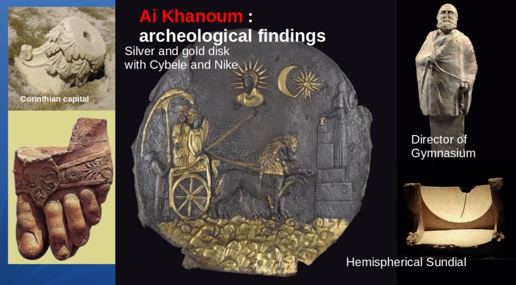
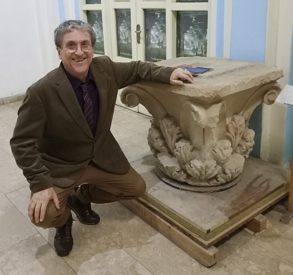
Relations avec l’Inde
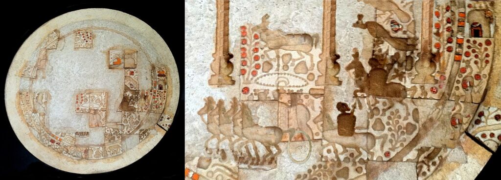
Ce qu’on a trouvé à Aï Khanoum, les pièces de monnaie, les objets et les céramiques, notamment d’origine indienne, témoigne qu’il s’agissait d’une importante plaque tournante du commerce avec l’Inde.
En 258 avant notre ère, Ashoka le Grand, souverain de l’empire Maurya (l’État dominant en Inde), fait ériger ce que l’on appelle « l’Edit grec d’Ashoka à Kandahar », une inscription rupestre bilingue, en grec et en araméen. Une autre inscription d’Ashoka était rédigée uniquement en grec.
Le contenu même de ces édits donne également une indication claire du niveau des échanges entre l’Inde et le monde hellénistique. Par exemple, dans son XIIIe édit, Ashoka, faisant preuve d’érudition, énumère avec précision tous les souverains du monde hellénistique de son époque.
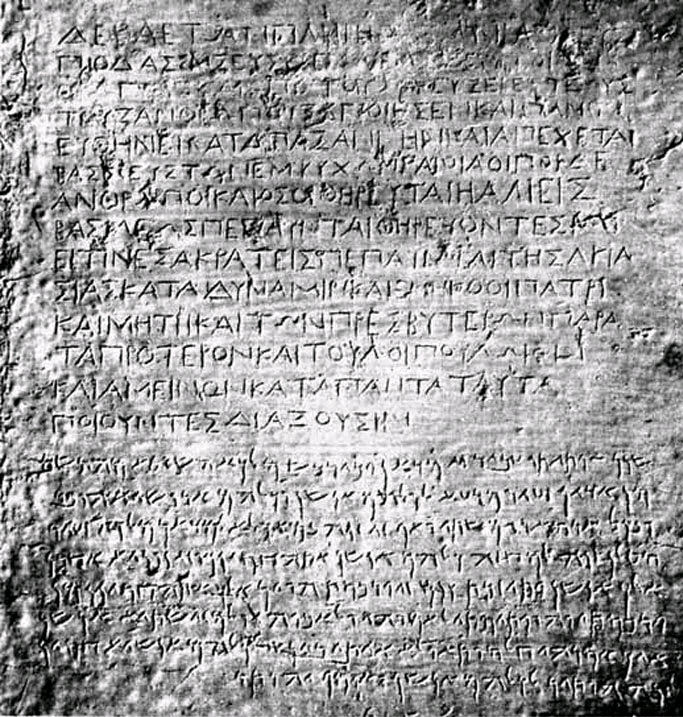
Relations avec la Chine
Outre son interaction avec le sous-continent indien, la Bactriane établira des contacts avec une puissance située encore plus à l’est : la Chine.
À la fin du IIe siècle avant JC, Zhang Qian, diplomate et explorateur de la dynastie Han, arrive en Bactriane. Le récit de sa visite, y compris son étonnement d’y trouver des marchandises chinoises sur les marchés (acquises via l’Inde), ainsi que ses voyages dans le reste de l’Asie centrale, sont conservés dans les œuvres de l’historien Sima Qian.
À son retour en Chine, Zhang Qian informe l’empereur de l’existence de civilisations urbaines sophistiquées en Asie centrale : le Dayuan (vallée de la Ferghana), la Bactriane (Afghanistan) et la Partie (nord-est du plateau iranien).
Les découvertes de Zhang Qian incitent l’empereur à envoyer des émissaires chinois en Asie centrale pour y favoriser le commerce avec la Chine. Certains historiens n’hésitent pas à qualifier cette décision de l’Empereur chinois de « naissance de la Route de la soie ».
Déclin et chute
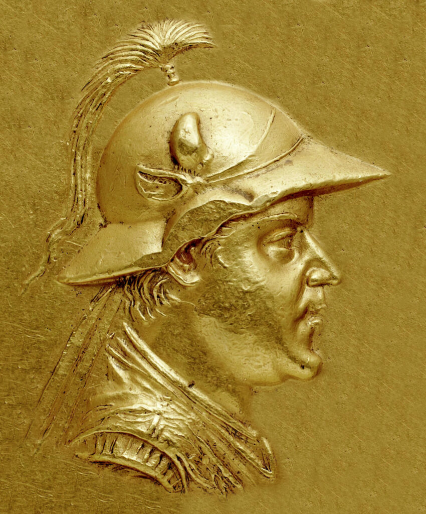
Une grande partie des ruines actuelles d’Aï Khanoum datent de l’époque d’Eucratides Ier (172-145 av. JC), qui a considérablement réaménagé la ville et l’a peut-être rebaptisée Eucratideia, d’après son nom.
Il fut assassiné en 145 av. JC. par son fils. Un an plus tard, le royaume s’effondre face à l’invasion des nomades.
Aï Khanoum est pillée une première fois en 145 av. JC par les Sakas, des tribus iraniennes d’origine scythe, suivis quinze ans plus tard par les nomades chinois Yuezhi.
Le « complexe du trésor » d’Aï Khanoum montre des signes de pillage lors de deux assauts, à quinze ans d’intervalle. D’après des témoins oculaires, certaines villes se sont arrangées avec les envahisseurs et organisèrent une coexistence pacifique. Les villes qui ont résisté, comme Aï Khanoum, ont été pillées et incendiées.
L’empire Kouchan
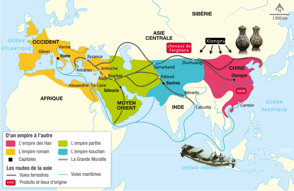
Les nomades chinois Yuezhi se sédentarisent et créent au début du Ier siècle l’Empire kouchan, qui englobe une grande partie de ce qui est aujourd’hui l’Ouzbékistan, l’Afghanistan, le Pakistan et l’Inde du Nord.
Son territoire s’étend de l’Asie centrale et du Gandhara (frontière occidentale actuelle du Pakistan) à Pataliputra, dans la plaine du Gange (Inde d’aujourd’hui). La capitale principale de son empire était située à Purushapura (aujourd’hui Peshawar au Pakistan).
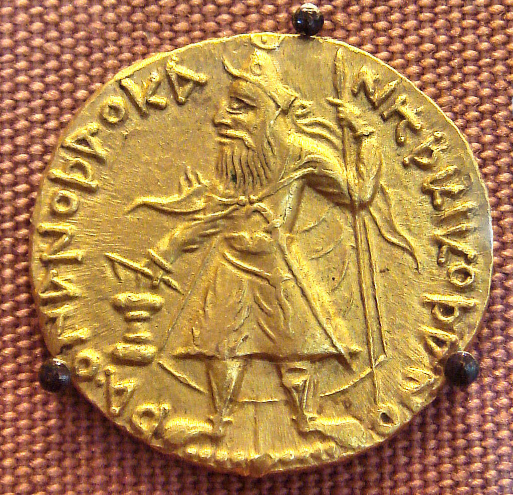
C’est sous le règne de Kanishka le Grand (vers 127-150) que l’Empire kouchan deviendra célèbre pour ses réalisations militaires, politiques et spirituelles. Kanishka échange des ambassadeurs avec l’empereur romain Marc Aurèle (161-180) et l’empereur Han de Chine. Il noue des contacts diplomatiques avec la Perse sassanide et le royaume d’Aksoum (Yémen et Arabie saoudite d’aujourd’hui).
Si la dynastie kouchane reprend la tradition gréco-bactrienne, elle se forge peu à peu sa propre identité.
Les artistes kouchans enrichirent la sculpture bouddhique en donnant à Bouddha la forme humaine, innovation qui fut la plus importante de l’époque.
En 127, Kanishka remplace le grec par le bactrien, une langue moyenne iranienne utilisant l’alphabet grec.
Le bouddhisme
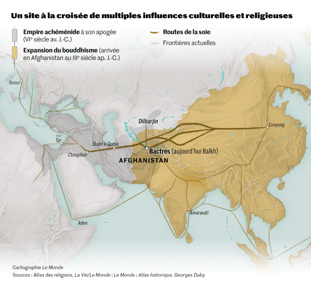
Les Kouchans joueront également un rôle majeur dans la transmission du bouddhisme. Le rayonnement de cette religion venue des rives du Gange favorisera celui des Routes de la soie.
Dans le domaine de la religion, les Kouchans, initialement attirés par l’hindouisme, joueront un rôle majeur dans la transmission du bouddhisme mahayana du Gandhara vers la Chine, l’Asie centrale et même le Sri Lanka, favorisant ainsi l’expansion de la route de la soie.
Tous ces facteurs ont inauguré une période de paix relative de 200 ans, connue comme la « Pax Kouchana ».
À partir du milieu du IIIe siècle après JC, l’Empire kouchan, affaibli, commence à se désintégrer. Dans sa partie occidentale, il passe sous le contrôle des Kushanshahs, c’est-à-dire les Indo-Sassanides (perses), progressivement supplantés au nord par les Hephtalites (appelés également les « Huns blancs » ou « Huns iraniens ») venus de la steppe d’Asie centrale.
Le bouddhisme connaît néanmoins une période de grande prospérité, comme l’illustrent les descriptions du moine chinois Xuanzang du VIIe siècle ainsi que la construction des statues géantes de bouddhas dans la vallée de Bamiyan en Afghanistan.

L’Islam
Après avoir conquis l’Iran, l’islam pénètre l’Afghanistan par le nord. Il n’y a pas de preuve d’un rejet massif de la nouvelle religion, sauf dans des régions isolées. Cependant, la volonté de rester indépendants des gouverneurs nommés par Damas (Omeyyades) puis par Bagdad (Abassides) se manifeste rapidement. C’est même à partir d’une province couvrant une partie du nord de l’Afghanistan, le Khorasan, que se répand initialement une partie de l’insurrection contre les Omeyyades pour les remplacer par le califat abbasside d’Haroun-al-Rachid, plus humaniste, et la création de Bagdad (voir notre article).
À partir de la fin du Xe siècle, une dynastie d’origine turque, les Ghaznévides, bâtit autour de leur capitale Ghazni (Afghanistan) un vaste sultanat qui s’étend jusqu’en Inde et fonde une communauté musulmane durable.

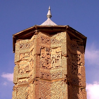
Leur influence culturelle se mesure par la beauté de l’architecture qu’ils nous ont laissée, mais aussi par le patronage qu’ils accordèrent au grand poète épique Ferdowsi (940-1025), à qui l’on doit la grande épopée nationale en langue persane, le Shahnameh : Le livre des rois.
Les Ghaznévides ont été suivis par une nouvelle dynastie, les Ghorides, originaire de la partie centrale de l’Hindou Kouch. C’est à eux que l’on doit l’impressionnant minaret de Jam.
Ce riche patrimoine culturel, qui a jeté les bases de leur identité et qui a donné sa dignité au peuple afghan, a été ignoré, détruit par les guerres successives, pillé et saccagé.
Fortement combattu par les talibans au pouvoir à Kaboul, ISIS, Daech et d’autres groupes terroristes, dont certains encouragés en sous-main par des agences de renseignement occidentales se sont livrés à un pillage à échelle quasi-industrielle du patrimoine culturel afghan. Pour eux, la revente d’objets d’art et d’antiquités est une des principales sources de revenus.
Recommandations
Aujourd’hui, le temps est venu d’un nouveau départ. L’Afghanistan peut changer complètement son image dans le monde, qui a été polluée par des adversaires et des ennemis qui veulent maintenir l’Afghanistan comme une zone de non-développement pour leur propre grand jeu géopolitique.
Ma proposition pour renouveler la contribution de l’Afghanistan à la culture mondiale est simple.
Avec Mes Aynak, qui signifie « petite mine », située à 35 km au sud de Kaboul, l’Afghanistan dispose du deuxième plus grand gisement de cuivre au monde. Alors que la Chine et les autres pays du BRICS ont besoin de ce métal précieux pour leur développement industriel, la mine offrira un revenu substantiel dont l’Afghanistan a un besoin urgent pour reconstruire le pays.
Le 25 mai 2008, Ibrahim Adel, ministre des Mines, et Shen Heting, directeur général de MCC, l’actionnaire majoritaire du consortium MCC-Jiangxi Copper MJAM, ont signé le contrat minier de Mes Aynak.
Ce contrat décrivait les conditions du premier grand projet minier et du plus important investissement étranger en Afghanistan. Cependant, suite à des incidents de sécurité qui ont créé d’importants problèmes d’insécurité, et sous la pression des puissances étrangères, le projet a été bloqué.
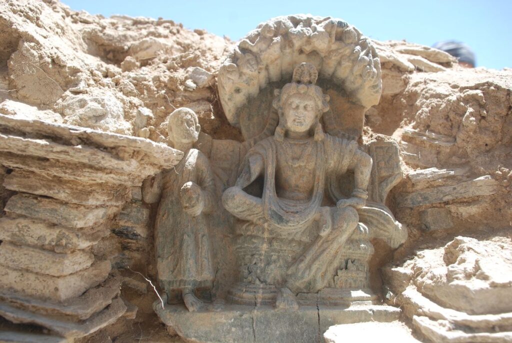
Paradoxalement, cela a donné aux archéologues le temps de mettre au jour sur le site minier une zone de 40 ha d’une valeur culturelle exceptionnelle de classe mondiale, principalement un vaste complexe de monastères bouddhistes, comprenant des stupas (temples), des peintures murales, des sculptures et des centaines d’artefacts archéologiques, etc.
Même si le contrat (fichier pdf) a pu être modifié depuis 2008, on ne peut que constater que le contrat initial contient une série d’aspects potentiellement très intéressants, à la fois pour la Chine mais surtout pour l’Afghanistan lui-même.
- EXPORTER DU MÉTAL, PAS DU MINERAI
De même que la Bolivie ne veut pas exporter du lithium (matière première) mais des batteries (produit fini transformé à haute valeur ajoutée), l’Afghanistan ne veut pas exporter du minerai de cuivre mais du cuivre métal. Pour atteindre cet objectif, le contrat prévoit la construction d’une fonderie sur le site.
Paragraphe IV, 33 : « Afin de respecter son engagement envers le gouvernement de financer, construire et exploiter une fonderie en Afghanistan, la MCC a demandé au gouvernement de lui donner accès à des gisements de phosphates, de calcaire et de quartz qu’elle pourra utiliser dans le cadre du projet Aynak. » - ACHATS LOCAUX
Paragraphe VII, 38 : « MCC s’efforce d’acheter des biens et des services en Afghanistan s’ils sont disponibles. » - MAIN-D’ŒUVRE LOCALE
Paragraphe VIII, 39, a : « MCC emploie du personnel afghan, dans toute la mesure du possible. » - APPROVISIONNEMENT EN EAU
Paragraphe IV, 32 : « MCC s’est engagée auprès du gouvernement à construire des puits d’approvisionnement en eau et des systèmes de canalisation … pour répondre aux besoins en eau douce du projet. La MCC s’est également engagée à réutiliser et à recycler l’eau de traitement dans la mesure du possible. » - CENTRALE AU CHARBON
Paragraphe IV, 31 : « MCC s’est engagée auprès du ministère des Mines à construire … une centrale au charbon d’une capacité de 400 mégawatts pour fournir de l’énergie électrique au projet et à Kaboul. » - CHEMIN DE FER
Paragraphe IV, 30 : « MCC s’est engagée à construire un chemin de fer associé au projet ». - LOGEMENT
Paragraphe IV, 24 : « MCC doit fournir des logements de qualité et en quantité suffisante à ses salariés et à leurs familles immédiates, à un prix de location raisonnable. » - SOINS MÉDICAUX
Paragraphe IV, 25 : « MCC fournira des soins médicaux gratuits à tous ses salariés et à leurs familles… et établira, dotera en personnel et entretiendra des dispensaires, des cliniques et des hôpitaux en nombre suffisant … » - ÉCOLES
Paragraphe IV, 26 : « MCC doit fournir gratuitement un enseignement primaire et secondaire adéquat aux enfants de tous les salariés et résidents de la zone entourant Aynak. » - CADRE DE VIE
Paragraphe IV, 27 : « MCC construira et financera le fonctionnement de centres d’activités récréatives adéquats tels que des gymnases et des terrains de sport. … En outre, il construira un marché/une zone commerciale. » - RELIGION
Paragraphe IV, 28 : « MCC respectera et protégera les convictions religieuses du peuple afghan. »
Le monde serait stupéfait en constatant que l’Afghanistan mobilise ses meilleurs architectes et urbanistes pour construire une nouvelle ville à Mes Aynak qu’il baptisera poétiquement, l’« Aï Khanoum du XXIe siècle ».
A Kaboul, un archéologue de premier plan qui travaille sur le site depuis une décennie, m’a confié avec une joie non-dissimulée que, suite à d’intenses discussions en octobre dernier entre les autorités afghanes et l’entreprise chinoise, une issue heureuse a été trouvée.
A l’heure actuelle, dit-il, les deux parties ont convenu de préserver, non plus une infime partie du site archéologique (la partie centrale avec les temples bouddhistes), mais l’ensemble des vestiges historiques du site en surface. A en croire mon interlocuteur, la décision est prise que l’ensemble du site sera désormais exclusivement exploité par la technique d’exploitation minière souterraine. N’en déplaise à la presse occidentale, le sauvetage de Mes Aynak révèle au monde le vrai visage du nouveau gouvernement afghan.
Il rendra également pensable, d’ici un certain temps, la reconstruction des bouddhas géants de la vallée de Bamiyan, l’un de 55 mètres et l’autre de 38 mètres, détruits en 2001. Plusieurs experts, lors de colloques récents de l’UNESCO, ont précisé que les difficultés techniques ne sont pas insurmontables, les bouddhas étant fabriqué en stuc. Le soi-disant « danger » que les sculptures soient considérées comme « fausses » n’a aucun sens, tant que l’intention d’atteindre un bien supérieur par leur reconstruction est réelle.
La « Proposition technique pour la revitalisation des statues du Bouddha de Bâmiyân » de 2017, élaborée par le département d’architecture de l’université japonaise Mukogawa Women’s University, mérite d’être examinée. Sans doute pourra-t-on faire mieux, mais elle a le mérite d’exister. Des chercheurs chinois se disent également prêts à donner un coup de main.
Rappelons que le monde compte 620 millions de bouddhistes qui considèrent Bamiyan comme une partie de leur culture et pourraient envisager de venir en Afghanistan pour mieux comprendre leur propre histoire.
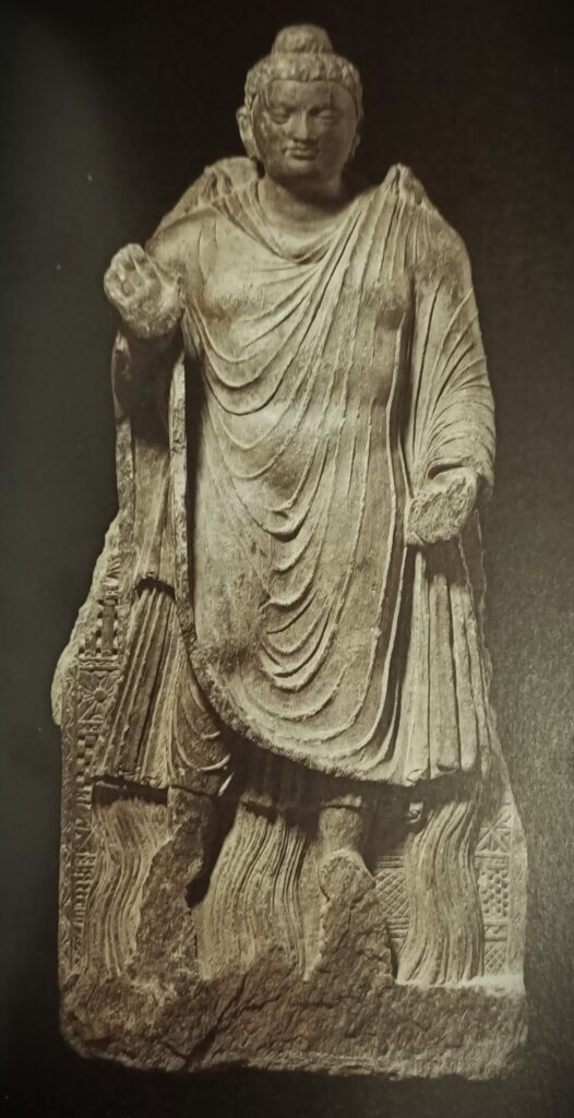
Si l’Afghanistan indiquait clairement au monde qu’il a décidé de renforcer ses activités économiques et minières tout en protégeant, notamment grâce à l’aide généreuse de la Chine, le patrimoine culturel mondial sur son sol, il apparaîtra aux yeux de tous ce qu’il est désormais aujourd’hui : une force du bien, de la tolérance et de la paix dans le monde, en cohérence avec sa propre identité et son histoire.
L’Afghanistan apparaîtra comme le « Bouddha de feu » (IIe-IIIe siècle) du Musée national de Kaboul, où l’on voit la réponse donnée par Bouddha à un défi lancé par des hérétiques selon lequel il ne pouvait pas faire de miracles.
Connu sous le nom de « miracles jumeaux », on y voit Bouddha confiant avec des flammes sortant de ses épaules et des cours d’eau de ses pieds ! En altérant ces deux flux, dit la légende, Bouddha a même fait apparaître un arc-en-ciel !
En augmentant sa production d’énergie et en gérant d’une façon plus intelligence ses ressources en eau, l’Afghanistan démontrera, j’en suis convaincu, sa splendide force spirituelle !
Merci à tous et j’ouvre le débat à vos questions.
Le défi que nous lance la modernité de la Civilisation de l’Indus

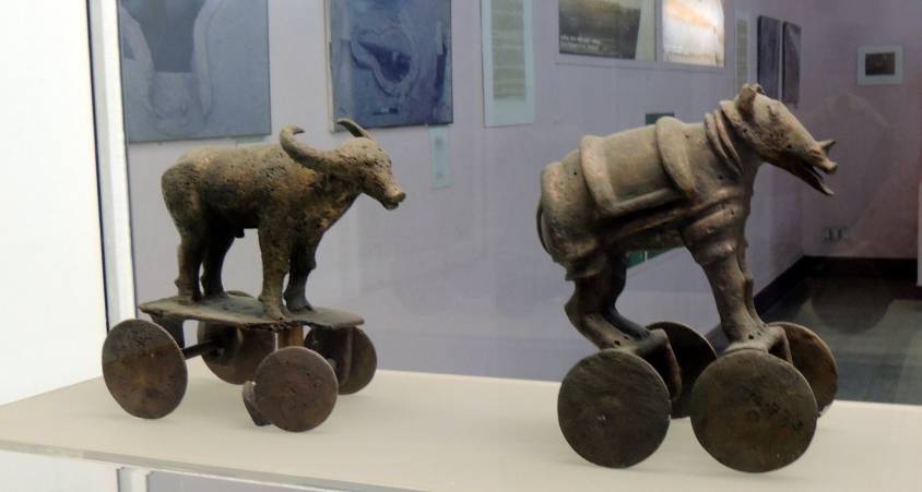
Une découverte archéologique majeure vient d’être effectuée en Israël en 2022 : les premières preuves de l’utilisation de fibres de coton au Proche-Orient et parmi les plus anciennes au monde, datant de près de 7000 ans, ont été découvertes par des archéologues israéliens, américains et allemands, lors d’une fouille archéologique à Tel Tsaf, au sud-est de Beit She’an, dans la vallée du Jourdain en Israël.

La plus ancienne preuve dont on disposait jusqu’à présent de la présence de fibres de coton dans la région a été datée de quelques centaines d’années plus tard, de la fin de la période chalcolithique (âge du cuivre) et de l’âge du bronze précoce (il y a environ 5000 à 6500 ans) en provenance du site archéologique de Dhuweila, dans l’est de la Jordanie.
Découvert en 1940, le site de Tel Tsaf nous livre ses secrets. « Tsaf se caractérise par une préservation étonnante des matériaux organiques », a déclaré au Times of Israel le professeur Danny Rosenberg, de l’Institut d’archéologie Zinman, au sein de l’université de Haïfa.
« Tel Tsaf était une sorte de pôle qui concentrait des activités commerciales importantes et qui avait établi des contacts avec de nombreux autres peuples, estime Rosenberg. Il y avait là-bas des capacités de stockage massives pour accueillir les céréales, des capacités énormes, comparées à d’autres sites.«
Par exemple, c’est là qu’on a découvert les preuves les plus anciennes de l’usage social de la consommation de bière et du stockage rituel de produits alimentaires. Rosenberg et les autres chercheurs ont également mis la main sur des perles en provenance de l’Anatolie contemporaine, de Roumanie, d’Egypte et d’autres secteurs d’Afrique ; des poteries venues d’Irak, de Syrie ou d’Arménie et les tout premiers cuivres et autres métaux trouvés dans le monde.
« L’arbre à laine » et « Routes du coton »
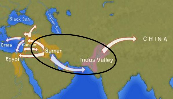
Le coton, on y reviendra, venait probablement de la région de l’Indus – le Pakistan moderne – le seul endroit au monde ayant commencé à en pratiquer la culture à cette époque avant qu’elle n’apparaisse en Afrique des milliers d’années plus tard.
« Ce qui est intéressant dans cette preuve précoce d’un lien avec une région aussi lointaine, c’est qu’elle provient de fibres – des morceaux microscopiques de fils anciens. Nous supposons que ces fibres de coton, trouvées avec des fibres de laine et des fibres végétales, sont arrivées sur le site en tant que partie de tissus ou de vêtements, c’est-à-dire de textiles anciens », précise Rosenberg.
Le coton ne servait pas qu’à l’habillement :
« A l’ère préhistorique, les textiles étaient impliqués dans de nombreux domaines de l’existence, pas seulement dans les vêtements mais aussi dans la chasse, la pêche, etc. C’est beaucoup plus important que de se dire seulement que ce que nous avons trouvé, ce sont des morceaux de vêtements qui étaient portés par les habitants du coin. Cette découverte nous en dit long sur les pratiques économiques de la région », estime l’archéologue.
Dans la mesure où le coton n’a jamais été cultivé à Tel Tsaf, en trouver à cet endroit fut une surprise pour les chercheurs, qui estimèrent que cette présence dénotait l’importance de la ville en tant que pôle commercial mondial au cœur de ce qu’on pourrait appeler les « Routes du coton » de cette époque.
La culture du coton pose un défi considérable. D’abord, elle requiert un climat modéré ou tropical et des quantités d’eau faramineuses. Fabriquer un tee-shirt et une paire de jeans (représentant environ 1 kg de coton) ne nécessite pas moins de 20 000 litres d’eau ! Quelle civilisation pouvait s’offrir une telle performance au début du VIIe millénaire avant J.-C. ?
La civilisation de la vallée de l’Indus

Le terme de « Civilisation de la vallée de l’Indus » désigne un ensemble culturel et politique qui s’épanouit dans la région nord du sous-continent indien entre environ 8000 et 1900 avant J.-C., s’étendant du Baloutchistan (Pakistan), à l’ouest, à l’Uttar Pradesh (Inde), à l’est, et du nord-est de l’Afghanistan, au nord, au Gujarat (Inde), au sud.
Faute de monuments permettant d’étayer cette hypothèse, on ne parle pas de royaume ou d’empire de l’Indus. Son nom moderne dérive simplement de son emplacement dans la vallée de l’Indus, mais cette culture est aussi communément appelée la « civilisation Indus-Saraswati » ou encore « civilisation harappéenne ». Ces désignations proviennent d’une part de la rivière Saraswati, mentionnée dans les sources védiques, qui coulait à côté de l’Indus et qui aurait disparu, et de la ville de Harappa (Pendjab, Pakistan), une cité antique découverte dès 1829, mais laissée inexplorée par les Britanniques jusqu’en 1921.
L’apparition d’une grande civilisation urbaine dans la vallée de l’Indus, qui atteint sa maturité vers 2500-2400 avant J.-C., a longtemps été considérée comme un phénomène soudain et mystérieux. Cependant, un ensemble de découvertes permet de retracer, de 7000 à 2500 avant J.-C., une suite de transformations et d’innovations dont les effets cumulatifs, stimulés par l’élargissement du réseau des échanges à partir de 3000 avant J.-C., créent les conditions favorables au développement d’une civilisation urbaine.
Mehrgarh, lumière du monde !
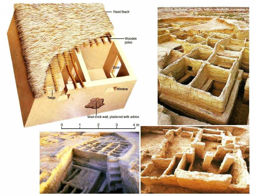
En haut, à droite, un entrepôt pour céréales.
Depuis la préhistoire, la région de l’Indus est pionnière et riche en découvertes. A titre d’exemple, bien qu’il s’agisse d’un cas à part, le village agricole de Mehrgarh (Baloutchistan, Pakistan), qui date du néolithique (n’utilisant que la pierre comme outil) mais peut être considérée comme la culture et la ville clé ayant fait passer l’humanité, dès le VIIIe millénaire avant J.-C., de la pierre à l’âge du bronze.
Le site est situé sur la route principale entre ce qui est aujourd’hui l’Afghanistan et la vallée de l’Indus : cette route faisait aussi sans doute partie d’une connexion commerciale établie assez tôt entre le Proche-Orient et le sous-continent indien.
Les fouilles menées à Mes Aynak (Afghanistan), où les archéologues commencent à peine à découvrir, sous le niveau bouddhique, les vestiges d’un site de l’âge du bronze vieux de 5000 ans, dont une ancienne fonderie de cuivre, apporteront sans doute un nouvel éclairage sur ces relations.
Sur la base de découvertes archéologiques bien documentées, il a été établi que la culture « pré-harappéenne » de Mehrgarh représente plusieurs percées historiques pour l’ensemble de l’humanité :
- des traces d’agriculture (blé et orge) et d’élevage (bovins, moutons et chèvres), parmi les plus anciennes en Asie du Sud ;
- les premières brasseries (à partir de blé et d’orge) ;
- les plus anciens lacs de retenue au service d’une agriculture irriguée et de la prévention contre les inondations ;
- les plus anciennes traces de culture du coton (VIe millénaire avant J.-C.) ;
- le plus ancien bijou en bronze fabriqué avec la technique de fonte à la cire perdue, dite « amulette de Mehrgarh » (VIe millénaire avant J.-C.) ;
- les plus anciens forets à archet (en jaspe vert) permettant de percer des trous dans le lapis-lazuli et la cornaline ;
–les toutes premières pratiques réussies de la dentisterie (!) (IXe millénaire avant J.-C.), comme en témoignent les dents percées de certains des squelettes découverts sur le site. L’analyse des dents montre que les dentistes préhistoriques soignaient les maux de dents avec des forets fabriqués à partir de lames de silex. Le travail était si élaboré que même les dentistes modernes sont surpris de l’efficacité avec laquelle leurs prédécesseurs éliminaient les tissus dentaires en décomposition. Parmi les vestiges, un total de onze couronnes percées a été découvert, dont un exemple témoigne d’une procédure complexe impliquant le retrait de l’émail dentaire suivi de la sculpture de la paroi de la cavité ! Aucun des individus présentant des dents percées ne semble provenir d’une tombe ou d’un sanctuaire particulier, ce qui indique que les soins bucco-dentaires qu’ils recevaient étaient accessibles à tous.
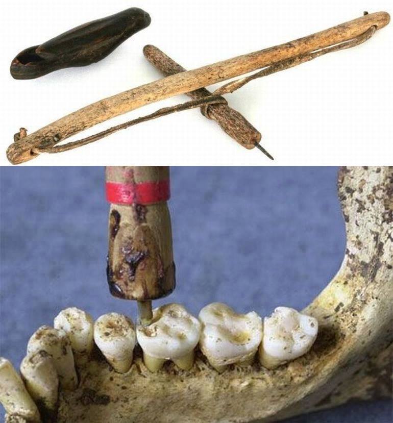
Densément peuplée
A l’origine, cette civilisation s’est érigée autour des méandres poissonneux de l’Indus, ce fleuve long de près de 3200 kilomètres qui s’écoule des montagnes de l’Himalaya vers la mer d’Arabie. A l’image des populations d’autres grandes vallées fluviales, cette société a été séduite par la fertilité des terres et la possibilité d’utiliser l’Indus comme voie de transport. Cette civilisation, dont la prospérité repose en grande partie sur l’exploitation de plus en plus systématique des riches limons de l’Indus, se répand sur un immense territoire englobant toute sa vallée et une partie du Gujarat indien.
A la vaste zone de distribution de la civilisation de l’Indus, il faut ajouter quelques « colonies » harappéennes comme Sutkagan Dor, près de Gwadar sur les bords de la mer d’Oman, à la frontière irano-pakistanaise, et la ville Shortugai (mines de lapus lazuli), proche du fleuve Amou Darya, à la frontière afghano-tadjik, à près de 1200 kilomètres de Mohenjo-daro.
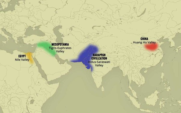
A son apogée, cette civilisation était deux fois plus vaste que l’ancien empire d’Egypte. Avec une superficie de 2,5 millions de kilomètres carrés, c’était alors la civilisation la plus étendue au monde : elle regroupait 5 millions de personnes, soit 10 % de la population mondiale de l’époque, bien plus que Sumer (0,8 à 1,5 million de personnes) ou que l’Egypte antique (2 à 3 millions).
A ce jour, ce sont plus de 2000 sites répartis entre l’Inde, le Pakistan et l’Afghanistan actuels qui ont été découverts, dont moins de 10 % de la surface totale a été fouillée. Sur le sous-continent indien, les principaux centres de cette civilisation sont Harappa et Mohenjo-daro au Pakistan et Lothal, Dholavira et Kalibangan en Inde. Outre les relations commerciales avec la Mésopotamie et l’Iran, les cités-états harappéens entretenaient également des relations commerciales actives avec les peuples d’Asie centrale.
Agriculture, artisanat et industries
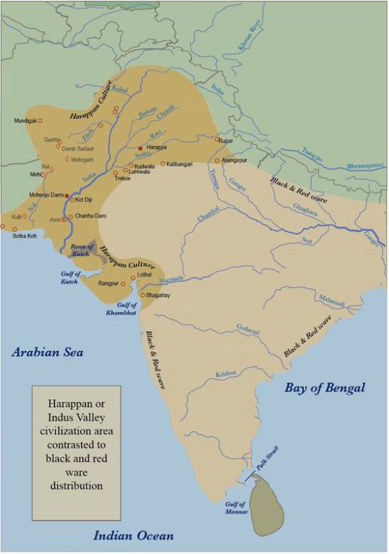
Agriculture, élevage, industrie, commerce et échanges constituaient la principale source de revenus.
L’agriculture était la principale activité des habitants de la vallée de l’Indus. Ils cultivaient l’orge et le blé à grande échelle mais aussi d’autres produits tels que légumineuses, coton, céréales, sésame, dattes, moutarde, melons, pois, etc. Il n’y a pas de preuve réelle de la culture du riz, mais quelques grains en ont été trouvés à Rangpur et à Lothal.
Dans le village de Mehrgarh et les villes d’Harappa et de Mohenjo-daro, on trouve des vestiges de grands greniers à grains, ce qui suggère que leur production était supérieure aux besoins de leurs habitants et qu’ils faisaient des stocks en prévision de mauvaises récoltes.
L’élevage était une autre occupation majeure. Les sceaux suggèrent qu’ils domestiquaient les vaches, buffles, chèvres, moutons, cochons, etc., mais aussi les chameaux et les ânes, qui servaient de bêtes de somme. Des os de chameaux ont été retrouvés en grand nombre sur de nombreux sites, mais on ne trouve aucune trace de ces animaux sur les sceaux. Lors de la fouille de Surkotado au Gujarat (Inde), la mâchoire d’un cheval a été trouvée. Des figurines en terre cuite représentant un cheval ont été trouvées à Nausharo et à Lothal.
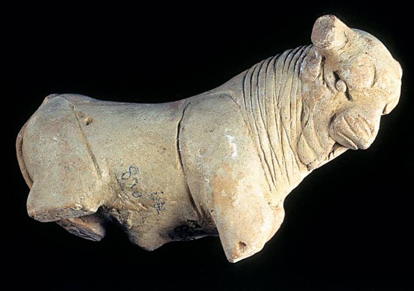
Les habitants de la vallée de l’Indus étaient très habiles. Ils fabriquaient, à l’aide de tours de potier, des céramiques, des récipients en métal, des outils et des armes, tissaient et filaient, teignaient et pratiquaient d’autres métiers. Les tisserands portaient des vêtements en coton et en laine. Ils connaissaient le cuir, mais il n’y a aucune trace de la production de soie.
A l’origine, les habitants de cette civilisation appartenaient à l’âge du bronze et utilisaient des outils en pierre, mais ils vont rapidement exceller dans la fabrication et la transformation de l’or, de l’argent, du cuivre, du plomb et du bronze, notamment pour des ornements artistiques d’une grande finesse.
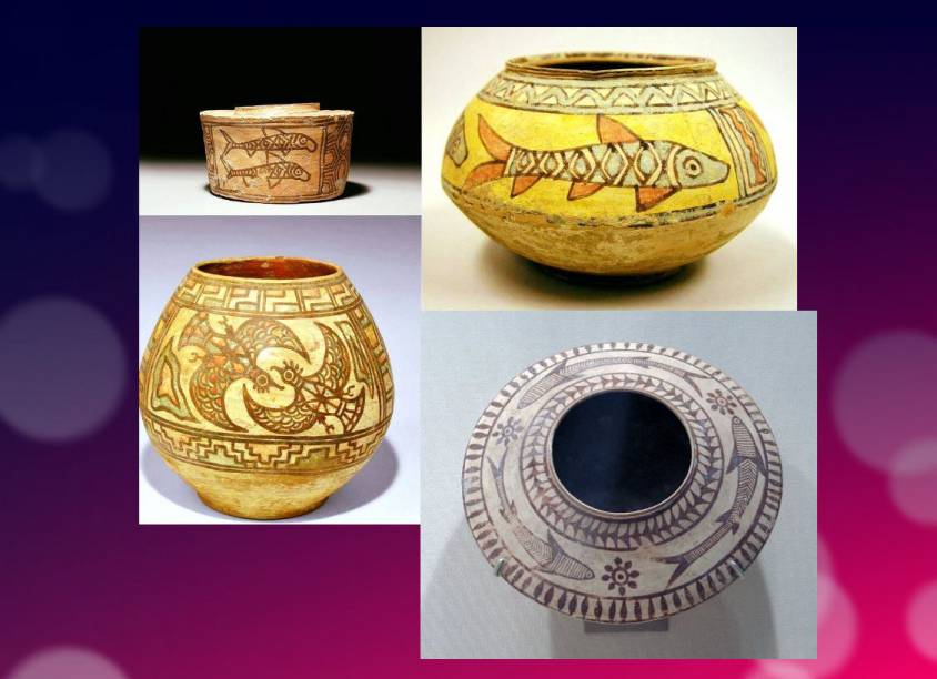
Des artisans fabriquaient des bijoux à Mohenjo-daro, à Chanho-daro et à Lothal, utilisant l’ivoire et diverses pierres précieuses comme la cornaline, le lapis-lazuli, l’agate et le jaspe. Le travail des coquillages était également une industrie prospère. Les artisans des colonies côtières en faisaient des boutons de chemise, des pendentifs, des anneaux, des bracelets, des perles, etc.
Pour le transport, on utilisait la charrette à bœufs, mais également les voies fluviales le long de l’Indus et de ses affluents.
Les professions artisanales nécessitaient diverses matières premières. Pour fabriquer des briques et des céramiques, l’argile était disponible localement, mais pour le métal, ils devaient l’acquérir à l’étranger.
Le commerce était axé sur l’importation de matières premières destinées aux ateliers des cités harappéennes, notamment des minéraux d’Iran et d’Afghanistan, du plomb et du cuivre d’autres régions de l’Inde, du jade de Chine et du bois de cèdre descendant les rivières de l’Himalaya et du Cachemire. Les autres marchandises échangées comprenaient des pots en terre cuite, de l’or, de l’argent, des métaux, des perles, des silex pour la fabrication d’outils, des coquillages, des perles et des pierres précieuses de couleur, comme le lapis-lazuli et la turquoise.
L’un des moyens par lesquels les historiens connaissent le réseau commercial maritime opérant entre les civilisations harappéennes et mésopotamiennes est la découverte de sceaux et de bijoux sur des sites archéologiques dans les régions de la Mésopotamie, qui comprend la majeure partie de l’Irak, du Koweït et de certaines parties de la Syrie actuels.

Le commerce maritime à longue distance sur des étendues d’eau telles que la mer d’Oman, la mer Rouge et le golfe Persique est peut-être devenu possible grâce au développement de bateaux à planches, équipés chacun d’un mât central unique supportant une voile en joncs ou en tissu.
Les historiens ont également fait des déductions sur les réseaux d’échange en se basant sur les similitudes entre les artefacts des différentes civilisations. Entre 4300 et 3200 avant notre ère, les céramiques de la région de la civilisation de la vallée de l’Indus présentent des similitudes avec le sud du Turkménistan et le nord de l’Iran. Au cours de la période harappéenne précoce – entre 3200 et 2600 avant J.-C. – on observe des similitudes culturelles dans la poterie, les sceaux, les figurines et les ornements qui témoignent du commerce caravanier avec l’Asie centrale et le plateau iranien.
Les merveilles de Mohenjo-daro

Parfois surnommée la « Manhattan de l’âge du bronze » pour le tracé quadrillé du plan de la ville, la cité de Mohenjo-daro (Sind, Pakistan) est restée enfouie sous des mètres de sédiments alluviaux jusqu’à sa découverte au début des années 1920.

Véritable métropole faite de briques cuites, elle s’étend sur plus de 200 hectares. Strictement quadrillée, coupée en deux par un boulevard de dix mètres de large, sillonnée du nord au sud par une douzaine d’artères tracées au cordeau et traversée d’est en ouest par des rues pavées, Mohenjo-daro représente, de par son cadre urbain parfaitement réfléchi, la cité modèle de la civilisation de l’Indus. Elle aurait pu accueillir jusqu’à quarante mille personnes !
Maîtres en ingénierie hydraulique, les Harappéens pratiquaient l’agriculture irriguée dans les corridors fluviaux qu’ils exploitaient. Ils possédaient à la fois le chadouf (appareil à bascule servant à puiser l’eau d’un puits) et le moulin à vent. Dans leurs cités, les quartiers d’habitation et les zones manufacturières étaient séparés les uns des autres.
Les habitants, qui occupent des logements d’un, deux et parfois trois étages, semblent avoir été principalement des artisans, des agriculteurs et des marchands. Ils avaient développé la roue, les charrettes tirées par le bétail, des bateaux à fond plat suffisamment larges pour transporter les marchandises, et peut-être aussi la voile. Dans le domaine de l’agriculture, ils avaient compris les techniques d’irrigation et construit des canaux, ils utilisaient divers outils agricoles et avaient délimité différentes zones pour le pâturage et les cultures.
Les sceaux et l’écriture harappéenne

et que le texte donne des détails annexes.
Parmi les milliers d’artefacts découverts sur les différents sites, on trouve de petits sceaux en stéatite d’un peu plus d’un pouce (3 cm) de diamètre, utilisés pour signer des contrats, autoriser des ventes de terres et authentifier le point d’origine, l’expédition et la réception de marchandises lors d’échanges de longue distance.
Les contacts commerciaux entre les populations de l’Indus et de Sumer sont bien documentés. De nombreux sceaux de la vallée de l’Indus ont été découverts en Mésopotamie. Sur chaque sceau, un petit texte en harappéen, une langue qui reste à déchiffrer.
Si 4200 textes nous sont parvenus, 60 % d’entre eux sont des sceaux ou des mini-tablettes de pierre ou de cuivre, gravées, et elles ne comportent en moyenne… que cinq signes ! Le texte le plus long comporte 26 signes. Les textes sont toujours accompagnés de l’image d’un animal, souvent une licorne ou un buffle majestueux. Ils étaient destinés à marquer des marchandises en indiquant probablement le nom du propriétaire ou du destinataire et une quantité ou une année. Tenter de décrypter la langue de l’Indus, c’est un peu comme si l’on essayait d’apprendre le français uniquement à partir des étiquettes du rayon alimentation d’un supermarché !
L’invention des sanitaires

Outre cette attention toute particulière qu’ils portaient à l’urbanisme, les membres de la civilisation de l’Indus semblent également avoir été des pionniers de l’hygiène moderne. Certaines villes, notamment Mohenjo-daro, étaient équipées de petits conteneurs (poubelles) dans lesquels les habitants pouvaient déposer leurs ordures ménagères.
Anticipant nos systèmes de « tout à l’égout » imaginés au XVIe siècle par Léonard de Vinci pour le projet dont François Ier voulait doter la nouvelle capitale française, Romorantin, de nombreuses villes disposaient d’approvisionnement public en eau et d’un système ingénieux d’assainissement.
A Mohenjo-daro, Harappa, Lothal ou encore Rakhigari, notamment, les maisons individuelles ou blocs de maisons s’approvisionnaient en eau à partir de puits. Cette eau de qualité servait tout autant à l’alimentation et l’hygiène personnelle (bains, toilettes) qu’aux activités économiques des habitants.

A titre d’exemple, le système d’assainissement de la ville portuaire de Lothal (aujourd’hui en Inde), où de nombreuses habitations disposaient d’une salle de bain et de latrines privées en brique. Les eaux usées étaient évacuées par un réseau communal d’égouts aboutissant soit vers un canal du port, soit dans une fosse de trempage hors des murs de la ville, soit dans des urnes enterrées, équipées d’un trou permettant l’évacuation des liquides, régulièrement vidées et nettoyées.
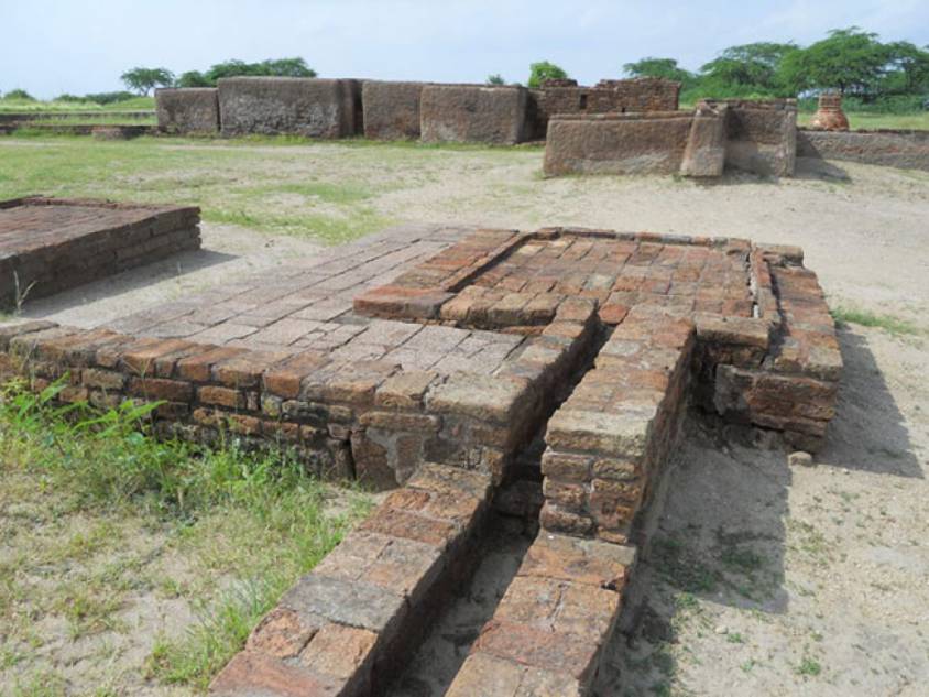
Les fouilles réalisées sur le site de Mohenjo-daro ont également révélé l’existence de pas moins de 700 puits en brique, de maisons équipées de salles de bains et de latrines individuelles et collectives. Les toilettes y étaient un élément essentiel. Cependant, les premiers archéologues ont identifié la plupart de ces installations comme des urnes funéraires post-crémation ou de simples puisards. De nombreux bâtiments de la ville comportaient deux étages ou plus. L’eau ruisselant du toit et des salles de bain des étages supérieurs était acheminée par des tuyaux en terre cuite fermés ou des goulottes ouvertes qui se vidaient, le cas échéant via les toilettes, dans les égouts couverts sous la rue.
Affirmation confirmée par une étude scientifique de 2016, intitulée « L’évolution des toilettes dans le monde à travers les millénaires », qui rapporte que
« les premières toilettes à chasse d’eau multiple reliées à un système d’égouts sophistiqué qui ont été identifiées jusqu’à présent, se trouvaient dans les villes antiques de Harappa et Mohenjo-daro dans la vallée de l’Indus, datant du milieu du IIIe millénaire av. J.-C. Presque chaque unité d’habitation à Harappa, Mohenjo-daro et Lothal était équipée d’un espace bain-toilette privé, avec des drains pour évacuer les eaux sales dans un plus grand drain qui se déversait dans le système d’égouts et de drainage.«
Jusqu’à présent, c’est à la civilisation minoenne (Crète) et à la Chine que l’on attribue la première utilisation de canalisations souterraines en argile pour l’assainissement et l’approvisionnement en eau. La capitale crétoise de Knossos possédait un système bien conçu pour acheminer l’eau propre, évacuer les eaux usées, et éviter les débordements en cas de fortes pluies.
On y a retrouvé également l’une des premières utilisations de toilettes à chasse d’eau, datant du XVIIIe siècle av. JC. La civilisation minoenne possédait des égouts en pierre qui étaient périodiquement nettoyés à l’eau claire. Dans l’Antiquité, la Crète était un grand fournisseur de minerai de cuivre pour le monde entier et avait de vastes connexions commerciales internationales.
Croyances religieuses et culturelles

Des rituels de fertilité furent sans doute observés afin de favoriser une pleine récolte ainsi que pour les grossesses des femmes, comme en témoignent un certain nombre de figurines, d’amulettes et de statuettes de forme féminine.
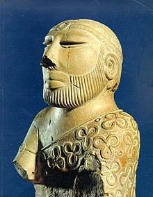
On pense que le peuple, à l’instar des Dravidiens que certains croient être à l’origine de la civilisation de l’Indus, vénérait une « déesse mère » et, éventuellement, un compagnon masculin représenté sous la forme d’une figure cornue en compagnie d’animaux sauvages. Statue dit du Roi-Prêtre, trouvé sur le site de Mohenjo-daru au début des années 1920.
Le « grand bain » de Mohenjo-daro aurait été utilisé pour des rites de purification liés à la croyance religieuse, mais il pourrait tout aussi bien s’agir d’une piscine publique. Nos connaissances des croyances religieuses de cette culture restent dans le domaine de simples hypothèses.
L’intitulé de la fameuse statue du « Roi-prêtre », retrouvée à Mohenjo-daro, est trompeur, car aucun indice factuel ne permet de démontrer qu’il s’agisse d’un roi ou d’un prêtre. Il pourrait tout autant s’agir de l’effigie d’un simple marchand de coton…
A part la poterie, des armes rudimentaires (pointes de lance, haches, flèches, etc.) et certains outils agricoles et industriels, deux types d’artefacts retrouvés nous livrent quelques rares indices culturels sur la société harappéenne.

D’abord, des figurines, qu’on tente d’interpréter comme des objets de dévotion, semblent n’être que de simples jouets.
Pour d’autres objets, il s’agit clairement de jouets, notamment des animaux montés sur des petits chariots à roulettes (bœufs, buffles, éléphants, chèvres et même une simple poule), fabriqués en bronze ou en terre cuite.
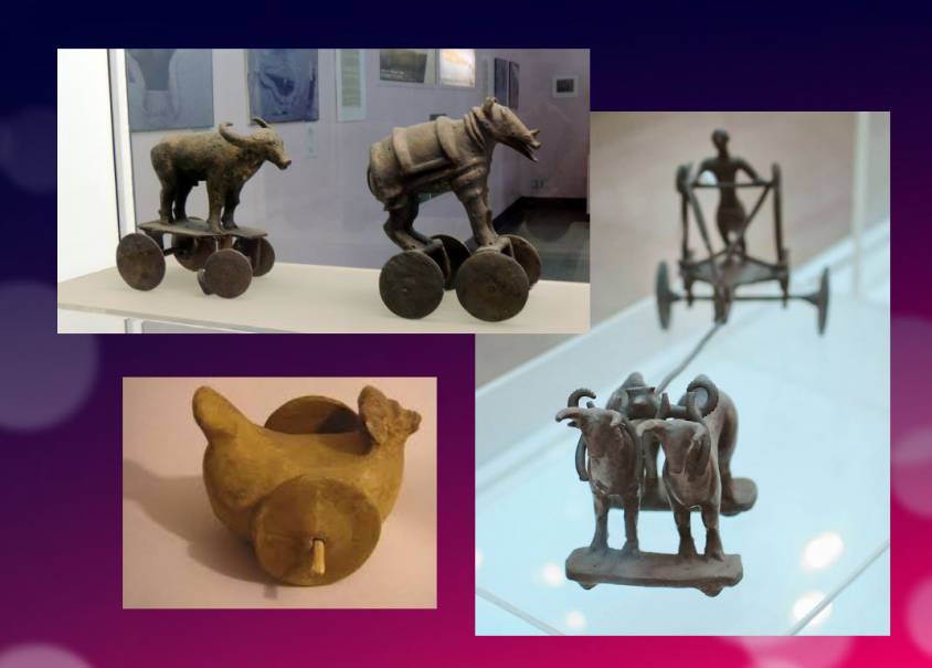
Révélant un haut niveau de sensibilité et de conscience, une série de masques avec des visages humains, dont certains, pourvus de deux petits trous pour attacher les ficelles, semblent inspirés des masques de Mongolie.
Il s’agit clairement de masques ayant servi (à des enfants et/ou des adultes) lors de représentations comiques ou tragiques, nous rappelant ceux qui nous sont parvenus de la Grèce classique.

Plus ancien que Sumer et l’Egypte ?
Les fouilles archéologiques de la civilisation de la vallée de l’Indus ont donc démarré bien tardivement, et l’on pense aujourd’hui que nombre des réalisations et des « premières » attribuées à l’Egypte (- 3150 av. JC) et à la Mésopotamie (- 4500 av. JC) pourraient en fait appartenir aux habitants de la civilisation de la vallée de l’Indus.
En mai 2016, le rapport rédigé par une équipe de chercheurs de l’IIT Kharagpur, de l’Institut d’archéologie, du Deccan College de Pune, du Physical Research Laboratory et de l’Archaeological survey of India (ASI), publié dans la revue Nature, a fait voler en éclats un certain nombre de faits considérés comme des certitudes inébranlables.
Jusque-là, on datait les 900 ans de la phase de « maturité » de la civilisation de l’Indus comme allant de -2800 à -1900 av. J.-C. Or, l’étude indienne indique que cette civilisation était beaucoup plus ancienne qu’on ne le pensait : elle a au moins 8000 ans !
Pour déterminer l’âge de cette civilisation, les chercheurs ont daté des poteries grâce à une technique appelée « luminescence optiquement stimulée » (OSL), et ont découvert qu’elles avaient près de -6000 ans, soit les plus anciennes poteries connues à ce jour. D’autres artefacts ont été datés jusqu’à -8000 ans. Les résultats proviennent d’un site majeur fouillé à Bhirrana, dans l’Haryana, qui montre la préservation de tous les niveaux culturels de cette ancienne civilisation, de la phase pré-harappéenne Hakra à l’époque harappéenne mature, en passant par la phase harappéenne précoce. Bhirrana faisait partie d’une forte concentration de sites le long de la mythique rivière védique Saraswati, aujourd’hui asséchée, une extension de la rivière Ghaggar dans le désert du Thar.
Les villes submergées du golfe de Khambhat
Ces nouvelles datations convergent avec la découverte, en janvier 2002, de ruines de villes submergées au large de la côte de l’Etat de Gujarat, au nord-ouest de l’Inde.
Ce sont les océanographes du National Institute of Ocean Technology (NIOT) de Madras qui font cette découverte. L’équipe parcourait la mer boueuse à 30 km au large de l’Etat du Gujarat, dans le golfe de Khambhat (ex-Cambay), afin de mesurer les niveaux de pollution marine. Par mesure de routine, ils enregistrèrent des images acoustiques du fond de l’océan.
Ce n’est que plusieurs mois plus tard, en analysant les données, que l’équipe se rend compte qu’elle a, sans le savoir, recueilli des images des ruines d’une immense cité, engloutie à 40 mètres sous le niveau de la mer. Et, fin janvier 2002, après avoir passé des semaines à draguer le site et remonté plus de 2000 objets, l’équipe du NIOT était en mesure de faire d’extraordinaires révélations.
Les ruines s’étendent sur 9 km le long des rives d’un ancien fleuve, et l’on peut distinguer les vestiges d’un barrage. La ville engloutie partage des similarités frappantes avec les sites de la civilisation de l’Indus. L’un des édifices, de la taille d’une piscine olympique, aux marches effondrées, rappelle le Grand Bain de Mohenjo-daro. Un autre monument rectangulaire de 200 m de long sur 45 m de large est aussi vaste que l’acropole découverte à Harappa. L’équipe du NIOT a également entrevu un autre édifice, sorte de grenier à blé, fait de briques de boue, d’une longueur de 183 m. A proximité de ces installations monumentales, on aperçoit des rangées de constructions rectangulaires qui s’apparentent aux fondations de maisons en ruine, un système de drainage, et même des routes. Lors d’une autre visite sur le site, l’équipe a remonté des outils en pierre polie, des ornements et des figurines, des débris de poteries, des pierres semi-précieuses, de l’ivoire et les restes fossilisés d’une colonne vertébrale, d’une mâchoire et d’une dent humaine. Mais l’équipe n’était pas au bout de ses surprises.
Elle envoya les échantillons d’un rondin de bois fossilisé à deux grands laboratoires indiens spécialisés dans les méthodes de datation : le Birbal Sbahni Institute of Paleobotany (BSIP), à Lucknow, et le National Geophysical Research Institute (NGRI), à Hyderabad. Le BSIP l’a daté de 5500 av. J.-C., alors que, pour le NGRI, l’échantillon est bien plus ancien et remonte probablement à 7500 av. J.-C.
Cette datation ferait de Khambhat le site le plus ancien découvert en Inde. Cette découverte pourrait marquer la fin de la théorie selon laquelle l’urbanisation se propage de l’Asie, depuis l’ouest, vers l’Indus. Cette datation suscita d’intenses controverses. L’archéologue G. Possehl signale qu’il n’y a aucune raison de croire que ce morceau de bois fossilisé appartient aux ruines de l’ancienne cité. Etant donné les forts courants marins de la région, il pourrait provenir d’ailleurs. Reconnaissant le bien-fondé de ces critiques, l’équipe de NIOT a assuré que d’autres objets seraient soumis aux méthodes de datation. Il s’agit aussi de comprendre comment cette cité a été engloutie et comment elle s’est retrouvée à 30 km de la côte. Harsh Gupta, géologue, pense que c’est un gigantesque tremblement de terre qui en a causé la destruction. On se trouve dans une zone à fort risque sismique, et le tremblement de terre de 2001 à Bhuj a montré la vulnérabilité de la région à ces phénomènes. Toutefois, la priorité est d’établir définitivement l’âge de la cité engloutie, et si ces recherches dans le passé de Khambhat sont approfondies, cette découverte peut se révéler la plus excitante de ce siècle.
Berceau historique du textile
Dans son livre Empire of Cotton, A Global History (2015), Sven Beckert retrace en profondeur le développement de ce que les anciens, intrigués par sa ressemblance avec le toucher de la laine, appelaient « arbre à laine ». Si cette plante pousse dans des climats tempérés et tropicaux, elle a besoin d’une abondante humidité pour prospérer pleinement, ce qui en circonscrit la culture aux vallées fluviales naturellement, puis artificiellement irriguées.
D’après l’auteur,
« Les agriculteurs de la vallée de l’Indus furent les premiers à filer et tisser le coton. En 1929, des archéologues ont retrouvé des fragments de textiles en coton à Mohenjo-daro, dans l’actuel Pakistan, datant de 3250 à 2750 avant notre ère. Les graines de coton trouvées à Mehrgarh, non loin de là, ont été datées de 5000 avant notre ère. Les références littéraires témoignent également de l’ancienneté de l’industrie du coton dans le sous-continent. Les écritures védiques, composées entre 1500 et 1200 avant notre ère, font allusion au filage et au tissage du coton. »
Historiquement, les premiers fragments de coton ont été découverts à Mohenjo-daro, dans la région pakistanaise du Sind, lors d’une expédition dirigée par Sir John Marshall, directeur général de l’Archaeological Survey of India de 1902 à 1928. Dans son livre sur Mohenjo-daro et la civilisation de l’Indus, Sir Marshall raconte que des fragments de tissu avaient été enroulés autour d’un pot à parfum en argent et d’une salière.
Gouvernement sans chef ?

Reste que l’organisation politique des cités de l’Indus échappe aux experts. Car contrairement aux civilisations mésopotamiennes et égyptiennes, les recherches réalisées sur les sites de la vallée de l’Indus n’ont mis au jour aucun temple ou palais d’envergure. Aucune preuve non plus de l’existence d’une armée permanente… De quoi s’interroger sur la présence ou non d’un pouvoir politique. Panique chez les archéologues et géopoliticiens britanniques, toujours enclins à projeter sur le reste du monde leur propre idéologie coloniale de castes aristocratiques.
En réalité, chaque ville semble avoir eu son propre gouverneur, ou un conseil citoyen se coordonnant avec d’autres centres urbains, tous adhérant à un certain nombre de principes communs considérés comme mutuellement bénéfiques.
Cette « coïncidence des opposés », celle de la grande diversité avec la plus parfaite similitude, intrigue l’expert John Keay :
« Ce qui a étonné tous ces pionniers, et qui reste la caractéristique distinctive des plusieurs centaines de sites harappéens aujourd’hui connus, est leur apparente similitude : ‘Notre impression dominante est celle d’une uniformité culturelle, à la fois tout au long des plusieurs siècles durant lesquels la civilisation harappéenne a prospéré, et sur la vaste zone qu’elle occupait.’ Les briques omniprésentes, par exemple, ont toutes des dimensions standardisées, de même que les cubes de pierre utilisés par les Harappéens pour mesurer le poids sont également standardisés et basés sur le système modulaire. La largeur des routes est conforme à un module similaire ; ainsi, les rues sont généralement deux fois plus larges que les voies latérales, tandis que les artères principales sont deux fois ou une fois et demie plus larges que les rues. La plupart des rues fouillées jusqu’à présent sont droites et vont du nord au sud ou d’est en ouest. Les plans de la ville se conforment donc à un quadrillage régulier et semblent avoir conservé cette disposition à travers plusieurs phases de construction.«
Vue l’existence d’un système de poids et de mesures unifié, vue la similitude de l’organisation urbaine ainsi que la standardisation de la taille des briques en terres cuites pour des centaines de villes, il est donc tout simplement impossible que le chacun pour soi ait régné en maître.
Berceau de la démocratie ?
En 1993, dans un article intitulé « La civilisation de la vallée de l’Indus, berceau de la démocratie ? », publié dans le Courrier de l’Unesco, l’archéologue et muséologue pakistanais de renommée internationale, Syed A. Naqv, qui s’est battu pour la préservation du site de Mohenjo-daro, tentait de répondre à la question.
« Dans toutes les civilisations hautement développées du passé – la Mésopotamie, la vallée du Nil, l’Anatolie, la Chine – on peut sentir l’influence omniprésente de l’autorité impériale, qui assure le patronage des arts et oriente le développement de la société. Un examen attentif du rôle d’une telle autorité dans cette civilisation, qui a fleuri il y a quelque 5 000 ans et couvrait presque deux fois la superficie des civilisations de la Mésopotamie et du Nil réunies, semble démentir la présence d’un régime autoritaire. La civilisation de l’Indus avait un mode de vie bien discipliné, des contrôles civiques et un système d’organisation qui ne pouvaient qu’être issus du type de ’gouvernement par le peuple’ exercé dans une cité-État grecque quelque 2 000 ans plus tard. La Grèce a-t-elle donné naissance à la démocratie ou s’est-elle contentée de suivre une pratique développée antérieurement ?«
Bien qu’il n’existe aucune grande structure agissant comme centre d’autorité,
« les découvertes effectuées suggèrent que la réglementation s’appliquait sur un territoire d’environ 1600 km du nord au sud et de plus de 800 km du sud au sud-est. Le principal argument en faveur de cette thèse est l’existence de normes et de standards bien établis qui auraient nécessité le consensus du peuple s’ils n’avaient pas été imposés par un régime autoritaire. Il est impossible d’ignorer les preuves fournies par la planification parfaite de la grande ville de Mohenjo-daro et l’utilisation dans sa construction de briques de taille standard de 27,94 cm de long, 13,96 cm de large et 5,71 cm d’épaisseur.«
Dans les deux grandes villes de Mohenjo-daro et de Harappa, distantes d’environ 600 km, « le quadrillage du tracé des rues mis au jour par les fouilles archéologiques montre qu’une grande attention a été accordée à la sécurité des habitants et suggère l’existence d’un système de contrôle civique très développé et bien monolithique ».
Il en va de même pour le système d’égouts très perfectionné et l’existence
« d’une série presque complète de poids en pierre hautement polis, de forme cubique, semi-cubique, cylindrique et sphérique, dont très peu seraient défectueux, ce qui prouve une fois de plus que les autorités civiles maintiennent des normes commerciales cohérentes.
Il n’est pas possible de conclure à l’existence d’une telle conception philosophique de la démocratie tant que l’on n’aura pas déchiffré l’écriture harappéenne et fourni des preuves écrites à ce sujet. Mais les signes sont là, et des recherches plus poussées dans cette direction pourraient bien établir que le ‘gouvernement par le peuple’ est né dans la vallée de l’Indus », conclut l’auteur.
Enfin, ce peuple agricole, qui connaissait l’usage des lances et des flèches, n’ayant par ailleurs laissé aucune trace d’une quelconque activité militaire (peu d’armes ni de fortifications à but exclusivement défensif retrouvées), de nombreux avis s’accordent à dire que cette société pourrait avoir connu la plus longue période de paix de l’histoire de l’humanité.
Déclin et chute

Dans deux de ses livres, le Timée et le Critias, le philosophe grec Platon raconte l’histoire « certainement vraie, bien qu’étrange » d’un peuple maritime à la puissance incomparable : les Atlantes, dont il décrit la civilisation et la capitale avec force détails.
Partis 10 000 ans avant notre ère d’une île située au-delà des colonnes d’Hercule, les Atlantes auraient fini par dominer l’ensemble de l’Afrique et de l’Europe de l’Ouest. Dans un passage qui n’est pas sans rappeler le type d’organisation politique qui a pu exister à Mohenjo-daro, Critias précise qu’Atlantide était alors habitée
« par les différentes classes d’hommes qui s’occupent des métiers et de l’agriculture. Les guerriers, séparés dès le commencement par des hommes divins, habitaient à part, possédant tout ce qui était nécessaire à leur existence et à celle de leurs enfants. Parmi eux, il n’y avait pas de fortunes particulières ; tous les biens étaient en commun : ils n’exigeaient rien des autres citoyens au-delà de ce qu’il leur fallait pour vivre, et remplissaient en retour toutes les obligations que notre entretien d’hier attribuait aux défenseurs de la patrie tels que nous les concevons.«
S’exprimant sans doute sous forme métaphorique, Platon affirme qu’initialement vertueuse, la civilisation atlante aurait sombré dans la démesure, l’arrogance et la corruption au point d’être châtiée par Poséidon lui-même pour s’être lancée dans une guerre de trop, cette fois contre Athènes. Et « en l’espace d’un seul jour et d’une nuit terribles (…), l’île Atlantide s’abîma dans la mer et disparut ».
Au niveau historique, le déclin soudain de la civilisation de l’Indus, vers -1900 ans avant J.-C., reste un mystère.
Certains historiens soulignent des aspects de la civilisation minoenne (Crète) présentant d’étonnantes similitudes avec la civilisation de la vallée de l’Indus, notamment la gestion de l’eau et les premiers systèmes d’égouts à Knossos la capitale, les techniques de fonte de bronze à la cire perdue et les combats de taureaux qui font la gloire de Crète.
Quelques traces d’incendies et de destructions, ainsi qu’une quarantaine de squelettes blessés à l’arme blanche et retrouvés sans sépulture à Mohenjo-daro ont d’abord laissé supposer une invasion par des peuples d’Aryens venus de l’Asie centrale ou du plateau iranien. « Cette théorie est aujourd’hui abandonnée. Nous n’avons en effet retrouvé aucune trace effective de massacres ou de violences sur les sites de la vallée de l’Indus, ni de mobilier qui pourrait être associé à de telles populations », précise Aurore Didier, chargée de recherche au CNRS et directrice de la mission de l’Indus.
Autre hypothèse, l’incapacité à renforcer sa résilience face à un chaos climatique.
Les carottages réalisés dans le nord-ouest de l’Inde ont montré que le climat s’y est passablement altéré environ 2000 ans avant notre ère.
On rapporte que ce fut aussi le cas en Mésopotamie. « Il s’est rapproché de celui, sec et aride, que connaissent ces régions aujourd’hui, ce qui a perturbé les cultures et, de facto, le commerce des civilisations de l’Indus. Le bouleversement socio-économique qui s’ensuivit peut avoir mené au déclin de ces sociétés. Cette hypothèse est la plus communément admise à ce jour », indique l’archéologue.
Les habitants auraient quitté leurs vallées devenues infertiles pour migrer vers les plaines du Gange.
« Cela s’est accompagné d’un changement dans les stratégies de subsistance. La civilisation de l’Indus s’est progressivement convertie dans des cultures céréalières estivales basées sur le riz et le millet, deux denrées plus à même de supporter ces nouvelles conditions climatiques et nécessitant, pour le riz, le développement d’une agriculture irriguée, suggère Aurore Didier. Elle a également tissé des liens avec de nouveaux partenaires commerciaux. «
Pas de quoi, donc, parler d’« effondrement » d’une société au sens des « collapsologues ». Il s’agit plutôt d’une adaptation graduelle à l’évolution de l’environnement, s’étant étalée sur plusieurs siècles.
Au fur et à mesure que se poursuivent les fouilles des sites de la civilisation de la vallée de l’Indus, de nouvelles informations contribueront sans aucun doute à une meilleure compréhension de son histoire et de son développement. En tout cas, toute connaissance supplémentaire de cet héritage civilisationnel commun pourra à l’avenir servir de fondement à une coopération fraternelle entre le Pakistan, l’Inde et l’Afghanistan.
En attendant, au lieu de vouloir se calquer sur les modèles barbares de l’Empire mongol, de l’Empire romain ou encore de l’Empire britannique, les « élites » du monde transatlantique feraient mieux de s’inspirer de cette magnifique civilisation qui semble avoir prospéré pendant 5000 ans sans guerres et massacres perpétuels, mais simplement grâce à une bonne entente, au niveau national entre citoyens, et à des coopérations mutuellement bénéfiques avec de nombreux partenaires lointains.
La modernité de la civilisation de la vallée de l’Indus, capable d’offrir à chacun de la nourriture, un abri, de l’eau et des installations sanitaires, nous montre, à nous tous qui vivons dans le présent, à quel point nous sommes devenus arriérés.
The challenging modernity of the Indus Valley Civilization

Get an easy-to-print pdf file of this article
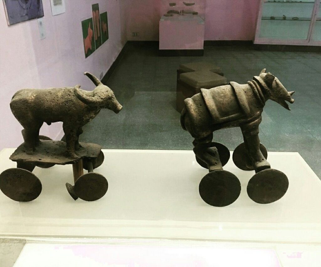
Karel Vereycken, Paris, France, January 2023
A major archaeological discovery has just been made in Israel in 2022: the first evidence of the use of cotton fibers in the Near East and among the oldest in the world, dating back nearly 7,000 years, was discovered by Israeli, American and German archaeologists during an archaeological excavation at Tel Tsaf, southeast of Beit She'an, in the Jordan Valley of Israel.
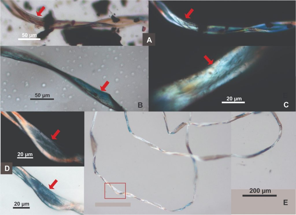
So far, the earliest available evidence of cotton fibers in the area was dated to a few hundred years later, to the late Chalcolithic (Copper Age) and Early Bronze Age (about 5,000 to 6,500 BCE) from the archaeological site of Dhuweila in eastern Jordan.
Discovered in 1940, the site of Tel Tsaf reveals its secrets. « Tsaf is characterized by an amazing preservation of organic materials, » said Professor Danny Rosenberg of the Zinman Institute of Archaeology at the University of Haifa. « Tel Tsaf was a kind of pole that concentrated important commercial activities and had established contacts with many other peoples, » Rosenberg believes. « There was massive storage capacity there to accommodate grain, enormous capacity if you compare it to other sites.
For example, the earliest evidence of the social use of beer drinking and ritual food storage has been found there. Rosenberg and the other researchers also found beads from contemporary Anatolia, Romania, Egypt and other parts of Africa; pottery from Iraq, Syria and Armenia; and the earliest copper and other metals found in the world.
“Wool Tree” and “Cotton Roads”

The cotton found in Israel, probably came from the Indus region—modern Pakistan/India—which was the only place in the world that had begun to domesticate cotton at that time before its cultivation appeared in Africa thousands of years later.
« What’s interesting about this early evidence of a link to such a distant region is that it comes from fibers – microscopic pieces of ancient yarn. We assume that these cotton fibers, found along with wool fibers and plant fibers, arrived at the site as part of fabrics or clothing, i.e., ancient textiles, » Rosenberg says.
In addition, cotton was not only used for clothing: « In the prehistoric era, textiles were involved in many areas of life, not only in clothing but also in hunting, fishing … This is much more important than just saying that what we found are pieces of clothing that were worn by the inhabitants of the area. This discovery tells us a lot about the economic practices of the area, » says Rosenberg.
Since cotton had never been grown in Tel Tsaf, it was a surprise for the researchers to find it, and they felt that its presence underscored the city’s importance as a global trading hub at the heart of what could be called, the « Cotton Roads » of those days.
Growing cotton poses major challenges: a moderate to tropical climate and vast amounts of water. Just to produce a single T-shirt and a pair of jeans (representing about 1 kg of cotton), no less than 20,000 liters of water are required! Which civilization can afford such a performance at the beginning of the 7th millennium BC?
The Indus Valley civilization (IVC)
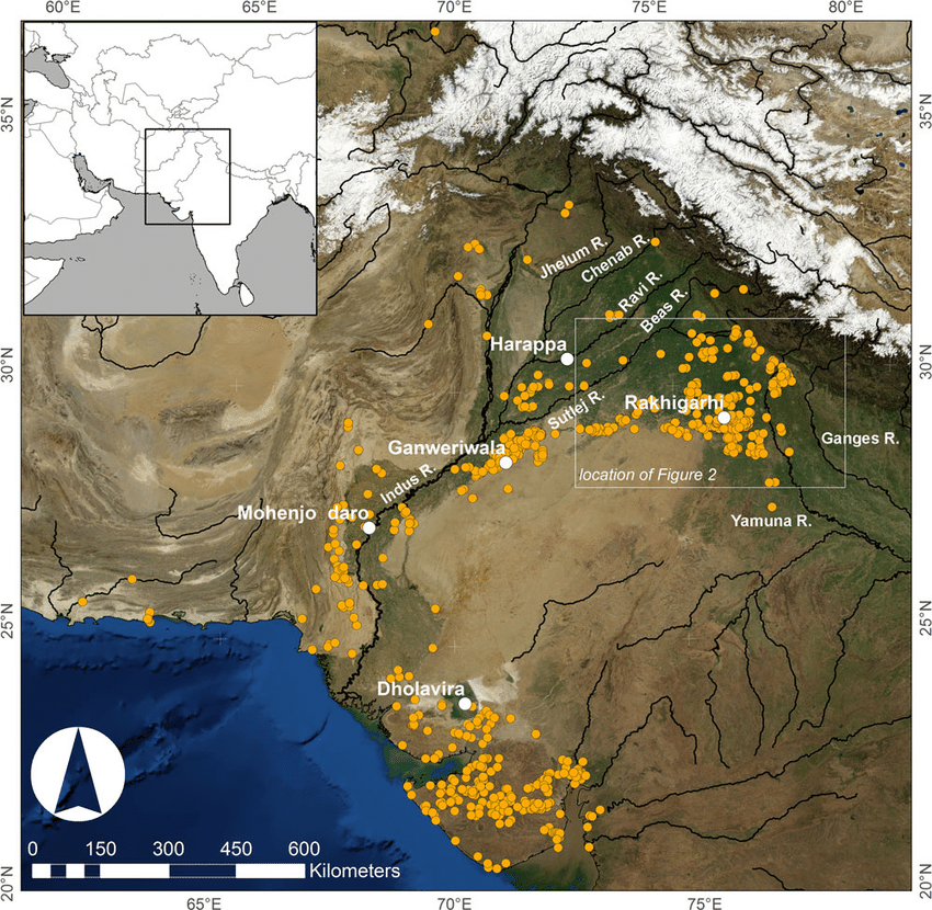
The term « Indus Valley Civilization » (IVC) refers to a vast cultural and political entity that flourished in the northern region of the Indian subcontinent between about 8000 and about 1900 BCE., a region that stretched from Baluchistan (Pakistan) in the west to Uttar Pradesh (India) in the east and from northeastern Afghanistan in the north to Gujarat (India) in the south.
In the absence of both literary sources and remnants of palaces and temples to confirm it, one cannot qualify this entity as a “Kingdom” or an “Empire”. Its modern name (IVC) derives simply from its location in the Indus Valley, but also goes under the name of the « Indus-Sarasvati civilization » or « Harappan civilization ». These last designations come from the river Sarasvati, mentioned in the Vedic sources, which flowed next to the Indus and which would have disappeared, and from the ancient city of Harappa (Punjab, Pakistan), discovered by the British in 1829, but deliberately left unexplored.
The rise of a great urban civilization in the Indus Valley, which reached its maturity around 2500-2400 BCE, was long considered a sudden and mysterious phenomenon. Today, a series of discoveries allows us to follow, from 7000 to 2500 BCE, a series of transformations and innovations whose cumulative effects, stimulated by the enlargement of the network of exchanges from 3000 BCE onwards, created the conditions for the development of an incredibly modern and prosperous urban civilization.
Enter Mehrgarh, the light of the world!

Since prehistoric times, the Indus region has been pioneering and rich in discoveries. As an example, for the Guinness Book of Records, although a case apart, the farming village of Mehrgarh (Baluchistan, Pakistan) which dates from the Neolithic (using only stones as tools) but can be considered as the key culture and city that lead humanity, as early as in the 8th millennia BCE, from the Stone Age into the Age of Copper.
The site is located on the principal route between what is now Afghanistan and the Indus Valley: this route was also undoubtedly part of a trading connection established quite early between the Near East and the Indian subcontinent.
Excavations in Mes Aynak (Afghanistan), where archaeologists are only beginning to find remnants of a 5,000-year-old Bronze Age site beneath the Buddhist level, including an ancient copper smelter, will undoubtedly shed new light on these relationships.
On the basis of a variety of well-documented archaeological finds, it has been established that “pre-Harrapan” Mehrgarh, made several historical breakthroughs for the benefit of humanity as a whole.
Mehrgarh gave the world:
- among the oldest traces of agriculture (wheat and barley) and breeding (cattle, sheep and goats) in South Asia ;
- the first breweries (with wheat and barley);
- the oldest reservoirs for irrigated agriculture and flood prevention;
- the oldest traces of cotton culture (6th millennium BCE);
- the oldest jewel, called the « Mehrgarh amulet » (6th millennium BCE), produced with the « lost wax » bronze casting technique ;
- the oldest bow drills (in green jasper) allowing to drill holes in lapis lazuli and carnelian;
- the very first traces of successfull dentistry practices (!) (9th millennium BCE); The inhabitants of Mehrgarh appeared to have developed an understanding of surgery and dentistry, as evidenced by the drilled teeth of some of the skeletons found at the site. Analysis of the teeth shows that prehistoric dentists worked to treat toothaches with drills made from flint heads. The work was so elaborate that even modern dentists are surprised at the efficiency with which the Mehrgarh « dentists » removed decaying tooth tissue. Among the remains, a total of eleven drilled crowns were found, with one example showing evidence of a complex procedure involving the removal of tooth enamel followed by carving of the cavity wall. Four of the teeth show evidence of decay associated with the drilled hole. None of the individuals with drilled teeth appear to have come from a special tomb or shrine, indicating that the oral health care they received was available to all.

Densely populated
Originally, the IVC was built around the fishy meanders of the Indus, a river nearly 3200 kilometers long that flows from the Himalayan mountains towards the Arabian Sea. Like the populations of other great river valleys, this society was seduced by the fertility of the land as well as by the possibility of using the Indus as a transportation route.
The IVC, whose prosperity rests largely on the increasingly systematic exploitation of the rich silt of the Indus, spread over an immense territory encompassing the entire Indus Valley and part of Indian Gujarat. It is necessary to add to the vast zone of distribution of the Indus civilization some Harappan « colonies » or outposts like Sutkagan Dor (Ballochistan, Pakistan), close to Gwadar on the edges of the sea of Oman, at the Iranian-Pakistani border, and the lapus lazuli mining town of Shortugai, close to Amu Darya river, at the Afghan-Tajik border, at nearly 1,200 kilometers of Mohenjo-daro, by far the largest IVC urban concentration.

At its peak, this civilization was twice as large as the Old Kingdom of Egypt. With an area of 2.5 million square kilometers, it was at the time the largest civilization in the world: it included 5 million people, or 10 % of the world population at the time, much more than less older civilizations as Sumer (0.8 to 1.5 million people) or ancient Egypt (2 to 3 million).
To date, about 2,000 sites have been discovered in India, Pakistan and Afghanistan. Because of various wars and conflicts, only 10 % of the territory of these sites has been excavated and scientifically investigated. On the Indian subcontinent, the main centers of this civilization are Harappa (estimated 23,500 inhabitants) and Mohenjo-daro (est. 40,000 inhabitants) in Pakistan and Lothal, Dholavira and Kalibangan in India. In addition to trade relations with Mesopotamia and Iran, the Harappan city-states also maintained active trade relations with the peoples of Central Asia.
Agriculture, crafts and industry

Agriculture, animal husbandry, industry, trade and commerce were the main source of income.
Agriculture was the main occupation of the people of the Indus Valley. They cultivated barley and wheat on a large scale (and made beer) but also other crops such as legumes, cotton, cereals, sesame, dates, mustard, melons, peas, etc.
There is no real evidence of rice, but a few grains of rice have been found in Rangpur and Lothal.
In the towns of Mehrgarh, Harappa, and Mohenjo-daro, there are remains of large granaries, suggesting that they produced more than they needed and physically stocked cereals and other food products in case of crop failure.

Animal husbandry was another major occupation. Seals suggest that they domesticated cows, buffalos, goats, sheep, pigs, etc. Camels and bullocks were also domesticated and used as beasts of burden. Camel bones have been found in large numbers at many sites, but there is no trace of them on the seals. During the excavation of Surkotado in Gujarat, India, the jawbone of a horse was found. Terracotta figurines representing a horse were found in Nausharo and Lothal.
The inhabitants of the Indus Valley were very skillful. They made ceramics, metal vessels, tools and weapons, weaved and spun, dyed and practiced other crafts with potter’s wheels. The weavers wore clothes made of cotton and wool. They knew leather, but there is no record of silk production.
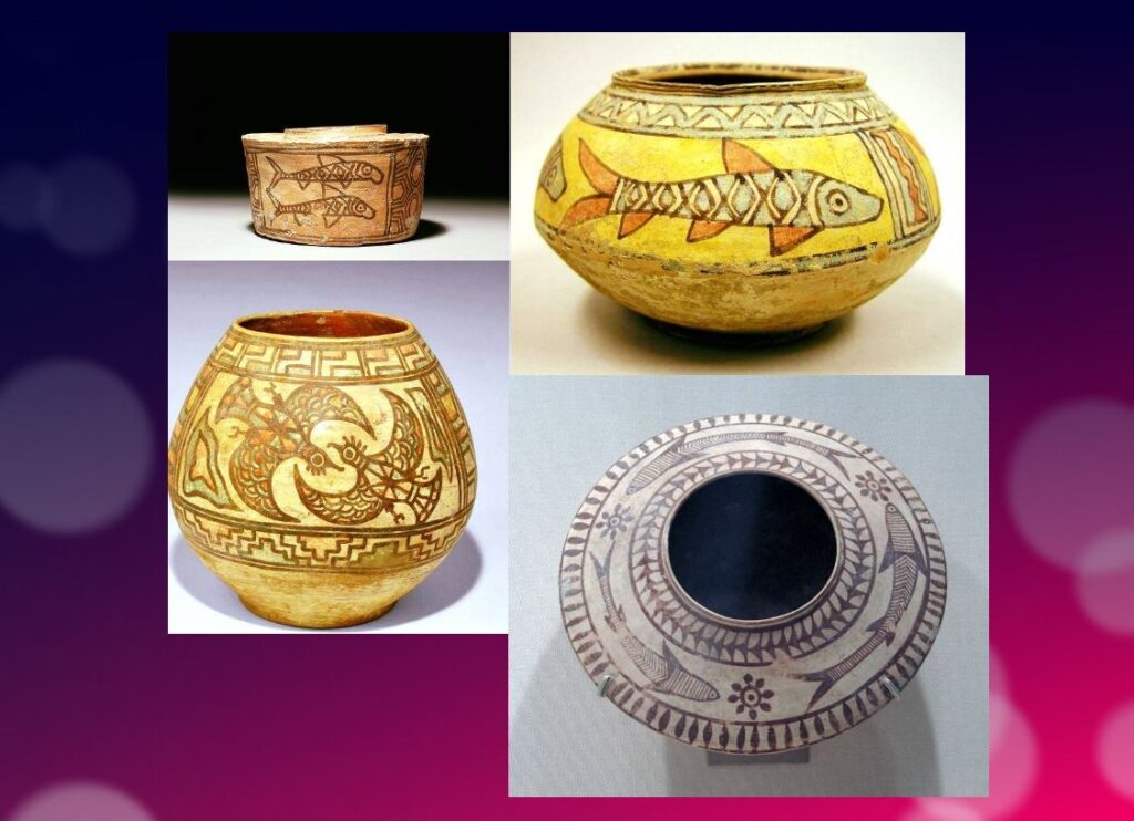
The inhabitants of this civilization originally came from the Bronze Age and used stone tools, but they soon excelled in the manufacture and processing of gold, silver, copper, lead and bronze, especially for artistic ornaments of great finesse.
Artisans made jewelry in Mohenjo-daro, Chanho-daro and Lothal. They used ivory and various precious stones such as carnelian, lapis lazulite, agate and jasper to make them. Shell work was also a thriving industry. Craftsmen in the coastal colonies used shells to make buttons for shirts, pendants, rings, bracelets, beads, etc.
To supply the production of these craft professions, they needed to import various raw materials. To produce bricks and ceramics, clay was available locally, but for metal they had to acquire it from abroad. Trade focused on importing raw materials to be used in Harappan city workshops, including minerals from Iran and Afghanistan, lead and copper from other parts of India, jade from China, and cedar wood floated down rivers from the Himalayas and Kashmir. Other trade goods included terracotta pots, gold, silver, metals, beads, flints for making tools, seashells, pearls, and colored gemstones, such as lapis lazuli and turquoise.
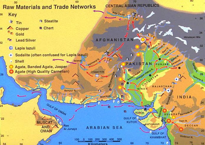
Ox carts were used to transport goods from one place to another. They also constructed barges used on the waterways along the Indus and its tributaries for transportation.
One of the ways historians know about the maritime trade network operating between the Harappan and Mesopotamian civilizations is the discovery of Harappan seals and jewelry at archaeological sites in regions of Mesopotamia, which includes most of modern-day Iraq, Kuwait, and parts of Syria. Long-distance sea trade over bodies of water—such as the Arabian Sea, Red Sea and the Persian Gulf—may have become feasible with the development of plank watercraft that were each equipped with a single central mast supporting a sail of woven rushes or cloth.
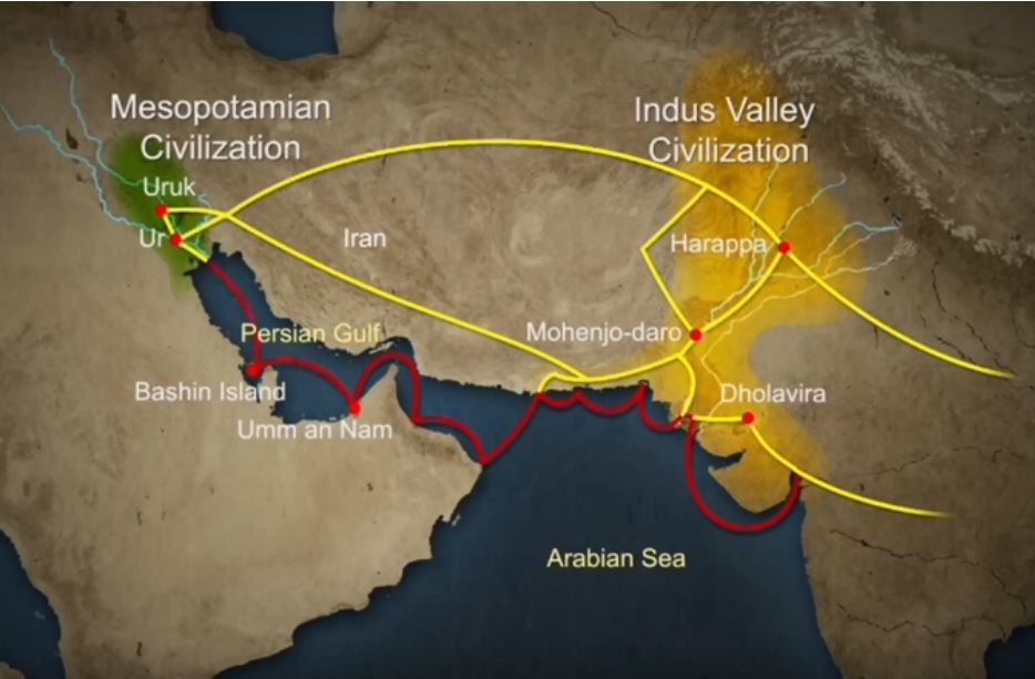
Historians have also made inferences about networks of exchange based on similarities between artifacts across civilizations.
Between 4300 and 3200 BCE, ceramics from the Indus Valley Civilization area show similarities with southern Turkmenistan and northern Iran. During the Early Harappan period—about 3200 to 2600 BCE—there are cultural similarities in pottery, seals, figurines, and ornaments that document caravan trade with Central Asia and the Iranian plateau.
The wonders of Mohenjo-daro
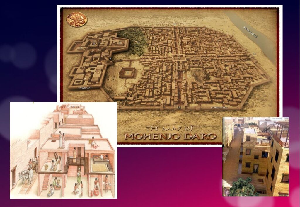
Sometimes referred to as the « Manhattan of the Bronze Age » for the grid pattern of the city plan, Mohenjo-daro (Sind, Pakistan) remained buried under meters of alluvial sediment until 1922.
A real metropolis made of baked bricks, it covers more than 200 hectares. Strictly squared, cut in two by a street of ten meters wide, divided from north to south by a dozen arteries drawn with the cord, and crossed from east to west by paved streets, Mohenjo-daro represents, by its strictly reflected urban framework, the model city of the Indus civilization. It could have accommodated up to 40,000 people!
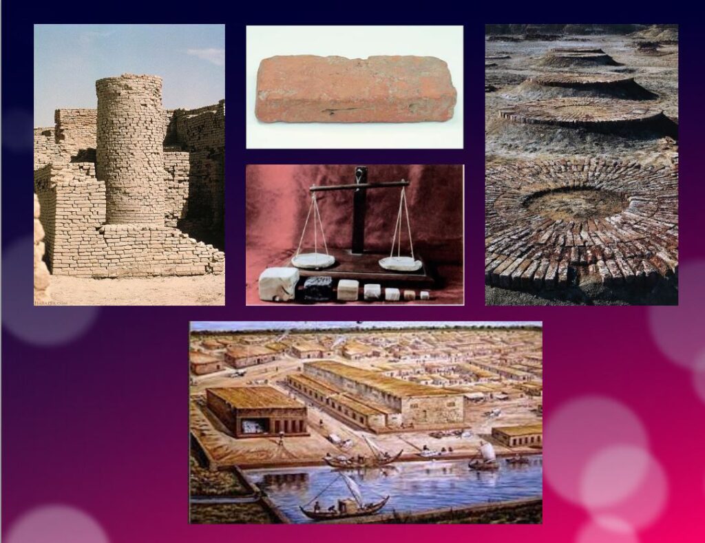
The Harappans were masters of hydraulic engineering, a “riparian” people working in river corridors practicing irrigated agriculture. They mastered both the shaduf (an irrigation tool used to draw water from a well), and windmills.
In the Harappan cities, the domestic and manufacturing areas were separated from each other.
The inhabitants, living in one-, two-, and sometimes three-story dwellings, seem to have been mainly artisans, farmers, and merchants. The people had developed the wheel, cattle-drawn carts, flat-bottomed boats large enough to carry goods, and perhaps also sailing. In the field of agriculture, they had understood and used irrigation techniques and canals, various agricultural implements, and had established different areas for livestock grazing and cultivation.
Seals and harrapan script
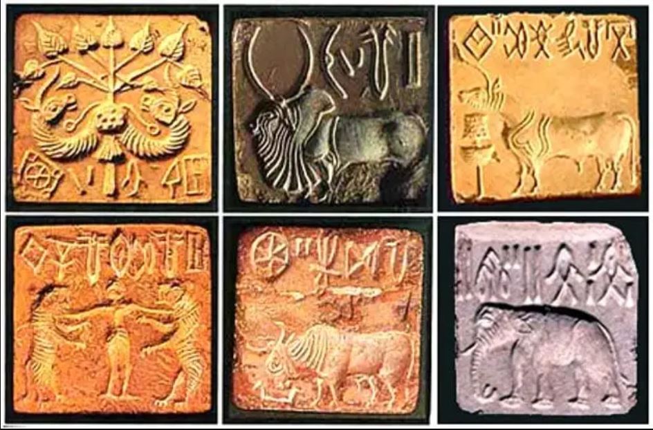
Among the thousands of artifacts found at the various sites are small soapstone seals just over one inch (3 cm) in diameter, used to sign contracts, authorize land sales, and authenticate the point of origin, shipment, and receipt of goods in long-distance trade. On each seal is a small text in Harappan, a language yet to be deciphered.
Among the thousands of artifacts found at the various sites are small soapstone seals just over one inch (3 cm) in diameter, used to sign contracts, authorize land sales, and authenticate the point of origin, shipment, and receipt of goods in long-distance trade.
Commercial contacts between the Indus and Sumer populations are well documented. Numerous seals from the Indus Valley have been discovered in Mesopotamia. On each seal, a small text in Harappean, a language that remains to be deciphered.
If 4,200 texts reached us, 60 % of them are seals or mini-tablets of stone or copper, engraved, and they comprise on average… only five signs! The longest text has 26 signs. The texts are always accompanied by the image of an animal, often a unicorn or a majestic buffalo. They were intended to mark goods, probably indicating the name of the owner or the recipient and a quantity or a year. Trying to decipher the Indus language is a bit like trying to learn French only from the labels on the food shelf of a supermarket!
The invention of sanitation
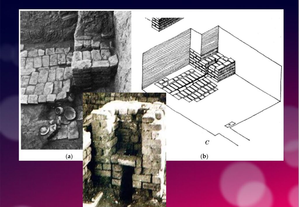
In addition to this particular attention that they paid to urban planning, the members of the Indus civilization also seem to have been pioneers of modern hygiene. Some cities, notably Mohenjo-daro, were equipped with small containers (dustbins) in which the inhabitants could deposit their household waste.
Anticipating our « all to the sewer » systems imagined in the 16th century by Leonardo da Vinci for the project envisaged by François I for the new French capital Romarantin, many cities had already public water supply and an ingenious sanitation system.
In many cities, including Mohenjo-daro, Harappa, Lothal and Rakhigari, individual houses or groups of houses were supplied with water from wells. This quality fresh water was used as much for food and personal hygiene (baths, toilets) as for the economic activities of the inhabitants.
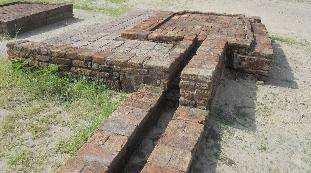
As an example, the sanitation system of the port city of Lothal (Gujarat, India) where many houses had a bathroom and private brick latrines. The wastewater was evacuated through a communal sewer system that led either to a canal in the port, or to a soaking pit outside the city walls, or to buried urns equipped with a hole allowing the evacuation of liquids, which were regularly emptied and cleaned.

Excavations at the Mohenjo-daro site have also revealed the existence of no less than 700 brick water wells, houses equipped with bathrooms and individual and collective latrines. Toilets were an essential element. However, early archaeologists erroneously identified most toilets as post-cremation burial urns or simple cesspools. Many buildings in the city were two or more stories high. Water from the roof and bathrooms of the upper floors was channeled through closed clay pipes or open troughs that emptied, if necessary via the toilets, into the covered sewers underneath the paved street.
This extraordinary achievement is confirmed by a 2016 scientific study, entitled « The Evolution of Toilets Around the World Across the Millennia, » which reports that,
The earliest multi-flush toilets connected to a sophisticated sewage system that have been identified so far were found in the ancient cities of Harappa and Mohenjo-Daro in the Indus Valley, dating from the middle of the third millennium BC. Nearly every dwelling unit in Harappa, Mohenjo-Daro, and Lothal was equipped with a private bath-toilet area with drains to carry dirty water into a larger drain that emptied into the sewer and drainage system.
Till now, it are the Minoan (Crete) civilization and China that have been credited for the first use of underground clay pipes for sanitation and water supply. In the Cretan capital Knossos, there was a well-organized water system to bring in clean water, to evacuate wastewater and to provide storm sewers for overflow in case of heavy rains.
In Knossos existed also one of the earliest uses of flush toilets, dating back to the 18th century BCE. The Minoan civilization had stone sewers that were periodically cleaned with clean water. Crete, of course, was a large provider of Copper ore for the entire world in Antiquity and had vast international trade connections.
Religious and cultural worldview
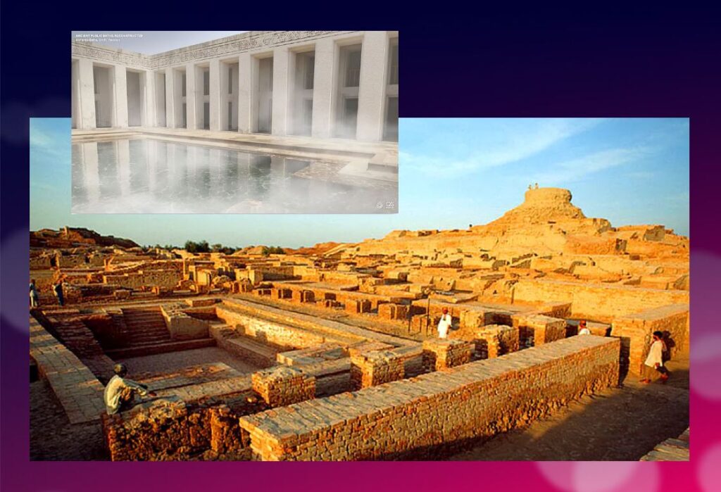
In the IVC, fertility rituals were probably observed in order to promote a full harvest as well as for women’s pregnancies, as evidenced by a number of figurines, amulets and statuettes with female form.
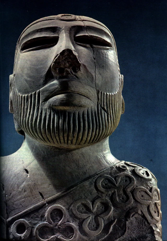
It is thought that the people, like the Dravidians who some believe were the origin of the Indus Civilization, worshiped a “mother goddess” and possibly a male companion represented as a horned figure in the company of wild animals.
The « Great Bath » at Mohenjo-daro would have been used for purification rites related to religious belief, but it could just as easily have been a public pool for recreation. Our knowledge of the religious beliefs of this culture remains in the realm of mere hypothesis.
The title of the famous statue of the « Priest-King » found at Mohenjo-daro is misleading, as there is no evidence that it is a king or a priest, and it may be a simple cotton trader…
Apart from pottery, certain types of elementary weapons (spearheads, axes, arrows, etc.) and certain tools for practical purposes, two types of artifacts give us cultural clues about Harappean society.
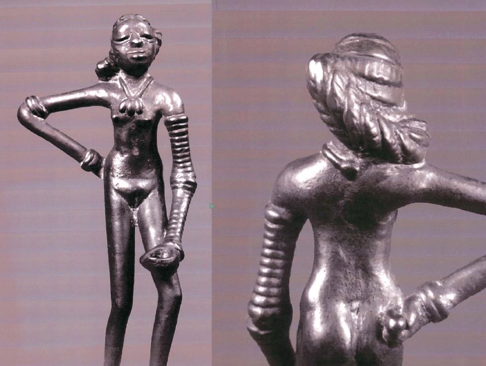
First, some figurines, which we try to interpret as devotional objects, seem to be simple toys. For others, they are clearly toys, notably animals (oxen, buffaloes, elephants, goats and even a simple hen), made of bronze or terracotta, mounted on small carts with wheels.

Second, among other objects expressing a high level of sensitivity and consciousness, a series of masks, some of which seem inspired by Mongolian masks.
These masks are clearly intended to serve comic or tragic representations and remind us of the ancient masks that have come down to us from classical Greece.
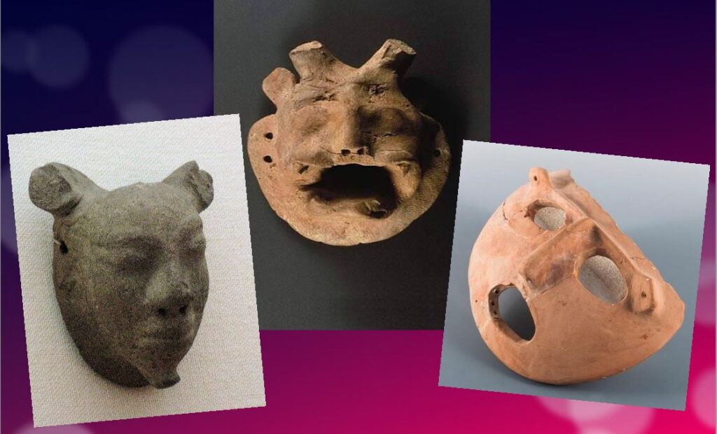
Older than Sumer and Egypt?
Archaeological excavations of the IVC got off to a late start, and it is now believed that some of the achievements and « firsts » attributed to Egypt ( – 3150 BC) and Mesopotamia ( – 4500 BC) may in fact belong to the inhabitants of the Indus Valley civilization.
In May 2016, the report published by a team of researchers from IIT Kharagpur, Institute of Archaeology, Deccan College Pune, Physical Research Laboratory and Archaeological survey of India (ASI), published by the journal Nature, shattered a number of “facts” that were considered unshakeable certainties.
Until now, the 900 years of the « mature » phase of the IVC was dated as ranging from 2800 to 1900 BCE. However, the aforementioned Indian study indicates that this civilization was much older than previously thought – it is at least 8,000 years old!
To determine the age of this civilization, researchers dated pottery using a technique called optically stimulated luminescence (OSL) – and found it to be nearly 6,000 years old, the oldest pottery known to date.
Other artifacts have been dated to 8,000 years ago. The results come from a major site excavated at Bhirrana (Haryana, India) that shows the preservation of all cultural levels of this ancient civilization, from the pre-Harappan phase through the Early Harappan to the Mature Harappan period. Bhirrana was part of a high concentration of sites along the mythical Vedic river « Saraswati », now dried up, an extension of the Harki-Ghaggar River in the Thar Desert.
The submerged cities of the Gulf of Khambhat
These new dates converge with the discovery, in January 2002, of ruins of submerged cities in the Gulf of Khambhat (formerly Cambay), off the coast of the state of Gujarat in northwest India.
It is the oceanographers of the National Institute of Ocean Technology (NIOT) of Madras who made this discovery. The team was surveying the muddy sea 30 km off the coast of the state of Gujarat, in the Gulf of Khambhat, to measure the levels of marine pollution. As a routine measure, they recorded acoustic images of the ocean floor.

It was only several months later, while analyzing the data, that the team realized that they had, without knowing it, obtained images of the ruins of a huge city, sunken 40 meters below sea level. And, at the end of January 2002, after having spent weeks to dredge the site and to bring up more than 2 000 objects, the team of the NIOT was able to make extraordinary revelations.
The ruins stretch for 9 km along the banks of an ancient river, and the remains of a dam can be distinguished. The sunken city shares striking similarities with the sites of the Indus civilization. One of the buildings, the size of an Olympic swimming pool, with collapsed steps, recalls the Great Bath of Mohenjo-daro. Another rectangular monument, 200 m long and 45 m wide, is as large as the acropolis discovered at Harappa. The team of NIOT also glimpsed another building, a kind of granary, made of mud bricks, 183 m long. Near these monumental installations, rows of rectangular buildings that resemble the foundations of ruined houses can be seen, and even a drainage system and roads. On another visit to the site, the team recovered polished stone tools, ornaments and figurines, pottery debris, semi-precious stones, ivory and the fossilized remains of a human spine, jaw and tooth. But the team was not at the end of its surprises.
It sent samples of a fossilized log to two major Indian laboratories specializing in dating methods: the Birbal Sbahni Institute of Paleobotany (BSIP) in Lucknow and the National Geophysical Research Institute (NGRI) in Hyderabad. The BSIP dated it to 5500 BCE, while the NGRI dated the sample much earlier, probably to 7500 BCE.
This dating would make Khambhat the oldest site discovered in India. According to some, this discovery could mark the end of the theory according to which urbanization spreads from Asia from the west towards the Indus. This dating caused intense controversy. Archaeologist G. Possehl points out that there is no reason to believe that the fossilized piece of wood belongs to the ruins of the ancient city, given the strong sea currents in the region, it could have come from elsewhere. NIOT’s team acknowledged the validity of these criticisms and assured that other objects would be subjected to dating methods. It is also a question of understanding how this city was sunk and how it ended up 30 km from the coast.
Harsh Gupta, geologist, thinks that it is a gigantic earthquake which caused the destruction of the city. We are in a high seismic risk area, and the 2001 Bhuj earthquake showed the vulnerability of the region to such phenomena. However, the priority is to definitively establish the age of the sunken city and prove it to be the most exciting discovery of this century.
Historical cradle of textiles

In his book Empire of Cotton, A Global History (2015) Sven Beckert traces in depth the development of what the ancients, intrigued by its resemblance to the feel of wool, called the « wool tree. » While this plant grows in both temperate and tropical climates, it needs an abundance of moisture to thrive fully, which consigns its cultivation to naturally and then artificially irrigated river valleys.
According to the author, « The farmers of the Indus Valley were the first to spin and weave cotton. In 1929, archaeologists found fragments of cotton textiles at Mohenjo-Daro, in present-day Pakistan, dating from 3250 to 2750 BCE. Cotton seeds found in nearby Mehrgarh have been dated to 5000 BCE. Literary references also attest to the antiquity of the cotton industry in the subcontinent. The Vedic scriptures, composed between 1500 and 1200 BCE., allude to the spinning and weaving of cotton…”
Historically, the discovery of the first cotton fragments was made at Mohenjo-daro during an expedition led by Sir John Marshall, Director General of the Archaeological Survey of India from 1902 to 1928. In his book on Mohenjo-daro and the Indus Civilization, Sir Marshall relates that fragments of cloth were wrapped around a silver perfume pot and a salt shaker.
Early forms of Self-government?
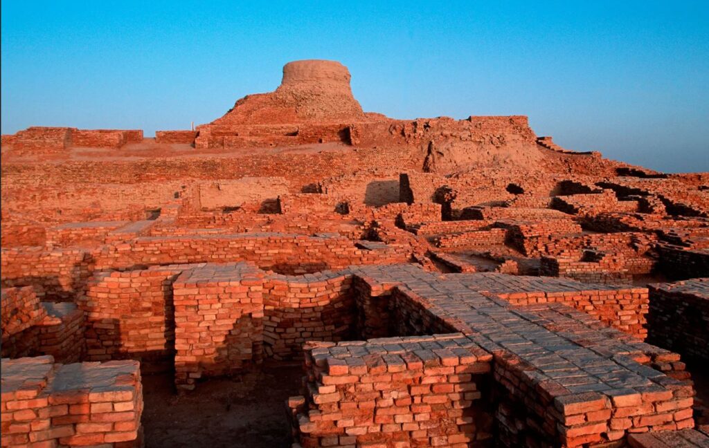
The fact remains that the political organization of the Indus cities escapes the experts. Because contrary to the Mesopotamian and Egyptian civilizations, the researches realized on the sites of the valley of the Indus did not bring to light any temple or palace of scale. There is no proof either of the existence of a permanent army…
Of what to wonder about the presence or not of a political power. Panic among British archaeologists and geopoliticians always inclined to project their own colonial ideology of aristocratic castes on the rest of the world.
In reality, each city seems to have had its own governor, or citizen council coordinating with other urban areas, all adhering to a number of common principles considered mutually beneficial.
This “Coincidence of Opposites”, of great diversity with perfect similarity, intrigues expert John Keay:
What amazed all those pioneers, and what remains the distinguishing characteristic of the several hundred Harappan sites now known, is their apparent similarity: ‘Our overriding impression is of cultural uniformity, both throughout the several centuries during which Harappan civilization flourished, and over the vast area it occupied.’ The ubiquitous bricks, for example, all have standardized dimensions, just as the stone cubes used by the Harappans to measure weight are also standardized and based on the modular system. The width of roads conforms to a similar module; thus, streets are generally twice as wide as side streets, while main arteries are two or one and a half times as wide as streets. Most of the streets excavated so far are straight and run north to south or east to west. The city plans thus conform to a regular grid pattern and seem to have retained this arrangement through several phases of construction.
Hence, given the existence of a unified system of weights and measures; given the similarity of urban organization as well as the standardization of the size of terracotta bricks for hundreds of cities, it is therefore simply impossible that the every man for himself reigned supreme.
Cradle of democracy?
In 1993, in an article entitled « The Indus Valley Civilization, Cradle of Democracy? », published by the UNESCO Courier, the internationally renowned Pakistani archaeologist and museologist, Syed A. Naqv, who has been fighting for the preservation of the Mohenjo-daro site, attempted to answer the question.
In all the highly developed civilizations of the past – Mesopotamia, the Nile Valley, Anatolia, China – the pervasive influence of an imperial authority can be felt, providing patronage for the arts and directing the evolution of society. A close examination of such an imperial authority over this civilization, which flourished some 5,000 years ago and covered almost twice the area of the civilizations of Mesopotamia and the Nile combined seems to belie the presence of an authoritarian regime, the Indus civilization had a well-disciplined way of life, civic controls and organizational system which could only have stemmed from the kind of “rule by the people” that was exercised in some Greek city-State some 2,000 years later. Did Greece give birth to democracy, or did Greece simply follow a practice developed earlier?
Although there are no large structures acting as centers of authority,
the discoveries made so far suggest that the rule of law extended over an area measuring roughly 1,600 kilometers from the north to the south and more that 800 kilometers from east to west. The main argument in support of this thesis is the existence of well-established norms and standards which would have required the consensus of the people if they had not been imposed by an authoritarian regime. It is impossible to ignore the evidence furnished by the perfect planning of the great city of Mohenjo-daro and the use in its construction of standard-sized bricks 27.94 cm long, 13.96 cm wide and 5.71 cm thick.
In the two large cities of Mohenjo-daro and Harappa, about 600 km distant,
the grid pattern of the street layout uncovered by the archaeological excavations shows that great attention was paid to the security of the inhabitants and suggests the existence of a highly developed and well-monolithic system of civic control.
The same is true of the highly sophisticated sewage system and the existence of
a virtually complete series of highly polished stone weights. Their shapes are cubical, half-cubical, cylindrical and spherical, and very few of them are reported to be defective. They provide yet another proof of a civic authority maintaining consistent commercial standards.
It is not possible to conclude that such « a philosophical conception of democracy exists until the Harappan script is deciphered and written evidence is provided. But the signs are there, and further research in this direction may well establish that ‘government by the people’ originated in the Indus Valley, » the author concludes.
Finally, since this agricultural people, who knew the use of the spears and the arrows but didn’t leave any trace of a major military activity – few weapons nor fortifications with exclusively defensive purpose have been found – , many observers agree to say that this society could have known the longest period of peace of the history of the humanity.
Decay and fall
In two of his books, the Timaeus and the Critias, the Greek philosopher Plato tells the story « certainly true, although strange » of a maritime people with incomparable power: the Atlantes whose civilization and capital he describes in great detail.
Starting 10,000 years before our era from an island located beyond the columns of Hercules, the Atlanteans would have ended up dominating the whole of Africa and Western Europe.
In a passage which is not without recalling the type of political organization which could exist in Mohenjo-daro, Critias specifies that Atlantis was then inhabited « by the various classes of men who deal with the trades and agriculture. The warriors, separated from the beginning by divine men, lived separately, possessing all that was necessary for their existence and that of their children. Among them, there were no particular fortunes; all goods were in common: they demanded from the other citizens nothing beyond what they needed to live, and fulfilled in return all the obligations that our talk of yesterday attributed to the defenders of the fatherland as we conceive them. »
Perhaps speaking metaphorically, Plato states that initially virtuous, the Atlantis civilization would have sunk into excess, arrogance and corruption to the point of being chastised by Poseidon himself for having embarked on one war too many, this time against Athens. And « in the time lapse of a single terrible day and night (…) the island of Atlantis sank into the sea and disappeared ».
At the historical level, the sudden decline of the Indus civilization around 1900 BC remains a mystery. Historians point to aspects of Minoan civilization (Crete) showing astonishing similarities with the IVC, especially watermanagement and early sewer systems in Knossos, lost wax broze casting techniques and bull fighting.
A few traces of fire and destruction, as well as forty skeletons wounded with knives and found without burial at Morenjo-daro, first suggested an invasion by Aryan peoples from Central Asia or the Iranian plateau. « This theory has now been abandoned. We have indeed found no effective trace of massacres or violence on the sites of the Indus Valley, or furniture that could be associated with such populations, » says Aurore Didier, researcher at the CNRS and director of the Indus mission.
Another hypothesis, an inability to strengthen its resilience to climatic chaos. « The samples taken in the northwest of India have shown that the climate there has changed significantly about 2000 years before our era. It is reported that this was also the case in Mesopotamia. « It became more like the dry and arid climate of today, which disrupted the cultivation and, in fact, the trade of the Indus civilizations. The ensuing socio-economic upheaval may have led to the decline of these societies. This hypothesis is the most commonly accepted to date, » says the archaeologist.
The inhabitants would have left their valleys become infertile to migrate to the plains of the Ganges. « This was accompanied by a change in livelihood strategies. The Indus civilization gradually converted to summer cereal crops based on rice and millet, two commodities more able to withstand these new climatic conditions and requiring, for rice, the development of irrigated agriculture, » says Aurore Didier. « It has also forged links with new trading partners.”
So there is no reason to talk about the « collapse » of a society in the sense of collapsologists. It is rather a gradual adaptation to the evolution of the environment, spread over several centuries.
As the excavations of the sites of the Indus Valley civilization continue, new information will undoubtedly contribute to a better understanding of its history and development. Any additional knowledge of this common civilizational legacy will serve in the future as a basis for fraternal cooperation between Pakistan, India and Afghanistan and others.
In the meantime, instead of trying to copy the barbaric « models » of the Mongolian Empire, the Roman Empire or the British Empire, the « elites » of the transatlantic world would do better to draw inspiration from a magnificent civilization that seems to have prospered for 5,000 years without perpetual wars and massacres, but simply thanks to a good mutual understanding, at the national level, between citizens, and thanks to mutually beneficial cooperation with the overriding majority of its distant partners.
The Indus Valley Civilization’s modernity, capable of offering food, shelter, water and sanitation to all, in a mirror image, shows all of us living in the present, how backwards we became.
Omar Merzoug: Avicenne ou l’islam des lumières

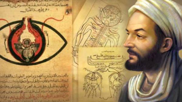
En avril 2022, Karel Vereycken s’est entretenu avec Omar Merzoug, docteur en philosophie et spécialiste de la pensée au Moyen Âge. Il a publié en 2018 Existe-t-il une philosophie islamique ? (Cahiers de l’Islam). Pendant sept ans, il a enseigné la philosophie et la civilisation islamique à l’Institut Al-Ghazâli de la Grande Mosquée de Paris.
This interview in EN (pdf)
Karel Vereycken : Monsieur Merzoug, bonjour. Après sept ans de recherches, d’études et de vérification de documents historiques, vous venez de publier en 2021, chez Flammarion, une biographie enthousiaste et fouillée d’Avicenne (980-1037). Qui était ce personnage et pourquoi avoir publié ce livre maintenant ?
Omar Merzoug : Il s’agit de l’illustre Ali Ibn Sînâ (que l’Occident nomme Avicenne), savant, médecin, philosophe et homme d’Etat, qui a eu une vie passionnante et fort mouvementée, et dont l’influence sur les penseurs chrétiens du Moyen Âge, de l’avis même des spécialistes les plus autorisés, fut considérable. Ce ne fut pas, comme on a tendance à le croire, un commentateur, mais c’était un penseur qui a créé tout un système s’inspirant d’Aristote, mais qui l’enrichit, le contredit.
Un penseur indépendant, par conséquent. Il fut lu comme philosophe jusqu’au XVIIe siècle et l’on retrouve dans les écrits des philosophes des Temps modernes, Malebranche, Leibniz et Spinoza, des échos de son œuvre. Comme médecin, ses travaux furent longtemps au programme des universités européennes. C’est donc une figure fort intéressante en tant que savant, mais aussi en tant qu’homme.
Publier ce livre maintenant, c’est d’abord saluer cette figure éminente du monde musulman à l’heure où, il faut bien le dire, l’islam n’a pas bonne presse. Le rationalisme d’Avicenne, sa curiosité intellectuelle, sa capacité à assimiler toutes sortes de savoir, son esprit encyclopédique et son inventivité philosophique sont autant de traits qui pourraient contribuer à une renaissance de la véritable culture philosophique dans le monde musulman, culture philosophique qui est bien malmenée aujourd’hui.
De père afghan, né en Ouzbékistan et d’éducation perse, de nombreux pays (qui n’existaient pas à son époque dans leurs frontières actuelles) se réclament les héritiers de sa gloire. Qui a raison ?
On ne prête qu’aux riches. Plus sérieusement, Avicenne est un persan d’Ouzbékistan. Tout l’indique, mais cela ne saurait empêcher Turcs, Arabes et Européens de se réclamer de lui, de le lire et même de le critiquer, et c’est d’ailleurs ce qui s’est produit.
La deuxième partie du titre de votre livre, L’islam des lumières, sous-entend qu’il y aurait plusieurs islams…
Il n’y a certes pas plusieurs islams, mais il y a des lectures et des approches différentes, et même contradictoires, de l’islam. Et cela ne date pas d’aujourd’hui. Il y a, pour résumer, une lecture littérale des textes fondamentaux de l’islam et il y a des lectures plus subtiles, plus soucieuses de faire prévaloir l’esprit sur la lettre. Au reste, le Coran lui-même autorise cette disparité des lectures (Sourate III, verset 7).
Comment Avicenne a-t-il concilié théologie et philosophie ?
Comme tous les grands penseurs du Moyen Âge et même des Temps modernes, Avicenne s’est attaqué à ce problème essentiel et inévitable du rapport entre la théologie et la philosophie. Il ne s’est pas tant agi de concilier la raison avec la foi, mais plutôt la Loi religieuse et la raison. Sur ce point, Avicenne présente notamment sa théorie de l’émanation comme la seule interprétation véritable de la création. Partant du principe qu’il ne faut pas prendre à la lettre les récits, les allégories, les métaphores et toute la symbolique du Coran, il conclut qu’il faut l’interpréter à l’aune des principes de la raison. C’est en définitive la raison qui garde la primauté en matière d’interprétation des textes religieux.
A son époque, Avicenne était-il apprécié pour son travail en médecine ou pour ses idées philosophiques ?
Sur ce point, les spécialistes d’Avicenne ne sont pas tous d’accord. En Orient on l’estime beaucoup plus comme médecin que comme philosophe. En Occident, on a plutôt tendance à le considérer comme philosophe, d’autant que sa médecine n’a plus, compte tenu des progrès de la science, qu’un intérêt historique.
Néo-platoniciens, aristotéliciens et thomistes se prétendent souvent disciples d’Avicenne, mais en le lisant, on constate que ce dernier n’entre dans aucune case. Quelle qualité faut-il donc avoir pour pouvoir se dire disciple d’Avicenne ?
Être disciple d’Avicenne aujourd’hui voudrait signifier être rationaliste, pas au sens d’une sorte d’agnosticisme ou d’athéisme, mais au sens où la raison a qualité pour examiner toutes choses, que peu de domaines sont soustraits à son empire. Bien entendu, dans sa mystique qui est intellectualiste, Avicenne ménage une transition vers un au-delà de la raison, qui ne peut être atteint que par une sorte d’illumination. C’est bien la raison pour laquelle certains penseurs chrétiens du Moyen Âge ont pu établir un lien entre saint Augustin et Avicenne.
Sans avoir vécu à Bagdad et né après la grande période des Abbassides, sous Al-Mamoun et ses Maisons de la sagesse réunissant penseurs arabes, juifs et chrétiens nestoriens pour traduire l’héritage grec et syriaque, voyez-vous en Avicenne un héritier de la démarche mutazilite qui fit la grandeur de Bagdad ?
Avicenne est certainement plus proche des Mu’tazila que des partisans de l’approche littéraliste et anthropomorphiste. Les Mu’tazila combattaient pour la liberté de l’esprit et c’est, à peu de chose près, le combat d’Avicenne, convaincu que tout outrage à ce principe serait catastrophique. S’il n’y a pas de débat, de controverse, de libre dialogue et de recherche indépendante, il ne saurait y avoir au bout du compte qu’un recul de la pensée. La grandeur de la civilisation de Bagdad a été précisément, sous Al-Ma’mûn et ses successeurs immédiats, de permettre, par une politique délibérée et réfléchie, ce bouillonnement culturel, cette effervescence intellectuelle extraordinaire qu’on n’a pas revue depuis dans le monde musulman.
En lisant votre biographie d’Avicenne, qui nous introduit à lui en partant de sa vie quotidienne, on découvre qu’il n’avait rien d’un intellectuel de salon. Activement engagé pour le bien commun et la santé de tous, sa vie est loin d’être une sinécure et on le voit souvent contraint de s’exiler. Pourquoi ?
Se situant dans la tradition platonicienne qui voulait que les philosophes gouvernent les Etats parce qu’ils sont les plus savants, Avicenne a directement exercé les responsabilités du pouvoir. A deux reprises, il a géré un Etat et cela a failli lui coûter la vie. Introduisant les réformes indispensables et luttant contre les privilèges qu’il estimait indus de l’armée, il a déclenché une mutinerie des prétoriens. Oui, s’engager dans la cité pour des causes méritoires, c’est être d’une certaine manière avicennien. Comme Platon, il a échoué dans son entreprise, mais elle méritait d’être tentée, comme elle le mérite toujours.
Pourquoi le Canon de la médecine d’Avicenne a-t-il permis tant de progrès en médecine ?
C’est un livre fort intéressant sous plusieurs angles. C’est une somme du savoir médical, qui a d’ailleurs, en tant que telle, une postérité exceptionnelle. Dans cet ouvrage, il y a plusieurs avancées intéressantes. C’est un livre fort bien composé et qui est fondé de part en part sur les règles et les principes de la logique. Il a été de surcroît conçu dans une perspective pédagogique. Des fragments entiers du Canon sont rédigés sous forme d’abrégés pour permettre une assimilation plus rapide du savoir médical.
Avicenne estime qu’on ne saurait comprendre la maladie et donc lui trouver un remède que si on établit des liens de causalité. Reprenant la théorie des quatre causes d’Aristote, il les adapte à sa recherche médicale et juge qu’on n’atteint la pleine connaissance d’une maladie que si on en recherche les causes, écartant ainsi une approche strictement empirique.
A ses yeux, il y a une unité entre les organes et les fonctions du corps, de la même manière qu’il établit un rapport entre l’organisme et le monde extérieur. C’est d’ailleurs pour cela qu’il accordait, en tant que médecin, une importance essentielle aux mesures prophylactiques et à l’environnement.
Autre chose à signaler, Avicenne fut certainement le premier à proposer une approche de l’anatomie de l’œil, à émettre le diagnostic de la pleurésie et de la pneumonie, à distinguer la méningite infectieuse des autres infections aiguës.
D’autre part, il accordait une importance primordiale aux exercices physiques. C’est sans doute le premier, dix siècles avant Freud, à avoir insisté sur l’importance de la sexualité et de son rôle dans l’équilibre psychologique de la personne. Enfin, il fut sans doute l’un des pionniers de la médecine psychosomatique. En témoigne le cas de l’amoureux transi que je rapporte dans ma biographie.
Estimant sa personnalité hors du commun capable d’inspirer le meilleur de la civilisation islamique, Mme Helga Zepp-LaRouche, la fondatrice de l’Institut Schiller, a lancé une grande « initiative Ibn Sînâ » pour reconstruire l’Afghanistan et de son système de santé. Comment voyez-vous cette démarche ?
C’est sans doute une initiative extrêmement louable qui réintègre Avicenne dans son milieu (son père était afghan) et qui, sous deux perspectives, la santé et la grandeur de sa gloire, lui rend hommage.
Les raisons du succès de votre livre ?
C’est toujours délicat pour un auteur de dire quelles sont les raisons qui expliquent le succès, relatif dans mon cas, d’un livre. Je l’attribue d’abord au genre biographique qui s’apparente un peu au roman – au reste, la vie d’Avicenne est très romanesque. Ensuite, à l’effort pédagogique qui rend accessible la présentation de cette éminente figure du savoir, et peut-être aussi, à un style littéraire agréable et délié.
On connaît bien, d’Avicenne, ses travaux en médecine et maintenant, grâce à votre biographie, sa vie. A quand un nouveau livre dédié plus spécifiquement à ses idées philosophiques ?
Il n’existe pas sur le marché d’exposé systématique de la pensée d’Avicenne. Ce qui existe, fruit du travail de certains universitaires travaillant dans le champ avicennien, ce sont des monographies sur des thèmes ou des concepts avicenniens.
C’est de toute façon un travail d’une tout autre nature que la biographie et pour un tout autre public, plus restreint. Je me laisserai peut-être tenté par un tel projet, qui sait ?
Persian Qanâts and the Civilization of Hidden Waters

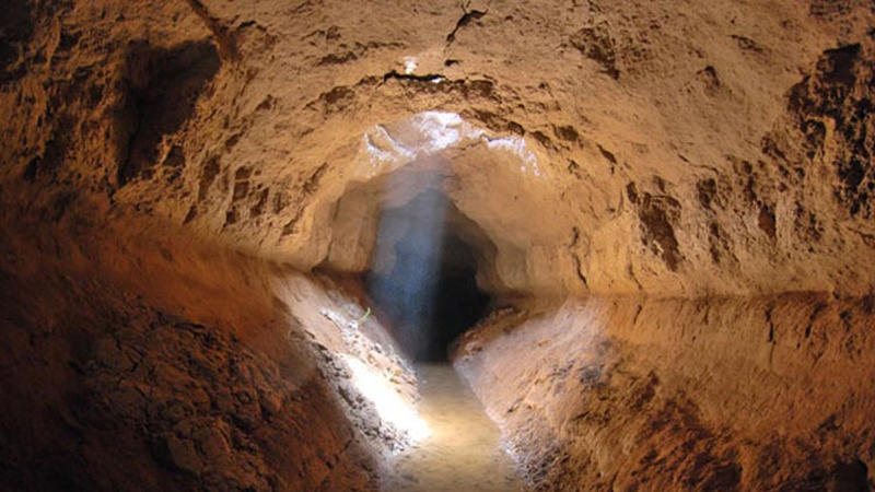
By Karel Vereycken, July 2021.

By Karel Vereycken, July 2021.
At a time when old diseases make their return and new ones emerge worldwide, the tragic vulnerability of much of humanity poses an immense challenge.
One wonders whether to laugh or cry when international authorities trumpet without further clarification that to stop the Covid-19 pandemic, “all you have to do” is “wash your hands with soap and water”!
They forget one small detail: 3 billion people do not have facilities to wash their hands at home and 1.4 billion have no access to either water or soap!
Yet, since the dawn of time, mankind has demonstrated its capacity to mobilize its creative genius to make water available in the most remote places.
Here is a short presentation of a marvel of such human genius, the “qanâts”, an underground water conveyance system dating from the Iron Age. Probably of Egyptian origin, it was deployed on a large scale in Persia from the beginning of the 1st millennium BC.
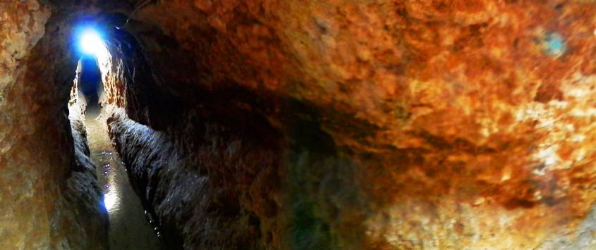
The qanât or underground aqueduct

Sometimes called “horizontal drilling”, the qanât is an underground aqueduct employed to draw water from a water table and convey it by simple gravitational effect to urban settlements and farmland. The word qanât is an old Semitic word, probably Accadian, derived from a root qanat (reed) from which come canna and canal.
This “drainage gallery”, cut into the rock or built by man, is certainly one of the earliest and most ingenious inventions for irrigation in arid and semi-arid regions. The technique offers a significant advantage: by conveying water through an underground conduit, contrary to open air canals, not a single drop of water is wasted by evaporation.
Oases’ are NOT natural phenomena. All known oases are man-made. It is the qanât technique that allows man, in a given geographic configuration, to create oases in the middle of the desert, when a water table is close enough to the ground level or at a site close to the bed of a river lost in the sands of the desert.
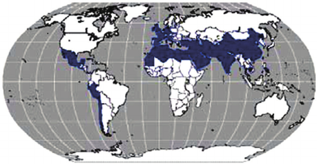
Copied and expanded by the Romans, the qanât technique was carried across the Atlantic to the New World by the Spaniards, where many such underground canals still function in Peru and Chile. In fact, there are even Persian qanâts in western Mexico.
While today this three thousand year old technique may not be appropriate everywhere to solve current water scarcity problems in arid and semi-arid regions, it has much to inspire us as a demonstration of human genius at its best, that is, capable of doing a lot with a little.
The oases of Egypt
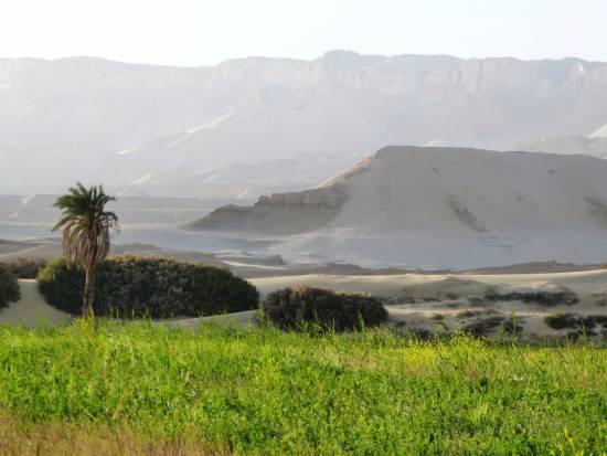
Today, 95% of the Egyptian population prospers on only 5% of its territory, mainly around the Nile delta. Hence, from the earliest days of Egyptian civilization, irrigation and water storage techniques for the Nile floods were developed in order to conserve this silty, nutrient-rich water for use throughout the year.
The river water was diverted and transported by canals to the fields by gravity. Since water from the Nile did not reach the oases, the Egyptians used the gushing water from the springs, which came from the large aquifer reserves of the western desert, and conveyed it to the fields by irrigation canals.
One of the fruits of this attempt to “conquer the desert” was a sustained habitation of the Dakhleh oasis throughout the Pharaonic period, explicable not only by a commercial interest on the part of the Egyptian state, but also by the new agricultural perspectives it offered.
Roman aqueducts
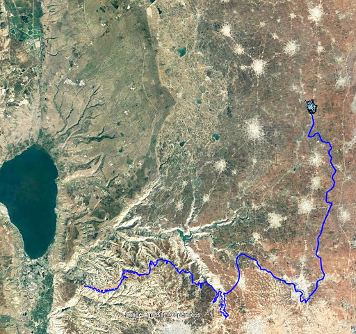
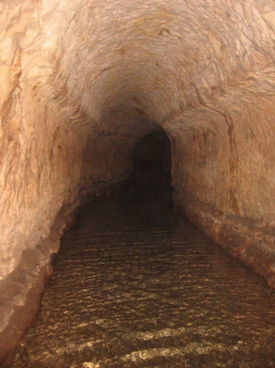
Closer to us in time, the Qanât Fir’aun (The Watercourse of the Pharaoh) also known as the aqueduct of Gadara, a city today in Jordan. As far as we know, this 170 km long structure, depending on the geography, combines several bridge-aqueducts (of the same type as the Gard aqueduct in France) and 106 km of underground canals using the Persian qanât technique. It is not only the longest but also the most sophisticated aqueduct of antiquity, and the fruit of a years of hydraulic engineering.
In reality, the Romans, hiring persian water experts, did nothing more than terminate in the 2nd century an ancient project designed to supply water to the “Decapolis”, a collaborative group of ten cities founded by Greek and Macedonian settlers under the Seleucid king Antiochos III (223 – 187 BC), one of the successors of Alexander the Great.
These ten cities were located on the eastern border of the Roman Empire (now in Syria, Jordan and Israel), united by language, culture and political status, each with a degree of autonomy and self-rule. Its capital, Gadara, was home to more than 50,000 people and known for its cosmopolitan atmosphere, its own university attracting scholars, writers, artists, philosophers and poets. But this rich city lacked something existential : an abundance of water.
The Gadara qanat made the difference. “In the capital alone, there were thousands of fountains, watering holes and baths. Wealthy senators cooled themselves in private pools and decorated their gardens with cooling caves. The result was a record daily consumption of more than 500 liters of water per capita,” explains Matthias Schulz, author of a report on the aqueduct in Spiegel Online.
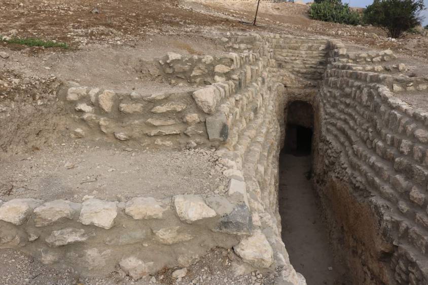
Persia
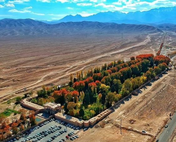
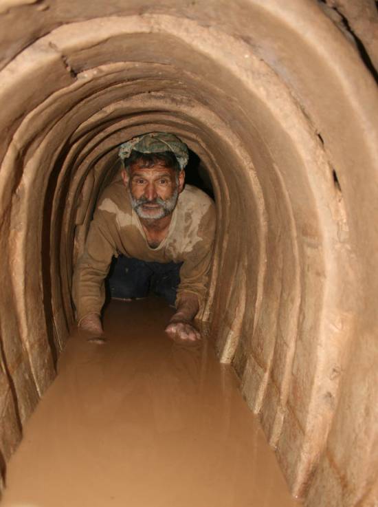
We all admire the roman aqueducts. But few of us are aware that the Romans only adapted the technique of the qanâts developed much earlier in Persia.
Indeed, it was under the Achaemenid Empire (around 559 – 330 BC.), that this technique spread slowly from Persia to the east and the west. Many qanâts can be found in North Africa (Morocco, Algeria, Libya), in the South East Asia (Iran, Oman, Iraq) and further east, in Central Asia, from Afghanistan to China (Xinjiang), via India.
The development of these “draining galleries” is attested in different regions of the world under various names: qanât and kareez in Iran, Syria and Egypt, kariz, kehriz in Pakistan and Afghanistan, aflaj in Oman, galeria in Spain, kahn in Balochistan, kanerjing in China, foggara in North Africa, khettara in Morocco, ngruttati in Sicily, bottini of Siena, etc.
Historically, the majority of the populations of Iran and other arid regions of Asia or North Africa depended on the water provided by the qanâts; their construction lifted entire areas to a higher “economic platform”, made deserts habitable and opened new land for agriculture. The map of demographic expansion followed the trail of the development of this new higher platform.
In his article « Du rythme naturel au rythme humain : vie et mort d’une technique traditionnelle, le qanât » (From natural rhythm to human rhythm: the life and death of a traditional technique, the qanât), Pierre Lombard, a researcher at the French CNRS, points out that this is not an artisanal and marginal process:
“Until a few years ago, the importance of the ancestral technique of qanât was sometimes ignored in Central Asia, Iran, Syria, and even in the countries of the Arabian Peninsula. For example, the Public Authority for Water Resources of the Sultanate of Oman estimated in 1982 that all the qanâts still in operation conveyed more than 70 % of the total water used in that country and irrigated nearly 55% of the cereal lands. Oman was still one of the few states in the Middle East to maintain and sometimes even develop its qanât network; this situation, apart from its longevity, does not appear to be exceptional. If one turns to the edges of the Iranian Plateau, one can note with Wulff (1968) the obvious discrepancy between the relative aridity of this area (between 100 and 250 mm of annual precipitation) and its non-negligible agricultural production, and explain it by one of the densest networks of qanâts in the Middle East. It can also be recalled that until the construction of the Karaj dam in the early 1960s, the two million inhabitants of Tehran at that time consumed exclusively the water brought from the Elbourz foothills by several dozen regularly maintained qanâts. Finally, we can mention the case of some major oases in the Near and Middle East (Kharga in Egypt, Layla in Saudi Arabia, Al Ain in the United Arab Emirates, etc.) or in Central Asia (Turfan, in Chinese Turkestan) that owe their vast development, if not their very existence, to this remarkable technique.”
On the website ArchéOrient, the French archaeologist Rémy Boucharlat, Director of Research Emeritus at the CNRS, an Iran expert, explains:
“Whatever the origin of the water, deep or not, the technique of construction of the gallery is the same. First, the issue is to identify the presence of water, either its going underground near a river, or the presence of a water table under a foothill, which requires the science and experience of specialists. A motherwell will be dug to reach the top of the water table, indicating at which depth the [horizontal] gallery should be drilled. It’s slope must be very small, less than 2‰, so that the flow of water is calm and regular, and conduct the water gradually to the surface area, according to a gradient much lower than the slope of the foothill.
“The gallery is then dug, not starting from the mother well because it would be immediately flooded, but from downstream, from the point of arrival. The conduct is first dug in an open trench, then covered, and finally gradually sinks into the ground in a tunnel. For the evacuation of soil and ventilation during excavation, as well as to identify the direction of the gallery, shafts are dug from the surface at regular intervals, between 5 and 30 m depending on the nature of the land ».
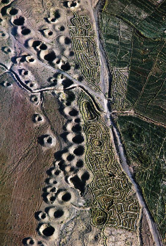
In April 1973, Lyndon LaRouche’s friend, the French-Iranian professor and historian Aly Mazahéri (1914-1991), published his translation from Arab into French of “The Civilization of Hidden Waters”, a treatise on the exploitation of underground waters composed in the year 1017 by the Persian hydrologist Mohammed Al-Karaji, who lived in Baghdad. (Translated in English in 2011)
After an introduction and general considerations on geography, natural phenomena, the water cycle, the study of terrain and the instruments of the hydrologist, Al-Karaji gives a highly precise technical outline of the construction and maintenance of qanâts, as well as legal considerations respecting their management and maintenance.
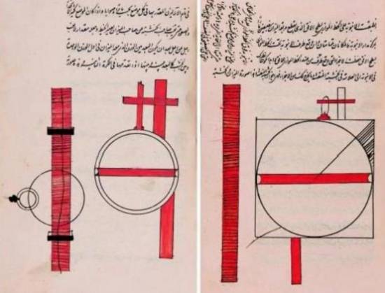
In his introduction to Al-Karji’s treatise, Professor Mazaheri emphasizes the role of the Iranian city of Merv (now in Turkmenistan). This ancient city, he says, was part of
“the long series of oases extending at the foot of the northern slope of the Iranian plateau, from the Caspian to the first foothills of the Pamirs. There, between the geological extension of the Caspian towards the East, there is a strip of arable land, more or less wide, but very fertile. Now, to exploit it, a lot of ingenuity is needed: where, for example in Merv, a big river, such as the Marghab, coming from the glaciers of the central East-Iranian massif, crosses the chain, it is necessary to establish dams, above the strip of arable land, without which, the ‘river’, divided into several dozens of arms, rushes under the sands. Elsewhere, and it is almost all along the northern slope of the chain, one can create artificial oases, by bringing the water by underground aqueducts.” (p. 44)
“The construction of dams and underground aqueducts are among the most interesting legacies of their (the ancient Persians) irrigation techniques (…) Long before Islam, the Persian hydrologists had built thousands of aqueducts, allowing the creation of hundreds of villages, dozens of cities previously unknown. And very often, even where there was a river, because of the insufficiency of this one, the hydronomists had brought to light many aqueducts allowing the extension of the culture and the development of the city. Naishabur was such a city. Under the Sassanids, and later under the Caliphs, an important network of aqueducts had been created there, so that the inhabitants could afford the luxury of owning a ‘’bathing room’ in the basement, at the level of the aqueduct serving the house.”

Let us recall that most Persian scholars, including the famous mathematician Al-Khwarizmi, not suffering from today’s hyper-specialization that tends to curb creative thinking, excelled in mathematics, geometry, astronomy and medicine as well as in hydrology.
Mazaheri confirms that this “civilization of underground waters” spread well beyond the Iranian borders:
“Already, under the [Umayyad] Caliph Hisham (723-42), Persian hydronomists built aqueducts between Damascus and Mecca (…) Later, Mecca suffering from lack of water, Zubayda, the wife of Hâroun Al-Rachîd, sent Persian hydronomists there who endowed the city with a large underground aqueduct. And each time the latter was silted up, a new team left Persia to restore the network: such repairs took place periodically under Al-Muqtadir (908-32), under Al-Qa’im (1031-1075), under Al-Naçir (1180-1226) and, at the beginning of the fourteenth century, under the Mongol prince Emir Tchoban. We would say the same of Medina and the stages on the pilgrimage route, between Baghdad and Mecca, wherever it was possible to do so, hydronomic works were undertaken and ‘underground aqueducts’ were created.
“Hydronomy is a highly demanding skill. To practice it, it is not enough to have mathematical knowledge: decadal calculus, algebra, trigonometry, etc., it is necessary to spend long hours in the galleries at the risk of dying by flooding, landslide or lack of air. It is necessary to have an ancestral instinct of ‘dowser’.”
The annual rainfall in Iran is 273 mm, which is less than one third of the world’s average annual precipitation.
The temporal and spatial distribution of precipitation is not uniform; about 75% occurs in a small area, mainly on the southern coast of the Caspian Sea, while the rest of the country does not receive sufficient rainfall. On the temporal scale, only 25% of the precipitation occurs during the plant growing season.
7,7 x the circonférence of the Earth

Still in use today in Iran, qanâts currently supply about 7.6 billion m3 of water, close to 15% of the country’s total water needs.
Considering that the average length of each qanât is 6 km in most parts of the country, the total length of the 30,000 qanât systems (potentially exploitable today) is about 310,800 km, which is about 7.7 times the circumference of the Earth or 6/7th of the Earth-Moon distance!
This shows the enormous amount of work and energy applied to build the qanâts. In fact, while more than 38,000 qanâts were in operation in Iran till 1966, its number dropped to 20,000 in 1998 and is currently estimated at 18,000. According to the Iranian daily Tehran Times, historically, over 120,000 qanat sites are documented.
Moreover, while in 1965, 30-50% of Iran’s total water needs were met by qanats, this figure has dropped to 15% in recent decades.
According to the Face Iran website:
“The water flow of qanâts is estimated between 500 and 750 cubic meters per second. As land aridity tends to vary according to the abundance of rains in each region, this quantity of water is used as a more or less important supplement. This makes it possible to use good land that would otherwise be barren. The importance of the impact on the desert can be summarized in one figure: about 3 million hectares. In seven centuries of hard work, the Dutch conquered 1.5 million hectares from the marshes or the sea. In three millennia, the Iranians have conquered twice as much on the desert.
Indeed, to each new qanât corresponded a new village, new lands. From where a new human group absorbed the demographic surplus. Little by little the Iranian landscape was constituted. At the end of the qanat, is the house of the chief, often with one floor. It is surrounded by the villagers’ houses, animal shelters, gardens and market gardens.
The distribution of land and the days of irrigation of the plots were regulated by the chief of the villages. Thus, a qanat imposed a solidarity between the inhabitants.”
If each qanât is “invented” and supervised by a mirab (dowser-hydrologist and discoverer), the realization of a qanât is a collective task that requires several months or years, even for medium-sized qanâts, not to mention works of record dimensions (a 300 m deep mother-well, a 70 km long gallery classified in 2016 as a World Heritage Site by UNESCO, in northeast Iran).
Each undertaking is carried out by a village or a group of villages. The absolute necessity of a collective investment in the infrastructure and its maintenance requires a higher notion of the common good, an indispensable complement to the notion of private property that rains and rivers do not take in account.
In the Maghreb, the management of water distributed by a khettara (the local name for qanâts) follows traditional distribution norms called “water rights”. Originally, the volume of water granted per user was proportional to the work contributed to build the khettara, translated into an irrigation time during which the beneficiary had access to the entire flow of the khettara for his fields. Even today, when the khettara has not dried up, this rule of the right to water persists and a share can be sold or bought. Because it is also necessary to take into account the surface area of the fields to be irrigated by each family.
The causes of the decline of the qanâts are numerous. Without endorsing the catastrophist theses of an anti-human ecology, it must be noted that in the face of the increasing urban population, the random construction of dams and the digging of deep wells equipped with electric pumps have disturbed and often depleted the aquifers and water tables.
A neoliberal ideology, falsely described as “modern”, also prefers the individualistic “manager” of a well to a collective management organized among neighbors and villages. A passive State authority has done the rest. In the absence of more thoughtful reflection on its future, the age-old system of qanâts is on the verge of extinction as a result.
In the meantime, the Iranian population has grown from 40 to over 82 million in 40 years. Instead of living off oil, the country is seeking to prosper through agriculture and industry. As a result, the need for water has increased substantially. To cope with rising demands, Iran is desalinating sea water at great cost. Its civilian nuclear program will be the key factor to provide water at a reasonable cost.
Beyond political and religious divisions, closer cooperation between all the countries in the region (Turkey, Syria, Iraq, Israel, Egypt, Jordan, etc.) with a perspective to improve, develop, manage and share water resources, will be beneficial to each and all.
Presented as an “Oasis Plan” and promoted for decades by the American thinker and economist Lyndon LaRouche, such a policy, translating word into action, is the only basis of a true peace policy.
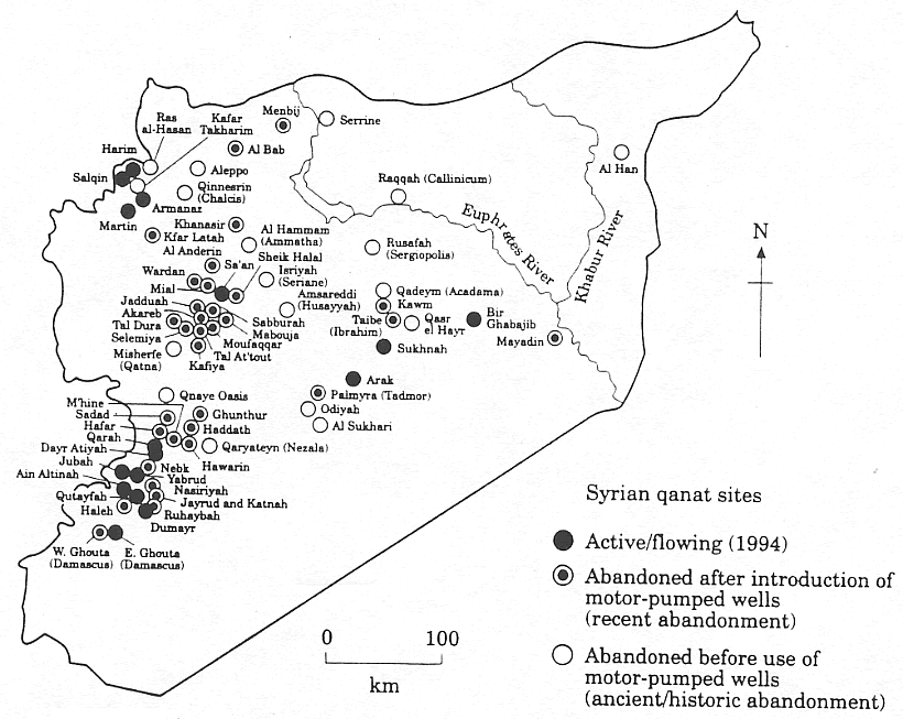
Bibliography :
- Remy Boucharlat, The falaj or qanât, a polycentric and multi-period invention, ArcheOrient – Le Blog, September 2015 ;
- Pierre Lombard, Du rythme naturel au rythme humain : vie et mort d’une technique traditionnelle, le qanat, Persée, 1991 ;
- Aly Mazaheri, La civilisation des eaux cachées, un traité de l’exploitation des eaux souterraines composé en 1017 par l’hydrologue perse Mohammed Al-Karaji, Persée, 1973 ;
- Hassan Ahmadi, Arash Malekian, Aliakbar Nazari Samani, The Qanat: A Living History in Iran, January 2010;
- Evelyne Ferron, Egyptians, Persians and Romans: the interests and stakes of the development of Egyptian oasis environments.
NOTE:
[1] The ten cities forming the Decapolis were: 1) Damascus in Syria, much further north, sometimes considered an honorary member of the Decapolis; 2) Philadelphia (Amman in Jordan); 3) Rhaphana (Capitolias, Bayt Ras in Jordan); 4) Scythopolis (Baysan or Beit-Shean in Israel), which is said to be its capital; It is the only city west of the Jordan River; 5) Gadara (Umm Qeis in Jordan); 6) Hippos (Hippus or Sussita, in Israel); 7) Dion (Tell al-Ashari in Syria); 8) Pella (Tabaqat Fahil in Jordan); 9) Gerasa (Jerash in Jordan) and 10) Canatha (Qanawat in Syria)
Qanâts perses et Civilisation des eaux cachées

Par Karel Vereycken, juillet 2021.
A une époque où d’anciennes maladies reviennent et où de nouvelles émergent à l’échelle mondiale, la vulnérabilité tragique d’une grande partie de l’humanité pose un immense défi.
On se demande s’il faut rire ou pleurer quand les autorités internationales claironnent sans plus de précisions que pour enrayer la pandémie de Covid-19, il « suffit » de bien se laver les mains à l’eau et au savon !
Ils oublient un petit détail : 3 milliards de personnes ne disposent pas d’installations pour se laver les mains chez elles et 1,4 milliard n’ont aucun accès, ni à l’eau, ni au savon !
Pourtant, depuis la nuit des temps, l’homme a su rendre l’eau disponible dans les endroits les plus reculés.
Voici un aperçu d’une merveille du génie humain, les qanâts perses, une technique de canalisations souterraines datant de l’âge de fer. Sans doute d’origine égyptienne, elle fut mise en œuvre à grande échelle en Perse à partir du début du 1er millénaire avant notre ère.
Le qanât ou aqueduc souterrain
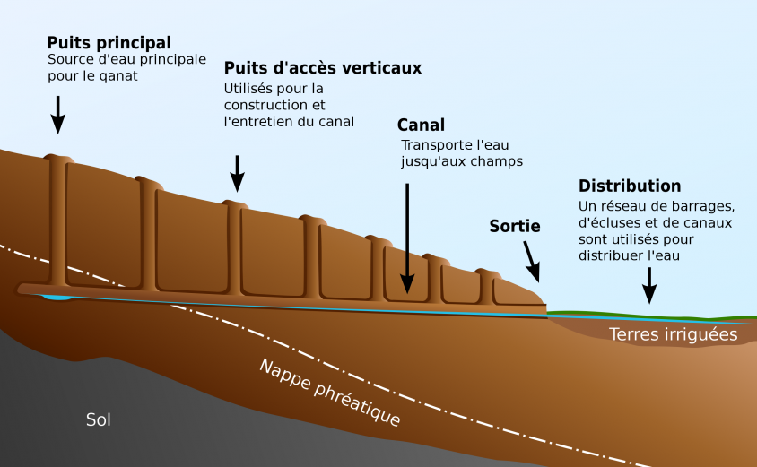
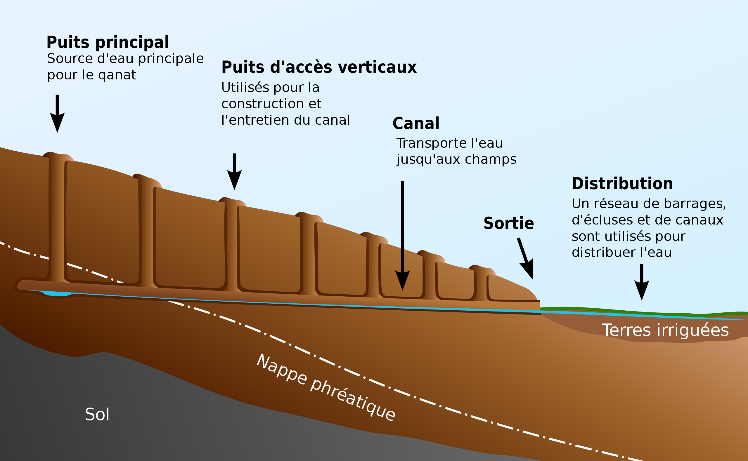
Parfois appelé « forage horizontal », le qanât est un aqueduc souterrain servant à puiser dans une nappe phréatique pour l’acheminer par simple effet de gravitation vers des lieux d’habitation et de cultures. Certains qanâts comprennent des aires de repos pour les travailleurs, des réservoirs d’eau, des salles d’eau souterraines et même des moulins à eau. Le mot qanâts, vieux mot sémitique, probablement accadien, dérivé d’une racine qanat (roseau) d’où viennent canna et canal.
Cette « galerie drainante », taillée dans la roche ou construite par l’homme, est certainement l’une des inventions les plus ingénieuses pour l’irrigation dans les régions arides et semi-arides. La technique offre un avantage non négligeable : se déplaçant dans un conduit souterrain, pas une goutte d’eau ne se perd par évaporation.
C’est cette technique qui permet à l’homme de créer des oasis en plein désert, lorsqu’une nappe phréatique est suffisamment proche de la surface du sol ou parfois sur le lit d’une rivière venant se perdre dans le désert.
Copiée et utilisée par les Romains, la technique des qanâts a été transportée par les Espagnols de l’autre côté de l’Atlantique vers le nouveau monde, où de nombreux canaux souterrains de ce type fonctionnent encore au Pérou et au Chili. En fait, il existe même des qanâts perses dans l’ouest du Mexique.
Si aujourd’hui, ce système triplement millénaire n’est pas forcément applicable partout pour résoudre les problèmes de pénurie d’eau dans les régions arides et semi-arides, il a de quoi nous inspirer en tant que démonstration du génie humain dans ce qu’il a de meilleur, c’est-à-dire capable de faire beaucoup avec peu.
Les oasis d’Égypte
Dès les balbutiements de la civilisation égyptienne, des techniques d’irrigation et de stockage de l’eau des crues du Nil furent développées afin de conserver cette eau limoneuse, riche en nutriments, pour l’utiliser tout au long de l’année. L’eau du fleuve était déviée et transportée par canaux vers les champs grâce à la gravité. Puisque l’eau du Nil ne parvenait pas dans les oasis, les Égyptiens utilisèrent l’eau jaillissante des sources, provenant des grandes réserves aquifères du désert de l’Ouest, et acheminée vers les terres par des canaux d’irrigation.
Le résultat de cette tentative de conquête du désert fut une habitation soutenue de l’oasis de Dakhleh tout au long de l’époque pharaonique, explicable non seulement par un intérêt commercial de la part de l’État égyptien, mais aussi par de nouvelles possibilités agricoles.
Aqueducs Romains
Plus proche de nous, le Qanât Fir’aun (Le cours d’eau du Pharaon) également connu comme l’aqueduc de Gadara, aujourd’hui en Jordanie.
En l’état actuel de nos connaissances, cet édifice de 170 kilomètres, qui alterne, en fonction de la géographie, plusieurs pont-aqueducs (du même type que celui du Gard en France) et 106 km de canaux souterrains utilisant la technique des qanâts perses.
Il est aussi le plus long aqueduc de l’Antiquité, et surtout le plus complexe et le fruit d’un long travail d’ingénierie hydraulique.
En réalité, les Romains ont achevé au IIe siècle un vieux projet visant à approvisionner en eau la Décapole, un ensemble de dix villes fondées par des colons grecs et macédoniens sous le roi séleucide Antiochos III (223 – 187 av. JC), un des successeurs d’Alexandre le Grand.
La Décapole était un groupe de dix villes [*] situées à la frontière orientale de l’Empire romain (aujourd’hui en Syrie, en Jordanie et en Israël), regroupées en raison de leur langue, de leur culture, de leur emplacement et de leur statut politique, chacune possédant un certain degré d’autonomie et d’autogestion.
Sa capitale, Gadara, abritait plus de 50 000 personnes et se distinguait par son atmosphère cosmopolite, sa propre université avec des érudits, attirant écrivains, artistes, philosophes et poètes.
Mais il manquait quelque chose à cette ville riche : une abondance d’eau.
Le qanât de Gadara a changé tout cela. « Rien que dans la capitale, il y avait des milliers de fontaines, d’abreuvoirs et de thermes. Les riches sénateurs se rafraîchissaient dans des piscines privées et décoraient leurs jardins de grottes rafraîchissantes. Il en résultait une consommation quotidienne record de plus de 500 litres d’eau par habitant », explique Matthias Schulz, auteur d’un reportage sur l’aqueduc dans Spiegel Online.
La Perse
La technique des qanâts, reprise et mise en œuvre par les Romains, leur était parvenue de Perse.
En effet, c’est sous L’Empire des Achéménides (vers 559 – 330 av. JC.), que cette technique se serait répandue lentement depuis la Perse vers l’est et l’ouest.
On trouve ainsi de nombreux qanâts en Afrique du Nord (Maroc, Algérie, Libye), au Moyen-Orient (Iran, Oman, Irak) et plus à l’est, en Asie centrale, de l’Afghanistan jusqu’en Chine (Xinjiang) en passant par l’Inde.
Ces galeries drainantes ou galeries de captage émergentes sont attestées dans différentes régions du monde sous des noms divers : qanât et kareez en Iran, Syrie et Égypte, kariz, kehriz au Pakistan et en Afghanistan, aflaj à Oman, galeria en Espagne, kahn au Baloutchistan, kanerjing en Chine, foggara en Afrique du Nord, khettara au Maroc, ngruttati en Sicile, bottini à Sienne, etc.).
Historiquement, la majorité des populations d’Iran et d’autres régions arides d’Asie ou d’Afrique du Nord dépendait de l’eau fournie par les qanâts ; les espaces de peuplement correspondaient ainsi aux lieux où leur construction était possible.
Dans son article « Du rythme naturel au rythme humain : vie et mort d’une technique traditionnelle, le qanât », Pierre Lombard, chercheur au CNRS, relève qu’il ne s’agit pas d’un procédé artisanal et marginal :
La technique ancestrale du qanât revêtait il y a quelques années encore une importance parfois méconnue en Asie centrale, en Iran, en Syrie, ou encore dans les pays de la péninsule arabique. A titre d’exemple, la Public Authority for Water Ressources du Sultanat d’Oman estimait en 1982 que l’ensemble des qanâts encore en activité convoyaient plus de 70 % du total de l’eau utilisée dans ce pays et irriguaient près de 55 % des terres à céréales. L’Oman demeurait certes alors l’un des rares Etats du Moyen-Orient à entretenir et parfois même développer son réseau de qanâts ; cette situation, hormis sa longévité, n’apparaît pourtant en rien exceptionnelle. Si l’on se tourne vers les bordures du Plateau iranien, on peut constater avec Wulff (1968) le décalage évident entre la relative aridité de cette zone (entre 100 et 250 mm de précipitations annuelles) et ses productions agricoles non négligeables, et l’expliquer par l’un des plus denses réseaux de qanâts du Moyen-Orient. On peut aussi rappeler que jusqu’à la construction du barrage du Karaj au début des années 60, les deux millions d’habitants que comptait alors Téhéran consommaient exclusivement l’eau apportée depuis le piémont de l’Elbourz par plusieurs dizaines de qanâts régulièrement entretenus. On peut enfin évoquer le cas de quelques oasis majeures du Proche et Moyen-Orient (Kharga en Egypte, Layla en Arabie saoudite, Al Ain aux Émirats arabes unis, etc.) ou d’Asie centrale (Turfan, dans le Turkestan chinois,) qui doivent leur vaste développement, sinon leur existence même à cette technique remarquable.
Sur le site ArchéOrient, l’archéologue Rémy Boucharlat, directeur de Recherche émérite au CNRS, spécialiste de l’Iran, explique :
Quelle que soit l’origine de l’eau, profonde ou non, la technique de construction de la galerie est la même. Il s’agit d’abord de repérer la présence de l’eau, soit son sous-écoulement à proximité d’un cours d’eau, soit la présence d’une nappe plus profonde sur un piémont, ce qui nécessite la science et l’expérience de spécialistes. Un puits-mère atteint la partie supérieure de cette couche ou nappe d’eau, qui indique à quelle profondeur devra être creusée la galerie. La pente de celle-ci doit être très faible, moins de 2‰, afin que l’écoulement de l’eau soit calme et régulier, et pour conduire peu à peu l’eau vers la surface, selon un gradient bien inférieur à la pente du piémont.
La galerie est ensuite creusée, non pas depuis le puits-mère car elle serait immédiatement inondée, mais depuis l’aval, à partir du point d’arrivée. Le conduit est d’abord creusé en tranchée ouverte, puis couverte, pour enfin s’enfoncer peu à peu dans le sol en tunnel. Pour l’évacuation des terres et la ventilation pendant le creusement, ainsi que pour repérer la direction de la galerie, des puits sont creusés depuis la surface à intervalles réguliers, entre 5 et 30 m selon la nature du terrain.
En avril 1973, notre ami, le professeur et historien franco-iranien Aly Mazahéri (1914-1991), publia sa traduction de La civilisation des eaux cachées, un traité de l’exploitation des eaux souterraines composé en 1017 par l’hydrologue perse Mohammed Al-Karaji, qui vécut à Bagdad.
Après une introduction et des considérations générales sur la géographie du globe, les phénomènes naturels, le cycle de l’eau, l’étude des terrains et les instruments de l’hydronome, Al-Karaji donne une description technique de la construction et de l’entretien des qanâts, ainsi que des considérations juridiques sur la gestion des puits et des conduites.
Dans son introduction au traité d’Al-Karji, le professeur Aly Mazahéri souligne le rôle de la ville iranienne de Merv (aujourd’hui au Turkménistan).
Cette ville antique faisait partie de
la longue série d’oasis s’étendant au pied du versant nord du plateau iranien, de la Caspienne aux premiers contreforts des Pamirs. Là, entre l’extension géologique de la Caspienne vers l’Est, se trouve une bande de terre arable, plus ou moins large, mais fort riche. Or, pour l’exploiter, il faut énormément d’ingéniosité : là où, par exemple à Merv, un grand cours d’eau, tel le Marghab, issu des glaciers du massif central est-iranien, franchit la chaîne, il faut établir des barrages, au-dessus de la bande de terre arable, sans quoi, le ’fleuve’ divisé en plusieurs dizaines de bras se précipite sous les sables. Ailleurs, et c’est presque tout au long du versant nord de la chaîne, on peut créer des oasis artificielles, en amenant l’eau par des aqueducs souterrains. (p. 44)
La construction de barrages et celle d’aqueducs souterrains sont parmi les legs les plus intéressants de leurs techniques d’irrigation (…) Bien avant l’islam, les hydronomes perses avaient construit des milliers d’aqueducs, permettant la création de centaines de villages, de dizaines de villes auparavant inconnues. Et très souvent, là même où il y avait une rivière, en raison de l’insuffisance de celle-ci, les hydronomes avaient mis au jour nombre d’aqueducs permettant l’extension de la culture et le développement de la ville. Naishabur était une ville de ce genre. Sous les Sassanides, puis sous les califes, un important réseau d’aqueducs y avait été créé, de sorte que les habitants pouvaient s’offrir le luxe de posséder chacun une ‘salle d’eau’ au sous-sol, au niveau de l’aqueduc desservant la maison.
Rappelons que la plupart des savants perses, notamment le fameux mathématicien Al-Khwarizmi, ne souffrant pas de l’hyper spécialisation qui tend à brider la pensée créatrice, excellaient aussi bien en mathématique, en géométrie, en astronomie et en médecine qu’en hydrologie.
Mazaheri confirme que cette « civilisation des eaux souterraines » s’est répandue bien au-delà des frontières iraniennes :
Déjà, sous le calife Hisham (723-42), des hydronomes persans construisirent entre Damas et La Mecque des aqueducs (…) Plus tard, La Mecque souffrant du manque d’eau, Zubayda, l’épouse de Hâroun Al-Rachîd, y envoya des hydronomes persans qui dotèrent la ville d’un grand aqueduc souterrain. Et chaque fois que celui-ci venait à être ensablé, une nouvelle équipe partait de Perse pour y restaurer le réseau : de telles réfections eurent lieu périodiquement sous Al-Muqtadir (908-32), sous Al-Qa’im (1031-1075), sous Al-Naçir (1180-1226) et, au début du XIVe siècle, sous le prince mongol l’émir Tchoban. Nous dirions autant de Médine et des étapes sur la route du pèlerinage, entre Bagdad et La Mecque, partout où il était possible de le faire, des travaux hydronomiques furent entrepris et des ‘aqueducs souterrains’ furent créés.
« L’hydronomie est un art pénible. Il ne suffisait pas, pour l’exercer, de posséder des connaissances mathématiques : calcul décadique, algèbre, trigonométrie, etc., il fallait passer de longues heures dans les galeries au risque d’y mourir par inondation, éboulement ou manque d’air. Il fallait posséder un instinct ancestral de ‘sourcier’.
Les précipitations annuelles en Iran sont de 273 mm, soit moins d’un tiers des précipitations annuelles moyennes mondiales.
La distribution temporelle et spatiale des précipitations n’est pas uniforme ; environ 75 % concernent une petite zone, principalement sur la côte sud de la mer Caspienne, alors que le reste du pays ne reçoit pas de précipitations suffisantes. À l’échelle temporelle, seulement 25 % des précipitations ont lieu pendant la saison de croissance des plantes.
Les qanâts iraniens : 7,7 x la circonférence de la Terre
Toujours utilisés aujourd’hui, les qanâts sont construits comme une série de tunnels souterrains et de puits qui amènent les eaux souterraines à la surface. Aujourd’hui, en Iran, ils fournissent environ 7,6 milliards de m3, soit 15 % du total des besoins en eau du pays.
Si l’on considère que la longueur moyenne de chaque qanât est de 6 km dans la plupart des régions du pays, la longueur totale des 30 000 systèmes de qanât (potentiellement exploitables aujourd’hui) est d’environ 310 800 km, soit environ 7,7 fois la circonférence de la Terre ou 6/7 de la distance Terre-Lune !
Cela montre l’énorme travail et l’énergie utilisés pour la construction des qanâts. En fait, alors que plus de 38 000 qanats étaient en activité en Iran jusqu’en 1966, ce nombre est tombé à 20 000 en 1998 et est actuellement estimé à 18 000. Selon le quotidien iranien Tehran Times, plus de 120 000 sites de qanâts sont documentés.
De plus, alors qu’en 1965, 30 à 50 % des besoins totaux en eau de l’Iran étaient couverts par les qanâts, ce chiffre est tombé à 15 % au cours des dernières décennies.
Comme le précise le site Face Iran :
Le débit des qanâts est estimé entre 500 et 750 mètres-cubes seconde. Comme l’aridité n’est pas totale, cette quantité sert d’appoint plus ou moins important suivant l’abondance des pluies de chaque région. Ceci permet d’utiliser de bonnes terres qui seraient autrement stériles. L’importance de l’emiètement ainsi réalisé sur le désert se résume en un chiffre : environ 3 millions d’hectares. En sept siècles de travail acharné, les Hollandais conquirent sur les marais ou sur la mer 1,5 million d’hectares. En trois millénaires, les Iraniens ont conquis le double sur le désert.
En effet, à chaque nouveau qanât correspondait un nouveau village, de nouvelles terres. D’où un nouveau groupe humain absorbait les excédents démographiques. Peu à peu se constituait le paysage iranien. Au débouché du qanât, se trouve la maison du chef, souvent à un étage. Elle est entouré des maisons des villageois, des abris des animaux, de jardins et de cultures maraichères.
La distribution des terrains et les jours d’irrigation des parcelles étaient réglés par le chef des villages. Ainsi un qanât imposait une solidarité entre les habitants.
Si chaque qanât est conçu et surveillé par un mirab (sourcier-hydrologue et découvreur), réaliser un qanât est un travail collectif qui demande plusieurs mois ou années, même pour les qanâts de dimensions moyennes, sans même parler des ouvrages aux dimensions records (puits-mère de 300 m de profondeur, galerie longue de 70 km classée en 2016 au Patrimoine mondial de l’humanité par l’UNESCO, dans le nord-est de l’Iran).
L’entreprise est réalisée par un village ou un groupe de villages. La nécessité absolue d’un investissement collectif dans l’infrastructure et sa maintenance nécessite une notion supérieure du bien commun, complément indispensable à la notion de propriété privée que les pluies et les fleuves n’ont guère l’habitude de respecter.
Au Maghreb, la gestion des eaux distribuées par une khettara (nom local des qanâts) obéit à des normes traditionnelles de répartition appelées « droit d’eau ». À l’origine, le volume d’eau octroyé par usager était proportionnel aux travaux fournis lors de l’édification de la khettara et se traduisait en un temps d’irrigation durant lequel le bénéficiaire disposait de l’ensemble du débit de la khettara pour ses champs. Encore aujourd’hui, lorsque la khettara n’est pas tarie, cette règle du droit d’eau perdure et une part peut se vendre ou s’acheter. Car il faut aussi prendre en compte la superficie des champs à irriguer de chaque famille.
Le déclin
Les causes du déclin des qanâts sont multiples. Sans endosser les thèses catastrophistes d’une écologie anti-humaine, force est de constater que face à l’augmentation de la population urbaine, la construction irréfléchie de barrages et le creusement de puits profonds équipés de pompes électriques, ont perturbé et souvent épuisé les nappes phréatiques.
Une idéologie néolibérale, faussement qualifiée de « moderne », préfère également le « manager » d’un puits à une gestion collective entre voisins et villages. Un Etat absent a fait le reste. Faute d’une réflexion plus réfléchie sur son avenir, le système millénaire des qanâts est en voie de disparition.
Entretemps, la population iranienne est passé de 40 à plus de 82 millions d’habitants en 40 ans. Au lieu de vivre de la rente pétrolière, le pays cherche à prospérer grâce à son agriculture et son industrie. Du coup, les besoins en eau explosent. Pour y faire face, l’Iran procède au dessalement de l’eau de mer. Son programme nucléaire civil sera la clé pour en réduire le coût.
Au-delà des divisions politiques et religieuses, une coopération resserrée entre tous les pays de la région (Turquie, Syrie, Irak, Israël, Egypte, Jordanie, etc.) en vue de l’amélioration, du partage et de la gestion des ressources hydriques, sera forcément bénéfique à chacun.
Présentée comme un « Plan Oasis » et promue depuis des décennies par le penseur et économiste américain Lyndon LaRouche, une telle politique, bien mieux que milles traités et autant de paroles, est la base même d’une véritable politique de paix.
Bibliographie :
- Remy Boucharlat, Le falaj ou qanât, une invention polycentrique et multipériode, ArcheOrient – Le Blog, septembre 2015 ;
- Pierre Lombard, Du rythme naturel au rythme humain : vie et mort d’une technique traditionnelle, le qanat, Persée, 1991 ;
- Aly Mazaheri, La civilisation des eaux cachées, un traité de l’exploitation des eaux souterraines composé en 1017 par l’hydrologue perse Mohammed Al-Karaji, Persée, 1973 ;
- Hassan Ahmadi, Arash Malekian, Aliakbar Nazari Samani, The Qanat : A Living History in Iran, janvier 2010 ;
- Evelyne Ferron, Egyptiens, Perses et Romains : les intérêts et les enjeux du développement des milieux oasiens égyptiens.
[*] Les dix villes formant la Décapole étaient : 1) Damas en Syrie, bien plus au nord, parfois considérée comme un membre honorifique de la Décapole ; 2) Philadelphia (Amman en Jordanie) ; 3) Rhaphana (Capitolias, Bayt Ras en Jordanie) ; 4) Scythopolis (Baysan ou Beït-Shéan en Israël), qui en serait la capitale ; c’est la seule ville à se trouver à l’ouest du Jourdain ; 5) Gadara (Umm Qeis en Jordanie) ; 6) Hippos (Hippus ou Sussita, en Israël) ; 7) Dion (Tell al-Ashari en Syrie) ; 8) Pella (Tabaqat Fahil en Jordanie) ; 9) Gerasa (Jerash en Jordanie) et 10) Canatha (Qanawat en Syrie).
Mutazilism and Arab astronomy, two bright stars in our firmament

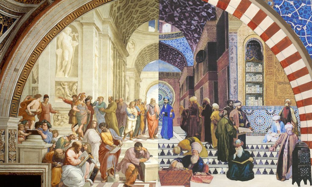
By Karel Vereycken
(texte original en français)
“The ink of the scholar is holier than the blood of the martyr.”
Sayings (Hadith) most often attributed to the Prophet.
“Seek knowledge from the Cradle to the Grave.”
“Seek knowledge even as far as China.”
PROLOGUE
We live in a time of cruel stupidity. While the history of civilization is characterized by multiple cultural contributions allowing an infinite and magnificent mutual enrichment, everything is done to dehumanize us.
By dint of media coverage of the most extreme crimes, notably by claiming that such and such an abject or barbaric act has been committed « in the name » of such and such a belief or religion, everything is done to set us against each other. If we do not react, the famous thesis of a « Clash of Civilizations », concocted by the British Islamologist Bernard Lewis (Henry Kissinger’s, Zbigniew Brzezinski’s and Samuel Huntington’s mentor) as an evil tool of geopolitical manipulation, will become a self-fulfilling prophecy.
INTRODUCTION
In order to combat prejudices and dangerous misunderstandings about “Islam” (with 1.6 billion believers a non-negligible part of the world’s population), here follows a brief overview of the major contributions of the Arab-Muslim civilization.
By recalling two major contributions of the “Golden Age” of Islam, notably Arab astronomy and mutazilism, what is at stake here is the recognition that –just like Memphis, Thebes, Alexandria, Athens and Rome– Baghdad, Damascus and Cordoba were major crucibles of a universal civilization which is ours today.
While Europe has come to recognize that the invention of printing took place in China long before Gutenberg, and that America was visited way before Christopher Columbus, consensus and group think keeps repeating that the Arabs contributed nothing to the progress of science.
In the 1300 years separating the Greek astronomer from Alexandria, Claudius Ptolemy (ca. 100-178 AD) from the Polish Nicolaus Copernicus (1473-1543), they pretend, nothing but “a black hole”.
In 1958, in his book The Sleepwalkers, British Hungarian writer Alfred Koestler, who helped Sydney Hook to co-found the CIA’s cultural cold war front, the Congress for Cultural Freedom, epitomized western arrogance, writing:
the Arabs had merely been the go-betweens, preservers and transmitters of the heritage. They had little scientific originality and creativeness of their own. During the centuries when they were the sole keepers of the treasure, they did little to put it to use. (…) and by the fifteenth century, the scientific heritage of Islam had largely been taken over by the Portuguese Jews. But the Jews, too, were no more than go-betweens, a branch of the devious Gulf-stream which brought back to Europe its Greek and Alexandrine heritage, enriched by Indian and Persian additions.
Nothing is more false. Definitely, one must be born on the right spot to be allowed to have a seat in the train of history…
Copernicus himself, unlike Koestler, was perfectly familiar with Arab astronomy. In 1543, in his De Revolutionibus, he quotes several Arab scientists, more precisely Al-Battani, al-Bitruji, al-Zarqallu, Ibn Rushd (Averroes) and Thabit ibn Qurra. Copernicus also refers to al-Battani in his Commentariolus, a manuscript published posthumously. Later, the great Johannes Kepler (1571-1630) would also refer to Ibn Al-Haytam in his work on optics.
In reality, Copernicus and even more Kepler, whose creative genius cannot be overrated, came up with answers to questions raised by several generations of Arab astronomers preceding them and whose contribution remains largely ignored and even worse, unexplored. To this day, with about 10,000 manuscripts preserved throughout the world, a large part of which has still not been the subject of a bibliographic inventory, the Arab astronomical corpus constitutes one of the best preserved components of medieval scientific literature waiting to be rediscovered.
Science and religion versus slavery
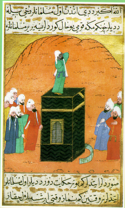
Before examining the contributions of Arab astronomy, a few words about the intimate link between Islam and the development of science.
According to tradition, it was in 622 AD that the Prophet Muhammad and his companions left Mecca and set out for a simple oasis that would become the city of Medina.
If this event is known as the “Hegira”, an Arabic word for emigration, break-up or exile, it is also because Mohammad broke with a societal model based on blood ties (clan organization), in favor of a model of a shared destiny based on belief. In this new religious and societal model, where each person is supposed to be a “brother,” it is no longer permissible to abandon the poor or the weak as was the case before.
The powerful clans in Mecca did everything they could to eliminate this new form of society, which diminished their influence.
The “Medina Constitution” allegedly proclaimed equality among all believers, whether they were free men or slaves, Arabs or non-Arabs.
The Koran advocates strict equality between Arabs and non-Arabs in accordance with the Prophet, who said, in his farewell address:
“There is no superiority of an Arab over a non-Arab, or of a non-Arab over an Arab, and no superiority of a white person over a black person or of a black person over a white person, except on the basis of personal piety and righteousness.”
(Reported by Al-Bayhaqi and authenticated by Shaykh Albani in Silsila Sahiha no. 2700).
Hence, if after the Prophet’s passing away, slavery and slave trade became a common practice in close to all Muslim countries, he cannot be held accountable. Zayd Ibn Harithah, according to tradition, after having been the slave of Khadija, Muhammad’s wife, was freed and even adopted by Muhammad as his own son.
For his part, Abu Bakr, Muhammad’s companion and successor as the first Caliph (Arab word for “successor”), also freed Bilal ibn-Raba, the son of a former Abyssinian princess who had been enslaved. Bilal, who had a magnificent voice, was even appointed the first muezzin, that is to say the one who calls for prayer five times a day from the top of one of the mosque’s minarets.
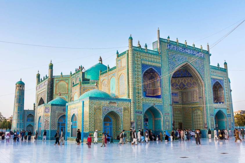
Among the first verses revealed to the Prophet Muhammad one finds :
“Read! And your Lord is the Most Generous,
(Surat 96).
Who taught by the pen — Taught man that which he knew not.”
The Prophet also states,
“The best among you (Muslims) are those who learn the Koran and teach it.”
Other sayings, often attributed to the Prophet, clearly invite Muslims to seek knowledge and cherish science :
“The ink of the scholar is more sacred than the blood of the martyr”.
“Seek knowledge from the Cradle to the Grave”.
“Seek knowledge even as far as China”.
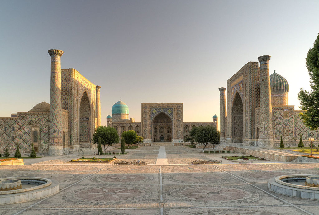

The mosque is therefore much more than a place of worship, it is a school of all sciences, where scholars are trained. It serves as a social and educational institution: it may be completed with a madrassa (Koranic school), a library, a training center, or even a university.
As in most religions, in Islam, practices and rituals are punctuated by astronomical events (years, seasons, months, days, hours). Every worshipper must pray five times a day at times that vary depending on where he or she is on Earth: at sunrise (Ajr), when the sun is at its zenith (Dhohr), in the afternoon (Asr), at sunset (Magrib) and at the beginning of the night (Icha). Astronomy, as a spiritual occasion to fine-tune one’s earthly existence according to the harmony of the Heavens, is omnipresent.
As an example, to underscore its importance, July 16, 622 AD, the first day of the lunar year, was declared the first day of the Hegira calendar. And during the eclipse of the sun, mosques host a special prayer.
Islam encourages Muslims to guide themselves by the stars. The Koran states :
“And He is the One who made the stars for you
to guide you with them in darkness of the land and the sea”.
With such an incentive, early Muslims could not but feel compelled to perfect astronomical and navigational instruments. As a result, today more than half of the stars used for navigation bear Arabic names. It was only natural that the faithful constantly tried to improve astronomical calculations and observations.
The first reason to do so is that during the Muslim prayer, the worshipper has to prostrate himself in the direction of the Kaaba in Mecca, so he has to know how to find this direction wherever he is on Earth. And the construction of a mosque will be decided according to the same data.
The second reason is the Muslim calendar. The Koran states :
“The number of months in the sight of Allah is twelve (in a year)-
so ordained by Him the day He created the heavens and the earth;
of them four are sacred: that is the straight usage.”
Clearly, the Muslim calendar is based on the lunar months, which are approximately 29.5 days long. But 12 times 29.5 days is only 345 days in the year. This is far from the 365 days, 6 hours, 9 minutes and 4 seconds that measure the duration of the rotation of the Earth around the Sun…
Finally, a last challenge was posed by the interpretation of the lunar movement. The months, in the Muslim religion, do not begin with the astronomical new moon, defined as the moment when the moon has the same ecliptic longitude as the sun (it is therefore invisible, drowned in the solar albedo); the months begin when the lunar crescent starts to appear at dusk.
The Koran says: “(Muhammad), they ask you about the different phases of the moon. Tell them that they are there to indicate to people the phases of time and the pilgrimage season.”
For all these reasons, the Muslims could not be satisfied with either the Christian or the Hebrew calendar, and had to create a new one.
Spherical geometry
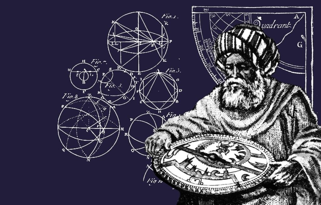
In order to forecast the phases of the moon, new methods of calculation and new instruments capable of observing them were required. The calculation of the day when the crescent moon starts to become visible again was a formidable challenge for the Arab scholars. To predict this day, it was necessary to be able to describe its movement in relation to the horizon, a problem whose resolution belongs to a rather sophisticated spherical geometry.
It was the determination of the direction of Mecca from a given location and the time of prayers that led the Muslims to develop such geometry. To solve these problems, it is necessary to know how to calculate the side of a spherical triangle of the celestial sphere from its three angles and the other two sides; to find the exact time, for example, it is necessary to know how to construct the triangle whose vertices are the zenith, the north pole, and the position of the Sun.
The field of astronomy has strongly stimulated the birth of other sciences, in particular geometry, mathematics, geography and cartography. Some people like to recall that Platonists and Aristotelians were arguing about rather abstract concepts, each of them believing that reason was sufficient to understand nature. Arab astronomy, on the other hand, played a decisive role in the emergence of a true scientific method by verifying the various hypotheses, by building measuring instruments and astronomical observatories and by rigorously recording observations over many years.
MUTAZILISM
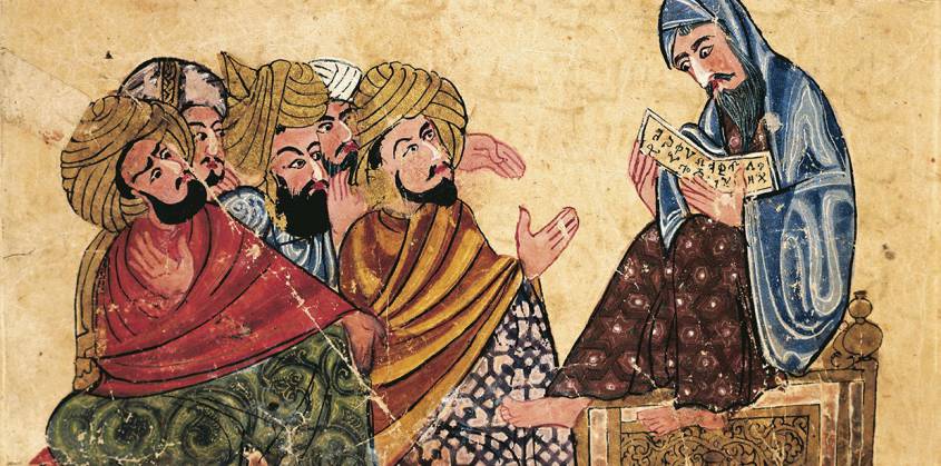
Arabic miniature from a manuscript, Turkey 13th Century.
The question then arises as to where this infatuation with science and astronomy could have come from, in a culture essentially centered on religion?
A first answer comes from the fact that in the 8th century, shortly after the birth of Sunnism (656), Kharidjism (657) and Shi’ism (660), but independently of these currents, a school of Muslim theological and philosophical thought appeared, founded by the revolutionary theologian Wasil ibn Ata (700-748), a current known as “mutazilism” (or motazilism), branded in the West as “the rationalists” of Islam. One explanation of its name came from the fact that the mutazili refused to take part in the internal strife inside factions using theological interpretations for earthly power, the arab word iʿtazala meaning “to withdraw”.
Wasil was born in Medina in the Arabian Peninsula and moved to Basra, now in Iraq. From there he formed an intellectual movement that spread all over the Arab-Muslim world. Many of his followers were merchants and non-Arabs (mawâlî) from Iranian or Aramaic “converted” families, victims of the Omayyad dynasty’s discriminating policies between Arabs and non-Arabs. This hypothesis is sufficient to back the claim of a Mutazilite participation in the overthrow of the Omayyad and that dynasty’s replacement with the Abbasid.
In a clear break with dualistic cosmology (Mazdeism, Zoroastrianism, Manichaeism, etc.), Mutazilism insists on the absolute unity of God, conceived as an entity outside time and space. For them, there is a close relationship between the unity of the Muslim community (Ummah) and the worship of the Lord. The Mutazilites are closely inspired by the Koran, and it is quite wrong to present them as the “free thinkers” of Islam.
However, “we reject faith as the only way to religion if it rejects reason,” the Mutazilite saying goes. Relying on reason (the logos dear to the Greek thinkers Socrates and Plato), which it considers compatible with Islamic doctrines, Mutazilism affirms that man can, outside of any divine revelation, access knowledge.
Just as Augustine, a christian, emphasized man can advance on the path of truth, not only through the Gospel (revelation), but by reading “the Book of Nature”, a reflection and foretaste of divine wisdom. One book of the Bible, The Book of Wisdom, recognizes that
For from the greatness and the beauty of created things
(Book of Wisdom, 13:5)
their original author,
by analogy, is seen.
The Mutazilites differed from their opponents in their teaching that God has endowed man with reason specifically so that he can come to know the moral order in creation and its Creator; that is what reason is for. Reason is central to man’s relationship to God.
In the Fundamentals, the great Mutazilite theologian Abdel al Jabbar Ibn Ahmad (935-1025), whose texts were discovered only in the 1950’s by Egyptian scholars in a mosque in Yemen, begins by positing the primary duty to reason: « If it is asked: What is the first duty that God imposes you? Say to him: Speculative reasoning which leads to knowledge of God, because He is not known intuitively or by the senses. Thus, He must be known by reflection and speculation ».
Therefore, Reason logically precedes revelation. Reason first needs to establish the existence of God before undertaking the question as to whether God has spoken to man. Natural theology mus be antecedent to theology.
Al Jabbar says: « The stipulates of revelation concerning what we should say and do are no good until after there is knowledge of God, » which knowledge comes from reason. « Therefore, » he concludes, « it is incumbent on me to establish His existence and to know Him so that I can worship Him, give Him thanks and do what satisfies Him and avoid disobedience toward Him ».
How does Reason lead man to the conclusion of God’s existance? It is through the observation of the ordered universe that man first comes to know that God exists, says Al Jabbar. As he sees hat nothing in the world is its own cause, but is caused by something else, man arrives at the contingent nature of creation. From there, man reasons to the necessity of a Creator, an uncaused cause.
The concept of an inherent nature in things (tab’) means that God, though he is the First Cause, acts indirectly through secondary causes, such as the physical law of gravity. In other words, God does not immediately or directly do everything. He does not make a rock fall; gravity does. God allows some autonomy in his creation, which has its own set of rules, according to how it was made.
As Mutazilite writer and theologian Uthman al-Jahiz (765-869) stated, every material element has it own nature. God created each thing with a nature according to which it consistently behaves. The unsupported rock will always fall where there is gravitational pull. These laws of nature, then, are not an imposition of order from without by a commander-in-chief, but an expression of it from within the very essence of things, which have their own integrity. Creation is possessed of an intrinsic rationality from the Creator. That is why and how man is able to understand God’s Reason as manifested in his creation (This does not discount God’s ability to supercede natural laws in the case of a miracle). From that standpoint, the act of discovery of the nature and beauty of things, by each human individual, brings him closer to God.
Hence, Muzatilism gives human reason (the faculty of thinking) and freedom (the faculty of acting) a place and importance not only unknown in other trends of Islam but even in most philosophical and religious currents of the time. Against fatalism (“mektoub!” = it was written!), which was the dominant tendency in Islam, mutazilism affirms that the human being is responsible for his acts.
More than five centuries before Erasmus, Mutazilite faith and philosophy offered already the foundations to solve most of the sterile theological disputes that would destroy the Renaissance and throw Europe in the abyss of self-destruction known as the “wars of religion”.
Here are the five Fundamentals (Principles), described by Abdel al Jabbar and summarized in 2015 by economist Nadim Michel Kalife:
—Monotheism (Al Tawhid) whose concept of God is beyond the simple intellect of the human mind. That is why the verses of the Koran describing God “sitting” on a throne should be interpreted only allegorically and not literally. Hence the Mutazilites called their opponents anthropomorphists who sought to reduce God who is unknowable to a human appearance. And they concluded that this one detail (!) of the Koran is sufficient to prove that the Koran is not “uncreated” but “created” by Allah, via man, to make it accessible to the believer, and therefore, that it can and should evolve and adapt according to the times and circumstances ;
—Divine justice (Adl) is about the origin of evil in our world where God is all-powerful. Mutazilism proclaims free will, where evil is man’s doing and not God’s will, because God is perfect and therefore cannot do evil or determine man to do it. And, if human wrongdoings were the will of God, punishment would lose all meaning since man would be doing nothing but respecting the divine will. This unquestionable logic allowed Mutazilism to refute predestination and the « mektoub » of the Sunni schools;
—Promise and threat (al-Wa’d wa al-Wa’id): this principle concerns the judgment of man at his death and that of the last judgment where God will reward the obedient in the heavenly paradise, and punish those who disobeyed him by damning them eternally in the fires of hell;
—The intermediate degree (al-manzilatu bayn al-manzilatayn), the first principle opposing Mutazilism to the Sunni schools. A great sinner (murder, theft, fornication, false accusation of fornication, drinking alcohol, etc. ) should be judged neither as a Muslim (as Sunnism thinks) nor as a disbeliever or kâfir (as the Kharidjites think), but considered in an intermediate degree from which, when he dies, he will go to hell if he failed to be redeemed by God’s mercy ;
—To order the good and blame the blameworthy (al-amr bil ma’ruf wa al-nahy ‘an al munkar): this principle authorizes even rebellion against authority when it is unjust and illegitimate, to prevent the victory of evil over all. This principle attracted the hatred of the ulama (theologians) and imams (predicators) who saw it as a manouver to weaken their own authority over the faithful. And the Seljuk Turks considered it a serious danger since it called into question their power… over the Arabs.
Mutazilism under the Abbasid
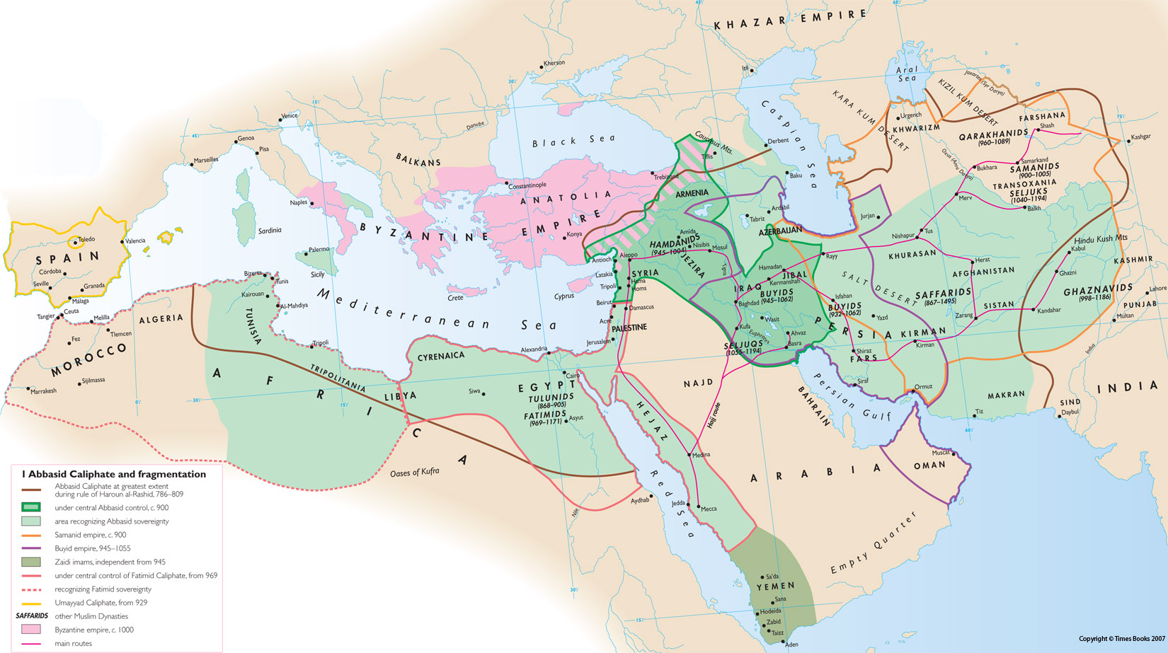
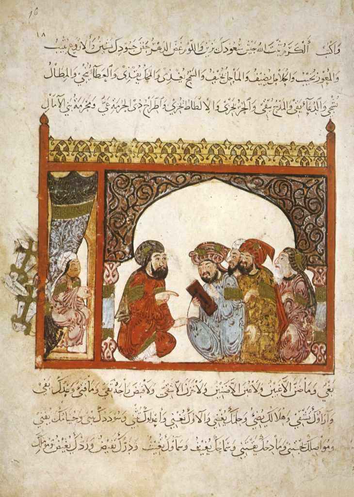
In Baghdad, it was with the rise of the Abbasid Caliphate in 749 that Mutazilism gained influence, first under the Caliph Hâroun al-Rachîd (765-809) (“Aaron the Well-Guided”) and then under his son, Al-Ma’mûn (786-833) (“The one to be trusted”). Shortly before his death in 833, the latter made Mutazilism the official doctrine of the Abbasid Empire.
This was too much for the conservative ulama and imams who rebelled against the Caliph’s enlightened vision that created a space for secular society and limited their grip over society. Faced with the revolt, the Abbasid administration (made up largely of Persians), which was won over to Mutazilism, carried out a ruthless crackdown on Sunni (Arab) clerics for fifteen years, from 833 to 848. This bloody persecution left an increasingly bitter taste in people’s minds, especially when the Abbasid power refused to release Muslim prisoners in the hands of the Byzantines if they did not renounce the dogma of the “uncreated” nature of the Koran…
Finally, in 848, Caliph Jafar al-Mutawakkil (847-861), changed course completely and asked the traditionalists to preach hadiths according to which Muhammad had condemned the Mutazilites and their supporters.
Dialectical theology (Kalâm) was banned and the Mutazilites were not any longer welcome at the Baghdad court. This was also the end of the spirit of tolerance and the return of persecution against Christians and Jews. If the craze for science continued, Mutazilism disappeared with the fall of the Abbasids and the destruction of Baghdad by the Mongols in the 13th century.
Mutazilism also influenced Judaism. The Kitab Al-Amanat Wa’l-I’tiqadat – that is, the Book of Beliefs and Opinions – by the tenth-century Jewish rabbinic scholar Saadia Gaon (882-942), who lived in Baghdad, draws its inspiration from Christian theological literature as well as from Islamic models. The Kitab al-Tawhid, the Book of Divine Unity, by Saadia’s Karaite contemporary, Jacob Qirqisani (d. 930), is unfortunately lost.
This makes the German Islamologist Sabine Schmidtke say:
The new tradition of Jewish rational thought that emerged in the course of the ninth century was, in its initial phase, mainly informed by Christian theological literature, both in its content and methodology. Increasingly, specifically Mutazilite Islamic ideas, such as theodicy [*1] and human free will, as well as the emphasis on the oneness of God (tawhid), resonated among Jewish thinkers, many of whom eventually adopted the entire doctrinal system of the Mutazila. The now emerging ‘Jewish Mutazila’ dominated Jewish theological thought for centuries to come.
Brothers in Purity
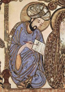
Also worth mentioning in this context, are the Epistles of the Brothers in Purity (Ikwân al-Safâ), an encyclopedia of 52 epistles (dealing with mathematics, natural sciences, rational sciences and theological sciences), composed between the beginning of the ninth and the end of the tenth century and containing common knowledge. The text will be promoted by the Ismailis, an esoteric branch of shiite islam strongly contesting the ruling powers of that time. Produced in Basra, in present-day Iraq, the book, neo-platonic in character, is a collective work. As for the authors, designated under the mysterious name of Brothers of Purity, they belonged to a brotherhood of sages and intellectuals who met regularly to organize sessions of discussion, readings and recitation. Its followers considered that knowledge was an indispensable condition for any spiritual and mystical elevation. Its avant-garde character is apparent in its hymn to tolerance advocating a plurality of paths to salvation. Some experts believe that the Epistles of the Brothers in Purity are the work of a high-level Pythagorean philosopher, a disciple of the mutazilist platonic, al-Kindi.
Leaving aside, therefore, the errors that were very real, it has to be recognized and underscored that the optimistic philosophical vision of Mutazilism (reason, free will, responsibility, perfectibility of man) strongly contributed to the emergence of a true « golden age » of Arab culture and sciences.
Finally, it is not uninteresting to note that today, “neo-Mutazilite” currents are appearing in reaction to obscurantist doctrines and the barbaric acts they provoke. For the Egyptian reformist thinker Ahmad Amin, “the death of mutazilism was the greatest misfortune that befell Muslims; they committed a crime against themselves.”
Bagdad
In 762, the second Abbasid caliph Al-Mansur (714-775) (“the victorious”) began construction of a new capital, Baghdad. Called Madinat-As-Salam (City of Peace), it houses the court palace, the mosque and the administrative buildings. Built on a circular plan, it is inspired by previous traditions, notably the one that gave birth to the Iranian city of Gur (current name: Firouzabad).
We are in the heart of fertile Mesopotamia, the “land between the rivers”, essentially the Euphrates and the Tigris, both of which have their source in Turkey. It is here that the Sumerians invented irrigation, agriculture (cereals and livestock) [*2], and writing (3400 years BC), starting in the 10th millennium BC.
Baghdad, a powerful and refined city, reigned over the entire East and became the capital of the Arab world. Crossed by the Tigris River, populated today by some 10 million inhabitants, it remains the largest city in Iraq as well as the second most populated city in the Arab world (behind Cairo in Egypt).
The Abbasid cities were built on huge sites. The palaces and mosques of Samarra, the new capital from 836, stretch along the banks of the Tigris for 40 kilometers. To match the scale of the sites, monumental buildings were erected, such as the Abu Dulaf Mosque or the Great Mosque of Samarra, which had no equivalent elsewhere. Its curious spiral minaret (52 meters high) inspired in the following centuries the Western representations of the Tower of Babel.
Moreover, by relying on an extremely disciplined and obedient army from Khorassan (a region in north-eastern Iran) [*3], as well as on an elaborate system of stagecoaches and mail distribution, the Abbasid rulers managed to increase their hold on the provincial governors. The latter, who in the time of the Omayyad caliphs paid little tax on the pretext that they had to spend locally for the defense of the caliphate’s borders, now had to pay the taxes imposed by the ruler.
The New “Paper” Road
After the military victory against the Chinese in the battle of Talas (a city in present-day Kyrgyzstan) in 751, the year that marked the most eastern advance of the Abbasid armies, Baghdad opened up to Chinese and Indian cultures.
The Abbasid quickly assimilated a number of Chinese techniques, in particular paper-making, an art developed in Samarkand (capital of Sogdiana, now in Uzbekistan), another stopover city on the Silk Roads. The craftsmen of this city smoothed the paper with an agate stone. The resulting extremely smooth and shiny surface absorbed less ink and as a result, both sides of the same sheet became usable. The Chinese, who had invented silk paper, did not need to smooth their paper because they wrote with brushes and not with pens.
Hâroun al-Rachîd was very interested in the industrial production of paper. He ordered the use of paper in all the administrations of the Empire: it is easier to manufacture, less expensive and more secure than silk, because one cannot easily erase what is written on it. He developed the paper factories of Samarkand and established similar ones in Baghdad, Damascus and Tiberias around 1046 – the paper of Tripoli or Damascus was then referred to, and its quality was considered better than that of Samarkand – in Cairo before 1199, where it was used as a packaging for goods, and in Yemen at the beginning of the 13th century. At the same time, several paper factories were established in North Africa. There were 104 paper factories in Fez, Morocco, before 1106, and 400 paper mills between 1221 and 1240. They will emerge in Andalusia, Spain, in Jativa near Valencia in 1054 and in Toledo in 1085.
Agro-industrial revolution
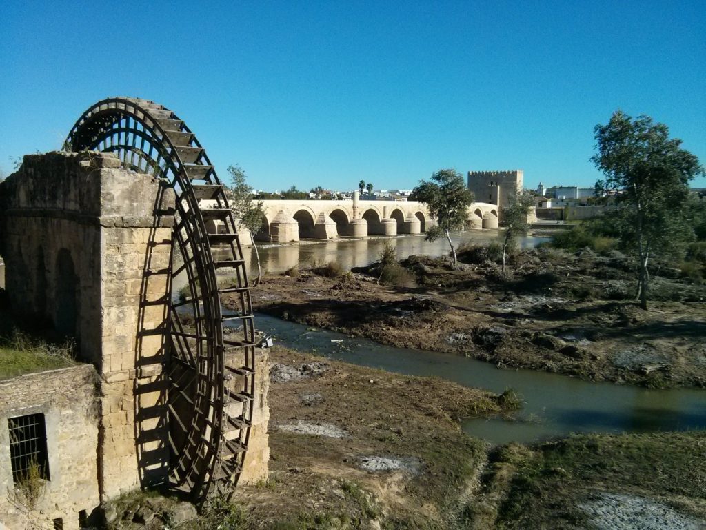
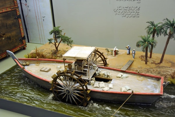
The first Abbasid caliphs led the economic transition from the Umayyad model of tribute, booty or the sale of slaves to an economy based on agriculture, manufacturing, trade and taxes. The introduction of more energy dense modes of technologies modes of energy (compared to the former ones), will revolutionize irrigation and agriculture:
–Construction of canals ensuring irrigation and limiting flooding;
–Construction of dams and the exploitation of the mechanical energy they produce;
–Construction of water mills;
–Use of tidal energy;
–Construction of windmills;
–Distillation of kerosene used as fuel for lamps and used since. [*4]
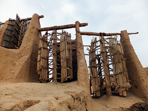
Industrial uses of water mills in the Islamic world date back to the 7th century. During the time of the Crusades, all provinces of the Islamic world had operating mills, from al-Andalus and North Africa to the Middle East and Central Asia.
These mills performed various agricultural and industrial tasks.
When Erasmus’ follower Cervantes’ Don Quichote starts attacking the windmills of La Mancha, a Spanish region where Arab influence was notable, he not only ironially mocks the cult of chivalry, but also the insane undertaking called the crusades.
Irrigation, inherited from the ancient world (floods of the Nile in Egypt, canals in Mesopotamia, pendulum wells (shadoof), water wheels used to raise water (noria), dams in Transoxiana, Khuzistan and Yemen, underground galleries at the foot of the mountains in Iran (qanat) or in the Maghreb (khettara), is organized thanks to a solid community organization and the intervention of the State.
Abbasid artisans and engineers will develop machines (such as pumps) incorporating crankshafts and use gears in mills and water-lifting machines. They will also use the dams to provide additional power to watermills and water-lifting machines. Such advances will allow the mechanization of many agricultural and industrial tasks and free up the workforce for more creative occupations.
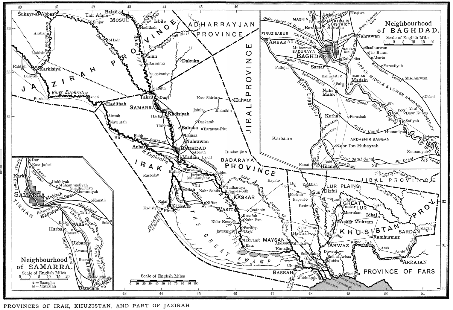
Agricultural production gains in diversity : cereals (wheat, rice), fruits (apricots, citrus fruits), vegetables, olive oil (Syria and Palestine), sesame (Iraq), roe, rapeseed, flax or castor oil (Egypt), wine production (Syria, Palestine, Egypt), dates, bananas (Egypt), sugar cane.
Breeding remains important for food, for the supply of raw materials (wool, leather) and for transport (camels, dromedaries, horses). Sheep are present everywhere but buffalo farming is developing (marshes of lower Iraq or Orontes). Small poultry, pigeon and bee farms are in high demand. The people’s diet is predominantly vegetarian (rice cake, wheat porridge, vegetables and fruits).
A number of industries will emerge from this agro-industrial revolution, including the first textile factories, the production of ropes, silk and, as noted above, the manufacture of paper. Finally, metalworking, glassware, ceramics, tooling and crafts also experience high levels of growth during this period.
Charlemagne, Baghdad and China

Finally, in the eighth and ninth centuries, seeking to counter the Omayyad and the Byzantine Empire, Abbasid and Carolingian Franks conclude several agreements and alliances.
Three diplomatic missions were sent by Charlemagne to the court of Hâroun al-Rachîd and the latter sent at least two embassies to Charlemagne. The caliph sent him many gifts, such as spices, fabrics, an elephant and an automatic clock, described in the Frankish Royal Annals of 807. It marked the 12 hours with copper balls falling on a plate at each hour, and also had twelve horsemen who appeared in turn at the same intervals.
The same caliph sent a diplomatic mission to Chang’an (now called Xi’an), capital of the Tang dynasty. Chang’an being the eastern terminus of the Silk Road, the western market of Chang’an became the center of world trade. According to the record of the Tang Six Authority, more than 300 nations and regions had trade relations with Chang’an.
Maritime Silk Road
These diplomatic relations with China were contemporary with the maritime expansion of the Muslim world into the Indian Ocean and the Far East. Apart from the Nile, Tigris and Euphrates, navigable rivers were uncommon, so transport by sea was very important. The ships of the caliphate began to sail from Siraf, the port of Basra, to India, the Straits of Malacca and Southeast Asia.
Arab merchants dominated trade in the Indian Ocean until the arrival of the Portuguese in the 16th century. Hormuz was an important center for this trade. There was also a dense network of trade routes in the Mediterranean, along which Muslim countries traded with each other and with European powers such as Venice or Genoa.
The Silk Road crossing Central Asia passed through the Abbasid caliphate between China and Europe. At that time, Canton, or Khanfu in Arabic, a port of 200,000 people in southern China, had a large community of traders from Muslim countries. And when the Chinese Emperor Yongle decided to send his famous flotilla of ships to Africa, he chose Admiral Zheng He (1371-1433), a court eunuch who was born a Muslim. And when in 1497 the Portuguese captain Vasco da Gama reached the Kenyan city of Malindi, he was able to obtain an Arab pilot who took him directly to Kozhikode (Calicut) in India. In short, a sailor who knew how to navigate on the stars.
Scientific and cultural renaissance
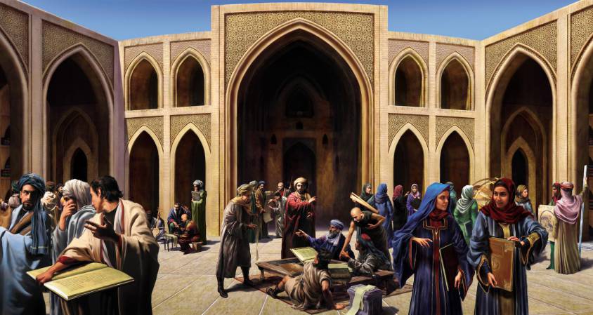
Thus, it is under the caliphate of Hâroun al-Rachîd and his son Al-Ma’mûn, that Baghdad and the Abbasids will experience a real golden age, both in the sciences (philosophy, astronomy, mathematics, medicine, etc.) and in the arts (architecture, poetry, music, painting, etc.). For the British writer Jim Al-Khalili, “the fusion of Greek rationalism and Mutazilite Islam will give rise to a humanist movement of a type that will hardly be seen before 15th century Italy.”
In the field of sciences, an assimilation of Hellenistic, Indian and Persian astronomical doctrines took place very early. Several Sanskrit [*5] and Pehlevi [*6] writings were translated into Arabic.
Indian works by the astronomer Aryabhata (476-560), a prominent scientist of the Indian Gupta Renaissance, and the mathematician Brahmagupta (590-668) were cited early on by their Arabic counterparts. A famous translation into Arabic appeared around 777 under the title Zij al-Sindhind (or Indian Astronomical Tables). Sources indicate that this text was translated after the trip of an Indian astronomer invited to the court of the Abbasid caliph Al-Mansur in 770. The Arabs also adopted the sines (inherited from Indian mathematics) which they preferred to the chords used by Greek astronomers. From the same period, a collection of astronomical chronicles compiled over two centuries in Sassanid Persia and known in Arabic as the Zij al-Shah (or Royal Tables).
In the field of music, the Persian-born Arab musician Ishaq al-Mawsili (767-850), among others, can be mentioned. A composer of about two hundred songs, he was also a virtuoso on the oud (a kind of lute with a short neck but no frets). He is credited with the first system of codification of learned Arabic music.

Respecting the visual arts, let us first stress that, contrary to the prevailing opinion, the Koran does not prohibit figurative images. There is no explicitly stated and universally accepted “ban” on images of living figures in Islamic legal texts. On the other hand, Islam, like other major religions, condemns the worship of idols.
From the eighth to the fifteenth century, numerous historical and poetic texts, both Sunni and Shi’a, many of which appeared in Turkish and Persian contexts, include admirable depictions of the Prophet Muhammad. The purpose of these images was not only to praise and pay homage to the Prophet, but represent occasions and central elements for the practice of Muslim faith.
In this respect, the book by the German art historian Hans Belting with the catchy title Florence & Baghdad, Renaissance Art and Arab Science (2011) is not only misleading but downright outrageous. Belting presents “Islam” as an aniconic faith (banning all human and animal representations), while in reality, besides exquisite calligraphy and geometric patterns in search for the infinite, representations of men and animals are an essential part of Islamic artistic expression.
In addition, other religions have experienced strong outbreaks of iconoclasm. For example, and this is one of the reasons why so little is known about ancient Greek painting, between 726 and 843, the Byzantine Empire ordered the systematic destruction of images representing Christ or the saints, whether they were mosaics adorning church walls, painted images or book illuminations.
From there on, Belting, for whom Islam is in essence an aniconic civilization, has great difficulty in demonstrating what he announces in the title: the influence of Arab science (notably Ibn al-Haytam work on human vision) on the Renaissance in Florence (in particular its definition of “geometric perspective”). In fact, presenting himself as an erudite, peaceful and “objective” scholar, Belting’s book feeds into the bellicose thesis of a supposed “Clash” of civilizations, while claiming the opposite.
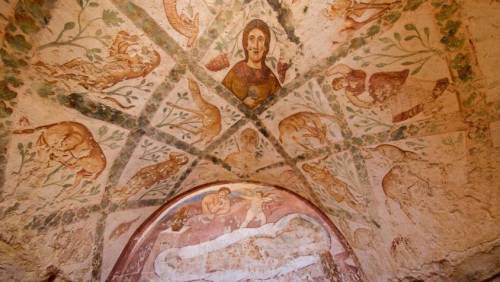
The first manifestations of pictorial art in the Arab-Muslim world date back to the Omayyad period (660-750). It is from this period that date the famous “desert castles”, such as Qusayr ‘Amra, in Eastern Jordan. Covered with wall paintings, these palaces reflect a contribution of the Byzantine, but also Persian Sassanid modes of representation. Thus, in the palace of Qusayr ‘Amra, used as a resort by the Caliph or his princes for sport and pleasure, the frescoes depict constellations of the zodiac, hunting scenes, fruits and women in the bath.
In the field of literature, Al-Rashid built up a vast library including a collection of rare books as well as thousands of books that kings and princes of the ancient world offered him.
For example, Kalila and Dimna, also known as the Indian Fables of Bidpaï, one of the most popular works of world literature. Compiled in Sanskrit nearly two thousand years ago, these animal fables, from which Aesop and La Fontaine drew, were translated from China to Ethiopia. Translated into Arabic around 750 by Ibn al-Muqaffa, they were richly illustrated in the Arab, Persian and Turkish worlds. The oldest illustrated Arabic version was probably produced in Syria in the 1200s. The landscape is symbolized by a few elements: a strip of grass, shrubs with stylized leaves and flowers. Men and animals are represented with bright colors and simplified lines.
A true manual for the education for kings, one of the fables evokes the idea,
of creating a university dedicated to the study of languages,
ancient and modern, and to the preservation,
in renewed forms, of the heritage of the human species…
And at the end of his story, the wise Bidpaï warns the young king Dabschelim:
“I must emphasize this last point: my stories require, at this stage, no extra commentary, wretched imaginings, or vapid guesswork by you, me, or anyone else. The very worst habit would be that of moralizing away the effective substance. Thus the urge to tag tidy little rationalizations, persuasive formulas, intellectual summaries, symbolical labels, or nay other convenient pigeon-holing device, mus be steadfastly resisted. Mental encapsulation perverts the medecine, rendering it impotent. It amount to a bypass around the story’s true destination; to explain away is to forget. It is also a type of hypocrisy – poisonous, an antidote to truth. Thus, let the stories which you can remember do their own work by their very diversity. Familiarize yourself with them, but fiddle with them not.”
Also noteworthy is The Sessions of the poet and man of letters Al-Hariri (1054-1122) [*7], written at the end of the tenth century and which had a tremendous diffusion throughout the Arab world. The text, which recounts the adventures of the brigand Abu Zayd, is particularly suitable for illustration.
Al-Ma’mûn and the Houses of Wisdom (Bayt al-Hikma)
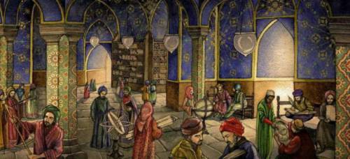
After a violent dispute with his brother who sought to remove him from power, Al-Ma’mûn, the youngest son of Al-Rashid, became the eighth Abbasid caliph in 813. He was particularly interested in the work of scholars, especially those who knew Greek. He gathered in Baghdad thinkers of all beliefs, whom he treated magnificently and with the greatest tolerance. They all wrote in Arabic, a language that allowed them to understand each other. He brought manuscripts from Byzantium to enrich the vast library of his father. Open to scholars, translators, poets, historians, physicians, astronomers, scientists and philosophers, this first public library became the basis of the Bayt Al-Hikma (the “Houses of Wisdom”) combining translation, teaching, research and even public health activities, long before the Western universities. It was here that all known scientific manuscripts of the time, especially Greek writings, were gathered for study.
In Baghdad, this cultural bubbling will not remain confined to the Court but will go down to the street as this description of Baghdad by Ibn Aqul (died in 1119) testifies:
“First there is the large space called the Bridge Square. Then the Birds’ Market, a market where one can find all kinds of flowers and on the sides of which are the elegant stores of the money changers. (…) Then the caterers’ market, the bakers’ market, the butchers’ market, the goldsmiths’ market, unrivaled for the beauty of its architecture: high buildings with teak beams, supporting corbelled rooms. Then there is the huge booksellers’ market, which is also the gathering place for scholars and poets, and the Rusafa market. In the markets of Karkh and the Gate of the Ark, the perfumers do not mix with the merchants of grease and products with unpleasant smells; in the same way the merchants of new objects do not mix with the merchants of used objects.”
Persia, the Nestorians and medicine
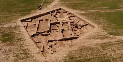
As a model for the Houses of Wisdom, the Persian influence and precedents are often mentioned. It is true that the Barmakids, a family of Persian origin [*8], had a great influence on the first Abbasid caliphs.
In fact, al-Ma’mûn’s tutor was Jafar ben Yahya Barmaki (767-803), a member of the family of the Armenians and the son of the Persian vizier of his father Al-Rashid. The Persian elite who advised the Abbasid caliphs took a keen interest in the works of the Greeks, whose translation had begun during the reign of the Sassanid king Khosro I Anushirvan (531-579).
The latter founded the Academy of Medicine in Gondichapur. Many Nestorian (Christian) scribes and scholars had taken refuge there after the Council of Ephesus in 431. [*9]
The liturgical language of the Nestorians was Syriac, a Semitic dialect [*10].
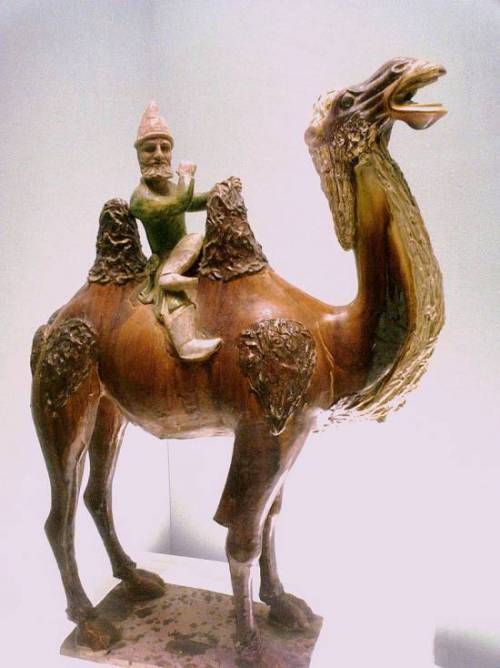
Like the Jews, these Nestorian Christians possessed a cosmopolitan culture and a knowledge of languages (Syriac and Persian) that enabled them to act as intermediaries between Iran and its neighbors. And thanks to their access to the wisdom of ancient Greece, they were often employed as physicians. [*11]
The Academy of Medicine of Gondichapur [*12] had reached its peak in the 5th century thanks to the Syriac scholars expelled from Edessa. In this school, medicine was taught based on the translations of the Greek scholar and physician Claudius Galen. These teachings were put into practice in a large hospital, a tradition taken up in the Muslim world. This school was a meeting place for Greek, Syriac, Persian and Indian scholars, whose scientific influence was mutual. Heir to the Greek medical knowledge of Alexandria, the school of Gondichapur trained several generations of physicians at the court of the Sassanid and later at that of the Muslim Abbasid. As early as 765, the Abbasid caliph Al-Mansur, who reigned from 754 to 775, consulted the head of the Gondichapur hospital, Georgios ben Bakhtichou, and invited him to Baghdad. His descendants will work and teach medicine there. Long after the establishment of Islam, the Arab elites sent their sons to this Nestorian Christian school.
Timothy I (727-823) was the Christian patriarch of the Church of the East (“Nestorian”) between 780 and 823. His first decision was to establish the seat of his church in Baghdad, where it was to remain until the end of the thirteenth century, thus forging privileged links between the Nestorians and the Abbasid caliphs. A man with a good command of Syriac, Arabic, Greek and eventually Pehlevi, Timothy enjoyed the consideration of the Abbasid caliphs Al-Mahdi, Al-Rashid and Al-Ma’mûn.
During his forty-three years of pontificate, the Eastern Church lived in peace. Moreover, the Nestorians played a major role in the spread of Christianity in Central Asia as far as China via the Silk Road. In Central Asia, before the arrival of Islam, it was Sogdian, (the Iranian language of Sogdia and its capital Samarkand) that served as the lingua franca on the Silk Road. [*13]
Translating, understanding, teaching, improving
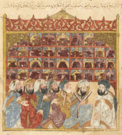
In Baghdad and Basra, in the Houses of Wisdom, the histories and texts collected after the collapse of the empire of Alexander the Great were translated and made available to scholars, texts initially collated and translated from Syriac into Persian under the aegis of the Sassanid emperors.
The Arab historian and economist Ibn Khaldun (1332-1406), who came from a large Andalusian family of Yemeni origin, paid tribute to this effort to preserve and disseminate the Greek heritage: “What happened to the sciences of the Persians whose writings, at the time of the conquest, were annihilated by order of Omar? Where are the sciences of the Chaldeans, the Assyrians, the inhabitants of Babylon? Where are the sciences that reigned among the Copts in the past? There is only one nation, that of the Greeks, whose scientific productions we possess exclusively, and that is thanks to the care that Al-Ma’mûn took in translating these works.”
These first translations into Arabic made available to the Arab-Muslim world hundreds of texts on philosophy, medicine, logic, mathematics, astronomy, music, etc., from Greek, Pehlevi, Syriac, Hebrew, Sanskrit, etc, including those of Plato, Aristotle, Pythagoras, Sushruta, Hippocrates, Euclid, Charaka, Ptolemy, Claudius Galen, Plotinus, Aryabhata and Brahmagupta.
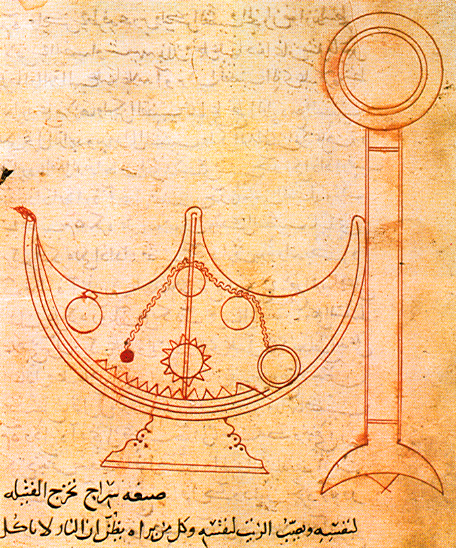
They were accompanied by reflections, commentaries, translations of commentaries, etc. and gave rise to a new form of literature. According to the Nestorian patriarch Timothy I, it was at the request of the Caliph Al-Mahdi that he translated Aristotle’s Topics from Syriac into Arabic. He also wrote a treatise on astronomy entitled The Book of Stars, now lost.
An astrology and astronomy enthusiast, Al-Ma’mûn once made it a condition of peace with the Byzantine Empire to hand over a copy of the Almagest, Ptolemy’s main work, which was supposed to summarize all Greek astronomical knowledge. In 829, in the upper district of Baghdad, he built the first permanent observatory in the world, the Baghdad Observatory, allowing his astronomers, who had translated the Astronomical Treatise of the Greek Hipparchus of Nicaea (190-120 B.C.), as well as his star register, to methodically monitor the movement of the planets.
Here is what Sâ’id al-Andalusî (1029-1070) tells us about Al-Ma’mûn’s interest in astronomy and his efforts to advance it:
“As soon as Al-Ma’mûn became caliph, his noble soul made every effort to attain wisdom, and to this end he was particularly concerned with philosophy; moreover, the scholars of his time studied in depth a book by Ptolemy and understood the diagrams of a telescope that was drawn therein. So Al-Ma’mûn gathered all the great scholars present throughout the regions of the caliphate, and he asked them to build the same kind of instrument so that they could observe the planets in the same way as Ptolemy had done and those who had preceded him. The object was built and the scholars brought it to the city of al-Shamâsiyya in the region of Damascus in the Sham in the year 214 AH (829 AD). Through their observations they determined the exact duration of a solar year as well as the inclination of the sun, the exit of its center and the situation of its various faces, which allowed them to know the state and positions of the other planets. Then the death of the caliph al-Ma’mûn in 218 A.H. (833) put an end to this project, but they nevertheless completed the astronomical telescope and named it ‘the Ma’mûn telescope’”
Now, let me present you a short list of the main astronomers, mathematicians, thinkers, scholars and translators who frequented the Houses of Wisdom:
—Al-Jahiz (776-867). The encyclopedic approach of this Mutazilite is conceived as « a necklace gathering pearls » or as a garden which, with its plants, its harmonious organization and its fountains, represents in miniature the whole universe. He sketches the principle of the evolution of species;
—Al-Khwarizmi (780-850), (in Latin Algorithmus). This Persian mathematician and astronomer, according to some a Zoroastrian converted to Islam, would have been a follower of mutazilism. He is best known for having invented the method of solving mathematical problems, which is still used today and which is called algorithm. He studied for some time in Baghdad but it is also reported that he made a trip to India. Al Khawarizmi invented the word algebra (from the Arabic word j-b-r, meaning force, beat or multiply), introduced the Indian numerical system to the Muslim world, institutionalized the decimal system in mathematics, and formalized the testing of scientific hypotheses based on observations;
—Sahl Rabban al-Tabari (786-845), a Jewish astronomer and physician whose name means “The son of the rabbi of Tabaristan”. His son Ali was the tutor of al-Razi (865-925). An alchemist who became a physician, he is said to have isolated sulfuric acid and ethanol and was among the first to advocate their medical use. He greatly influenced the conception of hospital organization in connection with the training of future doctors. He was the object of much criticism for his opposition to Aristotelianism;
—Al-Hajjaj (786-823) made the first Arabic translation of Euclid’s Elements from Greek. He also translated Ptolemy’s Almagest;
—Al-Kindi (801-873) (known as Alkindus), considered the father of Arab philosophy, was a mutazilist. He was a prolific author (about 260 books) and explored all fields: geometry, philosophy, medicine, astronomy, physics, arithmetic, logic, music and psychology. Along with his colleagues, Al-Kindi was entrusted with the translation of the manuscripts of Greek scholars. After the death of Al-Ma’mun in 833, he was considered too much of a mutazilist, fell into disgrace and his library was confiscated;
—The Banu Musa (“children of Moses”) brothers, three brilliant sons of a deceased astrologer, friend of the Caliph. Mohammed will work on astronomy; Ahmed and Hassan on the canals linking the Euphrates to the Tigris, a guarantee of the control and optimization of their respective floods. They published the Book of Ingenious Mechanisms, an inventory of new techniques and machines [*14];
—Hunayn ibn Ishâk (808-873) (known as Iohannitius). This Nestorian Christian was entrusted by Al-Ma’mun with the task of overseeing the quality of translations; a physician, he translated some of the works of the Greek physician Claudius Galen;
—Thabit ibn Qurra (836-901), a Syrian astronomer, mathematician, philosopher and musicologist;
—Qusta ibn Luqa (820-912), a Greek Byzantine physician, also a philosopher, mathematician, astronomer, naturalist and translator. A Christian of the Melkite Church, he spoke both Greek (his mother tongue) and Arabic, as well as Syriac. Considered, along with Hunayn ibn Ishaq, as one of the key figures in the transmission of Greek knowledge from Antiquity to the Arab-Muslim world. He was the translator of Aristarchus of Samos for whom the Earth revolved around the Sun and the author of a treatise on the astrolabe;
—Ibn Sahl (940-1000), in the footsteps of Al-Kindi, wrote a treatise on burning mirrors and lenses around 984, explaining how they can focus light on a point. His work was perfected by Ibn Al-Haytam (965-1040) (Latin name: Alhazen), whose writings reached as far as Leonardo da Vinci, via the Commentaries of Ghiberti. In Ibn-Sahl, we find the first mention of the law of refraction, later rediscovered in Europe as the law of Snell-Descartes.
Drawn into Bagdad for the opportunities it offered, these scholars generally worked in teams in a totally interdisciplinary spirit. Al-Ma’mûn, monitoring the science projets and noting the contradictions that arose from the translations of Greek, Persian and Indian sources, fixed with the scholars the next great scientific challenges to be met:
–To obtain, thanks to more efficient astronomical observatories, tables of astronomical ephemerides [*15] of greater precision than those of Ptolemy;
–To calculate with precision the circumference of the Earth with more advanced methods than those of the Greek astronomer Eratosthenes (3rd century BC);
–Produce a world map integrating the latest geographical knowledge concerning the distances between cities and the size of the continents;
–Deciphering the Egyptian hieroglyphs that Al-Ma’mûn had discovered during his trip to Egypt.
Translations of Plato

By asserting that what had advanced science at this period was the rediscovery of Aristotle and his purely empiricist method, one forgets the rediscovery of Plato, whose dialectical and hypothetical method has often done more for science than blind empiricism.
Al-Kindi’s intense involvement in the Platonic tradition is reflected in his summaries of the Apology and the Crito, and in his own works that paraphrase the Phaedo or are inspired by the Meno and the Symposium. The Syrian scientist Ibn al-Bitriq, a member of Al-Kindi’s “circle” in Bagdad, translated the Timaeus.
Otherwise, the House of Wisdom’s top translator, Hunayn ibn Ishaq and his circle translated the Greek physician Claudius Galen’s commentaries on the Timaeus, especially his On what Plato said in the Timaeus in a medical way and his On the doctrines of Hippocrates and Plato. And from Hunayn’s own works, we know that some of his students translated Galen’s lost Greek summaries of Plato’s Cratylus, Sophist, Parmenides, Euthydemus, Republic and Laws. Finally, the physician al-Razi presented and commented on Plutarch’s treatise On the Generation of the Soul in the Timaeus.
Inter-religious dialogue:
possible for some, complicated for others
In the West, the name of Al-Kindi is best known in association with The Apology of Al-Kindi, an anonymous text of the time. It is probably a fictitious dialogue between two believers, one Muslim (Abdallah Al-Hashimi), the other Christian (Al-Kindi), both criticizing the other’s and praising one’s own religion and inviting the other to join him! This dialogue supposedly took place at the time of the caliph Al-Ma’mûn. What we know about the open-mindedness of the Caliph does not contradict this assertion. The earliest known mention of the existence of this Apology came to us from Al-Biruni (973-1048).
The manuscript of Al-Kindi’s Apology was translated into Latin in 1142 at the request of Peter the Venerable (1092-1156), grand abbot of the abbey of Cluny, the most powerful and important in Latin Europe. That same year, after visiting Toledo, he conceived the idea of a systematic refutation of the Muslim religion, which he considered heretical and errant.
Here is how he explains the translation he has just ordered of the Koran (the Lex Mahumet pseudoprophete) by a team of translators (including an Arab) brought together for the occasion:
“Whether one gives the Mohammedan error the shameful name of heresy or the infamous one of paganism, one must act against it, that is, write. But the Latins and especially the moderns, the ancient culture perishing, according to the word of the Jews who once admired the polyglot apostles, do not know any other language than that of their native land. So they could neither recognize the enormity of this error nor stop it. So my heart was inflamed and a fire burned in my meditation. I was indignant that the Latins did not know the cause of such a perdition and their ignorance robbed them of the power to resist it; for no one answered, for no one knew. So I went to find specialists in the Arabic language which has allowed this deadly poison to infest more than half the globe. I persuaded them, by dint of prayers and money, to translate from Arabic into Latin the history and doctrine of this wretched man and his very law, which is called Koran”.
Accused hence “the Arabic language which allowed this deadly poison (Islam) to infest more than half of the globe”…
This declaration of war was undoubtedly required to motivate his troops. Let us recall that Eudes de Châtillon, the grand prior of the abbey of Cluny, who will become Pope Urban II in 1088, will be, in 1095, at the origin of the first crusade sending the bandits who ravaged France, to go and wage war elsewhere.
The decline and Al-Ghazali
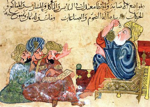
Let us return to the Abbasids. As we have said, with the arrival in power of Al-Mutawakkil in 847, mutazilism was removed from power and the Houses of Wisdom were reduced to simple libraries. This did not prevent a traveller, describing his visit to Baghdad in 891, from reporting that the city contained more than one hundred public libraries. Following the Bayt Al-Hikma model, small libraries were founded on every street corner of the city…
Entangled in endless theological debates between experts and won by sectarianism, the mutazilist elite cut itself off from a people who were losing confidence and eventually welcomed with a sense of relief the obscurantist doctrine of Al-Ghâzalî (1058-1111) (Latin name: Algazel), the worst enemy of the mutazilites.
Al-Ghâzalî proposed a radical solution: philosophy is only right when it agrees with religion – which, according to Al-Ghâzalî, is rare. This leads him to radicalize his position, and to attack more and more the Greco-Arab philosophy, guilty, in his eyes, of blasphemy.
Where someone like the Persian Ibn Sina (980-1037) (Latin name: Avicenna), author of the Canons or Precepts of Medicine (around 1020), crossed Greek philosophy and Muslim religion, Al-Ghazali wanted to filter the first through the second.
Hence his most famous and important work, The Incoherence of the Philosophers, written in 1095. In it, he denounces the “pride” of the philosophers who claim to “rewrite the Koran” through Plato and Aristotle. Their error is above all a logical one, as the title of the book itself indicates, which underlines their “incoherence”: they want to complete the Koran with Greek philosophy, whereas the Koran comes later in history and therefore does not need to be completed. He therefore promotes a much more literal approach to the Koranic text, whereas Ibn Sina defended, cautiously it is true, a metaphorical approach. In truth, it is Aristotelianism and nominalism that triumph. The doctrine opposing Mutazilism became known as Ash’arism.
For Ascharites, to speak of God’s justice and rationality is a double blasphemy, because it amounts to limiting his omnipotence. If God were, as the Mutazilites say, compelled to will what is good, then he would be … compelled, which the Ascharites find theologically unacceptable. Therefore, believers should not admit the idea that God wills good, but submit to the principle that whatever he wills is good because he wills it.
Similarly, it is blasphemous to look for « second causes » in nature, i.e. scientific laws. The world exists because God, at every moment, wants it to exist. Any scientific research, any attempt to apply reason and analysis, is an offense to the divine omnipotence.
For Sébastien Castellion, the rejection of reason by the Ascharite school – and subsequently by much of Muslim civilization – was not an implicit and subterranean process, but an explicit decision based on theological principles. The great jurist Ibn Hanbal, whose school is predominant in Saudi Arabia today, said that « all those who indulge in reasoning by analogy and personal opinions are heretics (…). Accept only, without asking why and without making comparisons. »
The fall of Bagdad
From the eleventh century onward, the Abbasid, whose Empire was fragmenting, called upon the Turkish Seljuk princes to protect them against the Shiites, supported by the Fatimid caliphate of Cairo. Gradually, the Turkish and Mongol troops, coming from Central Asia, ended up governing the security of the Abbasid caliph while letting him exercise his religious power.
Then, in 1258, they deposed the last caliph and confiscated his title of successor of the Prophet, which gave them religious power over the four schools of Sunnism. In order to subdue the Arab and Persian populations, the Seljuk Turks created the madrasa (Koranic school) where the conservative doctrine of Acharite Sunnism was taught to the exclusion of the dialectical Mutazilite theology, considered an ideological threat to Turkish authority over the Arabs.
The Abbasid Empire declined as a result of administrative negligence, abandonment of canal maintenance, flood-induced famine, social injustice, slave revolts, and religious tensions between Shiites and Sunnis. At the end of the 9th century, the Zendj, black slaves (from Zanzibar) who worked in the marshes of the lower Iraq, revolted several times, even occupying Basra and threatening Baghdad. The Caliph restored order at the cost of an unprecedentedly violent repression. The rebels were only crushed in 883 at the cost of many victims. The empire did not recover.
In 1019, the Caliph forbade any new interpretation of the Koran, radically opposing the Mutazilite school. This is a brutal stop to the development of critical thinking and intellectual and scientific innovations in the Arab Empire, the consequences of which are still felt today.
ASTRONOMY
Since the dawn of time (it is the case to say it), man has tried to understand the organization of the stars in the environment near the Earth.
Installations such as Stonehenge (2800 BC) in England allowed the first observers to identify the cycles that determine the place and the exact day when certain stars rise. All these observations posed paradoxes: around us, the earth appears relatively flat, but the Moon or the Sun that we perceive with the same eyes seem spherical. The Sun « rises » and « sets », our senses tell us, but where is the reality?
It seems that Thales of Miletus (625-547 BC) was the first to have really wondered about the shape of the Earth. He thought that the Earth was shaped like a flat disk on a vast expanse of water. Then Pythagoras and Plato imagined a spherical shape, which they considered more beautiful and rational. Finally Aristotle reported some observational evidence such as the rounded shape of the Earth’s shadow on the Moon during eclipses.
The Greek scientist Eratosthenes (276 BC- 194 BC), chief librarian of the Alexandria library, then calculated the Earth’s circumference. He had noticed that at noon, on the day of the summer solstice, there was no shadow on the side of Aswan. By measuring the shadow of a stick planted in Alexandria at the same time and knowing the distance between the two cities, he deduced the circumference of the Earth with a rather astonishing accuracy: 39,375 kilometers against some 40,000 kilometers for current estimates.
Between Ptolemy’s Almagest and Copernicus’ De Revolutionibus, as we have said, Arabic astronomy constitutes “the missing link”.
The original title of Ptolemy’s work is The Mathematical Composition. The Arabs, very impressed by this work, called it “megiste”, from the Greek meaning “very great”, to which they added the Arabic article “al”, to give “al megiste” which became Almageste.
It is important to know that Ptolemy never had the opportunity to re-read his treatise as a whole. After writing the first of the thirteen books of his work, the one on “The Fundamental Postulates of Astronomy”, Ptolemy passed it on to copyists who reproduced it and distributed it widely without waiting for the completion of the other twelve books…

In the end, confronted with observations that called into question his own observations and in order to rectify his errors, Ptolemy wrote another work, after the Almagest, entitled Planetary Hypotheses. The author returned to the models presented in the Almagest while making modifications to the average motions (of the planets) to take into account the latest observations. However, his Planetary Hypotheses went beyond the mathematical model of the Almagest to present a physical realization of the universe as a set of nested spheres, in which he used the epicycles of his planetary model to calculate the dimensions of the universe. Finally, the Almagest also contains a description of 1022 stars grouped into 48 constellations.
Ptolemy also presents stereographic projection invented by Hipparchus, the theoretical basis for the construction of the astrolabe by Arab astronomers.
In the ninth century, when the Arabs became interested in astronomy, knowledge was based on the following principles summarized in the work of Ptolemy:
–Ignoring the assertions of Aristarchus of Samos (310-230 BC) for whom the Earth revolved around the Sun, Ptolemy resumed in the second century AD the thesis of Eudoxus of Cnidus (approx. 400-355 BC) and especially Hipparchus (180 to 125 BC) to assert that the Earth is a motionless sphere placed at the center of the world (geocentrism);
–Ptolemy agreed with Plato, who was inspired by Pythagoras, that the circle was the only perfect form, and that the other bodies turning around the Earth did so according to circular and uniform trajectories (without acceleration or deceleration);
–Yet everyone knew that some planets do not follow these perfect rules. In the 6th century, the neo-Platonic philosopher Simplicius, in his Commentary on Aristotle’s Physics, wrote: “Plato then poses this problem to the mathematicians: what are the uniform and perfectly regular circular motions that should be taken as hypotheses, so that we can save the appearances that the wandering stars present?” ;
–In order to account for the « apparent retrograde motion » of Mars, Hipparchus will introduce other secondary perfect figures, again circles. The articulation and interaction of these “epicycles” gave the appearance of sticking with the observed facts. Ptolemy took up this approach;
–However, the more the precision of astronomical measurements improved, the more anomalies were discovered and the more it was necessary to multiply these interlocking “epicycles”. It quickly became very complicated and inextricable;
–The universe is divided into a sub-lunar region where everything is created and therefore perishable, and the rest of the universe, supra-lunar, which is imperishable and eternal.
Hipparchus of Nicea
The Arab astronomers, for both religious and intellectual reasons that we mentioned at the beginning of this article, initially discovered and then, on the basis of increasingly detailed observations, challenged Hipparchus’ hypotheses, which were the basis of the Ptolemaic model.
Hipparchus imagined a system of coordinates for the stars based on longitudes and latitudes. We also owe him the use of parallels and meridians to locate the Earth as well as the division of the circumference into 360° inherited from the sexagesimal calculation (base 60) of the Babylonians.
In astronomy, his works on the rotation of the Earth and the planets are numerous. Hipparchus explains the mechanism of the seasons by noting the obliquity of the ecliptic: the inclination of the Earth’s axis of rotation. By comparing his observations with older ones, he discovered the precession of the equinoxes due to this tilt: the Earth’s axis of rotation makes a conical movement from East to West and of revolution 26,000 years. Thus in a few millennia, the North Pole will no longer be found with the North Star (Polaris) but with another star, Vega.
Based on Hipparchus, the Arabs perfected and fabricated an important instrument for measuring positions: the astrolabe. This “mathematical jewel” allows to measure the position of stars, planets, to know the time on Earth. Later, the astrolabe was replaced by more precise and easier to use instruments, such as the quadrant, the sextant or the octant.
With the manuscripts at their disposal in the Houses of Wisdom and the observatories of Baghdad and Damascus, the Arab astronomers had texts of an incredible richness but often in flagrant contradiction with their own observations of the movements of the Moon and the Sun. It is from this confrontation that later discoveries were born. The Arabs introduced a lot of mathematics to solve problems, especially trigonometry and algebra.
The Arab astronomers
In order to present the main Arab astronomers and their contributions, here is an excerpt from J. P. Maratray’s remarkable article L’astronomie arabe.
—Al-Khwarizmi (783-850) called Algorithmi.
A mathematician, geographer and astronomer of Persian origin, he was a member of the « House of Wisdom ». He is one of the founders of Arab mathematics, inspired by Indian knowledge, in particular the decimal system, fractions, square roots… He is credited with the term “algorithm”. Algorithms are known since antiquity, and the name of Al-Khwarizmi (Algorithmi in Latin) will be given to these sequences of repeated elementary operations. He is also the author of the term “algebra”, which is the title of one of his works on the subject. He was also the first to use the letter x to designate an unknown in an equation. He wrote the first book of algebra (al-jabr) in which he described a systematic method of solving second degree equations and proposed a classification of these equations. He introduced the use of numbers that we still use today. These “Arabic” numbers are in fact of Indian origin, but were used mathematically by Al-Khwarizmi. He adopted the use of the zero, invented by the Indians in the 5th century, and adopted by the Arabs through him. The Arabs will translate the Indian word “sunya” by “as-sifr”, which becomes “ziffer” and “zephiro”. Ziffer will give “number”, and zephiro, “zero”. Al-Khwarizmi established astronomical tables (position of the five planets, the Sun and the Moon) based on Hindu and Greek astronomy. He studied the position and visibility of the Moon and its eclipses, the Sun and the planets. It is the first completely Arabic astronomical work. A crater of the Moon bears his name.
—Al-Farghani (805-880) called Alfraganus (mentioned in Dante’s Commedia).
Born in Ferghana in present-day Uzbekistan, he wrote in 833 the Elements of Astronomy, based on the Greek knowledge of Ptolemy. He was one of the most remarkable astronomers in the service of Al-Ma’mûn, and a member of the House of Wisdom. He introduced new ideas, such as the fact that the precession of the equinoxes must affect the position of the planets, and not only that of the stars. His work was translated into Latin in the 12th century, and had a great impact on the very closed circles of Western European astronomers. He determined the diameter of the Earth, which he estimated at 10500 km. We also owe him a work on sundials and another on the astrolabe.
—Al-Battani (850-929) called Albatenius.
He observed the sky from Syria. He is sometimes called “the Ptolemy of the Arabs”. His measurements are remarkably accurate. He determined the length of the solar year, the value of the precession of the equinoxes, the inclination of the ecliptic. He noted that the eccentricity of the Sun is variable, without going so far as to interpret this phenomenon as an elliptical trajectory. He wrote a catalog of 489 stars. We owe him the first use of trigonometry in the study of the sky. It is a much more powerful method than the geometrical one of Ptolemy. His main work is The Book of Tables. It is composed of 57 chapters. Translated into Latin in 1116 by Plato of Tivoli, it will greatly influence the European astronomers of the Renaissance.
—Al-Soufi (903-986) known as Azophi.
Persian astronomer, he translated Greek works including the Almagest and improved the estimates of the magnitudes of stars. In 964, he published « The Book of Fixed Stars », where he drew constellations. He seems to have been the first to report an observation of the large Magellanic cloud (a nebula), visible in Yemen, but not in Isfahan. Similarly, we owe him a first representation of the Andromeda galaxy, probably already observed before him. He described it as « a small cloud » in the mouth of the Arabian constellation of the Great Fish. Its name (Azophi) was given to a crater on the Moon.
—Al-Khujandi (circa 940- circa 1000).
He was a Persian astronomer and mathematician. He built an observatory in Ray, near Tehran, with a huge sextant, constructed in 994. It is the first instrument able to measure angles more precise than the minute of angle. He measures with this instrument the obliquity of the ecliptic, by observing the meridian passages of the Sun. He found 23° 32′ 19 ». Ptolemy found 23° 51′, and the Indians, much earlier, 24°. The idea of the natural variation of this angle never occurred to the Arabs. They discussed for a long time about the accuracy of the measurements, which made their science advance.
—Ibn Al-Haytam (965-1039) called Alhazen.
A mathematician and optician born in Basra in present-day Iraq, he was asked by the Egyptian authorities to solve the problem of the Nile floods. His solution was the construction of a dam towards Aswan. He gave up in front of the enormity of the task (the dam was finally built in 1970!). Faced with this “failure”, he feigned madness until the death of his boss. He made a critical assessment of Ptolemy’s theses and those of his predecessors, and wrote Doubts on Ptolemy. He draws up a catalog of the inconsistencies, without however proposing an alternative solution. Among the inconsistencies he noted were the variation in the apparent diameter of the Moon and the Sun, the non-uniformity of the allegedly circular motions, the variation in the position of the planets in latitude, the organization of the Greek spheres. Observing that the Milky Way has no parallax, he placed it very far from the Earth, in any case further away than Aristotle’s sub-lunar sphere. Despite his doubts, he maintains the central place of the Earth in the universe. Ibn Al-Haytam takes up the work of Greek scholars, from Euclid to Ptolemy, for whom the notion of light is closely linked to the notion of vision: the main question being whether the eye has a passive role in this process or whether it sends a kind of fluid to “interrogate” the object. Through his studies of the mechanism of vision, Ibn Al-Haytam showed that the two eyes were an optical instrument, and that they actually saw two separate images. If the eye sent this fluid, one could see at night, he speculated. He understood that the sunlight reflected off the objects and then entered the eye. But for him, the image is formed on the lens… He took up Ptolemy’s ideas on the rectilinear propagation of light, accepted the laws of reflection on a mirror, and sensed that light has a finite, but very great speed. He studied refraction, the deviation of a light ray as it passes from one medium to another, and predicted a change in the speed of light as it passes. But he could never calculate the angle of refraction. He found that the phenomenon of twilight is related to the refraction of sunlight in the atmosphere, which he tried to measure the height, without success. Already known in antiquity, we owe him a very precise description and the use for experimental purposes of the dark room (camera obscura), a black room that projects an image on a wall through a small hole drilled in the opposite wall. The result of all this optical research is recorded in his Treatise on Optics, which took him six years to write and was translated into Latin in 1270. [*16] In mechanics, he asserted that an object in motion continues to move as long as no force stops it. This is the principle of inertia before the letter. An asteroid bears his name: 59239 Alhazen.
—Al-Biruni (973-1048).
Certainly one of the greatest scholars of medieval Islam, originally from Persia, he was interested in astronomy, geography, history, medicine and mathematics, and philosophy in general. He wrote more than 100 works. He was also a tax collector and a great traveler, especially in India, where he studied language, religion and science. At the age of 17, he calculated the latitude of his native town of Kath (in Persia, now in Uzbekistan). At the age of 22, he had already written several short works, including one on cartography. In astronomy, he observed the eclipses of the Moon and the Sun. He is one of the first to evaluate the errors on his measurements and those of his predecessors. He noticed a difference between the average speed and the apparent speed of a star. He measured the radius of the Earth at 6339.6 km (the correct figure is 6378 km), a result used in Europe in the 16th century. During his travels, he met Indian astronomers who supported heliocentrism and the rotation of the Earth on its axis. He will always be skeptical, because this theory implies the movement of the Earth. But he will ask himself the question: « Here is a problem difficult to solve and to refute ». He believes that this theory does not lead to any mathematical problems. He refuted astrology, arguing that this discipline is more conjectural than experimental. In mathematics, he developed the calculation of proportions (rule of three), demonstrated that the ratio of the circumference of a circle to its diameter is irrational (future number Pi), calculated trigonometric tables, and developed methods of geodesic triangulations.
—Ali Ibn Ridwan (988-1061).
Egyptian astronomer and astrologer, he wrote several astronomical and astrological works, including a commentary on another book of Claudius Ptolemy, the Tetrabible. He observed and commented on a supernova (SN 1006), probably the brightest in history. Its magnitude is estimated today, according to the testimonies that have come down to us, at -7.5! It remained visible for more than a year. He explains that this new star had two to three times the apparent diameter of Venus, a quarter of the brightness of the Moon, and that it was low on the southern horizon. Other western observations corroborate this description, and place it in the constellation of the Wolf.
—From the 11th to the 16th century.
After a first phase, more important observatories were built. The first of them, model of the following ones, is that of Maragheh, in the current Iran. Their purpose was to establish planetary models and to understand the movement of the stars. (…) The school thus constituted will have its apogee with Ibn Al-Shâtir (1304-1375). Other observatories will follow, such as the one in Samarkand in the 15th century, Istanbul in the early 16th century, and, in the West, the one of Tycho Brahe in Uraniborg (Denmark at that time) at the end of the 16th century. The new models were no longer Ptolemaic inspired, but remained geocentric. The physics of the time still refused to put the Earth in motion and to remove it from the center of the world. These models were inspired by the Greek epicycles, keeping the circles, but simplifying them. For example, Al-Tûsî proposes a system comprising a circle rolling inside another circle of double radius. This system transforms two circular motions into an alternating rectilinear motion, and explains the variations of the latitude of the planets. Moreover, it accounts for the variations of the apparent diameters of the stars. But to go further, it will be necessary to change the reference system, which the Arabs refused to do. This change will occur with the Copernican revolution, during the Renaissance, in which the Earth loses its status as the center of the world.
—Al-Zarqali (1029-1087) said Arzachel.
Mathematician, astronomer and geographer born in Toledo, Spain, he discussed the possibility of the movement of the Earth. Like others, his writings will be known to Europeans of the sixteenth and seventeenth century. He designed astrolabes, and established the Toledo Tables, which were used by the great Western navigators such as Christopher Columbus, and served as a basis for the Alphonsine Tables. He established that the eccentricity of the Sun varies, more precisely that the center of the circle on which the Sun rotates moves periodically away from or towards the Earth. A crater of the Moon bears his name, as well as a bridge of Toledo on the Tagus.
—Omar Al-Khayyam (1048-1131).
Known for his poetry, he was also interested in astronomy and mathematics. He became director of the Isfahan observatory in 1074. He created new astronomical tables even more precise, and determined the duration of the solar year with great accuracy, given the instruments used. It is more accurate than the Gregorian year, created five centuries later in Europe. He reformed the Persian calendar by introducing a leap year (Djelalean reform). In mathematics, he was interested in third degree equations by demonstrating that they can have several solutions (he found some of them geometrically). He wrote several texts on the extraction of the cubic roots, and a treaty of algebra.
—Al-Tûsî (1201-1274).
Astronomer and mathematician, born in the city of Tus in present-day Iran, he built and directed the observatory of Maragheh. He studied the works of Al-Khayyam on proportions, and was interested in geometry. On the astronomical side, he commented on the Almagest and completed it, like several astronomers (Al-Battani…) before him. He estimates the obliquity of the ecliptic at 23°30′.
—Al-Kashi (1380-1439).
Persian mathematician and astronomer, he witnessed a lunar eclipse in 1406 and wrote several astronomical works afterwards. He spent the rest of his life in Samarkand, under the protection of Prince Ulugh Beg (1394-1449) who founded a university there. He became the first director of the new observatory of Samarkand. His astronomical tables propose values with 4 (5 according to the sources) digits in sexagesimal notation of the sine function. He gives the way to pass from a system of coordinates to another. His catalog contains 1018 stars. He improves the tables of eclipses and visibility of the Moon. In his treatise on the circle, he obtained an approximate value of Pi with 9 exact positions in sexagesimal notation, that is to say 16 exact decimals! A record, since the next improvement of the estimation of Pi dates from the 16th century with 20 decimals. He leaves his name to a generalization of the Pythagorean theorem to any triangles. This is the Al-Kashi theorem. He introduced the decimal fractions, and acquired a great reputation which made him the last great Arab mathematician astronomer, before the West took over.
—Ulugh Beg (1394-1449).
Grandson of Tamerlan, prince of the Timurid (descendants of Tamerlan). Viceroy from 1410, he acceded to the throne in 1447. He was a remarkable scholar and a poor politician, a position he delegated to devote himself to science. His teacher was Qadi Zada al-Rumi (1364-1436) who developed in him a taste for mathematics and astronomy. He built several schools, including one in Samarkand in 1420 where he taught, and an observatory in 1429. He worked there with some 70 mathematicians and astronomers (including Al-Kashi) to write the Sultanian Tables published in 1437 and improved by Ulugh Beg himself shortly before his death in 1449. The accuracy of these tables will remain unequaled for more than 200 years, and they were used in the West. They contain the positions of more than 1000 stars. Their first translation dates from around 1500, and was made in Venice.
—Taqi Al-Din (1526-1585).
After a period as a theologian, he became the official astronomer of the Sultan in Istanbul. He built an observatory there with the aim of competing with those of European countries, including that of Tycho Brahe. The observatory was opened in 1577. He drew up the Zij tables (“the unbroken pearl”). He was the first to use comma notation, rather than the traditional sexagesimal fractions in use. He observed and described a comet, and predicted that it was a sign of victory for the Ottoman army. This forecast turns out to be erronous, and the observatory is destroyed in 1580… He then devotes himself to mechanics, and describes the functioning of a rudimentary steam engine, invents a water pump, and is fascinated by clocks and optics.
The destruction of the observatory of Istanbul marks the end of the Arab astronomical activity of the Middle Ages. It was not until the Copernican revolution that new progress was made, and what progress! Copernicus and his successors were certainly strongly inspired by the results of the Arabs through their works. Travel and direct contact between scientists of the time were rare. Since Westerners did not understand Arabic, Latin translations probably influenced the West, along with the works of some Greek philosophers who had questioned the central position of the Earth, as Aristarchus of Samos had proposed around 280 BC.
Arab observatories
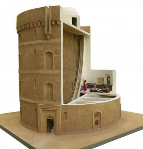
The modern observatory, in its conception, is a worthy successor of the Arab observatories of the late Middle Ages. Unlike the private observatories of the Greek philosophers, the Islamic observatory is a specialized astronomical institution, with its own premises, scientific staff, teamwork with observers and theoreticians, a director and study programs. They have recourse, as today, to increasingly large instruments, in order to constantly improve the accuracy of measurements.
The first of these observatories was built during the reign of Al-Ma’mûn in Bagdad in the 9th century. We have already mentioned the observatory of Ray, near Tehran and second city of the Abbasid Empire after Baghdad, with its monumental wall sextant dating from 994. To these must be added the observatories of Toledo and Cordoba in Spain, Baghdad and Isfahan.
Finally, the one in Maragheh in the north of present-day Iran, built in 1259 with funds collected to maintain hospitals and mosques. Al-Tusi worked there. Then came the era of the observatory of Samarkand, built in 1420 by the astronomer Ulugh Beg (1394-1449), whose remains were found in 1908 by a Russian team.
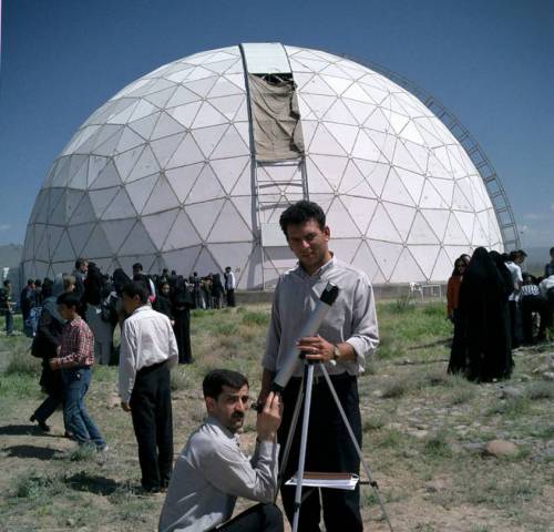
Conclusion
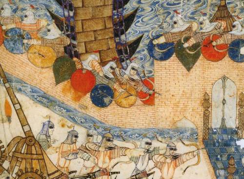
Much more than the crusades, it will be the Mongol offensives that will devastate entire sections of the Arab-Muslim civilization. Genghis Khan (1155-1227), to the great pleasure of some Westerners, will destroy the Muslim kingdoms of Khwarezm (1218) and Sogdia with Bukhara and Samarkand (1220). The great city of Merv in 1221. In 1238, his son will seize Moscow, then Kiev. In 1240, Poland and Hungary will be invaded. In 1241, Vienna was threatened.
Before bringing down the Song Dynasty in China in 1273, the Mongols turned against the Abbassid.
Hence, the Houses of Wisdom came to a brutal end on February 12, 1258 with the Mongol invasion of Baghdad led by Hulagu (Genghis Khan’s grandson), who killed the last Abbasid caliph Al-Mu’tassim (despite his surrender) and destroyed the city of Baghdad and its cultural heritage. Hulagu also ordered the massacre of the caliph’s entire family and entourage.
Mutazilism was banned and the magnificent collection of books and manuscripts in the House of Wisdom in Baghdad was thrown into the muddy water of the Tigris, which turned brown for a few days because of the inked papers of the books and manuscripts.
One report says that the Mongols exterminated twenty-four thousand scholars and an incalculable number of books were lost. Of Mutazilism, its doctrine was only known through the texts of the traditionalist theologians who had attacked it. It was only the discovery of the voluminous works of Abdel al Jabbar Ibn Ahmad in the 19th century that made it possible to understand the key role played my this current of thought in the Arab renaissance and the formation of current Muslim theology, whether Sunni or Shiite.
Closer to home, the Iraq war of 2003: until then, Iraq was the world’s largest publisher of scientific publications in Arabic. As a result of the chaos caused by a war waged in the name of “democracy” and “the war on terror”, both the National Library and the National Archives were looted and burned. The same happened to the Central Library of Pious Legacies, the Library of the Iraqi University of Sciences, as well as many public libraries in Baghdad, Mosul and Basra. The same was true for the archaeological treasures of the Iraqi Museum and its library. It seems that some people have declared war on civilization.
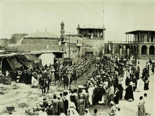
NOTES:
- A theodicy or « righteousness of God ») is an explanation of the apparent contradiction between the existence of evil and two characteristics peculiar to God: his omnipotence and his goodness.
- Sumer. The natural environment of the Sumerian country was not really favorable to the development of a productive agriculture: poor soils with a high content of salts harmful to the growth of plants, very high average temperatures, insignificant rainfall, and flooding of rivers coming in the spring, at harvest time, and not in the fall when the seeds need them to germinate, as is the case in Egypt. It was therefore the ingenuity and relentless labor of Mesopotamian farmers that enabled this country to become one of the granaries of the ancient Middle East. From the 6th millennium BC, the peasant communities developed an irrigation system which gradually branched out to cover a large area, thereby taking advantage of the advantage offered to them by the extremely flat relief of the Mesopotamian delta, where there was no no natural obstacle to the extension of the irrigation canals over tens of kilometers. By regulating the level of water derived from natural watercourses to adapt it to the needs of crops, and by developing techniques aimed at limiting soil salinization (leaching of fields, practice of fallow), it was possible to obtain very high cereal yields.
- Khorassan is a region located in northeastern Iran. The name comes from the Persian and means « where does the sun come from ». It was given to the eastern part of the Sassanid Empire. Khorassan is also considered the medieval name of Afghanistan by Afghans. Indeed, this territory included present-day Afghanistan, as well as southern Turkmenistan, Uzbekistan and Tajikistan.
- In the 10th century, the Persian medical scholar Mohammad Al-Razi describes the distillation of petroleum to obtain kerosene or « illuminating petroleum » in his Book of Secrets.
- Sanskrit is a language of India, among the oldest known Indo-European languages (older even than Latin and Greek). It is notably the language of Hindu religious texts and, as such, it continues to be used as a cultural language, like Latin in centuries past in the West.
- Peshlevi or Middle Persian is an Iranian language that was spoken during the Sassanid era. She descends from Old Persian. Middle Persian was usually written using the Pahlevi script. The language was also written using the Manichean script by the Manichaeans of Persia.
- Abu Muhammad al – Qasim ibn ’Ali al – Hariri (1054–1122), Arab man of letters, poet and philologist, was born near Basra, in present-day Iraq. He is known for his Oaths and his maqâmât (literally fashions, often translated as assemblies or sessions), a collection of 50 short stories combining social and moral commentary with the brilliant expressions of the Arabic language. If the genre of maqâma was created by Badi’al – Zaman al – Hamadhani (969–1008), it is the sessions of al – Hariri that best define it. Written in a rhyming prose style called saj ’and interwoven with exquisite verse, the stories are meant to be entertaining and educational. Each of the anecdotes takes place in a different city in the Muslim world during the time of al – Hariri. They tell of an encounter, usually at a gathering of townspeople, between two fictional characters: the narrator al – Harith ibn Hammam and the protagonist Abu Zayd al-Saruji. Over the centuries, the work has been copied and commented on many times, but only 13 copies still in existence today have illuminations illustrating scenes from the stories. The manuscript presented here, executed in 1237, was both copied and illustrated by Yahya ibn Mahmud al-Wasiti, often considered the first Arab artist. It contains 99 miniatures of exceptional quality. No other known copy contains so much. The miniatures, recognized for their striking depiction of Muslim life in the 13th century, are considered to be the earliest Arab paintings created by an artist whose identity is known. Al – Wasiti, founder of the Baghdad School of Illumination, was also a remarkable calligrapher, as evidenced by his fine Naskhi style. The almost immediate popularity of the maqâmât reached Arab Spain, where Rabbi Judah al-Harizi (1165-c. 1225) translated the sessions into Hebrew under the title Mahberoth Itiel and subsequently composed his own Tahkemoni, or Hebrew sessions. . The work was also translated into many modern languages.
- The Barmecids or Barmakids are members of a Persian nobility family originally from Balkh in Bactria (north of Afghanistan). This family of Buddhist religious (paramaka means in Sanskrit the superior of a Buddhist monastery) who became Zoroastrians and then converted to Islam provided many viziers to the Abbasid caliphs. The Barmakids had acquired a remarkable reputation as patrons and are regarded as the main instigators of the brilliant culture which then developed in Baghdad.
- The Christological thesis of Nestorius (born c. 381 – died 451), Patriarch of Constantinople (428-431), was declared a heretic and condemned by the Council of Ephesus. For Nestorius, two hypostases, one divine, the other human, coexist in Jesus Christ. From the Eastern Church, Nestorianism was one of the historically most influential forms of Christianity in the world throughout late Antiquity and the Middle Ages, to India, China and Mongolia.
- Syriac (a form of Aramaic, the language of Christ) is alongside Latin and Greek the third component of ancient Christianity, rooted in Hellenism but also descended from Near Eastern and Semitic antiquity. From the first centuries, in a movement symmetrical to that of the Greco-Latin Christian tradition towards the west, Syriac Christianity developed towards the east, as far as India and China. Syriac is still today the liturgical and classical language (a bit like Latin in Europe) of the Syriac Orthodox, Syriac Catholic, Assyrian, Chaldean and Maronite Churches in Lebanon, Syria, Iraq and South India. Where is. Finally, it is the branch of Christianity most in contact with Islam in which he continued to live.
- In South-West Asia, the Greek influence remained alive in several cities under Christian influence: Edessa (now Urfa in Turkey), at the time capital of the county of Edessa, one of the first Eastern Latin states, the closest to the Islamic world; Antioch (now Antakya in Turkey); Nisibe (now Nusaybin in Turkey); Al-Mada’in (ie “The Cities”), an Iraqi metropolis on the Tigris, between the royal cities of Ctesiphon and Seleucia on the Tigris and Gondichapour (now in Iran) whose ruins remain. To this must be added the cities of Latakia (in Syria) and Amed (today Diyarbakir in Turkey) where there were Jacobite centers (Christians of the East, but members of the Syriac Orthodox Church, not to be confused with the Nestorians).
- The Gondishapour Academy was located in present-day Khuzestan province in southwestern Iran, near the Karoun River. It offered the teaching of medicine, philosophy, theology and science. The faculty was well versed not only in Zoroastrian and Persian traditions, but also taught Greek and Indian languages. The Academy included a library, an observatory, and the oldest known teaching hospital. According to historians, the Cambridge of Iran was the most important medical center in the Old World (defined as the territory of Europe, the Mediterranean and the Near East) during the 6th and 7th centuries.
- Sogdian is a middle Iranian language spoken in the Middle Ages by the Sogdians, a trading people who resided in Sogdiana, the historic region encompassing Samarkand and Bukhara and covering more or less present-day Uzbekistan, Tajikistan and northern Afghanistan. Before the arrival of Arabic, Sogdian was the lingua franca of the Silk Road. Sogdian traders settled in China and Sogdian monks were among the first to spread Buddhism there. As early as the 6th century, Chinese rulers appealed to the Sogdian elite to resolve diplomatic, commercial, military and even cultural issues, prompting many Sogdians to migrate from Central Asia and China’s border regions to major Chinese political centers.
- The Book of Ingenious Machines contains a hundred machines or objects, most of them due to the Banou Moussa brothers or adapted by them: funnel, crankshaft, conical ball valves, float valve and other hydraulic regulation systems, mask gas and ventilation bellows for mines; dredge, variable jet fountains, hurricane lamp, auto-off light, auto-powered; automatic musical instruments including a programmable flute.
- Astronomical ephemeris: registers of the positions of stars at regular intervals.
- Ibn Al-Haytam. In 2007, during a conference at the Sorbonne, I explored the use, by the Flemish painter Jan Van Eyck (early 15th century), of a bifocal geometric perspective, wrongly qualified as « primitive », erroneous and intuitive, actually inspired by the work and binocular experiences of the Arab scholar Ibn Al-Haytam (Alhazen). The latter drew on the work of his predecessors Al-Kindi, Ibn Luca and Ibn Sahl. Alhazen was widely known in the West thanks to the translations of the Franciscans of the University of Oxford (Grosseteste, Bacon, etc.). See summary biography.
SUMMARY CHRONOLOGY:
- 310-230 BC.: Life of the Greek astronomer Aristarchus of Samos;
- 190-120 BC.: life of the Greek astronomer Hipparchus of Nicaea;
- v. 100-160 : life of Roman astronomer Claudius Ptolemy;
- 700-748: life of Wasil ibn Ata, intellectual founder of Mutazilism;
- 750: beginning of the Abbasid dynasty;
- 751: Abbasid victory against the Chinese at the battle of Talas (Kyrgyzstan);
- 763: founding of Baghdad by Caliph Al-Mansur;
- 780: Timothy I, patriarch of the Nestorian Christian church in Baghdad;
- 780-850: life of the Arab mathematician al-Kwarizmi;
- 786 to 809: caliphate for 23 years of Haroun al-Rachîd, legendary hero of the Thousand and One Nights tales. Development of mutazilism;
- 801-873: life of the mutazilist and Platonic philosopher Al-Kindi;
- 805-880: life of Al-Farghani, treatise on the Astrolabe;
- 813-833: caliphate of Al-Ma’mûn (20 years);
- 829: creation of the first permanent astronomical observatory in Baghdad followed by that of Damascus;
- 832: creation of the public library and creation of the Maisons de la Sagesse;
- 833: shortly before his death, Al-Ma’mûn decrees the created Koran and has mutazilism adopted as the official doctrine of the Abbasids;
- 836: transfer from the capital to Samarra;
- 848: the mutazilites removed from the Baghdad court;
- 858-930: life of Al-Battani, known as Albatenius;
- 865-925: life of translator and doctor Sahl Rabban al-Tabari;
- 869-883: revolt of the Zanj (black slaves from Zanzibar);
- 892: return from the capital of the Abbasids to Baghdad;
- 965-1039: life of Ibn Al-Haytam, known as Alhazen;
- 973-1048: life of Al-Biruni;
- 1095: first crusade;
- 1258: Baghdad sacked by the Mongols;
- 1259: creation of the Maragheh Astronomical Observatory (Iran);
- 1304-1375: life of Ibn Al-Shâtir;
- 1422: creation of the Astronomical Observatory of Samarkand, capital of Sogdiana;
- 1543: Polish astronomer Nicolas Copernicus publishes his De Revolutionibus;
- 1917: British troops enter Baghdad;
- 2003: looting and destruction by systematic arson of libraries and museums during the Iraq war.
BIBLIOGRAPHY:
- Mutazilism, website of the Association for the Renaissance of Mutazilite Islam (ARIM);
- Antoine Le Bail, Who are the mutazilites, sometimes called the « rationalists » of Islam ?, website of the Institut du Monde Arabe (IMA), Paris;
- Richard C. Martin, Mark R. Woodward with Dwi S. Atmaja, Defenders of Reason in Islam, Mu’tazilism from Medieval School to Modern Symbol, Oneworld, Oxford, 1997;
- Rober R. Reilly, The Closing of the Muslim Mind, How Intellectual Suicide Created the Modern Islamist Crisis, ISI, Wilmington, 2011;
- Nadim Michel Kalife, The Lights of the First Centuries of Islam, on financialafrik.com, 2019;
- Mahmoud Azab, A Vision of the Universality of Arab-Islamic Civilization, Oberta de Catalunya University, www.uoc.edu;
- Sabine Schmidke, The People of Monotheism and Justice: Mutazilism in Islam and Judaism, Institute for Advanced Study, 2017;
- Malek Chebel, Slavery in the Land of Islam, Fayard, Paris 2012;
- Jacques Cheminade, Sublime words and idiocy by Nasr Eddin Hodja;
- Jacques Cheminade, Proposals for an inter-religious dialogue;
- Hussein Askary: Baghdad 767-1258 A.D., Melting Pot for a Universal Renaissance, Executive Intelligence Review, 2013;
- Hussein Askary: The Beauty of the Islamic Renaissance, the Elephant Clock, S&P website;
- Dr Subhi Al-Azzawi, The House of Wisdom of the Abbasids in Baghdad or the beginnings of the University, pdf on the internet;
- Dimitri Gutas, Greek Thought, Arab Culture. The movement of Greco-Arabic translation in Baghdad and primitive Abbasid society (2nd-4th / 8th-10th centuries), Aubier, Paris 2005;
- Jim Al-Khalili, The House of Wisdom, How Arab Science Saved Ancient Knowledge and Gave Us the Renaissance, Pinguin, London 2010;
- Jonathan Lyons, The House of Wisdom, How the Arabs Transformed Western Civilization, Bloomsbury, London 2009;
- Pastor Georges Tartar, Islamo-Christian Dialogue under Caliph Al-Ma’mûn, Les épitres d’Al-Hashimi and d’Al-Kindî, Nouvelles Editions Latines, Paris, 1985;
- Al-Kindî, On First Philosophy, State University of New York Press, Albany, 1974;
- Marie Thérèse d´Alverny, The transmission of philosophical and scientific texts in the Middle Ages, Variorum, Aldershot 1994;
- Danielle Jacquart, Françoise Micheau, Arab medicine and the medieval West, Maisonneuve, Paris 1990;
- Juan Vernet Gines, What culture owes to the Arabs of Spain, Sindbad, Actes Sud, Paris, 2000;
- Karen Armstrong, Islam, A Short History, Phoenix, London, 2002;
- Muriel Mirak Weisbach, Andalusia, a gateway to the Renaissance;
- Régis Morelon, Eastern Arab Astronomy between the 8th and 11th Century, in History of Arab Sciences, edited by Roshdi Rashed, Vol. 1, Astronomy, Theoretical and Applied, Seuil, Paris, 1997;
- George Saliba, Planetary Theories in Arab Astronomy after the 11th Century, in History of Arab Sciences, edited by Roshdi Rashed, Vol. 1, Astronomy, Theoretical and Applied, Seuil, Paris, 1997;
- Roshi Rashed, Geometric Optics, in History of Arab Sciences, edited by Roshdi Rashed, Vol. 2, Mathematics and physics, Seuil, Paris, 1997;
- Jean-Pierre Verdet, A History of Astronomy, Seuil, Paris, 1990;
- J. P. Maratray, Arab Astronomy, on the Astrosurf.com website;
- Jean-Pierre Luminet, Ulugh Beg – The Astronomer of Samarkand, 2018;
- Kitty Ferguson, Pythagoras, His Lives and the Legacy of a Rational Universe, Walker publishing Company, New York, 2008;
- Sir Thomas Heath, Aristarchus of Samos, The Ancient Copernicus, Dover, New York, 1981:
- A. T. Papadopoulo, Islam and Muslim Art, The Art of Great Civilizations, Mazenod, Paris, 1976;
- Olag Grabar, Art and Culture in the Islamic World, Arts & Civilizations of Islam, Köneman, Cologne, 2000;
- Christiane Gruber, Images of Muhammad in Islam, Afkar / Ideas, Spring 2015;
- Hans Belting, Florence & Baghdad, Renaissance art and Arab science, Harvard University Press, 2011;
- Dominique Raynaud, Ibn al-Haytham on binocular vision: a precursor of physiological optics, Arabic Sciences and Philosophy, Cambridge University Press (CUP), 2003, 13, pp. 79-99;
- Jonathan M. Bloom, Paper Before Print: The History and Impact of Paper in the Islamic World, Yale University Press, 2001;
- Karel Vereycken, Jan Van Eyck, a Flemish painter in Arabic optics, S&P website;