Étiquette : Egypt
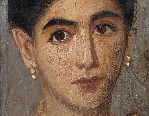
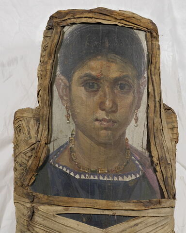
LOUVRE AUDIO GUIDE: The Greek tradition behind the Fayum Mummy Portraits
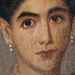
Karel Vereycken comments the Louvre’s Fayum Mummy Portraits.
Listen:
To the audio on this website
Read:
Joachim Patinir and the invention of landscape painting
In November 2008, a symposium was held at the Centre d’études supérieures sur la Renaissance in Tours on the theme of « Contemplation in Flemish painting (14th-16th centuries) ».
Here is a transcript of the contribution by Karel Vereycken on Joachim Patinir, a little-known Belgian painter who is essential to the history of art.
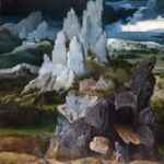
It is generally believed that the « modern » concept of landscape in Flemish painting only emerged with the work of Joachim Patinir (1485-1524), a Dinant-born painter working in Antwerp in the early 16th century.
For Viennese art historian Ludwig von Baldass (1887-1963), writing at the beginning of the 20th century, Patinir‘s work, presented as clearly ahead of its time, would herald landscape as überschauweltlandschaft, translatable as « panoramic landscape of the world », a truly cosmic and totalizing representation of the visible universe.
What characterizes Patinir‘s work, say the proponents of this analysis, is the sheer scale of the landscapes it presents for the viewer to contemplate.
This breadth has a dual character: the space depicted is immense (due to a panoramic viewpoint situated high up, almost « celestial »), while at the same time it encompasses, without concern for geographical verisimilitude, the greatest possible number of different phenomena and representative specimens, typical of what the earth can offer as curiosities, sometimes even imaginary, dreamlike, unreal, fantastic motifs: fields, woods, anthropomorphic mountains, villages and cities, deserts and forests, rainbows and storms, swamps and rivers, rivers and volcanoes.
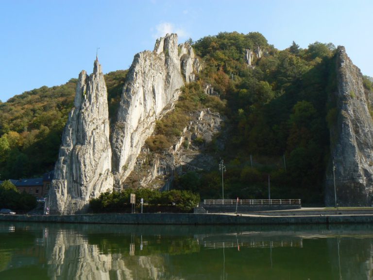
For example, the « Bayart Rock », which borders the Meuse not far from Patinir‘s native town of Dinant.
In addition to this panoramic perspective, Patinir uses aerial perspective – theorized at the time by Leonardo da Vinci – by dividing the space into three color planes: brown-ochre for the first plane, green for the middle plane and blue for the distant plane.
However, the painter preserves the visibility of the totality of details with a meticulousness, minutiae and preciousness worthy of the Flemish masters of the XVth century, who, by tending towards a quantitative infinity (consisting in showing everything), sought to approach a qualitative infinity (allowing us to see everything).
For their part, the authors of the weltlandschaft thesis, after showering with praise, do not hesitate to strongly relativize his contribution, saying:
« For landscape painting to become anything other than a virtuoso but compulsive accumulation of motifs, and more precisely, the quasi-documentary capture of an infinitesimal fragment of contingent reality, we have to wait for the XVIIth century and the full maturity of Dutch painting… ».
And it’s here that the trap of this approach, which consists in making us believe that the advent of landscape as an autonomous genre, its so-called « secularization », is simply the result of emancipation from a medieval and religious mental matrix, considered necessarily retrograde, for which landscape was reduced to a pure emanation or incarnation of divine power, is clearly identified.
Patinir, the first, would thus have demonstrated a purely « modern » aesthetic conception, and these « realistic » landscapes would mark the transition from a religious – and therefore obscurantist – cultural paradigm to a modern one, i.e. one devoid of meaning… which he would later be criticized for.
This is how the romantic and fantastic minds of the XVIIth and XVIIIth centuries viewed the artists of the XVth and XVIth centuries.
Von Baldass was undoubtedly influenced by the writings of Goethe, who, no doubt in a moment of enthusiasm for Greek paganism, analyzed the increasingly diminished role of religious figures in XVIth-century Flemish paintings and deduced that it was no longer the religious subject that was the subject, but the landscape.
Just as Rubens would have used the pretext of painting Adam and Eve expelled from Paradise to be able to paint nudes, Patinir would simply have seized the pretext of a biblical passage to be able to indulge his true passion, landscape…
A little detour via Hieronymus Bosch
A fresh look at Patinir’s work clearly demonstrates the error of this analysis.
To arrive at a more accurate reading, I suggest a detour to Hieronymus Bosch, whose spirit was very much alive among Erasmus‘ circle of friends in Antwerp (Gérard David, Quentin Massys, Jan Wellens Cock, Albrecht Dürer, etc.), of which Patinir was a member.
Bosch, contrary to the clichés still in vogue today, is above all a pious and moralizing spirit. If he shows vice, it’s not so much to praise it as to make us aware of just how much it attracts us. Faithful to the Augustinian traditions of Devotio Moderna, promoted by the Brothers of the Common Life (a spiritual renewal movement to which he was close), Bosch believes that man’s attachment to earthly things leads him to sin. This is the central theme of all his work, the spirit of which can only be penetrated by reading The Imitation of Christ, written, in all probability, by the founding soul of the Devotio Moderna, Geert Groote (1340-1384), or his disciple, Thomas à Kempis (1379-1471), to whom this work is generally attributed.
In this work, the most widely read in human history after the Bible, we read:
« Vanity of vanities, all is vanity, except loving God and serving Him alone.
Sovereign wisdom is to strive for the kingdom of heaven by despising the world.
—Vanity, then, to hoard perishable riches and hope in them.
—Vanity to aspire to honors and to rise to the highest.
—Vanity, to follow the desires of the flesh and seek that for which one must soon be rigorously punished.
—Vanity, to wish for a long life and not care about living well.
—Vanity, to think only of the present life and not to foresee what will follow it.
—Vanity, to cling to what passes so quickly and not hasten towards the joy that never ends.
Remember often the words of the wise man: the eye is not satisfied with what it sees, nor the ear with what it hears.
Apply yourselves, therefore, to detaching your heart from the love of visible things, to bring it entirely to the invisible ones, for those who follow the lure of their senses defile their souls and lose the grace of God. »
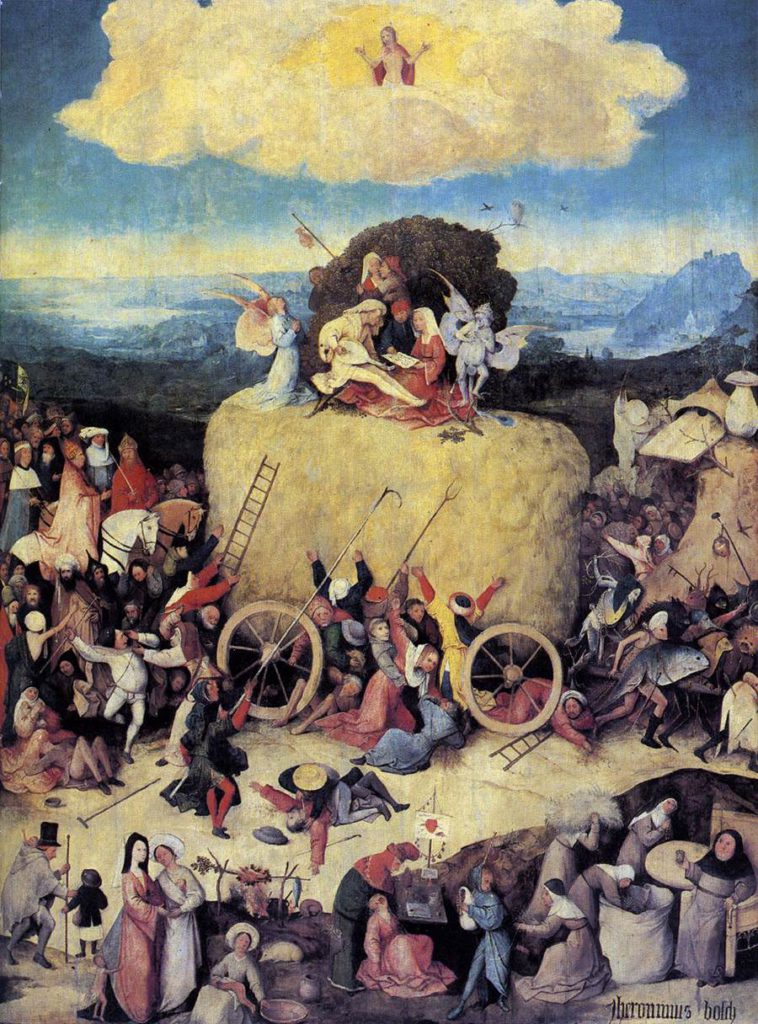
Bosch treats this subject with great compassion and humor in his painting The Hay Wagon (Prado Museum, Madrid).
The allegory of straw already exists in the Old Testament. Isaiah 40:6 :
« All flesh is grass,
and all its brightness like the flower of the field;
The grass withers, the flower withers,
when the breath of Yahweh passes over it.
« Yes, the people are grass.
The grass withers, the flower withers,
but the word of our God
is fulfilled forever.«
It was echoed in the New Testament by the apostle Peter (1:24):
« For all flesh is like grass,
and all its glory like the flower of grass.
The grass withers,
and the flower falls. »
Johannes Brahms uses this passage in the second movement of his German Requiem.
Bosch‘s triptych depicts a hay wagon, an allegory of the vanity of earthly riches, pulled by strange creatures on their way to hell.
The Duke of Burgundy, the Emperor of Germany and even the Pope himself (this is the time of Julius II…) follow close behind, while a dozen or so characters fight to the death for a blade of straw. It’s a bit like the huge speculative securities bubble that is leading our era into a great depression…
It’s easy to imagine the bankers who sabotaged the G20 summit to perpetuate their system, which is so profitable in the very short term. But this corruption doesn’t just affect the big boys. In the foreground of the picture, an abbot has entire sacks of hay filled, a false dentist and also gypsies cheat people for a bit of straw.
The peddler and the Homo Viator
The closed triptych sums up the same topos in the form of a peddler (not the prodigal son). This peddler, eternal homo viator, is an allegory of Man who fights to stay on the right path and insists on staying on it.
In another version of the same subject painted by Bosch (Museum Boijmans Beuningen, Rotterdam), the peddler advances op een slof en een schoen (on a slipper and a shoe), i.e. he chooses precariousness, leaving the visible world of sin (we see a brothel and drunkards) and abandoning his material possessions.
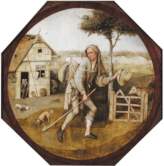
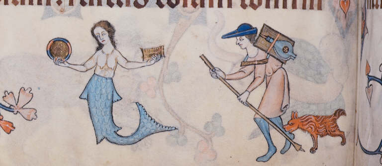
With his staff (symbol of faith), he fends off the infernal dogs (symbol of temptation), who try to hold him back.
Once again, these are not manifestations of Bosch‘s exuberant imagination, but of a metaphorical language common at the time. We find this representation in the margin of the famous Luttrell Psalter, a XIVth-century English psalter.
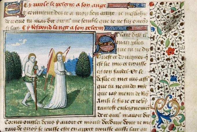
This theme of homo viator, the man who detaches himself from earthly goods, is also recurrent in the art and literature of this period, particularly since the Dutch translation of Pèlerinage de la vie et de l’âme humaine (pilgrimage of life and the human soul), written in 1358 by the Norman Cistercian monk Guillaume de Degulleville (1295-after 1358).
A miniature from this work shows a soul on its way, dressed as a peddler.
Nevertheless, while in the XIVth century this spiritual requirement may have dictated a sometimes excessive rigorism, the liberating laughter of nascent humanism (Brant, Erasmus, Rabelais, etc.) would bring happier, freer colors to Flemish Brabant culture (Bosch, Matsys, Bruegel), albeit later stifled by the dictates of the Council of Trent.
Man’s foolish attachment to earthly goods became a laughing matter. Published in Basel in 1494, Sébastien Brant’s Ship of Fools, a veritable inventory of all the follies that can lead man to his doom, left its mark on an entire generation, which rediscovered creativity and optimism thanks to the liberating laughter of Erasmus and his disciple, the Christian humanist François Rabelais.
In any case, for Bosch, Patinir and the Devotio Moderna, contemplation was the very opposite of pessimism and scholastic passivity. For them, laughter is the ideal antidote to despair, acedia (weariness) and melancholy.
Contemplation thus took on a new dimension. Each member of the faithful is encouraged to live out his or her Christian commitment, through personal experience and individual imitation of Christ. They must stop blaming themselves on the great figures of the Bible and Sacred History.
Man can no longer rely on the intercession of the Virgin Mary, the apostles and the saints. While following their examples, he must give personal content to the ideal of the Christian life. Driven to action, each individual, fully aware of his or her sinful nature, is constantly led to choose good over evil. These are just a few of the cultural backgrounds that enable us to approach Patinir’s landscapes in a different way.
Charon crossing the Styx
Patinir’s painting Charon Crossing the Styx (Prado Museum, Madrid), which combines ancient and Christian traditions, will serve here as our « Rosetta stone ». Inspired by the sixth book of the Aeneid, in which the Roman writer Virgil describes the catabasis, or descent into hell, or Dante‘s Inferno (3, line 78) taken from Virgil, Patinir places a boat at the center of the work.
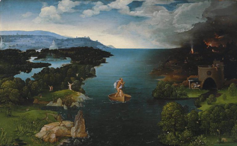
The tall figure standing in this boat is Charon, the Ferryman of the Underworld, usually portrayed as a gloomy, sinister old man. His task is to ferry the souls of the deceased across the River Styx.
In payment, Charon takes a coin placed in the mouths of the corpses. The passenger in the boat is thus a human soul.
Although the scene takes place after the person’s physical death, the soul – and this may come as a surprise – is tormented by the choice between Heaven and Hell.
Since the Council of Trent, it has been considered that a bad life irrevocably sends man to Hell from the moment of his death. But Christian faith continues, even today, to distinguish the Last Judgment from what is known as the « particular judgment ».
According to this concept, which is sometimes disputed within denominations, at the moment of death, although our final fate is fixed (Hebrews 9:27), all the consequences of this particular Judgment will not be drawn until the general Judgment, which will take place when Christ returns at the end of time.
So, the « particular judgment » that is supposed to immediately follow our death, concerns our last act of freedom, prepared by all that our life has been. Helping us to contemplate this ultimate moment therefore seems to be the primary aim of Patinir‘s painting, with other metaphors thrown in for good measure.
However, a closer look at the lower part of the painting reveals a contradiction that is absent from Virgil’s poem. While Hell is on the right (Cerberus, the three-headed dog guarding the gateway to Hell, can be seen), the gateway seems easily accessible, with splendid trees dotting the lawns.
To the left is Paradise. An angel tries to attract the attention of the soul in the boat, but it seems much more attracted by a seemingly welcoming Hell.
What’s more, the dimly-lit path to paradise seems perilous, with rocks, swamps and other dangerous obstacles. Once again, it’s our senses that may lead us to make a literally hellish choice.
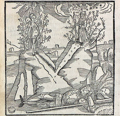
The subject of the painting is clearly that of the bivium, the binary choice at the crossroads that offers the pilgrim viewer the choice between the path of vice and that of salvation.
This theme was widespread at the time. We find it again in Sébastien Brant‘s Ship of Fools, in the form of Hercules at the crossroads. In this illustration, on the left, at the top of a hill, a naked woman represents vice and idleness. Behind her, death smiles down on us.
On the right, planted at the top of a higher hill, at the end of a rocky path, awaits virtue symbolized by work. Let’s also remember that the Gospel (Matthew 7:13-14) clearly evokes the choice we will face:
« Enter by the narrow gate.
For wide is the gate and broad is the road that leads to destruction,
and there are many who enter by it.
But the gate is narrow and the way to life is narrow,
and there are few who find it ».
Landscape as an object of contemplation
The art historian Reindert Leonard Falkenburg, in his 1985 doctoral thesis, was the first to note that Patinir takes pleasure in transposing this metaphorical language to the whole of his landscape.
Although the image of impassable rocks as a metaphor for the virtue achieved by choosing the difficult path is nothing new, Patinir exploits this idea with unprecedented virtuosity.
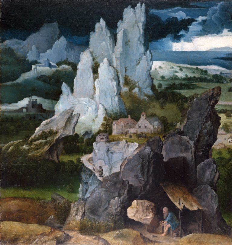
We thus discover that the theme of man courageously turning away from the temptation of a world that traps our sensorium, is the underlying theo-philosophical theme of almost all Patinir’s landscapes. In this way, his work finds its raison d’être as an object of contemplation, where man measures himself against the infinite.Let’s return to our Landscape with Saint Jerome by Patinir (National Gallery, London).
Here we discover the « narrow gate » leading to a difficult path that takes us to the first plateau. This is not the highest mountain. The highest, like the Tower of Babylon, is a symbol of pride.
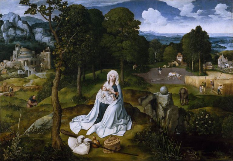
Next, let’s look at Resting on the Road to Egypt (Prado Museum, Madrid). At the side of the road, Mary is seated, and in front of her, on the ground, are the peddler’s staff and his typical basket.
In conclusion, we could say that, driven by his spiritual and humanist fervor, by painting increasingly impassable rocks – reflecting the immense virtue of those who decide to climb them – Patinir elaborates not « realistic » landscapes, but « spiritual landscapes », dictated by the immense need to tell the spiritual journey of the soul.
Hence, far from being mere aesthetic objects, his spiritual landscapes serve contemplation.
Like a half-ironic mirror image, they enable those who wish to do so to prepare for the choices their soul will face during, and after, life’s pilgrimage.
Bibliography:
- R.L. Falkenburg, Joachim Patinir, Het landschap als beeld van de levenspelgrimage, Nijmegen, 1985;
- Maurice Pons and André Barret, Patinir ou l’harmonie du monde, Robert Laffont, 1980;
- Eric de Bruyn, De vergeten beeldentaal van Jheronimus Bosch, Adr. Heinen, s’Hertogenbosch, 2001;
- Dirk Bax, Hieronymus Bosch, his picture-writing deciphered, A. A. Balkema, Capetown, 1979;
- Georgette Epinay-Burgard, Gérard Groote, fondateur de la Dévotion Moderne, Brepols, 1998.
- Karel Vereycken, Devotio Moderna, cradle of Humanism in the North, Artkarel.com, 2011;
- Karel Vereycken, With Hieronymus Bosch on the track of the Sublime, Schiller Institute, 2007.
- Karel Vereycken, How Erasmus Folly saved our Civilization, Schiller Institute, 2004.
The Maritime Silk Road, a history of 1001 Cooperations
Today, it’s fashionable to present maritime issues in the context of a moribund British geopolitical ideology that pits countries and peoples against each other. However, as this brief history of the Maritime Silk Road, drawn mainly from a document by the International Tourism Organization, demonstrates, the ocean has above all been a fantastic place for fertile encounters, cultural cross-fertilization and mutually beneficial cooperation.
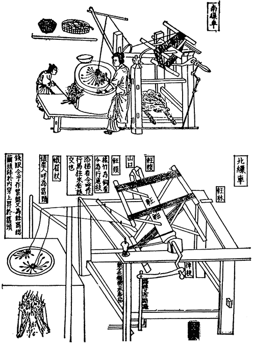
The ancient Chinese invented many of the things we use today, including paper, matches, wheelbarrows, gunpowder, the noria (water elevator), sluice locks, the sundial, astronomy, porcelain, lacquer paint, the potter’s wheel, fireworks, paper money, the compass, the stern rudder, the tangram, the seismograph, dominoes, skipping rope, kites, the tea ceremony, the folding umbrella, ink, calligraphy, animal harnesses, card games, printing, the abacus, wallpaper, the crossbow, ice cream, and especially silk, which we’ll be talking about here.
The Origins of Silk
Before we talk about silk « routes », a few words about the origins of sericulture, i.e. the rearing of silkworms.
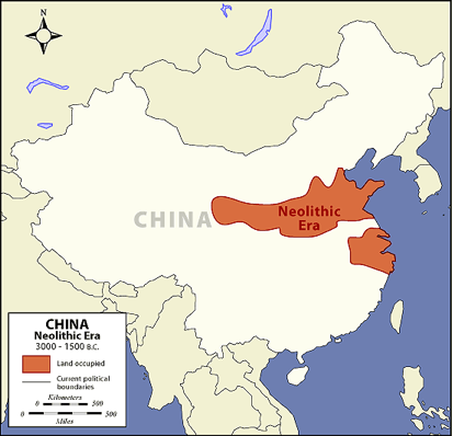
As recent archaeological discoveries confirm, silk production is an age-old skill. The presence of the mulberry tree for silkworm rearing was noted in China around the Yellow River by the Yangshao culture during the Middle Neolithic period in China, from 4500 to 3000 BC.
In general, we prefer to retain the legend that silk was discovered around 2500 BC, by the Chinese princess Si Ling-chi, when a cocoon accidentally fell into her tea bowl. When she tried to remove it, she discovered that the cocoon, softened by the hot water, had a delicate, soft and strong thread that could be unwound and assembled. Thus was born the idea of making cloth. The princess then decided to plant a number of white mulberry trees in her garden to raise silkworms.
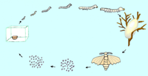
The silkworms (or bombyx) and mulberry trees were divinely cared for by the princess (silkworms feed solely on the leaves of white mulberry trees).
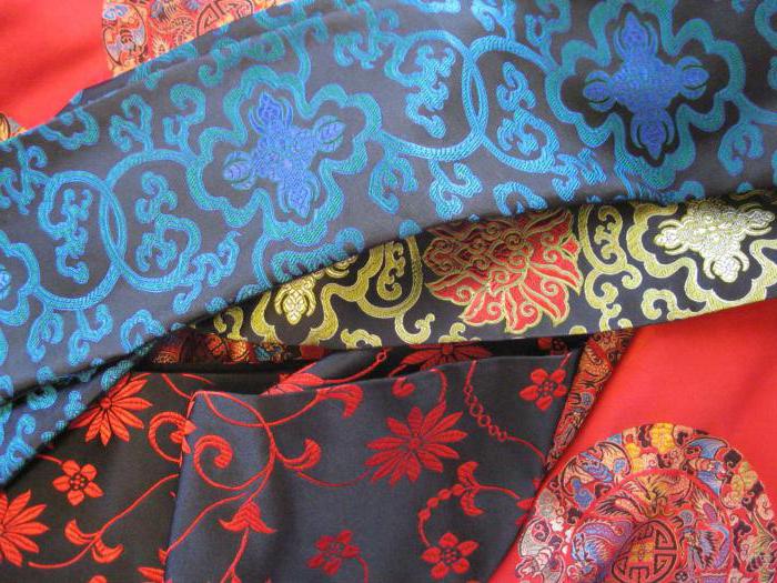
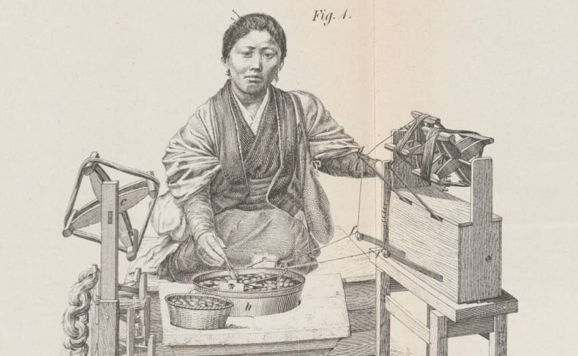
Silk production is a time-consuming process that requires careful monitoring. Silk moths lay around 500 eggs during their lives, which last from 4 to 6 days. After the eggs hatch, the baby worms feed on mulberry leaves in a controlled environment. They have a ferocious appetite and their weight can increase considerably. Once they’ve stored up enough energy, the worms secrete a white jelly from their silk glands and use it to build a cocoon around themselves. After eight or nine days, the worms are killed and the cocoons are immersed in boiling water to soften the protective filaments, which are wound onto a spool. These filaments can be 600 to 900 meters long. Several filaments are assembled to form a thread. The silk threads are then woven into a fabric or used for fine embroidery or brocade, a rich silk fabric embellished with brocaded designs in gold and silver thread.
The Early Silk Trade
Under threat of capital punishment, sericulture remained a well-kept secret, and China retained its monopoly on manufacturing for millennia.
It wasn’t until the Zhou dynasty (1112 BC) that a maritime Silk Road was established from China to Japan and Korea, as the government decided to send Chinese from the port in Bohai Bay (on the Shandong Peninsula) to train local inhabitants in sericulture and agriculture. The techniques of silkworm rearing, reeling and weaving were gradually introduced to Korea via the Yellow Sea.
When Emperor Qin Shi Huang unified China (221 BC), many people from the states of Qi, Yan and Zhao fled to Korea, taking with them silkworms and their rearing techniques. This accelerated the development of silk spinning in Korea.
Korea played a central role in China’s international relations, particularly as an intellectual bridge between China and Japan. Its trade with China also enabled the spread of Buddhism and porcelain-making methods. Although initially reserved for the imperial court, silk spread throughout Asian culture, both geographically and socially. Silk quickly became the luxury fabric par excellence that the whole world craved.
During the Han dynasties (206 BC to 220), a dense network of trade routes exploded cultural and commercial exchanges across Central Asia, profoundly impacting civilizational dynamics. The Han dynasty continued to build the Great Wall, notably creating the commandery of Dunhuang (Gansu), a key post on the Silk Road. Over two centuries B.C., its trade extended to Greece and Rome, where silk was reserved for the elite.
In the IIIrd century, India, Japan and Persia (Iran) unlocked the secret of silk manufacture and became major producers.
Silk Reaches Europe
According to a story by Procopius, it was not until 552 AD that the Byzantine emperor Justinian obtained the first silkworm eggs. He had sent two Nestorian monks to Central Asia, and they were able to smuggle silkworm eggs to him hidden in rods of bamboo. While under the monks’ care, the eggs hatched, though they did not cocoon before arrival.
A church manufacture in the Byzantine Empire was thus able to make fabrics for the emperor. Later emerged the intention of developing a large silk industry in the Eastern Roman Empire, using techniques copied from the Persian Sassanids.
Another version claims that it was the Han emperor Wu (IInd century) who sent ambassadors, bearing gifts such as silk, to the West.
In the VIIth century, sericulture spread to Africa and Sicily, from where, under the impetus of Roger I of Sicily (c. 1034-1101) and his son Roger II (1093-1154), the silkworm and mulberry were introduced to the ancient Peloponnese.
In the Xth century, Andalusia became the epicenter of silk manufacturing with Granada, Toledo and Seville. With the Arab conquest, sericulture spread to the rest of Spain, Italy (Venice, Florence and Milan) and France. The earliest French traces of sericulture date back to the 13th century, notably in the Gard (1234) and Paris (1290).
In the XVth century, faced with the ruinous import of Italian silk (raw or manufactured), Louis XI tried to set up silk factories, first in Tours on the Loire, then in Lyon, a city at the crossroads of north-south routes where Italian emigrants were already trading in silks.
In the XIXth century, silk production was industrialized in Japan, but in the XXth century, China regained its place as the world’s largest producer. Today, India, Japan, the Republic of Korea, Thailand, Vietnam, Uzbekistan and Brazil all have large production capacities.
Cultural Melting Pot
As much as silk itself, the transportation of silk by sea dates back to time immemorial.
For the Chinese, there are two main routes: the East China Silk Road (to Korea and Japan) and the South China Silk Road (via the Strait of Malacca to India, the Persian Gulf, Africa and Europe).
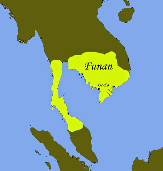
In Vietnam, the Hanoi Museum holds a coin dating back to the year 152, bearing the effigy of the Roman emperor Antoninus the Pious. The coin was discovered in the remains of Oc Eo, a Vietnamese town south of the Mekong Delta, thought to have been the main port of the Funan Kingdom (Ist to IXth centuries).
This kingdom, which covered the territory of present-day Cambodia and the Mekong Delta administrative region of Vietnam, flourished from the 1st to the 9th century. The first mention of the Fou-nan kingdom appears in the report of a Chinese mission that visited the area in the 3rd century.
The Founamians were at the height of their power when Hinduism and Buddhism were introduced to Southeast Asia.
Then, from Egypt, Greek merchants reached the Bay of Bengal. Considerable quantities of pepper then reached Ostia, Rome’s port of entry. All the historical evidence shows that East-West trade was flourishing as early as the first millennium.
Persians and Arabs in India, China and Asia
On the western side, at the entrance to Kuwait Bay, 20 kilometers off the coast of Kuwait City, not far from the mouth of the shared estuary of the Tigris and Euphrates rivers in the Persian Gulf, the island of Failaka was one of the meeting places where Greece, Rome and China exchanged goods.
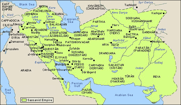
Under the Sassanid dynasty (226-651), the Persians developed their trade routes all the way to Southeast Asia, via India and Sri Lanka.
This trading infrastructure was later taken over by the Arabs when, in 762, they moved to Baghdad.

From the IXth century onwards, the city of Quilon (Kollam), the capital of Kerala in India, was home to colonies of Arab, Christian, Jewish and Chinese merchants.
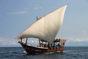
On the western side, Persian and then Arab navigators played a central role in the birth of the maritime Silk Road. Following the Sassanid routes, the Arabs pushed their dhows, or traditional Arab sailing ships, from the Red Sea to the Chinese coast and as far as Malaysia and Indonesia.
These sailors brought with them a new religion, Islam, which spread throughout Southeast Asia. While the traditional pilgrimage (the hajj) to Mecca was initially only an aspiration for many Muslims, it became increasingly possible for them to make it.
During the monsoon season, when winds were favorable for sailing to India in the Indian Ocean, the twice-yearly trade missions were transformed into veritable international fairs, offering an opportunity to transport large quantities of goods by sea in conditions (apart from pirates and unpredictable weather) relatively less exposed to the dangers of overland transport.
The Maritime Silk Road under the Sui, Tang and Song Dynasties
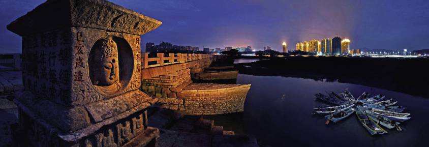
It was under the Sui dynasty (581-618) that the Maritime Silk Road set out from Quanzhou, a coastal city in Fujian province in south-east China, on its first trade routes.
With its wealth of scenic spots and historic sites, Quanzhou has been proclaimed « the starting point of the Maritime Silk Road » by UNESCO.
It was at this time that the first printing methods appeared in China. Wooden blocks were used to print on textiles. In 593, the Sui emperor Wen-ti ordered the printing of Buddhist images and writings. One of the earliest printed texts is a Buddhist script dating from 868, found in a cave near Dunhuang, a stopover town on the Silk Road.
Under the Tang dynasty (618-907), the Kingdom’s military expansion brought security, trade and new ideas. The fact that the stability of Tang China coincided with that of Sassanid Persia enabled the land and sea Silk Roads to flourish. The great transformation of the maritime Silk Road began in the 7th century, when China opened up to international trade. The first Arab ambassador took up his post in 651.
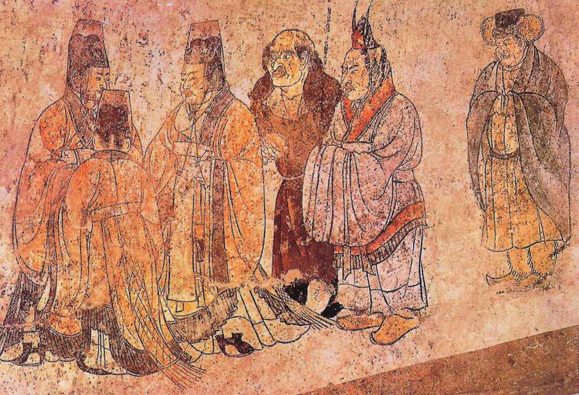
The Tang Dynasty chose Chang’an (now Xi’an) as its capital. It adopted an open attitude towards different beliefs. Buddhist, Taoist and Confucian temples coexisted peacefully with mosques, synagogues and Nestorian Christian churches. As the terminus of the Silk Road, Chang’an’s western market is becoming the center of world trade. According to the Tang Authority Six register, over 300 nations and regions had trade relations with Chang’an.
Almost 10,000 foreign families from the west lived in the city, especially in the area around the western market. There were many foreign inns staffed by foreign maids chosen for their beauty. The most famous poet in Chinese history, Li Bai, often strolled among them. Foreign food, costumes and music were the fashion of Chang’an.
After the fall of the Tang dynasty, the Five Dynasties and the Ten Kingdoms (907-960), the arrival of the Song dynasty (960-1279) ushered in a new period of prosperity, characterized by increased centralization and economic and cultural renewal. The maritime silk route regained its momentum. In 1168, a synagogue was built in Kaifeng, capital of the Southern Song dynasty, to serve merchants on the Silk Road.
During the same period, as Islam expanded, trading posts sprang up all around the Indian Ocean and the rest of Southeast Asia.
China encouraged its merchants to seize the opportunities offered by maritime traffic, in particular the sale of camphor, a highly sought-after medicinal plant. A veritable trade network developed in the East Indies under the auspices of the Kingdom of Sriwijaya, a city-state in southern Sumatra, Indonesia (see below), which for nearly six centuries served as a link between Chinese merchants on the one hand, and Indians and Malays on the other. A trade route truly emerged, deserving the name of the maritime « Silk Road ».
Increasing quantities of spices passed through India, the Red Sea and Alexandria in Egypt, before reaching the merchants of Genoa, Venice and other Western ports. From there, they moved on to the northern European markets of Lübeck (Germany), Riga (Lithuania) and Tallinn (Estonia), which from the 12th century onwards became important cities in the Hanseatic League.
In China, during the reign of the Song emperor Renzong (1022-1063), a great deal of money and energy was spent on bringing together knowledge and know-how. The economy was the first to benefit.
Drawing on the know-how of Arab and Indian sailors, Chinese ships became the most advanced in the world.
The Chinese, who had invented the compass (at least by 1119), quickly surpassed their competitors in cartography and the art of navigation, as the Chinese junk became the bulk carrier par excellence.
In his geographical treatise, Zhou Qufei, in 1178, reports:
« The big ships that cruise the South Sea are like houses. When they unfold their sails, they look like huge clouds. Their rudders are dozens of feet long. A single ship can house several hundred men. On board, there’s enough food to last a year.«
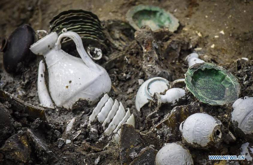
Archaeological digs confirm this reality, such as the wreck of a XIVth-century junk found off the coast of Korea, in which over 10,000 pieces of ceramic were discovered.
During this period, coastal trade gradually shifted from the hands of Arab traders to those of Chinese merchants. Trade expanded, notably with the inclusion of Korea and the integration of Japan, the Malabar coast of India, the Persian Gulf and the Red Sea into existing trade networks.
China exported tea, silk, cotton, porcelain, lacquers, copper, dyes, books and paper. In return, it imported luxury goods and raw materials, including rare woods, precious metals, precious and semi-precious stones, spices and ivory.
Copper coins from the Song period have been discovered in Sri Lanka, and porcelain from this period has been found in East Africa, Egypt, Turkey, some Gulf states and Iran, as well as in India and Southeast Asia.
The Importance of Korea and the Kingdom of Silla
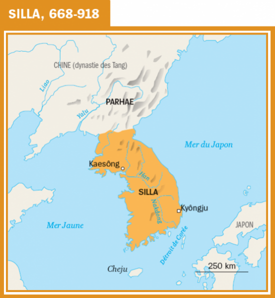
During the first millennium, culture and philosophy flourished on the Korean peninsula. A well-organized and well-protected trading network with China and Japan operated there.
On the Japanese island of Okino-shima, numerous historical traces bear witness to the intense exchanges between the Japanese archipelago, Korea and the Asian continent.
Excavations carried out in ancient tombs in Gyeongju, today a South Korean city of 264,000 inhabitants and capital of the ancient Kingdom of Silla (from 57 BC to 935), which controlled most of the peninsula from the VIIth to the IXth century, demonstrate the intensity of this kingdom’s exchanges with the rest of the world, via the Silk Road.
Indonesia, a Major Maritime Power at the Heart of the Maritime Silk Road
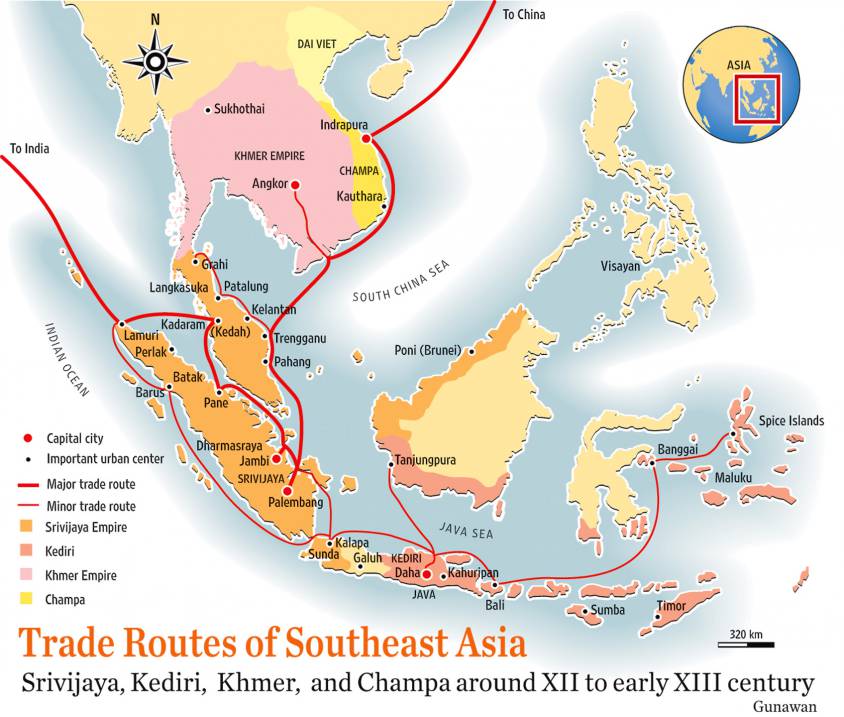
In Indonesia, Malaysia and southern Thailand, the Kingdom of Sriwijaya (VIIth to XIIIth centuries) played a major role as a maritime trading post, storing high-value goods from the region and beyond for later sale by sea. In particular, Sriwijaya controlled the Strait of Malacca, the essential sea passage between India and China.
At the height of its power in the XIth century, Sriwijaya’s network of ports and trading posts traded a vast array of products and commodities: rice, cotton, indigo and silver from Java, aloe (a succulent plant of African origin), vegetable resins, camphor, ivory and rhinoceros horns, tin and gold from Sumatra, rattan, redwoods and other rare woods, gems from Borneo, rare birds and exotic animals, iron, sandalwood and spices from East Indonesia, India and Southeast Asia, and porcelain, lacquer, brocade, textiles and silk from China.
With its capital at Palembang (population 1.7 million) on the Musi River in what is now the southern province of Sumatra, this Hindu-Buddhist-inspired kingdom, which flourished from the VIIIth to the XIIIth century, was the first major Indonesian kingdom and the country’s first maritime power.
By the VIIth century, it ruled a large part of Sumatra, the western part of Java and a significant part of the Malay Peninsula. It extended as far north as Thailand, where archaeological remains of Sriwijaya cities still exist.
Buddhism on the Maritime Silk Road
The museum in Palembang (today Indonesia) – a town where Chinese, Indian, Arab and Yemeni communities, each with their own particular institutions, have co-prospered for generations – tells a wonderful story of how the Maritime Silk Road generated exemplary mutual cultural enrichment.
Buddhism was closely tied to international or cross-boundary trade. Early inscriptions indicate it was common for seafarers to pray to the Buddha for a safe voyage.
The maritime routes were very challenging as they were often beset with cyclones and typhoons, and piracy was an ever-present danger.
As a consequence, merchant support for Buddhism along these travel routes helped to establish monastic life far beyond India. Monks and nuns also took passage on these trading ships, and the merchants sought good karma by helping them travel to spread the teachings of the Buddha.
Madagascar, Sanskrit and the Cinnamon Road
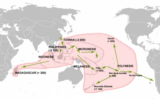
Map of the expansion of Austronesian languages.
Today, Madagascar is inhabited by Blacks and Asians. DNA tests have confirmed what has long been known: many of the island’s inhabitants are descended from Malay and Indonesian sailors who set foot on the island around the year 830, when the Sriwijaya Empire extended its maritime influence towards Africa.
Further evidence of this presence is the fact that the language spoken on the island borrows Sanskrit and Indonesian words.
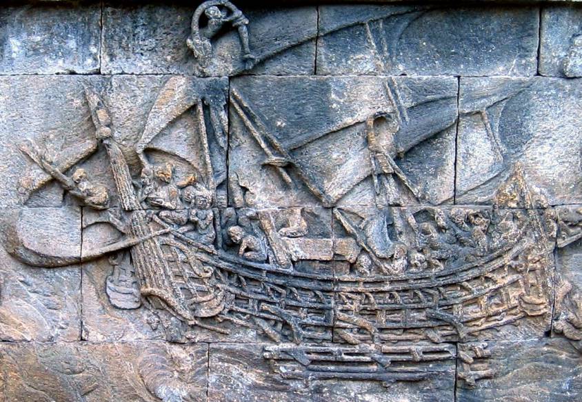
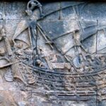
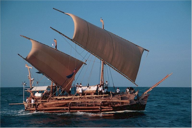
To demonstrate the feasibility of such sea voyages, in 2003 a team of researchers sailed from Indonesia to Ghana via Madagascar aboard the Borobudur, a reconstruction of one of the sailing ships featured in many of the 1,300 bas-reliefs decorating the 8th-century Buddhist temple of Borobudur on the island of Java in Indonesia.
Many believe that this vessel is a representation of those once used by Indonesian merchants to cross the ocean to Africa. Indonesian navigators usually used relatively small boats. To ensure balance, they fitted them with outriggers, both double (ngalawa) and single.
Their boats, whose hulls were carved from a single tree trunk, were called sanggara. Merchants from the Indonesian archipelago could reach as far east as Hawaii and New Zealand, a distance of over 7,000 km.
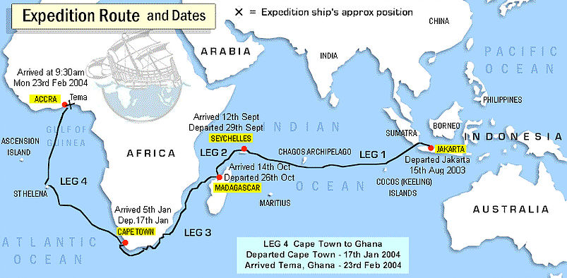
In any case, the researchers’ boat, equipped with an 18-meter-high mast, managed to cover the Jakarta – Maldives – Cape of Good Hope – Ghana route, a distance of 27,750 kilometers, or more than half the circumference of the Earth!
The expedition aimed to retrace a very specific route: the cinnamon route, which took Indonesian merchants all the way to Africa to sell spices, including cinnamon, a highly sought-after commodity at the time. Cinnamon was already highly prized in the Mediterranean basin long before the Christian era.
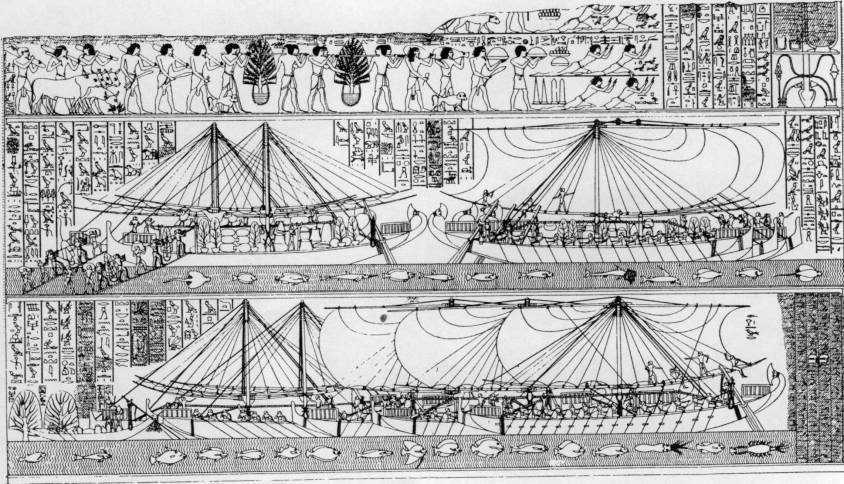
On the walls of the Egyptian temple at Deir el-Bahari (Luksor), a painting depicts a major naval expedition said to have been ordered by Queen Hatshepsut, who reigned from 1503 to 1482 BC. Around the painting, hieroglyphs explain that these ships carried various species of plants and fragrant essences destined for the cult. One of these was cinnamon. Rich in aroma, it was an important component of ritual ceremonies in the kingdoms of Egypt.
Cinnamon originally grew in Central Asia, the eastern Himalayas and northern Vietnam. The southern Chinese transplanted it from these regions to their own country and cultivated it under the name gui zhi.
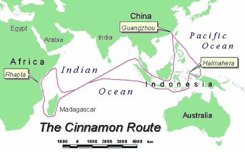
From China, gui zhi spread throughout the Indonesian archipelago, finding a very fertile home there, particularly in the Moluccas. In fact, the international cinnamon trade was a monopoly held by Indonesian merchants. Indonesian cinnamon was prized for its excellent quality and highly competitive price.
The Indonesians sailed great distances, up to 8,000 km, across the Indian Ocean to Madagascar and northeast Africa. From Madagascar, products were transported to Rhapta, in a coastal region that later became known as Somalia. From there, Arab merchants shipped them north to the Red Sea.
The Strait of Malacca
For China, the Strait of Malacca has always represented a major strategic interest. When the great Chinese admiral Zheng He led the first of his expeditions to India, the Near East and East Africa between 1405 and 1433, a Chinese pirate by the name of Chen Zuyi took control of Palembang.
Zheng He defeated Chen’s fleet and captured the survivors. As a result, the strait once again became a safe shipping route.
According to tradition, a prince of Sriwijaya, Parameswara, took refuge on the island of Temasek (present-day Singapore), but eventually settled on the west coast of the Malay Peninsula around 1400 and founded the city of Malacca, which would become the largest port in Southeast Asia, both successor to Sriwijaya and precursor to Singapore.
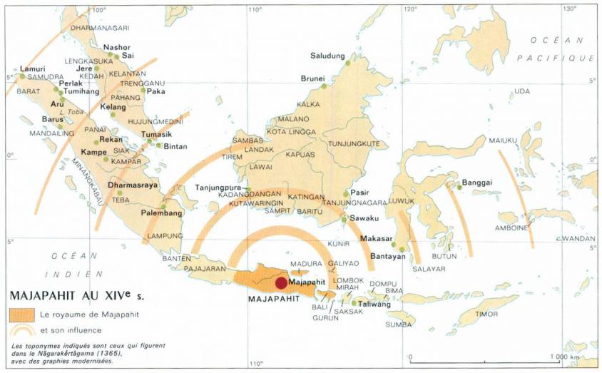
Following the decline of Sriwijaya, the Kingdom of Majapahit (1292-1527), founded at the end of the XIIIth century on the island of Java, came to dominate most of present-day Indonesia.
This was the period when Arab sailors began to settle in the region.
The Majapahit kingdom established relations with the Kingdom of Champa (192-1145; 1147-1190; 1220-1832) (South Vietnam), Cambodia, Siam (Thailand) and southern Myanmar.
The Majapahit kingdom also sent missions to China. As its rulers extended their power to other islands and sacked neighboring kingdoms, they sought above all to increase their share and control of the trade in goods passing through the archipelago.
The island of Singapore and the southernmost part of the Malay Peninsula was a key crossroads on the ancient maritime Silk Road.
Archaeological excavations in the Kallang estuary and along the Singapore River have uncovered thousands of shards of glass, natural and gold beads, ceramics and Chinese coins from the Northern Song period (960-1127).
The rise of the Mongol Empire in the middle of the XIIIth century led to an increase in seaborne trade and contributed to the vitality of the Maritime Silk Road.
Marco Polo, after a 17-year overland journey to China, returned by ship. After witnessing a shipwreck, he sailed from China to Sumatra in Indonesia, before setting foot on land again at Hormuz in Persia (Iran).
Under the Yuan and Ming Dynasties
Under the Song dynasty, large quantities of silk goods were exported to Japan. Under the Yuan dynasty (1271-1368), the government set up the Shi Bo Si, a trade office, in a number of ports, including Ningbo, Canton, Shanghai, Ganpu, Wenzhou and Hangzhou, enabling silk exports to Japan.
During the Tang, Song and Yuan dynasties, and at the beginning of the Ming dynasty, each port set up an oceanic trading department to manage all foreign maritime trade.
Maritime travel was dependent on the seasonal winds: the summer monsoons blow from the south-west (May to September) and reverse direction in the winter (October to April). As a result, seafaring merchants developed sailing circuits that allowed them to use the monsoon winds to travel long distances, then return home when the wind patterns shifted.
Trade with southern India and the Persian Gulf flourished. Trade with East Africa also developed with the monsoon season, bringing ivory, gold and slaves. In India, guilds began to control Chinese trade on the Malabar coast and in Sri Lanka.
Trade relations became more formalized, while remaining highly competitive. Cochin and Kozhikode (Calicut), two major cities in the Indian state of Kerala, competed to dominate this trade.
Admiral Zheng He’s Maritime Explorations
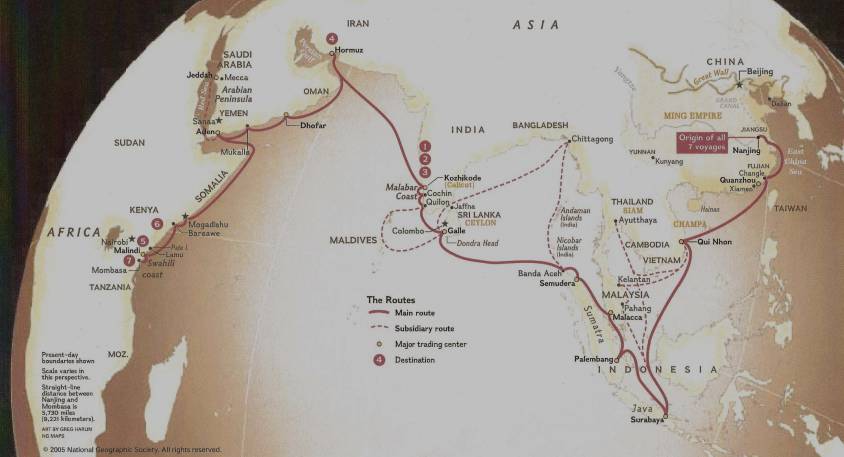
Chinese maritime exploration reached its apogee in the early XVth century under the Ming dynasty (1368-1644), which chose a Muslim court eunuch, Admiral Zheng He, to lead seven diplomatic naval expeditions.
Financed by Emperor Ming Yongle, these peaceful missions to Southeast Asia, East Africa, the Indian Ocean, the Persian Gulf and the Red Sea were intended above all to demonstrate the prestige and grandeur of China and its Emperor. The aim was also to recognize some thirty states and establish political and commercial relations with them.
In 1409, prior to one of these expeditions, the Chinese admiral Zheng He asked craftsmen to make a carved stone stele in Nanjing, the present-day capital of Jiangsu province (eastern China). The stele traveled with the flotilla and was left in Sri Lanka as a gift to a local Buddhist temple. Prayers to the deities in three languages – Chinese, Persian and Tamil – were engraved on the stele. It was found in 1911 in the town of Galle, in south-west Sri Lanka, and a replica is now in China.
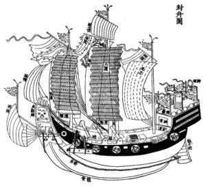
Zheng’s armada was made up of armed bulk carriers, the most modest being larger than Columbus’ caravels. The largest were 100 meters long and 50 meters wide. According to Ming chronicles of the time, an expedition could comprise 62 ships, each carrying 500 people. Some carried military cavalry, others tanks of drinking water. Chinese shipbuilding was ahead of its time. The technique of hermetic bulkheads, imitating the internal structure of bamboo, offered incomparable safety. It became the standard for the Chinese fleet before being copied by the Europeans 250 years later. Compasses and celestial maps painted on silk were also used.
The synergy that may have existed between Arab, Indian and Chinese sailors, all men of the sea who fraternized in the face of ocean adversity, was impressive. For example, some historians believe that the name « Sindbad the Sailor », which appears in the Persian tale of a sailor’s adventures from the time of the Abbasid dynasty (VIIIth century) and was included in the Tales of the One Thousand and One Nights, derives from the word Sanbao, the honorary nickname given by the Chinese Emperor to Admiral Zheng He, literally meaning « The Three Jewels », i.e. the three indissociable capital virtues: essence, breath, and spirit.

Maritime museums in China (Hong Kong, Macau, Fuzhou, Tianjin and Nanjing), Singapore, Malaysia and Indonesia showcase Admiral Zheng’s expeditions.
However, at least twelve other admirals carried out similar expeditions to Southeast Asia and the Indian Ocean.
In 1403, Admiral Ma Pi led an expedition to Indonesia and India. Wu Bin, Zhang Koqing and Hou Xian made others. After lightning caused a fire in the Forbidden City, a dispute broke out between the eunuch class, supporters of the expeditions, and the learned mandarins, who obtained the cessation of expeditions deemed too costly. The last voyage took place between 1430 and 1433, 64 years before the Portuguese explorer Vasco da Gama arrived in 1497.
Japan, for its part, similarly restricted its contacts with the outside world during the Tokugawa period (1600-1868), although its trade with China was never suspended. It was only after the Meiji Restoration in 1868 that a Japan open to the world re-emerged.
Withdrawing into themselves, trade with both China and Japan fell into the hands of maritime trading posts such as Malacca in Malaysia or Hi An in Vietnam, two cities now recognized by Unesco as world heritage sites. H?i An was a major stopover port on the sea route linking Europe and Japan via India and China. In the shipwrecks found at Hi An, researchers have discovered ceramics awaiting their departure for Sinai in Egypt.
History of Chinese Ports
Over the years, the main ports on the Maritime Silk Road have changed. From the 330s onwards, Canton and Hepu were the two most important ports. However, Quanzhou replaced Canton from the end of the Song to the end of the Yuan dynasty. At that time, Quanzhou in Fujian province and Alexandria in Egypt were considered the world’s largest ports. Due to the policy of closure to the outside world imposed from 1435 and the influence of war, Quanzhou was gradually replaced by the ports of Yuegang, Zhangzhou and Fujian.
From the beginning of the IVth century, Canton was an important port on the Silk Road. Gradually, under the Tang and Song dynasties, it became not only the largest, but also the most renowned port of the Orient worldwide. During this period, the sea route linking Canton to the Persian Gulf via the South China Sea and the Indian Ocean was the longest in the world.
Although later supplanted by Quanzhou under the Yuan dynasty, Canton remained China’s second-largest commercial port. Compared with the others, it is considered to have been a consistently prosperous port over the 2,000-year history of the Maritime Silk Road.
The Tributary System of 1368
China’s last imperial dynasty, the Qing, reigned from 1644 to 1912.
Since the arrival of the Ming dynasty, maritime trade with China proceded in two different ways:
- The Chinese « tributary system » ;
- The Canton system (1757-1842).
Born under the Ming in 1368, the « tributary system » reached its apogee under the Qing. It took the refined form of a mutually beneficial, inclusive hierarchy.
States adhering to it showed respect and gratitude by regularly presenting the Emperor with tribute made up of local products and performing certain ritual ceremonies, notably the « kowtow » (three genuflections and nine prostrations). They also demanded the Emperor’s investiture of their leaders and adopted the Chinese calendar. In addition to China, they included Japan, Korea, Vietnam, Thailand, Indonesia, the Ryükyü Islands, Laos, Myanmar and Malaysia.
Paradoxically, while occupying a central cultural status, the tributary system offered its vassals the status of sovereign entities, enabling them to exercise authority over a given geographical area.
The Emperor won their submission by showing virtuous concern for their welfare and promoting a doctrine of non-intervention and non-exploitation. Indeed, according to historians, in financial terms, China was never directly enriched by the tributary system. In general, all travel and subsistence expenses for tributary missions were covered by the Chinese government. In addition to the costs of running the system, the gifts offered by the Emperor were generally far more valuable than the tributes he received. Each tributary mission was entitled to be accompanied by a large number of merchants, and once the tribute had been presented to the Emperor, trade could begin.
It should be noted that when a country lost its status as a tributary state as a result of a disagreement, it would try at all costs, and sometimes violently, to be allowed to pay tribute again.
The Canton System of 1757
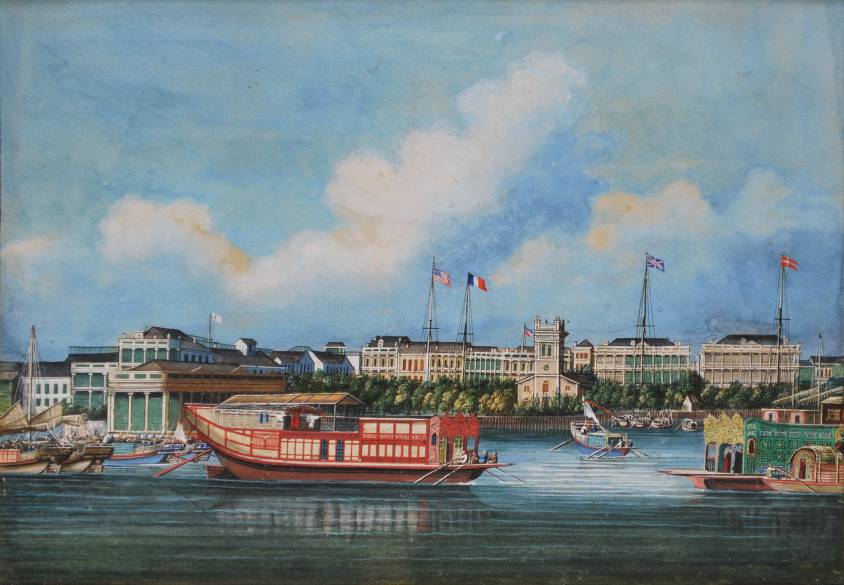
The second system concerned foreign, mainly European, powers wishing to trade with China. This involved the port of Guangzhou (then called Canton), the only port accessible to Westerners.
This meant that merchants, notably those of the British East India Company, could dock not in the port but off the coast of Canton, from October to March, during the trading season. It was in Macao, then a Portuguese possession, that the Chinese provided them with permission to do so. The Emperor’s representatives would then authorize Chinese merchants (hongs) to go on board to trade with foreign ships, while instructing them to collect customs duties before they left.
This way of trading expanded at the end of the XVIIIth century, particularly with the strong English demand for tea.
In fact, it was Chinese tea from Fujian that American « insurgents » threw into the sea during the famous « Boston Tea Party » in December 1773, one of the first events against the British Empire that sparked off the American Revolution.
Products from India, particularly cotton and opium, were exchanged by the East India Company for tea, porcelain and silk.
The customs duties collected by the Canton system were a major source of revenue for the Qing dynasty, even though it banned the purchase of opium from India. This restriction imposed by the Chinese Emperor in 1796 led to the outbreak of the Opium Wars, the first as early as 1839.
At the same time, rebellions broke out in the 1850-60s against the weakened Qing reign, coupled with further wars against hostile European powers.
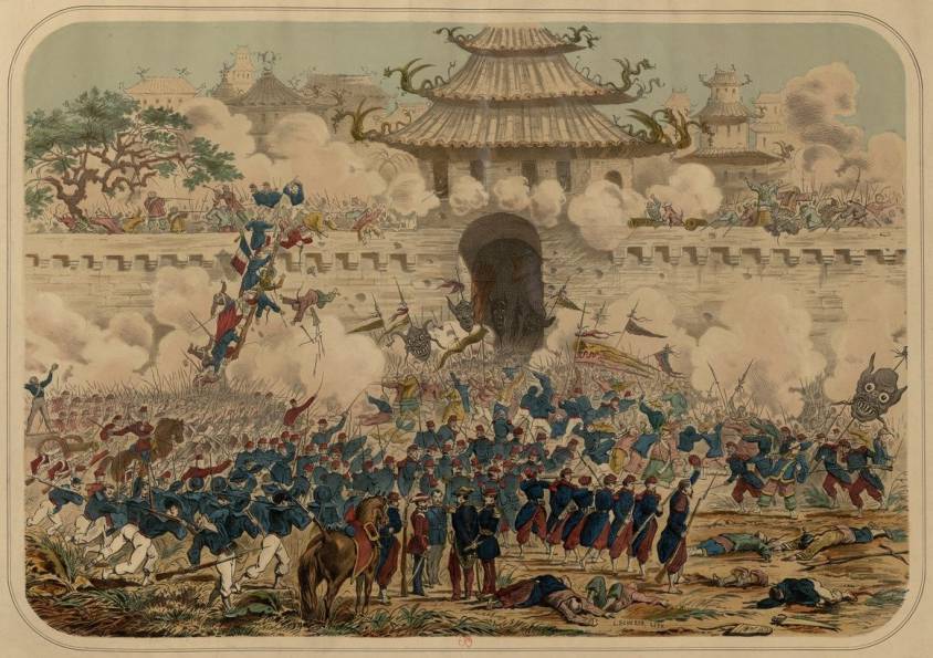
In 1860, the former Summer Palace (Yuanming Park), with its collection of pavilions, temples, pagodas and libraries – the residence of the Qing dynasty emperors 15 kilometers northwest of Beijing’s Forbidden City – was ravaged by British and French troops during the Second Opium War.
This assault goes down in history as one of the worst acts of cultural vandalism of the XIXth century. The Palace was sacked a second time in 1900 by an eight-nation alliance against China.
Today, a statue of Victor Hugo and a text he wrote against Napoleon III and the destruction of French imperialism can be admired there, as a reminder that this was not the work of a nation, but of a government.
By the end of the First World War, China had 48 open ports where foreigners could trade according to their own jurisdictions.
The 20th century was an era of revolution and social change. The founding of the People’s Republic of China in 1949 led to inward-looking attitudes.
It wasn’t until 1978 that Deng Xiaoping announced a policy of opening up to the outside world in order to modernize the country.

In the XXIst century, thanks to the One Belt (economic) One Road (maritime) Initiative launched by President Xi Jingping, China is re-emerging as a major world power offering mutually beneficial cooperation in the service of a better shared future for mankind.
The ancient practice of debt cancellation
While anyone with a modicum of rationality knows that a huge proportion of the world’s debts are absolutely unpayable, it’s a fact that today any debt cancellation, however odious or illegitimate, remains taboo.
By Karel Vereycken, December 2020.
Debt repayment is presented by heads of state and government, central banks, the IMF and the mainstream press as imperative, inevitable, indisputable, compulsory. Citizens have elected their governments, so they must resign themselves to paying the debt. For not to pay is more than violating a symbol: it is to exclude oneself from civilization, and to renounce in advance any new credit that is granted only to « good payers ». What counts is not the effectiveness of the act, but the expression of one’s « good faith », i.e. one’s willingness to submit to the strongest. The only possible discussion is how to modulate the distribution of the necessary sacrifices.
It seems that the ultra-liberal, monetarist model that has been surreptitiously imposed on us is that of the Roman Empire: zero debt for states and cities, and no debt forgiveness for citizens!
In his treatise on Duties (De officiis), written in 44-43, Cicero, who had just quelled a revolt by people demanding a debt remission, justifies the radical nature of his policy towards indebtedness:
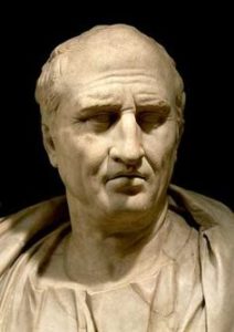
« What does the establishment of new debt accounts [i.e., remission] mean, if not that you buy land with my money, that you have this land, and that I don’t have my money? That’s why we have to make sure there are no debts, which can harm the state. There are many ways of avoiding it, but if there are debts, not in such a way that the rich lose their property and the debtors acquire the property of others. Indeed, nothing maintains the State more strongly than good faith (fides), which cannot exist if there is no need to pay one’s debts. Never has anyone acted more forcefully to avoid paying their debts than under my Consulate. It was attempted by men of all kinds and ranks, with weapons in hand, and by setting up camps. But I resisted them in such a way that this entire evil was eliminated from the State. »
What has been carefully concealed is that another human practice has also existed: moratoria, partial and even generalized debt cancellations have taken place repeatedly throughout history and were carried out according to different contexts.
Often, proclamations of generalized debt cancellation were the initiative of self-preservation-minded rulers, aware that the only way to avoid complete social breakdown was to declare a « washing of the shelves » – those on which consumer debts were inscribed – cancelling them to start afresh.
The American anthropologist David Graeber, in Debt, the first 5000 years (2011), pointed out that the first word we have for « freedom » in any human language is Sumerian amargi, meaning freed from debt and, by extension, freedom in general, the literal meaning being « return to the mother » insofar as, once debts were cancelled, all debt slaves could return home.
Debt cancellations were sometimes the result of bitter social struggles, wars and crises. What is certain is that debt has never been a detail of history.
David Graeber sums it up:
« For millennia, the struggle between rich and poor has largely taken the form of conflicts between creditors and debtors – disputes over the justice or injustice of interest payments, peonage, amnesty, property seizure, restitution to the creditor, confiscation of sheep, seizure of vineyards and the sale of the debtor’s children as slaves. And over the last 5,000 years, with remarkable regularity, popular insurrections have begun in the same way: with the ritual destruction of debt registers – tablets, papyri, ledgers or other media specific to a particular time and place. (After which, the rebels generally attacked cadastres and tax registers.) »
And as the great ancient scholar Moses Finley was fond of saying,
« All revolutionary movements have had the same program: cancellation of debts and redistribution of land. »
Let us now examine some historical precedents for voluntary debt forgiveness.
Debt cancellation in Mesopotamia
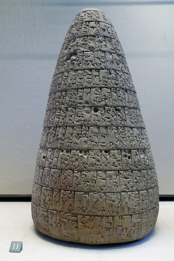
The earliest known debt cancellation was proclaimed in Mesopotemia by Entemena of Lagash c. 2400 BCE.
One of his successors, Urukagina, who was the last ruler of the 1st Dynasty of Lagash, is known for his code of rules that includes debt cancelation.
Urukagina’s code is the first recorded example of government reform, seeking to achieve a higher level of freedom and equality by limiting the power of priesthood and a usurous land-owner oligarchy. Usury and seizure of property for debt payment were outlawed. « The widow and the orphan were no longer at the mercy of the powerful man ».
Similar measures were enacted by later Sumerian, Babylonian and Assyrian rulers of Mesopotamia, where they were known as « freedom decrees » (ama-gi in Sumerian).
This same theme exists in an ancient bilingual Hittite–Hurrian text entitled « The Song of Debt Release ».
The reign of Hammurabi, King of Babylon (located in present-day Iraq), began in 1792 BC and lasted 42 years.
The inscriptions preserved on a 2-meter-high stele in the Louvre are known as the « Hammurabi Code ». It was placed in a public square in Babylon. If it is a long, very severe code of justice, prescribing the application of the law of retaliation (« an eye for an eye, a tooth for a tooth »), its epilogue nevertheless proclaims that « the powerful cannot oppress the weak, justice must protect the widow and the orphan (…) in order to render justice to the oppressed ».
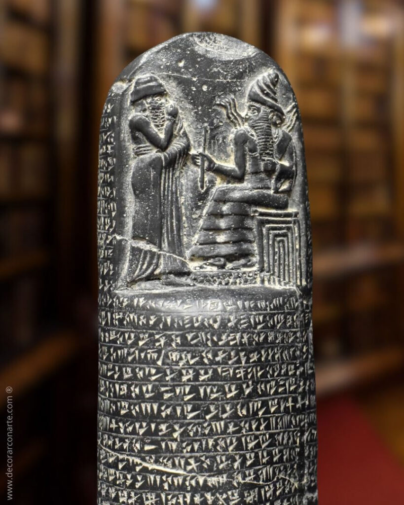
Hammurabi, like the other rulers of the Mesopotamian city-states, repeatedly proclaimed a general cancellation of citizens’ debts to public authorities, their high officials and dignitaries.
Thanks to the deciphering of numerous documents written in cuneiform, historians have found indisputable evidence of four general debt cancellations during Hammurabi’s reign (at the beginning of his reign in 1792, in 1780, in 1771 and in 1762 BC).
Babylonian society was predominantly agricultural. The temple and palace, and the scribes and craftsmen they employed, depended for their sustenance on a vast peasantry from whom land, tools and livestock were rented.
In exchange, each farmer had to offer part of his production as rent. However, when climatic hazards or epidemics made normal production impossible, producers went into debt.
The inability of peasants to repay debts could also lead to their enslavement (family members could also be enslaved for debt).
The Hammurabi Code obviously wanted to change this. Article 48 of the Code of Laws states:
« Whoever owes a loan, and a storm buries the grain, or the harvest fails, or the grain does not grow for lack of water, need not give any grain to the creditor that year, he wipes the tablet of the debt in the water and pays no interest for that year. »
This ideal of justice is notably supported by the terms kittum, « justice as the guarantor of public order », and « justice as the restoration of equity. » It was asserted in particular during the « edicts of grace » (designated by the term mîsharum), a general remission of public and private debts in the kingdom (including the release of people working for another person to repay a debt).
Thus, to preserve the social order, Hammurabi and the ruling power, acting in their own interests and in the interests of society’s future, periodically agreed to cancel all debts and restore the rights of peasants, in order to save the threatened old order in times of crisis, or as a kind of reset at the beginning of a sovereign’s reign.
Proclamations of general debt cancellation are not confined to the reign of Hammurabi; they began long before him and continued afterwards. There is evidence of debt cancellations as far back as 2400 BC, six centuries before Hammurabi’s reign, in the city of Lagash (Sumer); the most recent date back to 1400 BC in Nuzi.
In all, historians have accurately identified some thirty general debt cancellations in Mesopotamia between 2400 and 1400 BC.
These proclamations of debt cancellation were the occasion for great festivities, usually during the annual spring festival. Under the Hammurabi dynasty, the tradition of destroying the tablets on which debts were written was established.
In fact, the public authorities kept precise accounts of debts on tablets kept in the temple. Hammurabi died in 1749 BC after a 42-year reign. His successor, Samsuiluna, cancelled all debts to the state and decreed the destruction of all debt tablets except those relating to commercial debts.
When Ammisaduqa, the last ruler of the Hammurabi dynasty, acceded to the throne in 1646 BC, the general cancellation of debts he proclaimed was very detailed. The aim was clearly to prevent certain creditors from taking advantage of certain families. The annulment decree stipulates that official creditors and tax collectors who have expelled peasants must compensate them and return their property, on pain of execution.
After 1400 BC, no deeds of debt cancellation have been found, as the tradition has been lost. Land was taken over by large private landowners, and debt slavery returned.
In Egypt
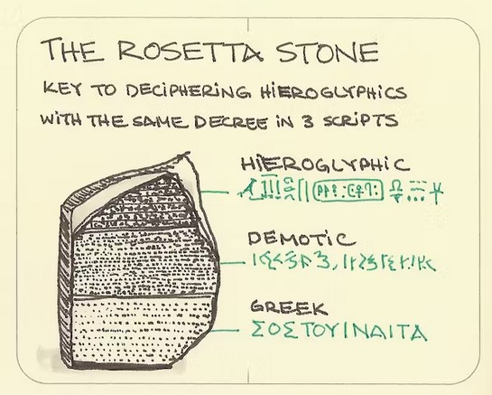
In Ancient Egypt interest-bearing debt did not exist for most of its history. When it started spreading in the Late Period, the rulers of Egypt regulated it and a number of debt remissions are known to have occurred during the Ptolemaic era, including the one whose proclamation was inscribed on the Rosetta Stone.
Now on display at the British Museum in London, the « Rosetta Stone » was discovered on July 15, 1799 at el-Rashid (Rosetta) by one of Napoleon’s soldiers during the Egyptian campaign. It contains the same text written in hieroglyphs, demotic (Egyptian cursive script) and Greek, giving Jean-François Champollion (1790-1832) the key to the passage from one language to another.
This was a decree issued by Pharaoh Ptolemy V on March 27, 196 BC, announcing an amnesty for debtors and prisoners. The Greek Ptolemy dynasty that ruled Egypt institutionalized the regular cancellation of debts.
It was perpetuating known practices, since Greek texts mention that Pharaoh Bakenranef, who ruled Lower Egypt from c. 725 to 720 BC, had promulgated a decree abolishing debt slavery and condemning debt imprisonment.
TRANSCRIPTION OF THE PHARAOH’S DECREE
ON THE ROSETTA STONE:
Assembled the Chief Priests and Prophets there and those who enter the inner temple to worship the gods, and the Fanbearers and Sacred Scribes and all the other priests of the temples of the earth who have come to meet the king at Memphis, for the feast of the Assumption of PTOLEMEE, THE LIVING FOREVER, THE BELOVED OF PTAH, THE GOD EPIPHANES EUCHARISTOS, the successor of his father, All assembled in the temple of Memphis on this day when it was declared:
“that King PTOLEMEE, THE LIVING FOREVER, THE BELOVED OF PTAH, THE GOD EPIPHANES EUCHARISTOS, the son of King Ptolemy and Queen Arsinoe, the Philopator Gods, both benefactors of the temple and those who dwell therein, as well as their subjects, being a god from a god and the goddess loves Horus the son of Isis and Osiris who avenged his father Osiris by being favorably disposed towards the gods, delivered to the revenues of the temples silver and corn and undertook much expenditure for the prosperity of Egypt, and the maintenance of the temples, and was generous to all out of his own resources ;
“and exempted them from some of the revenues and taxes levied in Egypt and alleviated others so that his people and all others could be in prosperity during his reign ;
“and that he cleared the debts to the crown for many Egyptians and for the rest of the kingdom; ”
The existence of this decree therefore confirms that the practice had existed for many centuries.
The Greek historian Diodorus Siculus (Ist Century BC) provides the following rationale for abolishing the debt bondage by Pharaoh Bakenranef:
« For it would be absurd… that a soldier, at the moment perhaps when he was setting forth to fight for his fatherland, should be haled to prison by his creditor for an unpaid loan, and that the greed of private citizens should in this way endanger the safety of all »
As one can see here, one of the very pragmatic reasons for debt cancellation was that the Pharaoh wanted to have a peasantry capable of producing enough food and, if need be, able to take part in military campaigns. For both of these reasons, it was important to ensure that peasants were not expelled from their lands under the thumb of creditors.
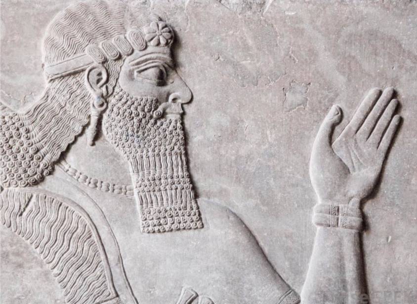
In another part of the region, the Assyrian emperors of the 1st millennium BC also adopted the tradition of debt cancellation.
In Greece: Solon of Athens

In Greece, the Athenian lawmaker Solon (c. 638 BC–558 BC), in order to rectify the widespread serfdom and slavery that had run rampant by the 6th century BCE, introduced a set of laws nown as the Seisachtheia introducing debt relief.
Before Solon, according to the account of the Constitution of the Athenians attributed to Aristotle, debtors unable to repay their creditors would surrender their land to them, then becoming hektemoroi, i.e. serfs who cultivated what used to be their own land and gave one sixth of produce to their creditors. However, should the debt exceed the perceived value of debtor’s total assets, then the debtor and his family would become the creditor’s slaves as well. The same would result if a man defaulted on a debt whose collateral was the debtor’s personal freedom. The fight for debt relief and the fight to abolish slavery were in practice identical.
Solon’s seisachtheia laws immediately cancelled all outstanding debts, retroactively emancipated all previously enslaved debtors, reinstated all confiscated serf property to the hektemoroi, and forbade the use of personal freedom as collateral in all future debts. The laws instituted a ceiling to maximum property size – regardless of the legality of its acquisition (i.e. by marriage), meant to prevent excessive accumulation of land by powerful families.
In the Torah and Old Testament
Social justice, particularly in the form of forgiving debts that shackle the poor to the rich, is a leitmotif in the history of Judaism. It was practiced in Jerusalem in the 5th century BC.
The writing of the Torah was completed at this time. Deuteronomy, 15 states:

The Year for Canceling Debts
15 At the end of every seven years you must cancel debts.
2 This is how it is to be done: Every creditor shall cancel any loan they have made to a fellow Israelite. They shall not require payment from anyone among their own people, because the Lord’s time for canceling debts has been proclaimed.
3 You may require payment from a foreigner, but you must cancel any debt your fellow Israelite owes you.
4 However, there need be no poor people among you, for in the land the Lord your God is giving you to possess as your inheritance, he will richly bless you,
5 if only you fully obey the Lord your God and are careful to follow all these commands I am giving you today.
6 For the Lord your God will bless you as he has promised, and you will lend to many nations but will borrow from none. You will rule over many nations but none will rule over you.
7 If anyone is poor among your fellow Israelites in any of the towns of the land the Lord your God is giving you, do not be hardhearted or tightfisted toward them.
8 Rather, be openhanded and freely lend them whatever they need.
9 Be careful not to harbor this wicked thought: “The seventh year, the year for canceling debts, is near,” so that you do not show ill will toward the needy among your fellow Israelites and give them nothing. They may then appeal to the Lord against you, and you will be found guilty of sin.
10 Give generously to them and do so without a grudging heart; then because of this the Lord your God will bless you in all your work and in everything you put your hand to.
11 There will always be poor people in the land. Therefore I command you to be openhanded toward your fellow Israelites who are poor and needy in your land.
Thus, the Israelites were obliged to free Hebrew slaves who had sold themselves to them for debt, and to offer them some of the produce of their small livestock, their fields and their wine presses, so that they would not return home empty-handed.
As the law is too rarely applied, Leviticus reaffirms it by modulating it:
The Year of Jubilee
8 “‘Count off seven sabbath years—seven times seven years—so that the seven sabbath years amount to a period of forty-nine years.
9 Then have the trumpet sounded everywhere on the tenth day of the seventh month; on the Day of Atonement sound the trumpet throughout your land.
10 Consecrate the fiftieth year and proclaim liberty throughout the land to all its inhabitants. It shall be a jubilee for you; each of you is to return to your family property and to your own clan.
11 The fiftieth year shall be a jubilee for you; do not sow and do not reap what grows of itself or harvest the untended vines.
12 For it is a jubilee and is to be holy for you; eat only what is taken directly from the fields.
13 “‘In this Year of Jubilee everyone is to return to their own property.
14 “‘If you sell land to any of your own people or buy land from them, do not take advantage of each other.
15 You are to buy from your own people on the basis of the number of years since the Jubilee. And they are to sell to you on the basis of the number of years left for harvesting crops.
16 When the years are many, you are to increase the price, and when the years are few, you are to decrease the price, because what is really being sold to you is the number of crops.
17 Do not take advantage of each other, but fear your God. I am the Lord your God.
Today, some will tell you that under these conditions, a year before the jubilee date, credit would necessarily be scarce and expensive, and that debt would thus find its limit!
This is a mistake, because to ensure that the law is followed, the codes describe in detail how purchases and sales of goods between private individuals must be carried out according to the number of years elapsed since the previous jubilee (i.e., the number of years remaining before the goods must be returned to their previous owner).
Another passage, this time from the prophet Jeremiah, vividly illustrates the scope of the law on the remission of debts.
Faced with the advance of enemy armies towards Jerusalem in 587 B.C., Jeremiah supports, in God’s name, the undertaking of King Zedekiah (then ruler of the Kingdom of Judea), who demands the immediate release of all those enslaved for debt from the powerful forces of his kingdom (Jer. 34:8-17).
Jeremiah forcefully recalls the ancient demand for the freeing of slaves… which the king, in fact, needs to patriotically reunite the social classes before the battle, and give himself sufficient troops free of all servile obligations!

A passage in the Book of (the prophet) Nehemiah (447 BC), the governor of Persian Judea under Artaxerxes I of Persia (465–424 BC), influenced by the ancient Mesopotamian tradition, also proclaims the cancellation of debts owed by indebted Jews to their rich compatriots.
The social situation Nehemiah discovered in Judea was appalling. To remedy the problem, Nehemiah placed the law of debt relief within a religious framework, the Covenant with Yahweh. From then on, it was God himself who commanded the forgiveness of debts and the liberation of slaves and their land, for the land belonged to God alone.
Nehemiah Helps the Poor
« Now the men and their wives raised a great outcry against their fellow Jews.
2 Some were saying, “We and our sons and daughters are numerous; in order for us to eat and stay alive, we must get grain.”
3 Others were saying, “We are mortgaging our fields, our vineyards and our homes to get grain during the famine.”
4 Still others were saying, “We have had to borrow money to pay the king’s tax on our fields and vineyards.
5 Although we are of the same flesh and blood as our fellow Jews and though our children are as good as theirs, yet we have to subject our sons and daughters to slavery. Some of our daughters have already been enslaved, but we are powerless, because our fields and our vineyards belong to others.”
6 When I heard their outcry and these charges, I was very angry.
7 I pondered them in my mind and then accused the nobles and officials. I told them, “You are charging your own people interest!” So I called together a large meeting to deal with them
8 and said: “As far as possible, we have bought back our fellow Jews who were sold to the Gentiles. Now you are selling your own people, only for them to be sold back to us!” They kept quiet, because they could find nothing to say.
9 So I continued, “What you are doing is not right. Shouldn’t you walk in the fear of our God to avoid the reproach of our Gentile enemies?
10 I and my brothers and my men are also lending the people money and grain. But let us stop charging interest!
11 Give back to them immediately their fields, vineyards, olive groves and houses, and also the money you are charging them—one percent of the money, grain, new wine and olive oil.”
12 “We will give it back,” they said. “And we will not demand anything more from them. We will do as you say.”
If we add to these passages the countless verses forbidding the lending of interest to fellow human beings and the taking of property as collateral, we get an idea of what the Israelites in the land of Canaan had put in place to try and maintain a certain social equilibrium.
Alas, in the first century AD, debt forgiveness and the freeing of slaves from debt were swept away from all Near Eastern cultures, including Judea.
The social situation there had deteriorated to such an extent that Rabbi Hillel was able to issue a decree requiring debtors to sign away their right to debt forgiveness.
In the Bible and New Testament
What happened to debt forgiveness in the New Testament?
While the Acts of the Apostles and the writings of the Fathers of the Church sometimes express a great docility, Jesus’ position on the forgiveness of debts, as reported repeatedly and most forcefully in Luke’s Gospel, chapter 4:16-21, appears to be marked by a revolutionary prophetic breath.
Luke places the passage at the beginning of Jesus’ public life. He makes it a key to everything that follows.
16 Jesus went to Nazareth, where he had been brought up, and on the Sabbath day he went into the synagogue, as was his custom. He stood up to read,
17 and the scroll of the prophet Isaiah was handed to him. Unrolling it, he found the place where it is written:
18 “The Spirit of the Lord is on me,
because he has anointed me
to proclaim good news to the poor.
He has sent me to proclaim freedom for the prisoners
and recovery of sight for the blind,
to set the oppressed free,
19 to proclaim the year of the Lord’s favor.”
20 Then he rolled up the scroll, gave it back to the attendant and sat down. The eyes of everyone in the synagogue were fastened on him.
21 He began by saying to them, “Today this scripture is fulfilled in your hearing.”

Let’s not forget that the « year of the Lord’s favor (Jubilee Year) » to which he called, demanded at once rest for the land, forgiveness of debts and the liberation of slaves.
In the midst of the slave-owning Roman Empire, which fiercely rejected the concept of debt forgiveness, Jesus’ declaration could only be seen as a declaration of war on the ruling system.
Before he was arrested, Jesus made a highly symbolic material gesture: he forcefully overturned the tables of the money-changers in the Jerusalem temple. For the Jewish high priests and the Roman authorities, this was too much.
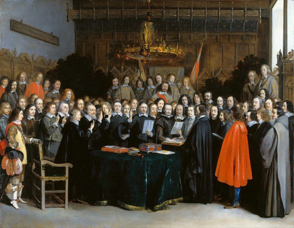
Peace of Westphalia of 1648
In 1648, after five years of negotiations, led by the French diplomat Abel Servien on the instructions of Cardinal Mazarin, the “Peace of Westphalia” was signed, putting an end to the Thirty Years’ War (1618-1648).
Long before the UN Charter, 1648 made national sovereignty, mutual respect and the principle of non-interference the foundations of international law.
But there was more. As we have documented, the peace deal also included the cancelation of debts that had become the very reason for continuing the war.
Unpayable, unsustainable and illegitimate debts, interests, bonds, annuities and financial claims, explicitly identified as fueling a dynamic of perpetual war, were examined, sorted out and reorganized, most often through the cancellation of debts (articles 13 and 35, 37, 38 and 39), through moratoria or debt rescheduling according to specific timetables (article 69).
Article 40 concludes that debt cancellations will apply in most cases, “and yet the Sums of Money, which during the War have been exacted bona fide, and with a good intent, by way of Contributions, to prevent greater Evils by the Contributors, are not comprehended herein. » (Implying that these debts would have to be honored.)
Finally, looking to the future, for Commerce to be “reestablished”, the treaty abolished many tolls and customs established by “private” authorities for they were obstacles to the exchange of physical goods and know-how and hence to mutual development. (Art. 69 and 70).
TREATY OF WESTPHALIA (1648)
Art. 13:
“Reciprocally, the Elector of Bavaria renounces entirely for himself and his Heirs and Successors the Debt of Thirteen Millions, as also all his Pretensions in Upper Austria; and shall deliver to his Imperial Majesty immediately after the Publication of the Peace, all Acts and Arrests obtain’d for that end, in order to be made void and null.”
Art. 35:
“That the Annual Pension of the Lower Marquisate, payable to the Upper Marquisate, according to former Custom, shall by virtue of the present Treaty be entirely taken away and annihilated; and that for the future nothing shall be pretended or demanded on that account, either for the time past or to come.”
During the Cold War
In the United States, Eisenhower was elected in November 1952.
His Secretary of State, John Foster Dulles, otherwise an evil man, noted that, despite the Marshall Plan, Europe, still burdened by a mountain of debt dating from before the First World War and the Treaty of Versailles, was unable to regain momentum.
So much so that it is in danger of turning to the USSR!
Action was called for. In 1953, under the leadership of German banker Hermann Abs, a former Deutsche Bank executive, a major conference was organized in London.
It was decided to write off 66% of Germany’s 30 billion marks in debt.
It was wisely agreed that annual repayments of German debt should never exceed 5% of export earnings. Those wishing to have their debts repaid by Germany should instead buy its exports, enabling it to honor its debts.
In other words, nothing like the madness recently imposed on Greece to « save » the euro!
Although this was done in the name of geopolitical principles, i.e. « in favor of some » but « against others », once again, it was in the name of a better future, i.e. a Europe capable of being the showcase of capitalism in the face of Moscow, that we were able to shed the weight of the past.
The challenging modernity of the Indus Valley Civilization

Get an easy-to-print pdf file of this article
Karel Vereycken, Paris, France, January 2023
A major archaeological discovery has just been made in Israel in 2022: the first evidence of the use of cotton fibers in the Near East and among the oldest in the world, dating back nearly 7,000 years, was discovered by Israeli, American and German archaeologists during an archaeological excavation at Tel Tsaf, southeast of Beit She'an, in the Jordan Valley of Israel.
So far, the earliest available evidence of cotton fibers in the area was dated to a few hundred years later, to the late Chalcolithic (Copper Age) and Early Bronze Age (about 5,000 to 6,500 BCE) from the archaeological site of Dhuweila in eastern Jordan.
Discovered in 1940, the site of Tel Tsaf reveals its secrets. « Tsaf is characterized by an amazing preservation of organic materials, » said Professor Danny Rosenberg of the Zinman Institute of Archaeology at the University of Haifa. « Tel Tsaf was a kind of pole that concentrated important commercial activities and had established contacts with many other peoples, » Rosenberg believes. « There was massive storage capacity there to accommodate grain, enormous capacity if you compare it to other sites.
For example, the earliest evidence of the social use of beer drinking and ritual food storage has been found there. Rosenberg and the other researchers also found beads from contemporary Anatolia, Romania, Egypt and other parts of Africa; pottery from Iraq, Syria and Armenia; and the earliest copper and other metals found in the world.
“Wool Tree” and “Cotton Roads”
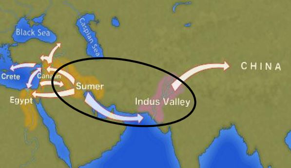
The cotton found in Israel, probably came from the Indus region—modern Pakistan/India—which was the only place in the world that had begun to domesticate cotton at that time before its cultivation appeared in Africa thousands of years later.
« What’s interesting about this early evidence of a link to such a distant region is that it comes from fibers – microscopic pieces of ancient yarn. We assume that these cotton fibers, found along with wool fibers and plant fibers, arrived at the site as part of fabrics or clothing, i.e., ancient textiles, » Rosenberg says.
In addition, cotton was not only used for clothing: « In the prehistoric era, textiles were involved in many areas of life, not only in clothing but also in hunting, fishing … This is much more important than just saying that what we found are pieces of clothing that were worn by the inhabitants of the area. This discovery tells us a lot about the economic practices of the area, » says Rosenberg.
Since cotton had never been grown in Tel Tsaf, it was a surprise for the researchers to find it, and they felt that its presence underscored the city’s importance as a global trading hub at the heart of what could be called, the « Cotton Roads » of those days.
Growing cotton poses major challenges: a moderate to tropical climate and vast amounts of water. Just to produce a single T-shirt and a pair of jeans (representing about 1 kg of cotton), no less than 20,000 liters of water are required! Which civilization can afford such a performance at the beginning of the 7th millennium BC?
The Indus Valley civilization (IVC)
The term « Indus Valley Civilization » (IVC) refers to a vast cultural and political entity that flourished in the northern region of the Indian subcontinent between about 8000 and about 1900 BCE., a region that stretched from Baluchistan (Pakistan) in the west to Uttar Pradesh (India) in the east and from northeastern Afghanistan in the north to Gujarat (India) in the south.
In the absence of both literary sources and remnants of palaces and temples to confirm it, one cannot qualify this entity as a “Kingdom” or an “Empire”. Its modern name (IVC) derives simply from its location in the Indus Valley, but also goes under the name of the « Indus-Sarasvati civilization » or « Harappan civilization ». These last designations come from the river Sarasvati, mentioned in the Vedic sources, which flowed next to the Indus and which would have disappeared, and from the ancient city of Harappa (Punjab, Pakistan), discovered by the British in 1829, but deliberately left unexplored.
The rise of a great urban civilization in the Indus Valley, which reached its maturity around 2500-2400 BCE, was long considered a sudden and mysterious phenomenon. Today, a series of discoveries allows us to follow, from 7000 to 2500 BCE, a series of transformations and innovations whose cumulative effects, stimulated by the enlargement of the network of exchanges from 3000 BCE onwards, created the conditions for the development of an incredibly modern and prosperous urban civilization.
Enter Mehrgarh, the light of the world!
Since prehistoric times, the Indus region has been pioneering and rich in discoveries. As an example, for the Guinness Book of Records, although a case apart, the farming village of Mehrgarh (Baluchistan, Pakistan) which dates from the Neolithic (using only stones as tools) but can be considered as the key culture and city that lead humanity, as early as in the 8th millennia BCE, from the Stone Age into the Age of Copper.
The site is located on the principal route between what is now Afghanistan and the Indus Valley: this route was also undoubtedly part of a trading connection established quite early between the Near East and the Indian subcontinent.
Excavations in Mes Aynak (Afghanistan), where archaeologists are only beginning to find remnants of a 5,000-year-old Bronze Age site beneath the Buddhist level, including an ancient copper smelter, will undoubtedly shed new light on these relationships.
On the basis of a variety of well-documented archaeological finds, it has been established that “pre-Harrapan” Mehrgarh, made several historical breakthroughs for the benefit of humanity as a whole.
Mehrgarh gave the world:
- among the oldest traces of agriculture (wheat and barley) and breeding (cattle, sheep and goats) in South Asia ;
- the first breweries (with wheat and barley);
- the oldest reservoirs for irrigated agriculture and flood prevention;
- the oldest traces of cotton culture (6th millennium BCE);
- the oldest jewel, called the « Mehrgarh amulet » (6th millennium BCE), produced with the « lost wax » bronze casting technique ;
- the oldest bow drills (in green jasper) allowing to drill holes in lapis lazuli and carnelian;
- the very first traces of successfull dentistry practices (!) (9th millennium BCE); The inhabitants of Mehrgarh appeared to have developed an understanding of surgery and dentistry, as evidenced by the drilled teeth of some of the skeletons found at the site. Analysis of the teeth shows that prehistoric dentists worked to treat toothaches with drills made from flint heads. The work was so elaborate that even modern dentists are surprised at the efficiency with which the Mehrgarh « dentists » removed decaying tooth tissue. Among the remains, a total of eleven drilled crowns were found, with one example showing evidence of a complex procedure involving the removal of tooth enamel followed by carving of the cavity wall. Four of the teeth show evidence of decay associated with the drilled hole. None of the individuals with drilled teeth appear to have come from a special tomb or shrine, indicating that the oral health care they received was available to all.

Densely populated
Originally, the IVC was built around the fishy meanders of the Indus, a river nearly 3200 kilometers long that flows from the Himalayan mountains towards the Arabian Sea. Like the populations of other great river valleys, this society was seduced by the fertility of the land as well as by the possibility of using the Indus as a transportation route.
The IVC, whose prosperity rests largely on the increasingly systematic exploitation of the rich silt of the Indus, spread over an immense territory encompassing the entire Indus Valley and part of Indian Gujarat. It is necessary to add to the vast zone of distribution of the Indus civilization some Harappan « colonies » or outposts like Sutkagan Dor (Ballochistan, Pakistan), close to Gwadar on the edges of the sea of Oman, at the Iranian-Pakistani border, and the lapus lazuli mining town of Shortugai, close to Amu Darya river, at the Afghan-Tajik border, at nearly 1,200 kilometers of Mohenjo-daro, by far the largest IVC urban concentration.
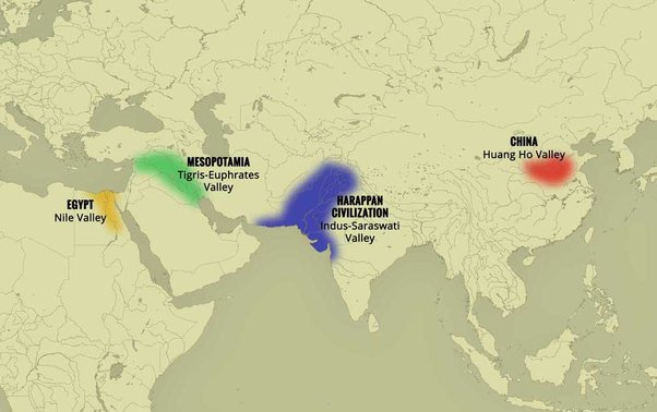
At its peak, this civilization was twice as large as the Old Kingdom of Egypt. With an area of 2.5 million square kilometers, it was at the time the largest civilization in the world: it included 5 million people, or 10 % of the world population at the time, much more than less older civilizations as Sumer (0.8 to 1.5 million people) or ancient Egypt (2 to 3 million).
To date, about 2,000 sites have been discovered in India, Pakistan and Afghanistan. Because of various wars and conflicts, only 10 % of the territory of these sites has been excavated and scientifically investigated. On the Indian subcontinent, the main centers of this civilization are Harappa (estimated 23,500 inhabitants) and Mohenjo-daro (est. 40,000 inhabitants) in Pakistan and Lothal, Dholavira and Kalibangan in India. In addition to trade relations with Mesopotamia and Iran, the Harappan city-states also maintained active trade relations with the peoples of Central Asia.
Agriculture, crafts and industry
Agriculture, animal husbandry, industry, trade and commerce were the main source of income.
Agriculture was the main occupation of the people of the Indus Valley. They cultivated barley and wheat on a large scale (and made beer) but also other crops such as legumes, cotton, cereals, sesame, dates, mustard, melons, peas, etc.
There is no real evidence of rice, but a few grains of rice have been found in Rangpur and Lothal.
In the towns of Mehrgarh, Harappa, and Mohenjo-daro, there are remains of large granaries, suggesting that they produced more than they needed and physically stocked cereals and other food products in case of crop failure.
Animal husbandry was another major occupation. Seals suggest that they domesticated cows, buffalos, goats, sheep, pigs, etc. Camels and bullocks were also domesticated and used as beasts of burden. Camel bones have been found in large numbers at many sites, but there is no trace of them on the seals. During the excavation of Surkotado in Gujarat, India, the jawbone of a horse was found. Terracotta figurines representing a horse were found in Nausharo and Lothal.
The inhabitants of the Indus Valley were very skillful. They made ceramics, metal vessels, tools and weapons, weaved and spun, dyed and practiced other crafts with potter’s wheels. The weavers wore clothes made of cotton and wool. They knew leather, but there is no record of silk production.
The inhabitants of this civilization originally came from the Bronze Age and used stone tools, but they soon excelled in the manufacture and processing of gold, silver, copper, lead and bronze, especially for artistic ornaments of great finesse.
Artisans made jewelry in Mohenjo-daro, Chanho-daro and Lothal. They used ivory and various precious stones such as carnelian, lapis lazulite, agate and jasper to make them. Shell work was also a thriving industry. Craftsmen in the coastal colonies used shells to make buttons for shirts, pendants, rings, bracelets, beads, etc.
To supply the production of these craft professions, they needed to import various raw materials. To produce bricks and ceramics, clay was available locally, but for metal they had to acquire it from abroad. Trade focused on importing raw materials to be used in Harappan city workshops, including minerals from Iran and Afghanistan, lead and copper from other parts of India, jade from China, and cedar wood floated down rivers from the Himalayas and Kashmir. Other trade goods included terracotta pots, gold, silver, metals, beads, flints for making tools, seashells, pearls, and colored gemstones, such as lapis lazuli and turquoise.
Ox carts were used to transport goods from one place to another. They also constructed barges used on the waterways along the Indus and its tributaries for transportation.
One of the ways historians know about the maritime trade network operating between the Harappan and Mesopotamian civilizations is the discovery of Harappan seals and jewelry at archaeological sites in regions of Mesopotamia, which includes most of modern-day Iraq, Kuwait, and parts of Syria. Long-distance sea trade over bodies of water—such as the Arabian Sea, Red Sea and the Persian Gulf—may have become feasible with the development of plank watercraft that were each equipped with a single central mast supporting a sail of woven rushes or cloth.
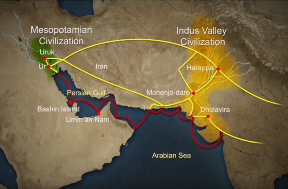
Historians have also made inferences about networks of exchange based on similarities between artifacts across civilizations.
Between 4300 and 3200 BCE, ceramics from the Indus Valley Civilization area show similarities with southern Turkmenistan and northern Iran. During the Early Harappan period—about 3200 to 2600 BCE—there are cultural similarities in pottery, seals, figurines, and ornaments that document caravan trade with Central Asia and the Iranian plateau.
The wonders of Mohenjo-daro
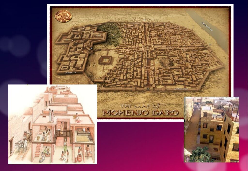
Sometimes referred to as the « Manhattan of the Bronze Age » for the grid pattern of the city plan, Mohenjo-daro (Sind, Pakistan) remained buried under meters of alluvial sediment until 1922.
A real metropolis made of baked bricks, it covers more than 200 hectares. Strictly squared, cut in two by a street of ten meters wide, divided from north to south by a dozen arteries drawn with the cord, and crossed from east to west by paved streets, Mohenjo-daro represents, by its strictly reflected urban framework, the model city of the Indus civilization. It could have accommodated up to 40,000 people!
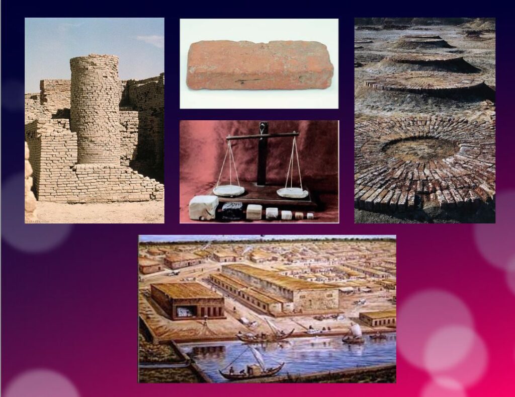
The Harappans were masters of hydraulic engineering, a “riparian” people working in river corridors practicing irrigated agriculture. They mastered both the shaduf (an irrigation tool used to draw water from a well), and windmills.
In the Harappan cities, the domestic and manufacturing areas were separated from each other.
The inhabitants, living in one-, two-, and sometimes three-story dwellings, seem to have been mainly artisans, farmers, and merchants. The people had developed the wheel, cattle-drawn carts, flat-bottomed boats large enough to carry goods, and perhaps also sailing. In the field of agriculture, they had understood and used irrigation techniques and canals, various agricultural implements, and had established different areas for livestock grazing and cultivation.
Seals and harrapan script
Among the thousands of artifacts found at the various sites are small soapstone seals just over one inch (3 cm) in diameter, used to sign contracts, authorize land sales, and authenticate the point of origin, shipment, and receipt of goods in long-distance trade. On each seal is a small text in Harappan, a language yet to be deciphered.
Among the thousands of artifacts found at the various sites are small soapstone seals just over one inch (3 cm) in diameter, used to sign contracts, authorize land sales, and authenticate the point of origin, shipment, and receipt of goods in long-distance trade.
Commercial contacts between the Indus and Sumer populations are well documented. Numerous seals from the Indus Valley have been discovered in Mesopotamia. On each seal, a small text in Harappean, a language that remains to be deciphered.
If 4,200 texts reached us, 60 % of them are seals or mini-tablets of stone or copper, engraved, and they comprise on average… only five signs! The longest text has 26 signs. The texts are always accompanied by the image of an animal, often a unicorn or a majestic buffalo. They were intended to mark goods, probably indicating the name of the owner or the recipient and a quantity or a year. Trying to decipher the Indus language is a bit like trying to learn French only from the labels on the food shelf of a supermarket!
The invention of sanitation
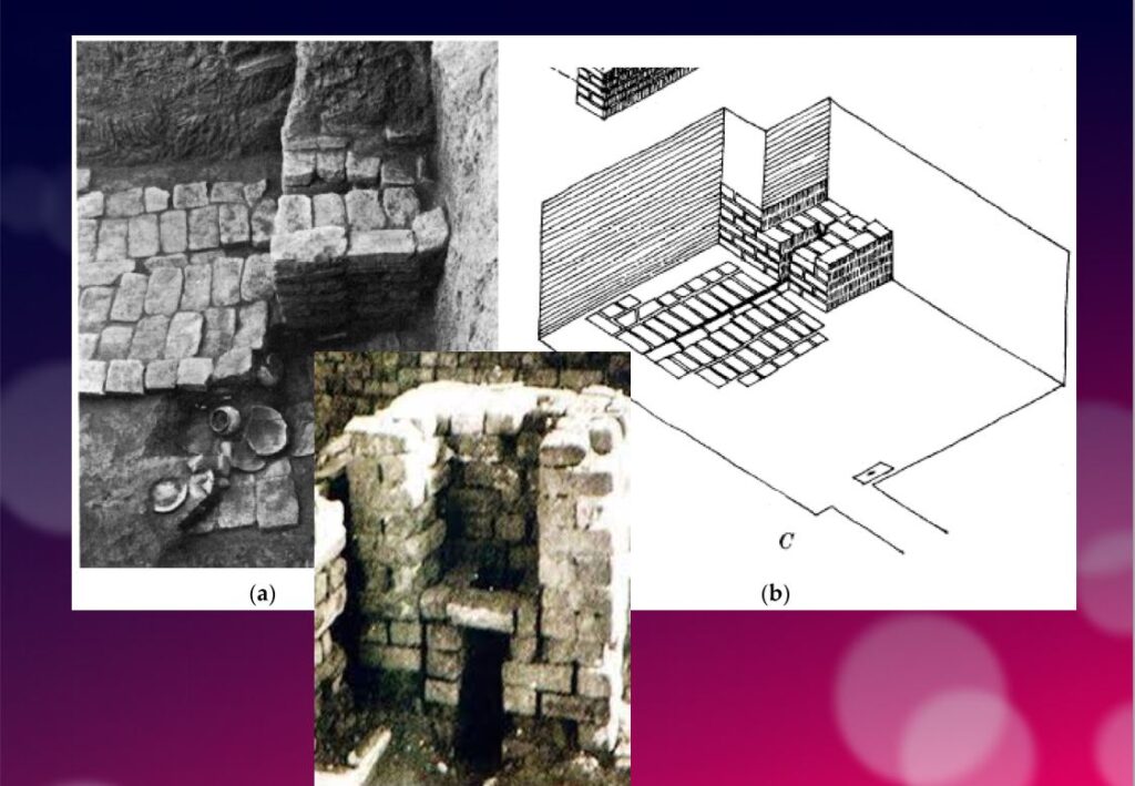
In addition to this particular attention that they paid to urban planning, the members of the Indus civilization also seem to have been pioneers of modern hygiene. Some cities, notably Mohenjo-daro, were equipped with small containers (dustbins) in which the inhabitants could deposit their household waste.
Anticipating our « all to the sewer » systems imagined in the 16th century by Leonardo da Vinci for the project envisaged by François I for the new French capital Romarantin, many cities had already public water supply and an ingenious sanitation system.
In many cities, including Mohenjo-daro, Harappa, Lothal and Rakhigari, individual houses or groups of houses were supplied with water from wells. This quality fresh water was used as much for food and personal hygiene (baths, toilets) as for the economic activities of the inhabitants.
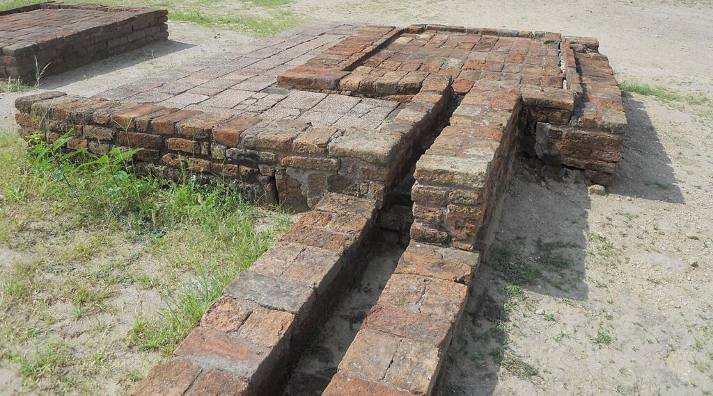
As an example, the sanitation system of the port city of Lothal (Gujarat, India) where many houses had a bathroom and private brick latrines. The wastewater was evacuated through a communal sewer system that led either to a canal in the port, or to a soaking pit outside the city walls, or to buried urns equipped with a hole allowing the evacuation of liquids, which were regularly emptied and cleaned.
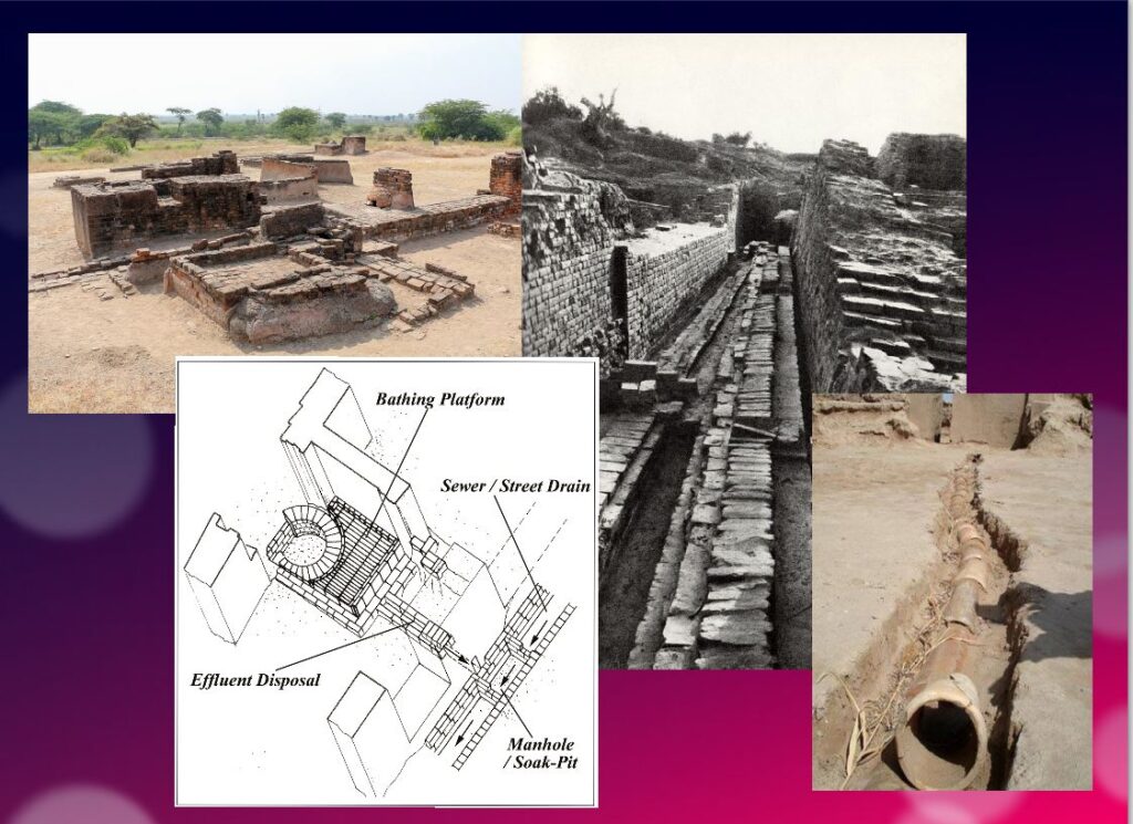
Excavations at the Mohenjo-daro site have also revealed the existence of no less than 700 brick water wells, houses equipped with bathrooms and individual and collective latrines. Toilets were an essential element. However, early archaeologists erroneously identified most toilets as post-cremation burial urns or simple cesspools. Many buildings in the city were two or more stories high. Water from the roof and bathrooms of the upper floors was channeled through closed clay pipes or open troughs that emptied, if necessary via the toilets, into the covered sewers underneath the paved street.
This extraordinary achievement is confirmed by a 2016 scientific study, entitled « The Evolution of Toilets Around the World Across the Millennia, » which reports that,
The earliest multi-flush toilets connected to a sophisticated sewage system that have been identified so far were found in the ancient cities of Harappa and Mohenjo-Daro in the Indus Valley, dating from the middle of the third millennium BC. Nearly every dwelling unit in Harappa, Mohenjo-Daro, and Lothal was equipped with a private bath-toilet area with drains to carry dirty water into a larger drain that emptied into the sewer and drainage system.
Till now, it are the Minoan (Crete) civilization and China that have been credited for the first use of underground clay pipes for sanitation and water supply. In the Cretan capital Knossos, there was a well-organized water system to bring in clean water, to evacuate wastewater and to provide storm sewers for overflow in case of heavy rains.
In Knossos existed also one of the earliest uses of flush toilets, dating back to the 18th century BCE. The Minoan civilization had stone sewers that were periodically cleaned with clean water. Crete, of course, was a large provider of Copper ore for the entire world in Antiquity and had vast international trade connections.
Religious and cultural worldview
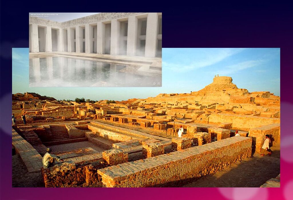
In the IVC, fertility rituals were probably observed in order to promote a full harvest as well as for women’s pregnancies, as evidenced by a number of figurines, amulets and statuettes with female form.
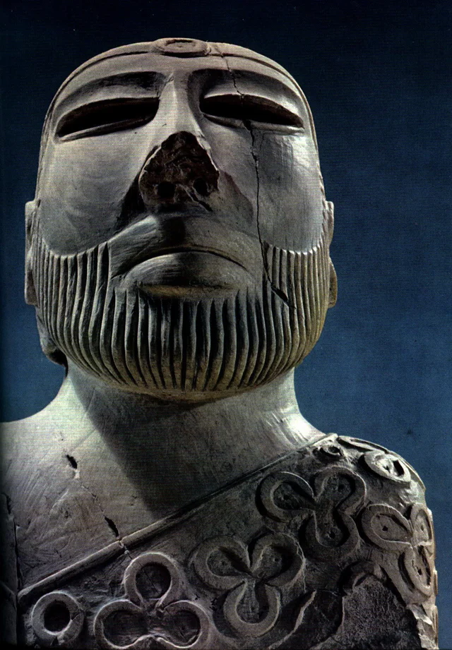
It is thought that the people, like the Dravidians who some believe were the origin of the Indus Civilization, worshiped a “mother goddess” and possibly a male companion represented as a horned figure in the company of wild animals.
The « Great Bath » at Mohenjo-daro would have been used for purification rites related to religious belief, but it could just as easily have been a public pool for recreation. Our knowledge of the religious beliefs of this culture remains in the realm of mere hypothesis.
The title of the famous statue of the « Priest-King » found at Mohenjo-daro is misleading, as there is no evidence that it is a king or a priest, and it may be a simple cotton trader…
Apart from pottery, certain types of elementary weapons (spearheads, axes, arrows, etc.) and certain tools for practical purposes, two types of artifacts give us cultural clues about Harappean society.
First, some figurines, which we try to interpret as devotional objects, seem to be simple toys. For others, they are clearly toys, notably animals (oxen, buffaloes, elephants, goats and even a simple hen), made of bronze or terracotta, mounted on small carts with wheels.
Second, among other objects expressing a high level of sensitivity and consciousness, a series of masks, some of which seem inspired by Mongolian masks.
These masks are clearly intended to serve comic or tragic representations and remind us of the ancient masks that have come down to us from classical Greece.
Older than Sumer and Egypt?
Archaeological excavations of the IVC got off to a late start, and it is now believed that some of the achievements and « firsts » attributed to Egypt ( – 3150 BC) and Mesopotamia ( – 4500 BC) may in fact belong to the inhabitants of the Indus Valley civilization.
In May 2016, the report published by a team of researchers from IIT Kharagpur, Institute of Archaeology, Deccan College Pune, Physical Research Laboratory and Archaeological survey of India (ASI), published by the journal Nature, shattered a number of “facts” that were considered unshakeable certainties.
Until now, the 900 years of the « mature » phase of the IVC was dated as ranging from 2800 to 1900 BCE. However, the aforementioned Indian study indicates that this civilization was much older than previously thought – it is at least 8,000 years old!
To determine the age of this civilization, researchers dated pottery using a technique called optically stimulated luminescence (OSL) – and found it to be nearly 6,000 years old, the oldest pottery known to date.
Other artifacts have been dated to 8,000 years ago. The results come from a major site excavated at Bhirrana (Haryana, India) that shows the preservation of all cultural levels of this ancient civilization, from the pre-Harappan phase through the Early Harappan to the Mature Harappan period. Bhirrana was part of a high concentration of sites along the mythical Vedic river « Saraswati », now dried up, an extension of the Harki-Ghaggar River in the Thar Desert.
The submerged cities of the Gulf of Khambhat
These new dates converge with the discovery, in January 2002, of ruins of submerged cities in the Gulf of Khambhat (formerly Cambay), off the coast of the state of Gujarat in northwest India.
It is the oceanographers of the National Institute of Ocean Technology (NIOT) of Madras who made this discovery. The team was surveying the muddy sea 30 km off the coast of the state of Gujarat, in the Gulf of Khambhat, to measure the levels of marine pollution. As a routine measure, they recorded acoustic images of the ocean floor.

It was only several months later, while analyzing the data, that the team realized that they had, without knowing it, obtained images of the ruins of a huge city, sunken 40 meters below sea level. And, at the end of January 2002, after having spent weeks to dredge the site and to bring up more than 2 000 objects, the team of the NIOT was able to make extraordinary revelations.
The ruins stretch for 9 km along the banks of an ancient river, and the remains of a dam can be distinguished. The sunken city shares striking similarities with the sites of the Indus civilization. One of the buildings, the size of an Olympic swimming pool, with collapsed steps, recalls the Great Bath of Mohenjo-daro. Another rectangular monument, 200 m long and 45 m wide, is as large as the acropolis discovered at Harappa. The team of NIOT also glimpsed another building, a kind of granary, made of mud bricks, 183 m long. Near these monumental installations, rows of rectangular buildings that resemble the foundations of ruined houses can be seen, and even a drainage system and roads. On another visit to the site, the team recovered polished stone tools, ornaments and figurines, pottery debris, semi-precious stones, ivory and the fossilized remains of a human spine, jaw and tooth. But the team was not at the end of its surprises.
It sent samples of a fossilized log to two major Indian laboratories specializing in dating methods: the Birbal Sbahni Institute of Paleobotany (BSIP) in Lucknow and the National Geophysical Research Institute (NGRI) in Hyderabad. The BSIP dated it to 5500 BCE, while the NGRI dated the sample much earlier, probably to 7500 BCE.
This dating would make Khambhat the oldest site discovered in India. According to some, this discovery could mark the end of the theory according to which urbanization spreads from Asia from the west towards the Indus. This dating caused intense controversy. Archaeologist G. Possehl points out that there is no reason to believe that the fossilized piece of wood belongs to the ruins of the ancient city, given the strong sea currents in the region, it could have come from elsewhere. NIOT’s team acknowledged the validity of these criticisms and assured that other objects would be subjected to dating methods. It is also a question of understanding how this city was sunk and how it ended up 30 km from the coast.
Harsh Gupta, geologist, thinks that it is a gigantic earthquake which caused the destruction of the city. We are in a high seismic risk area, and the 2001 Bhuj earthquake showed the vulnerability of the region to such phenomena. However, the priority is to definitively establish the age of the sunken city and prove it to be the most exciting discovery of this century.
Historical cradle of textiles

In his book Empire of Cotton, A Global History (2015) Sven Beckert traces in depth the development of what the ancients, intrigued by its resemblance to the feel of wool, called the « wool tree. » While this plant grows in both temperate and tropical climates, it needs an abundance of moisture to thrive fully, which consigns its cultivation to naturally and then artificially irrigated river valleys.
According to the author, « The farmers of the Indus Valley were the first to spin and weave cotton. In 1929, archaeologists found fragments of cotton textiles at Mohenjo-Daro, in present-day Pakistan, dating from 3250 to 2750 BCE. Cotton seeds found in nearby Mehrgarh have been dated to 5000 BCE. Literary references also attest to the antiquity of the cotton industry in the subcontinent. The Vedic scriptures, composed between 1500 and 1200 BCE., allude to the spinning and weaving of cotton…”
Historically, the discovery of the first cotton fragments was made at Mohenjo-daro during an expedition led by Sir John Marshall, Director General of the Archaeological Survey of India from 1902 to 1928. In his book on Mohenjo-daro and the Indus Civilization, Sir Marshall relates that fragments of cloth were wrapped around a silver perfume pot and a salt shaker.
Early forms of Self-government?
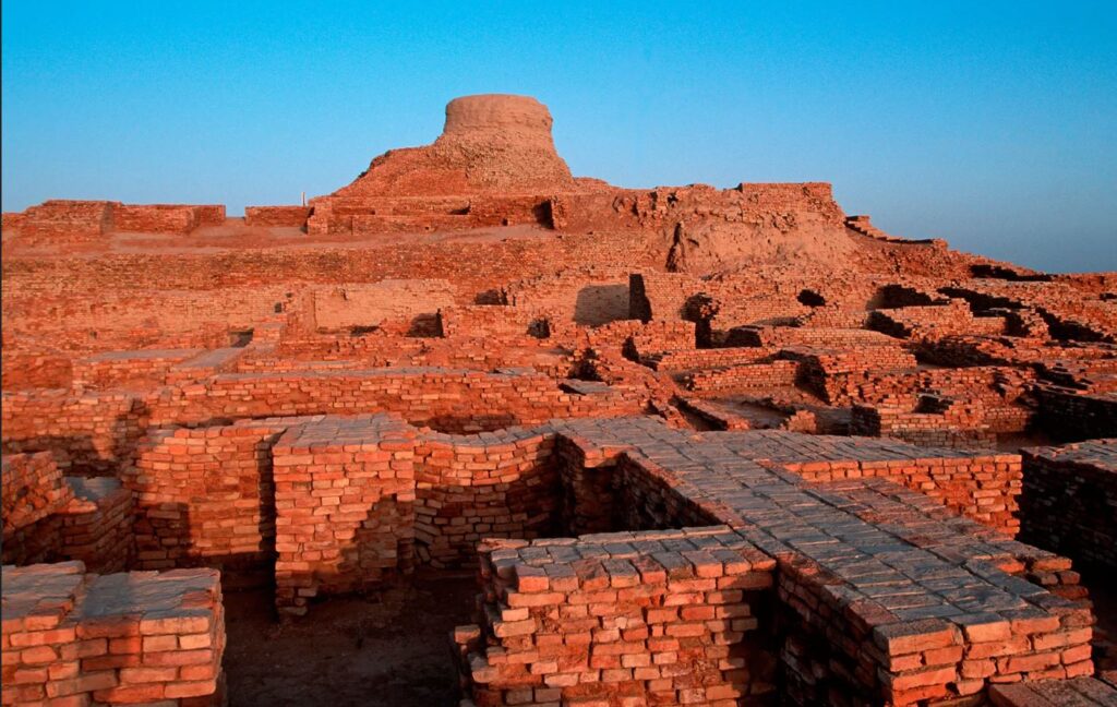
The fact remains that the political organization of the Indus cities escapes the experts. Because contrary to the Mesopotamian and Egyptian civilizations, the researches realized on the sites of the valley of the Indus did not bring to light any temple or palace of scale. There is no proof either of the existence of a permanent army…
Of what to wonder about the presence or not of a political power. Panic among British archaeologists and geopoliticians always inclined to project their own colonial ideology of aristocratic castes on the rest of the world.
In reality, each city seems to have had its own governor, or citizen council coordinating with other urban areas, all adhering to a number of common principles considered mutually beneficial.
This “Coincidence of Opposites”, of great diversity with perfect similarity, intrigues expert John Keay:
What amazed all those pioneers, and what remains the distinguishing characteristic of the several hundred Harappan sites now known, is their apparent similarity: ‘Our overriding impression is of cultural uniformity, both throughout the several centuries during which Harappan civilization flourished, and over the vast area it occupied.’ The ubiquitous bricks, for example, all have standardized dimensions, just as the stone cubes used by the Harappans to measure weight are also standardized and based on the modular system. The width of roads conforms to a similar module; thus, streets are generally twice as wide as side streets, while main arteries are two or one and a half times as wide as streets. Most of the streets excavated so far are straight and run north to south or east to west. The city plans thus conform to a regular grid pattern and seem to have retained this arrangement through several phases of construction.
Hence, given the existence of a unified system of weights and measures; given the similarity of urban organization as well as the standardization of the size of terracotta bricks for hundreds of cities, it is therefore simply impossible that the every man for himself reigned supreme.
Cradle of democracy?
In 1993, in an article entitled « The Indus Valley Civilization, Cradle of Democracy? », published by the UNESCO Courier, the internationally renowned Pakistani archaeologist and museologist, Syed A. Naqv, who has been fighting for the preservation of the Mohenjo-daro site, attempted to answer the question.
In all the highly developed civilizations of the past – Mesopotamia, the Nile Valley, Anatolia, China – the pervasive influence of an imperial authority can be felt, providing patronage for the arts and directing the evolution of society. A close examination of such an imperial authority over this civilization, which flourished some 5,000 years ago and covered almost twice the area of the civilizations of Mesopotamia and the Nile combined seems to belie the presence of an authoritarian regime, the Indus civilization had a well-disciplined way of life, civic controls and organizational system which could only have stemmed from the kind of “rule by the people” that was exercised in some Greek city-State some 2,000 years later. Did Greece give birth to democracy, or did Greece simply follow a practice developed earlier?
Although there are no large structures acting as centers of authority,
the discoveries made so far suggest that the rule of law extended over an area measuring roughly 1,600 kilometers from the north to the south and more that 800 kilometers from east to west. The main argument in support of this thesis is the existence of well-established norms and standards which would have required the consensus of the people if they had not been imposed by an authoritarian regime. It is impossible to ignore the evidence furnished by the perfect planning of the great city of Mohenjo-daro and the use in its construction of standard-sized bricks 27.94 cm long, 13.96 cm wide and 5.71 cm thick.
In the two large cities of Mohenjo-daro and Harappa, about 600 km distant,
the grid pattern of the street layout uncovered by the archaeological excavations shows that great attention was paid to the security of the inhabitants and suggests the existence of a highly developed and well-monolithic system of civic control.
The same is true of the highly sophisticated sewage system and the existence of
a virtually complete series of highly polished stone weights. Their shapes are cubical, half-cubical, cylindrical and spherical, and very few of them are reported to be defective. They provide yet another proof of a civic authority maintaining consistent commercial standards.
It is not possible to conclude that such « a philosophical conception of democracy exists until the Harappan script is deciphered and written evidence is provided. But the signs are there, and further research in this direction may well establish that ‘government by the people’ originated in the Indus Valley, » the author concludes.
Finally, since this agricultural people, who knew the use of the spears and the arrows but didn’t leave any trace of a major military activity – few weapons nor fortifications with exclusively defensive purpose have been found – , many observers agree to say that this society could have known the longest period of peace of the history of the humanity.
Decay and fall
In two of his books, the Timaeus and the Critias, the Greek philosopher Plato tells the story « certainly true, although strange » of a maritime people with incomparable power: the Atlantes whose civilization and capital he describes in great detail.
Starting 10,000 years before our era from an island located beyond the columns of Hercules, the Atlanteans would have ended up dominating the whole of Africa and Western Europe.
In a passage which is not without recalling the type of political organization which could exist in Mohenjo-daro, Critias specifies that Atlantis was then inhabited « by the various classes of men who deal with the trades and agriculture. The warriors, separated from the beginning by divine men, lived separately, possessing all that was necessary for their existence and that of their children. Among them, there were no particular fortunes; all goods were in common: they demanded from the other citizens nothing beyond what they needed to live, and fulfilled in return all the obligations that our talk of yesterday attributed to the defenders of the fatherland as we conceive them. »
Perhaps speaking metaphorically, Plato states that initially virtuous, the Atlantis civilization would have sunk into excess, arrogance and corruption to the point of being chastised by Poseidon himself for having embarked on one war too many, this time against Athens. And « in the time lapse of a single terrible day and night (…) the island of Atlantis sank into the sea and disappeared ».
At the historical level, the sudden decline of the Indus civilization around 1900 BC remains a mystery. Historians point to aspects of Minoan civilization (Crete) showing astonishing similarities with the IVC, especially watermanagement and early sewer systems in Knossos, lost wax broze casting techniques and bull fighting.
A few traces of fire and destruction, as well as forty skeletons wounded with knives and found without burial at Morenjo-daro, first suggested an invasion by Aryan peoples from Central Asia or the Iranian plateau. « This theory has now been abandoned. We have indeed found no effective trace of massacres or violence on the sites of the Indus Valley, or furniture that could be associated with such populations, » says Aurore Didier, researcher at the CNRS and director of the Indus mission.
Another hypothesis, an inability to strengthen its resilience to climatic chaos. « The samples taken in the northwest of India have shown that the climate there has changed significantly about 2000 years before our era. It is reported that this was also the case in Mesopotamia. « It became more like the dry and arid climate of today, which disrupted the cultivation and, in fact, the trade of the Indus civilizations. The ensuing socio-economic upheaval may have led to the decline of these societies. This hypothesis is the most commonly accepted to date, » says the archaeologist.
The inhabitants would have left their valleys become infertile to migrate to the plains of the Ganges. « This was accompanied by a change in livelihood strategies. The Indus civilization gradually converted to summer cereal crops based on rice and millet, two commodities more able to withstand these new climatic conditions and requiring, for rice, the development of irrigated agriculture, » says Aurore Didier. « It has also forged links with new trading partners.”
So there is no reason to talk about the « collapse » of a society in the sense of collapsologists. It is rather a gradual adaptation to the evolution of the environment, spread over several centuries.
As the excavations of the sites of the Indus Valley civilization continue, new information will undoubtedly contribute to a better understanding of its history and development. Any additional knowledge of this common civilizational legacy will serve in the future as a basis for fraternal cooperation between Pakistan, India and Afghanistan and others.
In the meantime, instead of trying to copy the barbaric « models » of the Mongolian Empire, the Roman Empire or the British Empire, the « elites » of the transatlantic world would do better to draw inspiration from a magnificent civilization that seems to have prospered for 5,000 years without perpetual wars and massacres, but simply thanks to a good mutual understanding, at the national level, between citizens, and thanks to mutually beneficial cooperation with the overriding majority of its distant partners.
The Indus Valley Civilization’s modernity, capable of offering food, shelter, water and sanitation to all, in a mirror image, shows all of us living in the present, how backwards we became.
Persian Qanâts and the Civilization of Hidden Waters

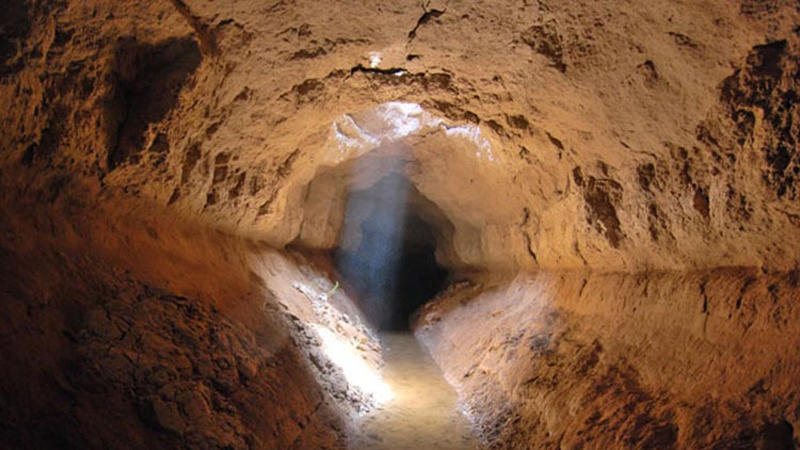
By Karel Vereycken, July 2021.

By Karel Vereycken, July 2021.
At a time when old diseases make their return and new ones emerge worldwide, the tragic vulnerability of much of humanity poses an immense challenge.
One wonders whether to laugh or cry when international authorities trumpet without further clarification that to stop the Covid-19 pandemic, “all you have to do” is “wash your hands with soap and water”!
They forget one small detail: 3 billion people do not have facilities to wash their hands at home and 1.4 billion have no access to either water or soap!
Yet, since the dawn of time, mankind has demonstrated its capacity to mobilize its creative genius to make water available in the most remote places.
Here is a short presentation of a marvel of such human genius, the “qanâts”, an underground water conveyance system dating from the Iron Age. Probably of Egyptian origin, it was deployed on a large scale in Persia from the beginning of the 1st millennium BC.
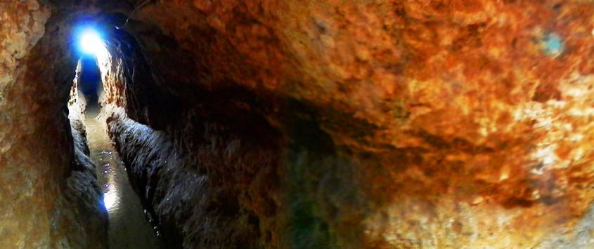
The qanât or underground aqueduct

Sometimes called “horizontal drilling”, the qanât is an underground aqueduct employed to draw water from a water table and convey it by simple gravitational effect to urban settlements and farmland. The word qanât is an old Semitic word, probably Accadian, derived from a root qanat (reed) from which come canna and canal.
This “drainage gallery”, cut into the rock or built by man, is certainly one of the earliest and most ingenious inventions for irrigation in arid and semi-arid regions. The technique offers a significant advantage: by conveying water through an underground conduit, contrary to open air canals, not a single drop of water is wasted by evaporation.
Oases’ are NOT natural phenomena. All known oases are man-made. It is the qanât technique that allows man, in a given geographic configuration, to create oases in the middle of the desert, when a water table is close enough to the ground level or at a site close to the bed of a river lost in the sands of the desert.
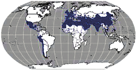
Copied and expanded by the Romans, the qanât technique was carried across the Atlantic to the New World by the Spaniards, where many such underground canals still function in Peru and Chile. In fact, there are even Persian qanâts in western Mexico.
While today this three thousand year old technique may not be appropriate everywhere to solve current water scarcity problems in arid and semi-arid regions, it has much to inspire us as a demonstration of human genius at its best, that is, capable of doing a lot with a little.
The oases of Egypt
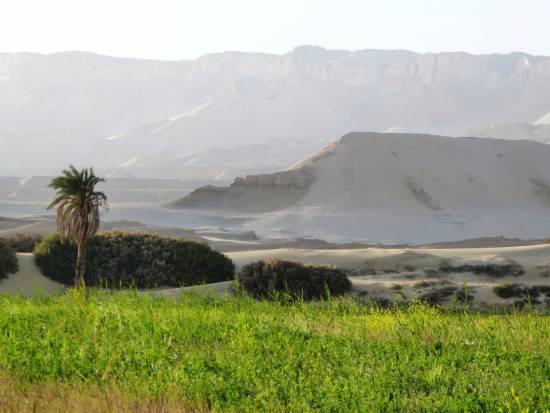
Today, 95% of the Egyptian population prospers on only 5% of its territory, mainly around the Nile delta. Hence, from the earliest days of Egyptian civilization, irrigation and water storage techniques for the Nile floods were developed in order to conserve this silty, nutrient-rich water for use throughout the year.
The river water was diverted and transported by canals to the fields by gravity. Since water from the Nile did not reach the oases, the Egyptians used the gushing water from the springs, which came from the large aquifer reserves of the western desert, and conveyed it to the fields by irrigation canals.
One of the fruits of this attempt to “conquer the desert” was a sustained habitation of the Dakhleh oasis throughout the Pharaonic period, explicable not only by a commercial interest on the part of the Egyptian state, but also by the new agricultural perspectives it offered.
Roman aqueducts
Closer to us in time, the Qanât Fir’aun (The Watercourse of the Pharaoh) also known as the aqueduct of Gadara, a city today in Jordan. As far as we know, this 170 km long structure, depending on the geography, combines several bridge-aqueducts (of the same type as the Gard aqueduct in France) and 106 km of underground canals using the Persian qanât technique. It is not only the longest but also the most sophisticated aqueduct of antiquity, and the fruit of a years of hydraulic engineering.
In reality, the Romans, hiring persian water experts, did nothing more than terminate in the 2nd century an ancient project designed to supply water to the “Decapolis”, a collaborative group of ten cities founded by Greek and Macedonian settlers under the Seleucid king Antiochos III (223 – 187 BC), one of the successors of Alexander the Great.
These ten cities were located on the eastern border of the Roman Empire (now in Syria, Jordan and Israel), united by language, culture and political status, each with a degree of autonomy and self-rule. Its capital, Gadara, was home to more than 50,000 people and known for its cosmopolitan atmosphere, its own university attracting scholars, writers, artists, philosophers and poets. But this rich city lacked something existential : an abundance of water.
The Gadara qanat made the difference. “In the capital alone, there were thousands of fountains, watering holes and baths. Wealthy senators cooled themselves in private pools and decorated their gardens with cooling caves. The result was a record daily consumption of more than 500 liters of water per capita,” explains Matthias Schulz, author of a report on the aqueduct in Spiegel Online.
Persia
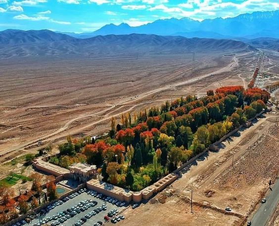
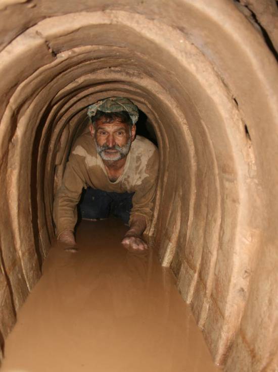
We all admire the roman aqueducts. But few of us are aware that the Romans only adapted the technique of the qanâts developed much earlier in Persia.
Indeed, it was under the Achaemenid Empire (around 559 – 330 BC.), that this technique spread slowly from Persia to the east and the west. Many qanâts can be found in North Africa (Morocco, Algeria, Libya), in the South East Asia (Iran, Oman, Iraq) and further east, in Central Asia, from Afghanistan to China (Xinjiang), via India.
The development of these “draining galleries” is attested in different regions of the world under various names: qanât and kareez in Iran, Syria and Egypt, kariz, kehriz in Pakistan and Afghanistan, aflaj in Oman, galeria in Spain, kahn in Balochistan, kanerjing in China, foggara in North Africa, khettara in Morocco, ngruttati in Sicily, bottini of Siena, etc.
Historically, the majority of the populations of Iran and other arid regions of Asia or North Africa depended on the water provided by the qanâts; their construction lifted entire areas to a higher “economic platform”, made deserts habitable and opened new land for agriculture. The map of demographic expansion followed the trail of the development of this new higher platform.
In his article « Du rythme naturel au rythme humain : vie et mort d’une technique traditionnelle, le qanât » (From natural rhythm to human rhythm: the life and death of a traditional technique, the qanât), Pierre Lombard, a researcher at the French CNRS, points out that this is not an artisanal and marginal process:
“Until a few years ago, the importance of the ancestral technique of qanât was sometimes ignored in Central Asia, Iran, Syria, and even in the countries of the Arabian Peninsula. For example, the Public Authority for Water Resources of the Sultanate of Oman estimated in 1982 that all the qanâts still in operation conveyed more than 70 % of the total water used in that country and irrigated nearly 55% of the cereal lands. Oman was still one of the few states in the Middle East to maintain and sometimes even develop its qanât network; this situation, apart from its longevity, does not appear to be exceptional. If one turns to the edges of the Iranian Plateau, one can note with Wulff (1968) the obvious discrepancy between the relative aridity of this area (between 100 and 250 mm of annual precipitation) and its non-negligible agricultural production, and explain it by one of the densest networks of qanâts in the Middle East. It can also be recalled that until the construction of the Karaj dam in the early 1960s, the two million inhabitants of Tehran at that time consumed exclusively the water brought from the Elbourz foothills by several dozen regularly maintained qanâts. Finally, we can mention the case of some major oases in the Near and Middle East (Kharga in Egypt, Layla in Saudi Arabia, Al Ain in the United Arab Emirates, etc.) or in Central Asia (Turfan, in Chinese Turkestan) that owe their vast development, if not their very existence, to this remarkable technique.”
On the website ArchéOrient, the French archaeologist Rémy Boucharlat, Director of Research Emeritus at the CNRS, an Iran expert, explains:
“Whatever the origin of the water, deep or not, the technique of construction of the gallery is the same. First, the issue is to identify the presence of water, either its going underground near a river, or the presence of a water table under a foothill, which requires the science and experience of specialists. A motherwell will be dug to reach the top of the water table, indicating at which depth the [horizontal] gallery should be drilled. It’s slope must be very small, less than 2‰, so that the flow of water is calm and regular, and conduct the water gradually to the surface area, according to a gradient much lower than the slope of the foothill.
“The gallery is then dug, not starting from the mother well because it would be immediately flooded, but from downstream, from the point of arrival. The conduct is first dug in an open trench, then covered, and finally gradually sinks into the ground in a tunnel. For the evacuation of soil and ventilation during excavation, as well as to identify the direction of the gallery, shafts are dug from the surface at regular intervals, between 5 and 30 m depending on the nature of the land ».
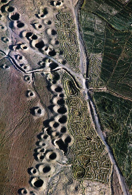
In April 1973, Lyndon LaRouche’s friend, the French-Iranian professor and historian Aly Mazahéri (1914-1991), published his translation from Arab into French of “The Civilization of Hidden Waters”, a treatise on the exploitation of underground waters composed in the year 1017 by the Persian hydrologist Mohammed Al-Karaji, who lived in Baghdad. (Translated in English in 2011)
After an introduction and general considerations on geography, natural phenomena, the water cycle, the study of terrain and the instruments of the hydrologist, Al-Karaji gives a highly precise technical outline of the construction and maintenance of qanâts, as well as legal considerations respecting their management and maintenance.
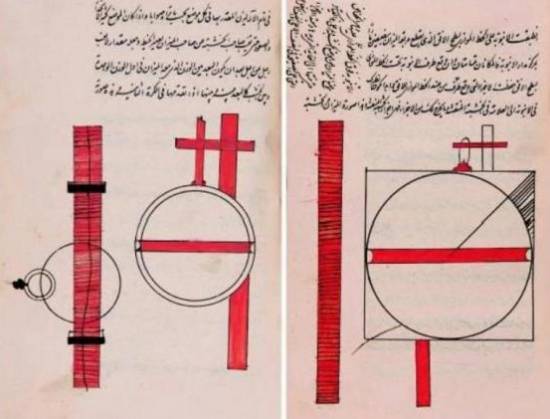
In his introduction to Al-Karji’s treatise, Professor Mazaheri emphasizes the role of the Iranian city of Merv (now in Turkmenistan). This ancient city, he says, was part of
“the long series of oases extending at the foot of the northern slope of the Iranian plateau, from the Caspian to the first foothills of the Pamirs. There, between the geological extension of the Caspian towards the East, there is a strip of arable land, more or less wide, but very fertile. Now, to exploit it, a lot of ingenuity is needed: where, for example in Merv, a big river, such as the Marghab, coming from the glaciers of the central East-Iranian massif, crosses the chain, it is necessary to establish dams, above the strip of arable land, without which, the ‘river’, divided into several dozens of arms, rushes under the sands. Elsewhere, and it is almost all along the northern slope of the chain, one can create artificial oases, by bringing the water by underground aqueducts.” (p. 44)
“The construction of dams and underground aqueducts are among the most interesting legacies of their (the ancient Persians) irrigation techniques (…) Long before Islam, the Persian hydrologists had built thousands of aqueducts, allowing the creation of hundreds of villages, dozens of cities previously unknown. And very often, even where there was a river, because of the insufficiency of this one, the hydronomists had brought to light many aqueducts allowing the extension of the culture and the development of the city. Naishabur was such a city. Under the Sassanids, and later under the Caliphs, an important network of aqueducts had been created there, so that the inhabitants could afford the luxury of owning a ‘’bathing room’ in the basement, at the level of the aqueduct serving the house.”

Let us recall that most Persian scholars, including the famous mathematician Al-Khwarizmi, not suffering from today’s hyper-specialization that tends to curb creative thinking, excelled in mathematics, geometry, astronomy and medicine as well as in hydrology.
Mazaheri confirms that this “civilization of underground waters” spread well beyond the Iranian borders:
“Already, under the [Umayyad] Caliph Hisham (723-42), Persian hydronomists built aqueducts between Damascus and Mecca (…) Later, Mecca suffering from lack of water, Zubayda, the wife of Hâroun Al-Rachîd, sent Persian hydronomists there who endowed the city with a large underground aqueduct. And each time the latter was silted up, a new team left Persia to restore the network: such repairs took place periodically under Al-Muqtadir (908-32), under Al-Qa’im (1031-1075), under Al-Naçir (1180-1226) and, at the beginning of the fourteenth century, under the Mongol prince Emir Tchoban. We would say the same of Medina and the stages on the pilgrimage route, between Baghdad and Mecca, wherever it was possible to do so, hydronomic works were undertaken and ‘underground aqueducts’ were created.
“Hydronomy is a highly demanding skill. To practice it, it is not enough to have mathematical knowledge: decadal calculus, algebra, trigonometry, etc., it is necessary to spend long hours in the galleries at the risk of dying by flooding, landslide or lack of air. It is necessary to have an ancestral instinct of ‘dowser’.”
The annual rainfall in Iran is 273 mm, which is less than one third of the world’s average annual precipitation.
The temporal and spatial distribution of precipitation is not uniform; about 75% occurs in a small area, mainly on the southern coast of the Caspian Sea, while the rest of the country does not receive sufficient rainfall. On the temporal scale, only 25% of the precipitation occurs during the plant growing season.
7,7 x the circonférence of the Earth

Still in use today in Iran, qanâts currently supply about 7.6 billion m3 of water, close to 15% of the country’s total water needs.
Considering that the average length of each qanât is 6 km in most parts of the country, the total length of the 30,000 qanât systems (potentially exploitable today) is about 310,800 km, which is about 7.7 times the circumference of the Earth or 6/7th of the Earth-Moon distance!
This shows the enormous amount of work and energy applied to build the qanâts. In fact, while more than 38,000 qanâts were in operation in Iran till 1966, its number dropped to 20,000 in 1998 and is currently estimated at 18,000. According to the Iranian daily Tehran Times, historically, over 120,000 qanat sites are documented.
Moreover, while in 1965, 30-50% of Iran’s total water needs were met by qanats, this figure has dropped to 15% in recent decades.
According to the Face Iran website:
“The water flow of qanâts is estimated between 500 and 750 cubic meters per second. As land aridity tends to vary according to the abundance of rains in each region, this quantity of water is used as a more or less important supplement. This makes it possible to use good land that would otherwise be barren. The importance of the impact on the desert can be summarized in one figure: about 3 million hectares. In seven centuries of hard work, the Dutch conquered 1.5 million hectares from the marshes or the sea. In three millennia, the Iranians have conquered twice as much on the desert.
Indeed, to each new qanât corresponded a new village, new lands. From where a new human group absorbed the demographic surplus. Little by little the Iranian landscape was constituted. At the end of the qanat, is the house of the chief, often with one floor. It is surrounded by the villagers’ houses, animal shelters, gardens and market gardens.
The distribution of land and the days of irrigation of the plots were regulated by the chief of the villages. Thus, a qanat imposed a solidarity between the inhabitants.”
If each qanât is “invented” and supervised by a mirab (dowser-hydrologist and discoverer), the realization of a qanât is a collective task that requires several months or years, even for medium-sized qanâts, not to mention works of record dimensions (a 300 m deep mother-well, a 70 km long gallery classified in 2016 as a World Heritage Site by UNESCO, in northeast Iran).
Each undertaking is carried out by a village or a group of villages. The absolute necessity of a collective investment in the infrastructure and its maintenance requires a higher notion of the common good, an indispensable complement to the notion of private property that rains and rivers do not take in account.
In the Maghreb, the management of water distributed by a khettara (the local name for qanâts) follows traditional distribution norms called “water rights”. Originally, the volume of water granted per user was proportional to the work contributed to build the khettara, translated into an irrigation time during which the beneficiary had access to the entire flow of the khettara for his fields. Even today, when the khettara has not dried up, this rule of the right to water persists and a share can be sold or bought. Because it is also necessary to take into account the surface area of the fields to be irrigated by each family.
The causes of the decline of the qanâts are numerous. Without endorsing the catastrophist theses of an anti-human ecology, it must be noted that in the face of the increasing urban population, the random construction of dams and the digging of deep wells equipped with electric pumps have disturbed and often depleted the aquifers and water tables.
A neoliberal ideology, falsely described as “modern”, also prefers the individualistic “manager” of a well to a collective management organized among neighbors and villages. A passive State authority has done the rest. In the absence of more thoughtful reflection on its future, the age-old system of qanâts is on the verge of extinction as a result.
In the meantime, the Iranian population has grown from 40 to over 82 million in 40 years. Instead of living off oil, the country is seeking to prosper through agriculture and industry. As a result, the need for water has increased substantially. To cope with rising demands, Iran is desalinating sea water at great cost. Its civilian nuclear program will be the key factor to provide water at a reasonable cost.
Beyond political and religious divisions, closer cooperation between all the countries in the region (Turkey, Syria, Iraq, Israel, Egypt, Jordan, etc.) with a perspective to improve, develop, manage and share water resources, will be beneficial to each and all.
Presented as an “Oasis Plan” and promoted for decades by the American thinker and economist Lyndon LaRouche, such a policy, translating word into action, is the only basis of a true peace policy.
Bibliography :
- Remy Boucharlat, The falaj or qanât, a polycentric and multi-period invention, ArcheOrient – Le Blog, September 2015 ;
- Pierre Lombard, Du rythme naturel au rythme humain : vie et mort d’une technique traditionnelle, le qanat, Persée, 1991 ;
- Aly Mazaheri, La civilisation des eaux cachées, un traité de l’exploitation des eaux souterraines composé en 1017 par l’hydrologue perse Mohammed Al-Karaji, Persée, 1973 ;
- Hassan Ahmadi, Arash Malekian, Aliakbar Nazari Samani, The Qanat: A Living History in Iran, January 2010;
- Evelyne Ferron, Egyptians, Persians and Romans: the interests and stakes of the development of Egyptian oasis environments.
NOTE:
[1] The ten cities forming the Decapolis were: 1) Damascus in Syria, much further north, sometimes considered an honorary member of the Decapolis; 2) Philadelphia (Amman in Jordan); 3) Rhaphana (Capitolias, Bayt Ras in Jordan); 4) Scythopolis (Baysan or Beit-Shean in Israel), which is said to be its capital; It is the only city west of the Jordan River; 5) Gadara (Umm Qeis in Jordan); 6) Hippos (Hippus or Sussita, in Israel); 7) Dion (Tell al-Ashari in Syria); 8) Pella (Tabaqat Fahil in Jordan); 9) Gerasa (Jerash in Jordan) and 10) Canatha (Qanawat in Syria)
The splendors of the kingdoms of Ife and Benin
The breathtaking beauty of the XIIth century bronze heads of Ife (Nigeria) challenge the colonial view that Africa was a virgin continent, populated by animals and a few primitive tribes which failed walking their first steps into « history ».
Today inhabited by a half million people, the city of Ife in southwest Nigeria, was formerly the religious center and former capital of the Yoruba people whose prosperity was essentially the fruit of their trade with the peoples of West Africa along the 4200 km long Niger River and beyond.
What some call today “Yorubu-land”, inhabited by some 55 million people, covered some 142,000 km2 comprising vast parts of countries such as today’s Nigeria (76%), Benin (18.9%) and Togo (6.5%).
Today, the Yoruba people live in Ghana, Burkina Faso, Ivory Coast and, since the slave trade, in the United States. It is not surprising, therefore, that yoruba, also the name of one of the three major languages of Nigeria, is also spoken in parts of Benin and Togo, as well as in the West Indies and Latin America, including Cuba and other settlements populated by descendants of African slaves.
An extraordinary discovery
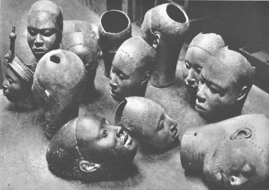
It was in January 1938, during excavation work for the construction of a house, that workers discovered an unusual treasure in the Wunmonije district of Ife. At a mere hundred meters distance away of the site of what once was the Royal Palace, they unearthed thirteen magnificent bronze heads dating from the XIIth century representing a king (an « Ooni« ), some women and courtiers. Others have since been unearthed.
Their faces, except for the lips, are covered with grooves. The hairstyle suggests a complex crown composed of several layers of tubular balls, topped by a crest with a rosette and an « egret ». The surface of this crown bears traces of red and black paint.
These large heads may have been used as effigies of the deceased in funeral ceremonies, which, among the Yoruba, sometimes took place a year after the rapid burial of the dead imposed by the tropical climate.
At the time of the discovery, the extremely naturalist rendering of the heads is considered anachronistic in the art of sub-Saharan Africa, and even more disturbing than the very “classical” i.e. realistic “mummy portraits” (Ist-IInd century) discovered as early as 1887 in the Faiyum depression of Egypt.
Yet a long tradition of figurative sculpture with similar characteristics as the bronze heads of Ife existed before, particularly among the Nok, a people of farmers who mastered iron metallurgy starting from 800 BC.
Hysteria
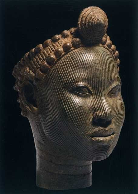
Since 1938, the « heads of Ife » have provoked reactions close to hysteria in Europe and the West in general.
On the one hand, the « modernists » and the « abstract » artists of the early XXth century, for whom the more abstract a sculpture is and the more distant it is from reality, the more it was considered as typically African. For those who were inspired by African « abstract » art to free themselves from what they considered as materialistic naturalism, the heads of Ife brutally challenged their self-deceiving “smart” narrative.
On the other hand, especially for the supporters of colonial imperialism, this art simply could not be. Frank Willett, at one point the head of the Nigerian Department of Antiquities and author of Ife, an African civilization (Editions Tallandier, 1967), reported that « Europeans visiting Ife frequently wonder how people living in houses of dried mud, with straw roofs, could have made such beautiful objects as the bronzes and terracotta in the museum ». Trying to answer that question, the publisher Sir Mortimer Wheeler replied: “The prejudice is alive and well that artistic creation and sensitivity cannot exist without domestic talent and sanitary comfort!”
The questions of the Europeans were numerous. How, in the XIIth century, could primitive peoples, who had never known an organized form of state, have made bronze heads of such refinement, using techniques that even Europe failed to master at that juncture? How could it have been possible, for tribes, subjected to superstition and irrational magic, could have observed the human anatomy so meticulously? How could savages have expressed such noble feelings towards both men and women? Faced with such an unbearable paradox, total denial was their only answer.

Hence, when the German archaeologist Leo Frobenius presented the bronze heads, western experts refused to believe in the existence of an African civilization capable of leaving artifacts of a quality they recognized as comparable to the best artistic achievements of ancient Rome or Greece. In a desperate attempt to explain what passed for an anomaly, Frobenius, without the slightest semblance of proof, came up with the theory that these heads had been cast by a Greek colony founded in the XIIIth century BC, and that the latter could be at the origin of the old legend of the lost civilization of Atlantis, a narrative immediately adopted in chorus by the mass media…
Bronze
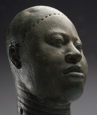
What first shocked Western experts was that these were not carved wood but sophisticated bronze heads (about 70 % copper, 16.5 % zinc and 11.3 % lead).
Given the extreme scarcity of copper ore in Nigeria, these objects demonstrate that the region had trade relations with distant countries. The ore is believed to have come from Central Europe, northwest Mauritania, the Byzantine Empire or, via the Niger River, from Timbuktu where the ore arrived by camel from southern Morocco.
If during the Neolithic period, copper, gold and silver nuggets were hammered cold or hot, it is only starting from the Bronze Age that man develops the science of real metallurgy. From ores, he was then able to extract metals thanks to a precise heat treatment, made possible by the experience of the ceramists of the time, great experts in the construction of high temperature ovens.
Copper only melts at 1083° Celsius, but by adding tin (which melts at 232°) and lead (which melts at 327°), it is possible to obtain bronze at 890° and brass at 900°. The terracotta is made at low temperature, around 600 to 800°. It should be underlined that in China, since the Shang Dynasty (1570-1045 BC), certain types of porcelain obtained much higher temperatures, between 1000 and 1300° Celsius, obtained thanks to the use of charcoal.
The oldest traces of ceramics in sub-Saharan Africa are thought to date back to more than 9000 BC, and perhaps earlier. Bu some fragmentary shards have been discovered in West Africa, in this case in Mali, and considered dating from 12000 BC. Ceramics also were produced further south, notably by the Nok culture in northern Nigeria at the beginning of the first millennium BC.
Lost-wax casting
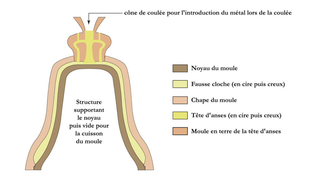
What also shocked the experts was that the technique used to make them was the quite sophisticated so-called « lost-wax casting » or “cire perdue” technique, a high precision molding process that is still used today to make church bells.
First, a model was made out of wax. This was covered with fine clay to form a mold, which was then heated so that the wax melted and ran away. Molten metal was poured into the clay mold which would be broken open to release the complete object.
Clearly, the foundries producing these artifacts required a highly skilled and well organized professional labor force.
The exceptional know-how and skills of the bronze founders of Ife was preceded by those of Igbo-Ukwu in eastern Nigeria where in 1939 a tomb filled with artifacts dating from the IXth century was discovered, revealing the existence of a powerful and refined kingdom mastering the famous lost-wax casting technique, but which so far could not be linked to any other culture in the region.
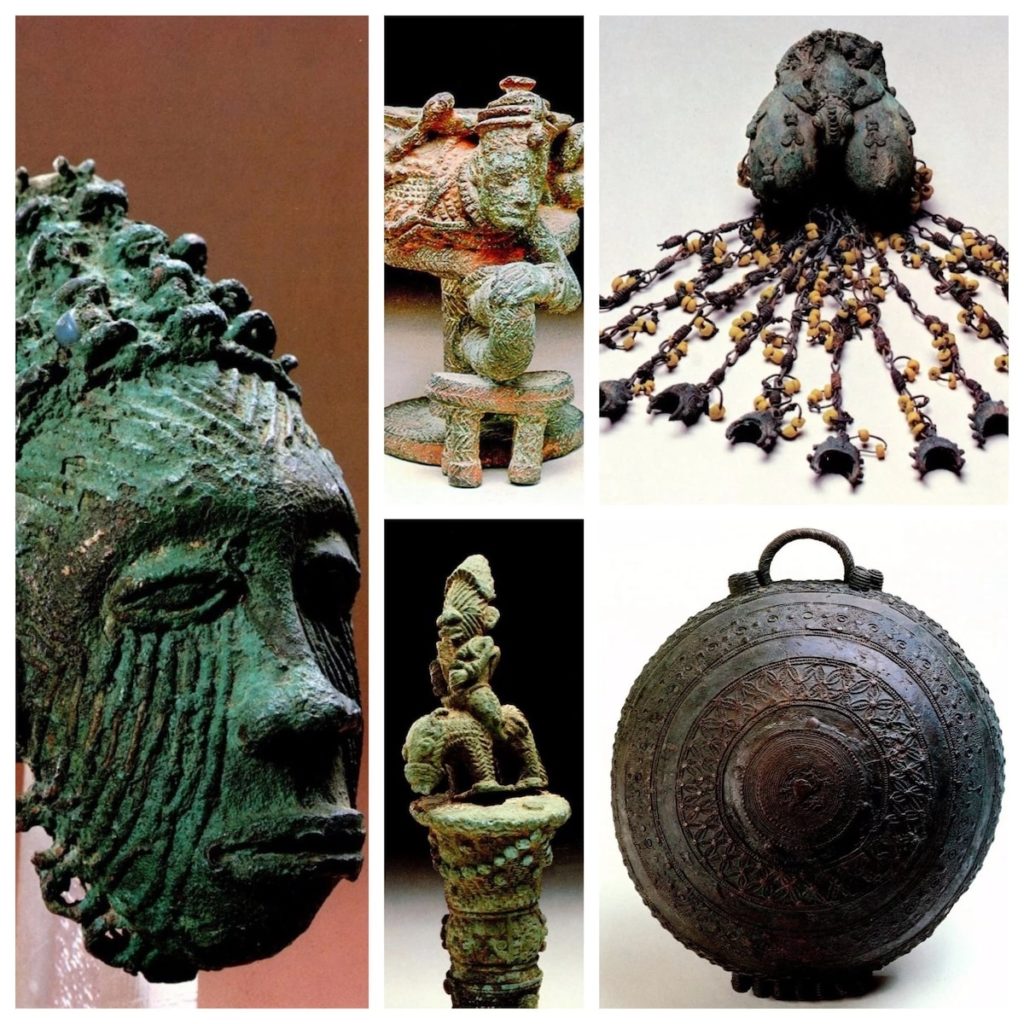
The oldest known example of the lost-wax technique comes from a 6,000-year-old wheel-shaped copper amulet found at Mehrgarh in today’s Pakistan. Although China, Greece and Rome mastered this technique, it was not until the Renaissance that it made its return to Europe.
Ife, an organized state
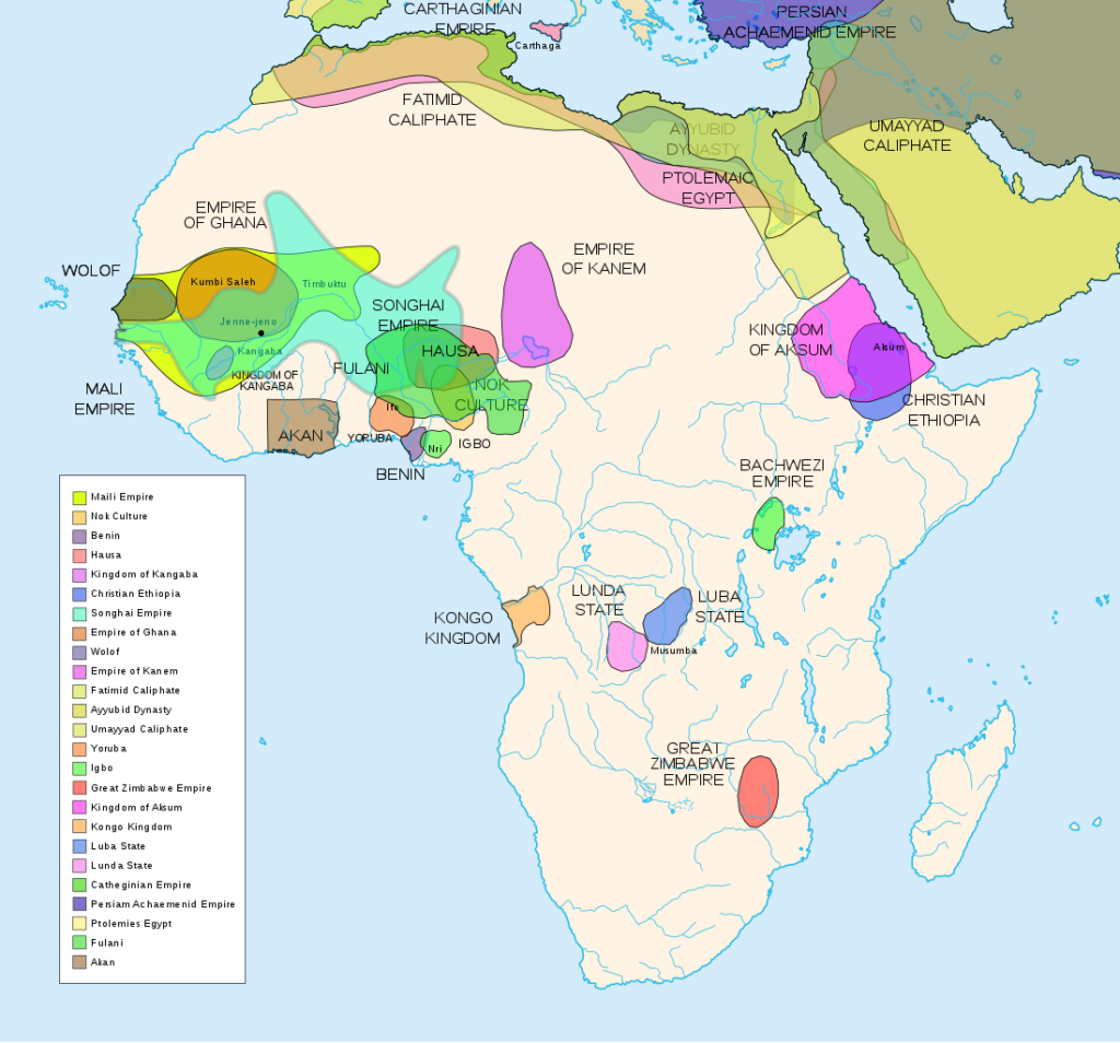
In reality, the art of Ife challenged the colonial theory that Africa was a virgin land, populated by animals and a few primitive tribes who had never taken their first steps in « history ».
Indeed, any evidence showing the existence of empires, kingdoms or great states on the African continent that allowed Africans to govern themselves peacefully for centuries could only de-legitimize the « civilizing mission » of colonialism.
However, according to oral traditions, Ife was founded in the 9th-10th centuries by Oduduwa, through the fusion of 13 villages into a single city becoming the hearth of Yoruba mythology, who considers Ife as the cradle of humanity and the center of the world.
Recognized as a minor god, Oduduwa became the first Ooni (King) and had an Aafin (palace) built. He ruled with the help of the isoro, former village chiefs who had recovered a religious title and were subject to royal political authority.
According to the same oral traditions, Oduduwa is said to have been an exiled Prince of a foreign people, who left his homeland and traveled south with his suite, settling among the Yoruba around the XIIth century. His religious faith, that he brought with him, was so important to him and his followers that it would have been the cause of their exodus in the first place.
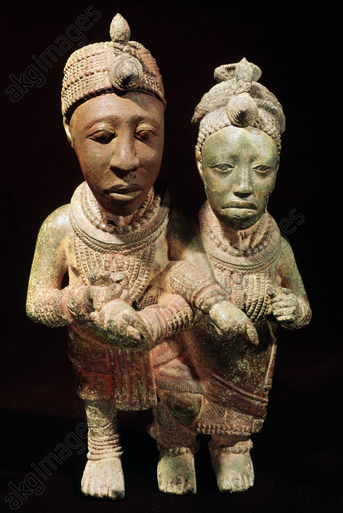
Oduduwa’s land or country of origin remains a matter of debate. For some, he comes from Mecca, for others from Egypt, as the technical skills he brought with him are supposed to demonstrate.
So far, most historians have looked to influences arriving by sea and waterways. However, it is a very plausible hypothesis that travel routs through the savanna, could have connected the Niger Delta with the Nile, like a sort of great transcontinental land-bridge, passing notably via Chad, a region where thousands of early cave paintings testify the vivacity of pictorial creativity.
As our good friend Kotto Essomé repeatedly underlined, African states often prospered along the climatic zones, following “horizontally” the latitudes. Colonial borders were deliberately drawn (laterally or “vertically”) to break the natural boundaries of pre-colonial African states.
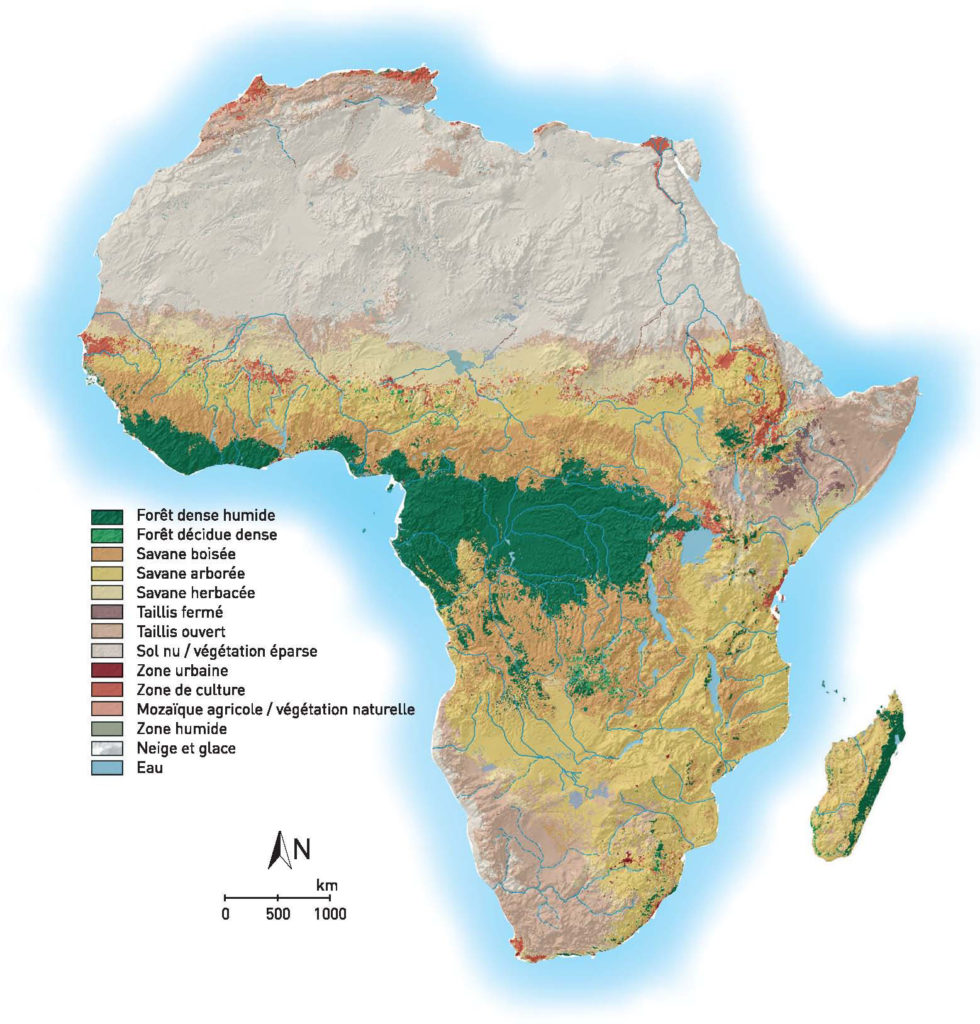
Now, as this map clearly indicates, a horizontal “ribbon” of habitable urban areas, on the borderline between the herbaceous and wooded savanna, stretches over the entire continent from the Atlantic till the Southern Nile. Unsurprisingly, this particular climatic and geographical area might have been optimally suited for both hunting, agriculture and cattle raising.
From their part, the Edo people of Benin City believed that Oduduwa was in fact a prince of their extraction, who would have fled Benin during a fight over royal succession. This is why one of his descendants, Prince Oramiyan, would have been allowed to return and found the dynasty ruling the Kingdom of Benin. Prince Oramiyan was thus the first oba of Benin, successfully replacing the Ogiso monarchical system that had reigned until then.
Metallurgy
What deserves attention here is the fact that metallurgy occupies a central place in Ife. Oduduwa had a forge in his Royal palace (Ogun Laadin). Kings from different kingdoms installed their forges within the royal palace, showing the strong symbolic relationship between power and metallurgy.
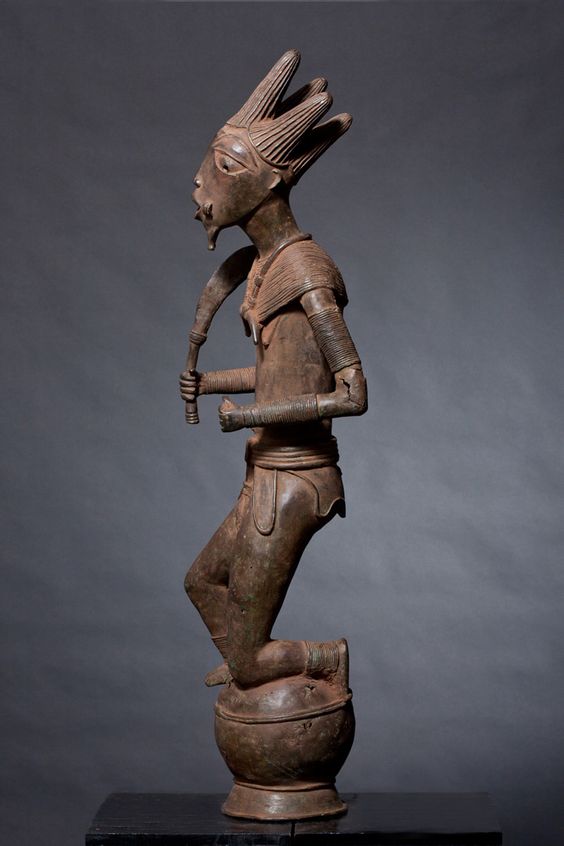
Contrary to what happened on other continents, the Iron Age in Africa would have preceded the Copper Age in some regions. The oldest indications documenting the transformation of iron ore in Africa date back to the third millennium BC. They are the archaeological sites of Egaro in eastern Niger and Giza and Abydos in Egypt. While the site of Buhen in Egyptian Nubia (- 1991), after working iron, became a « copper factory », the sites of Oliga in Cameroon (-1300) and Nok in Nigeria (-925) testify clearly of a dynamic metallurgical activity.
As we have seen, bronze casting techniques demonstrate the existence of a very advanced technological know-how. Ife will also be a major center for glass production, especially glass beads. The waste material of this ancestral production, made up of parts of crucibles covered with molten glass, will be looked for in the XIXth century by the inhabitants of the region, although the origin of the glass beads was neglected.
Recent archaeological excavations have shown that the settlements of this area are very ancient. But as we have seen, it was only at the beginning of the 2nd millennium that developments in the field of metallurgy would have made it possible to improve agricultural tools and generate surplus food. Yam, cassava, maize and cotton are cultivated here, the latter giving birth to an important cloth weaving industry.
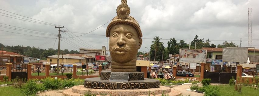
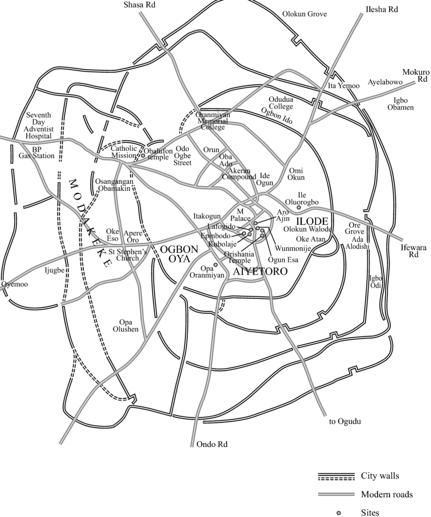
Hence, the city of Ife experienced a rapid demographic expansion thanks to this rise in agricultural productivity, itself the fruit of the mastery of an increased energy density allowing the transformation of « stones » (ores) into useful resources.
The medieval urbanization of Ife is today widely attested by the existence of numerous enclosures made of ditches and embankments, which seem to indicate the various spaces that have experienced a demographic concentration and the existence of a political body powerful enough to implement such great infrastructure programs.
Interesting, as a successful centralized state, Ife became increasingly a model for other states in the region and beyond. Several descendants and captains of Oduduwa founded their own kingdoms based on the same model and relying on the same legitimacy. The monarchical experience of Ife is exported with its cultural framework. The adé ilèkè, a crown of glass beads symbolizing royal power, is found in most monarchies in the region.
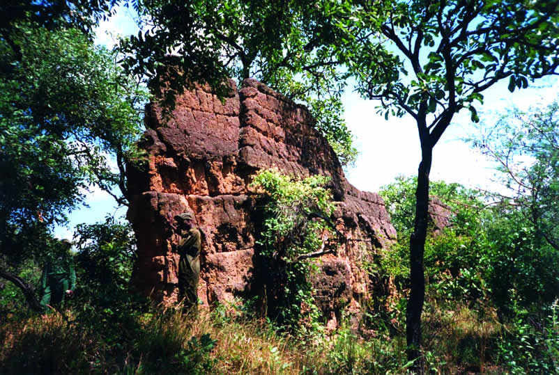
In total, depending on the sources, an estimated 7 to 20 kingdoms make up the Yoruba world in the first half of the second millennium AD.
- Oyo State in Nigeria was one of such powerful Yoruba city-states.
- Another example, the Kingdom of Ketou, currently in the southeast of Benin, is supposed to have been founded around the XIVth century by an alleged descendant of Oduduwa. He is said to have left Ife with his family and other members of his clan and moved westward, eventually settling in the city of Aro, northeast of the city of Ketou. Aro quickly became too small for the growing population, and the decision was made to settle in Ketou. King Ede therefore left Aro with 120 families and settled in this city.
- Another demonstration of Yoruba building science is the Sungbo Eredo Wall, near the Nigerian capital Lagos, a system of walls and ditches built in the XIVth century and located southwest of the town of Ijebu Ode, in Ogun State, southwestern Nigeria. More than 160 km (100 miles) long, these fortifications, some as high as 20 meters (65 feet), consist of a smooth-walled ditch that forms an inner moat in relation to the walls that overhang it. The ditch forms an irregular ring (Map) around the lands of the ancient kingdom of Ijebu. This ring is about 40 km in the north-south direction and 35 km in the east-west direction, which is the equivalent of the Paris périphérique ! Invaded by vegetation, the construction today looks like a green tunnel.
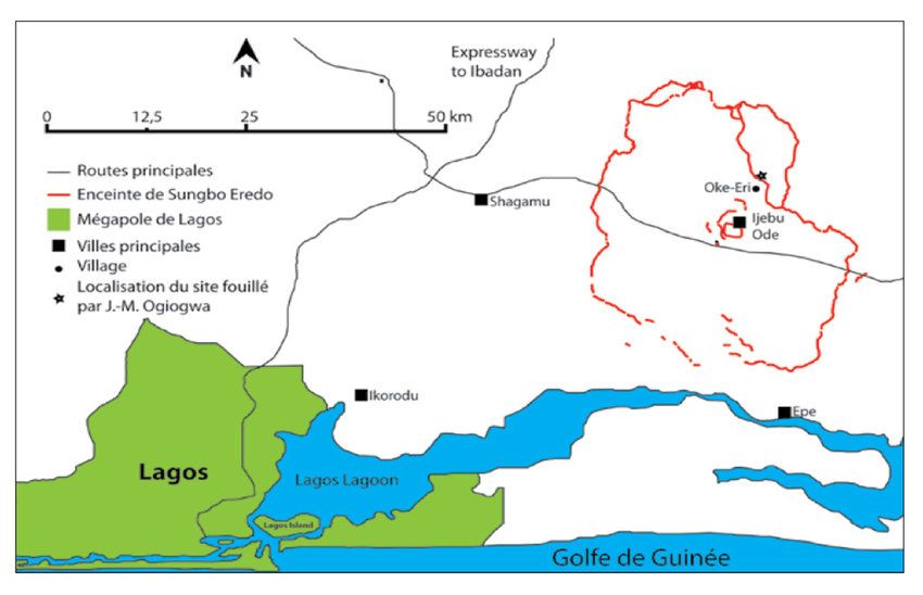
From Ife to the Kingdom of Benin
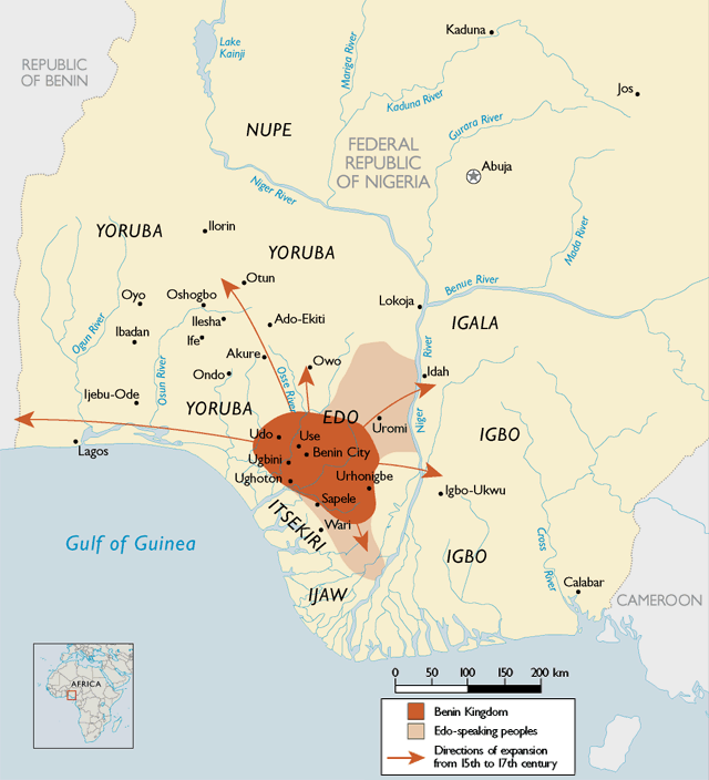
In the XIVth century, Ife experienced a demographic collapse, characterized by the abandonment of certain enclosures and a strong advance of the forest into formerly residential areas. There was also a break in the transmission of know-how and artisan techniques.
This demographic collapse has been explained as the result of a Black Plague, according to some authors, who draw a parallel with the pandemic waves hitting Europe at the same period.
Part of the inhabitants of Ife were able to take refuge and bring their know-how in metallurgy to the Kingdom of Benin, which lasted for seven hundred years, from the XIIth century until its invasion by the British Empire at the end of the XIXth century. Benin was a coastal West African city-state dominated by the Edos, an ethnic group whose dynasty still survives today.
Its territory covers to present-day Benin, plus part of Togo and southwestern Nigeria, where today « Benin City », a historic port on the Benin River, is located. In the heart of the city, the royal residence with monumental proportions translated visually the importance given to political, spiritual and traditional power.
Benin City, a marvel
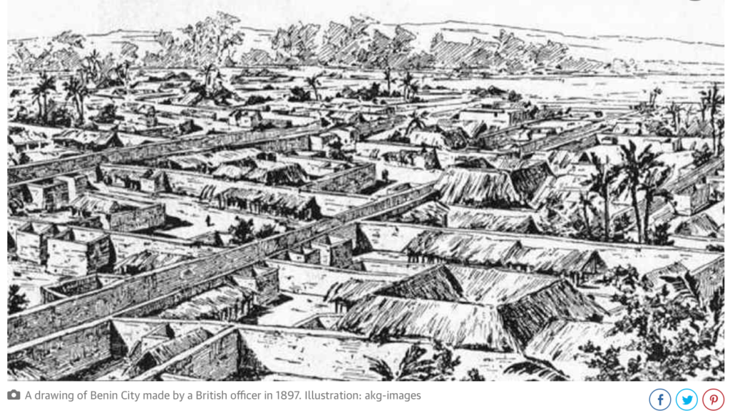
The social organization of the city impressed European visitors at the end of the XVth century. As a major regional economic trading pole, Benin was full of ivory, pepper and slaves. Benin offered the Europeans palm oil (the oil palm growing abundantly in the region). In exchange, they requested, and obtained guns, allowing the modernization of the Beninese armament.
Located in a plain, Benin City is surrounded by massive walls to the south and deep ditches to the north. Beyond the city walls, many other walls have been erected that organize the entire region of the capital into some 500 separate boroughs.
In 2016, an article published by The Guardian recounted the lost splendor of the city. The paper reported:
“The Guinness Book of Records (1974 edition) described the walls of Benin City and its surrounding kingdom as the world’s largest earthworks carried out prior to the mechanical era. According to estimates by the New Scientist’s Fred Pearce, Benin City’s walls were at one point “four times longer than the Great Wall of China, and consumed a hundred times more material than the Great Pyramid of Cheops”.
Pearce writes that these walls “extended for some 16,000 km in all, in a mosaic of more than 500 interconnected settlement boundaries. They covered 6,500 sq km and were all dug by the Edo people … They took an estimated 150 million hours of digging to construct, and are perhaps the largest single archaeological phenomenon on the planet”.
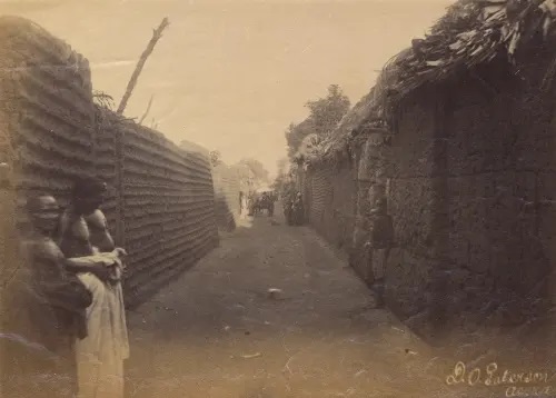
Benin City was also one of the first cities to have a semblance of street lighting. Huge metal lamps, many feet high, were built and placed around the city, especially near the king’s palace. Fueled by palm oil, their burning wicks were lit at night to provide illumination for traffic to and from the palace.
When the Portuguese first “discovered” the city in 1485, they were stunned to find this vast kingdom made of hundreds of interlocked cities and villages in the middle of the African jungle.
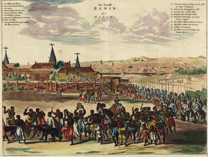
In 1691, the Portuguese ship captain Lourenco Pinto observed:
“Great Benin, where the king resides, is larger than Lisbon; all the streets run straight and as far as the eye can see. The houses are large, especially that of the king, which is richly decorated and has fine columns. The city is wealthy and industrious. It is so well governed that theft is unknown and the people live in such security that they have no doors to their houses.”
In contrast, London at the same time is described by Bruce Holsinger, professor of English at the University of Virginia, as being a city of “thievery, prostitution, murder, bribery and a thriving black market made the medieval city ripe for exploitation by those with a skill for the quick blade or picking a pocket”.
African fractals
Benin City’s planning and design was done according to careful rules of symmetry, proportionality and repetition now known as fractal design. The mathematician Ron Eglash, author of African Fractals – which examines the patterns underpinning architecture, art and design in many parts of Africa – notes that the city and its surrounding villages were purposely laid out to form perfect fractals, with similar shapes repeated in the rooms of each house, and the house itself, and the clusters of houses in the village in mathematically predictable patterns.
As he puts it:
“When Europeans first came to Africa, they considered the architecture very disorganized and thus primitive. It never occurred to them that the Africans might have been using a form of mathematics that they hadn’t even discovered yet.”
At the center of the city stood the king’s court, from which extended 30 very straight, broad streets, each about 120-ft wide. These main streets, which ran at right angles to each other, had underground drainage made of a sunken impluvium with an outlet to carry away storm water. Many narrower side and intersecting streets extended off them. In the middle of the streets were turf on which animals fed.
“Houses are built alongside the streets in good order, the one close to the other,” writes the XVIIth-century Dutch visitor Olfert Dapper. “Adorned with gables and steps … they are usually broad with long galleries inside, especially so in the case of the houses of the nobility, and divided into many rooms which are separated by walls made of red clay, very well erected.”
Dapper adds that wealthy residents kept these walls “as shiny and smooth by washing and rubbing as any wall in Holland can be made with chalk, and they are like mirrors. The upper stores are made of the same sort of clay. Moreover, every house is provided with a well for the supply of fresh water”.
Family houses were divided into three sections: the central part was the husband’s quarters, looking towards the road; to the left the wives’ quarters (oderie), and to the right the young men’s quarters (yekogbe).
Daily street life in Benin City might have consisted of large crowds going though even larger streets, with people colorfully dressed – some in white, others in yellow, blue or green – and the city captains acting as judges to resolve lawsuits, moderating debates in the numerous galleries, and arbitrating petty conflicts in the markets.
The early foreign explorers’ descriptions of Benin City portrayed it as a place free of crime and hunger, with large streets and houses kept clean; a city filled with courteous, honest people, and run by a centralized and highly sophisticated bureaucracy.

The city was split into 11 divisions, each a smaller replication of the king’s court, comprising a sprawling series of compounds containing accommodation, workshops and public buildings – interconnected by innumerable doors and passageways, all richly decorated with the art that made Benin famous. The city was literally covered in it.
The exterior walls of the courts and compounds were decorated with horizontal ridge designs (agben) and clay carvings portraying animals, warriors and other symbols of power – the carvings would create contrasting patterns in the strong sunlight. Natural objects (pebbles or pieces of mica) were also pressed into the wet clay, while in the palaces, pillars were covered with bronze plaques illustrating the victories and deeds of former kings and nobles.
At the height of its greatness in the XIIth century – well before the start of the European Renaissance – the kings and nobles of Benin City patronized craftsmen and lavished them with gifts and wealth, in return for their depiction of the kings’ and dignitaries’ great exploits in intricate bronze sculptures.
“These works from Benin are equal to the very finest examples of European casting technique,” wrote Professor Felix von Luschan, formerly of the Berlin Ethnological Museum. Italian Renaissance artist “Benvenuto Celini could not have cast them better, nor could anyone else before or after him. Technically, these bronzes represent the very highest possible achievement.”
The fatal encounter with « civilization »
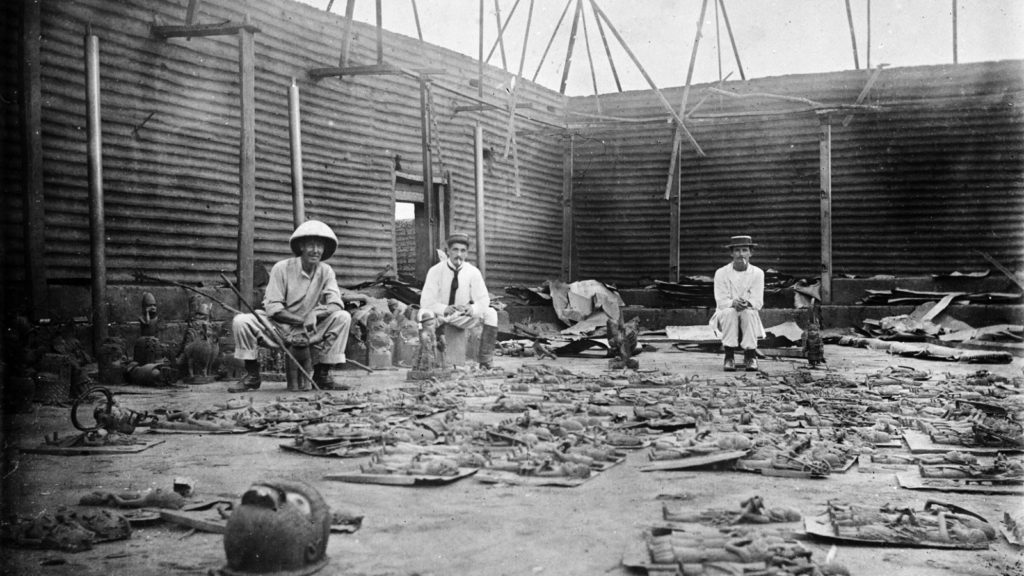
Following the Berlin Conference of 1885, where the British, Portuguese, Belgian, German, French, Italian and other European colonial powers shared Africa like a big chocolate cake that they intended to devour, in the name of the immutable laws of the freshly invented science of “geopolitics”, European invasions multiplied and gained in brutality.
Thus, following the king of Benin’s refusal to cede to the British the national monopoly on the production of palm oil and other products, Benin City was looted, burned and reduced to ashes during a British punitive expedition in 1897. The king (the oba) is arrested and forced into exile and thousands of beautiful « bronzes of Benin », though less realistic than those of Ife, are stolen, sold and partly lost.
They end up on the art market and in museums, including the British Museum (700 objects) and the Berlin Museum of Ethnology (500 pieces). The British government itself sells some of them « to cover the cost of the expedition« .
So, while some clearly entered history with their beautiful art, others exited civilization with their barbarian crimes.
Summary bibliography:
- Ifè, une civilisation africaine, Frank Willett, Jardin des Arts/Tallandier, Paris 1971;
- General History of Africa, Présence africaines/Edicef/Unesco, Paris 1987;
- Atlas historique de l’Afrique, Editions du Jaguar, Paris 1988;
- L’Afrique ancienne, de l’Acus au Zimbabwe, under the direction of François-Xavier Fauvelle, Belin/Humensis, Paris 2018.
On Leonardo da Vinci’s « Vitruvian Man »

By Karel Vereycken
Leonardo da Vinci’s « Viruvian Man ». Since we’re commemorating this year (2019) Leonardo Da Vinci, who died 500 years ago, many silly things are presented by fake scholars trying to make a real living.
Since I was introduced into the canon of proportions of the human body during my training as a professional painter and engraver, I want offer you some hints on how to look at what is called Da Vinci’s « Vitruvian man », a drawing currently on exhibit at the Da Vinci show at the Louvre in Paris.
Hence, as Leonardo underlines himself in his notebooks, adopting Cusanus wordings, it is only with the « eyes of the mind » that art becomes visible, because the « eyes of the flesh » are intrensically blind to it.
Canons of proportions
Europe, and Classical Greece, as everybody should know, emerged largely by absorbing several major discoveries accomplished much earlier by other civilizations. Much of it came from Asia, but African and especially Egypt, were key.
The very practice of mummification, a process which takes at least 60 days of work, made Egypt the key area of anatomical research.
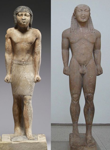
As demonstrated by early Egyptian sculpture, the exact size of the entire adult human body is 7,5 times the size of the head. The size of a newborn is only four heads, that of a seven year old, six heads and that of a 17 years old adolescent, 7 heads.
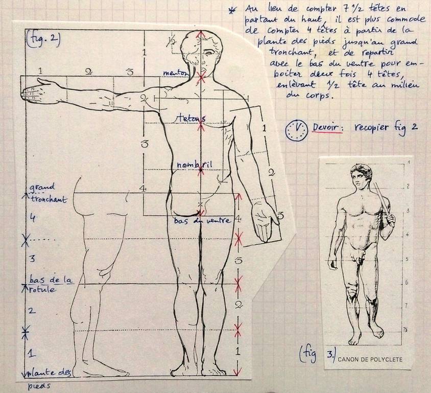
If one subdivides the overall 7.5 proportion, for an adult, from the top of the head till the lowest part of the torso, one measures four heads, one till the nipples, one till the belly button and a fourth one till the lowest part of the pubis. Going up from the sole till the middle of the pelvis, one measures 3.5 heads: 2 heads till the knee and 1.5 till the middle of the pelvis. That brings the total till 7.5 heads for the entire length of the adult human body and it is proportional in the sense that people with smaller heads also have small bodies.
Polikleitos versus Lysippus
In the Vth Century BC, the Greek sculptor Polikleitos’ spear bearer (The “Doryphoros”) of Naples National Archeological Museum applied this most beautiful canon of proportions, known as the “Polikleitos canon”.
During the Renaissance, the nostalgics of the Roman Empire preferred another Greek canon, that of Greek sculptor Lysippus (4th Century BC), formalized by the Roman author, architect and civil engineer, Vitrivius (1st century BC).
Vitruvius only transcribed the prevalent taste of his epoch. Roman sculptors, in order to give an athletic and heroic look to the Emperors which they were portraying, adopting the canon of Lysippus, could reduce the head of their models to only an eight of the total length of the body. The trick was that by reducing the relative size of the head, the body looked more preeminent and powerful, something most emperors, who were often physical failures, appreciated and secured their popularity. Even extreme cases of 12 to 15 heads of body length appeared. In short, Public relations ruled at the detriment of science and truth.
Today’s comic strip drawers chose proportions according to purpose:
–For real life, 7.5 or “normal canon”
–For a movie star, 8 heads, with the “idealistic canon”;
–For a fashion magazine: 8.5 heads;
–For a comic book hero: 9 heads for the “heroic canon”
Vitruvian man
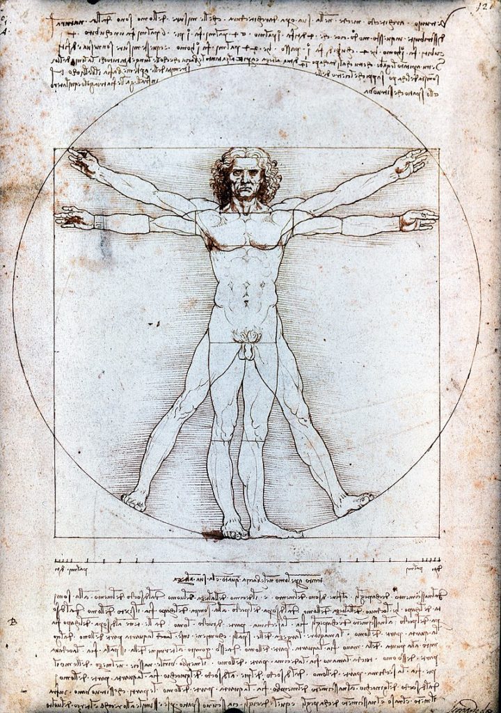
Text accompanying Leonardo DaVinci’s Vitruvian Man:
Vitruvius, the architect, says in his work on architecture that the measurements of the human body are distributed by Nature as follows that is that 4 fingers make 1 palm, and 4 palms make 1 foot, 6 palms make 1 cubit; 4 cubits make a man’s height. And 4 cubits make one pace and 24 palms make a man; and these measures he used in his buildings. If you open your legs so much as to decrease your height 1/14 and spread and raise your arms till your middle fingers touch the level of the top of your head you must know that the centre of the outspread limbs will be in the navel and the space between the legs will be an equilateral triangle.
The length of a man’s outspread arms is equal to his height.
From the roots of the hair to the bottom of the chin is the tenth of a man’s height; from the bottom of the chin to the top of his head is one eighth of his height; from the top of the breast to the top of his head will be one sixth of a man. From the top of the breast to the roots of the hair will be the seventh part of the whole man. From the nipples to the top of the head will be the fourth part of a man. The greatest width of the shoulders contains in itself the fourth part of the man. From the elbow to the tip of the hand will be the fifth part of a man; and from the elbow to the angle of the armpit will be the eighth part of the man. The whole hand will be the tenth part of the man; the beginning of the genitals marks the middle of the man. The foot is the seventh part of the man. From the sole of the foot to below the knee will be the fourth part of the man. From below the knee to the beginning of the genitals will be the fourth part of the man. The distance from the bottom of the chin to the nose and from the roots of the hair to the eyebrows is, in each case the same, and like the ear, a third of the face.
Of course, Da Vinci’s exploration of the Vitruvian man doesn’t mean he approves or disapproves the stated fakery in proportions.
Soul or muscle?
It should be known that in Italy, the pure Roman taste has become trendy again following the discovery in 1506 of the statue of the Laocoon on the site of Nero’s villa in Rome. From that moment, artist will feel obliged to increase the volume of the muscular masses in order to appear as working « in Antique style ».
Although Leonardo never openly criticized this trend, it is hard not to think of Michelangelo’s frescoes in the Sistine Chapel, when the artist, seeking to raise the spirit to unequalled philosophical heights, advised painters: « do not give all the muscles of the figures an exaggerated volume » and « if you act differently, it is more a sort of representation of a sack of nuts that you will have achieved than to that of a human figure » (Codex Madrid II, 128r).
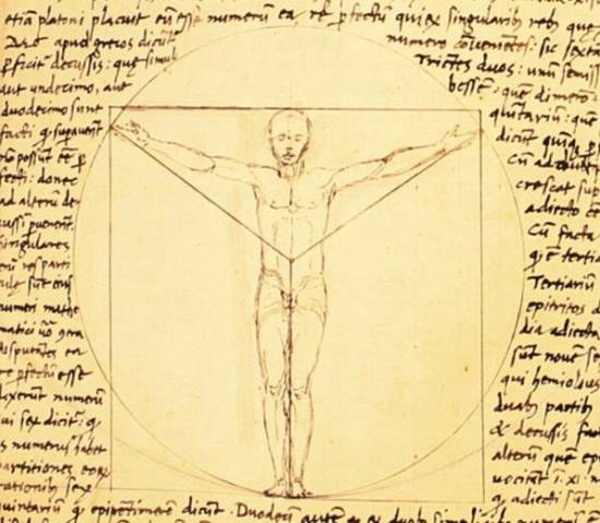
No doubt inspired by his friend, the architect Giacomo Andrea, in « The Vitruvian Man », Leonardo is above all interested by other harmonies: if a person extends his arms in a direction parallel to the ground, one obtains the same length as one’s entire height. This equality is inscribed by Leonardo in a square (symbol of the earthly realm). But if one stretches his arms and legs in a star shape, they are inscribed in a circle whose center is the navel. The location of the navel divides the body according to the golden ratio (in this example 5 heads out of a total of 8 heads, 5+3 being part of the Fibonnacci series: 1+2 = 3; 3+2 = 5; 5+3 = 8; 8+5 = 13; 13+8 = 21, etc.).
Leonardo clearly understood what the golden section really means: not a “magical” number in itself, but the reflexion of the dynamic of least action, the very principle uniting man (the square) with the creator and the universe (the circle).
So if you take a look, beware of what you see and especially what you don’t !