Étiquette : Karel Vereycken
Le « miracle » du Gandhara : quand Bouddha s’est fait homme
C’est lors de mon voyage en Afghanistan, en novembre 2023, que j’ai réalisé à quel point j’ignorais tout de cette partie du monde. Si aujourd’hui l’islam prévaut en Afghanistan et au Pakistan, on oublie souvent qu’une région commune à ces deux pays, historiquement connue sous le nom de Gandhara, a joué, du Ier au IIIe siècle de notre ère, un rôle majeur dans l’épopée du bouddhisme, une spiritualité qui, en refusant toute idée de caste, va bousculer l’ordre du monde.
Carrefour obligé sur les Routes de la soie reliant l’Europe à l’Inde et à la Chine, c’est au Gandhara, qu’a eu lieu un véritable dialogue entre les cultures eurasiatiques, perses, turques, grecques, chinoises et indiennes.
Bouddha. C’est par le volontarisme de deux grands rois d’Asie centrale (Ashoka et Kanishka) que le bouddhisme, né au Népal, trouvera l’énergie et la détermination pour gagner les esprits et les cœurs du monde.
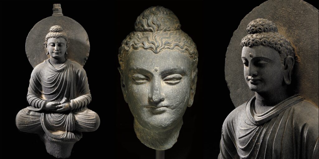
Enfin, c’est au Gandhara que l’art bouddhique, en rupture avec les consignes du maître, va s’approprier les plus belles formes de diverses cultures artistiques grecques, indiennes, perses et autres, pour présenter bouddha sous une forme humaine aux fidèles, un homme éclairé, plein de sagesse et animé de compassion.
En offrant fraîcheur, poésie et un sens du mouvement spectaculairement moderne, les premiers artistes bouddhistes du Gandhara nous invitent à identifier en nous-mêmes, un saut vers l’auto-perfectionnement. A ce titre, ils sont les précurseurs de l’humanisme classique et de bien des Renaissances.
N’est-il pas temps de reconnaître la juste place que mérite leur contribution à la civilisation universelle ?
Enfin, vu la situation actuelle du monde, je tiens à citer le Premier Ministre indien Nehru, qui, le 3 octobre 1960 s’adressait à l’Assemblée générale des Nations unies avec des paroles qui n’ont cessé de gagner en pertinence : « Dans un passé lointain, un grand fils de l’Inde, le Bouddha, a dit que la seule vraie victoire était celle où tous étaient également victorieux et où personne n’était vaincu. Dans le monde d’aujourd’hui, c’est la seule victoire concrète ; toute autre voie mène au désastre. »
- Introduction
- Bouddha, bio-express
- Les quatre vérités et l’octuple sentier
- Réincarnation
- Les Aryens et le védisme
- Les Brahmanes et le système des castes
- L’Inde avant le Bouddhisme
- Les grands conciles bouddhistes
- L’arrivée des Grecs
- L’Empire Maurya
- Le règne d’Ashoka le Grand
- Edits d’Ashoka
- Contenu des édits
- L’Empire Kouchan
- Le miracle de Gandhara
a) La poésie
b) La littérature
c) L’urbanisme
d) L’architecture, l’invention des stupa
e) Sculpture
–Aniconisme
–Fin de l’aniconisme
–Différence de forme, différence de contenu
1) Ecole greco-bouddhique de Gandhara
2) Ecole de Mathura
3) Ecole d’Andrah Pradesh
4) Ecole de la période Gupta. - Lorsque l’Asie rencontre la Grèce
a) Pièces de monnaies kouchanes
b) Reliquaire bimaran
c) Triade de Harra
d) Prendre la terre à témoin
e) Tous Bodhisattva - Le Bouddhisme aujourd’hui, l’exemple de Nehru
- Science et religion, Albert Einstein et Buddha.
Introduction
Les Ve et IVe siècles avant J.-C. furent une période d’effervescence intellectuelle mondiale. C’est l’époque des grands penseurs, tels que Socrate, Platon et Confucius, mais aussi Panini et Bouddha.
Dans le nord de l’Inde, c’est l’âge du Bouddha, après la mort duquel émerge une foi non théiste (Bouddha n’est qu’un homme…), qui se répand bien au-delà de sa région d’origine. Avec entre 500 millions et un milliard de croyants, le bouddhisme constitue aujourd’hui l’une des principales croyances religieuses et philosophiques du monde et sans doute une force potentielle redoutable pour la paix.
Bouddha, bio-express

« Le bouddha » (l’éveillé) est le nom donné à un homme appelé Siddhartha Gautama Shakyamuni (le muni ou sage du clan des Shakya). Il aurait atteint l’âge d’environ quatre-vingts an. Craignant l’idolâtrie, il refuse toute représentation de sa personne sous forme d’image.
Les traditions divergent sur les dates exactes de sa vie que la recherche moderne tend à situer de plus en plus tard : vers 623-543 av. J.-C. selon la tradition theravâda, vers 563-483 av. J.-C. selon la majorité des spécialistes du début du XXe siècle, tandis que d’autres le situent aujourd’hui entre 420 et 380 av. J.-C. (sa vie n’aurait pas dépassé les 40 ans).
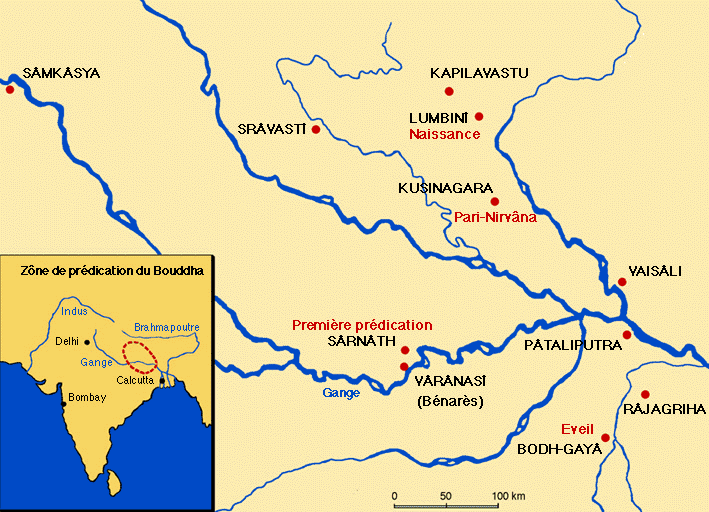
Selon la tradition, Siddhartha Gautama est né à Lumbini (dans l’actuel Népal) en tant que prince de la famille royale de la ville de Kapilavastu, un petit royaume situé dans les contreforts de l’Himalaya, dans l’actuel Népal.
Un astrologue aurait mis en garde le père du garçon, le roi Suddhodana : lorsque l’enfant grandirait, il deviendrait soit un brillant souverain, soit un moine influent, en fonction de sa lecture du monde. Farouchement déterminé à en faire son successeur, le père de Siddhartha ne le laissa donc jamais voir le monde en dehors des murs du palais. Tout en lui offrant tous les plaisirs et distractions possibles, il en fait un prisonnier virtuel jusqu’à l’âge de 29 ans.
Lorsque le jeune homme s’échappe de sa cage dorée, il découvre l’existence de personnes affectées par leur grand âge, la maladie et la mort. Bouleversé par la souffrance des gens ordinaires qu’il rencontre, Siddhartha abandonne les plaisirs éphémères du palais pour rechercher un but plus élevé dans la vie. Il se soumet d’abord à un ascétisme draconien, qu’il abandonne six ans plus tard, estimant qu’il s’agissait d’un exercice futile.
Il s’assoit alors sous un grand figuier pour méditer et y fait l’expérience du nirvana (la bodhi : libération ou, en sanskrit, extinction). On le désigne désormais sous le nom de « Bouddha » (l’éveillé ou l’éclairé).
Les « quatre vérités » et « l’octuple sentier »
Avant d’en esquisser le développement politique, quelques mots sur la philosophie sous-jacente au bouddhisme.
A ses jeunes disciples, Bouddha enseigne la « Voie du milieu », entre les deux extrêmes de la mortification et de la satisfaction des désirs.
Et il énonce les Quatre nobles vérités :
- La noble vérité de la souffrance.
- La noble vérité de l’origine de la souffrance.
- La noble vérité de la cessation de la souffrance.
- La noble vérité de la voie menant à la cessation de la souffrance, celle du Noble Chemin octuple.
Ainsi que le feront Augustin et plus encore les Frères de la Vie commune dans le monde chrétien, le bouddhisme insiste sur le fait que notre attachement à l’existence terrestre implique la souffrance.
Chez les chrétiens, c’est ce qui conduirait au « péché », notion inexistante dans le bouddhisme, pour qui l’errance vient de l’ignorance du bon chemin.
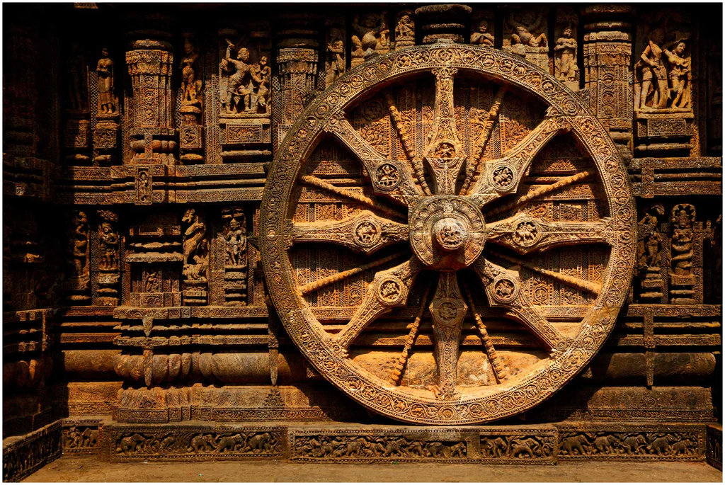
Pour Bouddha, il faut combattre, voire éteindre tout sens démesuré du moi (on dirait ego aujourd’hui). Il est possible de mettre fin à notre souffrance en transcendant ce fort sentiment de « moi », afin d’entrer dans une plus grande harmonie avec les choses en général. Les moyens d’y parvenir sont résumés dans le Noble Chemin octuple, parfois représenté par les huit rayons d’une Roue de la Loi (dharmachakra) que Bouddha mettra en marche, la Loi signifiant ici le dharma, un ensemble de préceptes moraux et philosophiques.
Ces huit points du Noble Chemin octuple sont :
- la vue juste
- la pensée juste
- la parole juste
- l’action juste
- les moyens d’existence justes
- l’effort juste
- la pleine conscience
- la concentration juste
– La vision juste est importante dès le départ, car sans cela, on ne peut pas voir la vérité des quatre nobles vérités.
– La pensée juste en découle naturellement. Le terme « juste » signifie ici « en accord avec les faits », c’est-à-dire avec la façon dont les choses sont (qui peut être différente de la façon dont je voudrais qu’elles soient).
– La pensée juste, la parole juste, l’action juste et les moyens d’existence justes impliquent une retenue morale – s’abstenir de mentir, de voler, de commettre des actes violents et gagner sa vie d’une manière qui ne soit pas préjudiciable aux autres. La retenue morale ne contribue pas seulement à l’harmonie sociale générale, elle nous aide aussi à contrôler et à diminuer le sentiment démesuré du « moi ». Comme un enfant gâté, le « moi » grandit et devient indiscipliné à mesure que nous le laissons agir à sa guise.
– Ensuite, l’effort juste est important parce que le « moi » prospère dans l’oisiveté et le mauvais effort ; certains des plus grands criminels sont les personnes les plus énergiques, donc l’effort doit être approprié à la diminution du « moi » (son ego, dirait-on aujourd’hui). Dans tous les cas, si nous ne sommes pas prêts à faire des efforts, nous ne pouvons pas espérer obtenir quoi que ce soit, ni dans le sens spirituel ni dans la vie. Les deux dernières étapes de la voie, la pleine conscience et la concentration ou absorption, représentent la première étape permettant de nous libérer de la souffrance.
Les ascètes qui avaient écouté le premier discours du Bouddha devinrent le noyau d’un sangha (communauté, mouvement) d’hommes (les femmes devaient entrer plus tard) qui suivaient la voie décrite par le Bouddha dans sa Quatrième noble vérité, celle précisant le Noble Chemin octuple.
Pour rendre le nirvana bouddhiste accessible au citoyen ordinaire, l’imagination bouddhiste a inventé le concept très intéressant de bodhisattva, mot dont le sens varie selon le contexte. Il peut aussi bien désigner l’état dans lequel se trouvait Bouddha lui-même avant son « éveil », qu’un homme ordinaire ayant pris la résolution de devenir un bouddha et ayant reçu d’un bouddha vivant la confirmation ou la prédiction qu’il en serait ainsi.
Dans le bouddhisme theravâda (l’école ancienne), seules quelques personnes choisies peuvent devenir des bodhisattvas, comme Maitreya, présenté comme le « Bouddha à venir ».
Mais dans le bouddhisme mahâyâna (Grand Véhicule), un bodhisattva désigne toute personne qui a généré la bodhicitta, un souhait spontané et un esprit compatissant visant à atteindre l’état de bouddha pour le bien de « tous les êtres sensibles », hommes aussi bien qu’animaux. Etant donné qu’une personne peut, dans une vie future, se réincarner dans un animal, le respect des animaux s’impose.
Réincarnation
Tout en voulant construire sa propre vision sur certains fondements de l’hindouisme, l’une des plus anciennes religions du monde, Siddhartha introduisit néanmoins des changements révolutionnaires aux implications politiques importantes.
Dans la plupart des croyances impliquant la réincarnation (hindouisme, jaïnisme, sikhisme), l’âme humaine est immortelle et ne se disperse pas après la disparition du corps physique. Après la mort, l’âme transmigre simplement (métempsychose) dans un nouveau-né ou un animal pour poursuivre son immortalité. La croyance en la renaissance de l’âme a été exprimée par les penseurs grecs anciens, à commencer par Pythagore, Socrate et Platon.
Le but du bouddhisme est d’apporter un bonheur durable et inconditionnel. Celui de l’hindouisme est de se libérer du cycle de naissance et de renaissance (samsara) pour atteindre, finalement, le moksha, qui en est la libération.
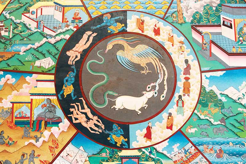
Le bouddhisme et l’hindouisme s’accordent sur le karma, le dharma, le moksha et la réincarnation. Mais ils diffèrent politiquement dans la mesure où le bouddhisme se concentre sur l’effort personnel de chacun et accorde par conséquent une moindre importance aux prêtres et aux rituels formels que l’hindouisme. Enfin, le bouddhisme ne reconnaît pas la notion de caste et prône donc une société plus égalitaire.
Alors que l’hindouisme soutient que l’on ne peut atteindre le nirvana que dans une vie ultérieure, le bouddhisme, plus volontariste et optimiste, soutient qu’une fois qu’on a réalisé que la vie est souffrance, on peut mettre un terme à cette souffrance dans sa vie présente.
Les bouddhistes décrivent leur renaissance comme une bougie vacillante qui vient en allumer une autre, plutôt que comme une âme immortelle ou un « moi » passant d’un corps à un autre, ainsi que le croient les hindous. Pour les bouddhistes, il s’agit d’une renaissance sans « soi », et ils considèrent la réalisation du non-soi ou du vide comme le nirvana (extinction), alors que pour les hindous, l’âme, une fois libérée du cycle des renaissances, ne s’éteint pas, mais s’unit à l’Être suprême et entre dans un éternel état de félicité divine.
Les Aryens et le védisme
L’une des grandes traditions ayant façonné l’hindouisme est la religion védique (védisme), qui s’est épanouie chez les peuples indo-aryens du nord-ouest du sous-continent indien (Pendjab et plaine occidentale du Gange) au cours de la période védique (1500-500 av. J.-C.).
Au cours de cette période, des peuples nomades venus du Caucase et se désignant eux-mêmes comme « Aryens » (« noble », « civilisé » et « honorable ») pénétrèrent en Inde par la frontière nord-ouest.

Le terme « aryen » a une très mauvaise connotation historique, en particulier depuis le XIXe siècle, lorsque plusieurs antisémites virulents, tels qu’Arthur de Gobineau, Richard Wagner et Houston Chamberlain, ont commencé à promouvoir le mythe d’une « race aryenne », soutenant l’idéologie suprémaciste blanche de l’aryanisme qui dépeint la race aryenne comme une « race des seigneurs », les non-aryens étant considérés non seulement comme génétiquement inférieurs (Untermensch, ou sous-homme) mais surtout comme une menace existentielle à exterminer.
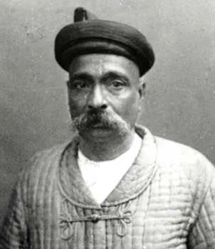
D’un point de vue purement scientifique, dans son livre The Arctic Home (1903), le patriote indien Bal Gangadhar Tilak (1856-1920), s’appuyant sur son analyse des observations astronomiques contenues dans les hymnes védiques, émet l’hypothèse selon laquelle le pôle Nord aurait été le lieu de vie originel des Aryens pendant la période préglaciaire, région qu’ils auraient quittée vers 8000 avant J.-C. à cause de changements climatiques, migrant vers les parties septentrionales de l’Europe et de l’Asie. Gandhi disait de Tilak, l’un des pères du mouvement de l’indépendance du pays, qu’il était « l’artisan de l’Inde moderne ».
Les Aryens arrivant du Nord étaient probablement moins barbares qu’on ne l’a suggéré jusqu’à présent. Grâce à leur supériorité militaire et culturelle, ils conquirent toute la plaine du Gange, avant d’étendre leur domination sur les plateaux du Deccan.
Cette conquête a laissé des traces jusqu’à nos jours, puisque les régions occupées par ces envahisseurs parlent des langues indo-européennes issues du sanskrit. (*1)

En réalité, la culture védique est profondément enracinée dans la culture eurasienne des steppes Sintashta (2200-1800 avant notre ère) du sud de l’Oural, dans la culture Andronovo d’Asie centrale (2000-900 avant notre ère), qui s’étend du sud de l’Oural au cours supérieur de l’Ienisseï en Sibérie centrale, et enfin dans la Civilisation de la vallée de l’Indus (Harappa) (4000-1500 avant notre ère).
Cette culture védique se fonde sur les fameux Védas (savoirs), quatre textes religieux consignant la liturgie des rituels et des sacrifices et les plus anciennes écritures de l’hindouisme. La partie la plus ancienne du Rig-Veda a été composée oralement dans le nord-ouest de l’Inde (Pendjab) entre 1500 et 1200 av. JC., c’est-à-dire peu après l’effondrement de la Civilisation de la vallée de l’Indus.
Le philologue, grammairien et érudit sanskrit Panini, qu’on croit être un contemporain de Bouddha, est connu pour son traité de grammaire sanskrite en forme de sutra, qui a suscité de nombreux commentaires de la part d’érudits d’autres religions indiennes, notamment bouddhistes.
Les Brahmanes et le système des castes
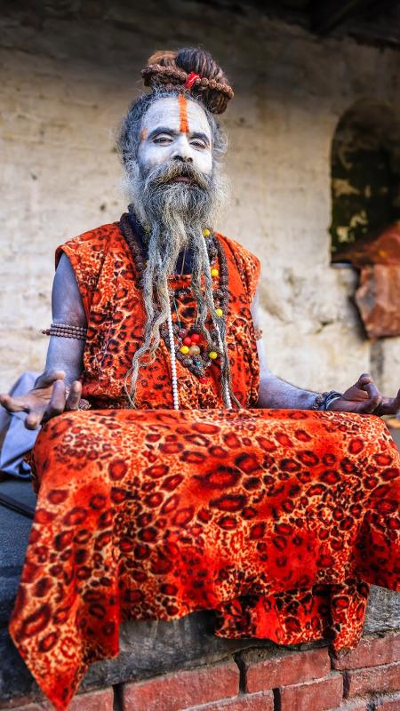
Cependant, avec l’émergence de cette culture aryenne apparut ce que l’on appelle le « brahmanisme », c’est-à-dire la naissance d’une caste toute puissante de grands prêtres.
« De nombreuses études linguistiques et historiques font état de troubles socioculturels résultant de cette migration et de la pénétration de la culture brahmanique dans diverses régions, de l’ouest de l’Asie du Sud vers l’Inde du Nord, l’Inde du Sud et l’Asie du Sud-Est », constate aujourd’hui Gajendran Ayyathurai, un anthropologue indien de l’Université de Göttingen en Allemagne.
Le brahman, littéralement « supérieur », est un membre de la caste sacerdotale la plus élevée (à ne pas confondre avec les adorateurs du dieu hindou Brahma). Bien que le terme apparaisse dans les Védas, les chercheurs modernes tempèrent ce fait et soulignent qu’il « n’existe aucune preuve dans le Rig-Veda d’un système de castes élaboré, très subdivisé et très important ».
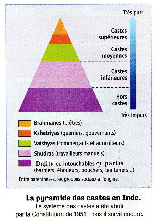
Mais avec l’émergence d’une classe dirigeante de brahmanes, devenus banquiers et propriétaires terriens, notamment sous la période Gupta (de 319 à 515 après J.-C.), un redoutable système de castes se met graduellement en place. La classe dirigeante féodale, ainsi que les prêtres, vivant des recettes des sacrifices, mettront l’accent sur des dieux locaux qu’ils intégreront progressivement au brahmanisme afin de séduire les masses. Même parmi les souverains, le choix des divinités indiquait des positions divergentes : une partie de la dynastie Gupta soutenait traditionnellement le dieu Vishnou, tandis qu’une autre soutenait le dieu Shiva.
Ce système déshumanisant des castes fut ensuite amplifié et utilisé à outrance par la Compagnie britannique des Indes orientales, une entreprise et une armée privée à la tête de l’Empire britannique, pour imposer son pouvoir aristocratique et colonial sur les Indes, une politique qui perdure encore aujourd’hui, surtout dans les esprits.
Le système hindou des castes s’articule autour de deux concepts clés permettant de catégoriser les membres de la société : le varṇa et la jati. Le varna (littéralement « couleur ») divise la société en une hiérarchie de quatre grandes classes sociales :
- Brahmanes (la classe sacerdotale)
- Kshatriyas (guerriers et dirigeants)
- Vaishyas (marchands)
- Shudras (travailleurs manuels)
En outre, la jati fait référence à plus de 3000 classifications hiérarchiques, à l’intérieur des quatre varnas, entre les groupes sociaux en fonction de la profession, du statut social, de l’ascendance commune et de la localité…
La justification de cette stratification sociale est intimement liée à la vision hindouiste du karma. Car la naissance de chacun est directement liée au karma, véritable bilan de sa vie précédente. Ainsi, la naissance dans le varna brahmanique est le résultat d’un bon karma…
« Ceux qui ont eu une bonne conduite ici auront rapidement une bonne naissance – naissance en tant que brahmane, kshatriya ou vaishya. Mais ceux dont la conduite ici a été mauvaise obtiendront rapidement une mauvaise naissance – naissance en tant que chien, porc ou chandala (bandit). »
(Chandogya Upanishad 5.10.7)
Selon cette théorie, le karma détermine la naissance de l’individu dans une classe, ce qui définit son statut social et religieux, qui fixe à son tour ses devoirs et obligations au regard de ce statut spécifique.
En 2021, une enquête a révélé que trois Indiens sur dix (30 %) s’identifient comme membres des quatre varnas et seulement 4,3 % des Indiens (60,5 millions) comme des brahmanes.
Certains d’entre eux sont prêtres, d’autres exercent des professions telles qu’éducateurs, législateurs, érudits, médecins, écrivains, poètes, propriétaires terriens et politiciens. Au fur et à mesure de l’évolution de ce système de castes, les brahmanes ont acquis une forte influence en Inde et ont exercé une discrimination à l’encontre des autres castes « inférieures ».
L’immense partie restante des Indiens (70 %), y compris parmi les hindous, déclare faire partie des dalits, encore appelés intouchables, des individus considérés, du point de vue du système des castes, comme hors castes et affectés à des fonctions ou métiers jugés impurs. Présents en Inde, mais également dans toute l’Asie du Sud, les dalits sont victimes de fortes discriminations. En Inde, une écrasante majorité de bouddhistes se déclarent dalits.
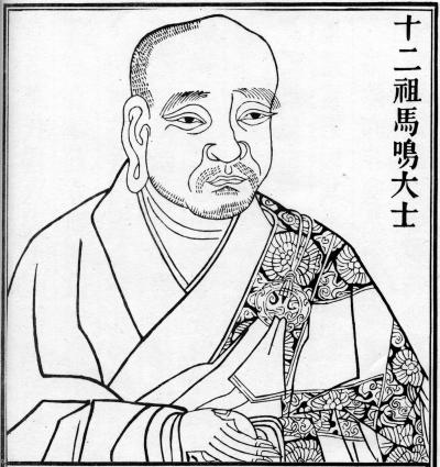
Dès le Ier siècle, le philosophe bouddhiste, dramaturge, poète, musicien et orateur indien Asvaghosa (v. 80 – v. 150 ap. J.-C.) a élevé la voix pour condamner ce système des castes, avec des arguments empruntés pour certains aux textes les plus vénérés des brahmanes eux-mêmes, et pour d’autres, fondés sur le principe de l’égalité naturelle entre tous les hommes.
Selon Asvaghosa,
« la qualité de brahmane n’est inhérente ni au principe qui vit en nous, ni au corps dans lequel réside ce principe, et elle ne résulte ni de la naissance, ni de la science, ni des pratiques religieuses, ni de l’observation des devoirs moraux, ni de la connaissance des Védas. Puisque cette qualité n’est ni inhérente ni acquise, elle n’existe pas, ou plutôt tous les hommes peuvent la posséder. »
Une allégorie bouddhiste rejette clairement et se moque de l’idée même du système de castes:
« De même que le sable ne devient pas de la nourriture simplement parce qu’un enfant le dit, lorsque de jeunes enfants jouant sur une route principale construisent des pâtés de sable et leur donnent des noms, en disant ‘Celui-ci est du lait, celui-ci de la viande et celui-ci du lait caillé’, il en va de même pour les quatre varnas, tels que vous, les brahmanes, les décrivez. »
L’Inde avant le bouddhisme
L’époque du Bouddha est celle de la deuxième urbanisation de l’Inde et d’une grande contestation sociale.
L’essor des shramaṇas, des philosophes ou moines errants ayant rejeté l’autorité des Védas et des brahmanes, était nouveau. Bouddha n’était pas le seul à explorer les moyens d’obtenir la libération (moksha) du cycle éternel des renaissances (saṃsara).
Le constat que les rituels védiques ne menaient pas à une libération éternelle conduisit à la recherche d’autres moyens. Le bouddhisme primitif, le yoga et des courants similaires de l’hindouisme, jaïnisme, ajivika, ajnana et chârvaka, étaient les shramanas les plus importants.
Malgré le succès obtenu en diffusant des idées et des concepts qui allaient bientôt être acceptés par toutes les religions de l’Inde, les écoles orthodoxes de philosophie hindoue (astika) s’opposaient aux écoles de pensée shramaṇiques et réfutèrent leurs doctrines en les qualifiant d’hétérodoxes (nastika), parce qu’elles refusaient d’accepter l’autorité épistémique des Védas.
Pendant plus de quarante ans, le Bouddha sillonna l’Inde à pied pour diffuser son dharma, un ensemble de préceptes et de lois sur le comportement de ses disciples. À sa mort, son corps fut incinéré, comme c’était la coutume en Inde, et ses cendres furent réparties dans plusieurs reliquaires, enterrés dans de grands monticules hémisphériques connus sous le nom de stupas. Alors déjà, sa religion était répandue dans tout le centre de l’Inde et dans de grandes villes indiennes comme Vaishali, Shravasti et Rajagriha.
Les grands conciles bouddhistes
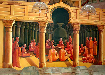
Quatre grands conciles bouddhistes furent organisés, à l’instigation de différents rois qui cherchaient en réalité à briser l’omnipuissante caste des brahmanes.
Le premier eut lieu en 483 avant J.-C., juste après la mort du Bouddha, sous le patronage du roi Ajatasatru (492-460 av. J.-C.) du Royaume du Magadha, le plus grand des seize royaumes de l’Inde ancienne, afin de préserver les enseignements du Bouddha et de parvenir à un consensus sur la manière de les diffuser.
Le deuxième intervint en 383 avant J.-C., soit cent ans après la mort du Bouddha, sous le règne du roi Kalashoka. Des divergences d’interprétation s’installant sur des points de discipline au fur et à mesure que les adeptes s’éloignaient les uns des autres, un schisme menaçait de diviser ceux qui voulaient préserver l’esprit originel et ceux qui défendaient une interprétation plus large.
Le premier groupe, appelé Thera (signifiant « ancien » en pâli), est à l’origine du bouddhisme theravâda, engagé à préserver les enseignements du Bouddha dans l’esprit originel.
L’autre groupe était appelé Mahasanghika (Grande Communauté). Ils interprétaient les enseignements du Bouddha de manière plus libérale et nous ont donné le bouddhisme Mahâyâna.
Les participants au concile tentèrent d’aplanir leurs divergences, sans grande unité mais sans animosité non plus. L’une des principales difficultés venait du fait qu’avant d’être consignés dans des textes, les enseignements du Bouddha n’avaient été transmis qu’oralement pendant trois à quatre siècles. (*2)
L’arrivée des Grecs
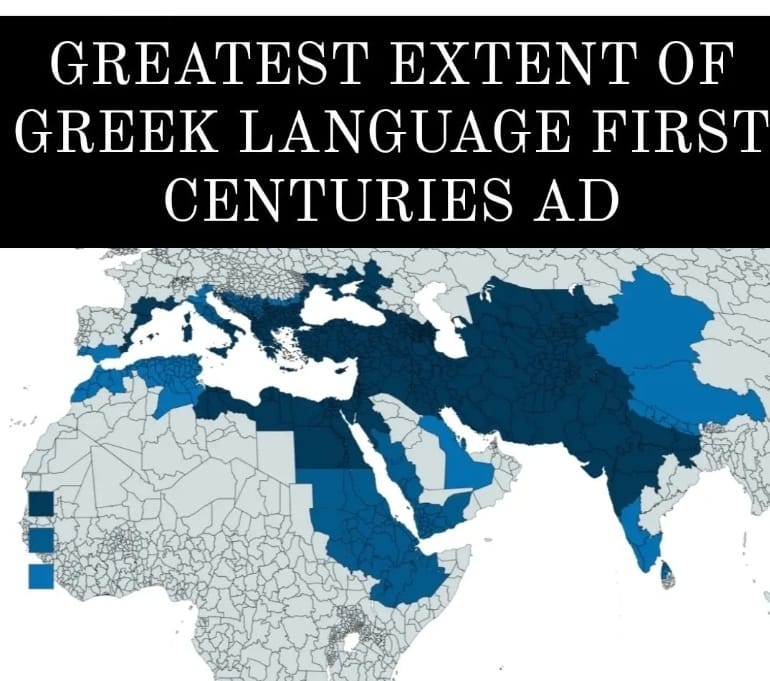
Ainsi que nous l’avons documenté par ailleurs, l’Asie centrale, et l’Afghanistan en particulier, furent le lieu de rencontre entre les civilisations perses, chinoises, grecques et indiennes.
C’est au Gandhara, région à cheval entre le Pakistan et l’Afghanistan, au cœur des Routes de la soie, que le bouddhisme prendra à deux reprises un envol majeur, donnant naissance à un art dit « gréco-bouddhiste », qui parviendra à faire la synthèse entre plusieurs cultures à travers des œuvres d’une beauté incomparable.
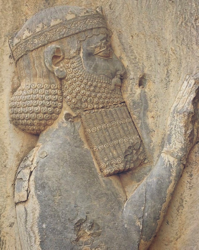
Les premiers Grecs commencèrent à s’installer dans la partie nord-ouest du sous-continent indien à l’époque de l’Empire perse achéménide. Après avoir conquis la région, le roi perse Darius le Grand (521 – 486 av. J.-C.) colonisa également une grande partie du monde grec, qui comprenait à l’époque toute la péninsule anatolienne occidentale.
Lorsque des villages grecs se rebellaient sous le joug perse, ils faisaient parfois l’objet d’un nettoyage ethnique et leurs populations étaient déportées à l’autre bout de l’empire.
C’est ainsi que de nombreuses communautés grecques virent le jour dans les régions indiennes les plus reculées de l’empire perse.
Au IVe siècle avant J.-C., Alexandre le Grand (356 – 323 av. J.-C.) vainquit et conquit l’empire perse. En 326 avant J.-C., cet empire comprenait la partie nord-ouest du sous-continent indien jusqu’à la rivière Beas (que les Grecs nommaient l’Hyphase). Alexandre établit des satrapies et fonde plusieurs colonies. Il se tourne vers le sud lorsque ses troupes, conscientes de l’immensité de l’Inde, refusent de pousser plus loin encore vers l’est.
Après sa mort, son empire se délite. De 180 av. J.-C. à environ l’an 10 de notre ère, plus de trente rois hellénistiques se succèdent, souvent en conflit entre eux. Cette époque est connue dans l’histoire sous le nom des « Royaumes indo-grecs ».
L’un d’eux a été fondé lorsque le roi gréco-bactrien Démétrius envahit l’Inde en 180 avant notre ère, créant ainsi une entité faisant sécession avec le puissant royaume gréco-bactrien, la Bactriane (comprenant notamment le nord de l’Afghanistan, une partie de l’Ouzbékistan, etc.).
Pendant les deux siècles de leur règne, ces rois indo-grecs intégrèrent dans une seule culture des langues et des symboles grecs et indiens, comme en témoignent leurs pièces de monnaie, et mêlèrent les anciennes pratiques religieuses grecques, hindoues et bouddhistes, comme le montrent les vestiges archéologiques de leurs villes et les signes de leur soutien au bouddhisme.
L’Empire Maurya
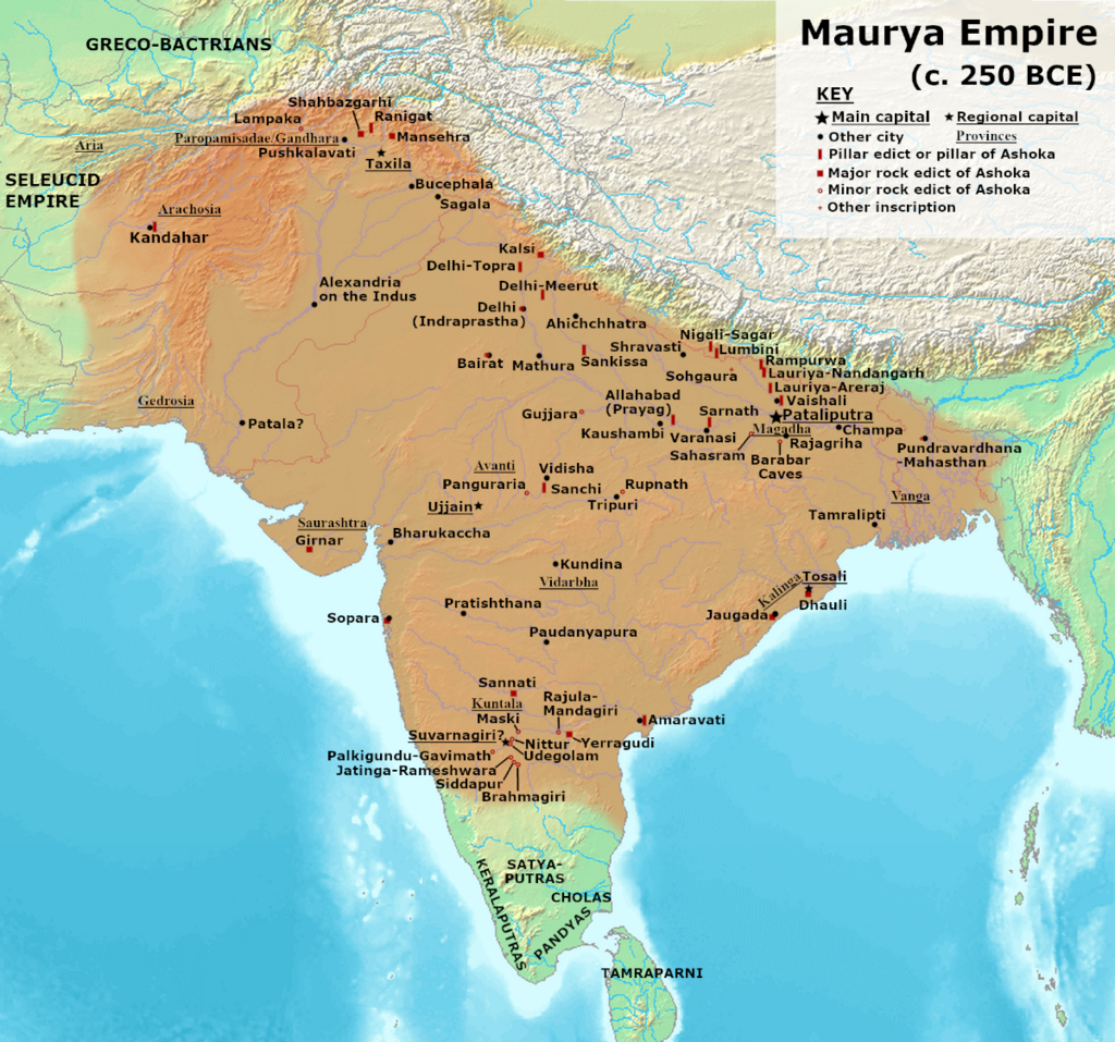
Vers 322 avant J.-C., les Grecs appelés Yona (Ioniens) ou Yavana dans les sources indiennes, participent, avec d’autres populations, au soulèvement de Chandragupta Maurya (né v. -340 et mort v. – 297), le fondateur de l’Empire maurya.
Le règne de Chandragupta ouvre une ère de prospérité économique, de réformes, d’expansion des infrastructures et de tolérance. De nombreuses religions ont ainsi prospéré dans son royaume et dans l’empire de ses descendants. Bouddhisme, jaïnisme et ajivika prennent de l’importance aux côtés des traditions védiques et brahmaniques, tout en respectant les religions minoritaires telles que le zoroastrisme et le panthéon grec.
Le règne d’Ashoka le Grand
(de 268 à 231 av. JC)
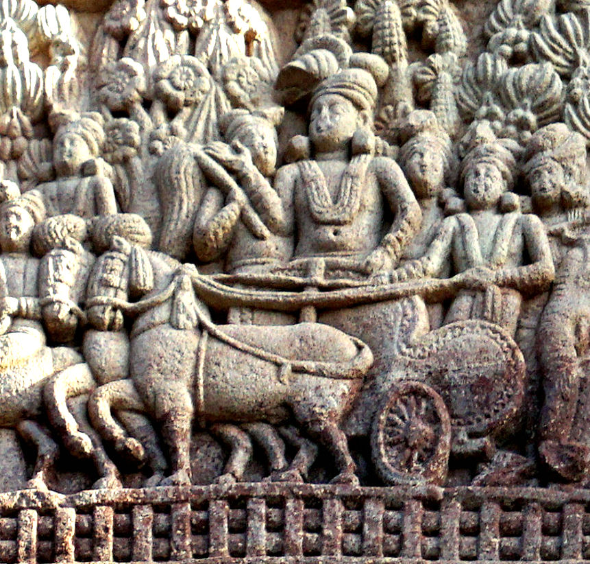
L’Empire Maurya atteint son apogée sous le règne du petit-fils de Chandragupta, Ashoka le Grand, de 268 à 231 av. J.-C. (parfois écrit Asoka).
Huit ans après sa prise de pouvoir, Ashoka mène une campagne militaire pour conquérir le Kalinga, un vaste royaume côtier du centre-est de l’Inde. Sa victoire lui permet de conquérir un territoire plus vaste que celui de tous ses prédécesseurs. Grâce aux conquêtes d’Ashoka, l’Empire Maurya devient une puissance centralisée couvrant une grande partie du sous-continent indien, s’étendant de l’actuel Afghanistan à l’ouest à l’actuel Bangladesh à l’est, avec sa capitale à Pataliputra (proche de l’actuelle Patna en Inde).
Alors que l’Empire Maurya avait existé dans un certain désordre jusqu’en 185 av. J.-C., Ashoka va transformer le royaume en recourant à une violence extrême qui caractérise le début de son règne. On parle de 100 000 à 300 000 morts, rien que lors de la conquête du Kalinga !
Mais le poids d’un tel carnage plonge le roi dans une grave crise personnelle. Ashoka est gravement choqué par la multitude de vies arrachées par ses armées. L’édit N° 13 d’Ashoka reflète le profond remords ressenti par le roi après avoir observé la destruction de Kalinga :
« Sa Majesté a éprouvé des remords à cause de la conquête de Kalinga car, lors de l’assujettissement d’un pays non conquis auparavant, il y a nécessairement des massacres, des morts et des captifs, et Sa Majesté en éprouve une profonde tristesse et un grand regret. »
Ashoka renonce alors aux démonstrations de force militaires et autres formes de violence, y compris la cruauté envers les animaux. Conquis par le bouddhisme, il se consacre alors à répandre sa vision du dharma, une conduite juste et morale. Il va encourager la diffusion du bouddhisme dans toute l’Inde. Selon l’archéologue et érudit français François Foucher, même si les cas de mauvais traitements envers les animaux ne disparurent pas du jour au lendemain, la croyance en la fraternité de tous les êtres vivants est plus florissante en Inde que partout ailleurs.
En 250 avant J.-C., Ashoka convoque le troisième concile bouddhique. Les sources theravâda mentionnent qu’en plus de régler les différends intérieurs, la principale fonction du concile était de planifier l’envoi de missionnaires bouddhistes dans différents pays afin d’y répandre la doctrine.
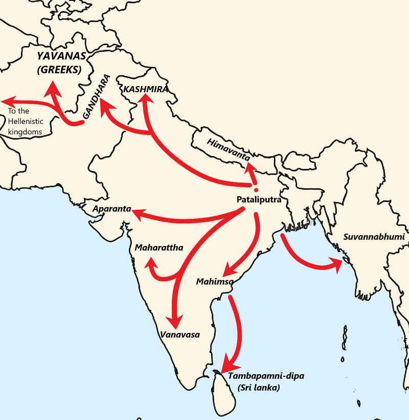
Ces missionnaires allèrent jusqu’aux royaumes hellénistiques de l’ouest, en commençant par la Bactriane voisine. Des missionnaires furent également envoyés en Inde du sud, au Sri Lanka et en Asie du Sud-Est (peut-être en Birmanie).
La forte implication de ces missions dans l’éclosion du bouddhisme en Asie à l’époque d’Ashoka est solidement étayée par des preuves archéologiques. Le bouddhisme ne s’est pas répandu par pur hasard, mais dans le cadre d’une opération politique créative, stimulante et bien planifiée, tout au long des Routes de la soie.
Le Mahavamsa ou Grande chronique (XII, 1er paragraphe), relatant l’histoire des rois cinghalais et tamouls de Ceylan (aujourd’hui Sri Lanka), donne la liste des missionnaires bouddhistes envoyés par le Concile et Ashoka :
- Le vieux Majjhantika prit la tête de la mission au Cachemire et au Gandhara (aujourd’hui le nord-ouest du Pakistan et l’Afghanistan) ;
- L’aîné Mahadeva dirigea la mission dans le sud-ouest de l’Inde (Mysore, Karnataka) ;
- Rakkhita, celle du sud-est de l’Inde (Tamil Nadu) ;
- Le vieux Yona (Ionien, Grec) Dharmaraksita partit vers Aparantaka (« frontière occidentale », comprenant le nord du Gujarat, le Kathiawar, le Kachch et le Sindh, toutes des parties de l’Inde à l’époque) ;
- L’aîné Mahadharmaraksita dirigea la mission de Maharattha (région péninsulaire occidentale de l’Inde) ;
- Maharakkhita (Maharaksita Thera) fut envoyé au pays des Yona (Ioniens), probablement la Bactriane et peut-être le royaume séleucide ;
- Majjhima Thera conduisit la mission dans la région d’Himavant (nord du Népal, contreforts de l’Himalaya) ;
- Sona Thera et Uttara Thera, celles de Suvannabhumi (quelque part en Asie du Sud-Est, peut-être au Myanmar ou en Thaïlande) ;
- Enfin, Mahinda, fils aîné d’Ashoka et donc le Prince de son royaume, accompagné de ses disciples Utthiya, Ittiya, Sambala et Bhaddasala, se rendit à Lankadipa (Sri Lanka).
Certaines de ces missions furent couronnées de succès, permettant d’implanter le bouddhisme en Afghanistan, au Gandhara et au Sri Lanka, par exemple.
Le bouddhisme gandharien, le gréco-bouddhisme et le bouddhisme cinghalais ont puissamment inspiré le développement du bouddhisme dans le reste de l’Asie, notamment en Chine, et ceci pendant des générations.
Si les missions dans les royaumes hellénistiques méditerranéens semblent avoir été moins fructueuses, il est possible que des communautés bouddhistes se soient établies pendant une période limitée dans l’Alexandrie égyptienne, ce qui pourrait être à l’origine de la secte dite des Therapeutae, mentionnée dans certaines sources anciennes comme Philon d’Alexandrie (v. 20 av. J.-C. – 50 apr. J.-C.).
Le courant juif des Esséniens et les Thérapeutes d’Alexandrie seraient des communautés fondées sur le modèle du monachisme bouddhique. « C’est l’Inde qui serait, selon nous, au départ de ce vaste courant monastique qui brilla d’un vif éclat durant environ trois siècles dans le judaïsme même », affirme l’historien français André Dupont-Sommer, et cette influence aurait même contribué, selon lui, à l’émergence du christianisme.
Edits d’Ashoka

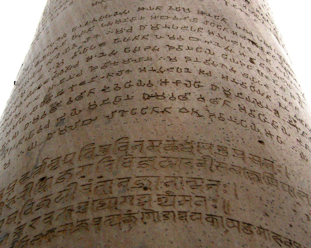
Ashoka transmettait ses messages par le biais d’édits gravés sur des piliers et des rochers en divers lieux du royaume, proches des stupas, sur des lieux de pèlerinage et le long de routes commerciales très fréquentées.
Une trentaine d’entre eux ont été conservés. Ils sont souvent rédigés non pas en sanskrit, mais en grec (la langue du royaume gréco-bactrien voisin et des communautés grecques du royaume d’Ashoka), en araméen (langue officielle de l’ancien empire achéménide) ou en divers dialectes du prâkrit (une langue indo-aryenne moyenne), y compris le gândhârî ancien, langue parlée au Gandhara. (*3)
Ces édits utilisaient la langue pertinente pour la région. Par exemple, en Bactriane, ou les Grecs dominaient, on trouve près de l’actuelle Kandahar un édit rédigé uniquement en grec et en araméen.
Contenu des édits
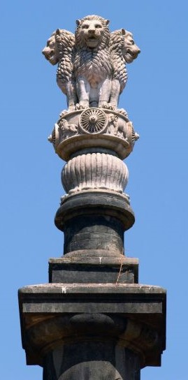
Certains d’entre eux reflètent l’adhésion profonde d’Ashoka aux préceptes du bouddhisme et ses relations étroites avec le Sangha, l’ordre monastique bouddhiste. Il utilise également le terme spécifiquement bouddhiste de dharma pour désigner les qualités du cœur qui sous-tendent l’action morale.
Dans son édit mineur sur rocher N° 1, le roi se déclare « adepte laïc de l’enseignement du Bouddha depuis plus de deux ans et demi », mais avoue que jusqu’ici, il n’a « pas fait grand progrès ». « Depuis un peu plus d’un an, je me suis rapproché de l’Ordre », ajoute-t-il.
Dans l’édit mineur sur rocher N° 3 de Calcutta-Bairat, il affirme : « Tout ce qui a été dit par le Bouddha a été bien dit », décrivant les enseignements du Bouddha comme le véritable dharma.
Ashoka a reconnu les liens étroits entre l’individu, la société, le roi et l’État. Son dharma peut être compris comme la moralité, la bonté ou la vertu, et l’impératif de le poursuivre lui a donné le sens du devoir. Les inscriptions expliquent que le dharma intègre la maîtrise de soi, la pureté de la pensée, la libéralité, la gratitude, la dévotion ferme, la véracité, la protection de la parole et la modération dans les dépenses et les possessions.
Le dharma a également un aspect social. Il comprend l’obéissance aux parents, le respect des aînés, la courtoisie et la libéralité envers les adorateurs de Brahma, la courtoisie envers les esclaves et les serviteurs, et la libéralité envers les amis, les connaissances et les parents.
La non-violence, qui consiste à s’abstenir de blesser ou de tuer tout être vivant, était un aspect important du dharma d’Ashoka. Ne tuer aucun être vivant est décrit comme faisant partie du bien (Édit mineur sur rocher N° 11), de même que la douceur à leur égard (Édit mineur sur rocher N° 9). L’accent mis sur la non-violence s’accompagne de l’incitation à une attitude positive d’attention, de douceur et de compassion.
Ashoka adopte et préconise une politique fondée sur le respect et la tolérance des autres religions. L’un de ses édits préconise :
« Tous les hommes sont mes enfants. A mes enfants, je souhaite prospérité et bonheur dans ce monde et dans l’autre ; mes vœux sont les mêmes pour tous les hommes. »
Loin d’être sectaire, Ashoka, s’appuyant sur la conviction que toutes les religions partagent une essence commune et positive, encourage la tolérance et la compréhension des autres religions :
« Le bien-aimé des dieux, le roi Piyadassi (c’est-à-dire Ashoka), souhaite que toutes les sectes puissent habiter en tous lieux, car toutes recherchent la maîtrise de soi et la pureté de l’esprit. » (Édit majeur sur rocher N° 7)
Et il précise :
« Car quiconque loue sa propre secte ou blâme les autres sectes, –par pure dévotion à sa propre secte, dans le simple but de la glorifier, – en agissant ainsi, il porte au contraire gravement préjudice à sa propre secte. Mais la concorde est méritoire, (c’est-à-dire) que tous doivent écouter et obéir à la morale de l’autre. » (Édit majeur sur rocher N° 12)
Ashoka avait l’idée d’un empire politique et d’un empire moral, le second englobant le premier. Sa conception de sa circonscription s’étendait au-delà de ses sujets politiques pour inclure tous les êtres vivants, humains et animaux, vivant à l’intérieur comme à l’extérieur de son domaine politique. Ses inscriptions expriment sa conception paternelle de la royauté et décrivent ses mesures d’aide sociale, notamment la fourniture de traitements médicaux, la plantation d’herbes, d’arbres et de racines pour les hommes et les animaux, et le creusement de puits le long des routes (Edit majeur sur rocher N°2). Les efforts du roi pour propager son dharma ne se limitaient pas à son propre domaine politique, mais s’étendaient aux royaumes des autres souverains.
L’empereur est devenu un sage. Il dirige un gouvernement centralisé depuis Pataliputra, capitale de l’Empire Maurya. Son administration perçoit des impôts et il demande à ses inspecteurs de lui rendre des comptes. L’agriculture se développe grâce à des canaux d’irrigation. Il fait construire des routes de qualité pour relier les points stratégiques et les centres politiques, exigeant, des siècles avant notre grand Sully en France, qu’elles soient bordées d’arbres d’ombrage, de puits et d’auberges.
Si l’existence même d’Ashoka en tant que personnage historique a été quasiment oubliée, depuis le déchiffrement de sources écrites en brahmi au XIXe siècle, il est désormais considéré comme l’un des plus grands empereurs indiens. La roue bouddhiste d’Ashoka figure d’ailleurs sur le drapeau indien.
Comme nous l’avons déjà dit, Ashoka et ses descendants ont utilisé leur pouvoir pour construire des monastères et répandre l’influence bouddhiste en Afghanistan, dans de vastes régions de l’Asie centrale, au Sri Lanka et, au-delà, en Thaïlande, Birmanie, Indonésie, puis en Chine, en Corée et au Japon.
Des statues en bronze de son époque ont été déterrées dans les jungles d’Annam, de Bornéo et des Célèbes. La culture bouddhiste s’est implantée dans l’ensemble de l’Asie du Sud-Est, même si chaque région a su conserver une partie de sa personnalité et de son caractère propres.
L’Empire Kouchan
(du Ier siècle av. JC au IIIe siècle)
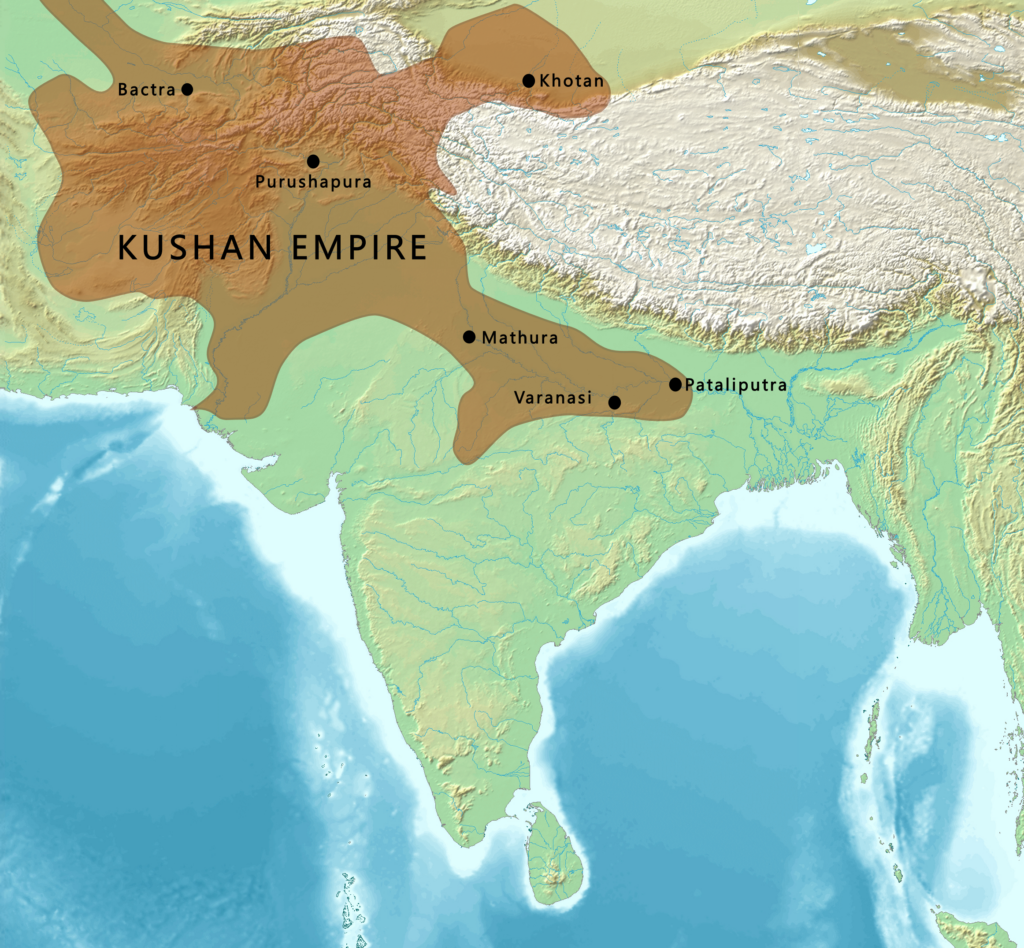
L’Empire Maurya, qui régnait sur la Bactriane et d’autres anciennes satrapies grecques, s’effondra en 185 avant J.-C., à peine cinq décennies après la mort d’Ashoka, accusé d’avoir trop dépensé pour les temples et les missions bouddhistes. Les mafias brahmaniques, qui avaient abhorré son règne, revinrent immédiatement au pouvoir.
Mais la période est turbulente. Au premier siècle avant J.C., les Kouchans, l’une des cinq branches de la confédération nomade chinoise Yuezhi, émigrent du nord-ouest de la Chine (Xinjiang et Gansu) et s’emparent, après les nomades iraniens Saka, de l’ancienne Bactriane.
Ils forment l’Empire kouchan dans les territoires de la Bactriane. Cet empire s’étend assez vite à une grande partie de ce qui est aujourd’hui l’Ouzbékistan, l’Afghanistan, le Pakistan et le nord de l’Inde, au moins jusqu’à Saketa et Sarnath, près de la ville de Varanasi (Bénarès).
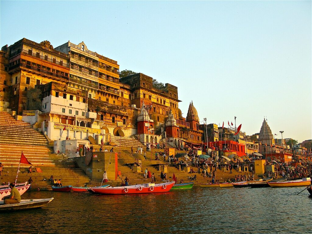
Le fondateur de la dynastie kouchane, Kujula Kadphisès, qui suit les idées culturelles et l’iconographie grecques après la tradition gréco-bactrienne, est un adepte de la secte shivaïte de l’hindouisme. Deux rois kouchans ultérieurs, Vima Kadphisès et Vasudeva II, furent également des mécènes de l’hindouisme et du bouddhisme. La patrie de leur empire se trouvait en Bactriane, où le grec était initialement la langue administrative, avant d’être remplacé par le bactrien écrit en caractères grecs jusqu’au VIIIe siècle, lorsque l’islam le remplace par l’arabe.

Les Kouchans devinrent également de grands mécènes du bouddhisme, en particulier l’empereur Kanishka le Grand (78-144 après J.-C.), qui joua un rôle important dans sa diffusion, via les Routes de la soie, vers l’Asie centrale et la Chine, inaugurant une période de paix relative de 200 ans, parfois décrite comme la « Pax Kouchana ».
Il semble également que dès ses débuts, le bouddhisme ait prospéré dans la classe des marchands, à qui la naissance interdisait l’accès aux ordres religieux de l’Inde et de l’Himalaya. La pensée et l’art bouddhistes se développèrent grâce aux routes commerciales entre l’Inde, l’Himalaya, l’Asie centrale, la Chine, la Perse, l’Asie du Sud-Est et l’Occident. Les voyageurs recherchaient la protection des images bouddhistes et faisaient des offrandes aux sanctuaires le long de la route, ramassant des objets et des sanctuaires portables pour leur usage personnel.
Le terme quatrième concile bouddhiste désigne deux évènements différents selon les écoles theravâda et mahâyâna.
1) La tradition theravâda : afin d’éviter que ne se perde l’enseignement du Bouddha, qui se serait jusqu’alors transmis oralement, cinq cents moines menés par le Vénérable Maharakkhita se réunirent à Tambapanni (Sri Lanka), sous le patronage du roi Vattagamani (r. 103 – 77 av. J.-C.) afin de coucher par écrit sur des feuilles de palme le Canon pâli. (*4)
Le travail, qui aurait duré trois ans, se serait déroulé dans la grotte Aloka lena, près de l’actuel Matale.
2) Selon la tradition mahâyâna, c’est 400 ans après l’extinction du Bouddha que cinq cents moines sarvastivadin se réunirent en 72 après J.-C. au Cachemire pour compiler et clarifier leurs doctrines sous la direction de Vasumitra et sous le patronage personnel de l’empereur Kanishka. Ils auraient ainsi produit le Mahavibhasa (Grande exégèse) en sanskrit.
Selon plusieurs sources, le moine bouddhiste indien Asvaghosa, considéré comme le premier dramaturge classique sanskrit et dont nous avons évoqué plus haut les attaques contre le système des castes, était le conseiller spirituel du roi Kanishka dans les dernières années de sa vie.
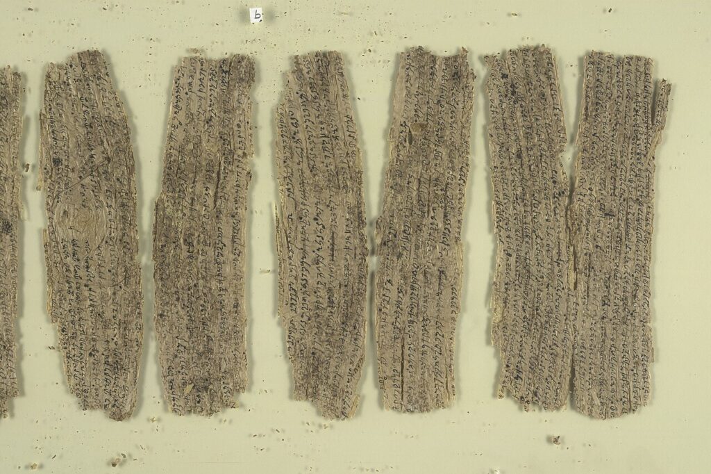
A noter que les plus anciens manuscrits bouddhiques découverts à ce jour, tels que les vingt-sept rouleaux d’écorce de bouleau acquis par la British Library en 1994 et datant du Ier siècle, ont été trouvés, non pas en Inde, mais enterrés dans les anciens monastères du Gandhara, la région centrale de l’empire maurya et kouchan, qui comprend les vallées de Peshawar et de Swat (Pakistan) et s’étend vers l’ouest jusqu’à la vallée de Kaboul en Afghanistan et vers le nord jusqu’à la chaîne du Karakoram
Ainsi, après le grand élan donné par le roi Ashoka le Grand, la culture du Gandhara connaîtra un second souffle sous le règne du roi kouchan Kanishka Ier.
Les villes de Begram, Taxila, Purushapura (aujourd’hui Peshawar) et Surkh Kotal atteignent alors des sommets de développement et de prospérité.
Le miracle de Gandhara
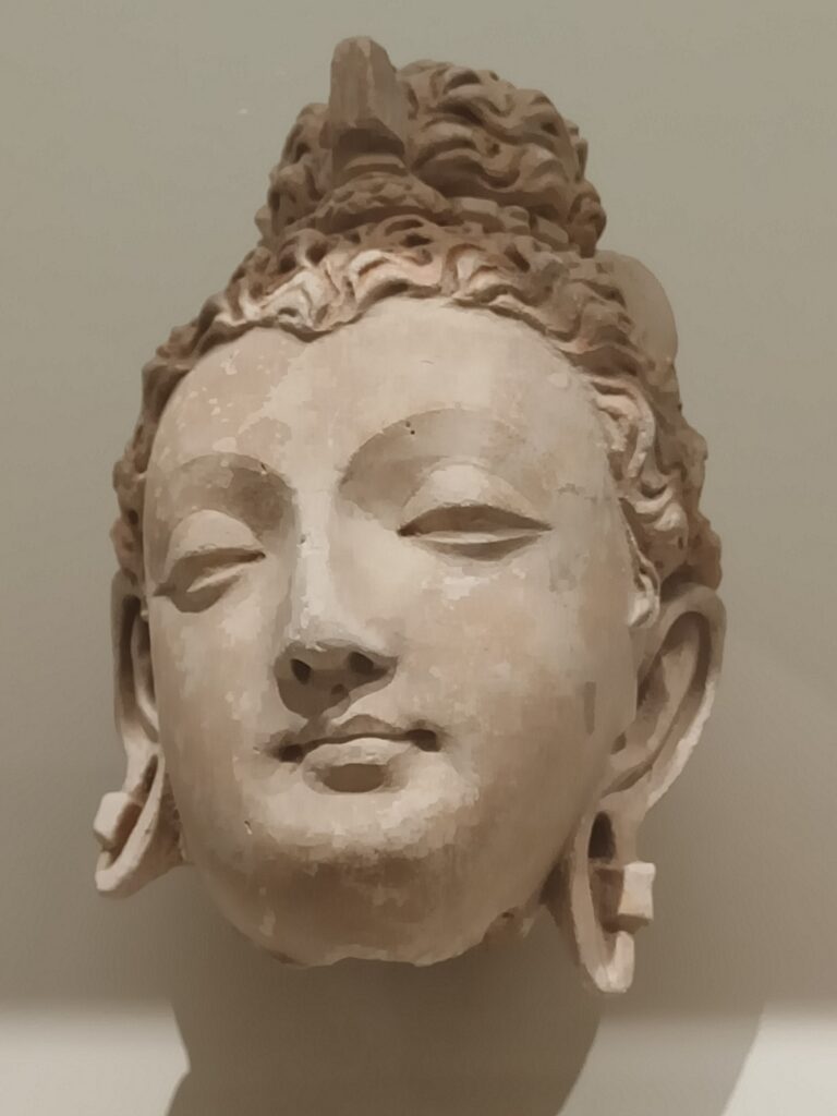
C’est peu dire que le Gandhara, surtout à l’époque kouchane, fut au cœur d’une véritable renaissance de la civilisation, avec une incroyable concentration de productions artistiques et une inventivité sans pareil. Si l’art bouddhiste était principalement centré sur les temples et les monastères, les objets de dévotion personnelle étaient très courants.
Grâce à l’art du Gandhara, le bouddhisme se mua en une grande force de beauté, d’harmonie et de paix, conquérant le monde.
Il favorisa alors une création artistique qui élève la pensée et la moralité en faisant appel à des paradoxes métaphoriques.
Les médiums et supports qui prévalent sont la peinture sur soie, les fresques, les livres illustrés et gravures, la broderie et autres arts du tissu, la sculpture (bois, métal, ivoire, pierre, jade) et l’architecture. Quelques exemples :
A. La poésie
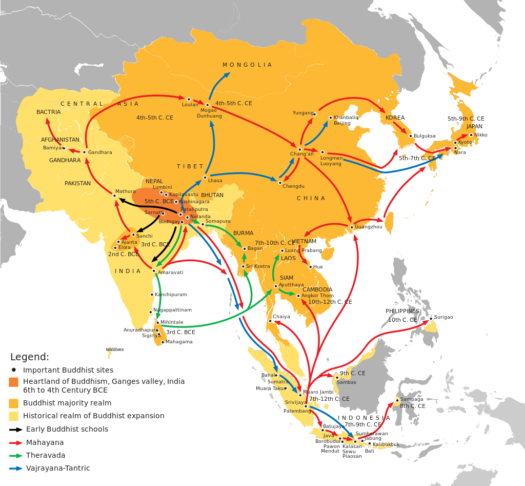
Pour la plupart des Occidentaux, le bouddhisme est une émanation typique de la culture asiatique, généralement associée à l’Inde, au Tibet, au Népal, mais aussi à la Chine et à l’Indonésie.
Peu de gens savent que les plus anciens manuscrits bouddhistes connus à ce jour (Ier siècle de notre ère) ont été découverts, non pas en Asie, mais en Asie centrale, dans d’anciens monastères bouddhistes du Gandhara.
A l’origine, avant leur transcription en sanskrit (pendant longtemps la langue des élites), ils étaient écrits en gândhârî, une langue indo-aryenne du groupe prâkrit, transcrit avec l’alphabet kharosthi (une ancienne écriture indo-iranienne). Le gândhârî était la lingua franca de la pensée bouddhiste à ses débuts. Preuve en est, les manuscrits bouddhistes écrits en gândhârî qui ont voyagé jusqu’en Chine orientale pour se retrouver dans les inscriptions de Luoyang et d’Anyang.
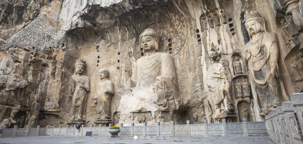
Afin de préserver leurs écrits, les bouddhistes étaient à l’avant-garde de l’adoption des technologies chinoises liées à la fabrication de livres, notamment le papier et la xylographie. Cette technique d’impression consiste à reproduire le texte à imprimer sur une feuille de papier transparente qui est retournée et gravée sur une planche de bois tendre. L’encrage des parties saillantes permet ensuite des tirages multiples. C’est ce qui explique que le premier livre entièrement imprimé est le Sutra du diamant bouddhique (vers 868) réalisé par ce procédé
Le Khaggavisana Sutta, littéralement « la corne du rhinocéros », est une expression authentique de la poésie religieuse bouddhiste originale. Connu sous le nom de Sutra du rhinocéros, cette œuvre poétique fait partie du recueil pâli de textes courts Kuddhhaka Nikava, la cinquième partie du Sutta Pitaka, écrit au Ier siècle de notre ère.
Parce que la tradition accorde au rhinocéros asiatique une vie solitaire dans la forêt, l’animal n’aime pas les troupeaux, ce sutra (enseignement) porte le titre approprié d’essai « sur la valeur de la vie solitaire et errante ». L’allégorie du rhinocéros permet de communiquer aux dévots un sens aigu de la souveraineté individuelle que requièrent les engagements moraux prescrits par le Bouddha pour mettre fin à la souffrance en se déconnectant des plaisirs et des douleurs terrestres.

Extrait :
Refuser la violence à l’égard de tous les êtres,
ne jamais faire de mal à un seul d’entre eux,
aider avec compassion et un cœur aimant ;
erre seul comme un rhinocéros.
Celui qui tient compagnie nourrit l’affection
et de l’affection naît la souffrance.
Réalisant le danger qui découle de l’affection,
erre seul comme un rhinocéros.
En sympathisant avec les amis et les compagnons,
l’esprit se fixe sur eux et perd son chemin.
Percevoir ce danger, c’est la familiarité,
erre seul comme un rhinocéros.
Les préoccupations que l’on a pour ses fils et ses femmes
sont comme une pensée et un bambou enchevêtré.
Reste démêlé comme un jeune bambou,
erre seul comme un rhinocéros.
Comme un cerf qui erre librement dans la forêt,
va où il veut en broutant,
un homme sage, qui chérit sa liberté,
erre seul comme le rhinocéros.
Laissez derrière vous vos fils, vos femmes et votre argent,
tous vos biens, vos parents et vos amis.
Abandonnez tous vos désirs, quels qu’ils soient,
erre seul comme le rhinocéros. (…)
B. La littérature
Deux autres chefs-d’œuvre tirés du même recueil sont d’une part les célèbres Jataka (Récits des vies antérieures du Bouddha), et d’autre part, le Milindapanha (Les questions du roi Milinda).
Les Jataka, qui mettent en scène de nombreux animaux, montrent comment, avant la dernière incarnation humaine au cours de laquelle il atteignit le nirvana, le Bouddha lui-même s’était réincarné d’innombrables fois en animal (en diverses sortes de poissons, en crabe, coq, pivert, perdrix, francolin, caille, oie, pigeon, corbeau, zèbre, buffle, plusieurs fois en singe ou en éléphant, en antilope, cerf et cheval).
Et puisque c’est Bouddha qui est incarné dans cet animal, celui-ci a soudainement des propos d’une grande sagesse.
Mais en d’autres occasions, ce sont des personnages qui sont des animaux alors que notre Bodhisattva apparaît sous forme humaine. Ces contes sont souvent pimentés d’un humour piquant. On sait d’ailleurs qu’elles ont inspiré La Fontaine, qui a dû les entendre du docteur François Bernier, qui les avait lui-même apprises alors qu’il était médecin en Inde pendant huit ans.
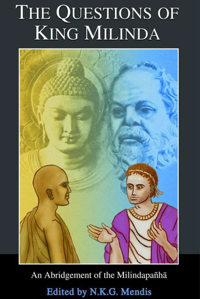
Les questions du roi Milinda est un compte-rendu imagé, véritable dialogue platonicien entre le roi grec de Bactriane, Milinda (le Grec, Ménandre), qui régnait au Pendjab, et le sage bouddhiste Bhante Nagasena. Leur dialogue animé, dramatique et spirituel, éloquent et inspiré, explore les divers problèmes de la pensée et de la pratique bouddhistes du point de vue d’un intellectuel grec perspicace, à la fois perplexe et fasciné par la religion étrangement rationnelle qu’il découvre sur le sous-continent indien.
Par le biais de paradoxes, Nagasena amène le « rationaliste » grec à s’élever jusqu’à la dimension spirituelle, au-delà de la logique et de la simple rationalité. Car le nirvana, tout comme l’espace, n’a « pas de cause » formelle et, bien qu’il peut se produire, « ne peut pas être causé ». Mince, comment faire alors pour y aboutir ?
Et à l’un de ses disciples qui un jour lui posa la question de savoir si l’univers était fini ou infini, éternel ou non, si l’âme était distincte du corps, ce que devenait l’homme après la mort, le Bouddha répondit par une parabole :
« Supposons qu’un homme soit gravement atteint d’une flèche, que l’on l’amène chez un médecin, et que l’homme dise : “Je ne laisserai pas retirer cette flèche, avant de savoir qui m’a blessé, de quel caste il est, de quel village il est né, de quel arc il s’est servi, de quelle matière a été faite la flèche, de quelle direction elle a été tirée…” Alors cet homme mourrait certainement avant d’avoir les réponses. »
C. Urbanisme
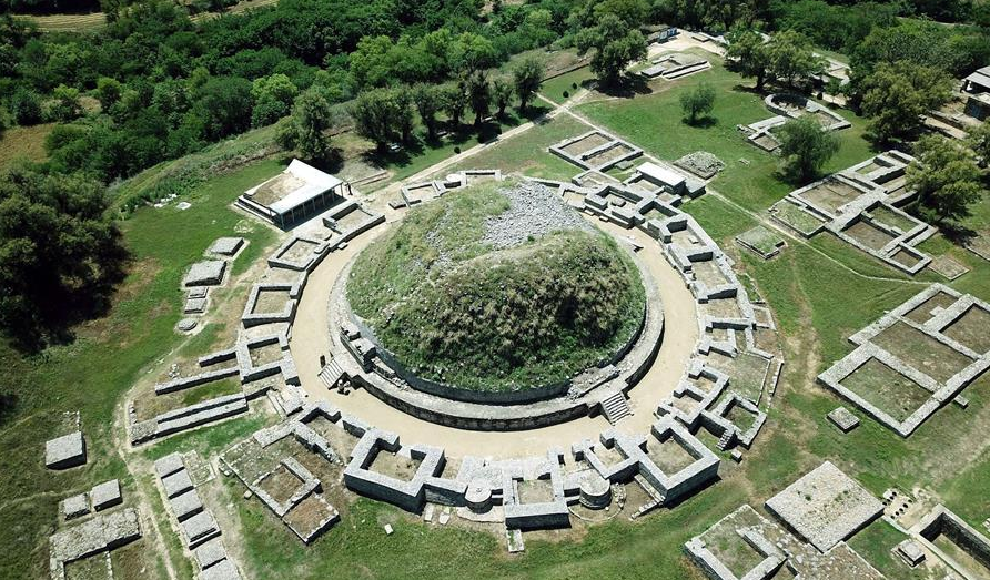
Taxila ou Takshashila (aujourd’hui au Pendjab), l’un des grands centres urbains et, pendant un certain temps, la capitale du Gandhara, fut fondée vers 1000 avant J.-C. sur les ruines d’une cité datant de la période Harappa et située sur la rive orientale de l’Indus, point de jonction entre le sous-continent indien et l’Asie centrale.
Certaines ruines de Taxila datent de l’époque de l’empire perse achéménide, suivi successivement par l’Empire Maurya, le royaume indo-grec, les Indo-Scythes et l’empire kouchan.
D’après certains témoignages, l’université de l’ancienne Taxila (des siècles avant l’université bouddhiste résidentielle de Nalanda fondée en 427 après J.-C.) peut être considérée comme l’un des premiers centres d’enseignement d’Asie du Sud. Dès 800 av. J.-C., la ville fonctionnait en grande partie comme une université, offrant des études supérieures. Avant d’y être admis, les étudiants devaient avoir terminé ailleurs leurs études primaires et secondaires. L’âge minimum requis était de seize ans. Non seulement les Indiens, mais aussi les étudiants de contrées voisines comme la Chine, la Grèce et l’Arabie affluaient dans cette ville d’apprentissage.
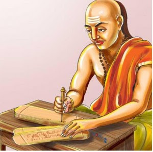
Vers 321 avant J.-C., c’est le grand philosophe, enseignant et économiste du Gandhara, Chanakya (375 à 283 av. J.-C.) qui aida le premier empereur maurya, Chandragupta, à accéder au pouvoir.
Sous la tutelle de Chanakya, Chandragupta avait reçu une éducation complète à Taxila, englobant les différents arts de l’époque, y compris l’art de la guerre, pendant sept à huit ans.
En 303 avant J.-C., Taxila tomba entre leurs mains et sous Ashoka le Grand, le petit-fils de Chandragupta, la ville devint un grand centre de l’enseignement et de l’art bouddhiste.
Chanakya, dont les écrits n’ont été redécouverts qu’au début du XXe siècle et qui fut le principal conseiller des deux empereurs Chandragupta et de son fils Bindusara, est considéré comme ayant joué un rôle majeur dans l’établissement de l’Empire Maurya.
Également connu sous les noms de Kauṭilya et Vishnugupta, Chanakya est l’auteur de l’Arthashastra, un traité politique sanskrit sur l’art de gouverner, la science politique, la politique économique et la stratégie militaire. L’Arthashastra aborde également la question d’une éthique collective assurant la cohésion de la société.
Il conseille au roi de lancer de grands projets de travaux publics dans les régions dévastées par la famine, les épidémies et autres catastrophes naturelles, ou par la guerre, tels que la création de voies d’irrigation et la construction de forts autour des principaux centres de production et villes stratégiques, et d’exonérer d’impôts les personnes touchées par ces catastrophes.
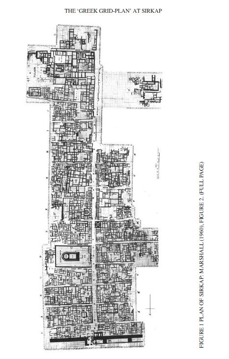
Au IIe siècle avant notre ère, Taxila fut annexée par le royaume indo-grec de Bactriane qui y érigea une nouvelle capitale nommée Sirkap, où des temples bouddhistes côtoyaient des temples hindous et grecs, signe de tolérance religieuse et de syncrétisme. Sirkap fut construite selon le plan quadrillé hippodamien (*5) caractéristique des villes grecques
Elle s’organise autour d’une avenue principale et de quinze rues perpendiculaires, couvrant une surface d’environ 1200 mètres sur 400, avec un mur d’enceinte de 5 à 7 mètres de large et de 4,8 kilomètres de long.
Après sa construction par les Grecs, la ville fut reconstruite lors des incursions des Indo-Scythes, puis par les Indo-Parthiens, après un tremblement de terre en l’an 30 de notre ère.
Certaines parties de la ville, notamment le stupa (reliquaire) bouddhiste de l’aigle bicéphale et le temple du dieu Soleil, furent construites par Gondophares, le premier roi du royaume indo-parthien. Enfin, des inscriptions datant de l’an 76 de notre ère démontrent que la ville était déjà passée sous la domination des Kouchans. Le souverain kouchan Kanishka érigera Sirsukh, à environ 1,5 km au nord-est de l’ancienne Taxila.
Des sutras bouddhistes de la région du Gandhara sont étudiés en Chine dès 147 de notre ère, lorsque le moine kouchan Lokakṣema (né en 147) commença à traduire en chinois certains des premiers sutras bouddhistes. Les plus anciennes de ces traductions montrent qu’elles ont été faites à partir de la langue
D. Architecture, l’invention des stupas
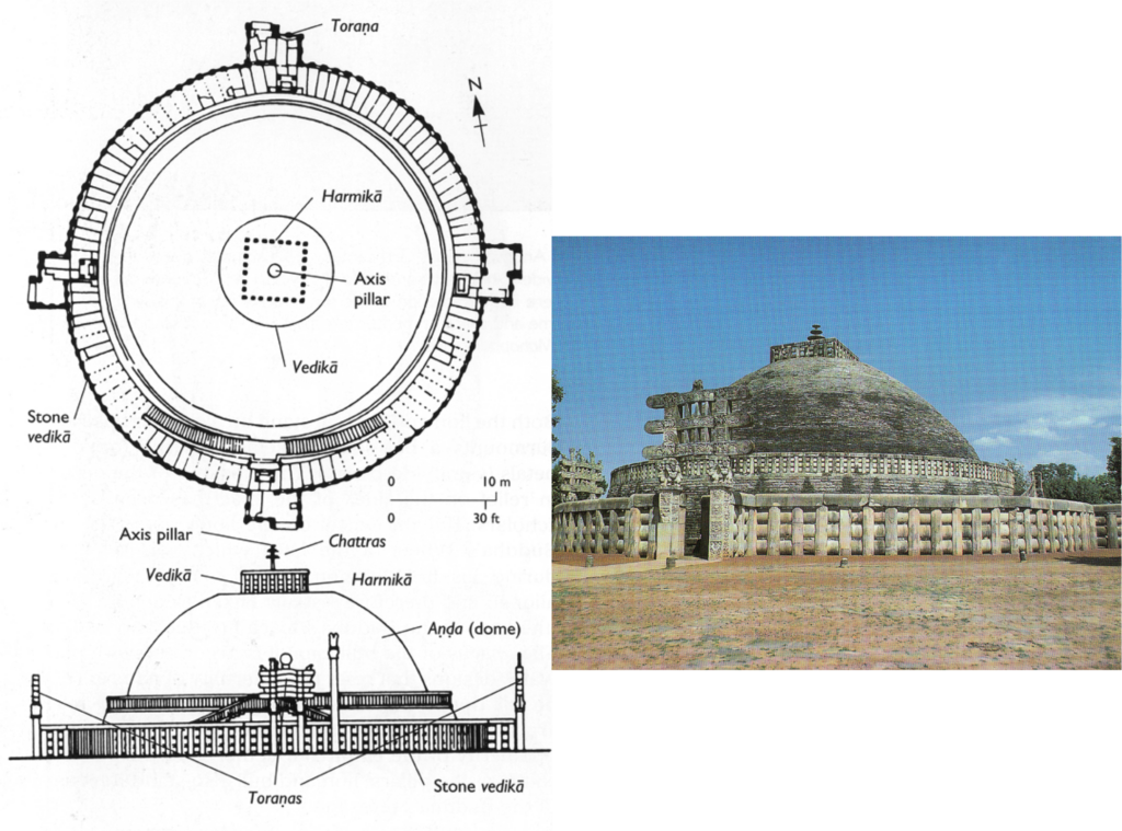
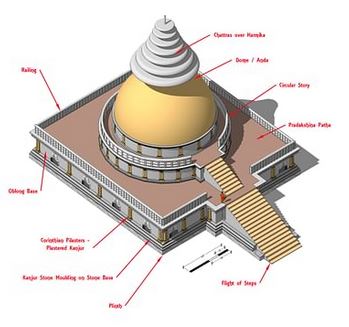
A l’origine, les édifices religieux sous forme de stupa (reliquaire) ont été érigés en Inde comme monuments commémoratifs associés à la conservation des reliques sacrées du Bouddha.
Construits en forme de dôme, ils sont entourés d’une balustrade qui sert de rampe pour la circumambulation rituelle. On accède à la zone sacrée par des portes situées aux quatre points cardinaux. Les stupas se situent souvent à proximité de sites funéraires préhistoriques beaucoup plus anciens, associés notamment à la Civilisation de la vallée de l’Indus.
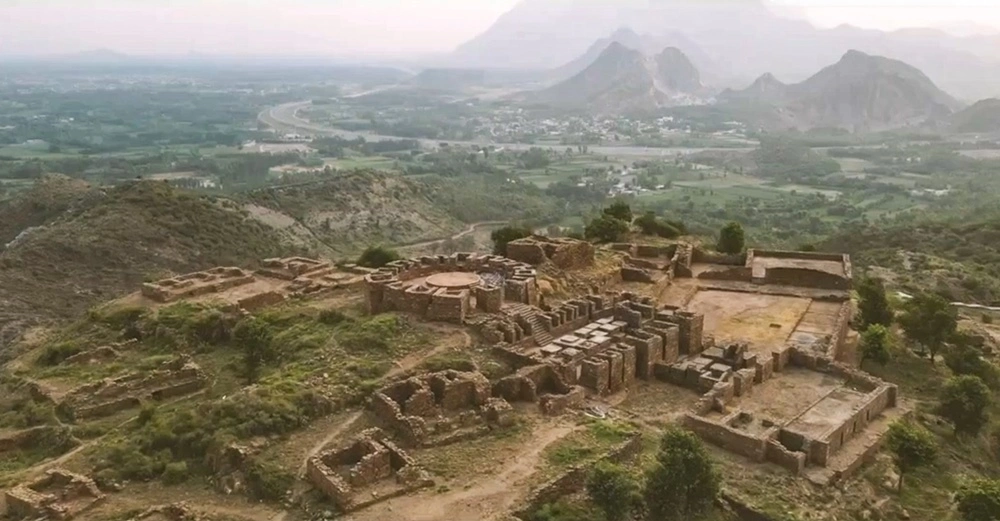
Des grilles et des portails en pierre, recouverts de sculptures, leur ont été ajoutés. Les thèmes favoris sont les événements de la vie historique du Bouddha, ainsi que de ses vies antérieures, au nombre de 550, décrites avec beaucoup d’ironie dans les Jatakas. (Voir B)
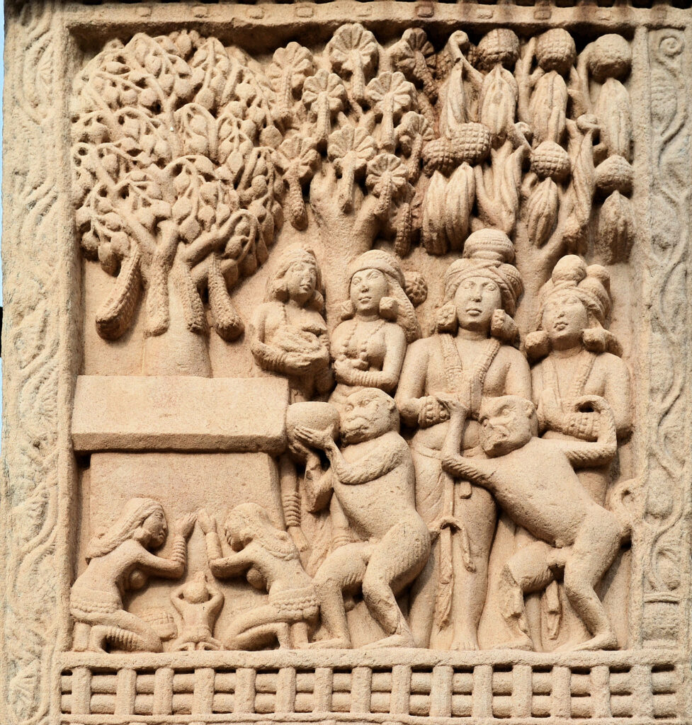
Les bas-reliefs des stupas sont comme des bandes dessinées qui nous racontent la vie quotidienne et religieuse du Gandhara : amphores, coupes à vin (kantaros), bacchanales, instruments de musique, vêtements grecs ou indiens, ornements, coiffures arrangées à la grecque, artisans, leurs outils, etc.
Sur un vase trouvé à l’intérieur d’un stupa, on trouve l’inscription d’un Grec, Théodore, gouverneur civil d’une province au Ier siècle avant J.-C., expliquant en alphabet kharosthi comment les reliques ont été déposées dans le stupa.
On pense que de nombreux stupas datent de l’époque d’Ashoka, comme celui de Sanchi (Inde centrale) ou de Kesariya (Inde de l’Est), où il a également érigé des piliers avec ses édits, et peut-être ceux de Bharhut (Inde centrale), Amaravati (sud-est de l’Inde) ou Dharmarajika (Taxila) dans le Gandhara (Pakistan).
Selon la tradition bouddhiste, l’empereur Ashoka aurait récupéré les reliques du Bouddha dans des stupas plus anciens et en aurait fait ériger 84 000 pour répartir l’ensemble de ces reliques sur tout le territoire indien.
Marchant dans les pas d’Ashoka, Kanishka ordonna la construction à Purushapura (Peshawar) du grand stupa de 400 pieds qui figure parmi les plus hauts édifices du monde antique.
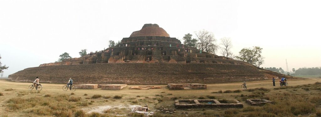
Les archéologues qui en ont redécouvert la base en 1908-1909 ont estimé que ce stupa avait un diamètre de 87 mètres. Selon les rapports de pèlerins chinois tels que Xuanzang, il faisait environ 200 mètres de haut et était recouvert de pierres précieuses. Sous les Kouchans également, d’immenses statues du Bouddha furent érigées dans les monastères ou sculptées à flanc de colline.
E. Sculpture
—PERIODE ANICONIQUE
Il est important de rappeler que dans les premiers temps, Bouddha n’était jamais représenté sous forme humaine.
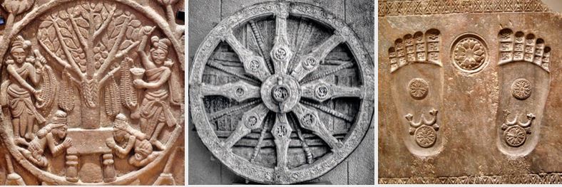
Pendant plus de quatre siècles, sa présence est simplement suggérée par des éléments symboliques tel qu’une empreinte de pieds, une fleur de lotus (indiquant la pureté de sa naissance), une roue à huit rayons (symbolisant la dharma), un trône vide, un espace inoccupé sous un parasol, un cheval sans cavalier ou encore le figuier sous lequel il a atteint le nirvana.
–FIN DE L’ANICONISME
Ce qui a conduit les bouddhistes à renoncer aux représentations aniconiques reste un vaste mystère. Un tel développement est assez unique dans l’histoire des religions. Imaginons soudainement les musulmans promouvant des statues du prophète Mohammed !
Les explications avancées jusqu’ici nous laissent sur la faim.
Pour les uns, les bouddhistes auraient voulu séduire une clientèle grecque, mais aussi bien les populations grecques que le bouddhisme était au Gandhara bien avant la révolution iconographique en question.
Pour les autres, les pratiquants, en l’absence de Bouddha lui-même, auraient cherché désespérément un centre d’intérêt visuel, soit une statue, une peinture ou mêmes quelques cheveux… Ces représentations symboliques, on l’a vu, répondaient à cette demande.
« Le Jataka de Kalingabodhi (écrit majeur sur les vies multiples de Bouddha) relate la frustration des habitants de Sravasti, en découvrant un jour qu’ils n’ont personne à vénérer lorsqu’ils se rendent au Jetavana et trouvent le Bouddha ‘absent’, parti en voyage. Pour remédier à cette situation, à son retour, le Bouddha permet à [son disciple] Ananda de planter un figuier Bodhi devant le [monastère de] Jetavana (…) qui sert de centre de substitution pour les dévotions des gens, chaque fois que le Bouddha n’est pas en résidence », écrit John Strong, dans Reliques du Bouddha.
Bouddha, rapporte-t-on, aurait refusé qu’il soit représenté d’aucune façon, craignant de voir prospérer l’idolâtrie.
Avec le temps, le bouddhisme va évoluer. Au Gandhara, c’est le bouddhisme mahâyâna (Grand Véhicule) qui s’épanouit. Pour ce courant, l’objectif ne se limite plus à atteindre le nirvana à titre personnel mais de libérer toute l’humanité de la souffrance.
Si pour le bouddhisme theravâda, Siddhartha Gautama n’était qu’un homme éclairé donnant l’exemple, pour le bouddhisme mahâyâna, il s’agit indubitablement, avec Bouddha, d’une tentative (réussie) de personnifier le dharma (la force spirituelle omniprésente, le principe ultime et suprême de la vie) dans la conception du premier de tous les bouddhas. Une sorte de Jésus, un dieu devenu homme pour ainsi dire…
Comme plus tard Jésus dans le christianisme à partir du Ve siècle, Bouddha pouvait dès lors être représenté sous une forme humaine.
Certains bouddhas du Gandhara représentent également des états d’âme spécifiques, tels que la sagesse, la tendresse et la compassion.
Contrairement à de nombreux artistes chrétiens chez nous, qui, conformément à la doxa, ont représenté le Christ souffrant sur la Croix (événement fondamental de la foi chrétienne), les artistes du Gandhara présentent Bouddha comme un être totalement détaché de la douleur humaine, regardant avec compassion l’humanité tout entière.
Le but étant d’éliminer la souffrance chez tous les hommes, la compassion n’est pas une notion passive chez les bouddhistes. Ce n’est pas seulement de l’empathie, mais plutôt un altruisme empathique qui s’efforce activement de libérer les autres de la souffrance, un acte de bienveillance empreinte à la fois de sagesse et d’amour.
DIFFERENCES DE FORME, DIFFERENCE DE CONTENU
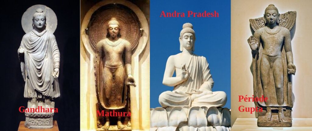
Avant de discuter de leurs différences, pour faire simple, distinguons ici, parmi tant d’autres, quatre types de représentations de bouddha:
- L’école dite « greco-bouddhique » de Gandhara produite dans la région qui va de Hadda (Afghanistan) à Taxila (Pundjab) en passant par Peshawar (Pakistan);
- L’école dite « indo-bouddhique » de Mathura;
- L’école d’Andra Pradesh, au sud de l’Inde;
- L’école de la période Gupta (3e au 5e siècle).
1. Greco-Bouddhique au Gandhara
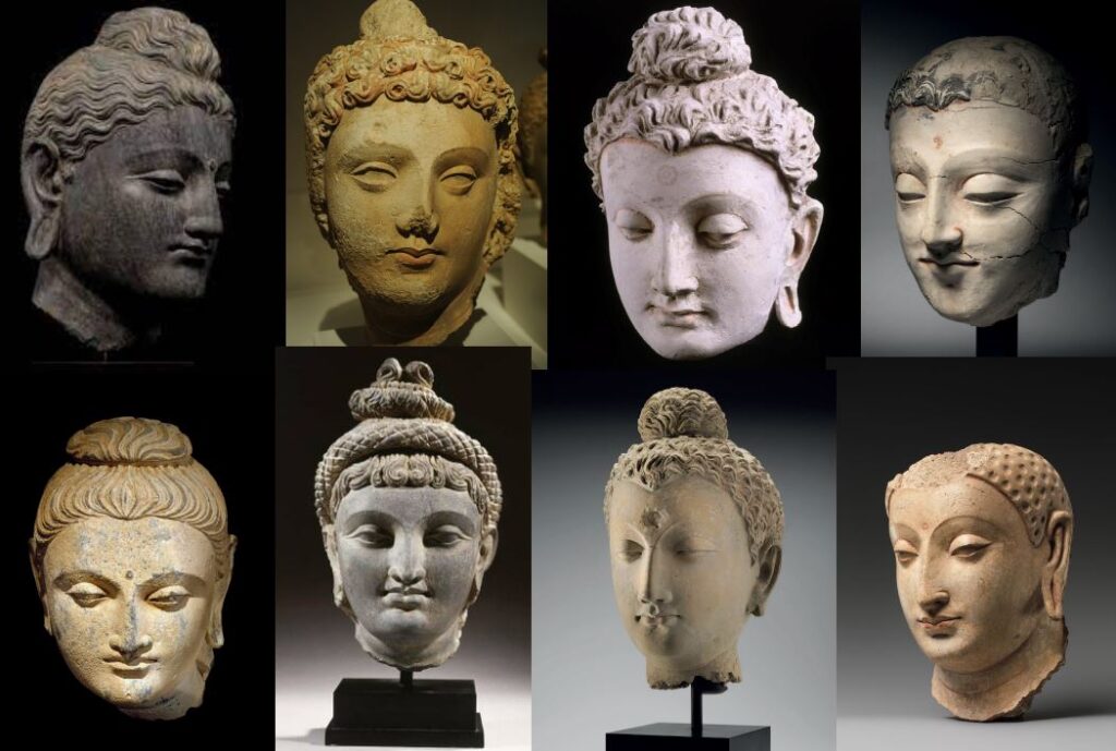
Le terme « greco-bouddhique », renvoie à la thèse de l’archéologue Alfred Foucher (1865-1952) soutenue à la Sorbonne en 1905 sur l’art du Gandhara.
Comme l’écrivait André Malraux (1901-1976) dans les « Voix du silence », en 1951, l’art gréco-bouddhique est cette rencontre entre hellénisme et bouddhisme. Au lieu de dire que l’art venu de Grèce s’était métamorphosé en art bouddhique comme le disait Malraux, je pense plutot qu’au Gandhara, c’est l’art bouddhique qui s’est approprié le meilleur de l’esthétique indienne, grecque et des steppes.
Cependant, Foucher avait raison d’insister, contre ses amis anglais, qu’il s’agit bien d’une influence hellénique et non pas romaine. De leur coté, avec l’Inde s’émancipant de l’Empire britannique, les savants indiens ont tenté de valider la thèse d’une création autochtone de l’image de Buddha, opposant au style du Gandhara, que Foucher voulait gréco-bouddhique, le style de Mathura, dans la région de Delhi, lui aussi englobé dans l’empire des Kouchans, et vu par certains comme contemporain, même s’il est beaucoup moins prolixe que l’art du Gandhara.
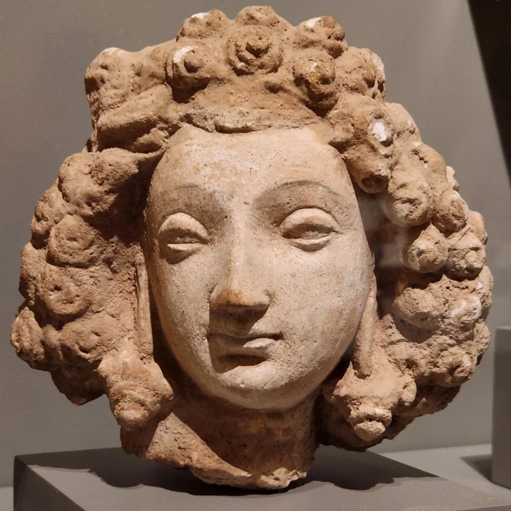
L’art du Gandhara prit véritablement son essor à l’époque kouchane, et plus particulièrement sous le règne du roi Kanishka.
Des milliers d’images furent produites et répandues dans tous les coins de la région, depuis les bouddhas portatifs jusqu’aux statues monumentales des lieux de culte sacrés.
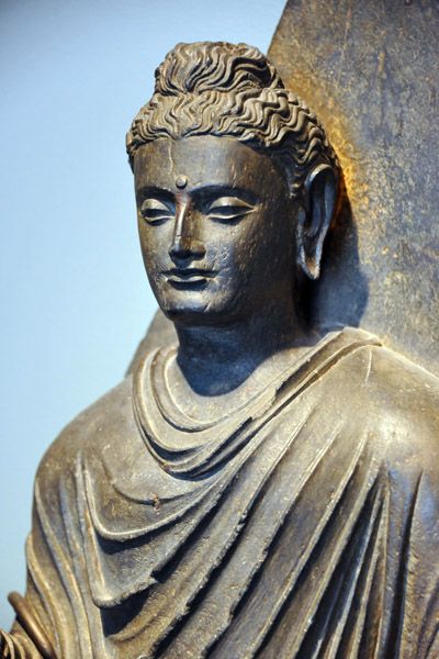
Au Gandhara, pour figurer Bouddha, on représente d’une façon très réaliste une belle personne, souvent un jeune homme, voire une femme. La charge spirituelle est telle que le genre n’est plus essentiel. On ne sait pas s’il s’agit de beaux portraits pris sur le vif, ou de purs fruits de l’imagination des artistes.
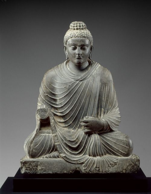
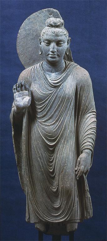
Bouddha y est souvent montré en posture méditative afin d’évoquer le moment où il atteint le nirvana.
Couronné d’une auréole, le visage grave ou souriant, les yeux mi-clos, il irradie la lumière. Plein de sérénité, il incarne le détachement, la concentration, la sagesse et la bienveillance.
Ses cheveux en chignon (l’ushnisha) au sommet du crâne indiquent qu’il est doué d’une connaissance supramondaine. Le point noire entre les deux yeux symbolise le troisième œil, celui de l’éveil.
Dans certaines sculptures, cette cavité contient une perle de cristal, symbole de lumière irradiante. Les lobes d’oreilles sont allongés et servent à accueillir les lourds bijoux que portait autrefois le jeune prince Siddhartha, durant sa jeunesse princière.
Le positionnement des mains, comme dans le reste de l’art indien, répond à des codes. Il peut s’agir de « l’abhayamudra », le geste qui rassure, la paume de la main tournée vers l’extérieur ; de la « varamudra », qui symbolise le don, la main pendante et ouverte avec le bras à demi plié, ou encore de la « vitarkamudra », qui symbolise l’argumentation, la main levée à hauteur de la poitrine, à demi fermée, paume en avant, l’index recourbé vers le pouce.
Au Gandhara, Bouddha est vêtu d’un manteau monastique qui lui couvre les deux épaules. L’étoffe n’est ni taillée, ni cousue, mais simplement drapée à la grecque autour du corps. Les plis à peine stylisés suivent les volumes naturels.
Le roi Kanitscha encouragea à la fois l’école d’art gréco-bouddhique du Gandhara (à Taxila, Peshawar et Hadda) et l’école indo-bouddhique (à Mathura, plus proche de l’Inde).
2. Ecole de Mathura
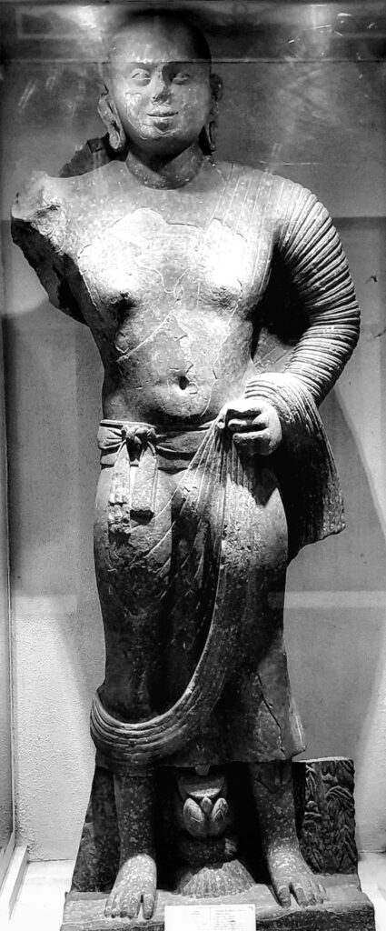

A Mathura, les artistes ont produit un Bouddha très différent. Son corps est dilaté par le souffle sacré (prana) et sa robe monastique est drapée à l’indienne de manière à laisser l’épaule droite dénudée.
On pense que les artistes, pour plaire à un public local, se sont inspirés des statues de yaksha, des esprits de la nature.
Dans les mythologies hindoue, jaïne et bouddhiste, le yakṣha a une double personnalité.
D’un côté, ce peut être une fée de nature inoffensive, associée aux forêts et aux montagnes ; mais il existe une version beaucoup plus sombre du yakṣa, qui est une sorte d’ogre, de fantôme ou de démon anthropophage qui harcèle et dévore les voyageurs.
3. Ecole d’Andrah Pradesh

Un troisième type de bouddha influent s’est développé dans l’Andhra Pradesh, au sud de l’Inde, où des représentations aux proportions imposantes, au visage grave, sans sourire, sont vêtues de robes qui laissent également apparaître l’épaule droite.
Ces sites méridionaux ont servi d’inspiration artistique à la terre bouddhiste du Sri Lanka, à la pointe sud de l’Inde, et les moines sri-lankais s’y rendaient régulièrement. Un certain nombre de statues de ce style se sont également répandues dans toute l’Asie du Sud-Est.
4. Ecole Gupta
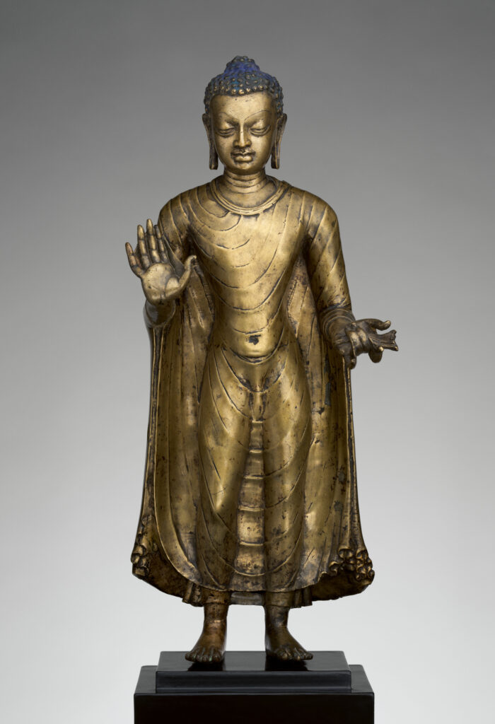
La période Gupta, du IVe au VIe siècle de notre ère, dans le nord de l’Inde, souvent qualifiée d’âge d’or, est supposée avoir synthétisé les deux courants. En réalité, en cherchant une image idéale, elle a sombré dans le maniérisme. Les bouddhas gupta ont les cheveux disposés en petites boucles individuelles et leur tunique arbore un réseau de cordelettes suggérant les plis des draperies (comme à Mathura).
Avec leurs yeux baissés et leur aura spirituelle, les bouddhas gupta deviendront le modèle des futures générations d’artistes, que ce soit dans l’Inde post-Gupta et Pala ou au Népal, en Thaïlande et en Indonésie.
Des statues métalliques gupta du Bouddha, emportées par les pèlerins, ont également été disséminées le long de la Route de la soie jusqu’en Chine.
Mais les Bouddhas du Gandhara sont uniques et vraiment à part. Ce sont de véritables individualités échappant à toute codification et aux normes. Ils ont été fabriqués par des artistes habités d’une spiritualité élevée, explorant de nouvelles frontières de la beauté, du mouvement et de la liberté, et non produisant des objets pour satisfaire un marché émergent.
Aujourd’hui, Pakistanais, Indiens, Afghans et Européens aiment à se quereller. Tous prétendent avoir été les principaux parrains et auteurs du « miracle de Gandhara », mais peu se demandent comment il s’est produit.
Dès le Ier siècle avant J.-C., les artistes locaux délaissent les matériaux périssables avec lesquels ils travaillaient, comme la brique, le bois, le chaume et le bambou, pour adopter la pierre. Le nouveau matériau utilisé était principalement une pierre de schiste allant du gris clair au gris foncé (dans la vallée de la rivière Kaboul et la région de Peshawar). Les périodes ultérieures se caractérisent par l’utilisation du stuc et de l’argile (spécialité de Hadda).
Les techniques utilisées pour les sculptures et les pièces de monnaie du Gandhara sont très proches de celles de la Grèce. Ont-elles été créées par des sculpteurs grecs itinérants ou par des artistes locaux qu’ils ont formés ? Rien n’a été prouvé, mais est-ce vraiment important ?
Lorsque l’Asie rencontre la Grèce
Examinons maintenant des expressions artistiques attestant la belle rencontre entre la culture hellénique et les cultures indiennes et locales.
A. Pièces de monnaie kouchanes
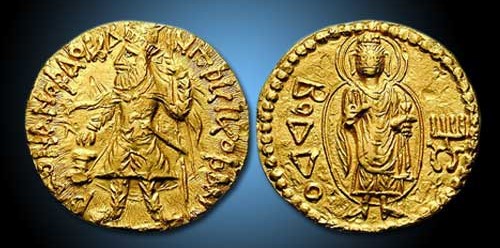
Tout en soutenant toutes les religions qu’il jugeait dignes, Kanishka ne cachait pas sa préférence pour le bouddhisme.
Une pièce d’or datant de 120 après J.-C. montre le roi vêtu d’un lourd manteau kouchan et de longues bottes, des flammes sortant de ses épaules, un étendard dans la main gauche et faisant un sacrifice sur un autel, avec cette légende en caractères grecs : « Roi des rois, Kanishka le Kouchan. » Le revers de la même pièce représente un bouddha debout, en costume grec, faisant de la main droite le geste « ne craignez rien » (abhaya mudra) et tenant un pli de sa robe dans la main gauche. La légende en caractères grecs se lit désormais ΒΟΔΔΟ (Boddo), pour Bouddha.
B. Reliquaire bimaran
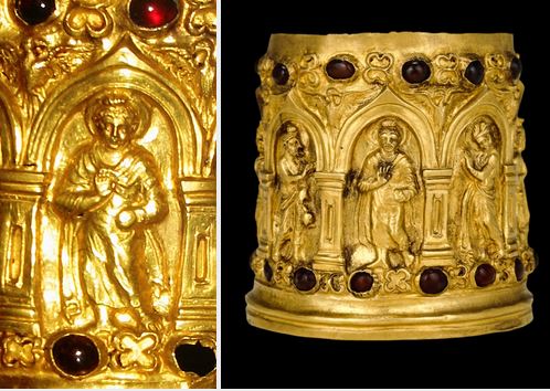
Un véritable thème classique du répertoire de tout artiste de l’époque consiste à montrer Bouddha entouré, accueilli et protégé des divinités d’autres croyances et de religions plus anciennes. La plus ancienne représentation de ce type connue à ce jour figure sur un reliquaire trouvé dans le stupa de Bimaran, au nord-ouest du Gandhara.
Sur cette petite urne en or, généralement datée de 50-60 après J.-C., figure, à l’intérieur de niches voûtées d’architecture gréco-romaine, une représentation hellénistique du Bouddha (coiffure, contrapposto, himation d’élite, etc.), entourée des divinités indiennes Brahma et Sakra.
Tout comme Ashoka, Kanishka, presque laïque, entendait régner, non pas contre mais avec, et surtout au-dessus de toutes les religions. Ainsi, à l’occasion, les divinités grecques, représentées sur les pièces de monnaie (Zeus, Apollon, Héraclès, Athéna, etc.), côtoient les divinités du védisme, du zoroastrisme et du bouddhisme.
Autre exemple, à Ellora, au centre de l’Inde, la grotte et le temple taillés dans le roc où se côtoient les représentants des trois religions (bouddhisme, hindouisme et jaïnisme).
C. Triade de Hadda


Un autre exemple exquis de cet art gandharien est un groupe sculptural connu sous le nom de Triade de Hadda, excavé à Tapa Shotor, un grand monastère sarvastivadin près de Hadda en Afghanistan, datant du IIe siècle après J.-C.
Pour donner une idée de son activité, ce sont quelque 23 000 sculptures gréco-bouddhiques, en argile et en plâtre, qui ont été mises au jour rien qu’à Hadda, entre les années 1930 et 1970.
Le site, fortement endommagé lors des dernières guerres, possédait de belles statues, notamment un bouddha assis, vêtu d’une chlamyde grecque (manteau blanc), les cheveux bouclés, accompagné d’Héraclès et de Tyché (déesse grecque de la fortune et de la prospérité), vêtue d’un chiton (robe à la grecque) et tenant une corne d’abondance.
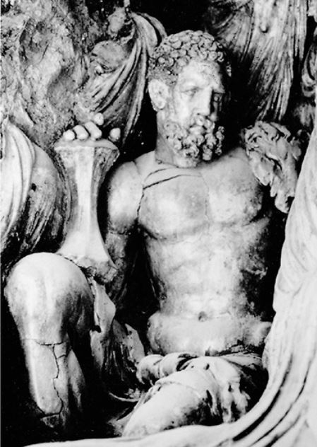
Seule adaptation aux traditions locales de l’iconographie grecque, Héraclès tient en main, non plus son habituelle massue, mais la foudre de Vajrapani (du sanskrit vajra, signifiant « foudre », et pani « en main »), l’une des trois premières divinités protectrices entourant le Bouddha.
C’est un bodhisattva. Il apparaît dès le IIe siècle dans l’iconographie mahāyāna comme doué d’une grande force et comme protecteur du Bouddha. Dans l’art gréco-bouddhique il ressemble à Héraclès ou Zeus, tenant en main une courte massue en forme de vajra, un foudre stylisé. On l’identifie au protecteur, « puissant comme un éléphant », qui aurait veillé sur Bouddha à sa naissance.
Une autre statue rappelle le portrait d’Alexandre le Grand.
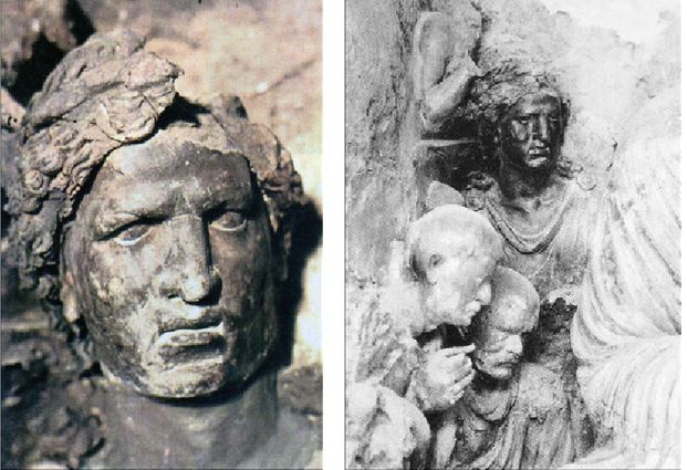
De cet ensemble sculptural, il ne reste malheureusement que des photographies.
Selon l’archéologue afghan Zemaryalai Tarzi, le monastère de Tapa Shotor, avec ses sculptures en argile datées du IIe siècle de notre ère, représente le « chaînon manquant » entre l’art hellénistique de Bactriane et les sculptures en stuc plus tardives trouvées à Hadda, généralement datées du IIIe-IVe siècle de notre ère.
Traditionnellement, l’afflux d’artistes, maître de l’art hellénistique, a été attribué à la migration des populations grecques des villes gréco-bactriennes d’Aî-Khanoum et de Takht-I-Sangin (Nord de l’Afghanistan).
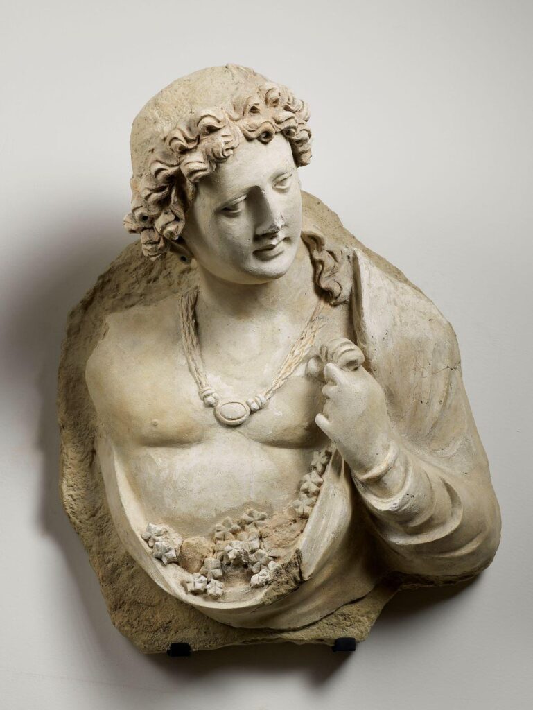
Tarzi suggère que les populations grecques se sont établies dans les plaines de Jalalabad, qui comprennent Hadda, autour de la ville hellénistique de Dionysopolis, et qu’elles sont à l’origine des créations bouddhistes de Tapa Shotor, au IIe siècle de notre ère.
Les colons grecs restés au Gandhara (les Yavanas) après le départ d’Alexandre, soit par choix, soit en tant que populations condamnées à l’exil par Athènes, ont grandement embelli les expressions artistiques de leur nouvelle spiritualité.
Offrant fraîcheur, poésie et un sens du mouvement spectaculairement moderne, les premiers artistes bouddhistes du Gandhara, saisissant des instants de « mouvement-changement » permettant à l’esprit humain d’appréhender un saut vers la perfection, sont une contribution inestimable à la culture de l’humanité tout entière. N’est-il pas temps de reconnaître ce magnifique travail ?
D. Prendre la terre à témoin
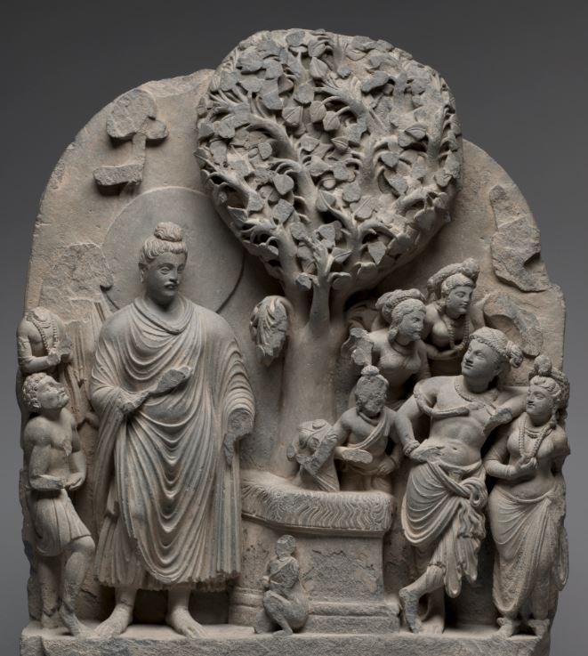
Parmi les autres types productions artistiques de Gandhara, ce magnifique bas-relief, aujourd’hui conservée au musée de Cleveland, illustre la lutte du Bouddha pour atteindre le nirvana.
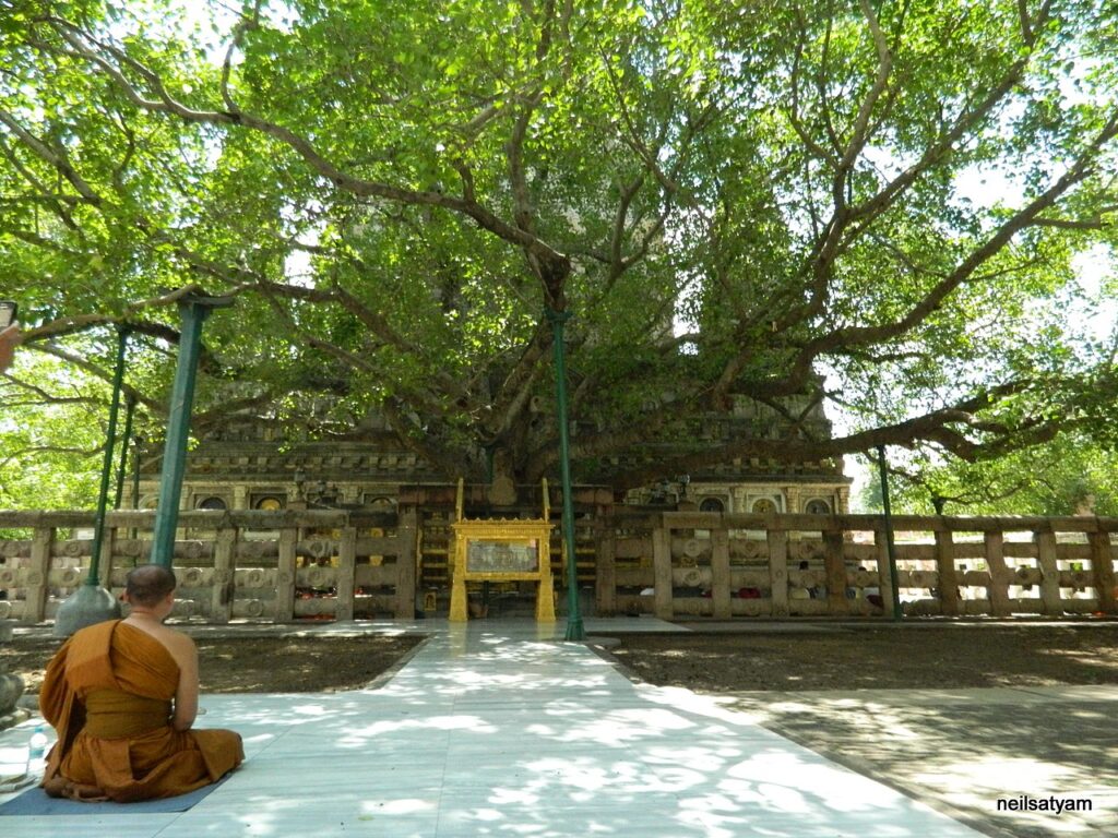
Au centre de la composition se trouve l’arbre de la Bodhi, sous lequel le Bouddha atteignit l’illumination. Ce figuier sacré est vénéré depuis des temps ancestraux par les villageois locaux, car il passe pour être la résidence d’une divinité de la nature. L’autel lui-même est recouvert de kusha, herbe utilisée pour des offrandes sacrificielles.
Il y a environ 2500 ans, après être resté en méditation pendant 49 jours, assis sous cet arbre, le Bouddha est défié par des démons cauchemardesques qui remettent en cause l’authenticité de son illumination.
Leur chef Mara (littéralement, la mort), qui se tient à droite dans une posture arrogante, entouré de ses filles, fait tout pour empêcher Bouddha d’atteindre le nirvana (l’éveil).
Il le menace et encourage ses propres filles à le séduire. Innocemment, il lui demande s’il est sûr de pouvoir trouver quelqu’un pour témoigner qu’il a véritablement atteint le nirvana. En réponse à ce défi, le Bouddha touche alors la terre et la prend à témoin.
Selon la mythologie, la jeune déesse de la Terre surgit alors du sol et commença à essorer les eaux déferlant de ses cheveux pour noyer Mara. Sur la sculpture, on peut la voir, toute petite, au pied de l’autel, agenouillée devant Bouddha en signe de révérence. Elle a également pris forme humaine en sortant de terre. Les anciennes religions interviennent ici pour défendre et protéger la nouvelle, celle de Bouddha.
Semblant, eux aussi, regretter les anciens dieux et déesses de leur panthéon, les Indiens convertis au bouddhisme les ajoutent au-dessus de la tête de Bouddha ou à côté, comme, par exemple, le dieu védique Indra.
E. Tous bodhisattva ?
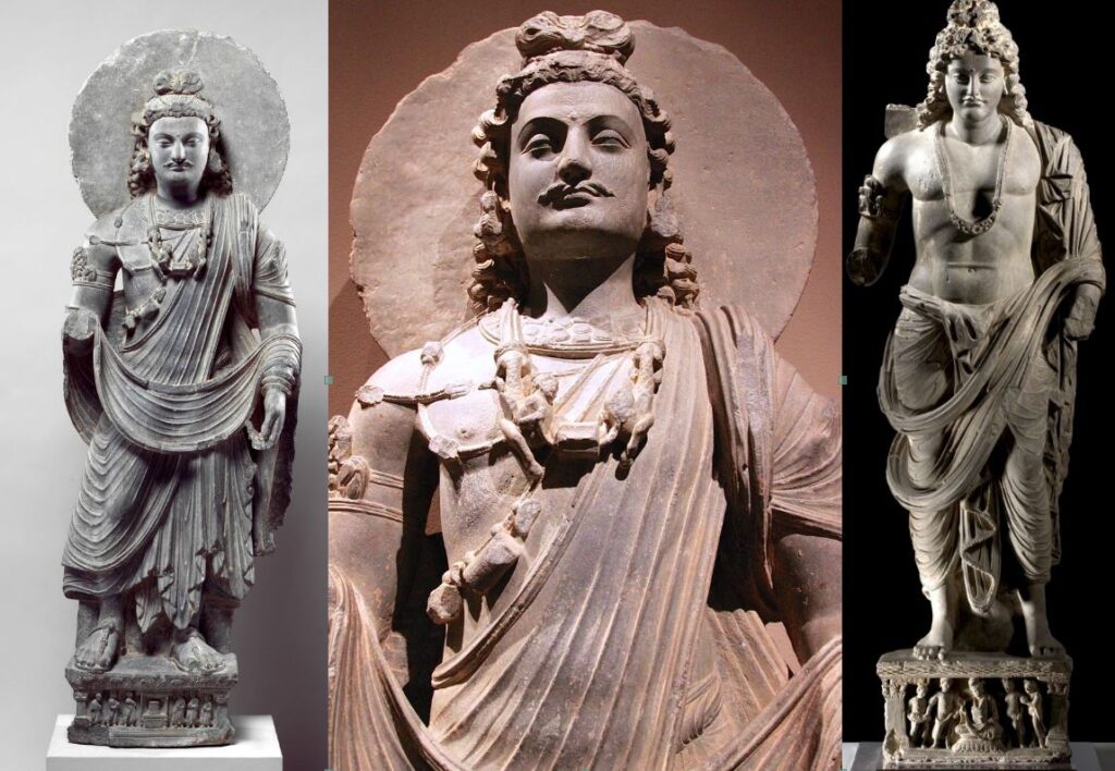
Enfin, pour conlure cette section sur la sculpture, deux mots sur le bodhisattva, figure très intéressante sortie de l’imaginaire bouddhiste pour rendre la spiritualité bouddhiste accessible au citoyen ordinaire.
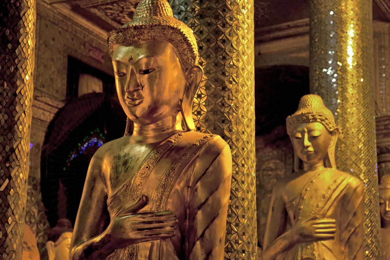
Il peut s’agir soit d’une représentation de Bouddha en personnage princier orné de bijoux, avant son renoncement à la vie de palais, soit d’un humain ordinaire, déjà conscient qu’il est sur la voie de l’illumination et qu’il est devenu un outil au service du bien.
Animé d’altruisme et obéissant les disciplines destinées aux bodhisattvas, il doit aider par compassion d’abord les autres êtres sensibles à s’éveiller, y compris en retardant sa propre libération !
Les bodhisattvas se distinguent par de grandes qualités spirituelles telles que les « quatre demeures divines » que sont:
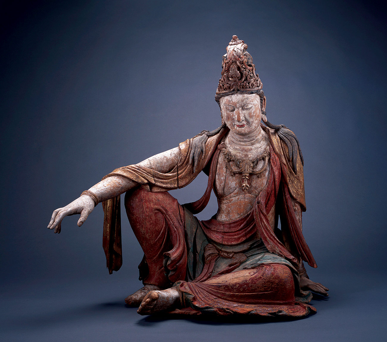
- l’amour bienveillant (maitri),
- la compassion (karuna),
- la joie empathique (mudita) et
- l’équanimité (upekṣa),
ainsi que les diverses perfections (paramitas), qui comprennent la prajnaparamita (« connaissance transcendante » ou « perfection de la sagesse ») et les moyens habiles (upaya).
Des bodhisattvas spirituellement avancés tels qu’Avalokiteshvara (ci-dessus), Maitreya et Manjushri, largement vénérés dans le monde bouddhiste mahâyâna, sont censés posséder un grand pouvoir, qu’ils utilisent pour aider tous les êtres vivants.
Pour certains courants bouddhistes, seul Maitreya mérite le titre de « Bouddha du futur ». Dans l’art on le représente à la fois comme un bouddha vêtu d’une robe monastique et comme un bodhisattva princier avant l’illumination.
Un magnifique bodhisattva de Gandhara peut être admiré au Dallas Museum of Art (ci-dessous).
Cette sculpture en terre cuite représente un « Bodhisattva pensant » de la région de Hadda en Afghanistan, une production typique du Gandhara.
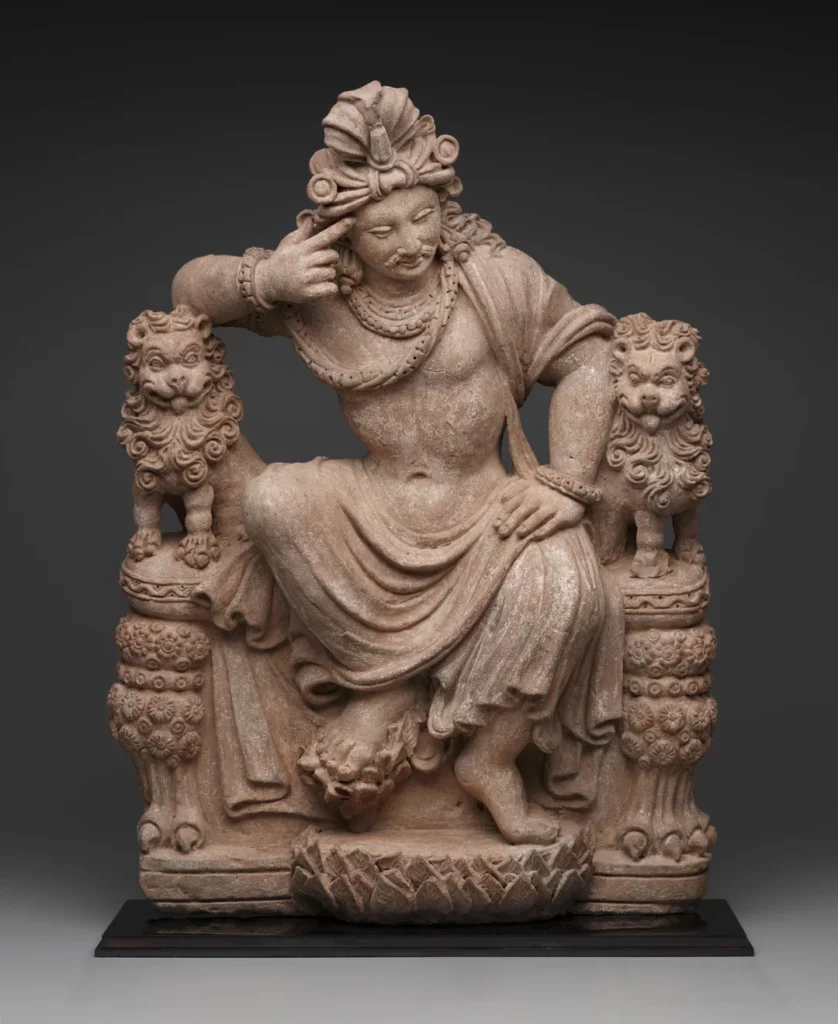
Avec très peu d’éléments visuels, l’artiste réussit un travail gigantesque. Les piliers de sa large chaise sont des lions au regard un peu fou, représentation allégorique de ces passions qui nous font souffrir et qui sont maintenues sous un sage contrôle par l’effort hautement réflexif du Bodhisattva héroïque au centre de l’œuvre.
Le bouddhisme aujourd’hui, l’exemple de Nehru

Paradoxalement, le bouddhisme, en tant que religion, a presque cessé d’exister dans son propre berceau, l’Inde, depuis le XIIe siècle de notre ère.
Bel exemple de la lutte incessante des meilleurs esprits indiens pour l’émancipation, en 1956, près d’un demi-million « d’intouchables » se sont convertis au bouddhisme sous l’impulsion du dirigeant politique à la tête du comité chargé de rédiger la Constitution de l’Inde, le réformateur social B. R. Ambedkar (1891-1956), et du Premier ministre indien et chef du Parti du Congrès Jawaharlal Nehru (1889-1964), lui-même issu d’une famille de brahmanes.
En juin de la même année, le Courrier de l’UNESCO consacrait son édition à « 25 siècles d’art et de culture bouddhistes ».
En Inde, les deux hommes d’État ont orchestré une année de célébration en l’honneur de « 2500 ans de bouddhisme », non pas pour ressusciter une ancienne religion en soi, mais pour s’approprier le statut de berceau de cette vieille religion et renvoyer au monde une image de champion de la non-violence et du pacifisme.
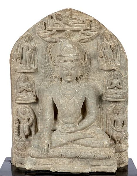
Quelques années plus tard, lors de sa visite d’État à la Maison Blanche, le 9 novembre 1961, le Premier ministre indien Nehru offrit une sculpture bouddhiste au président John F. Kennedy
Comme beaucoup d’hindous, Mahatma Gandhi vénérait Bouddha. Pour lui, le bouddhisme n’était qu’une « autre forme d’hindouisme » et sa critique venait donc « de l’intérieur de l’hindouisme ».
Un point de vue que ne partageait pas le Premier ministre indien Jawaharlal Nehru. Profondément troublé par certaines caractéristiques intrinsèques à l’hindouisme, telles que le ritualisme et les castes, Nehru ne pouvait pas placer le bouddhisme, qui abhorrait ces institutions, dans la même rubrique…
Nehru fut fortement influencé par le bouddhisme. C’est ainsi qu’il appela sa fille (la future Première ministre Indira Gandhi) Indira Priyadarshini, du nom de « Priyadarshi » adopté par le grand empereur Ashoka, après être devenu un prince bouddhiste de la paix !

Par ailleurs, Nehru contribua à faire de l’Ashoka Chakra (la Roue bouddhiste intégrée au drapeau national) le symbole de l’Inde. Chaque fois qu’il se rendait au Sri Lanka, il visitait la statue du Bouddha à Anuradhapura.
Le dirigeant indien, qui ne cessait d’exhorter les Indiens superstitieux et ritualistes à cultiver un « tempérament scientifique » et à faire entrer l’Inde dans l’ère de l’âge atomique, était naturellement attiré par le rationalisme prôné par le Bouddha.
« Bouddha ne demandait à personne de croire en quoi que ce soit d’autre que ce qui pouvait être prouvé par l’expérience et l’essai. Tout ce qu’il voulait, c’était que les hommes recherchent la vérité et n’acceptent rien sur la foi d’un autre homme, même s’il s’agissait du Bouddha lui-même. Il me semble que c’est là l’essence de son message », alléguait Nehru.
Et d’ajouter :
« Lui-même a eu le courage d’accepter la vérité et de ne rien accepter sur la foi d’un autre (…) Bouddha a eu le courage de s’attaquer à la religion populaire, à la superstition, au cérémonial et à la prêtrise, ainsi qu’à tous les intérêts qui s’y rattachent. Il a également condamné les perspectives métaphysiques et théologiques, les miracles, les révélations et les relations avec le surnaturel. Il fait appel à la logique, à la raison et à l’expérience ; il met l’accent sur l’éthique (…) Toute son approche est comme le souffle du vent frais des montagnes après l’air vicié de la spéculation métaphysique (…) Bouddha n’a pas attaqué directement les castes, mais dans son propre ordre, il ne les a pas reconnues, et il ne fait aucun doute que toute son attitude et son activité ont affaibli le système des castes. »
L’influence du Bouddha s’est manifestée dans la politique étrangère de Nehru. Cette politique était motivée par un désir de paix, d’harmonie internationale et de respect mutuel. Elle visait à résoudre les conflits par des méthodes pacifiques. Le 28 novembre 1956, Nehru déclare :
« C’est essentiellement grâce au message du Bouddha que nous pouvons envisager nos problèmes dans la bonne perspective et nous éloigner des conflits et de la concurrence dans le domaine des conflits, de la violence et de la haine. »
Visiblement inspirés par les préceptes bouddhistes, les concepts de non-alignement et le Traité de Panchsheel de Nehru, communément appelé « Traité des cinq principes de coexistence pacifique », ont été formellement énoncés pour la première fois dans l’Accord sur le commerce et les relations entre le Tibet chinois et l’Inde, signé le 29 avril 1954.
Cet accord stipulait, dans son préambule, que les deux gouvernements,
« ont décidé de conclure le présent accord sur la base des principes suivants :
1) respect mutuel de l’intégrité territoriale et de la souveraineté de l’autre,
2) non-agression mutuelle,
3) non-ingérence mutuelle,
4) égalité et avantage mutuel,
5) coexistence pacifique. »
Le 29 novembre 1952, lors de la Conférence culturelle bouddhiste internationale à Sanchi, où Kanitscha avait entamé la construction du plus haut stupa de l’Antiquité, Nehru précisait :
« Le message que Bouddha a transmis il y a 2500 ans a éclairé non seulement l’Inde et l’Asie, mais le monde entier. La question qui se pose inévitablement est la suivante : le grand message du Bouddha peut-il s’appliquer au monde d’aujourd’hui ? Peut-être que oui, peut-être que non, mais je sais que si nous suivons les principes énoncés par le Bouddha, nous gagnerons la paix et la tranquillité pour le monde. »
Le 3 octobre 1960, Nehru s’adressait à l’Assemblée générale des Nations unies :
« Dans un passé lointain, un grand fils de l’Inde, le Bouddha, a dit que la seule vraie victoire était celle où tous étaient également victorieux et où personne n’était vaincu. Dans le monde d’aujourd’hui, c’est la seule victoire concrète ; toute autre voie mène au désastre. »
Nehru a fait de son mieux pour appliquer les enseignements du Bouddha dans la gestion des affaires intérieures de l’Inde. Sa conviction que le changement social ne peut être obtenu que par le consensus social le plus large découle de l’influence du Bouddha, d’Ashoka et de Gandhi.
Dans son discours du 15 août 1956 à l’occasion de la fête de l’indépendance, Nehru fixe les défis à relever :
« Nous sommes fiers que le sol sur lequel nous sommes nés ait produit de grandes âmes comme le Bouddha Gautama et Gandhi. Rafraîchissons-nous la mémoire une fois de plus et rendons hommage à Gautama Bouddha et à Gandhi, ainsi qu’aux grandes âmes qui, comme eux, ont façonné ce pays. Suivons la voie qu’ils nous ont montrée avec force, détermination et coopération. »
Science et religion, Albert Einstein et Bouddha
Pour conclure, je vous invite à méditer quelques citations d’Albert Einstein discutant les rapports entre la science et la religion où il évoque l’importance de Bouddha :
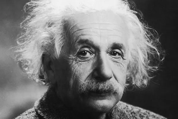
Le sentiment religieux cosmique
« Il existe un troisième état d’expérience religieuse… que j’appellerai le sentiment religieux cosmique. Il est très difficile d’expliquer ce sentiment à quelqu’un qui en est totalement dépourvu, d’autant plus qu’il n’y a pas de conception anthropomorphique de Dieu qui lui corresponde. L’individu ressent le néant des désirs et des objectifs humains, ainsi que la sublimité et l’ordre merveilleux qui se révèlent tant dans la nature que dans le monde de la pensée. Il considère l’existence individuelle comme une sorte de prison et veut faire l’expérience de l’univers comme un tout unique et significatif. Les prémices d’un sentiment religieux cosmique apparaissent déjà à un stade précoce du développement, par exemple dans de nombreux Psaumes de David et dans certains Prophètes.
Le bouddhisme, comme nous l’ont appris les merveilleux écrits de Schopenhauer en particulier, en contient un élément beaucoup plus fort. Les génies religieux de tous les temps se sont distingués par ce type de sentiment religieux, qui ne connaît ni dogme, ni Dieu conçu à l’image de l’homme, de sorte qu’il ne peut y avoir d’Église dont l’enseignement central se fonde sur lui.
C’est donc précisément parmi les hérétiques de toutes les époques que l’on trouve des hommes animés du sentiment religieux le plus élevé et qui, dans bien des cas, étaient considérés par leurs contemporains comme des athées, parfois même comme des saints. Vu sous cet angle, des hommes comme Démocrite, François d’Assise et Spinoza sont très proches les uns des autres. Comment le sentiment religieux cosmique peut-il se transmettre d’une personne à l’autre, s’il ne peut donner lieu à aucune notion précise de Dieu et à aucune théologie ? À mon avis, c’est la fonction la plus importante de l’art et de la science que d’éveiller ce sentiment et de le maintenir en vie chez ceux qui en sont capables ».
—Einstein, Albert. Le monde tel que je le vois. (Secaucus, NJ : Carol Publishing Group, 1999). p. 26.
Libéré des entraves et de ses désirs égoïstes
« Une personne religieusement éclairée me semble être celle qui, au mieux de ses capacités, s’est libérée des entraves de ses désirs égoïstes et se préoccupe de pensées, de sentiments et d’aspirations auxquels elle s’accroche en raison de leur valeur supra-personnelle. Il me semble que ce qui est important, c’est la force de ce contenu supra-personnel et la profondeur de la conviction concernant son sens impérieux, indépendamment de toute tentative d’unir ce contenu à un Être divin, car sinon il ne serait pas possible de considérer Bouddha et Spinoza comme des personnalités religieuses.
Par conséquent, une personne religieuse est pieuse dans le sens où elle ne doute pas de la signification et de la hauteur de ces objets et objectifs supra-personnels qui ne nécessitent ni ne peuvent être fondés rationnellement. Ils existent avec la même nécessité et la même évidence que lui. En ce sens, la religion est l’effort séculaire de l’humanité pour devenir clairement et complètement consciente de ces valeurs et de ces objectifs et pour renforcer et étendre constamment leur effet.«
—Einstein, Albert. Einstein, Science, Philosophy and Religion, A Symposium, publié par la Conference on Science, Philosophy and Religion in Their Relation to the Democratic Way of Life, Inc, New York, 1941.
Bouddha, Moïse et Jésus
« Ce que l’humanité doit à des personnalités comme Bouddha, Moïse et Jésus est pour moi plus important que toutes les réalisations de l’esprit curieux et constructif. Ce que ces hommes bénis nous ont donné, nous devons le garder et essayer de le maintenir en vie de toutes nos forces si l’humanité ne veut pas perdre sa dignité, la sécurité de son existence et sa joie de vivre ».
—Einstein, Albert. Déclaration écrite (septembre 1937), p. 70
Commencer par le coeur de l’homme
« Si nous voulons améliorer le monde, nous ne pouvons pas le faire avec des connaissances scientifiques, mais avec des idéaux. Confucius, Bouddha, Jésus et Gandhi ont fait plus pour l’humanité que la science. Nous devons commencer par le cœur de l’homme, par sa conscience, et les valeurs de la conscience ne peuvent se manifester que par un service désintéressé à l’humanité ».
—Einstein, Albert. Einstein et le poète (1983), p. 92
L’illusion optique de la conscience
L’un des échanges les plus poignants de son rôle de philosophe a eu lieu alors qu’il avait 70 ans et vivait à Princeton. Un rabbin ordonné lui avait écrit pour lui dire qu’il avait cherché en vain à réconforter sa fille de 19 ans après la mort de sa sœur, « une belle enfant de 16 ans, sans péché ».
L’être humain », écrit Einstein en réponse, « est une partie du tout, que nous appelons « Univers », une partie limitée dans le temps et l’espace. Il fait l’expérience de lui-même, de ses pensées et de ses sentiments comme quelque chose de séparé du reste – une sorte d’illusion d’optique de sa conscience. Cette illusion est une sorte de prison pour nous, nous limitant à nos désirs personnels et à l’affection pour quelques personnes qui nous sont proches. Notre tâche doit être de nous libérer de cette prison en élargissant notre cercle de compassion à toutes les créatures vivantes et à toute la nature dans sa beauté. Personne n’est en mesure d’y parvenir complètement, mais le fait de s’efforcer d’y parvenir est en soi une partie de la libération et un fondement de la sécurité intérieure ».
— Walter Sullivan, “The Einstein Papers: A Man of Many Parts,” New York Times, 29 mars 1972.
NOTES :
*1. Les langues indo-aryennes. Il existe plus de 200 langues indo-aryennes connues, parlées par environ 1 milliard de personnes. Leurs formes modernes descendent des langues indo-aryennes anciennes, telles que le sanskrit védique primitif, en passant par les langues indo-aryennes moyennes (ou prakrits). Les langues indo-aryennes les plus importantes en termes de premiers locuteurs sont l’hindi-ourdou (c. 330 millions), le bengali (242 millions), le pendjabi (environ 120 millions), le marathi (112 millions), le gujarati (60 millions), le rajasthani (58 millions), le bhojpuri (51 millions), l’odia (35 millions), le maithili (environ 34 millions), le sindhi (25 millions), le népali (16 millions), l’assamais (15 millions), le chhattisgarhi (18 millions), le cinghalais (17 millions) et le romani (environ 3,5 millions). Le sud de l’Inde compte des langues dravidiennes (telugu, tamil, kannada et malayalam). En Europe, les principales langues indo-européennes sont l’anglais, le français, le portugais, le russe, le néerlandais et l’espagnol.
*2. Discords. Dès le IIIe siècle avant J.-C., pas moins de dix-huit écoles bouddhistes distinctes sont à l’œuvre en Inde, mais toutes se reconnaissent mutuellement comme des adeptes de la philosophie du Bouddha. Enfin, le bouddhisme du Véhicule du Diamant, dit Vajrayâna, dont les textes et les rituels complexes ont été élaborés dans les universités du nord-est de l’Inde vers le VIIe et VIIIe siècles.
*3. Le prâkrit est un terme qui désigne une langue indo-aryenne dérivée du sanskrit classique. Le mot lui-même a une définition assez souple, car il a parfois le sens de « originel, naturel, sans artifices, normal, ordinaire, usuel, ou encore, local », contrastant ainsi avec la forme littéraire et religieuse du sanskrit ; mais parfois, on peut aussi comprendre prâkrit comme signifiant « dérivé d’une langue originelle », c’est-à-dire dérivé du sanskrit. On peut donc dire que le prâkrit, comme toute langue vulgaire et vernaculaire de l’Inde, est issu du sanskrit. En fait, on peut comparer les prâkrits au latin vulgaire, tandis que le sanskrit serait le latin classique. L’usage le plus ancien que l’on connaisse du prâkrit est formé par l’ensemble d’inscriptions de l’empereur indien Ashoka (IIIe siècle av. J.-C.). L’un des prâkrits les plus célèbres est le pâli, qui a accédé au statut de langue littéraire et intellectuelle en devenant celle des textes du bouddhisme theravâda.
*4. Le pâli est une langue indo-européenne de la famille indo-aryenne. C’est un prâkrit moyen indien proche du sanskrit et remontant vraisemblablement au IIIe siècle av. J.-C. Le pâḷi est utilisé comme langue liturgique bouddhiste au Sri Lanka, en Birmanie, au Laos, en Thaïlande et au Cambodge. Son statut de langue liturgique l’a rendu, à l’instar du sanskrit, figé et normalisé.
*5. Hippodamos de Milet (né en 498 av. J.-C. et mort en 408 av. J.-C.) est un géomètre et ingénieur du Ve siècle av. J.-C., qui fut aussi architecte urbaniste, physicien, mathématicien, météorologiste et philosophe pythagoricien. La tradition a retenu de lui ses grands travaux de planification urbaine. Bien que ces travaux se caractérisent par l’utilisation systématique du plan en damier, il n’en est pas l’inventeur, de très anciennes colonies grecques nous fournissant déjà des exemples de cette structure urbaine.
Paris Schiller Institute stages Afghan civil society protest against UNESCO
Paris, Feb. 2024 – On Thursday February 22, between 10:00 am and 1:00 pm CET, members and supporters of the International Schiller Institute, founded and presided by Helga Zepp-LaRouche, gathered peacefully in front of one of the main buildings of the headquarters of UNESCO in Paris (1, rue Miollis, Paris 75015). An appeal (see below), endorsed by both Afghans and respected personalities of four continents, was presented to the Secretary General and other officials of UNESCO.
How it started
Following a highly successful conference in Kabul last November by the Ibn-e-Sina Research & Development Center on the reconstruction of Afghanistan, a group of senior archaeologists of the Afghan Academy of Sciences (ASA), in discussion with the organizers and the invited experts of the Schiller Institute, suggested to launch a common appeal to UNESCO and Western governments to “lift the sanctions against cultural heritage cooperation.”
The Call
“We regret profoundly, says the call, that the Collective West, while weeping crocodile tears over destruction of the world’s cultural heritage, has imposed a selective ban of scientific cooperation on nations mistakenly considered as “opposed to its rules and values.” The complete freeze of all cooperation in the field of archaeology between France and both Syria and Afghanistan, is just one example of this tragedy.”
“The dramatic neglect of international cultural institutions and donors to Afghanistan, the lack of sufficient funds in the field of cultural heritage protection, and the political treatment of international cultural heritage institutions have seriously endangered Afghanistan,” underscores the petition.
Specifically, “UNESCO, which should raise its voice against any new form of ‘cultural and scientific apartheid,’ has repeatedly worsened the situation by politicizing issues beyond its prerogatives.”
To conclude, the signers call
“on the international community to immediately end this form of ‘collective punishment,’ which creates suffering and injustice, promotes ignorance, and endangers humanity’s capacity for mutual respect and understanding.”
Living Spirit of Afghanistan
To date, over 550 signatures have been collected, mainly from both Afghan male (370) and female (140) citizens, whose socio-professional profiles indicates they truly represent the « living spirit of the nation ».
Among the signatories: 62 university lecturers, 27 doctors, 25 teachers, 25 members of the Afghan Academy of Sciences, 23 merchants, 16 civil and women’s rights activists, 16 engineers, 10 directors and deans of private and public universities, 7 political analysts, 6 journalists, 5 prosecutors, several business leaders and dozens of qualified professionals from various sectors.
International support
On four continents (Europe, Asia, America, Africa), senior archaeologists, scientists, researchers, members of the Academy of Sciences, historians and musicians from over 20 countries have welcomed and signed this appeal.
Italian Professor Pino Arlacchi, a former member of the European Parliament and the former head of United Nations Office on Drugs and Crime (UNODC) was the first to sign. Award-winning American filmmaker Oliver Stone, is a more recent signer.
In France, Syria, Italy, the UK and Russia, among the signers one finds senior researchers suffering the consequences of what some have identified as a « New Cultural Cold War. » Superseding the very different opinions they have on many questions, the signatories stand united on the core issue of this appeal: for science to progress, all players, beyond ideological, political and religious differences, and far from the geopolitical logic of ‘blocs’, must be able to exchange freely and cooperate, in particular to protect mankind’s historical and cultural heritage.
Testifying to the firm commitment of the Afghan authorities, the petition has also been endorsed by the Deputy Minister of Foreign Affairs, the Minister of Culture and Arts, and the Minister of Agriculture, as well as senior officials from the Ministries of Higher Education, Water and Energy, Mines, Finance, and others.
“The 46th session of UNESCO’s World Heritage Committee, to be held in New Delhi in July this year, offers UNESCO the opportunity to announce Afghanistan’s full return into world heritage cooperation, if we can have our voice heard,” says Karel Vereycken of the Paris Schiller Institute. “We certainly will not miss transmitting this appeal to HE Vishal V Sharma, India’s permanent representative to UNESCO, recently nominated to make the Delhi 46th session a success.”
For all information, interview requests in EN, FR and NL:
Karel Vereycken, Schiller Institute Paris
00 33 (0)6 19 26 69 38
Full text of the appeal
International Call to Lift Sanctions Against Cultural Heritage Cooperation
Following the international conference, organized by the Ibn-e-Sina Research & Development Center’s in Kabul in early November 2023, on the reconstruction of Afghanistan, a group of researchers launched the following petition:
We, the undersigned, researchers and experts in the domains of the history of civilizations, cultural heritage, archaeology, anthropology, sociology, and many other fields, and other enlightened citizens of the world, in Afghanistan, Syria, Russia, China, and many other countries, launch the following call.
1) We regret profoundly that the “Collective West”, while weeping crocodile tears over destruction of the world’s cultural heritage, has imposed a selective ban of scientific cooperation on nations mistakenly considered as “opposed to its rules and values.” The complete freeze of all cooperation in the field of archaeology between France and both Syria and Afghanistan, is just one example of this tragedy.
2) We request particular attention to the case of Afghanistan. Its neighboring countries, national and international institutions, and countries involved in international conventions for the protection of cultural and natural heritage are committed to cooperation in the field of guarding cultural heritage sites and artifacts and preventing their smuggling and destruction. Therefore, it is expected that in the current situation, they will fully play their role in the protection of Afghanistan’s cultural heritage in accordance with international laws and conventions. However, the dramatic neglect of international cultural institutions and donors to Afghanistan, the lack of sufficient funds in the field of cultural heritage protection, and the political treatment of international cultural heritage institutions have seriously endangered Afghanistan. Undoubtedly, the non-recognition of the Afghan government has dimmed the attention of cultural institutions. Considering the above, we expect these international institutions to renew their full support to protect both the tangible and the intangible cultural heritage of Afghanistan.
3) We regret that UNESCO, which should raise its voice against any new form of “cultural and scientific apartheid,” has repeatedly worsened the situation by politicizing issues beyond its prerogatives.
4) Therefore, we call on the international community to immediately end this form of “collective punishment,” which creates suffering and injustice, promotes ignorance, and endangers humanity’s capacity for mutual respect and understanding.
The progress of scientific knowledge, in a positive climate permitting all to share it, is by its very nature beneficial to each and to all and to the very foundation of a true peace.
SIGNERS:
A. FROM AFGHAN CIVIL SOCIETY:
– Hussain Burhani, Archaeologist, Numismatist, Afghanistan ;
– Ketab Khan Faizi, Archaeologist, Director of the Academy of Sciences at the International Centre for Kushan Studies in Kabul, Afghanistan;
– Stora Ishams Mayar, Archaeologist, member of the Academy of Sciences at the International Centre for Kushan Studies in Kabul, editor in chief of the journal of this mentioned center, Afghanistan;
– Mahmood Jan Drost, Senior Architect, head of protection of old cities of Afghanistan, Ministry of Urban Development and Housing, Afghanistan;
– Ghulam Haidar Kushkaky, Archaeologist, associate professor, Archaeology Investigation Center, Afghanistan ;
– Shawkatullah Abed, Chief of staff, Afghan Science Academy, Afghanistan;
– Sardar Ghulam Ali Balouch, Head of Afghanistan Balochs Union, Afghanistan;
– Daud Azimi Shinwari, Ibn-e-Sina Research & Development Center, Germany;
– Abdul Fatah Raufi, Ibn-e-Sina Research & Development Center, Kabul, Afghanistan;
– Mirwais Popal, Dip, Master, Ibn-e-Sina Research & Development Center, Germany;
B. FROM ABROAD:
(Russia, China, USA, Indonesia, France, Angola, Germany, Turkiye, Italy, UK, Mexico, Sweden, Iran, Belgium, Argentina, Czech Republic, Syria, Congo Brazzaville, Yemen, Venezuela, Pakistan, Canada, Democratic Republic of Congo.)
– H.E. Mr Mohammad Homayoon Azizi, Afghanistan’s Ambassador to Paris, UNESCO and ICESCO, France;
— Julio Bendezu-Sarmiento, Researcher at the National Scientific Research Centre (CNRS), Archaeologist specializing in Central Asia; Former director of the Delegation of French Archaeologists in Afghanistan (DAFA) (2014-2018), France;
– Inès Safi, CNRS, Researcher in Theoretical Nanophysics, France;
– Pierre Leriche, Archeologist, Director of Research Emeritus at CNRS-AOROC, Scientific Director of the Urban Archaeology of the Hellenized Orient research program, France;
– Nadezhda A. Dubova, Institute of Ethnology and Anthropology, Dr. in Biology, Prof. in History. Head of the Russian-Turkmen Margiana archaeological expedition, Russian Academy of Science (RAS), Russia;
– Raffaele Biscione, retired, associate Researcher, Consiglio Nazionale delle Recerche (CNR); former first researcher of CNR, former director of the CNR archaeological mission in Eastern Iran (2009-2022), Italy;
– Dr. Razia Sultanova, Professor, Cambridge University, UK;
– Dr. Houmam Saad, Archaeologist, Directorate General of Antiquities and Museums, Syria;
– Estelle Ottenwelter, Institute of Archaeology, Czech Academy of Sciences, Natural Sciences and Archaeometry, Post-Doc, Czech Republic;
– Didier Destremau, author, diplomat, former French Ambassador, President of the Franco-Syrian Friendship Association (AFS), France ;
– Wang Feng, Professor, South-West Asia Department of Chinese Academy of Social Sciences (CASS), China;
– Dr. Engin Beksaç, Professor, Trakya University, Department of Art History, Turkiye;
– Bruno Drweski, Professor, National Institute of Oriental Languages and Civilizations (INALCO), France;
– Maurizio Abbate, National President of National Agency of Cultural Activities (ENAC), Italy;
– Patricia Lalonde, Former Member of the European Parliament, vice-president of Geopragma, author of several books on Afghanistan, France;
– Pino Arlacchi, Professor of sociology, Former Member of the European Parliament, former head of United Nations Office on Drugs and Crime (UNODC), Italy;
– Oliver Stone, Academy Award-winning Film director, Producer, and Screenwriter;
– Graham E. Fuller, Author, former Station chief for the CIA in Kabul until 1978, former Vice-Chair of the National Intelligence Council (1986), USA;
– Prof. H.C. Fouad Al Ghaffari, Advisor to Prime Minister of Yemen for BRICS Countries affairs, Yemen;
– Farhat Asif, President of Institute of Peace and Diplomatic Studies (IPDS), Pakistan;
— Dursun Yildiz, Director, Hydropolitics Association, Türkiye;
– Irène Neto, president, Fundacao Dr. Antonio Agostinho Neto (FAAN), Angola;
– Luc Reychler, Professor international politics, University of Leuven, Belgium;
– Pierre-Emmanuel Dupont, Expert and Consultant in public International Law, Senior Lecturer at the Institut Catholique de Vendée, France;
— Irene Rodríguez, Departamento de Historia, Facultad de Filosofía y Letras, Universidad de Buenos Aires, Argentina;
– Dr. Ririn Tri Ratnasari, Professor, Head of Center for Halal Industry and Digitalization, Advisory Board at Journal of Islamic Accounting and Business Research, Faculty of Economics and Business, Universitas Airlangga, Indonesia;
– Dr. Clifford A. Kiracofe, Author, retired Professor of International Relations, USA;
– Bernard Bourdin, Dominican priest, Philosophy and Theology teacher, Institut Catholique de Paris (ICP), France;
– Dr. jur. Wolfgang Bittner, Author, Göttingen, Germany;
– Annie Lacroix-Riz, Professor Emeritus of Contemporary History, Université Paris-Cité, France;
– Mohammad Abdo Al-Ibrahim, Ph.D in Philology and Literature, University Lecturer and former editor in chief of the Syria Times, Syria;
– Jean Bricmont, Author, retired Physics Professor, Belgium;
– Syed Mohsin Abbas, Journalist, Broadcaster, Political Analyst and Political Justice activist, Pakistan;
– Eduardo D. Greaves PhD, Professor of Physics, Universidad Simón Bolívar, Caracas, Venezuela;
– Dora Muanda, Scientific Director, Kinshasa Science and Technology Week, Democratic Republic of Congo;
– Dr. Christian Parenti, Professor of Political Economy, John Jay College CUNY, New York, USA;
– Diogène Senny, President of the Panafrican Ligue UMOJA, Congo Brazzaville;
– Waheed Seyed Hasan, Journalist based in Qatar, former Special correspondent of IRNA in New Delhi, former collaborator of Tehran Times, Iran;
– Alain Corvez, Colonel (retired), Consultant International Strategy consultant, France;
– Stefano Citati, Journalist, Italy;
– Gaston Pardo, Journalist, graduate of the National University of Mexico. Co-founder of the daily Liberacion, Mexico;
– Jan Oberg, PhD, Peace and Future Research, Art Photographer, Lund, Sweden.
– Julie Péréa, City Councilor for the town of Poussan (Hérault), delegate for gender equality and the fight against domestic violence, member of the Sète Agglopole Méditerranée gender equality committee, France;
– Helga Zepp-LaRouche, Founder and International President of the Schiller Institute, Germany;
– Abid Hussein, independent journalist, Pakistan;
– Anne Lettrée, Founder and President of the Garden of Titans, Cultural Relations Ambassador between France and China for the Greater Paris region, France;
– Karel Vereycken, Painter-engraver, amateur Art Historian, Schiller Institute, France;
– Carlo Levi Minzi, Pianist, Musician, Italy;
– Leena Malkki Brobjerg, Opera singer, Sweden;
– Georges Bériachvili, Pianist, Musicologist, France;
– Jacques Pauwels, Historian, Canada;
C. FROM AFGHAN AUTHORITIES
– Sher Mohammad Abbas Stanikzai, Deputy Foreign Minister, Islamic Emirate of Afghanistan (IEA);
– Mawlawi Muhibullah Wasiq, Head of Foreign Minister’s Office, IEA;
– Waliwullah Shahin, Member of Ministry of Foreign Affairs, IEA;
– Sayedull Afghani, Member of Ministry of Foreign Affairs, IEA;
– Hekmatullah Zaland, Member of Ministry of Foreign Affairs, IEA;
– Shafi Azam, Ministry of Foreign Affairs, IEA;
– Atiqullah Azizi, Deputy Minister of Culture and Art, Ministry of Information and Culture, IEA;
– Ghorzang Farhand, Ministry of Information and Culture, IEA;
– Ghulam Dastgir Khawari, Advisor of Ministry of Higher Education, IEA;
– Mawlawi Rahmat Kaka Zadah, Member of ministry of Interior Affairs, IEA;
– Mawlawi Arefullah, Member of Interior Affairs, IEA;
– Ataullah Omari, Acting Agriculture Minister, IEA;
– Mawlawi Hussain Ahmad, Head of office in Ministry of Agriculture, IEA:
– Musa Noorzai, Member of Ministry of Agriculture, IEA;
– Mawlawi Hussain Ahmad, Head of office, Ministry of Agriculture, IEA;
– Mawlawi Shar Aqa, Head of Kunar Agriculture Administration, IEA;
– Matiulah Mujadidi, Head of Communication of Ministry of Finance, IEA;
– Zabiullah Noori, Executive Manager, Ministry of Finance, IEA;
– Akbar Wazizi, Member of Ministry of Finance, IEA;
– Nasrullah Ebrahimi, Auditor, Ministry of Finance, IEA;
– Mir M. Haroon Noori, Representative, Ministry of Economy, IEA;
– Abdul Qahar Mahmodi, Ministry of Commerce, IEA;
– Dr. Ghulam Farooq Azam, Adviser, Ministry of Water & Energy (MoWE), IEA;
– Faisal Mahmoodi, Investment Facilitation Expert, Ministry of Mines and Petroleum, IEA;
– Rustam Hafiz Yar, Ministry of Transportation, IEA;
– Qudratullah Abu Hamza, Governor of Kunar, IEA;
– Mansor Faryabi, Member of Kabul Municipality, IEA;
– Mohammad Sediq Patman, Former Deputy Minister of Education for Academic Affairs, IEA;
COMPLEMENTARY LIST
A. FROM AFGHANS
- Jawad Nikzad, Ibn-e-Sina R&D Centre, Kabul, Afghanistan ;
- Dr. Akram Azimi, Ibn-e-Sina R&D Centre, Kabul, Afghanistan ;
- Najibullah Totakhel, Ibn-e-Sina R&D Centre, Germany
- Ghulam Farooq Ansari, Professor, Ibn-e-Sina R&D Centre, Kabul, Afghanistan ;
- Imran Zakeria, Researcher at Regional Studies Center, Academy of Sciences of Afghanistan, Ibn Sina R&D Centre, Kabul, Afghanistan ;
- Subhanullah Obaidi, Doctor, Ibn-e-Sina R&D Centre, Germany ;
- Ali Shabeez, Ibn-e-Sina R&D Centre, Kabul, Germany ;
- Mawlawi Wahid Ameen, Ibn-e-Sina R&D Centre, Kabul, Afghanistan ;
- Shar M. Amir Zadah, Ibne-eSina R&D Centre, Kabul, Afghanistan ;
- Sayed Rafiullah Halim, Professor, Ibn-e-Sina R&D Centre, Kabul Afghanistan ;
- Nazar Mohmmad Ragheb, Ibn-e-Sina R&D Centre, Kabul, Afghanistan ;
- Ali Sina Masoumi, Ibn-e-Sina R&D Centre Kabul, Afghanistan ;
- Faisal Mahmoodi, Ibn-e-Sina R&D Centre, Kabul, Afghanistan ;
- Fatima Basir, Ibn-e-Sina R&D Centre, Kabul, Afghanistan ;
- Muneera Aman, Ibn-e-Sina R&D Centre, Kabul, Afghanistan ;
- Abdul Shakoor, Ibn-e-Sina R&D Centre, Kabul, Afghanistan ;
- Abdul Waris Ebad, Employee of Ministry of Foreign Affairs, Afghanistan ;
- Waisullah Sediqi, Ibn-e-Sina R&D Centre, Kabul, Afghanistan ;
- Sayed Hakim Aria, Employee of Ministry of Information and Culture, Afghanistan ;
- Nayebuddin Ekrami, Employee of Ministry of information and Culture, Afghanistan ;
- Latifa Azimi, Former Employee of Ministry of Education, Afghanistan ;
- Latifa Noori, Former Employee of Ministry of Education, Afghanistan ;
- Habibullah Haqani, Employee of Kabul Municipality, Afghanistan ;
- Shafiqullah Baburzai, Cultural Heritage, Afghanistan ;
- Abdullah Kamawal, Cultural Heritage, Afghanistan ;
- Abdul Rashid Lodin, Cultural Heritage, Afghanistan ;
- Asef Nang, Cultural Heritage, Afghanistan ;
- Awal Khan Shekib, Member of Afghanistan Regional Studies Center, Afghanistan ;
- Mohammad Anwar Fayaz, Lecturer, Afghanistan Science Academy, Afghanistan ;
- Farhad Ahmadi, Lecturer, Afghanistan Science Academy, Afghanistan ;
- Fayqa Lahza Faizi, Lecturer, Afghanistan Science Academy, Afghanistan ;
- Dr. Hakim Haidar, Lecturer, Afghanistan Science Academy, Afghanistan ;
- Rahimullah Harifal, Lecturer, Afghanistan Science Academy, Afghanistan ;
- Sharifullah Dost, Lecturer, Afghanistan Science Academy, Afghanistan ;
- Eshaq Momand, Lecturer, Afghanistan Science Academy, Afghanistan ;
- Khalil Rahman Barekzal, Lecturer, Afghanistan Science Academy, Afghanistan ;
- Ghulam Haidar Kushkaki, Lecturer, Afghanistan Science Academy, Afghanistan ;
- Ghulam Nabi Hanifi, Lecturer, Afghanistan Science Academy, Afghanistan ;
- Marina Bahar, Lecturer, Afghanistan Science Academy, Afghanistan ;
- Sayed Muhaidin Hashimi, Lecturer, Afghanistan Science Academy, Afghanistan ;
- Abdul Majid Nadim, Lecturer, Afghanistan Science Academy, Afghanistan ;
- Elaha Maqsoodi, Lecturer, Afghanistan Science Academy, Afghanistan ;
- Khadim Ahmad Haqiqi, Lecturer, Afghanistan Science Academy, Afghanistan ;
- Shahidullah Safi, Member, Afghanistan Science Academy, Afghanistan ;
- Abdul Wahab Hamdard, Member, Afghanistan Science Academy, Afghanistan ;
- Burhanullah Niazi, Member, Afghanistan Science Academy, Afghanistan ;
- M. Alam Eshaq Zai, Member, Afghanistan Science Academy, Afghanistan ;
- Ghulam Hasan Farmand, Member, Afghanistan Science Academy, Afghanistan ;
- Zalmai Hewad Mal, Member, Afghanistan Science Academy, Afghanistan ;
- Abdul Rahman Atash, Head of Afghanistan National Development Company (NDC), Afghanistan ;
- Obaidullah, Head of Public Library, Afghanistan ;
- Sayed Abdul Maqdam, Head of Khawar construction company, Afghanistan ;
- Zaki Zarifi, Head of Zarifi company, Afghanistan ;
- Jamshid Faizi, Head of Faizi company, Afghanistan ;
- M. Yasin Farahman, Head of Agriculture Center, Afghanistan ;
- Mawlawi Nik M. Nikmal, Head of Planning in Technical Administration, Afghanistan ;
- Abdul Wahid Rahimi, Member of Bashtani Bank, Afghanistan ;
- M. Daud Mangal, Head of Ariana Afghan Airlines, Afghanistan ;
- Mostafa Yari, entrepreneur, Afghanistan;
- Gharwal Roshan, Head of Kabul International Airfield, Afghanistan ;
- Eqbal Mirzad, Head of New Kabul City Project, Afghanistan ;
- Najibullah Sadiq, Vice-president of Afghan Chamber of Commerce and Indunstry (ACCI), Afghanistan;
- M. Yunis Mohmand, Vice-president of ACCI, Afghanistan;
- Khanjan Alikozai, Member of ACCI, Afghanistan;
- Mawlawi Abdul Rashid, Kabul Municipality, Afghanistan ;
- Atiqullah Safi, Employee of Kabul Municipality, Afghanistan ;
- Abdul Jalil Safi, Employee of Kabul Municipality, Afghanistan ;
- Hujat Fazli, Head of Harakat, Afghanistan Investment Climate Facility Afghanistan ;
- Dr. Mehrab Hamidi, Member of Economical Commission, Afghanistan;
- Hamid Pazhwak, Economist, Afghanistan ;
- M. Awaz Ali Alizai, Economist, Afghanistan ;
- Shamshad Omar, Economist, Afghanistan ;
- Helai Fahang, Economy Specialist, Afghanistan ;
- Maryam Alikozai, Economy Specialist, Afghanistan ;
- Dunya Farooz, Economy Specialist, Afghanistan ;
- Soman Khamoosh, Economy Specialist, Afghanistan ;
- Drs. Shokoria Yousofi, Bachelor of Economy, Afghanistan;
- Sharifa Wardak, Specialist of Agriculture, Afghanistan;
- M. Asef Dawlat Shahi, Specialist of Chemistry, Afghanistan;
- Pashtana Hamami, Specialist of Statistics, Afghanistan;
- Asma Karimi, Master of Management, Afghanistan;
- Dr. Ahmad Zaki Afghanyar, Vice-President of Herat Health committee, Afghanistan ;
- Dr. Hashem Mudaber, Medical Doctor, Afghanistan ;
- Dr. Hekmatullah Arian, Medical Doctor, Afghanistan ;
- Dr. Abdul Wahab Rahmani, Medical Doctor, Afghanistan ;
- Dr. Karima Rahimyar, Medical Doctor, Afghanistan ;
- Dr. Sayeeda Basiri, Medical Doctor, Afghanistan ;
- Dr. Emran Sayeedi, Medical Doctor, Afghanistan ;
- Dr. Abdul Hadi Dawlatzai, Medical Doctor, Afghanistan ;
- Dr. Ghani Naseri, Medical Doctor, Afghanistan ;
- Dr. Nafisa Naseri, Medical Doctor, Afghanistan ;
- Dr. Abdul Ghani Naseri, Medical Doctor, Afghanistan;
- Dr. Mohammad Younis Shouaib, Medical Doctor, Afghanistan ;
- Dr. Halima Akbari, Medical Doctor, Afghanistan;
- Dr. Manizha Emaq, Medical Doctor, Afghanistan;
- Dr. Shafiq Shinwari, Medical Doctor, Afghanistan ;
- Dr. Akbar Jan Foolad, Medical Doctor, Afghanistan ;
- Dr. Haidar Omar, Medical Doctor, Afghanistan ;
- Dr. Ehsanuddin Ehsan, Medical Doctor, Afghanistan ;
- Dr. Abdul Wakil Matin, Medical Doctor, Afghanistan ;
- Dr. Abdul Matalib, Medical Doctor, Afghanistan ;
- Dr. Azizi Amer, Medical Doctor, Afghanistan ;
- Dr. Nasr Sajar, Medical Doctor, Afghanistan ;
- Dr. Humayon Hemat, Medical Doctor, Afghanistan ;
- Dr. Humaira Fayaq, Medical Doctor, Afghanistan ;
- Dr. Sadruddin Tajik, Medical Doctor, Afghanistan ;
- Dr. Abdul Baqi Ahmad Zai, Surgery Specialist, Afghanistan ;
- Dr. Beqis Kohistani, Medical Doctor, Afghanistan;
- Dr. Nafisa Nasiri, Medical Doctor, Afghanistan;
- Dr. Aziza Yousuf, Head of Malalai Hospital, Afghanistan;
- Dr. Yasamin Hashimi, Medical Doctor, Afghanistan;
- Dr. Zuhal Najimi, Medical Doctor, Afghanistan;
- Dr. Ahmad Salem Sedeqi, Medical Doctor, Afghanistan;
- Dr. Fazel Raman, veterinary, Afghanistan;
- Khatera Anwary, Health, Afghanistan;
- Rajina Noori, Member of Afghanistan Journalists Union, Afghanistan ;
- Sajad Nikzad, Journalist, Afghanistan ;
- Ahmad Suhaib Hasrat, Journalist, Afghanistan ;
- Shar Aqa Karimi, Journalist, Afghanistan ;
- Sayed Mohammad Suhrabi , Journalist, Afghanistan ;
- Mohammad Nasir Kuhzad, Journalist and Political Analyst, Afghanistan ;
- Fazel Menallah, Political Analyst, Afghanistan;
- M. Wahid Benish, Political Analyst, Afghanistan ;
- Mahmood Jan Shafizada, Political Analyst, Afghanistan ;
- Fazel Rahman Orya, Political Analyst, Afghanistan ;
- Zarghon Shah Shinwari, Political Analyst, Afghanistan ;
- Abdul Ghafor Shinwari, Political Analyst, Afghanistan ;
- Dr. Ahmad Yousufi, Dean, Kateb University, Afghanistan ;
- Dr. Yayia Balaghat, Scientific Vice-President, Kateb University, Afghanistan ;
- Chaman Shah Etemadi, Head of Gharjistan University, Afghanistan;
- Dr. Mesbah, Head of Salam University, Afghanistan;
- Dr. Pirzad Ahmad Fawad, Kabul University;
- Dr. Nasir Nawidi, Dean of a Private University, Afghanistan;
- Zabiullah Fazli, Dean of a Private University, Afghanistan;
- Ramish Adib, Vice of a Private University, Afghanistan;
- M. Taloot Muahid, Dean of a Private University, Afghanistan;
- Ebrahim Ansari, School Manager, Afghanistan;
- Abas Ali Zimozai, Univ. Lecturer, Afghanistan ;
- Arshad Rahimi, Univ. Lecturer, Afghanistan ;
- Fasihuddin Fasihi, Univ. Lecturer, Afghanistan ;
- Waisuddin Jawad, Univ. Lecturer, Afghanistan ;
- M. Murtaza Sharzoi, Univ. Lecturer, Afghanistan ;
- M. Matin Monis, Univ. Lecturer, Afghanistan ;
- Mohammad Wahid Benish, Univ. Lecturer, Afghanistan ;
- Hussian Iqbal, Univ. Lecturer, Afghanistan ;
- Muhsin Reshad, Univ. Lecturer, Afghanistan ;
- Mohammad Sadiq Baqori, Univ. Lecturer, Afghanistan ;
- Mohammad Zahir Halimi, Univ. Lecturer , Afghanistan ;
- Rohla Qurbani, Univ. Lecturer, Afghanistan ;
- Murtaza Rezaee, Univ. Lecturer, Afghanistan ;
- Ghulam Rasoul Qarluq, Univ. Lecturer, Afghanistan ;
- Najim Wahidi, Univ. Lecturer, Afghanistan ;
- M. Rashid Iqbal, Univ. Lecturer, Afghanistan ;
- Abdul Rahman Matin, Univ. Lecturer, Afghanistan ;
- M. Mujtaba Amin, Univ. Lecturer, Afghanistan ;
- Amanullah Faqiri, Univ. Lecturer, Afghanistan ;
- Abuzar Khpelwak Zazai, Univ. Lecturer, Afghanistan ;
- Belal Tayab, Univ. Lecturer, Afghanistan ;
- M. Adel Hakimi, Univ. Lecturer, Afghanistan ;
- Wasiqullah Ghyas, Univ. Lecturer, Afghanistan ;
- Faridduin Atar, Univ. Lecturer, Afghanistan ;
- Safiullah Jawhar, Univ. Lecturer, Afghanistan ;
- Amir Jan Saqib, Univ. Lecturer, Afghanistan ;
- Ahmad Shekib Rahmani, Univ. Lecturer, Afghanistan ;
- M. Gulzar Hashimi, Univ. Lecturer, Afghanistan ;
- Taj Mohammad, Univ. Lecturer, Afghanistan;
- Hekmatullah Mirzad, Univ. Lecturer, Afghanistan;
- Abdul Haq Atid, Univ. Lecturer, Afghanistan ;
- M. Fahim Momand, Univ. Lecturer, Afghanistan;
- Ahmad Fawad Ehsas, Univ. Lecturer, Afghanistan;
- Naqibullah Sediqi, Univ. Lecturer, Afghanistan;
- Maiwand Wahidi, Univ. Lecturer, Afghanistan;
- M. Nazir Hayati, Univ. Lecturer, Afghanistan;
- Najiba Rahmani, Univ. Lecturer, Afghanistan;
- Abeda Baba Karkhil, Univ. Lecturer, Afghanistan;
- Dr. M. Qayoum Karim, Univ. Lecturer, Afghanistan;
- Sayed Sharif Shabir, Univ. Lecturer, Afghanistan;
- Ahmad Walid Howaida, Univ. Lecturer, Afghanistan;
- Zalmai Rahib, Univ. Lecturer, Afghanistan;
- Dr. Sadiq Baqori, Univ. Lecturer, Afghanistan;
- Mir Zafaruddin Ansari, Univ. Lecturer, Afghanistan;
- Atta Mohammad Alwak, Univ. Lecturer, Afghanistan;
- Dr. Zabiullah Iqbal, Univ. Lecturer, Afghanistan;
- Dr. Hasan Fazaili, Univ. Lecturer, Afghanistan;
- M. Jawad Jalili, Univ. Lecturer, Afghanistan;
- Mukhtar Ali Nasto, Univ. Lecturer, Afghanistan;
- Namatullah Nabawi, Univ. Lecturer, Afghanistan;
- Ghulam Abas Noori, Univ. Lecturer, Afghanistan;
- Mustafa Anwari, Univ. Lecturer, Afghanistan;
- Fakhria Popal, Univ. Lecturer, Afghanistan;
- Shiba Sharzai, Univ. Lecturer, Afghanistan;
- Marya Hashimi, Univ. Lecturer, Afghanistan;
- Nilofar Hashimi, Univ. Lecturer, Afghanistan;
- Munisa Hasan, Univ. Lecturer, Afghanistan;
- Nazifa Azimi, Univ. Lecturer, Afghanistan;
- Sweeta Sharify, Lecturer; Afghanistan;
- Fayaz Gul, Lecturer, Afghanistan;
- Zakia Ahmad Zai, Lecturer, Afghanistan;
- Nigani Barati, Education Specialist, Afghanistan ;
- Azeeta Nazhand, Teacher, Afghanistan ;
- Sughra, Teacher, Afghanistan;
- Nadia Sharif, Teacher, Afghanistan;
- Maryam Omari, Teacher, Afghanistan;
- Masoud, Teacher, Afghanistan;
- Zubair Ahmad, Teacher, Afghanistan;
- Khalil Ahmad, Teacher, Afghanistan;
- Khadija Omid, Teacher, Afghanistan;
- Haida Rasouli, Teacher, Afghanistan;
- Hemat Hamad, Teacher, Afghanistan ;
- Wazir Safi, Teacher, Afghanistan ;
- Mohammad Qasim, Teacher, Afghanistan ;
- Zamin Shah, Teacher, Afghanistan ;
- Sayed Qayas, Teacher, Afghanistan ;
- Mehrabuddin, Teacher, Afghanistan ;
- Zahidullah Zahid, Teacher, Afghanistan ;
- Akmal Mahros, Teacher, Afghanistan ;
- Sadia Mohammadi, Teacher, Afghanistan;
- Mina Amiri, Teacher, Afghanistan;
- M. Sajad Nikzad, Teacher, Afghanistan ;
- Mursal Nikzad, Teacher, Afghanistan ;
- Abdul Qadir Shahab, Teacher, Afghanistan;
- M. Hasan Sahi, Teacher, Afghanistan ;
- Mirwais Haqmal, Teacher, Afghanistan ;
- Leeda Khurasai, Teacher, Afghanistan ;
- Karishma Hashimi, Instructor, Afghanistan;
- Majeed Shams, Architect, Afghanistan;
- Azimullah Esmati, Master of Civil Engineering, Afghanistan;
- Najibullah Hussaini, Engineer, Afghanistan ;
- Burhanuddin Nezami, Engineer, Afghanistan ;
- Abdul Hafiz Hafizi, Engineer, Afghanistan ;
- Bahir, Engineer, Afghanistan;
- Wali Bayan, Engineer, Afghanistan;
- Abdul Khaliq Najir, Engineer, Afghanistan;
- Diana Niazi, Engineer, Afghanistan;
- Imam Jan, Engineer, Afghanistan ;
- Khalil Ahmad Nadem, Engineer, Afghanistan;
- Sayeed Aqa, Engineer, Afghanistan ;
- Edris Rasouli, Engineer, Afghanistan ;
- Raz Mohammad, Engineer of Mines, Afghanistan ;
- Nasrullah Rahimi, Technical Engineer, Afghanistan ;
- Ehsanullah, Helmand, Construction Engineer, Netherlands;
- Ahmad Hamad, Technologist, Afghanistan ;
- Akmal Ahmadi, Technologist, Afghanistan ;
- Ershad Hurmati, Technologist, Afghanistan ;
- M. Akram Shafim, Technologist, Afghanistan ;
- M. Akbar Ehsan, Technologist, Afghanistan ;
- Raziullah, Technologist, Afghanistan ;
- Zaki Khorrami, IT Officer, Afghanistan ;
- Osman Nikzad, Graphic Designer, Afghanistan ;
- Maryam Ayani, Carpet Weaver, Afghanistan ;
- Be be sima Hashimi, Tailor, Afghanistan ;
- Maryam Masoumi, Tailor, Afghanistan ;
- Roya Mohammadi, Craftsman, Afghanistan ;
- Nadia Sayes, Craftsman, Afghanistan ;
- Nazdana Ebad, Craftsman, Afghanistan ;
- Sima Ahmadi , Bachelor of Biology, Afghanistan;
- Sima Rasouli, Merchant, Afghanistan ;
- Khatera Nawabi, Merchant, Afghanistan ;
- Haji Noor Agha Haqyar, Merchant, Afghanstan;
- Husna Anwari, Merchant, Afghanistan ;
- Nargis Hashimi, Merchant, Afghanistan ;
- Shakira Barish, Merchant, Afghanistan ;
- Nasima Darwish, Merchant, Afghanistan ;
- Wajiha Haidari, Merchant of Jawzjan, Afghanistan ;
- Shagul, Merchant, Afghanistan ;
- Fatima Nik Rasoul, Merchant, Afghanistan ;
- Haji Farid Alikozai, Merchant, Afghanistan;
- Nigina Nawabi, Merchant, Afghanistan ;
- Masouda Nazimi, Merchant, Afghanistan ;
- Najla Kohistani, Merchant, Afghanistan ;
- Kerisma Jawhari, Merchant, Afghanistan ;
- Hasina Hashimi, Merchant, Afghanistan ;
- Husna Anwari, Merchant, Afghanistan ;
- Maaz Baburzai, Merchant, Afghanistan ;
- Freshta Safari, Merchant, Afghanistan;
- Yalda Azimi, Merchant, Afghanistan ;
- Azim Jan Baba Karkhil, Merchant, Afghanistan ;
- Akhtar Mohammad, Merchant, Afghanistan ;
- M. Haroon Ahmadzai, Merchant, Afghanistan ;
- Azizullah Faizi, Former head of Afghanistan Cricket Board, Afghanistan ;
- Wakil Akhar, Prosecutor, Afghanistan ;
- Akhtar M. Azimi, Prosecutor, Afghanistan;
- Shabnam Noori, Prosecutor, Afghanistan;
- Be be Abeda Wayar, Prosecutor, Afghanistan;
- Madina Ahmad Zai, Prosecutor, Afghanistan;
- Shakila Joya, Former Employee of Attorney General, Afghanistan;
- Sardar M. Akbar Bashash, Member, Afghanistan Balochs Union, Afghanistan ;
- Eng. Abdul Dayan Balouch, Spokesperson of Afghanistan Balochs Union, Afghanistan ;
- Shah Mahmood Lahoti, Member of Afghanistan Balochs Union, Afghanistan ;
- Abdul Khaliq Barekzai, Advisor, Afghanistan Balochs Union, Afghanistan ;
- Salahuddin Ayoubi Balouch, Advisor, Afghanistan Balochs Union, Afghanistan ;
- Faizuddin Lashkari Balouch, Member, Afghanistan Balochs Union, Afghanistan ;
- Sayed Ishaq Gilani, head of the National Solidarity Movement of Afghanistan, IEA;
- Haji Zalmai Latifi, Representative, Qizilbash tribes, Afghanistan ;
- Gul Nabi Ahmad Zai, Former Commander of Kabul Garrison, Afghanistan ;
- Ghulam Hussain Rezaee, Member, Habitat Organization, Afghanistan ;
- Dr. Amani Adiba, Doctor of Liberal Arts in Architecture and Urban Planning, Afghanistan;
- Ismael Paienda, Afghan Peace Activist, France;
- Mohammad Belal Rahimi, Head of Peace institution, Afghanistan ;
- M. Mushtaq Hanafi, Head of Sayadan council, Afghanistan ;
- Sabira Waizi, Founder of T.W.P.S., Afghanistan ;
- Majabin Sharifi, Member of Women Network Organization, Afghanistan;
- Shekiba Saadat, Former head of women affairs, Afghanistan ;
- Atya Salik, Women rights activist, Afghanistan ;
- Fatima Mahmoodi, Women rights activist, Afghanistan;
- Diana Rohin, Women rights activist , Afghanistan;
- Amena Hashimi, Head of Women Organization, Afghanistan;
- Fatanh Sharif, Former employee of Gender equality, Afghanistan;
- Sediq Mansour Ansari, Civil Activist, Afghanistan ;
- Sebghatullah Najibi, Civil Activist, Afghanistan ;
- Naemullah Nasiri, Civil Activist, Afghanistan;
- Reha Ramazani, Civil Activist, Afghanistan ;
- Lia Jawad, Civil Activist, Afghanistan;
- Arezo Khurasani, Social Activist, Afghanistan ;
- Beheshta Bairn, Social Activist, Afghanistan;
- Samsama Haidari, Social Activist, Afghanistan;
- Shabnam Nikzad, Humans Rights Activist, Afghanistan;
- Mliha Sadiqi, Head of Young Development Organization, Afghanistan;
- Mehria, Sharify, University Student;
- Shiba Azimi, Member of IPSO Organization, Afghanistan;
- Nadira Rashidi, Master of Management, Afghanistan;
- Sefatullah Atayee, Banking, Afghanistan;
- Khatira Yousufi, Employee of RTA, Afghanistan;
- Yalda Mirzad , Employee of Breshna Company, Afghanistan;
- Izzatullah Sherzad, Employee, Afghanistan;
- Erfanullah Salamzai , Afghanistan;
- Naser Abdul Rahim Khil, Afghanistan;
- Ghulam Rasoul Faizi, Afghanistan;
- Dr. Mir Agha Hasan Khil, Afghanistan;
- Abdul Ghafor Muradi, Afghanistan;
- Gul M. Azhir, Afghanistan;
- Gul Ahmad Zahiryan, Afghanistan;
- Shamsul Rahman Shams, Afghanistan;
- Khaliq Stanekzai, Afghanistan;
- M. Daud Haidari, Afghanistan;
- Marhaba Subhani, Afghanistan;
- Maazullah Nasim, Afghanistan;
- Haji Mohammad Tayeb, Afghanistan;
- Ali Sina Masoumi, Afghanistan ;
- Sweeta Sadiqi Hotak, Afghanistan ;
- Khatira Anwari, Afghanistan ;
- Fatima Sharzad, Afghanistan ; Momen Shah Kakar, Afghanistan ;
- Shah Rukh Raufi, Afghanistan ;
- Hanifa Rasouli, Kabul, Afghanistan ;
- Qudsia Ebrahimi, Afghanistan ;
- Mahmood Haqiqat, Afghanistan ;
- Nasir Abdul Rahim Khan, Kabul, Afghanistan ;
- Abdul Hamid Ahmadzai, Afghanistan ;
- Sardar Khan Sirat, Afghanistan ;
- Zurmatullah Ahmadi, Afghanistan ;
- Yasar Khogyani, Afghanistan ;
- Shar Sha Lodi, Afghanistan ;
- Ahmad Shah Omar, Afghanistan ;
- M. Azam Khan Ahmad Zai, Afghanistan;
- Nadia Farooq Sharzoi, Afghanistan;
- Shar Ali Tazari, Afghanistan ;
- Mayel Aqa Hakim, Afghanistan ;
- Khatira Hesar, Afghanistan ;
- Tamim Mehraban, Afghanistan ;
- Lina Noori, Afghanistan ;
- Khubaib Ghufran, Afghanistan ;
- M. Yasin Farahmand, Afghanistan ;
- Dr. Mir M. Ayoubi, Afghanistan ;
- Dr. Namatullah Nabawi, Afghanistan ;
- Abozar Zazai, Afghanistan ;
- Atiqullah Rahimi, Afghanistan ;
- Fahim Ahmad Sultan, Afghanistan ;
- Humaira Farhangyar, Afghanistan ;
- Imam M. Wrimaj, Afghanistan ;
- Masoud Ashna, Afghanistan ;
- Dr. Yahia Baiza, Afghanistan ;
- Dr. Besmila, Afghanistan ;
- Ehsan Shorish, Germany;
- Irshad, Omer, Afghanistan;
- Musa Noorzai, Afghanistan;
- Lida Noori Nazhand, Afghanistan;
- Dr. Abdul Masood Panah, Afghanistan;
- Gholam Sachi Hassanzadah, Afghanistan;
- Dr. Sayed Ali Eqbal, Afghanistan;
- Hashmatullah Atmar, Afghanistan;
- Ahmad Matin Safi, Afghanistan;
- Ahmad Helmand, Afghanistan;
- Ehsanullah Helmand, Afghanistan;
- Izazatullah Sherzad, Afghanistan;
- Hafizullah Omarzai, Afghanistan;
- Hedayatullah Hilal, Afghanistan;
- Edris Ramez, student, Afghanistan;
- Amina Saadaty, Afghanistan;
- Muska Hamidi, Afghanistan;
- Raihana Ahmadi, Afghanistan;
- Zuhal Sherzad, Afghanistan;
- Meelad Ahmad, Afghanistan;
- Devah Kubra Falcone, Germany;
- Maryam Baburi, Germany;
- Suraya Paikan, Afghanistan;
- Abdul Fatah Ahmadzai, Afghanistan ;
- Dr. Mohammad Zalmai, Afghanistan ;
- Hashmatullah Parwarni, Afghanistan ;
- Asadullah, Afghanistan;
- Hedayat ullah Hillal, Afghanistan;
- Najibullah Zazai, Afghanistan;
- M. Yousuf Ahmadi, Afghanistan;
- Ahmad Reshad Reka, Afghanistan;
- Sayed Ahmad Arghandiwal, Afghanistan;
- Nooria Noozai, Afghanistan;
- Eng. Fahim Osmani, Afghanistan;
- Wafiullah Maaraj, Afghanistan;
- Roya Shujaee, Afghanistan;
- Shakira Shujaee, Afghanistan ;
- Adina Ranjbar, Afghanistan;
- Ayesha Shafiq, Afghanistan;
- Hajira Mujadidi, Afghanistan ;
- Abdul Zahir Shekib, Afghanistan;
- Zuhra Mohammad Zai, Afghanistan;
- Razia Ghaws, Afghanistan;
- Abdul Sabor Mubariz, Afghanistan;
- Abdul Khaliq Ferdows, Afghanistan;
- Abdul Shakoor Salangi, Afghanistan;
- Nasir Ahmad Basharyar, Afghanistan;
- Mohammad Mukhtar Sharifi, Afghanistan;
- Mukhtar Ahmad Haqtash, Afghanistan;
- Yousuf Amin Zazai, Afghanistan;
- Zakiri Sahib, Afghanistan;
- Mirwais Ghafori, Afghanistan;
- Nesar Rahmani, Afghanistan;
- Shar M. Amir Zadah, Afghanistan;
- Yasin Farahmand, Afghanistan;
- Faizul Haq Faizan, Afghanistan;
- Khaibar Sarwary, Afghanistan;
- Ali Sina Masoumi, Afghanistan;
- Hamidullah Akhund Zadah, Afghanistan;
- Dr. Benish, Afghanistan;
- Hayatullah Fazel, Afghanistan;
- Faizullah Habibi, Afghanistan;
- Abdul Hamid Lyan, Afghanistan;
- Abdul Qayoum Qayoum Zadah, Afghanistan;
- Qazi Qudratullah Safi, Afghanistan;
- Noor Agha Haqyar, Afghanistan;
- Maryan Aiany, Afghanistan;
B. FROM ABROAD
- Odile Mojon, Schiller Institute, Paris, France ;
- Johanna Clerc, Choir Conductor, Schiller Institute Chorus, France ;
- Sébastien Perimony, Africa Department, Schiller Institute, France ;
- Christine Bierre, Journalist, Chief Editor of Nouvelle Solidarité, monthly, France ;
- Marcia Merry Baker, agriculture expert, EIR, Co-Editor, USA ;
- Bob Van Hee,Redwood County Minnesota Commissioner, USA ;
- Dr. Tarik Vardag, Doctor in Natural Sciences (RER), Business Owner, Germany;
- Richard Freeman, Department of Physical Economy, Schiller Institute, USA ;
- Liliana Gorini, chairwoman of Movisol and singer, Italy;
- Ulrike Lillge,Editor Ibykus Magazine, Berlin, Germany ;
- Michelle Rasmussen, Vice President, Schiller Institute in Denmark, amateur musician;
- Feride Istogu Gillesberg, Vice President, Schiller Institute in Denmark;
- Jason Ross, Science Department, Schiller Institute, USA ;
- Dennis Small, Director of the Economic Department, Schiller Institute, USA ;
- Robert “Bob” Baker, Agriculture Commission, Schiller Institute, USA ;
- Dr. Wolfgang Lillge, Medical Doctor, Editor, Fusion Magazine, Berlin, Germany ;
- Ulf Sandmark, Vice-Chairman of the Belt and Road Institute, Sweden ;
- Mary Jane Freeman, Schiller Institute, USA ;
- Hussein Askary, South West Asia Coordinator, Schiller Institute, Sweden ;
- David Dobrodt, EIR News, USA ;
- Klaus Fimmen, 2nd Vice-Chairman of the Bürgerrechtsbewegung Solidarität (Büso) party, Germany;
- Christophe Lamotte, Consulting Engineer, France ;
- Richard Burden, EIR production staff, USA ;
- Rolf Gerdes, Electronic Engineer, Germany;
- Marcella Skinner, USA ;
- Delaveau Mathieu, Farm Worker, France ;
- Shekeba Jentsch, StayIN, Board, Germany;
- Bernard Carail, retired Postal Worker, France ;
- Etienne Dreyfus, Social Activist, France ;
- Harrison Elfrink, Social Activist, USA ;
- Jason Seidmann,USA ;
Letter of the minister of Information and Culture
Since Western researchers, based on what happened in the past, wondered about the current Afghan government’s actual policy on the issue of preservation of cultural and historical heritage, the Ibn-e-Sina Research and Development Center questioned the relevant authorities in Kabul.
At the end of January 2024, the Minister of Arts and Culture, in an hand-signed letter, provided them (and the world) with the following response, which completely clarifies the matter.
Transcript below, bold as in the original.
Islamic Emirate of Afghanistan
Ministry of Information and Culture
Letter N° 220, Jan. 31, 2024
To the attention of Ibn-e-Sina R&D Centre, International experts and cultural organizations and to those it concerns:
The ministry of Information and culture of the Emirate of Afghanistan (IEA) has, among others, the following tasks in its portfolio:
–To establish a suitable environment for the growth of genuine Afghan culture;
–To protect national identity, cultural diversity, and national unity;
–To preserve tangible and intangible cultural heritage;
–To support the development of creativities, initiatives and activities of various segments of the society in general and of the Afghan youth in particular;
–To support the freedom of speech;
–Development of tourism industry;
–Introduction and presentation of Afghan culture regionally and internationally, to transform Afghanistan into an important cultural hub and crossroads in the near future.
We would like to confirm that with preservation of tangible and intangible cultural heritage we mean all Afghan cultural heritage belonging to all periods of history, whether it belongs to Islamic or non/pre-Islamic periods of history.
This ministry expresses its concerns that due to insufficient means it is not able to preserve the Afghan cultural heritage sufficiently.
Therefore this ministry asks UNESCO and other international organizations, working on preservation of the world’s tangible and intangible cultural heritage, to support Afghanistan in preservation of its tangible and intangible cultural heritage, including the ones belonging to Islamic and non/pre-Islamic periods of its history. The cultural heritage of Afghanistan does deserve to be preserved without any political motivations.
Besides, this ministry also confirms it is ready for all kind of cooperation with all national and international organizations, working on preservation of world cultural heritage.
The ministry of Information and culture of the Islamic Emirate of Afghanistan (IEA) supports and appreciates all efforts of the Ibn-e-Sina R&D centre and their international experts in appealing for urgent attention of national and international organizations and experts to resume their support and cooperation with Afghanistan to preserve its cultural heritage, an important part of world cultural and historical heritage.
Sincerely,
Mowlavi Atiqullah Azizi
Deputy Minister of Culture and Art
moicdocymentsliaison@gmail.com
Afghanistan: Qosh Tepa canal and prospects of Aral Sea basin water management
Presentation of Karel Vereycken at the second panel discussion of the « Water for Peace » seminar organized by the Schiller Institute on January 9, 2024 in Paris.
Let’s start with current events. In August 2021, faced with the Taliban takeover, the United States hastily withdrew from Afghanistan, one of the world’s poorest countries, whose population has doubled in 20 years to 39.5 million.
While the UN acknowledged that the country was facing « the worst humanitarian crisis » in the post-war era, overnight all international aid, which represented more than half of the Afghan budget, was suspended. At the same time, $9.5 billion of the country’s central bank assets, held in accounts at the US Federal Reserve and a number of European banks, were frozen.
Qosh Tepa canal
Despite these dramatic conditions, the Afghan government, via its state construction group, the National Development Company (NDC), committed $684 million to a major river infrastructure project, the Qosh Tepa Canal, which had been suspended since the Soviet invasion.
In less than a week, over 7,000 drivers flocked from the four corners of the country to work day and night on the first section of the canal, the first phase of which was completed in record time.

Politically, the canal project is a clear expression of the re-birth of an inclusive Afghanistan, as the region is mainly inhabited by Turkmen and Tajik populations, whereas the government is exclusively in the hands of the Pashtuns. The latter represent 57% rather than 37% of the country.
According to the FAO, 62.5% of the Abu Darya’s water comes from Tajikistan, 27.5% from Afghanistan (22 million m3), 6.3% from Uzbekistan, 1.9% from Kyrgyzstan and 1.9% from Turkmenistan.

The river irrigates 469,000 ha of farmland in Tajikistan, 2,000,000 ha in Turkmenistan and 2,321,000 ha in Uzbekistan.
So it’s only natural that Afghanistan should harness some of the river’s waters (10 million m³ out of a total of 61.5 to 80 million m³ per year) to irrigate its territory and boost its ailing agricultural production
By harnessing part of the waters of the Amu Daria river, the new 285 km-long canal will eventually irrigate 550,000 ha of arid land in ancient Bactria to the north, the « Land of a 1000 Cities » and« The Land of Oases » whose incomparable fertility was already praised by the 1st-century Greek historian Strabo.
In October 2023, the first 108 km section was impounded.
Agricultural production has been kick-started to consolidate the riverbanks, and 250,000 jobs are being created.
While opium poppy cultivation has been virtually eradicated in the Helmhand, the aim is to double the country’s wheat production and to become a grain net exporter.
Today, whatever one may think of the regime, the Afghans, who for 40 years have been self-destructing in proxy wars in the service of the Soviets and Americans, have decided to take their destiny into their own hands. Putting an end to the systemic corruption that has enriched an international oligarchy, they are determined to build their country and give their children a future, notably by making water available for irrigation, for health and for the inhabitants.
How did the world react?
On November 7, in The Guardian, Daanish Mustafa, a professor of « critical geography », explains that Pakistan must rid itself of the colonial spirit of water.
In his view, the floods that hit Pakistan in 2010 and 2022 demonstrate that « colonial » river and canal development is a recipe for disaster. It’s time, he concludes, to « decolonize » our imaginations on the subject of water by abandoning all our vanitous desires to manage water.
On November 9, the Khaama Press News agency reported:

« Tensions have risen between the de facto authorities of Afghanistan and Pakistan due to the ongoing deportation of Afghan migrants. Most recently, Pakistan has called for a halt to the Qush Tepa project. Abdul Haq Hamad, former head of media publications supervision, said in a televised debate that the Pakistani authorities had made it explicitly known at an official meeting with Taliban administration leaders that they must ‘stop operations on the Qush Tepa channel’.
« According to him, the Pakistani authorities are not satisfied with the completion of the Qosh Tepa Canal, as Afghanistan gains autonomy through this canal in managing its waters. »

Two days earlier, on November 7, Cédric Gras, Le Figaro‘s correspondent in Tashkent, published an article entitled:
« En Afghanistan, les Talibans creusent le canal de la discorde » (« In Afghanistan, the Taliban are digging the canal of discord »):
« The Afghanistan of the Taliban is in the process of digging a gigantic irrigation canal upstream from the Amou-Daria river. To the detriment of downstream countries and the Aral Sea, whose water supply and agricultural crops are threatened ».
Obviously, the aim is to create scare. But if the accusation is hasty, it touches on a fundamental issue that deserves explanation.
Endoreic basin
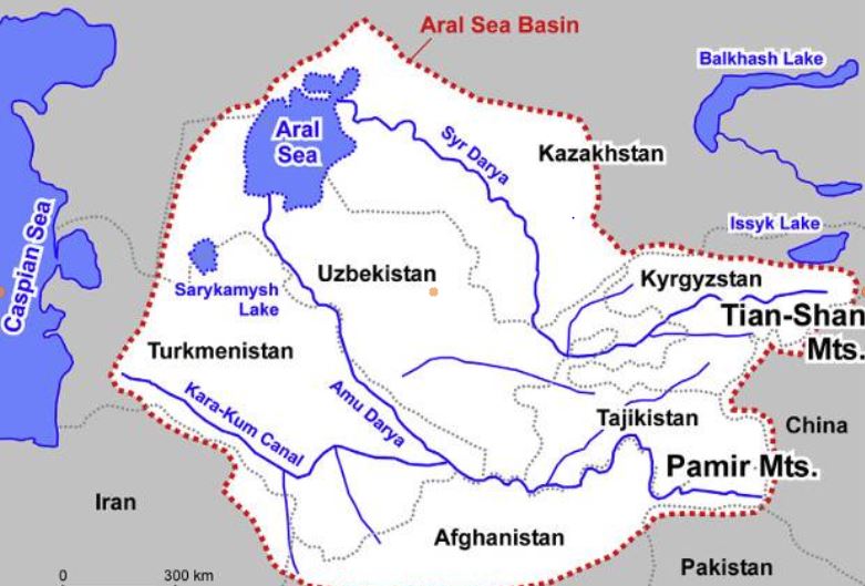
The Amu Daria, the 2539 km long river that the Greeks called the Oxus, and its brother, the 2212 km long Syr Daria, feed, or rather used to feed, the Aral Sea, which straddles the border between Uzbekistan and Kazakhstan. The water of both rivers were increasingly redirected by soviet experts to irrigate mainly cotton cultivation causing the Aral Sea to disappear.
I won’t go into detail here on the history of the ecological disaster that everyone has heard about but I am ready to answer your questions on that later;

The « Aral Sea Basin » essentially covers five Central Asian « stan » countries. To the North, these are Kazakhstan, followed by Kyrgyzstan, Tajikistan, Uzbekistan and Turkmenistan.
In fact, Afghanistan, whose border with the latter three countries is formed by sections of the Amu Darya, is geologically and geographically part of the « Aral Sea Basin ».
This is a so-called « endoreic basin ». (endo = inside; rhein = carried).


In Europe, we see falling rain and snowmelt flowing into rivers that discharge it into the sea. Not so in Central Asia. Rainwater, or water from melting snow, flows down mountain ranges. They eventually form rivers that either disappear under the sands, or form « inland seas » having no connection whatever to a larger sea and no outlet to the oceans. 18% of the world’s emerged surface is endoreic.
Among the best-known endoreic basins are the Dead Sea in Israel and Lake Chad in Africa.

In Asia, there are plenty of them. Just think of the Tarim Basin, the world’s largest endoreic river basin in Qinjiang, covering over 400,000 km². Then there’s the vast Caspian Sea, the Balkhach and Alakoll lakes in Kazakhstan, the Yssyk Kul in Kyrgyzstan and, as we’ve just said, the Aral Sea.
The very nature of an endoreic basin strongly reinforces the fear that water is a scarce limited source. That realty can either bolster the conviction that problems cannot but be solved true cooperation and discussion, or push countries to go to war one against the other. Democraphic growth, economic progress and climate/meteorogical chaos can worsen that perception and make water issues appear as a « time-bomb ».
The early Soviet planners started with a strict quota system laid down in 1987 by Protocol 566 of the Scientific and Technical Council of the Soviet Ministry of Water Resources. The system fixed quotas for all countries, both in percentage and in BCM (Billions of Cubic Meters).

That simple quota system looks 100 % functional on paper. However, nations are not abstractions.
First, this system created quite rigid procedures and even would forbid some upstream countries to invest in their own agriculture since they had to deliver the water to their neighbors.
Second, conflict arose about dissymetric seasonal use of the water. The use of the water was completely different between « Upstream countries » such as Kyrgyzstan and Tajikistan and « Downstream countries » such as Uzbekistan and Turkmenistan.
Upstream countries could accept releasing their water resources in autumn and winter since the release of the water provides them up to 90 % of their electricity via hydrodams.
Downstream countries however don’t need the water at that time but in spring and summer when their farmland needs to be irrigated.
However, in Central Asia, their seems to exist some sort of « geological justice » since downstream countries lacking water (Kazakhstan, Uzbekhistan and Turkmenistan) have vast hydrocarbon energy reserves such as coal, oil and gaz.
Therefore, not always stupid, Soviet planners, which realized that a simple quota system was insufficient to prevent conflict, created a compensation mechanism. Downstream nations, in exchange for water, would supply parts of their oil and gas to upstream nations to compensate the loss of potential energy that water represents.
However imperfect that mechanism, for want of a better one, it remained in place after the collapse of the Soviet Union in 1991.
It can be said that by appealing to an external factor of a given problem, in this case to bring energy in the equation to solve the water problem, soviet planners conceived in a rudimentary form what became known as the « Water, Energy, Food Nexus ». One cannot deal with theses factors as separate factors. They have to be conceived as part of a single, dynamic Monad.
Today, we should avoid the geopolitical trap. If we consider the water resources to be shared between the states of Central Asia and Afghanistan to be « limited », or even « declining » due to meteorological phenomena such as El Nino, we might hastily and geopolitically conclude that, with the construction of the Qosh Tepa canal, which will tap water from the Amu Daria, the « water time bomb » cannot but explode.
Solutions
So we need to be creative. We don’t have all the solutions but some ideas about where to find them:
- In Central Asia, especially in Turkmenistan but also Uzbekistan, huge quantities of water from the Abu Daria water basin are wasted. In 2021, Chinese researchers, looking at Central Asia’s potential in terms of food production, estimated that with improvements in irrigation, better seeds and other « agricultural technology », 56 % of the water can be saved farming the same crops, meaning that today, about half of the water is simply wasted.
- The lack of investment into new water infrastructure and maintenance cannot but lead to the kind of disasters the world has seen in Libya or Pakistan where, predictably, systems collapsed for lack of mere maintenance;
- Uncontrolled and controlled flooding are very primitive and inefficient forms of irrigation and should be outphased and replaced by modern irrigation techniques;
- Therefore, a water emergency should be declared and a vast international effort should assist all the countries of the Abu Daria basin, including Afghanistan, to modernize and improve the efficiency of their water infrastructure, be it lakes, canals, rivers and irrigation systems.
- Such and effort can best organized within the framework of the « One Belt, One Road » initiative and the Shanghai Cooperation Organization. BRICS countries such as China, Russia and India could help Afghanistan with data from their satellites and space programs.
- By improving the efficiency of water use, notably through targeted irrigation using « drip irrigation » as seen in the case of the Tarim basin in Xinjiang, it is possible to reduce the total amount of water used to obtain an even higher yield of agriculture production, while considerably increasing the availability of the water to be shared among neighbors. The know how and experience of African, South American, Israeli and Chinese agronomists, specialized in food production in arid countries, can play a key role.
- In the near future, Pumped Hydro Energy Storage (PHES), which means storing water in high altitude reservoirs for a later use, can massively increase the independance and autonomy of countries such as Afghanistan and others. Having sufficient water at hand at any time means also having the water security required to operate mining activities and handle thermal and nuclear electricity production units. PHES infrastructure would be greatly efficient on both sides of the Abu Daria and jointly operated among friendly nations.

Over the past 1,200 years, nations bordering waterways have concluded 3,600 treaties on the sharing of river usufructs, whether for fishing, river transport or the sharing of water for domestic, agricultural and industrial uses.
Afghanistan’s Qosh Tepa canal project is a laudable and legitimate initiative. But it is true that by breaking the status quo, it obliges a new dialogue among nations allowing each and all of them to rise to a higher level, a willing to live together increasingly the opposite to the dominant paradigm in the Anglosphere and its european followers.
It’s up to all of us to make sure it works out fine.
The science of Oases, from the Indus Valley to Persian qanats

Presentation of Karel Vereycken at the first panel discussion of the « Water for Peace » seminar organized by the Schiller Institute on January 9, 2024 in Paris.
While the dog was domesticated as early as 15,000 years BC, we associate the first human activities aimed at managing water with the Neolithic period, which began around 10,000 BC.
It is thought to be the moment at which mankind moved from a « tribal subsistence economy of hunter-gatherers » to agriculture and animal husbandry, giving rise to villages and cities, where pottery, weaving, metallurgy and the arts would start blooming.
Key to this, the domestication of animals. The goat was domesticated around 11,000 BC, the cow around 9,000 BC, the sheep around -8,000 BC, and finally the horse around 2,200 BC in the steppes of Ukraine.
The oldest archaeological sites showing agricultural activities and irrigation techniques were discovered in the Indus Valley and the « Fertile Crescent ».
The site of Mehrgarh, in the Indus Valley, now Pakistan Balochistan, discovered in 1974 by François and Cathérine Jarrige, two French archaeologists, demonstrates important agricultural practices from 7000 BC onward.
Cotton, wheat and barley were grown, and beer was brewed. Cattle, sheep and goats were raised. But Mehrgarh was much more than that.

Contradicting the linear « developmental » schema, since we’re in the middle of the Neolithic, Mehrgarh is also home to the oldest pottery in South Asia and, above all, to the “Mehrgahr amulet”, the oldest bronze object casted with the « lost-wax » method.
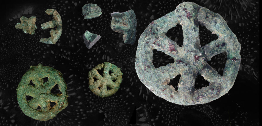
The first seals made of terracotta or bone and decorated with geometric motifs were found here.
On the technological side, tiny bow drills were used, possibly for dental treatment, as evidenced by the pierced teeth of some skeletons found on site.
At the same time, or shortly afterwards, around 6000 B.C., Mesopotamia, between the Tigris and Euphrates rivers, witnessed rapid urban development in terms of demographics, institutions, agriculture, techniques and trade.
A veritable « fertile crescent » emerged in the region stretching from Sumer to Egypt, passing through the whole of Mesopotamia and the Levant, i.e. Syria and the Jordan Valley.
Irrigation
Whether in the Indus Valley, Mesopotamia or Egypt, the earliest irrigation techniques are nothing but retaining as much water as possible when Mother Nature has the sweet kindness to offer it to mankind.
Rainwater was collected in cisterns and, as much as possible, when snowmelt or monsoon rains swell the rivers, the objective was to amplify and steer seasonal « flooding » by canals and trenches carrying the water as far away as possible to areas to be cultivated, while at the same time protecting crops.

In Egypt, for example, where the Nile rises by around 8 meters, the water brings not only moisture but also silt to the soil near the river, providing crops with the nutrients they need to grow and thus maintain the soil’s fertility.
While the Egyptians complained about the harsh labor condition of their farmers, for the Greek historian Herodotus, this was the place in the world where work was least arduous. Of Egypt he says:
“Its soil is black and crumbly, made of silt and alluvium brought from Ethiopia by the river. Certainly, these people are today, of all the human race in Egypt as elsewhere, those who go to the least trouble to obtain their crops.
« They don’t bother to plough and weed. When the river has come of its own accord to water their fields and, its task done, has withdrawn, each man sows his land and lets the pigs loose: by trampling, the beasts sink the seeds into the earth, and the man has only to wait for the harvest.”
In Mehrgarh, where agriculture was born from 7000 BC, the work was indeed far more demanding.
However, the drainage system around the village and the rudimentary dams to control water-logging indicate that the inhabitants understood most of the basic principles involved. The cultivation of cotton, wheat and barley, as well as the domestication of animals, show that they were also familiar with canals and irrigation systems.
Constantly refined, this know-how enabled the civilization of the Indus Valley to create great cities that impress us by their modernity, notably Harappa and Mohenjo Daro, a city of 40,000 inhabitants with a public bath in its center, not a palace.
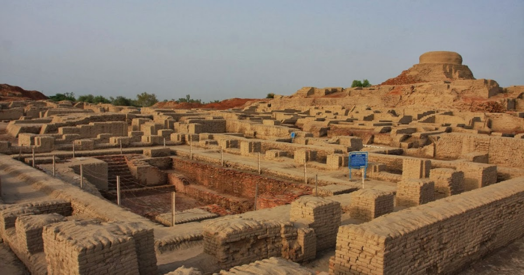
Pioneers of modern hygiene, these towns were equipped with small containers where residents could deposit their household waste.
Anticipating our « all-to-the-sewer » systems imagined in the early XVIth century by Leonardo da Vinci, for example in his plans for the new french capital of Romorantin, many towns had public water supplies as well as an ingenious sewage system.
In the port city of Lothal (now India), for example, many homes had private brick bathrooms and latrines. Wastewater was evacuated via a communal sewage system leading either to a canal in the port, or to a soaking pit outside the city walls, or to buried urns equipped with a hole for the evacuation of liquids, which were regularly emptied and cleaned.
Excavations at the Mohenjo Daro site reveal the existence of no fewer than 700 brick wells, houses equipped with bathrooms and individual and collective latrines.

Many of the city’s buildings had two floors or more. Water trickled down from cisterns installed on the roofs was channeled through closed clay pipes or open gutters that emptied into the covered sewers beneath the street.


This hydraulic and sanitary know-how was passed on to the civilization of Crete, the mother of Greece, before being implemented on a large scale by the Romans.
It was forgotten with the collapse of the Roman Empire, only to return during the Renaissance.
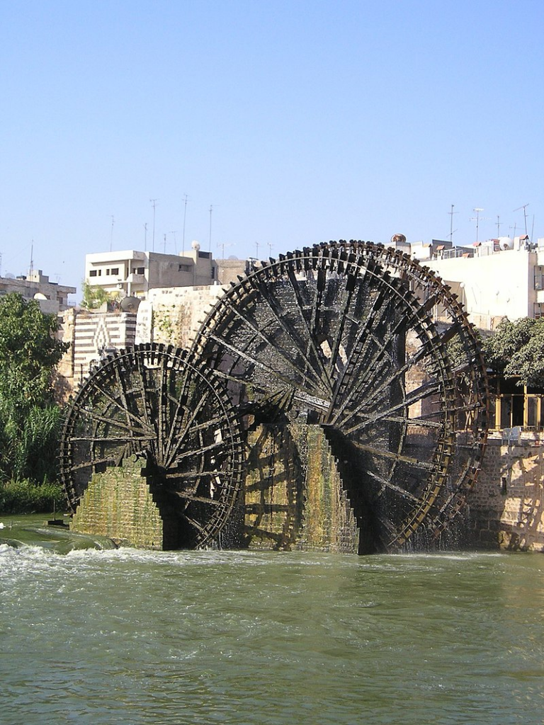
The first human contributions were aimed at maximizing water reservoirs and their gravity-flow capacity. To achieve this, it was necessary to transfer water from a lower level to higher ground and build « water towers ».
To this end, the Mesopotamian « chadouf » was widely used in Egypt, followed by the « Archimedean screw ».
Next came the « saquia » or « Persian wheel », a geared wheel driven by animal power, and finally the « noria », the best-known water-drawing machine, powered by the river itself.
Persian qanats
Before Alexander the Great, Persia’s Achaemenid Empire (6th century BC) developed the technique of underground qanats or underground aqueducts. This « draining gallery” cut into the rock or built by man, is one of the most ingenious inventions for irrigation in arid and semi-arid regions.
Whatever displeases our environmentalist friends, it’s not nature that magically produces « oases » in the desert.
It’s a scientific man who digs a drainage gallery from a water table close enough to the ground surface, or sometimes from an aquifer that flows into the desert.
On the website of ArchéOrient, archaeologist Rémy Boucharlat, Director of Emeritus Research at the French CNRS, an expert on Iran, explains:
« Whatever the origin of the water, deep or shallow, the gallery construction technique is the same. The first step is to identify the presence of the water, either its underflow near a river, or the presence of a deeper water table on a foothill, which requires the science and experience of specialists.
A motherwell reaches the upper part of this layer or water table, which indicates the depth at which the gallery should be dug. The slope of the gallery must be very shallow, less than 2‰, to ensure a calm and regular flow of water, and to gradually lead the water to the surface, at a gradient much lower than the slope of the piedmont.
The gallery is then excavated, not from the mother well, as it would be flooded immediately, but from downstream, from the arrival point. The pipe is first dug as an open trench, then covered, and finally gradually tunnelled into the ground.
Shafts are dug from the surface at regular intervals, between 5 and 30 m depending on the nature of the terrain, to evacuate soil and provide ventilation during excavation, and to mark the direction of the tunnel.”

Historically, the majority of the populations of Iran and other arid regions of Asia and North Africa depended on the water supplied by qanats; settlement areas thus corresponded to the places where their construction was possible.
The technique offers a significant advantage: as the water moves through an underground conduit, not a drop of water is lost through evaporation.
This technique spread throughout the world under various names: qanat and kareez in Iran, Syria and Egypt, kariz, kehriz in Pakistan and Afghanistan, aflaj in Oman, galeria in Spain, kahn in Balochistan, kanerjing in China, foggara in North Africa, khettara in Morocco, ngruttati in Sicily, bottini in Siena, etc.).
Improved by the Greeks and amplified by the Etruscans and the Romans, the qanats technique was carried by the Spaniards across the Atlantic to the New World, where numerous underground canals of this type still operate in Peru, Chile and western Mexico.
After Alexander the Great, Bactria, covering parts of today’s Uzbekistan, Turkmenistan and the northern part of Afghanistan, was even known as the « Oasis civilization » or the “Land of a 1000 Golden Cities”.
Iran boasts it had the highest number of qanats in the world, with approximately 50,000 qanats covering a total length of 360,000 km, about 9 times the circumference of the Earth !
Thousands of them are still operational but increasingly destabilized by erratic well digging and demographic overconcentration.
Shared responsability
In 1017, the Baghdad-based hydrologist Mohammed Al-Karaji provided a detailed description of qanat construction and maintenance techniques, as well as legal considerations about the collective management of wells and pipes.
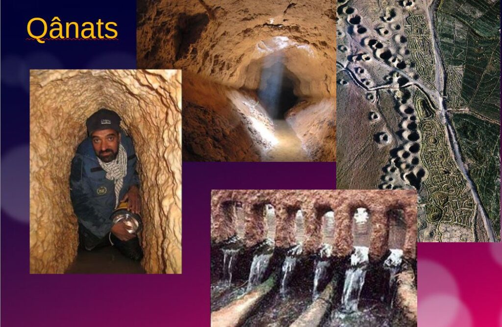
While each qanat is designed and supervised by a mirab (dowser-hydrologist and discoverer), building a qanat is a collective task that takes several months or years for a village or group of villages. The absolute necessity of collective investment in the infrastructure and its maintenance calls for a superior notion of the common good, an indispensable complement to the notion of private property that rains and rivers are not accustomed to respecting.
In North Africa, the management of water distributed by a khettara (the local name for qanâts) is governed by traditional distribution norms known as « water rights ».
Originally, the volume of water granted per user was proportional to the work involved in building the khettara, and translated into an irrigation period during which the beneficiary could use all the khettara’s flow for his or her fields. Even today, when the khettara has not dried up, this rule of water rights still applies, and a share can be bought or sold. The size of each family’s fields to be irrigated must also be taken into account
All of this demonstrates that good cooperation between man and nature can do miracles if man decides so.
Thank you for your attention and questions welcome!

Derrière les « chevaux célestes » chinois, la science terrestre
Le fait qu’aujourd’hui encore, en parlant d’une voiture, on utilise l’unité « cheval » (CV) pour indiquer la puissance et donc le « travail » que le moteur peut fournir, en dit long sur le rôle majeur que les chevaux ont joué dans l’histoire de l’humanité.
Récemment invité à une conférence à Kaboul, en Afghanistan, j’ai évoqué à propos du besoin d’investissement en infrastructures hydrauliques, la domestication du cheval comme un bel exemple du passage d’une « plateforme infrastructurelle donnée » à une « plateforme supérieure », le terme plateforme faisant référence ici non pas à l’impact direct de l’infrastructure en question, mais à l’effet beaucoup plus large induit dans l’ensemble de l’économie d’un pays.
Nul besoin d’être anthropologue pour comprendre que l’histoire de l’humanité a radicalement changé avec la domestication du cheval, certaines choses considérées comme impossibles auparavant devenant, du jour au lendemain, la normalité.
La question de savoir quand et comment l’animal a été domestiqué reste sujet à controverse. Bien que des chevaux apparaissent dans l’art rupestre du paléolithique dès 36 000 ans avant notre ère (grotte Chauvet, France), il s’agissait alors de chevaux sauvages sans doute chassés pour leur viande.
Pour les zoologistes, la domestication se définit comme la maîtrise de l’élevage, pratique confirmée par des restes de squelettes anciens indiquant des changements dans la taille et la variabilité des populations de chevaux anciens.
D’autres chercheurs s’intéressent à des éléments plus généraux de la relation homme-cheval, notamment les preuves squelettiques et dentaires de l’activité professionnelle, les armes, l’art et les artefacts spirituels, ainsi que les modes de vie. Il est prouvé que les chevaux furent une source de viande et de lait avant d’être dressés comme animaux de travail.
En Inde, près de Bhopal, les abris-sous-roche du Bhimbetka, qui constituent le plus ancien art rupestre connu du pays (100 000 av. JC)), représentent des scènes de danse et de chasse de l’âge de pierre ainsi que des guerriers à cheval d’une époque plus tardive (10 000 av. JC).
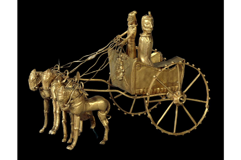
Les preuves les plus évidentes de l’utilisation précoce du cheval comme moyen de transport sont les sépultures présentant des chevaux avec leurs chars. Les plus anciens vrais chars, datant d’environ 2000 av. JC, ont été retrouvés dans des tombeaux de la culture de Sintachta, dans des sites archéologiques situés le long du cours supérieur de la rivière Tobol, au sud-est de Magnitogorsk en Russie. Il s’agit de chars à roues à rayons tirés par deux chevaux.
Kazakhstan et Ukraine
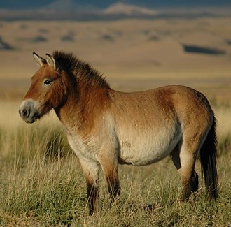
Jusqu’à récemment, on pensait que le cheval le plus communément utilisé aujourd’hui était un descendant des chevaux domestiqués par la culture de Botaï, vivant dans les steppes de la province d’Akmola au Kazakhstan.
Cependant, des recherches génétiques récentes (2021) indiquent que les chevaux de Botaï ne sont que les ancêtres du cheval de Przewalski, une espèce qui a failli disparaître.
Selon les chercheurs, notre cheval commun, Equus ferus caballus, aurait été domestiqué il y a 4200 ans en Ukraine, dans la région du Don-Volga, c’est-à-dire la steppe pontique-caspienne de l’Eurasie occidentale, vers 2200 av. JC. Au fur et à mesure de leur domestication, ces chevaux ont été régulièrement croisés avec des chevaux sauvages.
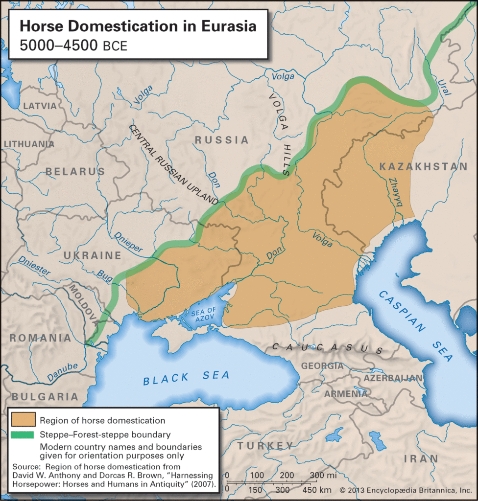
Il est intéressant de noter à cet égard que, selon « l’hypothèse kourgane » formulée par Marija Gimbutas en 1956, c’est depuis cette région que la plupart des langues indo-européennes se sont répandues dans toute l’Europe et certaines parties de l’Asie.
Le nom vient du terme russe d’origine turque, « kourgane », qui désigne les tumuli caractéristiques de ces peuples et qui marquent leur expansion en Europe.
La Route du thé, du cheval ou de la soie?
La description des échanges commerciaux, culturels et humains tout au long des « Routes de la soie » a fait couler beaucoup d’encre. Or, ce terme est récent. Ce n’est qu’en 1877 que le géographe allemand Ferdinand von Richthofen l’utilise pour la première fois afin de désigner ces axes Est-Ouest structurant les échanges mondiaux.
En réalité, il s’avère que l’une des principales marchandises échangées sur ladite Route de la soie était… les chevaux et autres animaux de labour (mules, chameaux, ânes et onagres).
Si l’on y échangeait effectivement la soie et le thé, ces produits constituaient, comme la porcelaine et l’or, un moyen pour régler d’autres achats, notamment les chevaux que les Chinois cherchaient à acquérir.
Ce que l’on appelait la « Route du thé et du cheval » (route de la soie du sud) partait de la ville de Chengdu, dans la province du Sichuan, en Chine, traversait le Yunnan vers le sud, jusqu’en Inde et dans la péninsule indochinoise, et s’étendait vers l’ouest jusqu’au Tibet.
C’était une route importante pour le commerce du thé en Chine du Sud et en Asie du Sud-Est, et elle a contribué à la diffusion de religions comme le taoïsme et le bouddhisme dans la région. Il est vrai que « Route de la soie » est plus poétique que « route du crottin » !
La Steppe et ses nomades
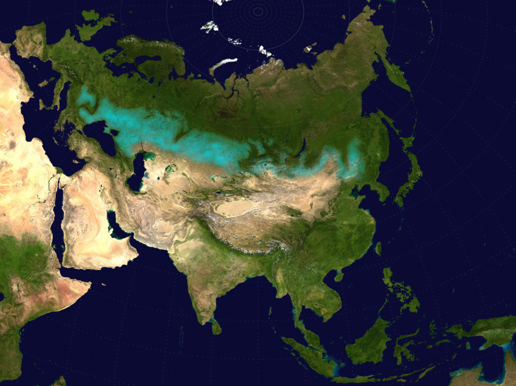
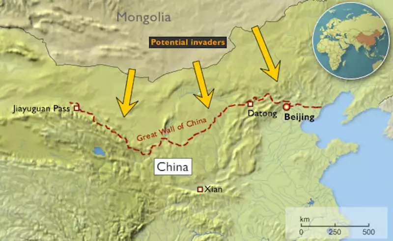
Constamment harcelée par les peuples nomades des steppes du Nord, la Chine entreprit la construction de sa Grande Muraille dès le VIIe siècle av. JC.
La liaison entre les premiers éléments fut réalisée par Qin Shi Huang (220-206 avant JC.), le premier empereur de Chine, et l’ensemble du mur, achevé sous la dynastie des Ming (1368-1644), est devenu l’un des exploits les plus remarquables de l’histoire humaine.
Le terme générique de « nomades eurasiens » englobe les divers groupes ethniques peuplant la steppe eurasienne, se déplaçant à travers les steppes du Kazakhstan, du Kirghizistan, du Tadjikistan, du Turkménistan, d’Ouzbékistan, de Mongolie, de Russie et d’Ukraine.
En domestiquant le cheval vers 2200 av. JC., ces peuples augmentèrent considérablement les possibilités de vie nomade.

Par la suite, leur économie et leur culture se concentrèrent sur l’élevage de chevaux, l’équitation et le pastoralisme nomade, permettant de riches échanges commerciaux avec les peuples sédentaires vivant en bordure de la steppe, que ce soit en Europe, en Asie ou en Asie centrale.
On pense qu’ils opéraient souvent sous forme de confédérations. Par définition, les nomades ne créent pas d’empires. Sans forcément les occuper, en contrôlant les points névralgiques, ils règnent en maître sur d’immenses territoires.
Ce sont eux qui développèrent le char, le chariot, la cavalerie et le tir à l’arc à cheval, introduisant des innovations telles que la bride, le mors, l’étrier et la selle, qui traversèrent rapidement toute l’Eurasie et furent copiées par leurs voisins sédentaires.
Durant l’âge du fer, des cultures scythes (iraniennes) apparurent parmi les nomades eurasiens, caractérisées par un art distinct, dont la joaillerie en or force l’admiration.
Le cheval en Chine
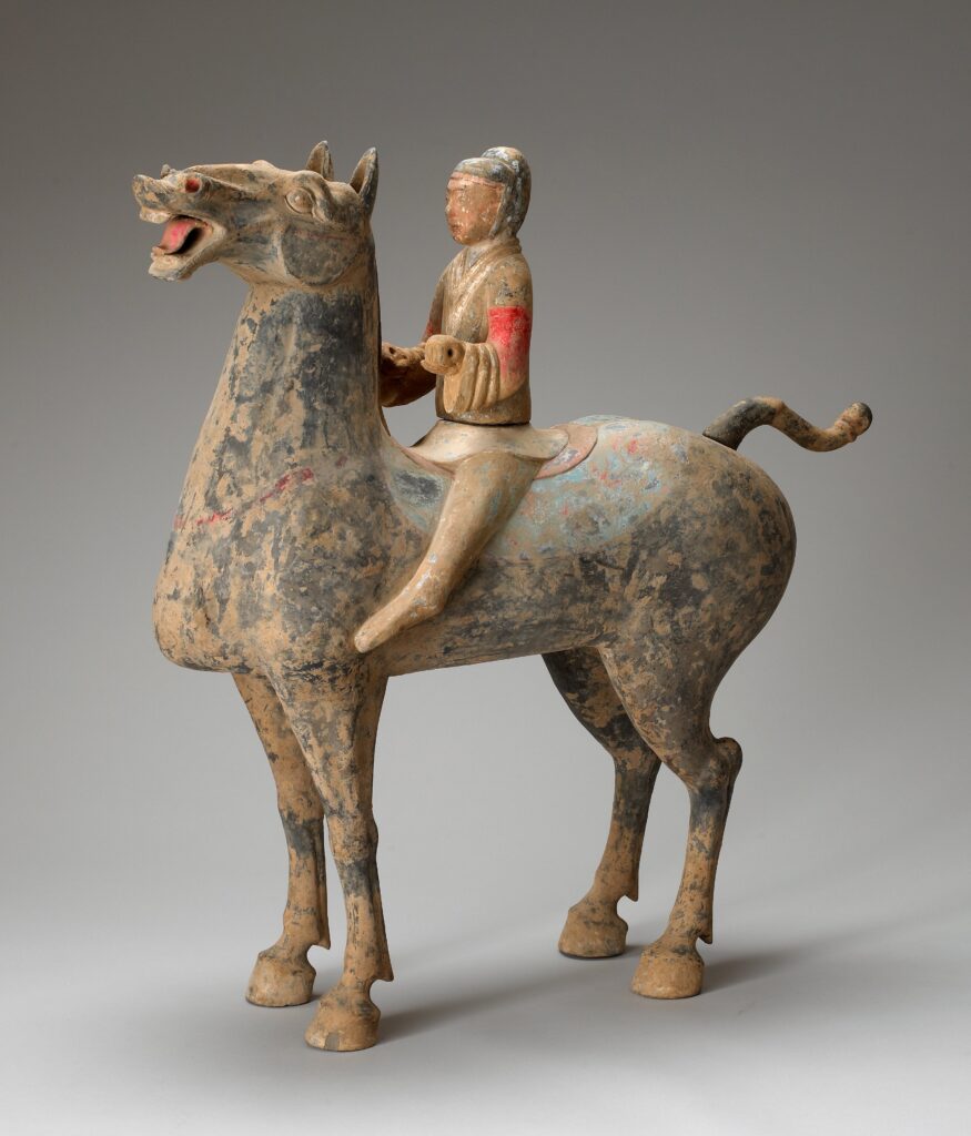
Les objets funéraires chinois fournissent une quantité extraordinaire d’informations sur le mode de vie des Chinois de l’Antiquité. La cavalerie militaire, mise sur pied dès le IIIe siècle avant J.C., s’y développe afin de faire face aux guerriers nomades et archers à cheval qui menacent la Chine le long de sa frontière septentrionale. Leurs grands et puissants chevaux étaient nouveaux pour les Chinois.
Échangés contre de la soie de luxe, comme nous l’avons dit, ils sont la première importation majeure en Chine depuis la Route de la soie. Des vestiges archéologiques montrent qu’en l’espace de quelques années, les merveilleux destriers arabes deviennent extrêmement populaires auprès des militaires et des aristocrates chinois, et les tombes des classes supérieures sont remplies de représentations de ces grands chevaux destinés à être utilisés dans l’au-delà. Ils restent cependant difficiles à trouver sur place…
Les diplomates chinois et le royaume de Dayuan (Ferghana)
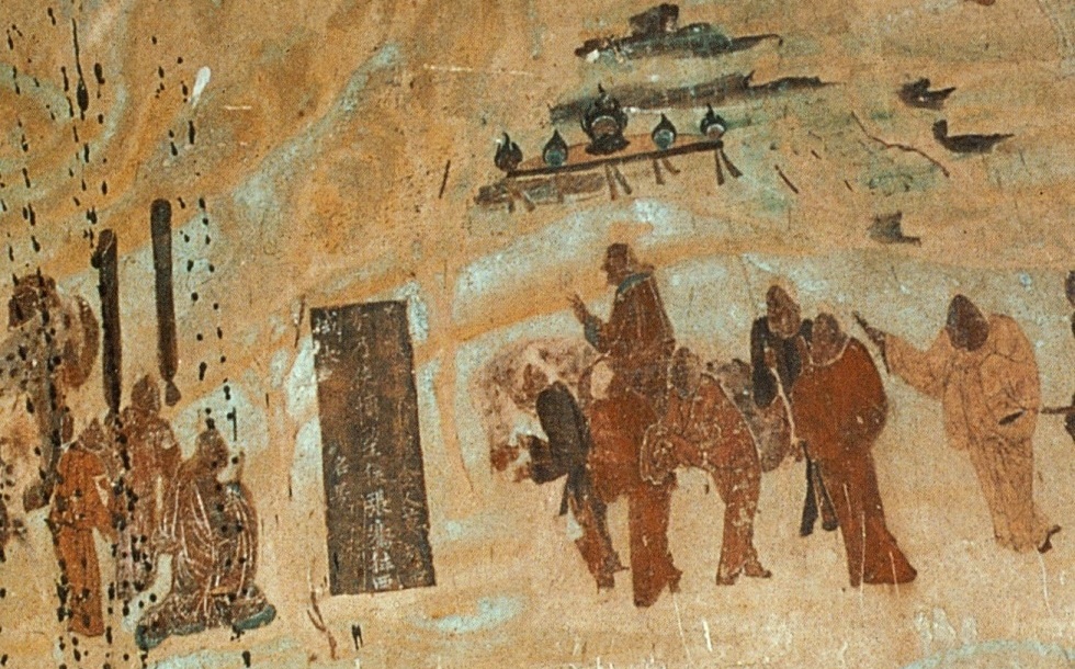
À la fin du IIe siècle av. JC., Zhang Qian, diplomate et explorateur de la dynastie Han, se rend en Asie centrale et découvre trois civilisations urbaines sophistiquées créées par des colons grecs appelés Ioniens.
Le récit de sa visite en Bactriane, et son étonnement d’y trouver des marchandises chinoises sur les marchés (acquises via l’Inde), ainsi que ses voyages en Parthie et au Ferghana, sont conservés dans les œuvres de Sima Qian, l’historien des premiers Han.
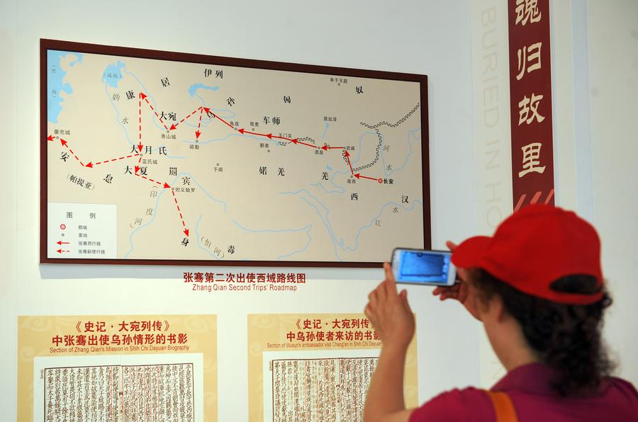
À son retour, son récit incite l’empereur chinois à envoyer des émissaires à travers l’Asie centrale pour négocier et encourager le commerce avec son pays. « Et c’est ainsi que naquit la route de la soie », affirment certains historiens.
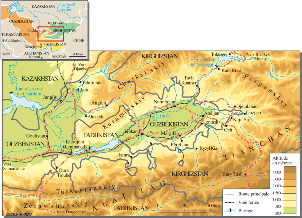
Outre la Parthie et la Bactriane, Zhang Qian visite, dans la fertile vallée de Ferghana (aujourd’hui essentiellement au Tadjikistan), un État que les Chinois baptisèrent le royaume de Dayuan (« Da » signifiant « grand » et « Yuan » étant la translittération du sanskrit Yavana ou du pali Yona, utilisé dans toute l’Antiquité en Asie pour désigner les Ioniens, ou colons grecs).
Les Actes du grand historien et le Livre des Han décrivent Dayuan comme un pays de plusieurs centaines de milliers d’habitants, vivant dans 70 villes fortifiées de taille variable.
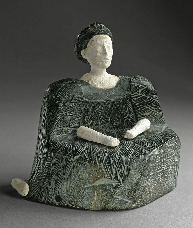
Ils cultivent le riz et le blé et produisent du vin à partir de leurs vignes. Ils avaient des traits caucasiens et des « coutumes identiques à celles de la Bactriane » (l’État le plus hellénistique de la région depuis Alexandre le Grand), dont l’épicentre se trouve alors au nord de l’Afghanistan. (voir notre article)
En outre, le diplomate chinois rapporte un fait d’un grand intérêt stratégique : la présence, dans la vallée de la Ferghana, de chevaux incroyables, rapides et puissants, élevés par ces Ioniens !
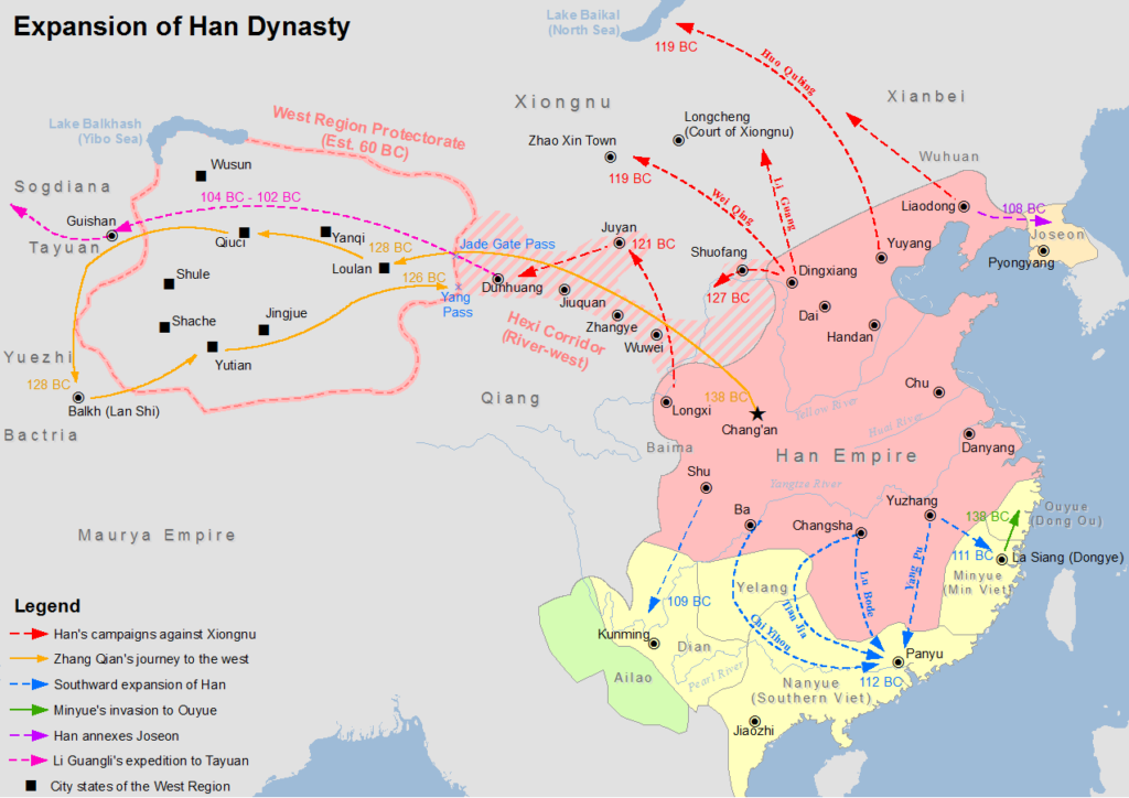
Or, comme nous l’avons déjà dit, la Chine, se sentant menacée en permanence par les peuples nomades des steppes, était en train de construire sa Grande Muraille. Elle avait également conscience de son infériorité militaire par rapport aux nomades des steppes et déplorait son manque cruel de puissants chevaux.
Sans oublier que, dans l’échelle des valeurs chinoises, le cheval possédait une valeur spirituelle et symbolique presque aussi forte que le dragon : il pouvait voler et représentait l’esprit divin et créatif de l’univers lui-même, chose essentielle pour tout empereur désireux d’acquérir aussi bien la sécurité militaire pour son empire que son immortalité personnelle.
Bref, posséder de bons chevaux est alors une question allant au-delà de la sécurité nationale, tout en l’incluant. À tel point qu’en 100 av. JC., lorsque le souverain de la vallée de Ferghana refuse de lui fournir des chevaux de qualité, la dynastie Han déclenche contre Dayuan la « guerre des chevaux célestes ».
Guerre des chevaux célestes
C’est un conflit militaire qui se déroule entre 104 et 102 av. JC. entre la Chine et Dayuan, Etat peuplé d’Ioniens (entre l’Ouzbékistan, le Kirghizstan et le Tadjikistan actuels
Tout d’abord, l’empereur Wu décide d’infliger une défaite décisive aux nomades des steppes, les Xiongnu, qui harcèlent la dynastie Han depuis des décennies.
Pour les faire plier, en 139 av. JC, il envoie le diplomate Zhang Qian avec pour mission d’arpenter l’ouest et d’y forger une alliance militaire avec les nomades chinois Yuezhi contre les Xiongnu.
Zhang Qian, comme nous l’avons dit, se rend en Parthie, en Bactriane et à Dayuan. À son retour, il impressionne l’empereur en lui décrivant les « chevaux célestes » de la vallée de Ferghana, qui pourraient grandement améliorer la qualité des montures de la cavalerie Han lors des combats contre les Xiongnu.
La cour des Han envoie alors jusqu’à dix groupes de diplomates pour acquérir ces « chevaux célestes ».
Une mission commerciale et diplomatique arrive donc à Dayuan avec 1000 pièces d’or et un cheval d’or pour acheter les précieux animaux. Dayuan, qui était à cette époque l’un des États les plus occidentaux à avoir des émissaires à la cour des Han, commerce déjà avec eux depuis un certain temps à son grand avantage. Non seulement sa population accède aux marchandises orientales, mais apprend des soldats Han la fonte des métaux pour fabriquer des pièces et des armes. Cependant, contrairement aux autres envoyés à la cour des Han, ceux de Dayuan ne se conforment pas aux rituels des Han et se montrent arrogants, pensant que leur pays est trop éloigné pour avoir à craindre une invasion.
Dès lors, dans un élan de folie et par pure arrogance, le roi du Dayuan non seulement refuse le marché, mais confisque l’or. Les envoyés des Han maudissent les hommes de Dayuan et brisent le cheval d’or qu’ils avaient amené. Furieux de cet acte de mépris, les nobles de Dayuan ordonnent aux militaires de Yucheng, qui se trouvent à leur frontière orientale, d’attaquer les envoyés, de les tuer et de s’emparer de leurs marchandises.
Humiliée et furieuse, la cour des Han envoie alors une armée dirigée par le général Li Guangli pour soumettre Dayuan, mais leur première incursion s’avère mal organisée et insuffisamment approvisionnée.
Deux ans plus tard, une seconde expédition, plus importante et mieux approvisionnée, parvient à assiéger la capitale des Dayuan, « Alexandria Eschate » (aujourd’hui proche de Khodjent, au Tadjikistan), forçant les Dayuan à se rendre sans condition.
Les forces expéditionnaires y installent alors un régime pro-Han et repartent avec 3000 chevaux. Il n’en restera que 1000 à leur arrivée en Chine, en 101 av. JC.
Le Dayuan accepte également d’envoyer chaque année deux chevaux célestes à l’empereur et des semences de luzerne sont ramenées en Chine, fournissant des pâturages de qualité supérieure pour élever de beaux chevaux afin de fournir une cavalerie capable de faire face aux Xiongnu qui menacent le pays.
Les chevaux ont depuis lors captivé l’imagination populaire en Chine, inspirant des sculptures, faisant l’objet d’élevage dans le Gansu et dotant la cavalerie de 430 000 chevaux de ce type sous la dynastie des Tang.
La Chine et la Révolution agricole
Après avoir imposé son rôle dans la stratégie militaire pour les siècles à venir, le cheval devient, avec la maîtrise de l’eau, le facteur clé permettant d’accroître la productivité agricole.
Contrairement aux Romains, qui préféraient utiliser du « bétail humain » (esclaves) plutôt que des animaux (qu’ils élevaient pour les courses), les Chinois ont contribué de façon décisive à la survie de l’humanité avec deux innovations cruciales concernant l’attelage des chevaux.
Rappelons que pendant toute l’Antiquité, que ce soit en Égypte ou en Grèce, charrues et chariots sont tirés à l’aide d’une bande de cuir encerclant le cou de l’animal.
Cet attelage s’apparente au joug utilisé pour les bœufs, la charge étant attachée au sommet du collier, au-dessus du cou. Le cheval se trouvant ainsi constamment étranglé, ce système réduit considérablement sa capacité à travailler, et plus il tire, plus il a du mal à respirer.
En raison de cette contrainte physique, le bœuf restera l’animal préféré pour les travaux lourds tels que le labourage. Cependant, il est lent, difficile à manœuvrer et n’a pas l’endurance du cheval, qui est deux fois supérieure pour une puissance équivalente.
La Chine aurait d’abord inventé la « bricole », large courroie de cuir enserrant le poitrail du cheval, ce qui était un premier pas dans la bonne direction.
Au Ve siècle, la Chine invente « le collier d’épaule », conçu comme un ovale rigide qui s’adapte au cou et aux épaules du cheval sans lui couper le souffle.
Il présente les avantages suivants :
— Il soulage la pression exercée sur la gorge du cheval, libérant les voies respiratoires de toute constriction, ce qui améliore considérablement le débit d’énergie de l’animal.
— Les traits peuvent être attachés de chaque côté du collier, ce qui permet au cheval de pousser sur ses pattes postérieures, plus puissantes, au lieu de tirer avec celles de devant, plus faibles.
Vous me direz qu’il s’agit là d’une simple anecdote. Vous avez tort, car ce qui semble n’être qu’un changement mineur aura des conséquences gigantesques.
La Renaissance européenne
Dans le cadre d’une alliance stratégique et d’une coopération avec le califat humaniste des Abbassides de Bagdad (voir notre article), Charlemagne et ses successeurs ont défriché de vastes terrains pour l’agriculture, amélioré l’usage de l’eau et généralisé le collier d’épaule pour les chevaux de trait.
Grâce à ce nouvel outil beaucoup plus efficace, les agriculteurs européens ont pu tirer pleinement parti de la force du cheval, qui sera alors capable de tirer une autre innovation récente, la lourde charrue. Cela s’est avéré particulièrement appréciable pour les sols durs et argileux, ouvrant de nouvelles terres à l’agriculture.
Le collier, la charrue lourde et le fer à cheval ont contribué à l’essor de la production agricole.

Ainsi, entre l’an 1000 et l’an 1300, on estime qu’en Europe, les rendements agricoles ont triplé, permettant de nourrir un nombre croissant de citoyens dans les villes urbaines apparues au XVe siècle et de donner le coup d’envoi à la Renaissance européenne. Merci la Chine !
Certains chiffres laissent néanmoins perplexes :
–Il aura fallu des milliers d’années à l’humanité pour domestiquer le cheval, en 2200 av. JC. (bien après la vache).
— Il faudra encore 2700 ans à l’humanité pour trouver, au Ve siècle de notre ère, la façon la plus efficace d’utiliser sa force motrice…
Le passage d’une plateforme d’infrastructure inférieure à une plate-forme d’infrastructure supérieure peut certes prendre un certain temps. Les nouvelles plateformes supérieures d’aujourd’hui s’appellent l’espace et l’énergie de fusion.
N’attendons pas encore un millénaire pour savoir comment les utiliser correctement !
Grands travaux : l’exemple inspirant du « Plan Freycinet »
En 1878, le ministre des travaux publics, l’ingénieur et polytechnicien Charles de Freycinet (1828-1923), proche de Léon Gambetta, lance un ambitieux programme de travaux publics.
Il comprenait principalement le parachèvement des voies ferrées, mais aussi la construction de canaux et d’installations portuaires, l’ensemble conçu comme un tout intégré où chaque partie apporte sa contribution.
L’analyse de Charles de Freycinet sur les buts de la science économique est limpide et se résume en une phrase : « Le progrès économique, c’est la plus grande satisfaction pour le moindre effort. »
Si l’objectif phare est de donner accès au chemin de fer à tous les Français, il s’agit de favoriser le développement économique du pays par le désenclavement des régions reculées.
Les promoteurs du plan veulent également aboutir à un contrôle plus strict de l’État voire au rachat des compagnies de chemins de fer.
L’analyse de Freycinet sur les buts de la science économique n’est pas sans rappeler la pensée du philosophe et scientifique allemand Leibniz :
« La science économique étant l’étude des causes qui concourent à la satisfaction des besoins matériels de l’homme, le progrès économique peut se résumer d’un mot: c’est la plus grande satisfaction pour le moindre effort. En d’autres termes, il consiste dans l’accroissement continu de la production pour une somme de travail déterminée.
Ainsi, rendre son effort de plus en plus efficace, de plus en plus fécond, tel est le véritable problème pour l’économie. Telle est la voie qui le conduit à l’affranchissement dont nous parlions et qui permet d’entrevoir cette vie idéale, de xxx et de lumières, qui est à la fois la plus noble des jouissances et l’accomplissement du plus impérieux des devoirs.
« On remarquera en quoi le progrès économique, tel que nous le comprenons, diffère de l’idée qui généralement a cours. On considère assez souvent comme étant un progrès une société dans laquelle la richesse augmente. Pour nous, ce signe extérieur ne suffit pas… ».
(Page 1 de son projet de livre Le Progrès économique de 1887, manuscrit jamais publié)
Pour sa mise en œuvre, le « plan Freycinet » est inscrit dans la loi de Finances et une première loi est votée le 18 mai 1878.
Ensuite, il fait l’objet de trois lois promulguées par Jules Grévy, président de la République, à quelques jours d’intervalle:
1. Nouvelles lignes ferroviaires nationales et secondaires
La première concerne la construction de 8700 kilomètres de nouvelles voies ferroviaires soit 154 lignes dites d’intérêt général (avec un écartement des voies d’1m43) afin de desservir toutes les sous-préfectures du pays.
Leur construction est assurée, soit par les grandes compagnies privées, le coût étant le plus souvent pris en charge par l’État, soit par l’État lui-même. Freycinet est ainsi à l’origine de la compagnie de l’État (loi du 18 mai 1878).
Dans le même temps il s’agit de désenclaver tous les chefs lieux de cantons par des réseaux secondaires (lignes dites « d’intérêt local » avec un écartement des voies d’1 m) construites principalement à l’initiative des conseils généraux.
La longueur des ces réseaux départementaux passera de 2187 kilomètres en 1880 à 17 653 km en 1913.
2. L’aménagement du réseau fluvial
Dans le domaine de la navigation fluviale le plan Freycinet ambitionne la création d’un réseau national unifié et cohérent de voies navigables, par l’amélioration de 14 600 km de voies existantes et par la mise en service de 1900 km de canaux supplémentaires.
Le plan Freycinet porte les dimensions des écluses à 39 m de long pour 5,20 m de large, afin qu’elles soient franchissables par des péniches de 300 à 350 tonnes.
En conséquence, les bateaux au gabarit Freycinet ne doivent pas dépasser 38,5 m sur 5,05 m.
Le « gabarit Freycinet » correspond aujourd’hui au gabarit européen de classe I.
En France, 5800 km de voies fluviales ont conservés cette taille et en 2011, 23 % du trafic fluvial y transite.
3. La modernisation des ports
Au niveau portuaire, Freycinet déplore que :
« Les crédits accordés pour ces travaux [la modernisation des ports] n’aient jamais été à la hauteur des besoins et tandis que les Anglais, les Hollandais, les Belges dépensaient sous nos yeux des centaines de millions pour créer ou transformer leurs magnifiques établissements de Liverpool, de Glasgow, d’Amsterdam ou d’Anvers, nous restions toujours fort loin en arrière. »
L’originalité du plan Freycinet, au niveau portuaire, recouvre trois aspects :
–le souci de l’interconnexion,
–l’étendue et
–le mode de financement.
La modernisation des ports, affirme-t-il :
« est imposée par la transformation du matériel naval, par le développement incessant des chemins de fer et des autres voies de communication, par les besoins de célérité et de régularité qui s’introduisent chaque jour davantage dans les habitudes du commerce et de l’industrie. »
Freycinet, qui avait bien conscience que la bataille pour le maritime se gagne sur terre ferme. Un port sans hinterland capable d’accueillir les flux de marchandises est comme un cœur déconnecté d’artères en mesure de faire circuler le sang.
Freycinet mettra donc l’accent sur l’amélioration de l’intermodalité, ce qui signifie l’extension des quais, la multiplication des bassins, notamment à flot, l’approfondissement des chenaux, afin que « l’installation générale soit appropriée à la fois aux deux modes de transport qui viennent s’y rencontrer ».
Alors que l’État financera les superstructures, les infrastructures, l’outillage sera à la charge des chambres de commerce ou des particuliers par voie de concession. 116 ports sur 188 sont ainsi modernisés.
–La longueur utile des quais passe de 140 km en 1879 à 205 km en 1900, une augmentation de 46 % ;
–le nombre de ports présentant plus de 7 mètres de profondeur s’est élevé de 9 en 1878 à 15 en 1900 ;
–le tonnage de jauge de navires entrés et sortis a progressé de 64 % entre 1878 et 1898 ;
–aux mêmes dates, le poids des marchandises importées ou exportées a augmenté de 75 %, passant de 17 à 30 millions de tonnes.
L’abaissement du prix du fret, l’accroissement de la rapidité et de la régularité des transports, le perfectionnement des moyens de manutention sont autant de progrès à enregistrer.
Un plan décennal
Dans son chiffrage initial, largement dépassé au final, le plan prévoyait de consacrer environ 3 milliards de francs aux lignes de chemin de fer, 1 milliard aux canaux et 500 millions aux ports. Le tout était financé par un crédit d’État à 3 %, remboursable en 75 annuités.
Si à l’origine, le « plan Freycinet » aurait du être réalisé en dix ans, la faillite retentissante de la banque l’Union générale en 1882 (cadre du roman L’Argent de Zola) et la crise économique qu’elle engendrera, retarderont sa mise en œuvre.
La crise du crédit public brise l’élan et entraîne à moyen terme le ralentissement considérable du rythme des réalisations. Cet arrêt brutal aura deux conséquences.
D’une part, l’allongement des délais de construction provoque une élévation de leurs coûts, et de l’autre, l’abandon prématuré du système de financement imaginé par la loi du 11 juin 1878.
Ainsi, ce n’est qu’en 1914, c’est-à-dire après 36 ans, que l’ensemble du plan arrivera, à quelques détails près, à son stade de réalisation.
Entre-temps, cette mobilisation des forces productives, par effet d’entrainement, à fait naître le savoir-faire permettant la réalisation de la tour Eiffel ou les écluses du canal de Suez et celui de Panama.
Faute de crédit productif public et de volonté politique réelle, à part quelques miracles accomplis à l’époque De Gaulle/Pompidou, la France n’a jamais connue une initiative de cette ampleur visant à susciter un « choc de productivité » par l’investissement en infrastructures. Quel candidat aura aujourd’hui le courage et la compétence pour défendre un « Nouveau plan Freycinet » ?
Relance française
Le 1er octobre 2020, dans sa chronique dans Le Monde, Pierre-Cyrille Hautcoeur, professeur à PSE, directeur d’études EHESS, confirme la réussite retentissante du Plan Freycinet.
Extrait:
« Que ce soit sous l’effet direct du plan Freycinet ou d’un regain plus large d’optimisme, le PNB croît de 20 % de 1879 à 1882, l’investissement de près de 40 %, indiquent Maurice Lévy-Leboyer et François Bourguignon dans La Croissance française au XIXe siècle (Economica, 1985).
« Cette reprise rapide s’accompagne d’une flambée d’opérations financières, notamment autour du grand emprunt d’Etat lancé en 1881 pour financer le plan. Elle est stoppée net par le krach de 1882, auquel une partie des banques nouvellement créées ne résiste pas. Si le marasme reprend, le plan Freycinet n’en est pas moins poursuivi, et quasi achevé avant 1914.«
Gain de population
« Mal aimé par certains, qui y voient – avec un brin d’anachronisme – l’origine étatique du développement excessif d’une technologie révolue et peu profitable, ainsi qu’une hausse irresponsable de la dette publique (les 6 milliards du plan représentent 30 % du PNB de 1879), le plan Freycinet n’empêche pourtant pas l’industrie automobile française d’être l’une des plus innovatrices au monde, ni la croissance française d’être particulièrement élevée de 1895 à 1914.
« Il a, en outre, atteint nombre de ses objectifs : le renforcement durable du BTP et de la métallurgie, et le développement, désormais piloté par l’Etat, d’un système national de chemins de fer qui contribue à l’intégration économique et sociale du territoire. Les 964 communes – notamment toutes les sous-préfectures et beaucoup de chefs-lieux – connectées au réseau grâce au plan Freycinet gagnent en population par rapport aux autres villes dans les décennies qui suivent ; les départements les plus concernés y gagnent aussi en revenu relatif. Ce désenclavement progressif des campagnes traduit dans les faits, parallèlement à la diffusion des écoles et bureaux de poste, la promesse d’égalité de la République, et lui rallie durablement les populations. »
Horse-power, the Earthly Science behind China’s “Heavenly Horses”


Indicating the major role horses have played in the history of mankind, the fact that still today, when people talk about the engine of their cars, they use the term “horsepower” (hp) to indicate how much “work” the engine is capable of.
In a lecture on hydro-infrastructure in Kabul, Afghanistan, I recently used the domestication of the horse as an example of what one should understand when we talk about moving from a “lower” to a “higher infrastructure platform”.
The history of mankind completely changed with the domestication of the horse. Things considered “impossible” before the domestication of the horse became the “new normal”. How and when horses became domesticated has been disputed. Although horses appear in Paleolithic cave art as early as 36,000 BC (Chauvet cave, France), these were wild horses and were probably hunted for meat.

Zoologists define « domestication » as human control over breeding, which can be detected in ancient skeletal samples by changes in the size and variability of ancient horse populations. Other researchers look at the broader evidence, including skeletal and dental evidence of working activity; weapons, art, and spiritual artifacts; and lifestyle patterns of human cultures. There is evidence that horses were kept as a source of meat and milk before they were trained as working animals.

In India, close to Bopal, the “Bhimbetka rock shelters”, which are the oldest known rock art of the country, figures dance and hunting scenes from the Stone Age as well as of warriors on horseback from a later time (10 000 BC).
Horses were a late addition to the barnyard. Dogs were domesticated 15,000 years ago; sheep, pigs and cattle, about 8,000 to 11,000 years ago. But clear evidence of horse domestication doesn’t appear in the archaeological record until about 5,500 years ago.
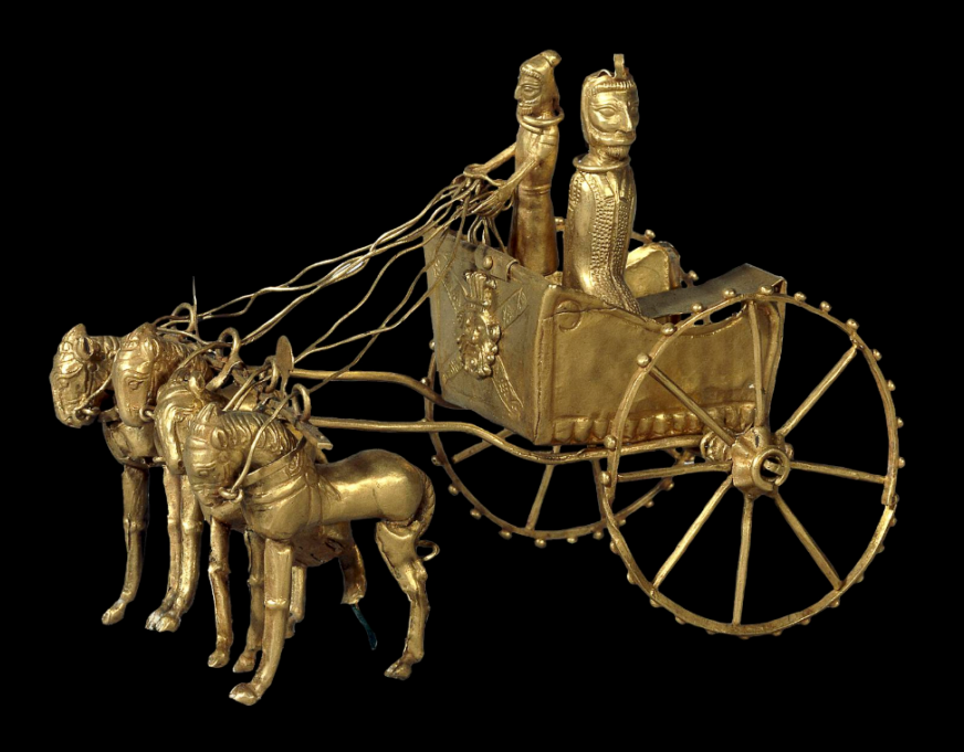
The clearest evidence of early use of the horse as a means of transport is from chariot burials. The earliest true chariots known are from around 2,000 BC, in burials of the Sintashta-Petrovka culture in modern Russia in a cluster along the upper Tobol river, southeast of Magnitogorsk.
They contain spoke-wheeled chariots drawn by teams of two horses.
Kazakhstan and Ukraine

Up till recently, it was thought that the most common horse used today was a descendant of the horses domesticated by the Botai culture living in the steppes of the Akmola Province of Kazakhstan, around 3500 BC.
Recent genetic research points to the fact that the Botai horses were the forefathers of the Przewalski horse, a species that nearly disappeared.
Our common horse, the Equus ferus caballus, genetic research says, has been domesticated 4,200 years ago in Ukraine, in an area known as the Volga-Don, in the Pontic-Caspian steppe region of Western Eurasia, around 2,200 BC.
As these horses were domesticated, they were regularly interbred with wild horses.

Interesting in this respect, is the fact that according to the “Kurgan” or “steppe hypothesis”, most Indo-European languages spread from the same region throughout Europe and parts of Asia.
It postulates that the people of a Kurgan culture in the Pontic steppe north of the Black Sea were the most likely speakers of what some call the Proto-Indo-European language (PIE).
The term is derived from the Turkic word kurgan, meaning tumulus or burial mound.
Tea Road, Horse Road or Silk Road?


As a matter of fact, the main commodities traded on the “Silk Road” (a term only coined in 1877 by the German geographer Ferdinand Von Richthofen), were… horses, mules, camels, donkeys and onagers.
Silk and tea were of course traded, but appeared mainly as a means… to pay for horses. People “paid” with silk, gold, porcelain and tea, the animals they needed to secure the survival of their society!
What was known as the « Tea-Horse Road » (Southern Silk Road) extended from the city of Chengdu in Sichuan Province, China, south through Yunnan into India and the Indochina Peninsula, and extended westwards into Tibet. It was an important route for the tea trade throughout South China and Southeast Asia and contributed to the spread of religions like Taoism and Buddhism across the region.
Eurasian Steppe

China, feeling itself under constant threat from the nomadic steppe people from the North, started building the first parts of its “Great Wall” as early as the VIIth Century BC, with selective stretches joined by Qin Shi Huang (220–206 BC), the first emperor of China and completed under the Ming dynasty (1368–1644) to become one of the most impressive feats in history.
The Eurasian nomads were groups of nomadic peoples living throughout the Eurasian Steppe. The generic title encompasses the varied ethnic groups who have at times inhabited the steppes of Kazakhstan, Kyrgyzstan, Tajikistan, Turkmenistan, Uzbekistan, Mongolia, Russia, and Ukraine.
By the domestication of the horse around 2,200 BC (i.e. 4,200 years ago), they vastly increased the possibilities of nomadic life and subsequently their economy and culture emphasized horse breeding, horse riding, and nomadic pastoralism, usually engaging in trade with settled peoples around the steppe edges, be it in Europe, Asia or Central Asia.

Nomads, by definition, don’t create empires. It is thought they operated often as confederations. But it was them who developed the chariot, wagon, cavalry, and horseback archery and introduced innovations such as the bridle, bit, stirrup, and saddle and the very rapid rate at which innovations crossed the steppe-lands spread these widely, to be copied by settled peoples bordering the steppes.
During the Iron Age, Scythian (Persian) culture emerged among the Eurasian nomads, which was characterized by a distinct Scythian art.
China and the Horse

Throughout China’s long and storied past, no animal has impacted its history as greatly as the horse. Its significance was such that as early as the Shang dynasty (ca.1600-1100 BC), military might was measured by the number of the war chariots available to a particular kingdom.
The mounted cavalery, which emerged in the IIIrd century BC grew rapidly during the IInd century BC to meet the challenge of horse-riding peoples threatening China along the northern frontier.
Their large, powerful, horses were very new to China. As said before, traded for luxurious silk, they were the first major import to China from the “Silk Road.”
Chinese grave goods provide extraordinary amounts of information about how the ancient Chinese lived. Archaeological evidence shows that within a few years, the marvelous Arabian steeds had become immensely popular with military and aristocracy alike and upper-class tombs began to be filled with images of these great horses for use in the afterlife. But horses were hard to find in China.
Chinese diplomats and the Kingdom of Dayuan (Ferghana)

Something had to be done. In the late IInd Century BC, Zhang Qian, a Han dynasty diplomat and explorer, travels to Central Asia and discovers three sophisticated urban civilizations created by Greek settlers he named « Ionians ». The account of his visit to Bactria, including his recollection of his amazement at finding Chinese goods in the markets (acquired via India), as well as his travels to Parthia and Ferghana, are preserved in the works of the early Han historian Sima Qian.

Upon returning to China, his account prompts the Emperor to dispatch Chinese envoys across Central Asia to negotiate and encourage trade with China. Some historians say that this dicision gave « birth of the Silk Road.«

Besides Parthia and Bactria, where Chinese goods were being traded via Indian imports, Zhang Qian visited, in the fertile Ferghana valley (today essentially in Tajikistan), a State the Chinese called the “Kingdom of Dayuan” (“Da” meaning “great”, and “Yuan” being the transliteration of Sanskrit Yavana or Pali Yona, used throughout antiquity in Asia to designate « Ionians », i.e. Greek settlers).
The Records of the Grand Historian and the Book of Han describe the Dayuan as numbering several hundred thousand people living in 70 walled cities of varying size. They grew rice and wheat, and made wine from grapes. They had Caucasian features and “customs identical to those of Bactria” (the most Hellenistic state of the region since Alexander the Great) which is today’s northern Afghanistan.
The Chinese diplomat reported something of great strategic interest: unbelievable, fast and powerful horses raised by these Ionians in the Ferghana Valley!

Now, as said before, China felt under permanent threat by the nomadic people from the steppes and was in the process of building the “Great Wall”. China also was acutely aware that the nomadic steppe people derived their military superiority from something dramatically lacking at home: powerful horses !
Added to that, the fact that in terms of China’s scale of values, horses where nearly of the same mythological nature as dragons: they could fly and represented the divine, creative spirit of the universe itself, something essential for any Chinese emperor eager to acquire both military security for his Empire and for his personal immortality.
In short, having good horses became an issue of national security. So much, that in 100 BC, the Han dynasty started what is known as the “War of the Heavenly Horses” with Dayuan, when its ruler refused to provide high quality horses to China !
The War of the Heavenly Horses

The War of the Heavenly Horses was a military conflict fought in 104 BC and 102 BC between China and a part of the Saka-ruled (Scythian) Greco-Bactrian kingdom known to the Chinese as Dayuan, in the Ferghana Valley (between modern-day Uzbekistan, Kyrgyzstan and Tajikistan).
First, Emperor Wu decided to defeat the nomadic steppe Xiongnu, who had harassed the Han dynasty for decades.
As said earlier, in 139 BC, the emperor sent diplomat Zhang Qian to survey the west and forge a military alliance with the Yuezhi nomads against another group of nomads, the Xiongnu. On the way to Central Asia through the Gobi desert, Zhang was captured twice. On his return, he impressed the emperor with his description of the « Heavenly Horses » of Dayuan, that could greatly improve the quality of Han cavalry mounts when fighting the Xiongnu.
The Han court sent at least five or six, and perhaps as many as ten diplomatic groups annually to Central Asia during this period to get a hold on these “Heavenly Horses”.

A trade mission arrived in Dayuan with 1000 pieces of gold and a golden horse to purchase these precious animals.
Dayuan, who was one of the furthest western states to send envoys to the Han court at that point, had already been trading with the Han for quite some time and benefited greatly from it. Not only were they overflowed by eastern goods, they also learned from Han soldiers how to cast metal into coins and weapons. However unlike the other envoys to the Han court, the ones from Dayuan did not conform to the proper Han rituals and behaved with great arrogance and self-assurance, believing they were too far away to be in any danger of invasion.
Hence, in a stroke of folly and taken by pure arrogance, the Dayuan king not only refused the deal, but confiscated the payment in gold. The Han envoys cursed the men of Dayuan and smashed the golden horse they had brought. Enraged by this act of contempt, the nobles of Dayuan ordered Yucheng, which lay on their eastern borders, to attack and kill the envoys and seize their goods.
Upon receiving word of the trade mission’s demise, humiliated and enraged, the Han court sent an army led by General Li Guangli to subdue Dayuan, but their first incursion was poorly organized and under-supplied.
A second, larger and much better provisioned expedition was sent two years later and successfully laid siege to the Dayuan capital at Alexandria Eschate, and forced Dayuan to surrender unconditionally.

The Han expeditionary forces installed a pro-Han regime in Dayuan and left with 3,000 horses, although only 1,000 remained by the time they reached China in 101 BCE.
The Ferghana also agreed to send two Heavenly horses each year to the Emperor, and lucerne seed was brought back to China providing superior pasture for raising fine horses in China, to provide cavalry which could cope with the Xiongnu who threatened China.
The horses have since captured the popular imagination of China, leading to horse carvings, breeding grounds in Gansu, and up to 430,000 such horses in the cavalry during the Tang dynasty.
China and the agricultural revolution
After imposing its role in military strategy for the next centuries, horsepower, together with water management, became a crucial factor to raise the productivity of the world’s food production.
First, contrary to the Romans, who preferred to use “human cattle” (slaves) rather than animals (which they raised for race contests), the Chinese greatly contributed to the survival of mankind with two crucial innovations respecting a more efficient use of horse power.

As can be seen in murals and paintings, through the ancient world, be it in Egypt or Greece, plows and carts were pulled using animal harnesses that had flat straps across the neck of the horse, with the load attached at the top of the collar, above the neck, in a manner similar to a yoke used for oxen.
In reality, this greatly limited a horse’s ability to exert itself as it was constantly choked at the neck. The harder the horse pulled, the harder it became to breathe.
Due to this physical limitation, oxen remained the preferred animal to do heavy work such as plowing. Yet oxen are hard to maneuver, are slow, and lack the quality of horses, whose power is equivalent but whose endurance is twice that of oxen.

China reportedly first invented the “breast strap” which was the first step in the right direction.
Then, in the Vth Century, China also invented what is called the “rigid horse collar”, designed as an oval that fits around the neck and shoulders of the horse.

It has the following advantages:
–First, it relieved the pressure of the horse’s windpipes. It left the airway of the horse free from constriction improving massively the animal’s energy through-put.
–Second, the traces could be attached to the sides of the collar. This allowed the horse to push forward with its more powerful hind-legs rather than pulling with the weaker front legs.
Now you can argue that this is anecdotal. It is NOT, because what appears as only a slight change had absolutely monumental consequences.
European Renaissance

In a strategic alliance and cooperation with the humanist Baghdad Abbasid caliphate, Charlemagne and his successors introduced the “rigid horse collar” in Europe.
With that new, far more efficient tool, European farmers finally could take full advantage of a horse’s strength. The horse was able to pull another recent innovation, the heavy plow. This became particularly important in areas where the soil was hard and clay-like. This opened up new plots of lands to agriculture. The rigid horse collar, the heavy plow, and horseshoes helped usher in a period of increased agricultural production.

As a result, between 1000 CE and 1300 CE, it is estimated that in Europe, crop yields increased by threefold, allowing to feed a rising number of citizens in the urban cities appearing in the XVth century and kick starting the global “Golden” European Renaissance. Thank you, China!
Some numbers are nevertheless disturbing:
–it took humanity thousands of years to finally domesticate the horse (long after the cow), in 3200 BC.
–it took humanity another 3700 years to learn how to find out, in the Vth century AD, the most efficient way to use horse-power…
Shifting from a “lower” infrastructure platform to a “higher” infrastructure platform might take some time. Today’s new “higher” platforms are called “space data” and “fusion power.” Let’s not wait another century to find out how to use them correctly!
Afghanistan : « Le pays des 1000 cités d’or » et l’histoire d’Aï Khanoum

Invité par le Centre de recherche et de développement Ibn-e-Sina en tant que représentant de l’Institut Schiller, Karel Vereycken est intervenu le 7 novembre à la conférence sur la reconstruction du pays.
Son propos introductif, devant un groupe de travail composé d’historiens, d’archéologues et de membres de l’Académie des sciences d’Afghanistan, a donné lieu à une longue après-midi d’échanges sur le rôle de l’art, la méthodologie scientifique et les combats à mener pour sortir l’Afghanistan de son isolement et préserver un héritage culturel qui certes est afghan, mais appartient à toute l’humanité.
Parler de la culture d’un pays étranger est toujours une chose difficile, surtout si l’on n’en connaît pas la langue et si l’on n’a pas pu séjourner et voyager dans le pays pendant de longues périodes. Par conséquent, je ne peux que vous offrir mes impressions de l’extérieur et commenter ce que j’ai découvert dans des livres. Vous allez donc m’aider en me corrigeant et en me signalant ce qui a échappé à mon attention.
L’Afghanistan est un pays fascinant. Sa réputation de « tombeau des Empires » a capté mon imagination. Récemment, votre pays s’est émancipé de l’occupation américaine et de l’OTAN. Une poignée de combattants déterminés a mis en déroute un immense empire déjà en train de s’autodétruire. 34 ans plus tôt, le pays avait chassé l’occupant russe, après avoir résisté à l’Empire britannique au cours des trois guerres anglo-afghanes du XIXe siècle (1839-42, 1878-80 et 1919), alors que Londres, engagé dans le « Grand Jeu » (Great Game), tentait d’empêcher la Russie d’accéder aux mers chaudes.
Pour éviter d’être colonisé à la fois par la Russie et la Grande-Bretagne, l’Afghanistan a même courageusement refusé d’avoir des chemins de fer, ce qui explique qu’il n’existe aujourd’hui que 300 km de voies ferrées, une situation bien sûr inacceptable aujourd’hui.
Cette capacité de résistance et ce sentiment de dignité découlent, j’en suis convaincu, du fait que votre pays a su faire siennes les diverses influences qui s’y sont rencontrées. Voilà ce qui est devenu au fil des siècles le socle d’une forte identité afghane, totalement à l’opposé de l’étiquette tribale que les colonisateurs cherchent à lui coller.
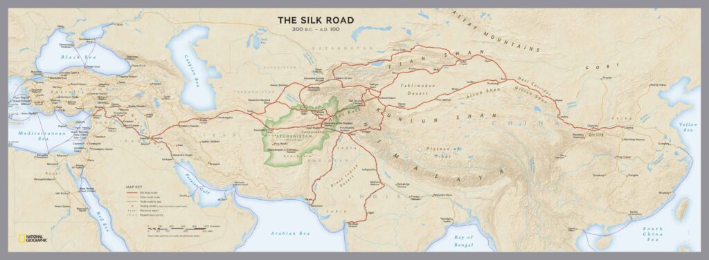
J’aborderai uniquement, aujourd’hui, l’influence grecque, qui s’est avérée majeure à partir du moment où Alexandre le Grand traverse le Hindou Kouch, en 329 av. JC.
Dès lors, des dizaines de milliers de colons grecs, appelés Ioniens, s’installent en Asie centrale.
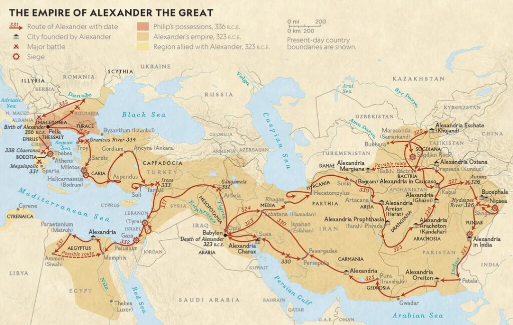
Sous le règne de ses successeurs concurrents, l’immense empire d’Alexandre le Grand se décompose en plusieurs entités et royaumes.
En 256 av. JC, Diodote Ier Soter fonde en Afghanistan le royaume gréco-bactrien, connu sous le nom de « Bactriane », dont le territoire englobe une grande partie de l’Afghanistan, de l’Ouzbékistan, du Tadjikistan et du Turkménistan actuels, ainsi que certaines parties de l’Iran et du Pakistan. L’influence grecque y perdure au moins jusqu’à l’arrivée de l’Islam au VIIIe siècle.
La Bactriane
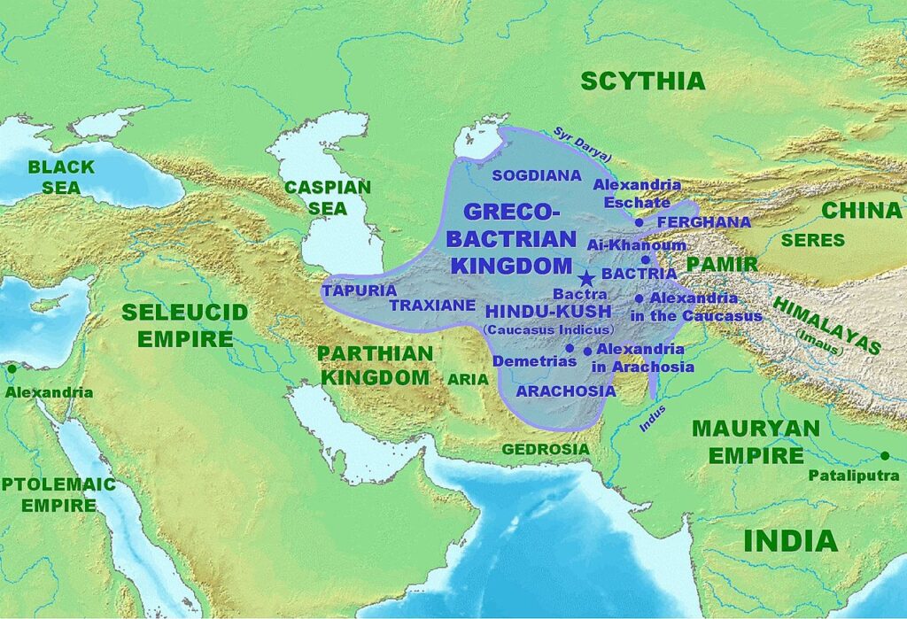
De nombreuses fouilles archéologiques confirment un développement urbain, économique, social et culturel remarquable.
Strabon (64 av. JC – 24 après JC), comme d’autres historiens grecs, qualifiait déjà la Bactriane de « Terre des mille cités », une terre que tous les écrivains, anciens et modernes, louaient pour la douceur de son climat et sa fertilité, car « la Bactriane produit tout, sauf de l’huile d’olive. »
Pour le naturaliste romain Pline l’Ancien (23 – 79 après JC), en Bactriane,
« les grains de blé poussent si gros qu’un seul grain est aussi gros que nos épis. »
Sa capitale Bactres (aujourd’hui Balkh, proche de Mazâr-e Charîf au nord de l’Afghanistan), « Mère des cités », figure parmi les villes les plus riches de l’Antiquité.
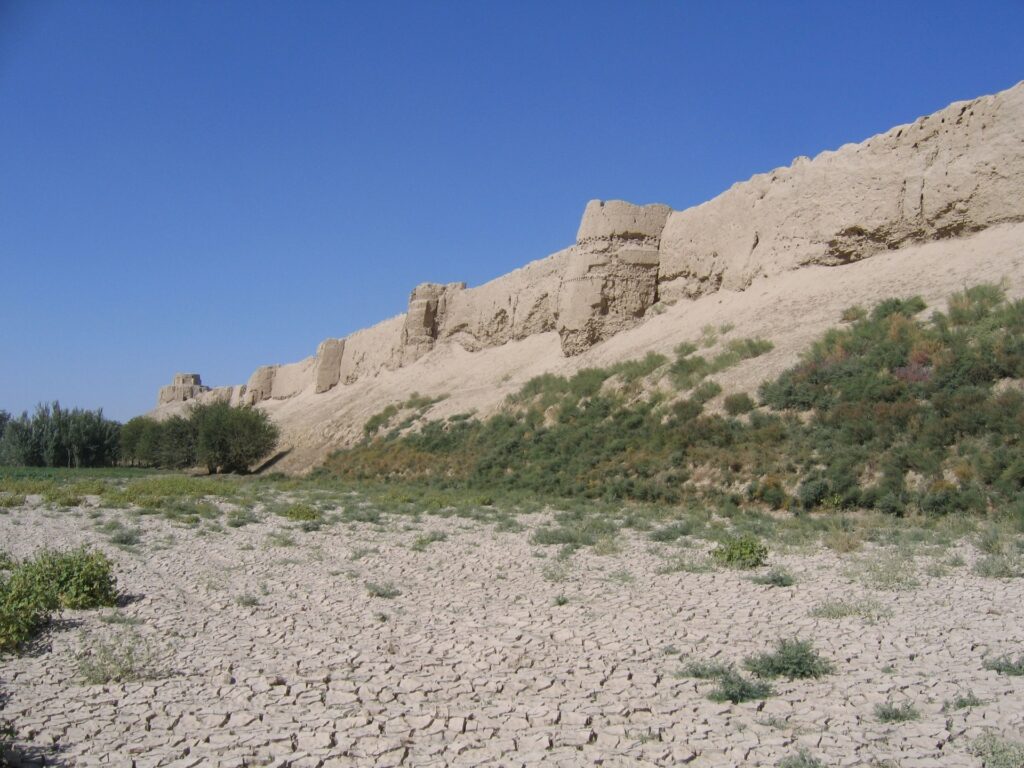

C’est là qu’Alexandre le Grand épouse Roxana (« Petite étoile ») et adopte l’habit perse pour pacifier son Empire. C’est également là que naîtra le père du grand médecin et philosophe Ibn Sina (Avicenne), avant de s’installer à Boukhara (Ouzbékistan).
Au fil du temps, la Bactriane sera le creuset de cultures et de civilisations où se mêlent, sur le plan artistique, architectural et religieux, traditions grecques et cultures locales.
Si le grec y est la langue de l’administration, les langues locales y foisonnent. Rien que les noms des villes démontrent la prédominance de la culture hellénique.
Ainsi, Ghazni s’appelle « Alexandrie en Opiana », Bagram « Alexandrie au Caucase », Kandahar « Alexandrie Arachosia », Hérat « Alexandria Ariana », etc., et la liste ne s’arrête pas là.
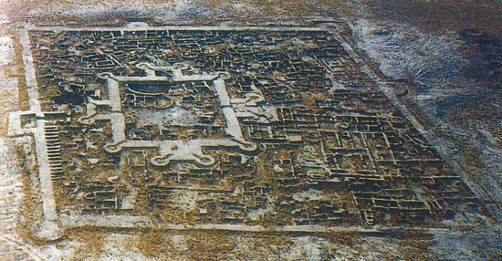
La ville de Gonur Depe (actuellement au Turkménistan, au nord de Mary, l’ancienne Merv), capitale du Royaume de Margiane, est un autre exemple de ce qu’on s’accorde maintenant à appeler la « Culture de l’Oxus »)
Aï Khanoum, la grecque

Si certaines villes ne font que changer de nom, d’autres sont construites ex nihilo. C’est le cas d’Aï Khanoum (« Dame Lune » en ouzbek), cité érigée au confluent du grand fleuve Amou Daria (l’Oxus des Grecs) et de la rivière Kokcha.
En 1961, le roi d’Afghanistan (Mohammed Zahir Shah), voulant marquer son indépendance vis-à-vis des Soviétiques et des Américains, invite la France à participer aux fouilles.
C’est le Département des archéologues français en Afghanistan (DAFA) qui met au jour les vestiges d’un immense palais dans la ville basse, ainsi qu’un grand gymnase, un théâtre pouvant accueillir 6000 spectateurs, un arsenal et deux sanctuaires.
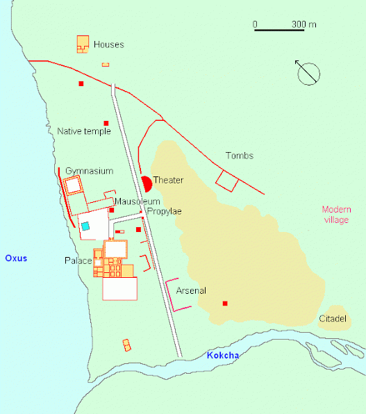
Entourée de terres agricoles bien irriguées, la ville elle-même était divisée entre une ville basse et une acropole de 60 mètres de haut.
Bien qu’elle n’est pas située sur une route commerciale majeure, Aï Khanoum commande l’accès aux mines du Hindou Koush. De vastes fortifications, continuellement entretenues et améliorées, entourent la ville.
Un monument au cœur de la ville y présente une stèle inscrite en grec avec une longue liste de maximes incarnant les idéaux de la vie grecque. Celles-ci sont copiées de Delphes et se terminent par :
« Dès l’enfance, apprends les bonnes manières ;
dans la jeunesse, maîtrise tes passions ;
dans la vieillesse, sois de bon conseil ;
dans la mort, n’aie aucun regret. »
L’architecture du site indique que les colons grecques y vivent en bonne entente avec les populations locales. Elle est très grecque mais intègre en même temps diverses influences artistiques et éléments culturels que les Ioniens ont pu observer au cours de leur voyage du bassin méditerranéen à l’Asie centrale. Par exemple, ils utilisent les styles néo-babylonien et achéménide pour la construction de leurs cours.
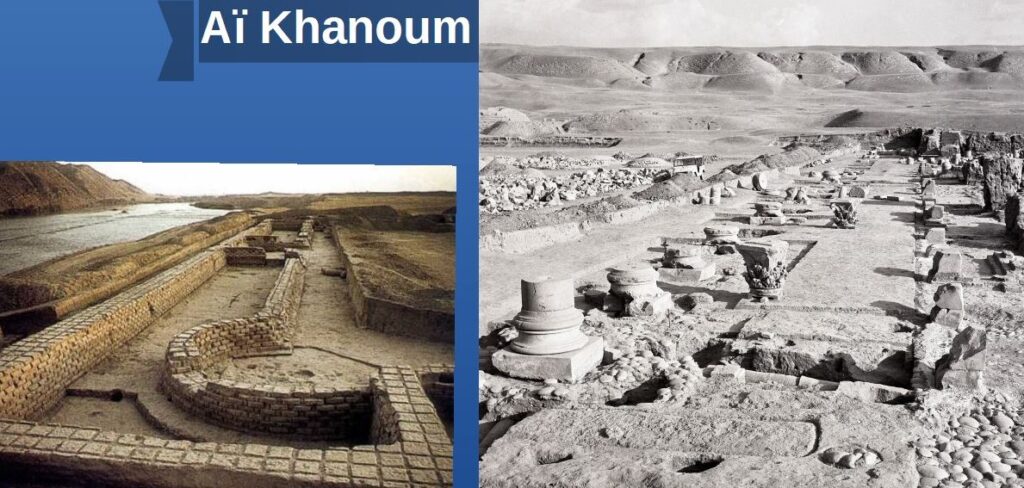
Shortugai et la Civilisation de la vallée de l’Indus
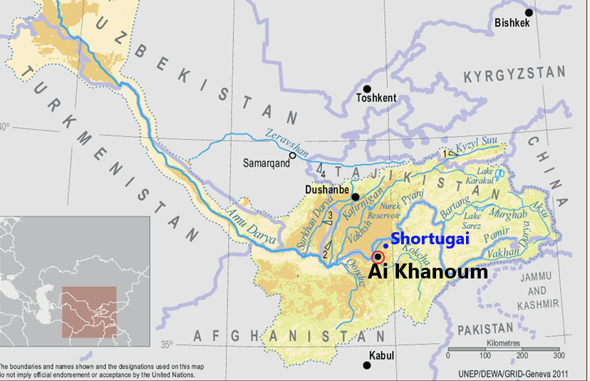
La date précise des premières fondations d’Aï Khanoum reste inconnue.
A une jetée de là, Shortugai, avant-poste commercial et minier de la fameuse civilisation de l’Indus (dite « harappéenne ») qui, au IIIe millénaire avant notre ère, était à l’avant-garde sur le plan de l’irrigation et de la maîtrise de l’eau. (voir notre article)
Des scientifiques de l’Institut indien de technologie de Kharagpur et du Service archéologique d’Inde ont publié le 25 mai 2016, dans la revue Nature, les fruits d’une recherche qui permettrait de dater la civilisation harappéenne d’au moins 8000 ans avant JC et non 5500 ans, comme on le croyait jusqu’à présent. Cette découverte majeure signifierait qu’elle serait encore plus ancienne que les civilisations mésopotamienne et égyptienne.
Shortugai est construite avec des briques standardisées typiques de la vallée de l’Indus. Des sceaux de la civilisation de la vallée de l’Indus ont également été trouvés sur d’autres sites archéologiques d’Afghanistan.
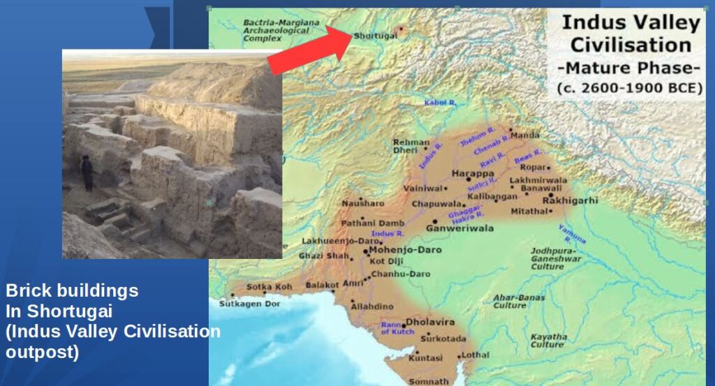
Pendant plusieurs siècles, Shortugai a fonctionné comme un site minier exceptionnel pour l’extraction de l’étain (un minerai indispensable pour la fabrication du bronze), de l’or et du fameux lapis-lazuli, cette pierre précieuse bleue qui, avec l’or, habille de sa splendeur la tombe du pharaon égyptien Toutankhamon et d’autres tombes religieuses majeures en Mésopotamie (Irak).
Les données archéologiques démontrent que Shortugai commerçait avec ses voisins d’Aï Khanoum et construisit les premiers systèmes d’irrigation de la région, une spécialité de la civilisation de la vallée de l’Indus.
Bien des sites restent inexplorés en Afghanistan, pays où les guerres, les occupations étrangères et les pillages ont perturbé ou rendu impossible les recherches archéologiques.
Voici quelques-unes des découvertes de la DAFA, dont certaines restent exposées au Musée national de Kaboul.
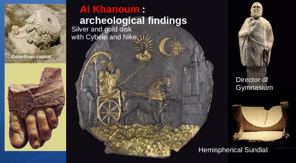
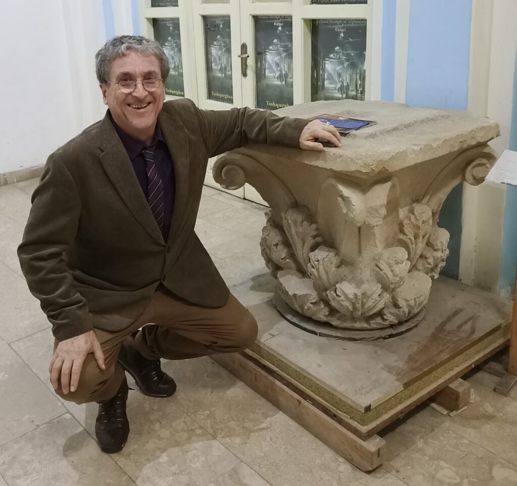
Relations avec l’Inde
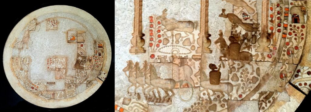
Ce qu’on a trouvé à Aï Khanoum, les pièces de monnaie, les objets et les céramiques, notamment d’origine indienne, témoigne qu’il s’agissait d’une importante plaque tournante du commerce avec l’Inde.
En 258 avant notre ère, Ashoka le Grand, souverain de l’empire Maurya (l’État dominant en Inde), fait ériger ce que l’on appelle « l’Edit grec d’Ashoka à Kandahar », une inscription rupestre bilingue, en grec et en araméen. Une autre inscription d’Ashoka était rédigée uniquement en grec.
Le contenu même de ces édits donne également une indication claire du niveau des échanges entre l’Inde et le monde hellénistique. Par exemple, dans son XIIIe édit, Ashoka, faisant preuve d’érudition, énumère avec précision tous les souverains du monde hellénistique de son époque.
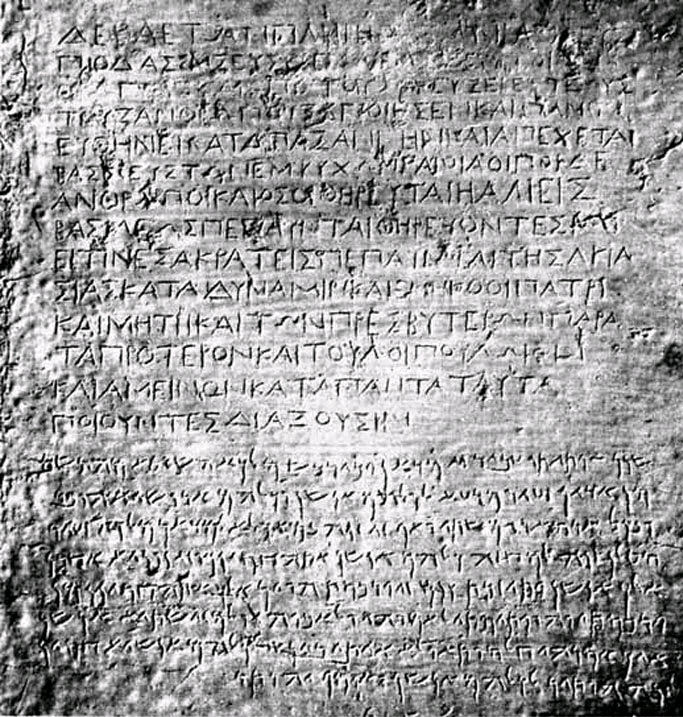
Relations avec la Chine
Outre son interaction avec le sous-continent indien, la Bactriane établira des contacts avec une puissance située encore plus à l’est : la Chine.
À la fin du IIe siècle avant JC, Zhang Qian, diplomate et explorateur de la dynastie Han, arrive en Bactriane. Le récit de sa visite, y compris son étonnement d’y trouver des marchandises chinoises sur les marchés (acquises via l’Inde), ainsi que ses voyages dans le reste de l’Asie centrale, sont conservés dans les œuvres de l’historien Sima Qian.

À son retour en Chine, Zhang Qian informe l’empereur de l’existence de civilisations urbaines sophistiquées en Asie centrale : le Dayuan (vallée de la Ferghana), la Bactriane (Afghanistan) et la Partie (nord-est du plateau iranien).
Les découvertes de Zhang Qian incitent l’empereur à envoyer des émissaires chinois en Asie centrale pour y favoriser le commerce avec la Chine. Certains historiens n’hésitent pas à qualifier cette décision de l’Empereur chinois de « naissance de la Route de la soie ».
Déclin et chute
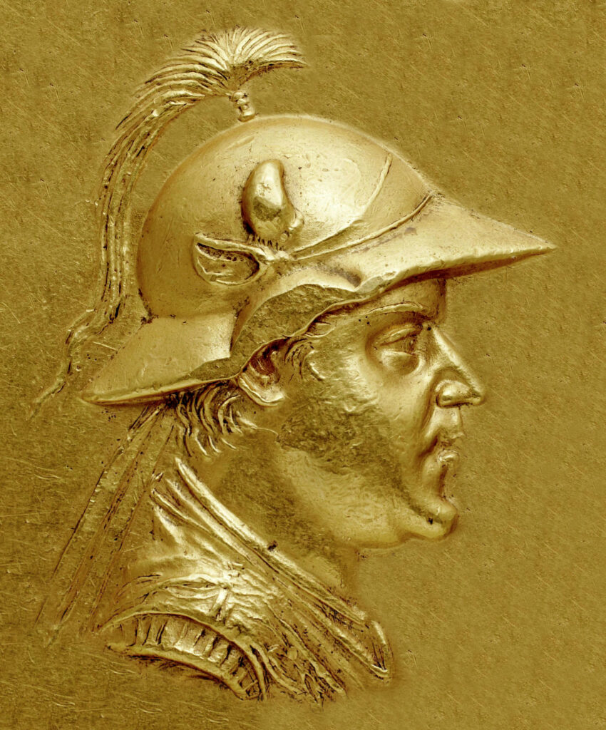
Une grande partie des ruines actuelles d’Aï Khanoum datent de l’époque d’Eucratides Ier (172-145 av. JC), qui a considérablement réaménagé la ville et l’a peut-être rebaptisée Eucratideia, d’après son nom.
Il fut assassiné en 145 av. JC. par son fils. Un an plus tard, le royaume s’effondre face à l’invasion des nomades.
Aï Khanoum est pillée une première fois en 145 av. JC par les Sakas, des tribus iraniennes d’origine scythe, suivis quinze ans plus tard par les nomades chinois Yuezhi.
Le « complexe du trésor » d’Aï Khanoum montre des signes de pillage lors de deux assauts, à quinze ans d’intervalle. D’après des témoins oculaires, certaines villes se sont arrangées avec les envahisseurs et organisèrent une coexistence pacifique. Les villes qui ont résisté, comme Aï Khanoum, ont été pillées et incendiées.
L’empire Kouchan
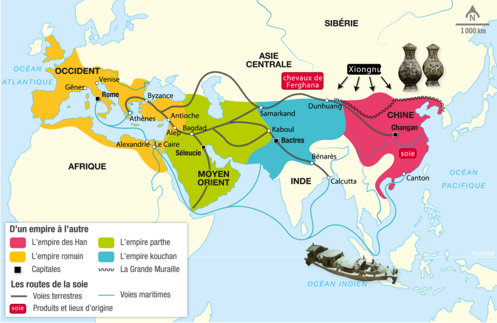
Les nomades chinois Yuezhi se sédentarisent et créent au début du Ier siècle l’Empire kouchan, qui englobe une grande partie de ce qui est aujourd’hui l’Ouzbékistan, l’Afghanistan, le Pakistan et l’Inde du Nord.
Son territoire s’étend de l’Asie centrale et du Gandhara (frontière occidentale actuelle du Pakistan) à Pataliputra, dans la plaine du Gange (Inde d’aujourd’hui). La capitale principale de son empire était située à Purushapura (aujourd’hui Peshawar au Pakistan).
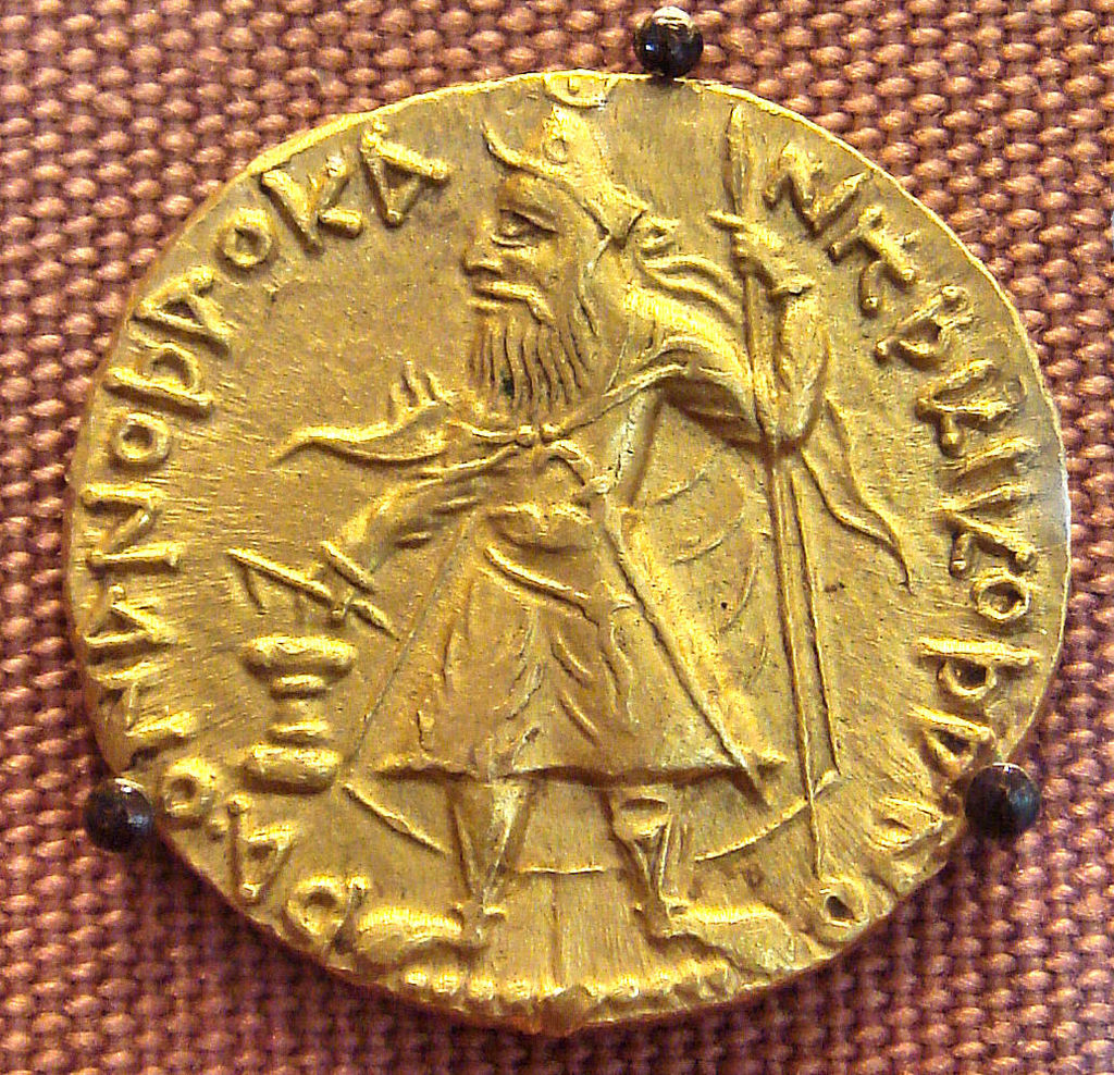
C’est sous le règne de Kanishka le Grand (vers 127-150) que l’Empire kouchan deviendra célèbre pour ses réalisations militaires, politiques et spirituelles. Kanishka échange des ambassadeurs avec l’empereur romain Marc Aurèle (161-180) et l’empereur Han de Chine. Il noue des contacts diplomatiques avec la Perse sassanide et le royaume d’Aksoum (Yémen et Arabie saoudite d’aujourd’hui).
Si la dynastie kouchane reprend la tradition gréco-bactrienne, elle se forge peu à peu sa propre identité.
Les artistes kouchans enrichirent la sculpture bouddhique en donnant à Bouddha la forme humaine, innovation qui fut la plus importante de l’époque.
En 127, Kanishka remplace le grec par le bactrien, une langue moyenne iranienne utilisant l’alphabet grec.
Le bouddhisme
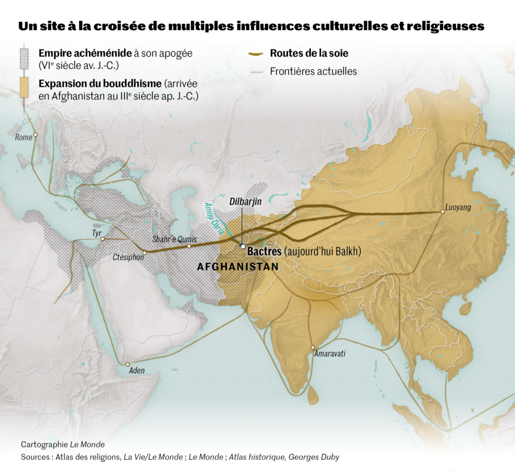
Les Kouchans joueront également un rôle majeur dans la transmission du bouddhisme. Le rayonnement de cette religion venue des rives du Gange favorisera celui des Routes de la soie.
Dans le domaine de la religion, les Kouchans, initialement attirés par l’hindouisme, joueront un rôle majeur dans la transmission du bouddhisme mahayana du Gandhara vers la Chine, l’Asie centrale et même le Sri Lanka, favorisant ainsi l’expansion de la route de la soie.
Tous ces facteurs ont inauguré une période de paix relative de 200 ans, connue comme la « Pax Kouchana ».
À partir du milieu du IIIe siècle après JC, l’Empire kouchan, affaibli, commence à se désintégrer. Dans sa partie occidentale, il passe sous le contrôle des Kushanshahs, c’est-à-dire les Indo-Sassanides (perses), progressivement supplantés au nord par les Hephtalites (appelés également les « Huns blancs » ou « Huns iraniens ») venus de la steppe d’Asie centrale.
Le bouddhisme connaît néanmoins une période de grande prospérité, comme l’illustrent les descriptions du moine chinois Xuanzang du VIIe siècle ainsi que la construction des statues géantes de bouddhas dans la vallée de Bamiyan en Afghanistan.

L’Islam
Après avoir conquis l’Iran, l’islam pénètre l’Afghanistan par le nord. Il n’y a pas de preuve d’un rejet massif de la nouvelle religion, sauf dans des régions isolées. Cependant, la volonté de rester indépendants des gouverneurs nommés par Damas (Omeyyades) puis par Bagdad (Abassides) se manifeste rapidement. C’est même à partir d’une province couvrant une partie du nord de l’Afghanistan, le Khorasan, que se répand initialement une partie de l’insurrection contre les Omeyyades pour les remplacer par le califat abbasside d’Haroun-al-Rachid, plus humaniste, et la création de Bagdad (voir notre article).
À partir de la fin du Xe siècle, une dynastie d’origine turque, les Ghaznévides, bâtit autour de leur capitale Ghazni (Afghanistan) un vaste sultanat qui s’étend jusqu’en Inde et fonde une communauté musulmane durable.

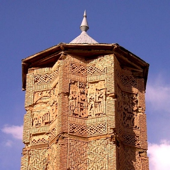
Leur influence culturelle se mesure par la beauté de l’architecture qu’ils nous ont laissée, mais aussi par le patronage qu’ils accordèrent au grand poète épique Ferdowsi (940-1025), à qui l’on doit la grande épopée nationale en langue persane, le Shahnameh : Le livre des rois.
Les Ghaznévides ont été suivis par une nouvelle dynastie, les Ghorides, originaire de la partie centrale de l’Hindou Kouch. C’est à eux que l’on doit l’impressionnant minaret de Jam.
Ce riche patrimoine culturel, qui a jeté les bases de leur identité et qui a donné sa dignité au peuple afghan, a été ignoré, détruit par les guerres successives, pillé et saccagé.
Fortement combattu par les talibans au pouvoir à Kaboul, ISIS, Daech et d’autres groupes terroristes, dont certains encouragés en sous-main par des agences de renseignement occidentales se sont livrés à un pillage à échelle quasi-industrielle du patrimoine culturel afghan. Pour eux, la revente d’objets d’art et d’antiquités est une des principales sources de revenus.
Recommandations
Aujourd’hui, le temps est venu d’un nouveau départ. L’Afghanistan peut changer complètement son image dans le monde, qui a été polluée par des adversaires et des ennemis qui veulent maintenir l’Afghanistan comme une zone de non-développement pour leur propre grand jeu géopolitique.
Ma proposition pour renouveler la contribution de l’Afghanistan à la culture mondiale est simple.
Avec Mes Aynak, qui signifie « petite mine », située à 35 km au sud de Kaboul, l’Afghanistan dispose du deuxième plus grand gisement de cuivre au monde. Alors que la Chine et les autres pays du BRICS ont besoin de ce métal précieux pour leur développement industriel, la mine offrira un revenu substantiel dont l’Afghanistan a un besoin urgent pour reconstruire le pays.
Le 25 mai 2008, Ibrahim Adel, ministre des Mines, et Shen Heting, directeur général de MCC, l’actionnaire majoritaire du consortium MCC-Jiangxi Copper MJAM, ont signé le contrat minier de Mes Aynak.
Ce contrat décrivait les conditions du premier grand projet minier et du plus important investissement étranger en Afghanistan. Cependant, suite à des incidents de sécurité qui ont créé d’importants problèmes d’insécurité, et sous la pression des puissances étrangères, le projet a été bloqué.
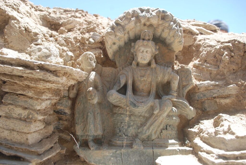
Paradoxalement, cela a donné aux archéologues le temps de mettre au jour sur le site minier une zone de 40 ha d’une valeur culturelle exceptionnelle de classe mondiale, principalement un vaste complexe de monastères bouddhistes, comprenant des stupas (temples), des peintures murales, des sculptures et des centaines d’artefacts archéologiques, etc.
Même si le contrat (fichier pdf) a pu être modifié depuis 2008, on ne peut que constater que le contrat initial contient une série d’aspects potentiellement très intéressants, à la fois pour la Chine mais surtout pour l’Afghanistan lui-même.
- EXPORTER DU MÉTAL, PAS DU MINERAI
De même que la Bolivie ne veut pas exporter du lithium (matière première) mais des batteries (produit fini transformé à haute valeur ajoutée), l’Afghanistan ne veut pas exporter du minerai de cuivre mais du cuivre métal. Pour atteindre cet objectif, le contrat prévoit la construction d’une fonderie sur le site.
Paragraphe IV, 33 : « Afin de respecter son engagement envers le gouvernement de financer, construire et exploiter une fonderie en Afghanistan, la MCC a demandé au gouvernement de lui donner accès à des gisements de phosphates, de calcaire et de quartz qu’elle pourra utiliser dans le cadre du projet Aynak. » - ACHATS LOCAUX
Paragraphe VII, 38 : « MCC s’efforce d’acheter des biens et des services en Afghanistan s’ils sont disponibles. » - MAIN-D’ŒUVRE LOCALE
Paragraphe VIII, 39, a : « MCC emploie du personnel afghan, dans toute la mesure du possible. » - APPROVISIONNEMENT EN EAU
Paragraphe IV, 32 : « MCC s’est engagée auprès du gouvernement à construire des puits d’approvisionnement en eau et des systèmes de canalisation … pour répondre aux besoins en eau douce du projet. La MCC s’est également engagée à réutiliser et à recycler l’eau de traitement dans la mesure du possible. » - CENTRALE AU CHARBON
Paragraphe IV, 31 : « MCC s’est engagée auprès du ministère des Mines à construire … une centrale au charbon d’une capacité de 400 mégawatts pour fournir de l’énergie électrique au projet et à Kaboul. » - CHEMIN DE FER
Paragraphe IV, 30 : « MCC s’est engagée à construire un chemin de fer associé au projet ». - LOGEMENT
Paragraphe IV, 24 : « MCC doit fournir des logements de qualité et en quantité suffisante à ses salariés et à leurs familles immédiates, à un prix de location raisonnable. » - SOINS MÉDICAUX
Paragraphe IV, 25 : « MCC fournira des soins médicaux gratuits à tous ses salariés et à leurs familles… et établira, dotera en personnel et entretiendra des dispensaires, des cliniques et des hôpitaux en nombre suffisant … » - ÉCOLES
Paragraphe IV, 26 : « MCC doit fournir gratuitement un enseignement primaire et secondaire adéquat aux enfants de tous les salariés et résidents de la zone entourant Aynak. » - CADRE DE VIE
Paragraphe IV, 27 : « MCC construira et financera le fonctionnement de centres d’activités récréatives adéquats tels que des gymnases et des terrains de sport. … En outre, il construira un marché/une zone commerciale. » - RELIGION
Paragraphe IV, 28 : « MCC respectera et protégera les convictions religieuses du peuple afghan. »
Le monde serait stupéfait en constatant que l’Afghanistan mobilise ses meilleurs architectes et urbanistes pour construire une nouvelle ville à Mes Aynak qu’il baptisera poétiquement, l’« Aï Khanoum du XXIe siècle ».
A Kaboul, un archéologue de premier plan qui travaille sur le site depuis une décennie, m’a confié avec une joie non-dissimulée que, suite à d’intenses discussions en octobre dernier entre les autorités afghanes et l’entreprise chinoise, une issue heureuse a été trouvée.
A l’heure actuelle, dit-il, les deux parties ont convenu de préserver, non plus une infime partie du site archéologique (la partie centrale avec les temples bouddhistes), mais l’ensemble des vestiges historiques du site en surface. A en croire mon interlocuteur, la décision est prise que l’ensemble du site sera désormais exclusivement exploité par la technique d’exploitation minière souterraine. N’en déplaise à la presse occidentale, le sauvetage de Mes Aynak révèle au monde le vrai visage du nouveau gouvernement afghan.
Il rendra également pensable, d’ici un certain temps, la reconstruction des bouddhas géants de la vallée de Bamiyan, l’un de 55 mètres et l’autre de 38 mètres, détruits en 2001. Plusieurs experts, lors de colloques récents de l’UNESCO, ont précisé que les difficultés techniques ne sont pas insurmontables, les bouddhas étant fabriqué en stuc. Le soi-disant « danger » que les sculptures soient considérées comme « fausses » n’a aucun sens, tant que l’intention d’atteindre un bien supérieur par leur reconstruction est réelle.
La « Proposition technique pour la revitalisation des statues du Bouddha de Bâmiyân » de 2017, élaborée par le département d’architecture de l’université japonaise Mukogawa Women’s University, mérite d’être examinée. Sans doute pourra-t-on faire mieux, mais elle a le mérite d’exister. Des chercheurs chinois se disent également prêts à donner un coup de main.
Rappelons que le monde compte 620 millions de bouddhistes qui considèrent Bamiyan comme une partie de leur culture et pourraient envisager de venir en Afghanistan pour mieux comprendre leur propre histoire.
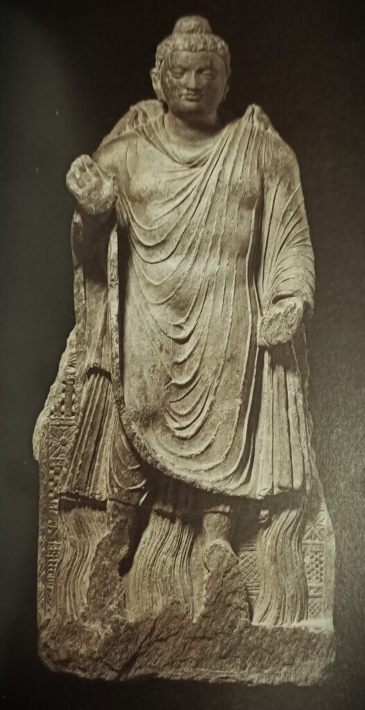
Si l’Afghanistan indiquait clairement au monde qu’il a décidé de renforcer ses activités économiques et minières tout en protégeant, notamment grâce à l’aide généreuse de la Chine, le patrimoine culturel mondial sur son sol, il apparaîtra aux yeux de tous ce qu’il est désormais aujourd’hui : une force du bien, de la tolérance et de la paix dans le monde, en cohérence avec sa propre identité et son histoire.
L’Afghanistan apparaîtra comme le « Bouddha de feu » (IIe-IIIe siècle) du Musée national de Kaboul, où l’on voit la réponse donnée par Bouddha à un défi lancé par des hérétiques selon lequel il ne pouvait pas faire de miracles.
Connu sous le nom de « miracles jumeaux », on y voit Bouddha confiant avec des flammes sortant de ses épaules et des cours d’eau de ses pieds ! En altérant ces deux flux, dit la légende, Bouddha a même fait apparaître un arc-en-ciel !
En augmentant sa production d’énergie et en gérant d’une façon plus intelligence ses ressources en eau, l’Afghanistan démontrera, j’en suis convaincu, sa splendide force spirituelle !
Merci à tous et j’ouvre le débat à vos questions.
Afghanistan: « The Land of 1000 Golden Cities » and the Story of Ai-Khanoum
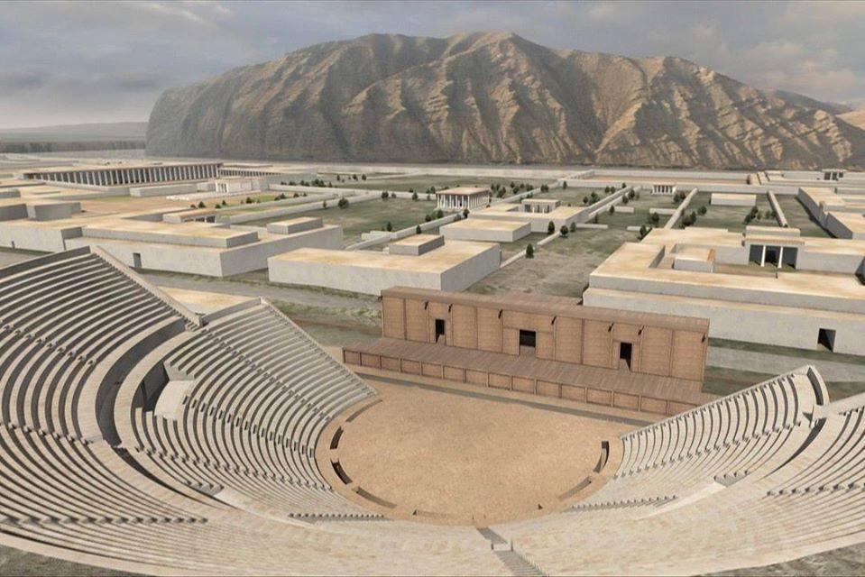

Edited transcript of Karel Vereycken’s presentation at the workshop on the « Cultural heritage of Afghanistan », presented in Kabul on Nov. 7 at the International conference on the economic reconstruction of Afghanistan organized by the Ibn-e-Sina Research and Development Center.
To talk about the culture of a foreign country is always a difficult thing to do, especially if one doesn’t know the language and if one wasn’t able to stay and travel around the country for a longer period. Therefore, I only can offer some impressions from the outside and things I read in books. So probably you will have to correct those things that escaped my attention.
Seen from the outside, Afghanistan is a fascinating country. Its reputation as the “Graveyard of Empires” captured my imagination. Most recently, Afghanistan resisted American and NATO occupation. A handful of determined combatants defeated a huge Empire already in the process of defeating itself. Before, Afghanistan resisted Russian occupation. And in the XIXth century, it resisted the British Empire during three Anglo-Afghan wars: the first in 1839-42, the second in 1878-1880 and the third one in 1919. Britain was playing the “Great Game”, trying to prevent Russia from getting access to the warm waters of the Arab gulf and the Indian Ocean. To prevent being colonized by both Russia and Britain, Afghanistan even courageously refused to have railroads, explaining why there only exists 300 km of rail today, a situation of course inacceptable today.
This capacity to resist, this quality of self respect and dignity, I think, derives from the fact that Afghanistan, being a roundabout on what was called the Silk-Road, absorbed and integrated into its own culture the best of the various influences that came to meet in this region and this became over centuries the foundation upon which was built the Afghan identity.
Totally opposed to that, foreign colonial powers, of course, always have wanted to erase the history, culture and heritage of the subjects over which they want to rule by “divide and conquer”. Justifying themselves as the unifying central power, they always pretend locals are mere representatives of eternally quarreling tribes.
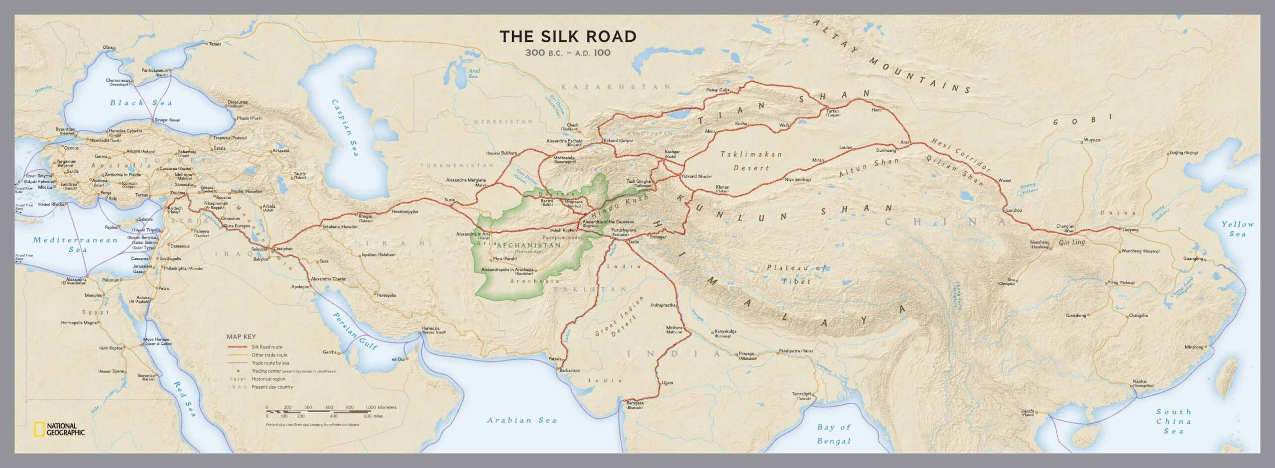
The Greek influence along this trade spread massively into Central Asia in the IVth Century BC with Alexander the Great (356 BC – 323 BC) crossing the Hindu Kush mountain range in 329 BC.
Alexander and his successors brought with them thousands of Greek settlers sometimes called the « The Ionians ». Greek influence, before reaching regions as distant from Macedonia as India, would last at least till the arrival of Islam in the VIIIth Century.
The Greco-Bactrian Kingdom

Under the rule of his competing successors, Alexander the Great’s huge empire collapsed into various entities and kingdoms.
One of them, and I will limit myself to this one as an example, stands what today’s historians call the Greco-Bactrian Kingdom or Bactria (or Bactriana), where Greek influence can be thoroughly documented by archeological findings that demonstrate an exceptional urban, economic, social and cultural development.


Bactria was founded in 256 BC by the Seleucid (persian) satrap Diodotus I Soter and lasted till its fall in 145 BC. Its territory stretched out from the Parthian Empire at its West side, to the North of the Indus River Valley civilization, much older, at its East. It covered much of present-day Afghanistan, Uzbekistan, Tajikistan, and Turkmenistan, and some parts of Iran and Pakistan.
Among the largest and richest cities of antiquity one counts cities as Ai-Khanoum and Bactria‘s capital Bactra (todays Balkh, some kilometers east of Mazar-e-Shariff in Afghanistan), the city where Ibn-Sina’s father, before moving to Buchara, currently Uzbekistan, was born.
Centuries before, it was also in Balkh, that Alexander the Great married Roxana (« Little Star »), the daughter of a Bactrian warlord and adopted local dress in a vast effort to create peace inside his Empire.
Strabo (64 or 63 BC – c. 24 AD), as many other Greek historians, referred to Bactria as « The Land of a 1000 Golden Cities », a land that all writers, both ancient and modern, praised for its gentle climate and fertility:
« Bactria produces everything, except olive oil. »
And for the Roman naturalist Pliny the Elder (AD 23/24 – AD 79), in Bactria,
« the grains of wheat grow so large that a single grain is as big as our ears of corn. »
Often erected at key strategic positions of trading routes, over time Bactria‘s cities became significant cultural centers where local and Greek traditions interacted and blended in artistic areas, as well as in architecture and religion.
Greeks lived alongside the local population in these places. The Greek language was used in this Central Asian region for administrative, economic, and philosophical matters. However, due to the constant flow of ideas and people of different professions, it was employed alongside local languages.
It is sufficient to look at the Greek names of many afghan cities to realize how predominant the Greek heritage is in this country.
Nearly all cities founded by Alexander the Great were of course called “Alexandria”, the best known being the major port of Egypt where Greek scientists such as Eratosthenes and others worked and lived.
- Ghazni, for example, was simply named “Alexandria” (in Opiana);
- Bagram, mainly known as the former US Airbase, was called “Alexandria in the Caucasus” and “Kapisa” in the Middle Ages.
- Kandahar had a Greek name: “Alexandria Arachosia”;
- Herat was “Alexandria Ariana”;
- Merv in today’s Turkmenistan was named “Alexandria” and later “Antiochia in Margiana”.
And the list doesn’t end there.
Also part of Bactria, the city and oasis of Gonur Depe (now in Turkmenistan, north of Mary, the ancient Merv), capital of the Kingdom of Margiane, is another example of what has been called the Bactro-Margian Archeological Complex (BMAC), more recently rebranded as the « Oxus Culture ».

Other parts of today’s Afghanistan also came under the influence of Hellenistic culture under the rule of what are called the “Indo-Greek” Kingdoms, but that is yet another long story which I will not tell today.
Ai-Khanoum, the Greek

Some cities in Bactria just got new names, but others were entirely built new or given a new beginning. Such seems to have been the case of an ancient city whose name remains unknown but who became known over centuries as Ai-Khanoum (meaning “Lady Moon” in Uzbek).
The city was beautifully located at the confluence of the Amou Daria (the Greek “Oxus”) and the Kokcha rivers.
In 1961, after visiting the site on a hunting trip, the King of Afghanistan, (Mohammed Zahir Shah), showed huge interest.
Invited by Afghanistan, which wanted to mark its independance from both the Soviets and the US, it was a French archaeological delegation, led by Paul Bernard of the Département des archéologues français en Afghanistan (DAFA), that unearthed the remains of a huge palace in the lower town, along with a large gymnasium, a theater capable of holding 6000 spectators, an arsenal, and two sanctuaries.
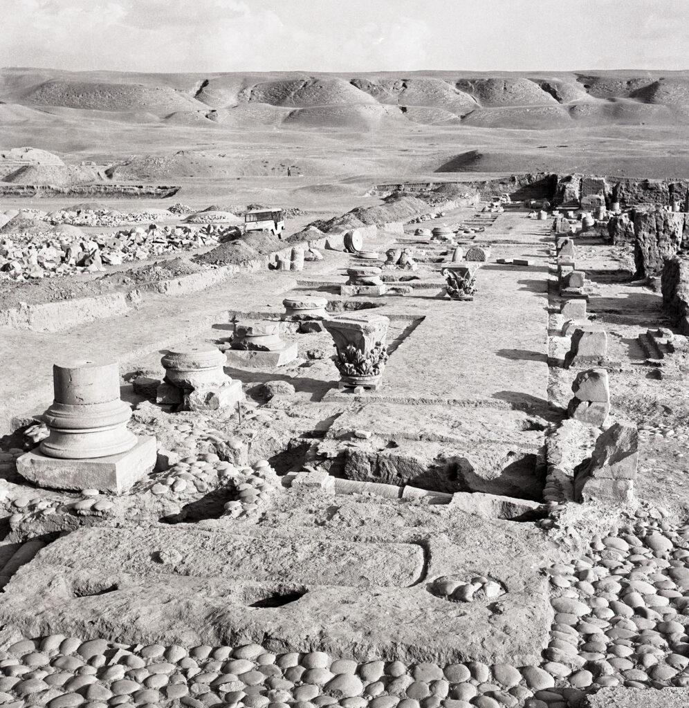

The precise date of Ai-Khanoum‘s initial foundations remains unknown. Interesting enough, Ai-Khanoum was erected some 20 kilometers south of Shortugai, an outpost and trading colony of the very innovative Indus Valley Civilization (also known as “Harappan”) during the late third millennium BC. (see my article here)
Shortugai was built with the typical Indus Valley standardized bricks. Indus Valley Civilization seals have also been found on other sites.

For several centuries Shortugai operated as an exceptional mining site for the extraction of tin, a key component of bronze, gold and the world famous magical blue gems of lapis lazuli used for the tomb of the Egyptian pharaon Toutankhamun and other major religious tombs in Mesopotamia (Iraq).
Shortugai traded with its southern neighbors of Ai-Khanoum and constructed the first irrigation systems in the area, a specialty of the Indus Valley Civilization.
In Ai-Khanoum, several inscriptions were found, along with coins, artifacts, and ceramics including from Indian origin showing the extensive trade relations of the city ! One monument in the heart of the city displayed a stela inscribed in Greek with a long list of maxims embodying the ideals of Greek life. Those were copied from Delphi and ended with:
« In childhood, learn good manners;
in youth, control your passions;
in old age, be of good counsel;
in death, have no regrets. »
Unfortunately, the onset of the Soviet-Afghan War in the late 1970s halted scholarly progress and during the following conflicts in Afghanistan, the site was extensively looted.
The excavations in Ai-Khanoum nevertheless show archaeological evidence of the Greek presence and their peaceful coexistence with the local populations in this region.
Its architecture remains very Greek, but has also integrated various artistic influences and cultural elements which they saw during their travel from the Mediterranean area to Central Asia. For example, they used the Neo-Babylonian and Achaemenid styles – for the construction of their courtyards.
Here are some of the findings of the DAFA, most of them in possession and eventually on display at the National Museum in Kabul.


Surrounded by well-irrigated farmland, the city itself was divided between a lower town and a 60-meter-high (200 ft) acropolis. Although not situated on a major trade route, Ai-Khanoum controlled access to both mining in the Hindu Kush and strategically important choke points. Extensive fortifications, which were continually maintained and improved, surrounded the city.
Trading with India

Ai-Khanoum also became an important trade hub with India. It is a testament to the level of Greek interaction with India and the influence of urban centres such as Ai-Khanoum in the region that even as early as 258 BCE, Ashoka the Great, ruler of the Maurya Empire (the dominant state in India), created the so-called « Kandahar Greek Edict of Ashoka », a bilingual rock inscription written in Greek and Aramaic. Another of Ashoka’s inscriptions near Kandahar was written solely in Greek. The actual content of these edicts also gives a clear indication of the level of exchange between India and the Hellenistic world. In his 13th Edict, Ashoka accurately names all of the rulers in the Hellenistic world at the time of the inscription.

Relations with China

In addition to its interaction with the Indian subcontinent, the Greco-Bactrian Kingdom as a whole would eventually come to develop increasing contacts with a power even further to the East: China.
In the late Second Century BC, Zhang Qian, a Han dynasty diplomat and explorer, arrived in Bactria. His account of his visit to Bactria, including his recollection of his amazement at finding Chinese goods in the markets (acquired via India), as well as his travels in the rest of Central Asia, is preserved in the works of the early Han historian Sima Qian.
Upon returning to China, Zhang Qian informed the Emperor of the sophisticated urban civilisations in Ferghana, Bactria and Parthia. Zhang Qian’s discoveries prompted the Emperor to dispatch Chinese envoys across Central Asia to negotiate and encourage trade with China. Some historians are convinced that « this was the birth of the Silk Road. »

Many of the present ruins of Ai-Khanoum date from the time of Eucratides I (reigned 172–145 BC), who substantially redeveloped the city and who may have renamed it Eucratideia, after himself.
Eucratides I was killed in 145 BC by his son and soon after his death, the Greco-Bactrian kingdom collapsed.
This invasion of Ai-Khanoum was probably carried out by the Iranian Saka tribes of Scythian origin driven south by the nomadic Chinese Yuezhi peoples, who in turn formed a second wave of invaders, in around 130 BC. The treasury complex of the city shows signs of having been plundered in two assaults, fifteen years apart.
According to eye-witness reports, some cities made arrangements with the invaders and organized peaceful co-existence. Urban cities that resisted, such as Ai-Khanoum, were plundered and burned to the ground.
Kushan Empire

Very soon, showing a very interesting process of sedentarization, after the Saka tribes, the Yuezhi themselves took over Bactria and created in the early Ist century the “Kushan Empire” encompassing much of what is now Uzbekistan, Afghanistan, Pakistan, and Northern India and which lasted from around the year 30 AD till its subjugation in 375 AD by the (persian) Kushanshahs, the name used to designate the Kushano-Sasanian Kingdom that established its rule over Bactria over the declining Kushans.
The Kushan empire, which lasted till the end of 300 AD, was a center-point of the Silk Roads. Northern Pakistan and parts of India became part of the kingdom, which extended from Central Asia and Gandhara (Today’s western border of Pakistan) to Pataliputra on the Gangetic plain (today’s India). The main capital of his empire was located at Puruṣapura (today’s Peshawar in Pakistan).

Kanishka the Great was an emperor of the Kushan dynasty, under whose reign (c. 127–150 CE) the empire reached its zenith. He is famous for his military, political, and spiritual achievements. Under his rule, the Kushan Empire exchanged ambassadors with the Roman Emperor Marcus Aurelius (161-180) and the Han Emperor of China. He had had diplomatic contacts with Sassanian Persia and the Kingdom of Aksum (today’s Yemen and Saudi Arabia).
So while initially the Kushan dynasty followed Greek cultural ideas and iconography after the Greco-Bactrian tradition, they gradually developed their own.
For example, while initially they kept the Greek language for administrative purposes but in 127 AD, Kanisha replaced Greek with Bactrian, an Iranian language written in Greek letters, as the official language of administration in the empire.
In the domain of religion, the Kushans, which initially were attracted by Hinduism, would play a major role in the transmission of Mahayana Buddhism from Gandhara across the Karakoram range to China, Central Asia and even Sri Lanka, favoring the overall expansion of the Silk Road.
All of these factors ushered in a period of relative peace for 200 years, sometimes described as “Pax Kushana”.
From the middle of the 3rd century AD, the weakened Kushan kingdom began to disintegrate. In its western part, it came under the control of the (persian) Sassanids, gradually supplanted in the north by the Hephtalites (Called the « White » or « Iranian Huns ») from the Central Asian steppe.
Buddhism nevertheless enjoyed a period of great prosperity, as illustrated by the descriptions of the VIIth century Chinese monk Xuanzang and the construction of the giant buddha statues of the Bamiyan Valley in Afghanistan.
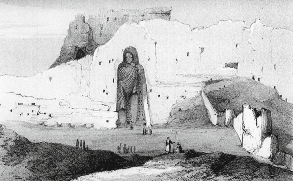
Islam
After conquering Iran, Islam penetrated Afghanistan from the north. There is no evidence of mass rejection of the new religion, except in isolated areas. However, the desire to remain independent from the governors appointed by Damascus and then Baghdad soon became apparent. It was even from a province covering part of northern Afghanistan, Khorasan, that part of an insurrection spread against the Umayyad to replace them with the more humanist Abbasid Caliphate of Harun-al-Rachid and the creation of Baghdad (see my article here)
From the end of the Xth century, a dynasty of Turkish origin, the Ghaznevids, built a vast sultanate around their capital Ghazni, extending as far as India and establishing a long-lasting Muslim community.


Their cultural influence can be measured by the beauty of the architecture they left us, but also by the patronage they gave to the great poet Ferdowsi (940-1025), to whom we owe the great Persian-language national epic Shahnameh: The Book of Kings.
The Ghaznevids were followed by a new dynasty, the Ghorids, from the central Hindu Kush. It was to them that we owe Jam’s “Minaret”.
Much of this rich cultural heritage, which laid the foundations of their identity and gave dignity to the Afghan people, has been ignored, destroyed in successive wars, looted and plundered.
ISIS, Daech and other terrorist groups, some of them backed by certain western intelligence agencies, currently being eliminated by the Afghan government, have engaged in industrial plunder using their loot as a source of income.
Recommandations
Today, the time is ripe for a new beginning. Afghanistan can completely change its image in the world, which currently has been polluted by adversaries and enemies that want to keep Afghanistan a zone of non-development for their own new geopolitical Great Game.
My proposal to renew Afghanistan’s contribution to world culture is simple.
Mes Aynak, meaning “Little Mine”, 35 km south of Kabul, is in reality the world’s second largest copper reserve. While China and other BRICS countries need copper for industrial development, the mine could generate a substantial income which Afghanistan urgently requires to rebuild the country.
On May 25, 2008, Ibrahim Adel, Minister of Mines, and Shen Heting, general manager of MCC, the MCC-Jiangxi Copper MJAM consortium’s majority stakeholder, signed the Mes Aynak mining contract. The contract described the conditions for the first major mining project andbiggest foreign investment in Afghanistan.
However, after security incidents created major insecurity problems, and pressured by foreign powers, the project was stalled.

Archeological remains of Buddhist complex in Mes Aynak copper mine.
Paradoxically, this gave archeologists the time to unearth on the mining site an area of 40 ha of exceptional world class cultural value, mainly a vast complex of buddhist monasteries, including stupas (temples), murals, sculptures and hundreds of archeological artifacts, and more.
Even if the contract (pdf file) might have been modified since 2008, one cannot but note that the initial contract contains a series of potentially very interesting aspects, both for China but mainly for Afghanistan itself.
- SMELTER
Just as Bolivia doesn’t want to export lithium (as a raw material) but batteries (a finished transformed product with high added value), Afghanistan doesn’t want to export copper ore but copper metal. To achieve that aim, the contract plans to build a smelter on the site Part IV, 33: « In order to fulfill its commitment to the Government to fund, construct and operate a smelter in Afghanistan, MCC has requested that the Government provide access to deposits of phosphats, limestone and quartz for MCC’s use in the Aynak Project. » - LOCAL PURCHASING
Part VII, 38: « MCC shall use its best efforts to purchase goods and services in Afghanistan if they are available. » - LOCAL WORKFORCE
Part VIII, 39, a : « MCC shall employ Afghan personnel, to the maximum extent practicable. » - WATER
Part IV, 32: « MCC has made a commitment to the Government to construct water supply wells and pipeline systems … to supply the project’s fresh water requirements. MCC has also committed to reuse and re-circulate process water to the extent possible. » - POWER SUPPLY
Part IV, 31: « MCC has made a commitment to the Ministry of Mines to construct … one 400 megawatt capacity coal fired plant to supply electrical power to the project and to Kabul. » - RAILWAY
Part IV, 30: « MCC has committed to construct a railway associated with the project ». - HOUSING
Part IV, 24: « MCC shall provide housing facilities of sufficient quality and quantity for its employees and their immediate families at a reasonable rental rate. » - MEDICAL FACILITIES
Part IV, 25: « MCC shall furnish free medical care and attention to all its employees and families of employees … and shall establish, staff and maintain sufficient dispensary, clinic and hospital facilities … » - SCHOOLS
Part IV, 26: « MCC shall provide, free of charge, adequate primary and secondary school education for the children of all employees and residents in the area surrounding Aynak. » - ENTERTAINMENT AND SHOPPING
Part IV, 27: « MCC shall construct and fund the operation of adequate recreational activity centers such as gymnasiums and sport fields. … In addition, it shall construct a market/shopping area. » - RELIGION
Part IV, 28: MCC shall « respect and protect the religious belief of the Afghan people. »
The world would be stunned if Afghanistan would mobilize its best architects and city builders and make the new city under construction in Mes Aynak « The Aï Khanoum of the XXIst Century ». Let’s think about it.
According to a senior field archeologist who worked on the site for a decade, following intense discussions last October between the Afghan authorities and the Chinese company, big progress has been made. As of now, he says, both are fully committed to preserve the entire historical remains on the surface and not only a small part. While the contract planned to do « open-pit » mining in the western part and only wanted to preserve the central part with the Buddhist stupas (temples), from now on, says this highly credible source, the entire site will be mined by (more expensive) underground mining exploitation techniques that will leave the surface historical remains untouched.
If the world discovers the remains of the Mes Aynak buddhist monasteries are saved, Afghanistan’s image in the world will change. In a second period, it might become much easier to consider the reconstruction of the Bamiyan giant buddha statues, one of 55 meters and the other of 38 meters, destroyed in 2001.
It has been scientifically demonstrated by several experts speaking at conferences of UNESCO that this is not a technical problem and relatively easy to accomplish. The so-called “danger” that the sculptures would be considered as “fake” makes no sense, as long as the intention to reach a higher good by their reconstruction is real.
The 2017 “Technical Proposal for Revitalizing the Bamiyan Buddha Statues”, by the department of architecture of the Japanese Mukogawa Women’s University should be studied. It needs to be improved but it has the merit to exist. One should not forget that 620 million Buddhists in the world consider Bamiyan as a part of their own culture and might consider coming to Afghanistan to visit the site.

If Afghanistan would make it clear to the world it has decided to bolster its economic and mining activities but in the same time will protect at all cost and, in this case, with generous Chinese help, the world’s cultural heritage on its soil, it would underline its willingness to act as a force of good, tolerance and peace in the world, in coherence with its own identity and history.
An Afghan economic and cultural « miracle » would impress the world as much as Buddha in the story of the Greek influenced Buddha statue found north of Kabul in 1965.
Called the « Fire Buddha » (IInd-IIIrd Century) it represents Buddha’s response to a challenge from heretics that he could not perform miracles.
Known as « The Twin miracles », flames emanated from his shoulders and water poured from his feet, demonstrating his pre-eminence. By alternating both currents (fire and water), a wonderful rainbow appeared and convinced the heretics this man definitely was kind of special.
Today, in a simular miracle, by boosting its energy production and smart water management, Afghanistan will demonstrate its spiritual strength !
Thank You,
Rembrandt and the Light of Agapè
Rembrandt Harmenszoon van Rijn. Don’t count on me here to tell his story in a few lines! (*1) In any case, since the romantics, all, and nearly to much has been said and written about the rediscovered Dutch master of light inelegantly thrown into darkness by the barbarians of neo-classicism.
By Karel Vereycken, June 2001.
The uneasy task that imparts me here is like that of Apelles of Cos, the Greek painter who, when challenged, painted a line evermore thinner than the abysmal line painted by his rival. In order to draw that line, tracing the horizons of the political and philosophical battles who raged that epoch will unveil new and surprising angles throwing unusual light on the genius of our painter-philosopher.
First, we will show that Rembrandt (1606-1669) was « the painter of the Thirty years War » (1618-1648), a terrible continental conflict unfolding during a major part of his life, challenging his philosophical, religious and political commitment in favor of peace and unity of mankind.
Secondly, we will inquire into the origin of that commitment and worldview. Did Rembrandt met the person and ideas of the Czech humanist Jan Amos Komensky (« Comenius ») (1592-1670), one of the organizers of the revolt of Bohemia? This militant for peace, predecessor of Leibniz in the domain of pansophia (universal wisdom), traveled regularly to the Netherlands where he settled definitively in 1656. A strong communion of ideas seems to unite the painter with the great Moravian pedagogue.
Also, isn’t it astonishing that the treaties of Westphalia, who put an end to the atrocious war, are precisely based on the notions of repentance and pardon so dear to Comenius and sublimely evoked in Rembrandt’s art?
Finally, we will dramatize the subject matter by sketching the stark contrast opposing Rembrandt’s oeuvre with that of one of the major war propagandist: (Sir) Peter Paul Rubens (1577-1640).
Rembrandt, who finished rejecting any quest for earthly glory could not but paint his work away from that of the fashion-styled Flemish courtier painter. Moreover, Rubens was in high gear mobilizing all his virtuoso energy in support of the oligarchy whose Counter Reformation crusades and Jesuitical fanaticism were engulfing the continent with gallows, fire and innocent blood.
What Rembrandt advises us for his painting also applies to his life: if you stick your head to close to the canvass, the toxic odors will sharply irritate your nose and eyes. But taking some distance will permit you to discover sublime and unforgettable beauty.
What Art?
Since the triumph of Immanuel Kant‘s modernist thesis, the Critique of the Faculty of Judgment, it has not been « politically correct » to assert that art has a political dimension. And with good reason! If art can influence the course of history and shape it through its power, it is because it is a vector of ideas! An impossibility, according to the Kantian thesis, because art is a gratuitous act, free of everything, including meaning. The ultimate freedom! You either like it or you don’t, it’s all a matter of taste.
Following in the footsteps of the German poet Friedrich Schiller, we’re here to convince you otherwise, and abolish the tyranny of taste. For us, art is an eminently political act, although the work of art has nothing in common with a mere political manifesto, and the artist can in no way be reduced to an ordinary « activist ».
His domain, that of the poet, the musician or the visual artist, is to be a guide for mankind. To enable people to identify within themselves what makes them human, i.e. to strengthen that part of their soul, of their divine creativity, which places them entirely at the zenith of their responsibility for the whole of creation.
To achieve this, and we’ll develop this here, what counts in art is the type of conception of love it communicates. By making this « universal » sensitive, sublime art makes the most elevated conception of love accessible.
Such art, which forces us think, employs enigmas, ambiguities, metaphores and ironies to give us access to the idea beyond the visible. For art that limits itself to theatricality and the beauty of form fatally sinks into erotic, romantic love, depriving man of his humanity and therefore of his revolutionary power.
Rubens will be the ambassador of the great un-powers of his time: the glory of the empire and the magnificent financial strength of those days « new economy », the « tulip bubble ». In short, the oligarchy.
Rembrandt, in turn, will be the ambassador of the have-nots: the weak, the sick, the humiliated, the refugees; he will live in the image of the living Christ as the ambassador of humanity. It might seem strange to you to call such a man the « the painter of the thirty years war. »
Paradoxically, his historical period underscores the fact that very often mankind only wakes up and mobilizes its best resources for genius when confronted with the terrible menace of extinction. Today, when the Cheney’s, the Rumsfeld’s and the Kissinger’s want to plunge the world into a « post-Westphalian epoch », in reality a new dark age of « perpetual war », Rembrandt will be one of our powerful weapons of mass education.
Historical context and the origins of the war
Before entering Rembrandt, it is indispensable to know what was at stake those days. The academic name « Thirty Years War » indicates only the last period of a far longer period of « religious » conflict which was taking place around the globe during the sixteenth century, mainly centered in central Europe, on the territory of today’s Germany.
While 1618 refers to the revolt of Bohemia, the 1648 peace of Westphalia defines a reality far beyond the apparent religious pretext: the utter ruin of the utopian imperial dream of Habsburg and the birth of modern Europe composed of nation-states (*2)
On the reasons for « religious » warfare, let us look at the first half of the sixteenth century. At the eighteen years long Council of Trent (1545-1563), the Roman Catholic Church discarded stubbornly all the wise advise given earlier to avoid all conflict by one of its most ardent, but most critical supporters: Erasmus of Rotterdam.
As Erasmus forewarned, by choosing as main adversary the radical anti-semite demagogue Martin Luther, the church degraded itself to sterile and intolerant dogmatism, opening each day new highways for « the Reformation ».
The religious power-sharing of the « Peace of Augsburg » of 1555, between Rome and the protestant princes, temporarily calmed down the situation, but the ambiguous terms of that treaty incorporated all the germs of the new conflicts to come. Note that « freedom of religion » meant above all « freedom of possession ». The « peace » solely applied to Catholics and Lutherans, authorizing both to possess churches and territories, while ostracizing all the others, very often abusively labeled « Calvinists ».
Playing diabolically on internal divisions, some evil Jesuits of those days set up Calvinists and Lutherans to combat each other bitterly, by claiming, for example in Germany, that Calvinism was illegal since not explicitly mentioned in the treaty. Furthermore, the citizen obtained no real freedom of religion; he was simply authorized to leave the country or adopt the confessions of his respective lord or prince, which in turn could freely choose.
As a result of a general climate of suspicion, the protestant princes created in 1608 the « Evangelical Union » under the direction of the palatine elector Frederic V. Their eyes and hopes were turned on King Henri IV‘s France, where the Edit of Nantes and other treaties had ended a far long era of religious wars. After Henry IV‘s assassination in 1610, the Evangelical Union forged an alliance with Sweden and England.
The answer of the Catholic side, was the formation in 1609 of a « Holy League » allied with Habsburg’s Spain by Maximilian of Bavaria. Beyond all the religious and political labels, a real war party is created on both sides and the heavy clouds carrying the coming tempest threw their menacing shadows on a sharply divided Europe.
1618: The Revolt of Bohemia
Hence, after the never-ending revolt of the Netherlands, the very idea of an insurrection of Bohemia drove the Habsburgs (and the slave trading Fugger and Welser banking empires controlling them) into total hysteria, since they felt the heath on their plans. If Bohemia would become « a new, but larger Holland », then many other nations, such as Poland, could join the Reformation camp and destabilize the imperial geopolitical power balance forever.
As from 1576, the crown of Bohemia was in the hands of the Catholic Rudolphe II, Holy Roman Emperor. Despite a far-fetched passion for esotericism, Rudolphe II will be the protector of astronomers Tycho Brahe and Johannes Kepler in Prague.
In 1609, the Protestants of Bohemia obtain from him a « Letter of Majesty » offering them certain rights in terms of religion. After his death in 1612, his brother Matthias, Holy Roman Emperor, became his successor and left the direction of the country to cardinal Melchior Klesl, a radical Counter Reformation militant refusing any application of the « letter of majesty ».
This set the conditions for the famous « defenestration of Prague », when two representatives of the imperial power were thrown out of the window and fall on a manure heap, at the end of hot diplomatic negotiations. That highly symbolical act was in reality the first signal for a general uprising, and following the early death of Matthias, the rebels made Frederic V their sovereign instead of accepting Habsburg’s choice.
Charles Zerotina, a protestant nobleman and Comenius, (see box below), a Moravian reverend and respected community leader, masterminded that revolt. Frederic V, for example was crowned in 1619 by Jan Cyrill, who was Zerotina’s confessor, and whose daughter will become Comenius wife.
The insurgents were defeated at the battle of White Mountain, close to Prague, in 1620 by a Catholic coalition, composed of Spanish troops pulled out of Flanders together with Maximilian’s Bavarians. On the scene: French philosopher René Descartes, who paid his own trip and who was part of the war coalition and joined in entering defeated Prague in search for Kepler’s astronomical instruments… (*3)
An arrest warrant immediately targeted Comenius, who escaped with Zerotina from bloody repression. Protestantism was forbidden and the Czech language replaced by German.
Most resistance leaders were arrested and 27 beheaded in public. Their heads were put up on pins and shown on the roof of Prague’s Saint-Charles bridge.
One of them was the famous Jan Jessenius, head of the University of Prague who performed one of Europe’s early public anatomical dissections in 1600 and was a close friend of Tycho Brahe. To warn those who used their speech to encourage « heresy », his tongue was pulled out before he was beheaded, quartered and impaled.
Thirty thousand people went into exile while Frederic V and his court took refuge in Den Haag in the Netherlands. There, but years before, Comenius had a personal encouter with the future « Winterkönig » and his wife Elisabeth Stuart, on their way back from their wedding in England for which Shakespeare had arranged a representation of « The Tempest ».
A World War
1618 marked the outbreak of an all-out war across Europe, provoked by the imperial drive of Habsburg to reunify all of the continent behind one unique emperor and one single religion.
As of 1625, aided by French and English financial facilities, Christian IV of Denmark and Gustave Adolphus of Sweden intervened on the northern flank against Habsburg descending from the north as far as up till Munich.
Then, France opened another flank on the western front in 1635. Catholic cardinal Richelieu, who defeated the Huguenots at LaRochelle in 1628 (since he « fought their political rights but not their religious ones », will heavily aid the Protestant camp. His fears were that,
« if the protestant party is completely in shambles, the offensive of the house of Austria will come down on France ».
The famous etchings of the Lorraine engraver Jacques Callot, « Misery and calamities of war » of 1633, give an idea how this savage war swept Europe with its cortège of misery, famine, epidemics and desolation.
The estimated population loss on the territory of present day Germany indicates a downturn from 15 to less than 10 million. Hundreds of cities were turned back into simple villages and thousands of communities simply disappeared from the map.
War affected all the colonies of those powers involved in the conflict. Dutch and English pirates would sink any Spanish or Portuguese ships encountered at the other edge of the Earth’s curve. For Spain, loyal pillar of Habsburg, 250 million ducats were spent for the war effort (between 1568 and 1654), despite the state bankruptcy of 1575. That amount represents more than the double of the revenue from the loot of the new world (gold, spices, slaves, etc.) which scarcely amounted only to 121 million ducats…
Rembrandt and Comenius
That the young Rembrandt was totally heckled by the situation of general war which was shaking up Europe is easily visible in the early self-portrait of Nuremberg.
Here he portrays himself divided between two choices. One shoulder reveals the gorget, a piece of armor that invokes the patriotic call for serving the nation calling on every young Dutchman of his generation in age of serving the military, especially after the surprise attack of the Spanish troops on Amersfoort of august 1629.
The other shoulder is nonchalantly caressed by a « liefdelok », the French « cadenette » or lovelock exhibited by amorous adolescents. What to choose? Love the nation, or the beloved?
More and more irritated by the ambitions of Constantijn Huygens, the powerful secretary of the stadholder which got him well-paid orders for the government and made him move from Leiden to Amsterdam, Rembrandt’s thinking and activity gets ever more concentrated and powerful.
Ten years later, the dying away of his wife Saskia in 1642, year of the « Night watch », plunges the painter into a deep personnal existential crisis. Gone, the self-portraits where he paints himself as an Italian courtier, with a glove in one hand carrying a heavy golden chain around his neck fronting for his social status and competing with the court. Suddenly he seems to realize that the totality of the world’s gold will never buy back the lost lives of those once loved.
When interrogated on the matter, Rembrandt would bluntly state he didn’t need to go to Italy, as the tradition used to be, since everything Italy ever produced came to him anyway as it was available in one form or another on the Amsterdam art market. But traveler he was, as drawings of the gates of London indicate, done in the early forties, maybe the year Comenius crossed the channel?
In 1644, the neo-Platonist rabbi and teacher of Spinoza, Menasseh Ben Israel, for which Rembrandt illustrated books, received a letter from Comenius agent John Dury, chaplain of Mary Princess of Orange, starting a discussion on the reintegration of the Jews in England, and Menasseh finally went for negotiations to meet Cromwell in 1655.
The Nightly Conspiracy
Although some timid hypothesis’ exists concerning Comenius‘ influence on Rembrandt, a rigorous historian’s research could certainly bring more light on this matter.
Although Rembrandt’s worldview evolved in an environment of the Mennonite community, peace-loving Anabaptists miles away from any political commitment, Rembrandt’s passion for the « cause of Bohemia » seems particularly striking in « The nightly conspiracy of Claudius Civilus at the Schakerbos ».
The large painting figured as one in a series planned to decorate the new Amsterdam city hall to celebrate the revolt of the Batavians against the Romans. Starting from historical elements of Tacitus, the story had been cooked up to warm up Dutch patriotism since the reference to Spanish tyranny was clear to all. For reasons unknown today, Rembrandt’s painting was taken down after a couple of months. To mock the cowardice of the ruling elites, Rembrandt seems to have transposed the historical scene into his present timeframe.
One Swedish historian thinks that the leader of the conspiracy here is not Claudius Civilis (the Batavian general who lost an eye in battle), but another general who equally lost an eye in battle and which was non-other than the Hussite general Jan Zizka! (*4).
Remember that Comenius and the revolt of Bohemia strongly identified with John Huss. Looking closely makes you discover that Rembrandt’s Claudius Civilis is indeed dressed up in central European costume. From left to right one sees first a Dutch patrician. Is this a portrait of the then rising republican Jan De Wit?
Next, one sees a monk, without weapons, who poses his hand on Civilus’ arm in a conspiratorial gesture. Is this Comenius resistance movement, the Unity of the Brethren?
According to the historians, the two chalices, one wide, the other narrow, could signify the « Eucharist under the two species », namely that bread and wine be shared with all, which happened to be one of the demands of the Jan Hus tradition.
One also can identify a Jew or rabbi taking place in the conspiracy. Looks pretty weird for a simple Batavian conspiracy! That the establishment was unhappy to see their hero painted as an ugly Cyclops seems probable.
But to be challenged in their flight forward into pompous fantasy in stead of taking up the urgent tasks of their time was another one.
King of Swedish Steel, Louis De Geer
Comenius arrives in Amsterdam on invitation of the de Geer family in 1656, the year of Rembrandt’s bankruptcy (*5).
Louis de Geer, alias « the Steel King » and his son Laurent were the life-long protectors of Comenius for whom they paid the funeral and even build a chapel in the city of Naarden, some miles outside Amsterdam.
Originally from Luik (Liège) in today’s Belgium, that uncompromising Calvinist family settled in Amsterdam. It was the de Geer family who led the foundations of Sweden’s industrial flowering of iron, steel and copper . To do this, de Geer brought three hundred families of Walloon steelworkers to Sweden, and for whom he build hospitals, schools, housing projects and commercial facilities.
De Geer also financed the scottish preacher John Dury and the « intelligencer » Samuel Hartlib, two active friends of Comenius in England. At war with the Royal Society and Francis Bacon, they wanted to render scientific knowledge available to all of the population.
John Milton’s treatise On Education was dedicated to the same Samuel Hartlib. Louis de Geer and Sweden’s prime Minister Johan Skytte, realized Comenius education projects were the best of all possible investment to foster the physical economy. His educational reforms created a labor force of such an exceptional quality and astonishing productivity, that they warmly invited him to Sweden and asked him to reform the nation’s educational system.
That relationship of Comenius with the de Geer family leads us to Rembrandt, since Louis de Geer’s sister, Marghareta, and her husband Jacob Trip, one of the major shareholders of the Swedish copper mines, had their portrait done by Rembrandt, offering him a well paid order during very difficult years.
The City of Amsterdam allotted Comenius a yearly pension, encouraged him to publish his complete works on pedagogy and offered him the keys of the city library. Comenius brought over his family and assistants and installed a library and a printing shop behind the Westerkerk where Rembrandt will be buried.
Comenius, when going every day from his house to his printing shop crossed the street where Rembrandt lived his last days. Since early this century, Czech curators got convinced that Rembrandt’s Portrait of an old man at the Uffizi Gallery in Florence, is in reality a portrait of Comenius (*6).

True or not, one has to realize that Rembrandt demanded to each of his models to sit each day for four hours over a period of three months to paint their portrait, a thing maybe not so evident for the aging Comenius.
But what is known with certainty is the fact that one of Rembrandt’s pupils, Juriaen Ovens, painted Comenius portrait during that period.
The Peace of Westphalia and the « Via Lucis »
Although Bohemia did not gain its long-desired independence at the peace of Westphalia, one cannot underestimate Comenius influence on the negotiations leading to the establishment of the peace-treaty. His work, Cesta Pokoje (Road to peace) of 1630, written in Czech is described as,
« an ethical-religious writing in which love, faith and mutual comprehension are established as the single ethical foundations of a possible peace ».
From 1641 to 1642, right before the start of the first peace negotiations, Comenius wrote the Via Lucis (The path of light), which could have been used as a guiding memorandum for the negotiators.
At the question if this Via Lucis was a millenarist mystical vision, as has been often pretended, we can consider the following.
Asked what could be hoped for and when a major change could take place, Comenius answered that the hope would come with the arrival of a time where the Gospel of the Kingdom would be preached all over the world and universal peace established.
That change could arise as the result of the emergence of a light to which will turn not only the Christian, but all the people of the world.
That light will come, « from the combination of the lanterns of human conscience, of a rational consideration of the works of God or of nature, and from the law or divine will ».
For him, « human enterprise can, through prayer and considerations of pious men imagine the possible ways to unite these rays of light, to irradiate them on the entirety of the human species and to spill similar thoughts in the minds of others » (*7).
One identifies exactly that concept in an etching of Rembrandt that Goethe awkwardly used by having it copied as frontispiece for his Faust in 1790 (*8).
The subject here is not at all a man going along to get along with the devil, but light (mirror of Christ) enlightening the life and the mind of the mortals. Way before Voltaire and opposed to the Venetian illuminati, Comenius and Rembrandt made own the metaphor of light.
To get an even more precise idea of Comenius demands for peace, one can read another memorandum called Angelus Pacis (The peace-angel),
« send to the English and Dutch peace Ambassadors at Breda, a writing designated to be sent afterwards to all the Christians of Europe and then to all the nations of the world in order to stop them, that they cease fighting each other ».
Comenius first remarks laconically that England and Holland are morally so degraded that they even don’t need some spiritual difference as a pretext, but fight each other for purely material possessions! As a way out, he proposes a new friendship:
« But how do you conceive that new friendship (or rather reestablishment of your friendship)? Will it be not by the general pardon that you will allow each other? The wise men have always seen the oblivion of received injuries as the surest road leading to peace. Touching too rudely the wounds, is to revivify the pains and to furnish the wounds an occasion for irritation.
« When this is true, it would be to be wished that the river Aa, whose tranquil waters irrigate Breda, would turn for this hour into the river Lethe of which the poets tell us that whoever drinks their water forgets everything of the past.
« The one who is guilty of trouble, God will find him, even when men, for love of peace, spare him. That the just one starts accusing himself; that means that the one whose conscience accuses him of having broken the friendship and witnessed enmity, should, according to justice, be the first one and the most ardent to reestablish friendship. If the offended party neglects that duty of justice, it will be the honor of the offended party to assume that honorable role, according to the word of the philosopher. » (*9)
COMENIUS: TEACH EVERYTHING TO ALL AND EVERYONE
Jan Amos Komensky (« Comenius ») (1592-1670) was above all a militant teacher, practicing « the universal art of teaching everything to everybody » (pan-sophia) and reckless source of inspiring enthusiasm.
One year after his death in 1670, Leibniz wrote of him: « time will come, Comenius, that honors will be offered to your works, to your hopes and even to the objects of your desires ».
In some domains, indeed, Comenius was Leibniz‘s precursor. First, he fought the fossilization of thought resulting from the dominant Aristotelianism: « Little time after that unification between Christ and Aristotle, the church fell into a pitiable state and became filled with the uproar of theological dispute ».
Strong defender of the free will that he didn’t see entirely in contradiction with an Augustinianconcept of predestination, he felt closer to John Huss than to Calvin, while generally labeled a « Calvinist » by historians.
In 1608, Comenius enters the Latin School of Prérov (Moravia), a school reorganized at the demand of Charles Zerotina on the model of the Calvinist school of Sankt-Gall in Switzerland. Zerotina was one of the key figures of the Bohemian nobility, promoter of the Church of Unity of Brethren, organizer of popular education and key leader of the international anti-Habsburg resistance. For example, in 1589 he lends a considerable amount of money to the French King Henri IV, which he meets in Rouen, France, in 1593 in support of ending the religious wars with the the Spanish.
Henri IV’s conversion to Catholicism (« Paris is worth a mass ») ruined Zerotina’s hope to reproach the Unity of Brethren with the French Huguenots. Befriended with Theodore de Bèze, which he met regularly when studying in Basel and Geneva, Zerotina sent Comenius to study at the Herborn University in Nassau. That University was founded in 1584 by Louis of Nassau, brother of William the Silent, the leader of the revolt of the Netherlands against Habsburg’s Spain. Louis of Nassau, a key international coordinator of the revolt was in permanent contact with the humanist Huguenot leader Gaspard de Coligny in France and with Walsingham, the chancellor of England’s Queen Elisabeth Ist.
Together with Zerotina, Comenius unleashed the revolt of Bohemia of 1618. After spending some time with the guerrilla forces for which he drew a map of Moravia, Comenius went into exile, as bishop of his church, the « Unity Brethren of Bohemia ».
Till his death, he was the soul of the Bohemian resistance, the gray eminence of the Diaspora and the guardian that prevented the Czech language from disappearing, since it was replaced by German in Bohemia. Since wars are only possible if large parts of the population remain uneducated, for Comenius education became the leading edge to fight for Peace.
Opposed to the Jesuit educators who consolidated their own power by education the elites only, Comenius, starting from his conviction that every individual is made in the living image of God, elaborated with great passion a very high level curriculum, which he wanted accessible to all, as he develops this in his « The Great Didactic » (1638).
Following the advice of Erasmus and Vivès, Comenius abolishes corporal punishment and decides to bring boys and girls in the same class. With him, a school needs to be available in every village, free of cost and open to everybody.
Breaking the division between intellectual and manual work, the schools were part-time technical workshops, anticipating France’s Ecole Polytechnique and the Arts et Metiers (technical school to perfect working people), completely oriented towards the joy of discovery. Leibniz idea of academies originated in Comenius’ schools and societies of friends.
For him, as for Leibniz, the body of physics couldn’t walk without the legs of metaphysics. Integrating that transcendence, he strongly rejected the very idea that nature was reducible to a mere aggregate defined by formal laws, and he adamantly lambasted Bacon, Galileo and Descartes for doing so. In stead, nature has to be looked to as a dynamic process defined by the becoming. That becoming is not repetitive, but permanent progression and potentialization: nature has a quality of development, tending towards self-accomplishment and harmony.
He was severely attacked by Descartes’ « Judgment of the Pansophical works » and mocked by Voltaire, who made him appear as Candide‘s naive philosophy teacher « Pangloss ».
Founder of modern pedagogy, he realized children are beings of affection, before becoming beings of reason. Up till those days, ignorant children were often seen as possessed by the devil, a devil which had to be beaten out of them. The French cardinal Pierre de Bérulle, founder of the Oratorians, reflected that mindset when he wrote that « infancy is the most vile and abject state of man’s nature after that of death ».
To make knowledge accessible to all, Comenius revolutionized the dogmas of that educational approach. In well-ordered classrooms, beautifully decorated with maps, classes would last only one hour covering all the domains one fiends in an engraving of Comenius: theology, manual works, music, astronomy, geometry, botany, printing, construction, painting and sculpture.
Comenius taught Latin, but was strongly convinced that every pupil had to master first his mother tongue. That was a total revolution, since up till then, Latin was taught in Latin, and to bad for those who didn’t understand already !
He also will also re-introduce illustrated textbooks (« The sensible world in images »)(1653), which had been stupidly banned from schools to « not invite the senses to disturb the intellect ». For Comenius, images have the same role as a telescope, displacing the field of perception beyond immediate limits.
His ideas, and especially the rapid successes of schools adopting his pedagogy attracted all of Europe and beyond. In 1642, Comenius was hired by Johan Skytte, the influential chancellor of the University of Uppsala, to reorganize the Swedish education system according to his principles. Skytte, an erudite Platonist inspired by Erasmus, will be Gustaphe Adolph’s preceptor and his son Bengt Skytte will be an influential teacher of Leibniz.
Before that job, Comenius discarded a similar offer originating from Richelieu of France and the offer that came from John Winthrop Junior from the United States who offered Comenius to preside Harvard University, newly founded in the Massachussetts Bay Colony of America.
Rembrandt and Forgiveness
To express in art that precise moment where love gives birth to pardon and repentance will be precisely one of Rembrandt’s favorite subjects. The fact that he choose the name Titus for his son, after the roman emperor who supposedly had showed great clemency toward the early Christians, demonstrates that point. But Titus was also the name of a bishop of Creta who was a close collaborator of Apostle Paul.
Rembrandt was fascinated by the figure of Saint-Paul, who used to be after all a roman officer who, through his conversion, showed the possible transformation of each individual for the better, capable of becoming a militant for the good.
Rembrandt’s self-portrait of the Rijksmuseum, with the famous « ghost-image » of a badly lit dagger nearly planted his breast supposedly represent him as Saint-Paul, traditionally represented defending Christian faith with the scripture in one hand and the sword in the other.
The bible in the armored hand do appear in that painting, but the sword here seems more as a dagger, suggesting an eventual reference to the name given by Erasmus to his Christian’s manual, the « Enchiridion » after the Greek word egkheiridion (dagger).
The Prodigal Son
In one of Rembrandt’s late works, the « Return of the prodigal son », despite the fact that the work was completed by a pupil, we see how profoundly he dealt with precisely that subject. The expressiveness of the figures is amplified by the nearly life-size representation on the wide canvas (262 x 205 cm).
The father’s eyes, plunged in interior vision, look yonder the small passage by which the son hasarrived, as doubting of the happiness that overwhelms him, since his son « who was dead », « came back to life ».
The son, who installs his convicts head on the father’s abdomen, engages in the act of total repentance. The naked foot who leaves behind the rotten shoe, communicates in a metaphorical way that sinners deed of repentance, offering what he has inside. The father embraces his son by putting his pardoning hands on his shoulders, while the jealous brothers stand by wondering and enraged why so much love is given to the son « who had spoiled the fathers good with prostitutes ».
Three observations indicate Comenius person and thought might have inspired this work.
First, according to all available portraits, the face of the father shows heavy resemblance with the treats of Comenius himself, a well known militant for peace based on repentance and pardon which Rembrandt probably met frequently during that period.
Second, and after a second look, the son doesn’t look European at all, but actually Negroid, which would add to the painting some critical thoughts on the widely practiced slavery of the European powers of those days.
To conclude, one could interpret the parable of the prodigal son in a much larger sense: is this not man itself, son of God, who returns to his father after having wandered on the roads of sin? Comenius, after a moment of nearly total desperation uses that same image in his book The labyrinth of the world and the paradise of the hearth (1623).
Similar to the image employed by the Dutch painter Hieronymous Bosch, in his « ambulant salesman », man gets lost in the multiplicity of the world that leads him to self-destruction, but after a crisis decides to regain divine unity.
In order to add still another dimension to the discussion on the quality of love involved in art, it is useful to contrast our master with the works of the most talented belonging to the tradition of his detractors: Peter-Paul Rubens.
Rembrandt, Rubens and other Philistines
But before investigating Rubens, it is appropriate to consider the following. Despite the fact that Rembrandt came out of the immense intellectual ferment of the late sixteenth century University of Leiden, one of the cradle’s of humanism, one cannot escape the fact that his lashing career would have infatuated many.
Remember, Constantijn Huygens « discovered Rembrandt » in 1629, while still a young millers son running a small boutique with Jan Lievens, asking them to come to Amsterdam and work for the government. (*10).
Rembrandt’s « patron » nevertheless would write without blushing in his diary Mijn Jeugd (my youth) that Peter Paul Rubens, the Flemish baroque painter was « one of the seven marvels of the world ».
Rubens was, before everything else, the talented standard bearer of the « enemy » Counterreformation and its Jesuits army, whose admiration made Rembrandt totally uncomfortable. How could this virtuoso painter be seen as the brightest star on the firmament of painting? According to some, Huygens was looking for « a Dutch Rubens », capable of making shine the « elites » of the nation.
Rembrandt at one point got so irritated with Huygens’ shortsightedness that he
offered him a large painting called Samson blinded by the Philistines. The work, a pastiche of the violent style, painted « à la Rubens », shows roman soldiers gouging out Samson’s eye with a dagger. Did Rembrandt suggest that his Republic (the strong giant) and its representatives were blinded by their own philistinism?
When a little Page becomes a great Leporello
Rembrandt perfectly translates the feeling of revulsion any honest Dutch patriot would have felt in front of Rubens. Had the Dutch elites already forgotten that Peter Paul’s father, Jan Rubens, once a Calvinist city councilor of Antwerp close to the leadership of the revolt of the Netherlands, had severely damaged the integrity of the father of the fatherland by engaging in an extra-conjugal relationship with Anna of Saxen, the unstable spouse of William the Silent?
Humiliated, but with courage and determination, Rubens mother fought as a lioness to free her husband from an uncertain jail. Her son Peter Paul, could not but become the calculated instrument of vengeance against the protestants and an indispensable tool to do away the blame hanging over the family. Hence, at the age of twelve, Peter Paul was sent to the special college of Romualdus Verdonck, a private school specifically designed to train the shock troops of the Counterreformation.
From there on, Rubens becomes a pageboy at the little court of Marguerite de Ligne, countess de Lalaing at Oudenaarde, whose descendants still form the Royal blood of today’s Belgium. As a kid, Rubens copied the biblical images of the woodprints of Holbein and the Swiss engraver Tobias Stimmer. After two waves of iconoclasm (1566 and 1581), the Counterreformation was very eager to recruit image-makers of all kinds, but under strict regulations specified by the final session of the Council of Trent in 1563. (*12).
After a short training by Abraham van Noort, Rubens career was boosted by his entering of the workshop of Otto van Veen. Born in Leiden in 1556 and trained by the Jesuits, « Venius » was the pupil of the master-courtier Federico Zuccari in Rome. Zuccari was the court painter of Habsburg’s Philippe II of Spain and the founder of the « Accademia di San Luca ». Traveling from court to court, Venius succeeded in getting the favors of Alexander Farnèse, the malign Spanish governor in charge of occupying Flanders.
Farnèse, who actually organized the successful assassination of the father of the Netherlands, the erasmian humanist William the Silent in 1584, nominated Venius as his court painter and as engineer of the Royal armies.
Furthermore, Venius will be the man who opened Rubens mind on Antiquity and together they will read and comment classical authors in Latin. Especially, he will show Rubens that an artist, if he wants to attain glory during his lifetime, must appeal a little bit to his talent and a very much to the powerful.
In Italia
In may 1600, Rubens rides his horse to Venice. In June, during Carnival he encounters the Duke of Mantua, Vincent of Gonzague, who is the cousin of archduke Albert who is ruling then Flanders with Isabella since 1598.
The duke of Mantua, the oligarchic type Mozart portrays in his « Don Giovanni » and Verdi explicitly in « Rigoletto », was very fond at the idea to add a « fiamminghi » to his stable.
The court of Mantua, in a competition of magnificence with other courts, notably those of Milan, Florence or Ferrare, employed once the painter Mantegna, the architect Leon Battista Alberti and the codifier of courtly manners Baldassare Castiglione. At the times of Rubens, the court paid the living of poet Torquato Tasso and the composer Monteverdi which wrote in Mantua his « Orpheus » and « Ariane » in 1601.
Galileo was also one of the guests for a short period in 1606. But especially, the Duke had in his possession one of the largest collections of works of art of that period, and his agents in Italy and all over the world were in charge of identifying new works worth becoming part of the collection.
An inventory of 1629 lists three Titian’s, two Raphael’s, one Veronese, one Tintoretto, eleven Giulio Romano’s, three Mantegna’s, two Corregia’s and one Andrea del Sarto amidst others. Similar to Giulio Romano who became the mere instrument of the « scourge of the princes » Pietro Aretino, our Flemish painter became just another Leporello, an obligingly « valet » enslaved by the Duke.
When we look to his self-portrait with his Circle of friends in Mantua, we see a fearful man, who « became somebody » because surrounded by « people who made it » and recognized by the powerful.
In Espagna
Immediately the Duke gave Rubens a truly Herculean task: transport a quite sophisticated present to Philippe III and his prime minister the Duke of Lerma from Mantua to Madrid. On top of a little chariot specially designed for hunting and several boxes of perfume, the core of the present consisted of not less then forty copies of the best paintings of the Duke’s private collection, notably some Raphael‘s and Titians. On top, Rubens’ mission was « to paint the fanciest women of Spain » during his trip. While his patron in Mantua whines for his return, Rubens will deploy his seductive capabilities at the Spanish court which looked far more promising to his career.
Back in Italy, his immediate going to Rome seems an opportune move, since in these days Barocci was held for to old, Guido Reni for to young. Also, Annibale Carracci appeared out of order since suffering from melancholic apoplexies while Caravagio, accused of murder, was hiding on the properties of his patrons, the Colonna’s.
But essentially, Rubens goes to the holy city because he’s enthusiastically promoted there by the Genovese cardinal Giacoma Serra, very impressed by the « splendid portraits » of women Rubens painted for the Spinola-Doria dynasty in Genoa.
Nevertheless, hearing about the imminent death of his mother, Rubens rushes to Antwerp, and after much a hesitation settles his workshop there, far at a distance from the centers of power, but close to the fabulous privileges he obtains from the Spanish regents over the Netherlands, Albrecht and Isabella.
In Antwerpia
These advantages were such that conspiracy-theorist see them as sufficient proof that there was a blueprint to kill the soul of the Erasmian spirit in Christian painting in the region.
First, Rubens will receive 500 guilders per year without any obligation concerning his artistic output except the double portrait of the rulers, any supplementary order necessitating separate payment.
Next, Rubens obtains a status permitting him to bypass the regulations and obligations of the Saint-Luc painters guild, particularly the rule that limits the number of pupils and the amount of their salary. And since a lot is never enough, Rubens obtains a tax-exemption status in Antwerp! As a real patrician he orders the building of his palace.
Broken down long time ago, and for whatever reasons, one has to observe that it was during the times of Flemish collaboration with Hitler’s Germany (from 1938 to 1946) that his Genovese modeled resort, temporarily recreated in 1910 for the Universal Exposition in Brussels, will be entirely rebuild after the engravings of Jacobus Harrewijn of 1692, decorated as the original and the interior filled with fitting old furniture (*14).
It is true that his enthusiasm for opulent blondes and violent action was interpreted by Nazi historians as the expression of profound sympathy for the Nordic races, while his visual energy was seen as the antithesis of « degenerated » art. The Rubens cult in Antwerp might tell us something interesting about the recurrent rise of rightwing extremism in that city.
Propaganda Genius
Rubens feat was to « merchandize » the ruling taste of the oligarchy of his time. Similar to the German filmmaker Leni Riefenstahl under Hitler, Rubens became the genial producer of their propaganda. Precocious child and brilliant draughtsman, he had spent hours and hours working after Italian collections and bas-reliefs in the ruins of Rome.
Since the « Warrior-pope » Julius II and Leo X took over the Vatican, art had to submit to the dictatorship of the degenerated taste of imperial Rome. Eight years of work, from 1600 to 1608, in Genoa, Mantua, Florence, Rome, without forgetting Madrid, with free access to nearly all the great collections of antiquities and paintings of the old families, enabled Rubens to constitute a « data-base », whose fructification will generate the bulk of his fortune.
Specialists do point easily to the unending stream of visual quotes identified in his works. A group of Michelangelo in « The Baptism of Christ » (Koninklijk Museum voor Schone Kunsten, Antwerp); a pose of Raphael’s Aristotle in the School of Athens in his « St-Gregory with St-Domitilla, St-Maurus and Papianus » (Gemäldegalerie, Berlin) or one of his Madonna’s in « The fall of man » (Rubenshuis, Antwerp), without forgetting a head of the Laocone in the « Elevation of the Cross » (Cathedral, Antwerp) or the « contraposto » of a Venus coming straight away from a roman statuary in « The union of Earth and Water » (Hermitage, Saint-Petersburg). (*11).
The Tulip, Seneca plus Ultra
The desire to be accepted by the ruling oligarchs becomes even clearer when we discover his admiration for Seneca.
Through his education and under the influence of his brother Philippe, Peter Paul Rubens will become a fanatical follower of the Roman neo-stoic Seneca (4 BC – 65 AC). In his painting The four philosophers, Rubens paints himself standing, once again « on the map » with those who got a chair at the table.
With a view on the palatine hill in the background, site of the Apollo cult considered the authentic Rome, we see his brother Philippe, a renowned jurist, sitting across the leading stoic ideologue of those days, Justus Lipsius and his pupil Wowerius, all situated beneath a niche filled with a bust of Seneca honored by a vase with four tulips, two of them closed, and the other two opened.
Originally from Persia, the tulip bulb was brought from Turkey to Europe by an Antwerp diplomat in 1560. Its culture degenerated rapidly from a hobby for gentleman-botanist into the immense collective folly known as the Tulip Mania and « tulip-bubble » or « Windhandel » (wind-trade).
That gigantic speculative bubble bursted in Haarlem on February 2, 1637, while some days earlier, a tulip with the name of « vice-roy » went for 2500 guilders, paid in real goods being two units of wheat and four of rye, four fat calves, eight pigs, a dozen of sheep, two barrels of wine, four tons of butter, a thousand pounds of cheese, a bed and a silver kettle drum (*14).
As can be seen in his painting Rubens in his garden with Helena Fourment, Rubens was not indifferent to that highly profitable business. Behind the master and his spouse, appears discretely behind a tree in Rubens garden a rich field of tulips!
But in the « Four philosophers », the tulip is nothing else than a metaphor of the « Brevity of life », an essay of Seneca.
The latter, tutor of Nero, preached a Roman form of sharp cynicism known under the label of fatum (fatality): to rise to (Roman) grandeur, man must cultivate absolute resignation. By an active retreat of oneself on oneself and by a obstinate denegation of a threatening and absurd world, man discovers his over-powerful self. That power even increases, if the self decides that death means nothing.
At the opposite of Socrates, who accepted to die for giving birth to the truth, Seneca makes his suicide his main existential deed. Waiting for his hour, his job is to steer his boredom by managing alternating pleasures and pains in a world where good and bad have no more sense.
As all cases of radical Aristotelianism, that philosophy, or « art of life » steers us in the hell of dualism, separating « reason », cleaned from any emotion, from the unbridled horses driving our senses. These two ways of being unfree makes us a double fool. Rubens fronts for that philosophy in his work Drunk Silenus.
The excess of alcohol evacuates all reason and brings man back to his bestial state, a state which Rubens considers natural. Instead of being a polemic, the painting reveals all the complacency of the painter-courtier with the concept of man being enslaved by blind passion. Instead of fighting it, as Friedrich Schiller outlines the case repeatedly and most explicitly in his « On the Esthetical Education of Mankind », Rubens cultivates that dualism and takes pleasure in it. And sincerely tries to recruit the viewer to that obscene and degrading worldview.
Peace IS war
As an example of « allegories », let us look for a moment at Rubens canvas Peace and War.
Above all, that painting is nothing but a glittering « business-card » as one understands knowing the history of the painting. At one point, Rubens, who had become a diplomat thanks to his international relations, organized successfully the conclusion of a peace-treaty between Spain and England (which collapsed fairly soon).
Repeating that for him « peace » was based on the unilateral capitulation of the Netherlands (reunification of the Catholic south with the North ordered to abandon Protestantism), he succeeded entering the Spanish diplomatic servicesomething pretty unusual for a Flemish subject, in particular during the revolt of the Netherlands.
Following this diplomatic success, the painter is threefold knighted: by the Court of Madrid to which he presents a demand to obtain Spanish nationality; by the Court of Brussels and also by the King of England!
Before leaving that country, he offers his painting « Peace and War » to King Charles. The canvas goes as follows: Mars is repelled by wisdom, represented as Minerva, the goddess protecting Rome. Peace is symbolized by a woman directing the flow of milk spouting out of her breast towards the mouth of a little Pluto. In the mean time a satyr with goat hooves displays the corn of abundance…
On the far left, a blue sky enters on stage while on the right the clouds glide away as carton accessories of a theatre. Rubens main argument here for peace is not a desire for justice, but the increase of pleasures and gratifications resulting from the material objects which men could accumulate under peace arrangements! Ironically, seen the cupidity of the ruling Dutch elites, which Rembrandt would lambaste uncompromisingly, it seems that Rubens might have succeeded in convincing these elites to sell the Republic for a handful of tulips. If only his art would have been something else then self-glorification! Here, his style is purely didactical, copied from the Italian mannerism Leonardo despised so much.
Instead of using metaphors capable to make people think and discover ideas, the art of Rubens is to illustrate symbolized allegories. The beauty of an invisible idea has never, and can not be brought to light by this insane iconographical approach. His « style » will be so impersonal that dozens of assistants, real slave laborers, will be generously used for the expansion of his enterprise.
King Christian IV’s physician, Otto Sperling, who visits Rubens in 1621 reported:
« While still painting he was hearing Tacitus read aloud to him and at the same time was dictating a letter. When we kept silent so as not to disturb him with our talk, he himself began to talk to us while still continuing to work, to listen to the reading and to dictate his letter, answering our questions and then displaying his astonishing power. »
« Then he charged a servant to lead us through his magnificent palace and to show us his antiquities and Greek and Roman statues which he possessed in considerable number. We then saw a broad studio without windows, but which captured the light of the day through an aperture in the ceiling. There, were united a considerable amount of young painters occupied each with a different work of which M. Rubens had produced the design by his pencil, heightened with colors at certain points. These models had to be executed completely in paint by the young people till finally, M. Rubens administered with his own hand the final touch.
« All these works came along as painted by Rubens himself, and the man, not satisfied to merely accumulate an immense fortune by operating in this manner, has been overwhelmed with honors and presents by kings and princes ». (*15).
We know, for example, that between 1609 and 1620, not less than sixty three altars were fabricated by « Rubens, Inc. ». In 1635, in a letter to his friend Pereisc, when the thirty years war is ravaging Europe, Rubens states cynically « let us leave the charge of public affairs to those who’s job it is ».
The painter asks and obtains a total discharge of his public responsibilities the same year while retiring to enjoy a private life with his new young partner.
Painter of Agapè, versus painter of Eros
Being a human, Rembrandt correctly had thousand reasons to be allergic to Rubens. The latter was not simply « on the wrong side » politically, but produced an art inspiring nothing but lowness: portraits designated to flatter the pride of the mighty by making shine and glitter some shabby gentry; history scenes being permanent apologies of Roman fascism where, under the varnish of pseudo-Catholicism, the alliance of the violent forces of nature and iron-cold reason dominated. Behind the « art of living » of Seneca, there stood the brutal methods of manipulation of the perfect courtier described by Baldassare Castiglione in his « Courtier ». For courtly ethics, everything stands with balance (sprezzatura) and appearance, and behind the mask of nice epithets operates the savage passions of seduction, possession, rape and power-games.
On the opposite, Rembrandt is the pioneer of interiority, of the creative sovereignty of each individual. To show the beauty of that interiority, why not underline paradoxically exterior ugliness?
In the « Old man and young boy » of Domenico Ghirlandajo, an imperfect appearance unveils a splendid beauty. The old man has a terribly looking nose, but the visual exchange between him and the boy shows a quality of love which transcends both of them. At the opposite of Seneca, they don’t contemplate the « brevity of life », but the longevity or « immortality of the soul ».
Martin Luther King, in a sermon tries equally to define these different species of love. After defining Eros (carnal love), and Philia (brotherly love), he says:
« And then the Greek language comes out with another word. It’s the word agape. Agape is more than Eros; it’s more than an aesthetic or romantic love; it is more than friendship. Agape is understanding, creative, redemptive goodwill for all men. It is an overflowing love which seeks nothing in return. Theologians would say that it is the love of God operating in the human heart. And so when one rises to love on this level, he loves every man, not because he likes him, not because his ways appeal to him, but he loves every man because God loves him, and he rises to the level of loving the person who does an evil deed, while hating the deed that the person does. » (*17)
Then, King shows how that love intervenes into the political domain:
« If I hit you and you hit me and I hit you back and you hit me back and go on, you see, that goes on ad infinitum. It just never ends. Somewhere somebody must have a little sense, and that’s the strong person.
The strongperson is the person who can cut off the chain of hate, the chain of evil. And that is the tragedy of hate, that it doesn’t cut it off. It only intensifies the existence of hate and evil in the universe. Somebody must have religion enough and morality enough to cut it off and inject within the very structure of the universe that strong and powerful element of love. »
You probably understood our point here. Martin Luther King, in his battle for justice, was living in the same « temporal eternity » as Rembrandt and Comenius opposing the thirty years war. Isn’t that a most astonishing truth: that the most powerful political weapon at man’s disposal is nothing but transforming universal love, over more available to everyone on simple demand? But to become a political weapon, that universal love cannot remain a vague sentiment or fancy romantic concept. Strengthened by reason, Agapè can only reach height with the wings of philosophy.
Rembrandt and Comenius knew that « secret », which will remain a secret for the oligarchs, if they remain what they are. »
The Little Fur
Another comparison between two paintings will make the difference even more clearer between Eros and Agapè: Het pelsken (the little fur) of Rubens (left) and Hendrickje bathing in a river of Rembrandt (right).

That comparison has a particular significance since the two paintings show the young wives of both painters. At the age of fifty-three Rubens remarried the sixteen year old Helena Fourment, while Rembrandt settled at the age of forty-three with the twenty-two year old Hendrickje Stoffels.
The naked Helena Fourment, with staring eyes, and while effecting an hopeless gesture of pseudo-chastity, pulls a black fur coat over her shoulders. The stark color contrast between the pale body skin and the deep dark fur, a typical baroque dramatic touch of Rubens, unavoidably evokes basic instincts. No wonder that this canvas was baptized the « little fur » by those who composed the catalogues.
However, paradoxically, Hendrickje is lifting her skirt to walk in the water, but entirely free from any erotic innuendo! Her hesitating, tender steps in the refreshing water seem dominated by her confident smile. Here, the viewer is not some « Peeping Tom » intruding into somebody’s private life, but another human being invited to share a moment of beauty and happiness.
Suzanne and the Elderly
Another excellent example is the way the two painters paint the story of Suzanne and the elderly. Comenius, was so impassioned by this story that in 1643 he called his daughter Zuzanna in 1646 his son Daniel. This Biblical parable (Daniel 13) deals with a strong notion of justice, quite similar to the one already developed in Greece by Sophocles Antigone. In both cases, in the name of a higher law, a young woman defies the laws of the city.
In her private garden, far from intruding viewers, the beautiful Suzanne gets watched on by two judges which will try to blackmail her: or you submit to our sexual requests, or we will accuse you of adultery with a young man which just escaped from here! Suzanne starts shouting and refuses to submit to their demands. The next day, Suzanne gets accused publicly by the judges (the strongest) in front of her family, but Daniel, a young man convinced of her innocence, takes her defense and unmasks the false proofs forged by the judges. At the end, the judges receive the sentence initially slated for Suzanne.
In the Rubens painting, a voluptuous Suzanne lifts her desperate eyes imploring divine help from heaven. The image incarnates the dominant but
insane ideology of both Counterreformation Catholicism and radical Protestantism: the denial of the free will, and thus of the incapacity to obtain divine grace through one’s acting for the good. For the Calvinist/protestant ideologues, the soul was predestinated for good or evil. Reacting by a simple inversion to the crazy indulgences, it was « logical » that no earthly action could « buy » divine grace. So whatever one did, whatever our commitment for doing the good on earth, nothing could derail God’s original design. The Counterreformation Catholics thought pretty much the same, except that one could claim God’s indulgence in the context of the rites of the Roman Catholic Church, especially by paying the indulgences: « No salvation outside the church ».
In a spectacular way, Rembrandt’s Suzanne and the elderly reinstates the real evangelical Christian humanist standpoint: a chaste Suzanne looks straight in the eyes of the viewer which is witnessing the terrible injustice happening right under his nos. So, will you be the new Daniel? Will you find the courage to intervene against the laws of the State to defend a « Divine » justice? Hence, agapè is that infinite love for justice and truth, that leads you to courageous action and makes you a sublime personality capable of changing history, in the same way Antigone, Jeanne d’Arc, or Suzanne did before.
Plato versus Aristotle
The fact that Rembrandt was a philosopher is regularly put into question, even denied. The inventory of his goods, established when his enemies forced him into bankruptcy in 1654, doesn’t mention any book outside a huge bible, supposedly establishing a legitimate suspicion of him being near to illiteracy. While romanticized biographies portray him as an accursed poet, a narcissistic genius or the simple-minded mystical visionary son of a miller, a comment in 1641 from the artist Philips Angel underscores, not his painting, but Rembrandt’s « elevated and profound reflection ».
It is Aristotle contemplating Homer’s bust, which demonstrates once and for ever how stupid the Romantics can be. Ordered by an Italian nobleman, the painting shows Aristotle as a Venetian aristocrat, as a perfect courtier: with a wide white shirt, a large black hat and especially carrying a heavy golden chain.
In short, clothed as Castiglione, Aretino, Titian and Rubens… Rembrandt shows here his intimate knowledge of the species nature of Plato’s enemies of the Republic, that oligarchy to whom Aristotelianism became a quasi-religion.
With great irony, the canvas completely mocks knowledge derived from the « blind » submittal to sense perception. Here Rembrandt seems to join Erasmus of Rotterdam saying « experience is the school of fools! ».
Equipped with empty eyes, incapable of perception, Aristotle is groping with an uncertain hand Homer’s head of which he was supposedly a knowledgeable commentator. Homer, the Greek poet who turned blind, stares worriedly to Aristotle with the open eyes of mind.
That inversion of the respective roles of Aristotle and Homer is dramatized by situating the source enlightening the scene as a tangent behind the bust of the poet.
Light reflections illuminating Aristotle’s hat underneath make appear the ironical « ghost image » of donkey ears, the conventional attribute widely used since the Renaissance to designate the stubbornness of scholastic Aristotelianism.
To this Aristotelian blindness, Rembrandt, whose own father became blind, opposes the other clear-sightedness of Simeon, as seen in his last painting, found on Rembrandt’s easel after his death.
All during his life, Simeon had wished to see the Christ with his own eyes. But, growing old, that hope quitted him with along with his sight. As he did every day, Simeon went one day to the temple. There, Maria asked him to keep her child in his arms. Suddenly, an infinite joy
overwhelmed Simeon, who, without seeing Christ with his mortal eyes, saw him much more clearly with his mind than all the healthy seers. Rembrandt wanted us to reflect on that conviction: don’t believe what you see, but act coherently with God’s design and you might see him. On Simeon’s hands, a series of dashes of paint suggest some kind of crystal ball, an image which only « appears » when our minds dares to see it, underlining Simeon’s prophetic nature.
Jesus Christ healing the sick
Rembrandt’s anti-Aristotelian philosophy is also explicitly manifest in an engraving known as Christ healing the sick, an exceptionally large etching on which he worked passionately over a six year period. In order to « sculpt » the ambiguous image of the Christ, son of both God and mankind, Rembrandt executed six oil portraits featuring young rabbi’s of Amsterdam. But it was Leonardo’s fresco, the Last Supper, which Rembrandt extensively studied as shown by drawings done after reproductions, that seems to have been his starting point.
Scientific analysis of his still existing copperplate indicate that the Christ’s hands were originally drawn as an exact imitation of Leonardo’s « Last Supper » fresco.
Completely different from the kind of « spotlight theatrics » that go from Caravagio to Hitchcock, the work reminds the description of the myth of the cavern in Plato’s Republic. But here stands the Christ blessing the sick.
Transfigured, and akin to the prisoners in Beethoven’s opera Fidelio, the sick people walk from right to left towards Christ. Encountering the light transforms them into philosophers!
One generally identifies easily, amidst others, Homer and Aristotle (who’s turning his head away from Christ), but also Erasmus and Saint-Peter, which according to some possesses here the traits of Socrates.
The etching brings together in a single instant eternal several sequences of Chapter XIX of Saint Mathew:
“Let the little children come to me, and do not hinder them, for the kingdom of heaven belongs to such as these.”
In a powerful gesture, Christ brushes aside even the best of all wise wisdom to make his love the priority, where Peter desperately tries to prevent the children from being presented to Jesus.
Sitting close to him we observe the image of an undecided young wealthy man plunged in profound doubts, since he desired eternal life but hesitated to sell his possessions and give it all to the poor.
When he left, Jesus commented that it was certainly easier for a camel to get through the eye of a needle, than for a rich man to enter the his kingdom.
Above simple earthly space situated in clock-ticking time, the action takes place in « the time of all times », an instantaneous eternity where human minds are measured with universality, some kind of « last judgment » of divine and philosophical consciousness.
The healing of the sick souls and bodies is the central breaking point which articulates the two universes, the one of sin and suffering, with the one of the good and happiness. Christ’s love, metaphorized as light, heals the « sick » and makes philosopher-kings out of them. They appear nearly as apostles and figure exactly on the same level as the apostles of Leonardo‘s milan fresco The last Supper. Brought out of darkness into the light, they become themselves sources of light capable of illuminating many others.
That « light of Agapè » is the single philosophical basis of Rembrandt’s revolution in the techniques of oil-painting: in stead of starting drawing and paint on a white gesso underground or lightly colored under-paint (the so-called priming, eventually adding imprimatura), all the later works are painted on a dark, even black under-paint!
The « modern » thick impasto, possible through the use of Venetian turpentine and the integration of bee wax, are revived by Rembrandt from the ancient « encaustic » techniques described by Pliny the Elder. They were employed by the School of Sycione three hundred years before Christ and gave us Alexander the Great‘s court painter Apelles, and the Fayoum mommy paintings in Alexandria, Egypt (*17).
Building the color-scale inversely permitted Rembrandt to reduce his late palette to only six colors and made him into a « sculptor of light ». His indirect pupil, Johannes Vermeer, systemized Rembrandt’s revolutionary discovery (*18).
Deprived of much earthly glory during their lives, Rembrandt and Comenius were immediately scrapped from official history by the oligarchic monsters that survived them. But their lives represent important victories for humanity. Their political, philosophical, esthetical and pedagogical battles against the oligarchy and its « valets » as Rubens, makes them eternal.
They are and will remain inexhaustible sources of inspiration for today’s and tomorrows combat.
NOTES:
- Karel Vereycken, « Rembrandt, bâtisseur de nation« , Nouvelle Solidarité, June 1985.
- The treatises of Westphalia (Munster and Osnabruck) of 1648, and the ensuing separate peace accords between France and the Netherlands with Spain, finally shred into pieces every political, philosophical and juridical argument serving as basis of the notion of empire, and by doing so put an end to Habsburg’s imperial fantasy, the « Thirty years war ». As some had outlined before, notably French King Henry IV’s great advisor Sully in his concept of « Grand Design », making the sovereign nation-state the highest authority for international law was, and remains today, the only safe road to guaranty durable peace. Empires, by definition, mean nothing but perpetual wars. If you want perpetual war, create an empire! Hence, through this revolution, small countries obtained the same rights as those held by large ones and the notions of big= strong, and small=weak, went out of the window. The Hobbesian idea that « might makes right » was abolished and replaced by mutual cooperation as the sole basis of international relations between sovereign nation-states. Hence, tiny Republics, as Switzerland or the Netherlands,the latter at war with Spain for nearly eighty years, finally obtained peace and international recognition. Second, and that’s undoubtedly the most revolutionary part of the agreements, mutual pardon became the core of the peace accords. For example paragraph II stipulated explicitly « that there shall be on the one side and the other a perpetual Oblivion, Amnesty or Pardon of all that has been committed since the beginning of these Troubles, in what place, or what manner soever the Hostilitys have been practis’d, in such a manner, that no body, under any pretext whatsoever, shall practice any Acts of Hostility, entertain any Enmity, or cause any Trouble to each other; » (translation: Foreign Office, London). Moreover, several paragraphs (XIII, XXXV, XXXVII, etc.) stipulate (with some exceptions) that there will be a general debt forgiveness concerning financial obligations susceptible of maintaining a dynamic of perpetual vengeance. In reality, the Peace of Westphalia was the birth of new political order, based on the creation of a new international economic and monetary system necessary to build peace on the ruins of the bankrupt imperial order.
- Footnote, p. 77 in Comenius by Olivier Cauly, Editions du Félin, Paris, 1995.
- Brochure dealing with that painting published by the Nationalmuseum of Stockholm.
- To put to an end to the politically motivated financial harassment which was organized by the family of his deceased wife, Saskia van Uylenburgh, Rembrandt submits on July 14, 1656 to the Dutch High Court a cessio bonorum (Cessation of goods to the profit of the creditors), accepting the sale of his goods. In 1660, Rembrandt abandons the official management of his art trading society to his wife Hendrickje Stoffels and his son Titus.
- p. 105, Henriette L.T.de Beaufort, in Rembrandt, HDT Willinck & Zoon, Harlem, 1957.
- p. 358, Samuel Hartlib and Universal Reformation, Cambridge University Press, 1994.
- p. 12-13, Bob van den Bogaert, in « Goethe & Rembrandt », Amsterdam University Press, Amsterdam 1999.
- p. 25, Marcelle Denis in Comenius, pédagogies & pédagogues, Presse Universitaire de France, 1994.
- Constantijn Huygens (1596-1687), was an exceptional precocious erudite. Politician, scientist, moralist, music composer, he played the violin at the age of six, wrote poems in Dutch, Latin, French, Spanish, English and Greek. His satire, « ‘t Kostelick Mal » (expensive folly), opposed to the « Profijtelijk Vermaak » (profitable amusement) makes great fun of courtly manners and the then rampant beaumondism. His son, Christiaan Huygens was a brilliant scientist and collaborator of Leibniz at the Paris Academy of sciences.
- One has to outline shortly here that contrary to the rule of the Greek canon of proportions (height of man = seven heads and a half), the Romans, as Leonardo seems to observe sourly in his drawing reworking Vitrivius, increase the body size up to eight and sometimes many more heads. It was the Greek canon established after the « Doryphore » of Polycletius, which settled the matter much earlier after many Egyptian inquiries on these matters. Leonardo, who wasn’t a fool, realized Vitruvius proportions (8 heads) are wrong, as can be seen by the two belly-buttons appearing in the famous man bounded by square and circle. Hence, the proportional « reduction » of the head was an easy trick to create the illusion of a stronger, more powerful musculature. That image of a biological man displaying « small head, big muscles » supposedly stood as the ultimate expression of Roman heroism. Foreknowledge of this arrangement permits the viewer to identify accurately what philosophy the painter is adhering to: Greek humanist or Roman oligarch? That Rubens chose Rome rather than Athens, leaves no doubt, as proven by his love for Seneca.
- « The holy Council states that it isn’t permitted to anybody, in any place or church, to install or let be installed an unusual image, unless it has been approved so by the bishop »; « finally any indecency shall be avoided, of that sort that the images will not be painted or possess ornaments of provoking beauty… » P. 1575-77, t. II-2, in G. Alberigo, « The ecumenical Councils », quoted by Alain Taton (p. 132) in « The Council of Trent », editions du CERF, Paris, 2000.
- p. 172, Simon Schama, in his magnificent Rembrandt’s eyes, Knopf, New York, 1999.
- For a more elaborate description of the tulip-bubble, Simon Schama, p. 471, « L’embarras de richesses, La culture hollandaise au Siècle d’Or », Gallimard, Paris, 1991.
- p. 117, Otto Sperling, Christian IV’s doctor, quoted by Marie-Anne Lescouret in her biography Pierre-Paul Rubens, J.C. Lattès, Paris, 1990.
- « Love your enemies », sermon of Martin Luther King, November 17, 1957, Dexter Avenue Baptist Church, Montgomery, Alabama. Quoted in Martin Luther King, Minuit, quelqu’un frappe à la porte, p.63, Bayard, Paris 1990.
- p. 87-88, Karel Vereycken, in The gaze from beyond, Fidelio, Vol. VIII, n°2, summer 1999.
- Johannes Vermeer of Delft was a close friend of Karel Fabritius, the most outstanding pupil of Rembrandt, who died at the age of thirty-four when the powderkeg of Delft exploded. Vermeer became the executor of his last will, a role generally reserved for the closest friend or relative. Anthonie van Leeuwenhoek, the inventor of the microscope and Leibniz correspondent, will become in turn the executor of Vermeer’s last will. That filiation does nothing more than prove the constant cross-fertilization of the artistic and scientific milieu. The Dutch « intimist » school, of which Vermeer is the most accomplished representative, is the most explicit expression of a « metaphysical » transcendence, transposed for political reasons, from the domain of religion, into the beauty of daily life scenes.
SELECTED BIBLIOGRAPHY:
- Baudiquey, Paul, Le retour du prodigue, Editions Mame, 1995, Paris.
- Bély, Lucien, L’Europe des Traités de Westphalie, esprit de la diplomatie et diplomatie de l’esprit, Presses Universitaires de France, Paris, 2000.
- Callot, Jacques, etchings, Dover, New York, 1974.
- Castiglione, Baldassare, Le Livre du Courtisan, GF-Flammarion, 1991.
- Cauly, Olvier, Comenius, Editions du Félin, Paris, 1995.
- Clark, Kenneth, An introduction to Rembrandt, Readers Union, Devon, 1978.
- Comenius, La Grande Didactique, Editions Klincksieck, Paris, 1992.
- Denis, Marcelle, Comenius, Presses Universitaires de France, Paris 1994.
- Descargues, Pierre, Rembrandt, JC Lattès, 1990.
- Goethe Rembrandt, Tekeningen uit Weimar, Amsterdam University Press, 1999.
- Grimberg, Carl, Histoire Universelle, Marabout Université, Verviers, 1964.
- Haak, B., Rembrandt, zijn leven, zijn werk, zijn tijd, De Centaur, Amsterdam.
- Hobbes, Thomas, Le Citoyen ou les fondements de la politique, Garnier Flammarion, Paris, 1982.
- Jerlerup, Törbjorn, Sweden und der Westphalische Friede, Neue Solidarität, mai 2000.
- King, Martin Luther, Minuit, quelqu’un frappe à la porte, Bayard, Paris, 2000.
- Komensky, Jan Amos, Le labyrinthe du monde et le paradis du cœur, Desclée, Paris, 1991.
- Lescourret, Marie Anne, Pierre-Paul Rubens, JC Lattès, Paris, 1990.
- Marienfeld Barbara, Johann Amos Comenius : Die Kunst, alle Menschen alles zu lehren. Neue Solidarität.
- Rembrandt and his pupils, Nationalmuseum, Stockholm, 1993.
- Sénèque, Entretiens, Editions Bouquins, Paris, 1993.
- Schama Simon, Rembrandt’s Eyes, Knopf, New York 1999.
- Schama, Simon, L’embarras de richesses, La culture hollandaise au Siècle d’Or, Gallimard, 1991.
- Schiller, Friedrich, traduction de Regnier, Vol. 6, Histoire de la Guerre de Trente ans, Paris, 1860.
- Sutton, Peter C., Le Siècle de Rubens, Mercatorfonds, Albin Michel, Paris, 1994.
- Tallon, Alain, Le Concile de Trente, CERF, Paris, 2000.
- Tümpel, Christian, Rembrandt, Fonds Mercator-Albin Michel, 1986.
- Van Lil, Kira, La peinture du XVIIème siècle aux Pays-Bas, en Allemagne et en Angleterre, dans l’art du Baroque, Editions Köneman, 1998, Cologne.
How Jacques Cœur put an end to the Hundred Years’ War

has much to inspire us today.
Without waiting for the end of the Hundred Years’ War (1337-1453), Jacques Cœur, an intelligent and energetic man of whom no portrait or treatise exists, decided to rebuild a ruined, occupied and tattered France.
Not only a merchant, but also a banker, land developer, shipowner, industrialist and master of mines in Forez, Jacques Coeur was a contemporary of Joan of Arc (1412-1431), who lived in 1429 in Coeur’s native city of Bourges.
First and foremost, he entered into collaboration with some of the humanist popes of the Renaissance, patrons of the scientific genius Nicolaus Cusanus and the painter Piero della Francesca. With Europe threatened with implosion and chaos, their priority was to put an end to interminable warfare and unify Christendom.
Secondly, following in the footsteps of Saint-Louis (King Louis IX), Cœur was one of the first to fully assume France’s role as a naval power. Finally, thanks to an intelligent foreign exchange policy and by taking advantage of the maritime and overland Silk Roads of his time, he encouraged international trade. In Bruges, Lyon and Geneva, he traded silk and spices for cloth and herring, while investing in sericulture, shipbuilding, mining and steelmaking.
Paving the way for the reign of Louis XI, and long before Jean Bodin, Barthélémy de Laffemas, Sully and Jean-Baptiste Colbert, his mercantilism heralded the political economy concepts later perfected by the German-American economist Friedrich List or the first American Secretary of the Treasury, Alexander Hamilton.
We will concentrate here on his vision of man and economy, leaving aside important subjects such as the trial against him, his relationship with Agnès Sorel and Louis XI, to which many books have been dedicated.
Jacques Cœur (1400-1454) was born in Bourges, where his father, Pierre Cœur, was a merchant pelletier. Of modest income, originating from Saint-Pourçain, he married the widow of a butcher, which greatly improved his status, as the butchers’ guild was particularly powerful.
The Hundred Years’ War
The early XVth century was not a particularly happy time. The « Hundred Years’ War » pitted the Armagnacs against the Burgundians allied with England. As with the great systemic bankruptcy of the papal bankers in 1347, farmland was plundered or left fallow.
While urbanization had thrived thanks to a productive rural world, the latter was deserted by farmers, who joined the hungry hordes populating towns lacking water, hygiene and the means to support themselves. Epidemics and plagues became the order of the day; cutthroats, skinners, twirlers and other brigands spread terror and made real economic life impossible.
Jacques Cœur was fifteen years old when one of the French army’s most bitter defeats took place in France. The battle of Agincourt (1415) (Pas-de-Calais), where French chivalry was routed by outnumbered English soldiers, marked the end of the age of chivalry and the beginning of the supremacy of ranged weapons (bows, crossbows, early firearms, etc.) over melee (hand-to-hand combat). A large part of the aristocracy was decimated, and an essential part of the territory fell to the English. (see map)
King Charles VII
In 1418, the Dauphin, the future Charles VII (1403-1461), as he is known thanks to a painting by the painter Jean Fouquet, escaped capture when Paris was taken by the Burgundians. He took refuge in Bourges, where he proclaimed himself regent of the kingdom of France, given the unavailability of his insane father (King Charles VI), who had remained in Paris and fallen to the power of John the Fearless, Duke of Burgundy.
The dauphin probably instigated the latter’s assassination on the Montereau bridge on September 10, 1419. By his ennemies, he was derisively nicknamed « the little King of Bourges ». The presence of the Court gave the city a boost as a center of trade and commerce.
Considered one of the most industrious and ingenious of men, Jacques Coeur married in 1420 Macée de Léodepart, daughter of a former valet to the Duke of Berry, who had become provost of Bourges.
As his mother-in-law was the daughter of a master of the mints, Jacques Coeur’s marriage in 1427 left him, along with two partners, in charge of one of the city’s twelve exchange offices. His position gave rise to much jealousy. After being accused of not respecting the quantity of precious metal contained in the coins he produced, he was arrested and sentenced in 1428, but soon benefited from a royal pardon.
Yolande d’Aragon
Although the Treaty of Troyes (1420) disinherited the dauphin from the kingdom of France in favor of a younger member of the House of Plantagenets, Charles VII nonetheless proclaimed himself King of France on his father’s death on October 21, 1422.
The de facto leader of the Armagnac party, retreating south of the Loire, saw his legitimacy and military situation considerably improved thanks to the intervention of Joan of Arc (1412-1431), operating under the benevolent protection of an exceptional world-historic person: the dauphin’s mother-in-law Yolande of Aragon (1384-1442), Duchess of Anjou, Queen of Sicily and Naples (Note 1).
Backed and guided by Yolande, Jeanne helped lift the siege of Orléans and had Charles VII crowned King of France in Reims in July 1429. In the mean time Yolande d’Aragon established contacts with the Burgundians in preparation for peace, and picked Jacques Coeur to be part of the Royal Court (Note 2).
The contemporary chronicler Jean Juvenal des Ursins (1433–44), Bishop of Beauvais described Yolande as « the prettiest woman in the kingdom. » Bourdigné, chronicler of the house of Anjou, says of her: « She who was said to be the wisest and most beautiful princess in Christendom. » Later, King Louis XI of France recalled that his grandmother had « a man’s heart in a woman’s body. »
A twentieth-century French author, Jehanne d’Orliac wrote one of the few works specifically on Yolande, and noted that the duchess remains unappreciated for her genius and influence in the reign of Charles VII. « She is mentioned in passing because she is the pivot of all important events for forty-two years in France », while « Joan [of Arc] was in the public eye only eleven months. »
Journey to the Levant
In 1430, Jacques Cœur, already renowned as a man « full of industry and high gear, subtle in understanding and high in comprehension; and all things, no matter how high, knowing how to lead by his work » (Note N° 3), with Barthélémy and Pierre Godard, two Bourges notables, set up,
« a company for all types of merchandise, especially for the King our lord, my lord the Dauphin and other lords, and for all other things for which they could provide proof ».
In 1431, Joan of Arc was handed over to the English by the Burgundians and burned alive at the stake in Rouen. One year later, in 1432, Jacques Cœur went to the Levant. A diplomat and humanist, Cœur went as an observer of customs as well as economic and political life.
His ship coasted from port to port, skirting the Italian coast as closely as possible, before rounding Sicily and arriving in Alexandria, Egypt. At the time, Alexandria was an imposing city of 70,000 inhabitants, bustling with thousands of Syrian, Cypriot, Genoese, Florentine and Venetian ships.
In Cairo, he discovered treasures arriving from China, Africa and India via the Red Sea. Around the Sultan’s Palace, Armenian, Georgian, Greek, Ethiopian and Nubian merchants offered precious stones, perfumes, silks and carpets. The banks of the Nile were planted with sugar cane and the warehouses full of sugar and spices.
Selling Silver at the Price of Gold
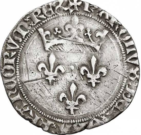
To understand Jacques Coeur’s financial strategy, a few words about bimetallism. At the time, unlike in China, paper money was not widely used. In the West, everything was paid for in metal coins, and above all in gold.
According to Herodotus, Croesus issued silver and pure gold coins in the 6th century BC. Under the Roman Empire, this practice continued. However, while gold was scarce in the West, silver-lead mines were flourishing.
Added to this, in the Middle Ages, Europe saw a considerable increase in the quantities of silver coinage in circulation, thanks to new mines discovered in Bohemia. The problem was that in France, national production was not sufficient to satisfy the needs of the domestic market. As a result, France was obliged to use its gold to buy what was lacking abroad, thus driving gold out of the country.
According to historians, during his trip to Egypt, Coeur observed that the women there dressed in the finest linens and wore shoes adorned with pearls or gold jewels. What’s more, they loved what was fashionable elsewhere, especially in Europe. Coeur was also aware of the existence of poorly exploited silver and copper mines in the Lyonnais region and elsewhere in France.
Historian George Bordonove, in his book Jacques Coeur, trésorier de Charles VII (Jacques Coeur, treasurer of Charles VII), reckons that Coeur was quick to note that the Egyptians « strangely preferred silver to gold, bartering silver for equal weight ». whereas in Europe, the exchange rate was 15 volumes of silver for one volume of gold !
In other words, he realized that the region « abounded in gold », and that the price of silver was very advantageous. The opportunity to enrich his country by obtaining a « golden » price for the silver and copper extracted from the French mines must have seemed obvious to him
What’s more, in China, only payments in silver were accepted. In other words, the Arab-Muslim world had gold, but lacked silver for its trade with the Far East, hence its huge interest in acquiring it from Europe…
Lebanon, Syria and Cyprus
Cœur then travels via Beirut to Damascus in Syria, at the time by far the biggest center of trade between East and West.
The city is renowned for its silk damasks, light gauze veils, jams and rose essences. Oriental fabrics were very popular for luxury garments.
Europe was supplied with silk and gold muslin from Mosul, damasks with woven motifs from Persia or Damascus, silks decorated with baldacchino figures, sheets with red or black backgrounds adorned with blue and gold birds from Antioch, and so on.
The « Silk Road » also brought Persian carpets and ceramics from Asia. The journey continues to another of the Silk Roads’ great maritime warehouses: Cyprus, an island whose copper had offered exceptional prosperity to the Minoan, Mycenaean and Phoenician civilizations.
The best of the West was bartered here for indigo, silk and spices.
Genoa and Venice

During his voyage, Coeur also discovered the maritime empires of Venice and Genoa, each enjoying the protection of a Vatican dependent on these financial powers.
The former, to justify their lucrative trade with the Muslims, claimed that « before being Christian », they were Venetians…
Like the British Empire, the Venetians promoted total free trade to subjugate their victims, while applying fierce dirigisme at home and prohibitive taxes to others. Any artist or person divulging Venetian know-how suffered terrible consequences.
Venice, outpost of the Byzantine Empire and supplier to the Court of Constantinople, a city of several million inhabitants, developed fabric dyeing, manufactured silks, velvets, glassware and leather goods, not to mention weapons. Its arsenal employs 16,000 workers.
Its rival, Genoa, with its highly skilled sailors and cutting-edge financial techniques, had colonized the Bosphorus and the Black Sea, from where treasures from Persia and Muscovy flowed. They also shamelessly engaged in the slave trade, a practice they would pass on to the Spanish and especially the Portuguese, who held a monopoly on trade with Africa.
Avoiding direct confrontation with such powers, Cœur kept a low profile. The difficulty was threefold: following the war, France was short of everything! It had no cash, no production, no weapons, no ships, no infrastructure!
So much so, in fact, that Europe’s main trade route had shifted eastwards. Instead of taking the route of the Rhône and Saône rivers, merchants passed through Geneva, and up the Rhine to Antwerp and Bruges. Another difficulty was soon added: a royal decree prohibited the export of precious metals! But what immense profits the Kingdom could draw from the operation.
The Oecumenial Councils
On his return from the Levant, France’s history accelerated. While preparing the economic reforms he wanted, Jacques Cœur also became involved in the major issues of the day. Through his brother Nicolas Cœur, the future bishop of Luçon, he played an important role in the process initiated by the humanists to unify the Western Church in the face of the Turkish threat.
Since 1378, there had been two popes, one in Rome and the other in Avignon. Several councils attempted to overcome the divisions. Nicolas Cœur attended them. First there was the Council of Constance (1414 to 1448), followed by the Council of Basel (1431), which, after a number of interruptions, was transferred to Florence (1439), establishing a doctrinal « union » between the Eastern and Western churches with a decree read out in Greek and Latin on July 6, 1439, in the cathedral of Santa Maria del Fiore, i.e. under the dome of Florence’s dome, built by Brunelleschi.

The central panel of the Ghent polyptych (1432), painted by the diplomatic painter Jan Van Eyck on the theme of the Lam Gods (the Lamb of God or Mystic Lamb), symbolizes the sacrifice of the Son of God for the redemption of mankind, and is capable of reuniting a church torn apart by internal differences. Hence the presence, on the right, of the three popes, here united before the Lamb. Van Eyck also painted portraits of Cardinal Niccolo Albergati, one of the instigators of the Council of Florence, and Chancellor Rolin, one of the architects of the Peace of Arras in 1435.
The Peace treaty of Arras
To achieve this, the humanists concentrated on France. First, they were to awaken Charles VII. After the victories won by Joan of Arc, wasn’t it time to win back the territories lost to the English?
However, Charles VII knew that peace with the English depended on reconciliation with the Burgundians. He therefore entered into negotiations with Philip the Good, Duke of Burgundy.
The latter no longer expected anything from the English, and wished to devote himself to the development of his provinces. For him, peace with France was a necessity. He therefore agreed to treat with Charles VII, paving the way for the Arras Conference in 1435.
This was the first European peace conference. In addition to the Kingdom of France, whose delegation was led by the Duke of Bourbon, Marshal de La Fayette and Constable Arthur de Richemont, and Burgundy, led by the Duke of Burgundy himself and Chancellor Rolin, it brought together Emperor Sigismund of Luxembourg, Mediator Amédée VIII of Savoy, an English delegation, and representatives of the kings of Poland, Castile and Aragon.
Although the English left the talks before the end, thanks to the skill of the scholar Aeneas Silvius Piccolomini, at that cardinal of Cyprus (and futur Pope Pius II) and spokesman for the Council of Basel, the signing of the Treaty of Arras in 1435 led to a peace agreement between the Armagnacs and the Burgundians, the first step towards ending the Hundred Years’ War.
In the meantime, the Council of Basel, which had opened in 1431, dragged on but came to nothing, and on September 18, 1437, Pope Eugene IV, advised by cardinal philosopher Nicolaus Cusanus and arguing the need to hold a council of union with the Orthodox, transferred the Council from Basel to Ferrara and then Florence. Only the schismatic prelates remained in Basel. Furious, they « suspended » Eugene IV and named the Duke of Savoy, Amédée VIII, Felix V, as the new pope. This « anti-pope » won little political support. Germany remained neutral, and in France, Charles VII confined himself to implementing many of the reforms decreed in Basel by the Pragmatic Sanction of Bourges on July 13, 1438.
King’s Treasurer and Great State Servant
In 1438, Cœur became Argentier de l’Hôtel du roi. L’Argenterie was not concerned with the kingdom’s finances. Rather, it was a sort of commissary responsible for meeting all the needs of the sovereign, his servants and the Court, for their daily lives, clothing, armament, armor, furs, fabrics, horses and so on.
Cœur was to supply the Court with everything that could neither be found nor manufactured at home, but which he could bring in from Alexandria, Damascus and Beirut, at the time major nodal points of the Silk Road by land and sea, where he set up his commercial agents, his « facteurs » (manufacturers).
Following this, in 1439, after having been appointed Master of the Mint of Bourges, Jacques Cœur became Master of the Mint in Paris, and finally, in 1439, the King’s moneyer. His role was to ensure the sovereign’s day-to-day expenses, which involved making advances to the Treasury and controlling the Court’s supply channels.
Then, in 1441, the King appointed him commissioner of the Languedoc States to levy taxes. Cœur often imposed taxes without ever undermining the productive reconstruction process. And in times of extreme difficulty, he would even lend money, at low, long-term rates, to those who had to pay it.
Ennobled, Coeur became the King’s strategic advisor in 1442. He acquired a plot of land in the center of Bourges to build his « grant’maison », currently the Palais Jacques Coeur. This magnificent edifice, with fireplaces in every room and an oven supplying the rest and bath room with hot water, has survived the centuries, although Coeur rarely had the occasion to live there.
Coeur is a true grand state servitor, with broad powers to collect taxes and negotiate political and economic agreements on behalf of the king. Having reached the top, Coeur is now in the ideal position to expand his long-cherished project.
Rule over Finance
On September 25, 1443, the Grande Ordonnance de Saumur, promulgated at Jacques Coeur’s instigation, put the state’s finances on a sounder footing.
As Claude Poulain recounts in his biography of Jacques Coeur:
« In 1444, after affirming the fundamental principle that the King alone had the right to levy taxes, but that his own finances should not be confused with those of the kingdom, a set of measures was enacted that affected the French at every level. »
These included: « Commoners owning noble fiefs were obliged to pay indemnities; nobles who had received seigneuries previously belonging to the royal domain would henceforth be obliged to share in the State’s expenses, on pain, once again, of seizure; finally, the kingdom’s financial services were organized, headed by a budget committee made up of high-ranking civil servants, ‘Messieurs des Finances’. »
In clear, the nobility was henceforth obliged to pay taxes for the Common Good of the Nation !
The King’s Council of 1444, headed by Dunois, was composed almost exclusively, not of noblement but of commoners (Jacques Coeur, Jean Bureau, Étienne Chevalier, Guillaume Cousinot, Jouvenel des Ursins, Guillaume d’Estouteville, Tancarville, Blainville, Beauvau and Marshal Machet). France recovered and enjoyed prosperity.
If France’s finances recovered, besides « taxing the rich », it was above all thanks to strategic investments in infrastructure, industry and trade. The revival of business activity enabled taxes to be brought in. In 1444, he set up the new Languedoc Parliament in conjunction with the Archbishop of Toulouse and, on behalf of the King, presided over the Estates General.
Master Plan
In reality, Jacques Cœur’s various operations, sometimes mistakenly considered to be motivated exclusively by his own personal greed, formed part of an overall plan that today we would describe as « connectivity » and at the service of the « physical economy ».
The aim was to equip the country and its territory, notably through a vast network of commercial agents operating both in France and abroad from the major trading cities of Europe (Geneva, Bruges, London, Antwerp, etc.), the Levant (Beirut and Damascus) and North Africa (Alexandria, Tunis, etc.), in order to promote win-win trade. ), to promote win-win trade, while reinvesting part of the profits in improving national productivity: mining, metallurgy, arms, shipbuilding, training, ports, roads, rivers, sericulture, textile spinning and dyeing, paper, etc.
Mining
Of special interest were the silver mines of Pampailly, in Brussieu, south of l’Arbresle and Tarare, 25 kilometers west of Lyon, acquired and exploited as early as 1388 by Hugues Jossard, a Lyonnais jurist. They were very old, but their normal operation had been severely disrupted during the war. In addition, there were the Saint-Pierre-la-Palud and Joux mines, as well as the Chessy mine, whose copper was also used for weapons production.
Jacques Cœur made them operational. Near the mines, « martinets » – charcoal-fired blast furnaces – transformed the ore into ingots. Cœur brought in engineers and skilled workers from Germany, at the time a region far ahead of us in this field. However, without a pumping system, mining was no picnic.
Under Jacques Cœur’s management, the workers benefited from wages and comforts that were absolutely unique at the time. Each bunk had its own feather bed or wool mattress, a pillow, two pairs of linen sheets and blankets, a luxury that was more than unusual at the time. The dormitories were heated.
High quality food was provided to the laborers: bread containing four-fifths wheat and one-fifth rye, plenty of meat, eggs, cheese and fish, and desserts included exotic fruits such as figs and walnuts. A social service was organized: free hospitalization, care provided by a surgeon from Lyon who kept accident victims « en cure ». Every Sunday, a local priest came to celebrate a special mass for the miners. On the other hand, workers were subject to draconian discipline, governed by fifty-three articles of regulation that left nothing to chance.
The Ports of Montpellier and Marseille
On his return from the Levant in 1432, Jacques Coeur chose to make Montpellier the nerve center of his port and naval operations.
In principle, Christians were forbidden to trade with Infidels. However, thanks to a bull issued by Pope Urban V (1362-1370), Montpellier had obtained the right to send « absolved ships » to the East every year. Jacques Cœur obtained from the Pope that this right be extended to all his ships. Pope Eugene IV, by derogation of August 26, 1445, granted him this benefit, a permission renewed in 1448 by Pope Nicholas V.
At the time, only Montpellier, in the middle of the east-west axis linking Catalonia to the Alps (the Roman Domitian Way) and whose outports were Lattes and Aigues-Mortes, had a hinterland with a network of roads that were more or less passable, an exceptional situation for the time.
In 1963, it was discovered that at the site of the village of Lattes (population 17,000), 4 km south of today’s Montpellier and on the River Lez, there had been an Etruscan port city called Lattara, considered by some to be the first port in Western Europe. The city was built in the last third of the VIth century BC. A city wall and stone and brick houses were built. Original objects and graffiti in Etruscan – the only ones known in France – have suggested that Etrurian brokers played a role in the creation and rapid urbanization of the settlement.
Trading with the Greeks and Romans, Lattara was a very active Gallic port until the 3rd century AD. Then maritime access changed, and the town fell into a state of numbness.
In the 13th century, under the impetus of the Guilhem family, lords of Montpellier, the port of Lattes was revitalized, only to regain its splendor when Jacques Cœur set up his warehouses there in the 15th century.
As for the port of Aigues-Mortes, built from top to bottom by Saint-Louis in the XIIIth century for the crusades, it was also one of the first in France. To connect the two, Saint-Louis dug the canal known as « Canal de la Radelle » (today’s Canal de Lunel), which ran from Aigues-Mortes across the Lake of Mauguio to the port of Lattes. Cœur restored this river-port complex to working order, notably by building Port Ariane in Lattes.
Over the following centuries, these disparate elements of canals and water infrastructure will become an efficient network built around the Canal du Rhône à Sète, a natural extension of the « bi-oceanic » Canal du Midi (between the Meditteranean and the Atlantic) begun by Jean-Baptiste Colbert (see map).
Coeur had the local authorities involved in his project, shaking Montpellier out of its age-old lethargy. At the time, the town had no market or covered sales buildings. Also lacking were moneychangers, shipowners and other cloth merchants.
In Montpellier, an entire district of merchants and warehouses was erected him, the Great Merchants Lodge, modeled on those in Perpignan, Barcelona and Valencia.
Numerous houses in Béziers, Vias and Pézenas also belonged to him, as did residences in Montpellier, including the Hôtel des Trésoriers de France, which, it is said, was topped by a tower so high that Jacques Cœur could watch his ships arrive at the nearby Port of Lattes.
And yet, as an old merchant and industrial city, Montpellier had long been home to Italians, Catalans, Muslims and Jews, who enjoyed a tolerance and understanding that was rare at the time. It’s easy to see why François Rabelais felt so at home here in the XVIth century.
Port of Marseille
The hinterland was rich and industrious. It produced wine and olive oil, in other words, exportable goods. Its workshops produced leather, knives, weapons, enamels and, above all, drapery.
From 1448 onwards, faced with the limitations of the system and the constant silting-up of the port infrastructure, Coeur moved one of his agents, the navigator and diplomat Jean de Villages, his nephew by marriage, to the neighboring port of Marseille, at that time outside the Kingdom, to the home of King René d’Anjou, where port operations were easier, a deep harbor protected from the Mistral by hills and a port equipped with waterfront shops and storehouses. The boost that Jacques Coeur gave to Montpellier’s port Lattes, Jean de Villages, on Coeur’s behalf, immediately gave to Marseille.
Shipbuilding
Good ports mean ocean-going ships! Hence at that time, the best France could do was build a few river barges and fishing boats.
To equip himself with a fleet of ocean-going vessels, Cœur ordered a « galéasse » (an advanced model of the ancient three-masted « galley », designed primarily for boarding) from the Genoa arsenals.
The Genoese, who saw only immediate profit in the project, soon discovered that Coeur had had the shapes and dimensions of their ship copied by local carpenters in Aigues Mortes!
Furious, they landed at the shipyard and took it back, arguing that Languedoc merchants had no right to fit out ships and trade without the prior approval of the Doge of Venice!
Stained glass window of a ship (a caraque) in the Palais de Jacques Cœur in Bourges.
After complicated negotiations, but with the support of Charles VII, Coeur got his ship back. Cœur let the storm pass for a few years. Later, seven great ships would leave the Aigues-Mortes shipyard, including « La Madeleine » under the command of Jean de Villages, a great sailor and his loyal lieutenant.
Judging by the stained-glass window and bas-relief in the Palais de Coeur in Bourges, these were more like caraques, North Sea vessels with large square sails and much greater tonnage than galleasses. But that’s not all!
Having understood perfectly well that the quality of a ship depends on the quality of the wood with which it is built, Cœur, with the authorization of the Duke of Savoy, had his wood shipped from Seyssel. The logs were floated down the Rhône, then sent to Aigues-Mortes via the canal linking the town to the river.
The crews
One last problem remained to be solved: that of crews. Jacques Cœur’s solution was revolutionary: on January 22, 1443, he obtained permission from Charles VII to forcibly embark, in return for fair wages, the « idle vagabonds and caimans » who prowled the ports.
To understand just how beneficial such an institution was at the time, we need to remember that France was being laid to waste by bands of plunderers – the routiers, the écorcheurs, the retondeurs – thrown into the country by the Hundred Years’ War. As always, Coeur behaves not only according to his own personal interests, but according to the general interests of France.
Connecting France to the Silk Road
Now with financial clout, ports and ships at his disposal, Cœur organized win-win commercial exchanges and, in his own way, involved France in the land and Maritime Silk Road of the time. First and foremost, he organized « détente, understanding and cooperation » with the countries of the Levant.
After diplomatic incidents with the Venetians had led the Sultan of Egypt to confiscate their goods and close his country to their trade, Jacques Coeur, a gentleman but also in charge of a Kingdom that remained dependent on Genoa and Venice for their supplies of arms and strategic raw materials, had his agents on site mediating a happy end to the incident.
Seeing other potential conflicts that could disrupt his strategy, and possibly inspired by Admiral Zheng He‘s great Chinese diplomatic missions to Africa from 1405 onwards, he convinced the king to send an ambassador to Cairo in the person of Jean de Villages, his loyal lieutenant.
The latter handed over to the Sultan the various letters he had brought with him. Flattered, the Sultan handed him a reply to King Charles VII:
« Your ambassador, man of honor, gentleman, whom you name Jean de Villages, came to mine Porte Sainte, and presented me your letters with the present you mandated, and I received it, and what you wrote me that you want from me, I did.
« Thus I have made a peace with all the merchants for all my countries and ports of the navy, as your ambassador knew to ask of me… And I command all the lords of my lands, and especially the lord of Alexandria, that he make good company with all the merchants of your land, and on all the others having liberty in my country, and that they be given honor and pleasure; and when the consul of your country has come, he will be in favor of the other consuls well high…
« I send you, by the said ambassador, a present, namely fine balsam from our holy vine, a beautiful leopard and three bowls (cups) of Chinese porcelain, two large dishes of decorated porcelain, two porcelain bouquets, a hand-washer, a decorated porcelain pantry, a bowl of fine green ginger, a bowl of almond stones, a bowl of green pepper, almonds and fifty pounds of our fine bamouquet (fine balsam), a quintal of fine sugar. Dieu te mène à bon sauvement, Charles, Roy de France. »
To the Orient, Coeur exported furs, leathers and, above all, cloth of all kinds, notably Flanders cloth and Lyon canvas. His « factors » also offered Egyptian women dresses, coats, headdresses, ornaments and jewels from our workshops. Then came basketry from Montpellier, oil, wax, honey and flowers from Spain for the manufacture of perfumes.
From the Near East, he received animal-figured silks from Damascus (Syria), fabrics from Bukhara (Uzbekistan) and Baghdad (Iraq); velvet; wines from the islands; cane sugar; precious metals; alum; amber; coral; indigo; coral; indigo from Baghdad; madder from Egypt; shellac; perfumes made from the essence of the flowers he exported; spices – pepper, ginger, cloves, cinnamon, jams, nutmegs, etc. – and more.
From the Far East, by the Red Sea or by caravans from the Euphrates and Turkestan, came to him: gold from Sudan, cinnamon from Madagascar, ivory from Africa, silks from India, carpets from Persia, perfumes from Arabia – later evoked by Shakespeare in Macbeth – precious stones from India and Central Asia, lapis lazuli from Afghanistan, pearls from Ceylon, porcelain and musk from China, ostrich feathers from the black Sudan.
Manufactures
As we saw in the case of mining, Coeur had no hesitation in attracting foreigners with valuable know-how to France to launch projects, implement innovative processes and, above all, train personnel. In Bourges, he teamed up with the Balsarin brothers and Gasparin de Très, gunsmiths originally from Milan. After convincing them to leave Italy, he set up workshops in Bourges, enabling them to train a skilled workforce. To this day, the Bourges region remains a major center of arms production.
In the early days of printing in Europe, Coeur bought a paper mill in Rochetaillée, on the Saône near Lyon.
In Montpellier, he took an interest in the dyeing factories, once renowned for their cultivation of madder, a plant that had become acclimatized in the Languedoc region.
It’s easy to understand why Cœur had his agents buy indigo, kermes seeds and other coloring substances. The aim was to revive the manufacture of cloth, particularly scarlet cloth, which had previously been highly sought-after.
With this in mind, he built a fountain, the Font Putanelle, near the city walls, to serve the population and the dyers.
In Montpellier, he also teamed up with Florentine charterers based in the city, for maritime expeditions.
Through their intermediary, Coeur personally traveled to Florence in 1444, registering both his associate Guillaume de Varye and his own son Ravand as members of the « Arte della Seta » (silk production corporation), the prestigious Florentine guild whose members were the only ones authorized to produce silk in Florence.
Coeur engaged in joint ventures, as he often did in France, this time with Niccolo Bonnacorso and the Marini brothers (Zanubi and Guglielmo). The factory, in which he owned half the shares, manufactured, organized and controlled the production, spinning, weaving and dyeing of silk fabrics.
It is understood that Coeur was also co-owner of a gold cloth factory in Florence, and associated in certain businesses with the Medici, Bardi and Bucelli bankers and merchants. He was also associated with the Genevese and Bruges families.
Going International
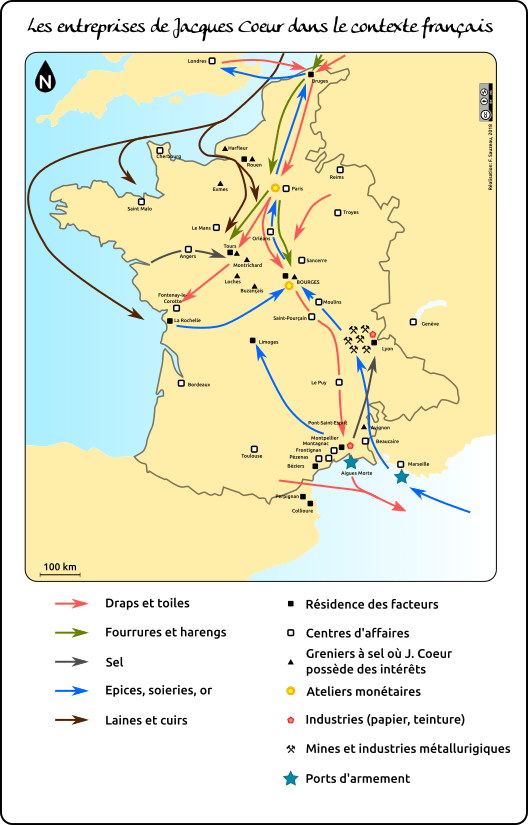
Jacques Coeur organized a vast distribution network to sell his goods in France and throughout Europe. At a time when passable roads were extremely rare, this was no easy task. Most roads were little more than widened paths or poorly functioning tracks dating back to the Gauls.
Cœur, who had his own stables for land transport, renovated and expanded the network, abolished internal tolls on roads and rivers, and re-established the collection (abandoned during the Hundred Years’ War) of taxes (taille, fouage, gabelle) to replenish public finances.
Jacques Cœur’s network was essentially run from Bourges. From there, on the French level, we could speak of three major axes: the north-south being Bruges-Montpellier, the east-west being Lyon-Tours. Added to this was the old Roman road linking Spain (Barcelona) to the Alps (Briançon) via Languedoc.
From Bourges, for example, the Silverware, which served the Court, was transferred to Tours. This was only natural, since from 1444 onwards, Charles VII settled in a small castle near Tours, Plessis-les-Tours. So it was at the Argenterie de Tours that the exotic products the Court was so fond of were stocked. This did not prevent the goods from being shipped on to Bruges, Rouen or other towns in the kingdom.
Counters also existed in Orléans, Loches, Le Mans, Nevers, Issoudun and Saint-Pourçain, birthplace of the Coeur family, as well as in Fangeaux, Carcassonne, Toulouse, Bordeaux, Limoges, Thouars, Saumur, Angers and Paris.
Orléans and Bourges stocked salt from Guérande, the Vendée marshes and the Roche region. In Lyon, salt from the Camargue and Languedoc saltworks. River transport (on the Loire, Rhône, Saône and Seine rivers) doubled the number of road carts.

Jacques Coeur revived and promoted trade fairs. Lyon, with its rapid growth, geographic location and proximity to silver-lead and copper mines, was a particularly active trading post. Goods were shipped to Geneva, Germany and Flanders.
Montpellier received products from the Levant. However, trading posts were set up all along the coast, from Collioure (then in Catalonia) to Marseille (at the home of King René d’Anjou), and inland as far as Toulouse, and along the Rhône, in particular at Avignon and Beaucaire.
A trading post was set up in La Rochelle for the salt trade, certainly with a view to expanding maritime traffic. Jacques Cœur also had « factors » in Saint-Malo, Cherbourg and Harfleur. After the liberation of Normandy, these three centers grew in importance, and were joined by Exmes. In the north-east, Reims and Troyes are worth mentioning. They manufactured cloth and canvas. Abroad, Geneva was a first-rate trading post, as the city’s fairs and markets had already acquired an international character.
Coeur also had a branch in Bruges, bringing back spices and silks from the Levant, and shipping cloth and herring from there.

The fortunes of Bruges, like many other towns in Flanders, came from the cloth industry. The city flourished, and the power of its cloth merchants was considerable. In the 15th century, Bruges was one of the lungs of the Hanseatic League, which brought together the port cities of northern Europe.
It was in Bruges that business relations were handled, and loan and marine insurance contracts drawn up. After cloth, it was the luxury industries that ensured its prosperity, with tapestries. By land, it took less than three weeks to get from Bruges to Montpellier via Paris.
Between 1444 and 1449, during the Truce of Tours between France and the English, Jacques Coeur tried to build peace by forging trade links with England.
Coeur sent his representative Guillaume de Mazoran. His other trusted associate, Guillaume de Varye, began trading in sheets from London in February 1449. He also bought leather, cloth and wool in Scotland. Some went to La Rochelle, others to Bruges.
Internationally, Coeur continued to expand, with branches in Barcelona, Naples, Genoa (where a pro-French party was formed) and Florence.
At the time of his arrest in 1451, Jacques Coeur had at least 300 « factors » (associates, commercial agents, financial representatives and authorized agents), each responsible for his own trading post in his own region, but also running « factories » on the spot, promoting meetings and exchanges of know-how between all those involved in economic life. Several thousand people associated and cooperated with him in business.
The Military Reform that saved the Nation
Cœur used the profits from this lucrative business to serve his country. When in 1449, at the end of the truce, the English troops were left to their own devices, surviving by pillaging the areas they occupied, Agnès Sorel, the king’s mistress, Pierre de Brézé, the military leader, and Jacques Cœur, encouraged the king to launch a military offensive to finally liberate the whole country.
Coeur declared bluntly:
« Sire, under your shadow, I acknowledge that I have great proufis and honors, and mesme, in the land of the Infidels, for, for your honor, the souldan has given me safe-conduct to my galleys and factors… Sire, what I have, is yours. »
We’re no longer in 1435, when the king didn’t have a kopeck to face strategic challenges. Jacques Coeur, unlike other great lords, according to a contemporary account,
« spontaneously offered to lend the king a mass of gold, and provided him with a sum amounting, it is said, to around 100,000 gold ecus to use for this great and necessary purpose ».
Under the advice of Jacques Coeur and others, Charles VII was to carry out a decisive military reform.
On November 2, 1439, at the Estates General that had been meeting in Orleans since October of that year, Charles VII ordered a reform of the army following the Estates General’s complaint about the skinners and their actions.
As Charles V (the Wise) had tried to do before him, he set up a system of standing armies that would engage these flayers full-time against the English. The nobility got in the king’s way. In fact, they often used companies of skinners for their own interests, and refused to allow the king alone to be responsible for recruiting the army.
In February 1440, the king discovered that the nobles were plotting against him. Contemporaries named this revolt the Praguerie, in reference to the civil wars in Prague’s Hussite Bohemia.
Yolande d’Aragon passed away in November 1442, but Jacques Coeur would continue pressuring the King to go ahead with the required reforms.
Following the Truce of Tours in 1444, an ordinance was issued on May 26 announcing no general demobilization should occur; instead, the best of the larger units were reconstituted as “companies of the King’s ordinance » (Compagnies d’Ordonnance),” which were standing units of cavalry well selected and well equipped; they served as local guardians of peace at local expense. This consisted of some 10,000 men organized into 15 Ordonnance companies, entrusted to proven captains. These companies were subdivided into detachments of ten to thirty lances, which were assigned to garrisons to protect the towns’ inhabitants and patrol the countryside. In a territory similarly patrolled by the forerunners of our modern gendarmerie, robbery and plunder quickly ceased.
Although still a product of the nobility, this new military formation was the first standing army at the disposal of the King of France. Previously, when the king wished to wage war, he called upon his vassals according to the feudal custom of the ban. But his vassals were only obliged to serve him for forty days. If he wished to continue the war, the king had to recruit companies of mercenaries, a plague against which Machiavelli would later warn his readers. When the war ended, the mercenaries were dismissed. They then set about plundering the country. This is what happened at the start of the Hundred Years’ War, after the victories of Charles V and Du Guesclin.
Then, with the Ordinance of April 8, 1448, the Francs-Archers corps was created. The model for the royal « francs archiers » was probably taken from the militia of archers that the Dukes of Brittany had been raising, by parish, since 1425.
The Ordinance stipulated that each parish or group of fifty or eighty households had to arm, at its own expense, a man equipped with bow or crossbow, sword, dagger, jaque and salad, who had to train every Sunday in archery. In peacetime, he stays at home and receives no pay, but in wartime, he is mobilized and receives 4 francs a month. The Francs-Archers thus formed a military reserve unit with a truly national character.
As writes the Encyclopedia Brittanica:
« With the creation of the “free archers” (1448), a militia of foot soldiers, the new standing army was complete. Making use of a newly effective artillery, its companies firmly in the king’s control, supported by the people in money and spirit, France rid itself of brigands and Englishmen alike. »
At the same time, artillery grandmaster Gaspard Bureau and his brother Jean (Note N° 4) developed artillery, with bronze cannons capable of firing cast-iron cannonballs, lighter hand cannons, the ancestors of the rifle, and very long cannons or couleuvrines that could be dragged on wagons and taken to the battlefield.
As a result, when the time came to go on the offensive, the army went into battle. From all over the country, the Francs-Archers, made up of commoners trained in every region of France rather than nobles, began to converge on the north.
The war was on, and this time, « the gale changed sides ». The merciless French army, armed to the highest standards, pushed its opponents to the limit. This was particularly true at the Battle of Formigny near Bayeux, on April 15, 1450. It was a kind of Azincourt in reverse, with English losses amounting to 80% of the forces engaged, with 4,000 killed and 1,500 taken prisoner. At last, towns and strongholds returned to the Kingdom!
Helping a Humanist Pope
As mentioned above, the Council of Basel had ended in discord. On the one hand, with the support of Charles VII and Jacques Coeur, Eugene IV was elected Pope in Rome in 1431. On the other, in Basel, an assembly of prelates meeting in council sought to impose themselves as the sole legitimate authority to lead Christendom. In 1439, the Council declared Eugene IV deposed and appointed « his » own pope: the Duke of Savoy, Amédée VIII, who had abdicated and retired to a monastery. He became pope under the name of Felix V.
His election was based solely on the support of theologians and doctors of the universities, but without the support of a large number of prelates and cardinals.
In 1447, King Charles VII commissioned Jacques Coeur to intervene for Eugene IV’s return and Felix V’s renunciation. With a delegation, he went to Lausanne to meet Felix V. While the talks were going well, Eugene IV died. As Felix V saw no further obstacles to his pontificate, the Pontifical Council in Rome quickly proceeded to elect a new pope, the humanist scholar Nicholas V (Tommaso Parentucelli).
To make France’s case to him, Charles VII sent Jacques Coeur at the head of a large delegation. Before entering the Eternal City, the French formed a procession.
The parade was sumptuous: more than 300 horsemen, dressed in bright, shimmering colors, bearing weapons and glittering jewels, mounted on richly caparisoned horses, dazzled and impressed the whole of Rome, except for the English, who saw themselves doubled by the French to serve the Pope’s mission.
From the very first meeting, Nicholas V was charmed by Jacques Coeur. Slightly ill, Coeur was treated by the pope’s physician. Thanks to information obtained from the Pontiff, notably on the limits of concessions to be made, Coeur’s delegation subsequently obtained the withdrawal of Felix V, with whom Coeur remained on good terms.
Nicholas V, it should be remembered, was a happy exception. Nicknamed the « humanist pope », he knew Leonardo Bruni (Note N° 5), Niccolò Niccoli (Note N° 6) and Ambrogio Traversari (Note N° 7) in Florence, in the entourage of Cosimo de’ Medici.
With the latter and Eugenio IV, whose right-hand man he was, Nicholas V was one of the architects of the famous Council of Florence, which sealed a « doctrinal union » between the Western and Eastern Churches. (Note N° 8)
Elected pope, Nicholas V considerably increased the size of the Vatican Library. By the time of his death, the library contained over 16,000 volumes, more than any other princely library.
He welcomed the erudite humanist Lorenzo Valla to his court as apostolic notary. Under his patronage, the works of Herodotus, Thucydides, Polybius and Archimedes were reintroduced to Western Europe. One of his protégés, Enoch d’Ascoli, discovered a complete manuscript of Tacitus’ Opera minora in a German monastery.
In addition to these, he called to his court a whole series of scholars and humanists: the scholar and former chancellor of Florence Poggio Bracciolini, the Hellenist Gianozzo Manetti, the architect Leon Battista Alberti, the diplomat Pier Candido Decembrio, the Hellenist Giovanni Aurispa, the cardinal-philosopher Nicolas de Cues, founder of modern science, and Giovanni Aurispa, the first to translate Plato’s complete works from Greek into Latin.
Nicholas V also made gestures to his powerful neighbors: at the request of King Charles VII, Joan of Arc was rehabilitated.
Later, when he sought refuge in Rome, Jacques Coeur was received by Nicholas V as if he was a member of his family.
The Coup d’Etat against Jacques Coeur
Jacques Coeur’s adventurous life ended as if in a cloak-and-dagger novel. On July 31, 1451, Charles VII ordered his arrest and seized his possessions, from which he drew one hundred thousand ecus to wage war.
The result was one of the most scandalous trials in French history. The only reason for the trial was political. The hatred of the courtiers, especially the nobles, had built up. By making each of them a debtor, Coeur, believing he had made allies of them, made terrible enemies. By launching a number of national products, he undermined the financial empires of Genoa, Venice and Florence, which eternally sought to enrich themselves by exporting their products, notably silk, to France.
One of the most relentless, Otto Castellani, a Florentine merchant, treasurer of finances in Toulouse but based in Montpellier, and one of the accusers whom Charles VII appointed as commissioner to prosecute Jacques Coeur, practiced black magic and pierced a wax figure of the silversmith with needles!
Lastly, Charles VII undoubtedly feared collusion between Jacques Coeur and his own son, the Dauphin Louis, future Louis XI, who was stirring up intrigue after intrigue against him.
In 1447, following an altercation with Agnès Sorel, the Dauphin had been expelled from the Court by his father and would never see him again. Jacques Cœur lent money to the Dauphin, with whom he kept in touch through Charles Astars, who looked after the accounts of his mines.
« Trade with infidels », « Lèse majesté », « export of metals », and many other pretexts, the reasons put forward for Jacques Coeur’s trial and conviction are of little interest. They are no more than judicial window-dressing. The proceedings began with a denunciation that was almost immediately found to be slanderous.

A certain Jeanne de Mortagne accused Jacques Coeur of having poisoned Agnès Sorel, the king’s mistress and favorite, who died on February 9, 1450. This accusation was implausible and devoid of any serious foundation; for, having placed all her trust in Jacques Coeur, she had just appointed him as one of her three executors.
Coeur is imprisoned for a dozen equally questionable reasons. When he refused to admit what he was accused of, he was threatened with « the question » (torture). Confronted by the executioners, the accused, trembling with fear, claims that he « relies » on the words of the commissioners charged with breaking him.
His condemnation came on the same day as the fall of Constantinople, May 29, 1453. Only the intervention of Pope Nicholas V saved his life. With the help of his friends, he escaped from his prison in Poitiers, and took the route of the convents, including Beaucaire, to Marseille for Rome.
Pope Nicholas V welcomed him as a friend. The pontiff died and was succeeded by his successor. Jacques Cœur chartered a fleet in the name of his illustrious host, and set off to fight the infidels. Jacques Coeur, we are told, died on November 25, 1456 on the island of Chios, a Genoese possession, during a naval battle with the Turks.
The great King Louis XI, unloved son of Charles VII, as evidenced by his ordinances in favor of the productive economy, would continue the recovery of France begun by Jacques Coeur. Many of Coeur’s collaborators soon entered his service, including his son Geoffroy, who, as cupbearer, became Louis XI’s most trusted confidant.
Charles VII, by letters patent dated August 5, 1457, restored to Ravant and Geoffroy Coeur a small portion of their father’s property. It was only under Louis XI that Geoffroy obtained the rehabilitation of his father’s memory and more complete letters of restitution.
NOTES:
- During the five years between Joan of Arc’s first appearances and her departure for Chinon, several people attached to the Court stayed in Lorraine, including René d’Anjou, the youngest son of Yolande d’Aragon. While Charles VII remained undecided, his mother-in-law welcomed La Pucelle with maternal solicitude, opening doors for her and lobbying the king until he deigned to receive her. During the Poitiers trial, when Jeanne’s virginity had to be verified, she presided over the council of matrons in charge of the examination. She also provided financial support, helped her gather her equipment, provided safe stopping points on the road to Orléans, and gathered food and relief supplies for the besieged. To this end, she did not hesitate to open her purse wide, even going so far as to sell her jewelry and golden tableware. Yolande’s support was rewarded on April 30, 1429 with the liberation of Orléans, followed on July 17 by the King’s coronation in Reims. Although many of her contemporaries praised her simplicity, her closeness to her subjects and the warmth of her court, Yolande d’Aragon was a stateswoman. And whatever sympathy she may have felt for her protégée, she would not hesitate to abandon her to her sad fate when her warlike impulses no longer accorded with her own political objectives : to negociate a peaceful alliance with the Duchy of Burgundy. The Duchess knew how to be implacable, and like her comrades-in-arms, the Church and the King himself, she abandoned La Pucelle to the English, to Cauchon, to her trial and to the stake. For more: Gérard de Senneville, Yolande d’Aragon : La reine qui a gagné la guerre de Cent Ans, Editions Perrin)
- Georges Bordonove, Jacques Coeur, trésorier de Charles VII, p. 90, Editions Pygmalion, 1977).
- Description given by the great chronicler of the Dukes of Burgundy, Georges Chastellain (1405-1475), in Remontrances à la reine d’Angleterre.
- Jean Bureau was Charles VII’s grand master of artillery. On the occasion of his coronation in 1461, Louis XI knighted him and made him a member of the King’s Council. Louis XI stayed at Jean Bureau’s Porcherons house in northwest Paris after his solemn entry into the capital. Jean Bureau’s daughter Isabelle married Geoffroy Coeur, son of Jacques.
- Leonardo Bruni succeeded Coluccio Salutati as Chancellor of Florence, having joined his circle of scholars, which included Poggio Bracciolini and the erudite Niccolò Niccoli, to discuss the works of Petrarch and Boccaccio. Bruni was one of the first to study Greek literature, and contributed greatly to the study of Latin and ancient Greek, offering translations of Aristotle, Plutarch, Demosthenes, Plato and Aeschylus.
- Niccolò Niccoli built up one of the most famous libraries in Florence, and one of the most prestigious of the Italian Renaissance. He was assisted by Ambrogio Traversari in his work on Greek texts (a language he did not master). He bequeathed this library to the Florentine Republic on condition that it be made available to the public. Cosimo the Elder de’ Medici was entrusted with implementing this condition, and the library was entrusted to the Dominican convent of San Marco. Today, the library is part of the Laurentian Library.
- Prior General of the Camaldolese Order, Ambrogio Traversari was, along with Jean Bessarion, one of the authors of the decree of church union. According to the Urbino court historian Vespasiano de Bisticci, Traversari gathered in his convent at San Maria degli Angeli near Florence. There, Traversari brought together the heart of the humanist network: Nicolaus Cusanus; Niccolo Niccoli, who owned an immense library of Platonic manuscripts; Gianozzi Manetti, orator of the first Oration on the Dignity of Man; Aeneas Piccolomini, the future Pope Pius II; and Paolo dal Pozzo Toscanelli, the physician-cartographer and future friend of Leonardo da Vinci, whom Piero della Francesca also frequented.
- Philosophically speaking, reminding the whole of Christendom of the primordial importance of the concept of the filioque, literally « and of the son », meaning that the Holy Spirit (divine love) came not only from the Father (infinite potential) but also from the Son (its realization, through his son Jesus, in whose living image every human being had been created), was a revolution. Man, the life of every man and woman, is precious because it is animated by a divine spark that makes it sacred. This high conception of each individual was reflected in the relationship between human beings and their relationship with nature, i.e., the physical economy.
The Congress for Cultural Freedom: How the CIA « weaponized » Modern Art
This article, first published in 2006, came as a book review of the book Who Paid the Piper of British researcher Frances Stonor Saunder, published in French Article under the title Qui mène la danse? La CIA et la guerre froide culturelle, 506 pages, Editions Denoël, Paris, 2003.
This book, which caused a stir in Germany, England and the Hispanic world, is literally appalling. Not only for what it reveals, but above all for what it leaves unsaid.
After years of meticulous research, interviews and archival work, the young writer Frances Stonor Saunders, producer of historical documentaries for the BBC, delivers an uncompromising account of the Anglo-American cultural Cold War against the Soviet Union from 1947 onwards.
Congress for Cultural Freedom
At the heart of this secret « Kulturkampf », a veritable cultural Cold War, was the Paris-based Congress for Cultural Freedom (CCF), headed from 1950 to 1967 by CIA agent Michael Josselson.
Josselson, who spoke four languages, along with music composer Nicholas Nabokov, was a former member of the psychological warfare division of the Office for Strategic Services (OSS), which US President Harry Truman replaced with the CIA in 1945.
The first thing that strikes the reader is the analogy between the language of the Cold War and the narrative of today’s war hawks to justify a new crusade « against terrorism. »
Back then, under the guise of a merciless struggle against the horrors of Stalinism, the Anglo-American imperial faction deployed whole swathes of the CIA in an attempt to impose Bertrand Russell‘s utopian vision of « world government. »
The CIA described itself as an « Order of Knights Templar » charged with « saving Western freedom from Communist darkness ». Its principal theoretician was George Kennan, Director of the Policy Planning Staff at the State Department.
Like the « Noble Lies » employed today by the neo-conservatives, followers of Leo Strauss, Kennan asserted in 1947 that the Communists had gained a position of prominence in Europe,
« through the shameless and skillful use of lies. They fought us with the weapon of unreality and irrationalism. Can we triumph over this unreality with rationalism, truth, honest and well-intentioned economic assistance? »
Obviously not! And the most formidable weapon for world domination will be, as always: the soft power of « culture ».
Indeed, « you can’t be a great power if you don’t have the art to go with it, it’s like Venice without Tintoretto or Florence without Giotto ».
So, ironically, while American public opinion was held hostage by the McCarthyite psychosis for whom « all modern art is communist », to the point of suspecting certain abstract paintings of indicating the exact location of American military bases (sic), the oligarchs saw in « lyrical abstract » expressionism the virtues of a specifically anti-communist ideology.
By a simple logic of inversion, everything that Nazis and Stalinists considered « degenerate art » automatically became emblematic of the values of freedom and free enterprise, and therefore got massively financed… in the greatest secrecy.
With a wealth of detail, the author documents the mesh of this operation over some five hundred pages. It is, of course, impossible to summarize here the descriptions of the lives of dozens of men, women, musicians, authors, magazines, networks and foundations, each page of which delivers a few pearls.
Some of the details shed a special light on contemporary French history.
The CIA in Paris
In Paris, it was Irving Brown (1911-1989), a representative of the powerful AFL-CIO union (with free access to secret Marshall Plan funds), who offered the CCF in Paris a suite in the Hôtel Baltimore on Avenue Kléber to set up its temporary headquarters, before paying the rent for a permanent office on Boulevard Haussmann.
On behalf of his boss Jay Lovestone (1897-1990), himself a helper of the CIA’s James Jesus Angleton, Irving Brown financed anything that might weaken France’s resistance to the utopia of world government, i.e. anything that might harm Gaullism and, to a certain extent, Communism.
Josselson and his wife met him quite often in a gay bar, « L’Indifférent ». One evening, they find him handing over a large sum of money to a Marseille mobster. A fan of the big boys, Brown was heavily involved in anything that could reduce the influence of the Communists.
It was from that perspective that he helped former members of the Vichy government, as well as Trotskyites. He controlled French ports, broke strikes and financed the new Force Ouvrière union to split the CGT communist union, all the while promoting modern art!*
Alongside Irving Brown, the CCF board included Michael Josselson, Lawrence de Neufville (his CIA recruiter, later appointed to Radio Free Europe), Arthur Koestler, Melvin Lasky, former Trotskyist James Burnham, as well as Carlo Schmid of the German SPD, Haakon Lie, leader of the Norwegian Labour Party, and David Rousset of the French Parti Socialiste.
In his book The Machiavellians, Burnham used Machiavelli to « challenge egalitarian political theory and show the persistence and inescapability of the elite, even in an age of equality ».
In 1953, Burnham played a crucial role in the CIA’s Operation AJAX, which overthrew Dr. Mossadegh in Teheran and replaced him with the Shah.
Later, « more presentable » funding sources than Irving Brown came into play: CIA front organizations such as the Farfield Foundation, headed by Julius Fleischman, or the Hoblitzelle Foundation, but also classics like the Ford, Carnegie or Rockefeller brothers’ foundations.
Thanks to these generous donors, the CCF made millions of dollars available to literary magazines such as
- Encounter, edited by former Trotskyite Irving Kristol (father of current neo-conservative William Kristol) in London;
- Preuves, edited in Paris by François Bondy of the European Union of Federalists;
- Der Monat, edited by Melvin Lasky in Berlin;
- Tempo Presente, edited by Ignazio Silone in Rome;
- Soviet Survey, edited in Israel by historian Walter Laqueur.
After the OSS’s (reciprocal) expressions of sympathy for Hemingway or Antoine de Saint-Exupéry, these magazines opened their columns to authors such as Jorge-Louis Borges, Raymond Aron, Arnold Toynbee, Bertrand Russell, Arthur Schlesinger Jr., Herbert Read or Hugh Trevor-Roper, or contributed to the publication of their writings.
In 1950, the CIA commissioned the production of a cartoon based on George Orwell’s Animal Farm (real name Eric Blair).
Also in Paris, CIA man Peter Matthiessen helped found the Paris Review run by John Train, a far-right liberal New York billionaire.
CIA Culture

Destruction of the well tempered music
The CCF also financed major musical events to promote « modern » twelve-tone serialism (dodecaphony), such as the April 1952 festival organized by Nicolas Nabokov in Paris.
Nabokov believed that « dodecaphony abolishes natural hierarchies » and allows us to free ourselves from the internal logic of music.
Anne C. Shreffler argues that the « compositional avant-garde » was politicized more by its advocacy of personal freedom than by political influence. Shreffler goes on to argue that both the Soviet Union and the United States sent out messages that dealt with « freedom. » However, Western Europe and the United States claimed a « moral high ground » in the struggle for individual freedom, a high ground that made certain artistic aesthetics (e.g., cubism, surrealism, dodecaphony, and existentialism) almost « obligatory » for artists.
The promotion of « liberated » music as a counterpoint to « Social Realism« , which essentially « marginalized » the populist Soviet musical aesthetic, was explicitly a politically calculated move by the Congress for Cultural Freedom.
The festival opened with « The Rite of Spring » of Igor Stravinsky, new convert to twelve-tone dodecaphonic system.
Among the participants from the USA: Leontyne Price, Aaron Copland, Samuel Barber, the New York City Ballet (Balanchine‘s troupe), the Boston Symphony Orchestra, the New York Museum of Modern Art (MoMA), James T. Farrell, W.H. Auden and Gertrude Stein.
European participants included Jean Cocteau, William Walton, Laurence Olivier, Benjamin Britten, the Vienna Opera, Covent Garden Opera, Czeslaw Milosz, Denis de Rougemont and Guido Piovene, to name but a few.
Appointed Eisenhower’s special advisor on Cold War strategy, American Vice-President Nelson Rockefeller played a fundamental role in promoting the CIA’s modernist painting. Supporting left-wing artists practicing abstract expressionism was commonplace for the Rockefellers.
Nelson’s mother, Abby Aldrich Rockefeller, had founded the Museum of Modern Art in New York – the Modern Art Museum (MoMA) – asserting that reds would stop being reds « if we gave them artistic recognition ». Several MoMA trustees were also trustees of the Farfield Foundation, as indicated, a CIA front.
As Donald Jameson of the CIA put it:
« We understood that this was the kind of art that has nothing to do with social realism and makes it even more stylized, rigid and confined than it was. »
MoMA bought works by Diego Riviera, Jackson Pollock, Arshile Gorky, Alexander Calder, Robert Motherwell, Stuart Davis, Edward Hopper and others.
By attributing the « success » of an impressive number of contemporary cultural actors to the will of an imperial elite, motivated by a more than suspect ideological blindness and endowed, what’s more, with unparalleled financial resources and communication strategies, Stonor Saunders’ book immediately casts deep discredit on all post-war artistic creation.
Most of these « artists » were chosen because they conveyed an ideology deemed compatible with the totalitarian designs of the high priests of world order.
Only the reactionary Peregrine Worsthorne titles his book review of Saunders’ Who Paid the Piper, « How Western Culture was saved by the CIA », nostalgically lamenting the Machiavellian genius of the Anglo-American elite in its heyday.
Of course, some artists weren’t necessarily aware of the source of the funds, but they all expected them to fill their pockets… And perhaps most shockingly of all, the CIA took art more seriously than many citizens or critics of the time.
So, perhaps this survey does posthumous justice to all those talents sacrificed on the altar of illusory power. Think of all those crushed hopes, sabotaged careers and stifled seeds of genius. For in this delirious tournament of the Cold War, the great priesthood ruling over the art world would only saddle those willing to bend the knee, while with a wave of the hand, send others to the deadly silence of oblivion.
NOTE:
*In his book Les Trotskistes (Fayard, 2002), Christophe Nick states, with regard to the non-communist student union UNEF, that at one time, « thanks to Irwing Brown‘s good offices, the U.S. Embassy was able to cover the student union’s end-of-month budgets ».
In Secrets de famille (Fayard, Paris 2001), Serge Raffy reveals that « Lionel Jospin, then First Secretary of the Socialist Party, met in Washington on April 14, 1982 with leaders of the American AFL-CIO union to reassure them that the Mauroy government would include Communist ministers. The man who organized the meeting was a CIA agent, Irving Brown, the same man who founded and financed the French trade union Force Ouvrière to combat the Communist CGT financed by Soviet Russia. Irving Brown is also said to have constantly maintained links between the Trotskyites, and in particular the OCI, and FO. »
On the right, the student union, Union Inter-Universitaire (UNI), which made the career of so many politicians on the right, was also backed by CIA agent of influence Irving Brown and received $575,000 between April 1984 and April 1985 from the government of the United States through the National Endowment for Democracy.
Van Eyck, a Flemish Painter using Arab Optics?

What follows is an edited transcript of a lecture by Karel Vereycken on the subject of “Perspective in XVth-century Flemish religious painting”.
It was delivered at the international colloquium “La recherche du divin à travers l’espace géométrique” (The quest for the divine through geometrical space) at the Paris Sorbonne University on April 26-28, 2006, under the direction of Luc Bergmans, Department of Dutch Studies (Paris IV Sorbonne University).
Introduction
« Perspective in XVth-century Flemish religious painting ». At first glance, this title may seem surprising. While the genius of fifteenth-century Flemish painters is universally attributed to their mastery of drying oil and their intricate sense of detail, their spatial geometry as such is usually identified as the very counter-example of the “right perspective”.
Disdained by Michelangelo and his faithful friend Vasari, the Flemish « primitives » would never have overcome the medieval, archaic and empirical model. For the classical “narritive”, still in force today, stipulates that only « Renaissance » perspective, obeying the canon of « linear », “mathematical” perspective, is the only « right », and the “scientific” one.
According to the same narrative, it was the research carried out around 1415-20 by the Duomo architect Filippo Brunelleschi (1377-1446), superficially mentioned by Antonio Tuccio di Manetti some 60 years later, which supposedly enabled Leon Battista Alberti (1404-1472), proclaiming himself Brunelleschi’s intellectual heir, to invent « perspective ».
In 1435, in De Pictura, a book entirely devoid of graphic illustration, Alberti is said to have formulated the premises of a perspectivist canon capable of representing, or at least conforming to, our modern notions of Cartesian space-time (NOTE 1), a space-time characterized as « entirely rational, i.e. infinite, continuous and homogeneous », « in one word, a purely mathematical space [dixit Panofsky] » (NOTE 2)
Long afterwards, in a drawing from the Codex Madrid, Leonardo da Vinci (1452-1519) attempted to unravel the workings of this model.
But in the same manuscript, he rigorously demonstrated the inherent limitations of the Albertian Renaissance perspectivist canon.
The drawing on f°15, v° clearly shows that the simple projection of visual pyramid cross-sections on a plane paradoxically causes their size to increase the further they are from the point of vision, whereas reality would require exactly the opposite. (NOTE 3)
With this in mind, Leonardo began to question the mobility of the eye and the curvilinear nature of the retina. Refusing to immobilize the viewer on an exclusive point of vision (NOTE 4), Leonardo used curvilinear constructions to correct these lateral deformations. (NOTE 5) In France, Jean Fouquet and others worked along the same lines.
But Leonardo’s powerful arguments were ignored, and he was unable to prevent this rewriting of history.
Despite this official version of art history, it should be noted that at the time, Flemish painters were elevated to pinnacles by Italy’s greatest patrons and art connoisseurs, specifically for their ability to represent space.
Bartolomeo Fazio, around the middle of the 15th century, observed that the paintings of Jan van Eyck, an artist billed as the « principal painter of our time », showed « tiny figures of men, mountains, groves, villages and castles rendered with such skill that one would think them fifty thousand paces apart. » (NOTE 6)
Such was their reputation that some of the great names in Italian painting had no qualms about reproducing Flemish works identically. I’m thinking, for example, of the copy of Hans Memlinc‘s Christ Crowned with Thorns at the Genoa Museum, copied by Domenico Ghirlandajo (Philadelphia Museum).
But post-Michelangelo classicism deemed the non-conformity of Flemish spatial geometry with Descartes’ « extended substance » to be an unforgivable crime, and any deviation from, or insubordination to, the « Renaissance » perspectivist canon relegated them to the category of « primitives », i.e. « empiricists », clearly devoid of any scientific culture.
Today, ironically, it is almost exclusively those artists who explicitly renounce all forms of perspectivist construction in favor of pseudo-naïveté, who earn the label of modernity…
In any case, current prejudices mean that 15th-century Flemish painting is still accused of having ignored perspective.
It’s true, however, that at the end of the XIVth century, certain paintings by Melchior Broederlam (c. 1355-1411) and others by Robert Campin (1375-1444) (Master of Flémalle) show the viewer interiors where plates and cutlery on tables threaten to suddenly slide to the floor.
Nevertheless, it must be admitted that whenever the artist « ignores » or disregards the linear perspective scheme, he seems to do so more by choice than by incapacity. To achieve a limpid composition, the painter prioritizes his didactic mission to the detriment of all other considerations.
For example, in Campin’s Mérode Altarpiece, the exaggerated perspective of the table clearly shows that the vase is behind the candlestick and book.
Jan van Eyck’s Lam Gods (Mystic Lamb) in Ghent is another example.
Never could so many figures, with so much detail and presence, be shown with a linear perspective where the figures in the foreground would hide those behind. (NOTE 7)
But the intention to approximate a credible sense of space and depth remains.
If this perspective seems flawed by its linear geometry, Campin imposes an extraordinary sense of space through his revolutionary treatment of shadows. As every painter knows, light is painted by painting shadow.
In Campin’s work, every object and figure is exposed to several sources of light, generating a darker central shadow as the fruit of crossed shadows.
Van Eyck influenced by Arab Optics?
Roger Bacon, statue in Oxord.
This new treatment of light-space has been largely ignored. However, there are several indications that this new conception was partly the result of the influence of « Arab » science, in particular its work on optics.
Translated into Latin and studied from the XIIth century onwards, their work was developed in particular by a network of Franciscans whose epicenter was in Oxford (Robert Grosseteste, Roger Bacon, etc.) and whose influence spread to Chartres, Paris, Cologne and the rest of Europe.
It should be noted that Jan van Eyck (1395-1441), an emblematic figure of Flemish painting, was ambassador to Paris, Prague, Portugal and England.
I’ll briefly mention three elements that support this hypothesis of the influence of Arab science.

Curved mirrors
Robert Campin (master of Flémalle) in the Werl Triptych (1438) and Jan van Eyck in the Arnolfini portrait (1434), each feature convex mirrors of considerable size.
It is now certain that glaziers and mirror-makers were full members of the Saint Luc guild, the painters’ guild. (NOTE 8)
But it is relevant to know that Campin, now recognized as having run the workshop in Tournai where the painters Van der Weyden and Jacques Daret were trained, produced paintings for the Franciscans in this city. Heinrich Werl, who commissioned the altarpiece featuring the convex mirror, was an eminent Franciscan theologian who taught at the University of Cologne.
Artistic representation of Ibn Al-Haytam (Alhazen)
These convex and concave (or ardent) mirrors were much studied during the Arab renaissance of the IXth to XIth centuries, in particular by the Arab philosopher Al-Kindi (801-873) in Baghdad at the time of Charlemagne.
Arab scientists were not only in possession of the main body of Hellenic work on optics (Euclid‘s Optics, Ptolemy‘s Optics, the works of Heron of Alexandria, Anthemius of Tralles, etc.), but it was sometimes the rigorous refutation of this heritage that was to give science its wings.
After the decisive work of Ibn Sahl (Xth century), it was that of Ibn Al-Haytam (Latin name : Alhazen) (NOTE 9) on the nature of light, lenses and spherical mirrors that was to have a major influence. (NOTE 10)
As mentioned above, these studies were taken up by the Oxford Franciscans, starting with the English bishop of Lincoln, Robert Grosseteste (1168-1253).
In De Natura Locorum, for example, Grosseteste shows a diagram of the refraction of light in a spherical glass filled with water. And in his De Iride he marvels at this science which he connexts to perspective :
« This part of optics, so well understood, shows us how to make very distant things appear as if they were situated very near, and how we can make small things situated at a distance appear to the size we desire, so that it becomes possible for us to read the smallest letters from incredible distances, or to count sand, or grains, or any small object.«
Grosseteste’s pupil Roger Bacon (1212-1292) wrote De Speculis Comburentibus, a specific treatise on « Ardent Mirrors » which elaborates on Ibn Al-Haytam‘s work.
Flemish painters Campin, Van Eyck and Van der Weyden proudly display their knowledge of this new scientific and technological revolution metamorphosed into Christian symbolisms.
Their paintings feature not only curved mirrors but also glass bottles, which they use as a metaphor for the immaculate conception.
A Nativity hymn of that period says:
« As through glass the ray passed without breaking it, so of the Virgin Mother, Virgin she was and virgin she remained… » (NOTE 11)
The Treatment of Light
In his Discourse on Light, Ibn Al-Haytam develops his theory of light propagation in extremely poetic language, setting out requirements that remind us of the « Eyckian revolution ». Indeed, Flemish « realism » and perspective are the result of a new treatment of light and color.
Ibn Al-Haytam:
« The light emitted by a luminous body by itself -substantial light- and the light emitted by an illuminated body -accidental light- propagate on the bodies surrounding them. Opaque bodies can be illuminated and then in turn emit light. »
This physical principle, theorized by Leonardo da Vinci, is omnipresent in Flemish painting. Just look at the images reflected in the helmet of St. George in Van Eyck‘s Madonna to Canon van der Paele (NOTE 12).
In each curved surface of Saint George’s helmet, we can identify the reflection of the Virgin and even a window through which light enters the painting.
The shining shield on St. George’s back reflects the base of the adjacent column, and the painter’s portrait appears as a signature. Only a knowledge of the optics of curved surfaces can explain this rendering.
Ibn Al-Haytam:
« Light can penetrate transparent bodies: water, air, crystal and their counterparts. »
And :
« Transparent bodies have, like opaque bodies, a ‘receiving power’ for light, but transparent bodies also have a ‘transmitting power’ for light.«
Isn’t the development of oil mediums and glazes by the Flemish an echo of this research? Alternating opaque and translucent layers on very smooth panels, the specificity of the oil medium alters the angle of light refraction.
In 1559, the painter-poet Lucas d’Heere referred to van Eyck‘s paintings as « mirrors, not painted scenes.«
Binocular perspective

Before the advent of « right » central linear perspective, art historians sought a coherent explanation for its birth in the presence of several seemingly disparate vanishing points by theorizing a so-called central « fishbone » perspective.
In this model, a number of vanishing lines, instead of coinciding in a single central vanishing point on the horizon, either end up in a « vanishing region » (NOTE 13), or align with what some call a vertical « vanishing axis », forming a kind of « fishbone ».
French Professor Dominique Raynaud, who worked for years on this issue, underscores that « all medieval treatises on perspective address the question of binocular vision », notably the Polish scholar Witelo (1230-1280) (NOTE 15) in his Perspectiva (I,27), an insight he also got from the works of Ibn Al-Haytam.
Witelo presents a figure to defend the idea that
« the two forms, which penetrate two homologous points of the surface of the two eyes, arrive at the same point of the concavity of the common nerve, and are superimposed at this point to become one » (Perspectiva, III, 37).
A similar line of reasoning can be found in Roger Bacon‘s Perspectiva Communis, written by John Pecham, Archbishop of Canterbury (1240-1290) for whom:
« the duality of the eyes must be reduced to unity »
So, as Professor Raynaud proposed, if we extend the famous vanishing lines (i.e., in our case, the « fish bones ») until they intersect, the « vanishing axis » problem disappears, as the vanishing lines meet. Interestingly, the result is a perspective with two vanishing points in the central region!
Suddenly, the diagrams drawn up to demonstrate the « empiricism » of the Flemish painters, if viewed from this point of view, reveal a legitimate construction probably based on optics as transmitted by Arab science and rediscovered by Franciscan networks and others.
Two paintings by Jan van Eyck clearly demonstrate that he followed this approach: The Madonna with Canon van der Paele of 1436 and the Dresden Tryptic of 1437.
What seemed a clumsy, empirical approach in the form of a « fishbone » perspective (left) turns out to be a binocular perspective construction.
Was this type of perspective specifically Flemish?
A close examination of works by Ghiberti, Donatello and Paolo Uccello, generally dating from the first half of the XVth Century, reveals a mastery of the same principle.
Cusanus
But this whole demonstration is merely a look into the past through the eyes of modern scientific rationality. It would be a grave error not to take into account the immense influence of the Rhenish (Master Eckhart, Johannes Tauler, Heinrich Suso) and Flemish (Hadewijch of Antwerp, Jan van Ruusbroec, etc.) « mystics ».
This trend began to flourish again with the rediscovery of the Christianized neo-Platonism of Dionysius the Areopagite (Vth-VIth century), made accessible… by the new translations of the Franciscan Grosseteste in Oxford.
The spiritual vision of the Aeropagite, expressed in a powerful imagery language, is directly reminiscent of the metaphorical approach of the Flemish painters, for whom a certain type of light is simply the revelation of divine grace.
In On the Heavenly Hierarchy, Dionysius immediately presents light as a manifestation of divine goodness. It ennobles us and enables us to enlighten others:
« Let those who are illuminated be filled with divine clarity, and the eyes of their understanding trained to the work of chaste contemplation; finally, let those who are perfected, once their primitive imperfection has been abolished, share in the sanctifying science of the marvelous teachings that have already been manifested to them; similarly, let the purifier excel in the purity he communicates to others; let the illuminator, gifted with a greater penetration of spirit, equally fit to receive and transmit light, happily flooded with sacred splendor, pour it out in pressing streams on those who are worthy… » [Chap. III, 3]
Let’s think again of the St. George in Van Eyck‘s Madonna to Canon van der Paele, which indeed pours forth the multiple images of the Virgin who enlightens him.
This theo-philosophical trend reached full maturity in the work of Cardinal Nicolas of Cusa (Cusanus) (1401-1464) (NOTE 16), embodying the extremely fruitful encounter of this « negative theology » with Greek science, Socratic knowledge and Christian Humanism.
In contrast to both a science « without a hypothesis of God » and a metaphysics with an esoteric drift, an agapic love leads it to the education of the greatest number, to the defense of the weak and the humiliated.
The Brothers and Sisters of the Common Life, educating Erasmus of Rotterdam and inspiring Cusanus, are the best example of this.
But let’s sketch out some of Cusanus’ key ideas on painting.
In De Icona (The Vision of God) (1453), which he sent to the Benedictine monks of the Tegernsee, Cusanus condenses his fundamental work On Learned Ignorance (1440), in which he develops the concept of the coincidence of opposites. His starting point was a self-portrait of his friend « Roger », the Flemish painter Rogier van der Weyden, which he sent together with his sermon to the monks.
This self-portrait, like the multiple faces of Christ painted in the XVth century, uses an « optical illusion » to create the effect of a gaze that fixes the viewer, regardless of his or her position in front of the altarpiece.
In De Icona, written as a sermon, Cusanus asks monks to stand in a semicircle around the painting and watch this gaze pursue them as they move along the segment of the curve. In fact, he elaborates a pedagogical paradox based on the fact that the Greek name for God, Theos, has its etymological origin in the verb theastai (to see, to look at).
As you can see, he says, God looks at you personally, and his gaze follows you everywhere. He is therefore one and many. And even when you turn away from him, his gaze falls on you. So, miraculously, although he looks at everyone at the same time, he nevertheless establishes a personal relationship with each one. If « seeing » for God is « loving », God’s point of vision is infinite, omniscient and omnipotent love.
A parallel can be drawn here with the spherical mirror at the center of Jan van Eyck’s painting The Arnolfini portrait, painted in 1434, nineteen years before this sermon.
Firstly, this circular mirror is surrounded by the ten stations of Christ’s Passion, juxtaposed by a rosary, an explicit reference to God.
Secondly, it reveals a view of the entire room, an image that completely escapes the linear perspective of the foreground. A view comparable to the allcompassing « Vision of God » developed by Cusanus.
Finally, we see two figures in the mirror, but not the image of the painter behind his easel. These are undoubtedly the two witnesses to the wedding. Instead of signing his painting with « Van Eyck invent. », the painter signed his painting above the mirror with « Van Eyck was here » (NOTE 17), identifying himself as a witness.
As Dionysius the Aeropagite asserted:
« [the celestial hierarchy] transforms its adepts into so many images of God: pure and splendid mirrors where the eternal and ineffable light can shine, and which, according to the desired order, reflect liberally on inferior things this borrowed brightness with which they shine. » [Chap. III, 2]
The Flemish mystic Jan van Ruusbroec (1293-1381) evokes a very similar image in his Spiegel der eeuwigher salicheit (Mirror of eternal salvation) when he says:
« Ende Hi heeft ieghewelcs mensche ziele gescapen alse eenen levenden spieghel, daer Hi dat Beelde sijnre natueren in gedruct heeft. » (And he created each human soul as a living mirror, in which he imprinted the image of his nature).
And so, like a polished mirror, Van Eyck’s soul, illuminated and living in God’s truth, acts as an illuminating witness to this union. (NOTE 18)
So, although the Flemish painters of the XVth century clearly had a solid scientific foundation, they choose such or such perspective depending on the idea they wanted to convey.
In essence, their paintings remain objects of theo-philosophical speculation or as you like « intellectual prayer », capable of praising the goodness, beauty and magnificence of a Creator who created them in His own image. By the very nature of their approach, their interest lay above all in the geometry of a kind of « paradoxical space-light » capable, through enigma, of opening us up to a participatory transcendence, rather than simply seeking to « represent » a dead space existing outside metaphysical reality.
The only geometry worthy of interest was that which showed itself capable of articulating this non-linearity, a « divine » or « mystical » perspective capable of linking the infinite beauty of our commensurable microcosm with the immeasurable goodness of the macrocosm.
Thank you,
NOTES:
- Recently, Italian scholars have pointed to the role of Biagio Pelacani Da Parma (d. 1416), a professor at the University of Padua near Venice, in imposing such a perspective, which privileged only the « geometrical laws of the act of vision and the rules of mathematical calculation ».
- Erwin Panofsky, Perspective as Symbolic Form, p.41-42, Les Éditions de Minuit, Paris, 1975.
- Institut de France, Manuscrit E, 16 v° « the eye [h] perceives on the plane wall the images of distant objects greater than that of the nearer object. »
- Leonardo understands that Albertian perspective, like anamorphosis, condemns the viewer to a single, immobile point of vision.
- See, for example, the slight enlargement of the apostles at the ends of Leonardo da Vinci’s Last Supper in the Milan refectory.
- Baxandall, Bartholomaeus Facius on painting, Journal of the Warburg and Courtauld Institutes, 27, (1964). Fazio is also enthusiastic about a world map (now lost) by Jan van Eyck, in which all the places and regions of the earth are depicted recognizably and at measurable distances.
- To escape this fate, Pieter Bruegel the Elder used a cavalier perspective, placing his horizon line high up.
- Lionel Simonot, Etude expérimentale et modélisation de la diffusion de la lumière dans une couche de peinture colorée et translucide. Application à l’effet visuel des glacis et des vernis, p.9 (PhD thesis, Nov. 2002).
- Ibn Al-Haytam (Alhazen) (965-1039) wrote some 200 works on mathematics, astronomy, physics, medicine and philosophy. Born in Basra, after working on the development of the Nile in Egypt, he travelled to Spain. He is said to have carried out a series of highly detailed experiments on theoretical and experimental optics, including the camera obscura (darkroom), work that was later to feature in Leonardo da Vinci’s studies. Da Vinci may well have read the lengthy passages by Alhazen that appear in the Commentari of the Florentine sculptor Ghiberti. According to Gerbert d’Aurillac (the future Pope Sylvester II in 999), Bishop of Rheims, brought back from Spain the decimal system with its zero and an astrolabe, it was thanks to Gerard of Cremona (1114-c. 1187) that Europe gained access to Greek, Jewish and Arabic science. This scholar went to Toledo in 1175 to learn Arabic, and translated some 80 scientific works from Arabic into Latin, including Ptolemy’s Almagest, Apollonius’ Conics, several treatises by Aristotle, Avicenna‘s Canon, and the works of Ibn Al-Haytam, Al-Kindi, Thabit ibn Qurra and Al-Razi.
- In the Arab world, this research was taken up a century later by the Persian physicist Al-Farisi (1267-1319). He wrote an important commentary on Alhazen’s Treatise on Optics. Using a drop of water as a model, and based on Alhazen’s theory of double refraction in a sphere, he gave the first correct explanation of the rainbow. He even suggested the wave-like property of light, whereas Alhazen had studied light using solid balls in his reflection and refraction experiments. The question was now: does light propagate by undulation or by particle transport?
- Meiss, M., Light as form and symbol in some fifteenth century paintings, Art Bulletin, XVIII, 1936, p. 434.
- Note also the fact that the canon shows a pair of glasses…
- Brion-Guerry in Jean Pèlerin Viator, sa place dans l’histoire de la perspective, Belles Lettres, 1962, p. 94-96, states in obscure language that « the object of representation behaves most often in Van Eyck as a cubic volume seen from the front and from the inside. Perspectival foreshortening is achieved by constructing a rectangle whose sides form the base of four trapezoids. The orthogonals thus tend towards four distinct points of convergence, forming a ‘vanishing region' ».
- Dominique Raynaud, L’Hypothèse d’Oxford, essai sur les origines de la perpective, PUF, Paris 1998.
- Witelo was a friend of the Flemish Dominican scholar Willem van Moerbeke, a translator of Archimedes in contact with Saint Thomas Aquinas. Moerbeke was also in contact with the mathematician Jean Campanus and the Flemish neo-Platonic astronomer Hendrik Bate van Mechelen. Johannes Kepler‘s own work on human vision builds on that of Witelo.
- Cusanus was above all a man of science and theology. But he was also a political organizer. The painter Jan van Eyck fought for the same goals, as evidenced by the ecumenical theme of the Ghent polyptych. It shows the Mystic Lamb, symbolizing the sacrifice of the Son of God for the redemption of mankind, capable of reuniting a church torn apart by internal differences. Hence the presence of the three popes in the central panel, here united before the lamb. Van Eyck also painted a portrait of Cardinal Niccolo Albergati, one of the instigators of the great Ecumenical Council organized by Cusanus in Ferrara and then moved to Florence. If Cusanus called Van der Weyden « his friend Roger », it is also thought that Robert Campin may have met him, since he would have attended the Council of Basel, as did one of his commissioners, the Franciscan theologian Heinrich Werl.
- Jan Van Eyck was one of the first painters in the history of art to date and sign his paintings with his own name.
- Myriam Greilsammer’s book L’Envers du tableau, Mariage et Maternité en Flandre Médiévale (Editions Armand Colin, 1990) documents Arnolfini’s sexual escapades. Arnolfini was taken to court by one of his victims, a female servant. Van Eyck seems to have understood that the knightly Arnoult Fin, Lucchese financier and commercial representative of the House of Medici in Bruges, required the somewhat peculiar presence of the eye of the lord.
The ancient practice of debt cancellation
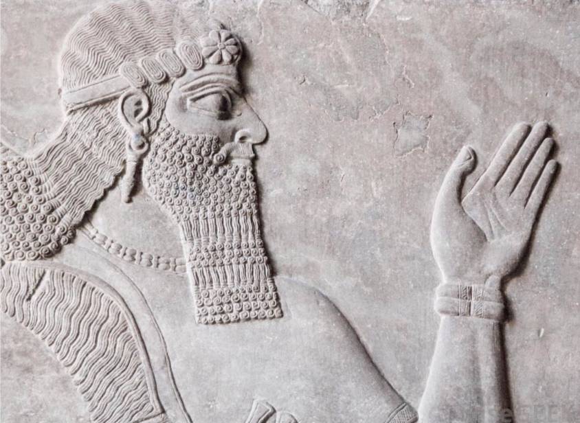
While anyone with a modicum of rationality knows that a huge proportion of the world’s debts are absolutely unpayable, it’s a fact that today any debt cancellation, however odious or illegitimate, remains taboo.
By Karel Vereycken, December 2020.
Debt repayment is presented by heads of state and government, central banks, the IMF and the mainstream press as imperative, inevitable, indisputable, compulsory. Citizens have elected their governments, so they must resign themselves to paying the debt. For not to pay is more than violating a symbol: it is to exclude oneself from civilization, and to renounce in advance any new credit that is granted only to « good payers ». What counts is not the effectiveness of the act, but the expression of one’s « good faith », i.e. one’s willingness to submit to the strongest. The only possible discussion is how to modulate the distribution of the necessary sacrifices.
It seems that the ultra-liberal, monetarist model that has been surreptitiously imposed on us is that of the Roman Empire: zero debt for states and cities, and no debt forgiveness for citizens!
In his treatise on Duties (De officiis), written in 44-43, Cicero, who had just quelled a revolt by people demanding a debt remission, justifies the radical nature of his policy towards indebtedness:
« What does the establishment of new debt accounts [i.e., remission] mean, if not that you buy land with my money, that you have this land, and that I don’t have my money? That’s why we have to make sure there are no debts, which can harm the state. There are many ways of avoiding it, but if there are debts, not in such a way that the rich lose their property and the debtors acquire the property of others. Indeed, nothing maintains the State more strongly than good faith (fides), which cannot exist if there is no need to pay one’s debts. Never has anyone acted more forcefully to avoid paying their debts than under my Consulate. It was attempted by men of all kinds and ranks, with weapons in hand, and by setting up camps. But I resisted them in such a way that this entire evil was eliminated from the State. »
What has been carefully concealed is that another human practice has also existed: moratoria, partial and even generalized debt cancellations have taken place repeatedly throughout history and were carried out according to different contexts.
Often, proclamations of generalized debt cancellation were the initiative of self-preservation-minded rulers, aware that the only way to avoid complete social breakdown was to declare a « washing of the shelves » – those on which consumer debts were inscribed – cancelling them to start afresh.
The American anthropologist David Graeber, in Debt, the first 5000 years (2011), pointed out that the first word we have for « freedom » in any human language is Sumerian amargi, meaning freed from debt and, by extension, freedom in general, the literal meaning being « return to the mother » insofar as, once debts were cancelled, all debt slaves could return home.
Debt cancellations were sometimes the result of bitter social struggles, wars and crises. What is certain is that debt has never been a detail of history.
David Graeber sums it up:
« For millennia, the struggle between rich and poor has largely taken the form of conflicts between creditors and debtors – disputes over the justice or injustice of interest payments, peonage, amnesty, property seizure, restitution to the creditor, confiscation of sheep, seizure of vineyards and the sale of the debtor’s children as slaves. And over the last 5,000 years, with remarkable regularity, popular insurrections have begun in the same way: with the ritual destruction of debt registers – tablets, papyri, ledgers or other media specific to a particular time and place. (After which, the rebels generally attacked cadastres and tax registers.) »
And as the great ancient scholar Moses Finley was fond of saying,
« All revolutionary movements have had the same program: cancellation of debts and redistribution of land. »
Let us now examine some historical precedents for voluntary debt forgiveness.
Debt cancellation in Mesopotamia
The earliest known debt cancellation was proclaimed in Mesopotemia by Entemena of Lagash c. 2400 BCE.
One of his successors, Urukagina, who was the last ruler of the 1st Dynasty of Lagash, is known for his code of rules that includes debt cancelation.
Urukagina’s code is the first recorded example of government reform, seeking to achieve a higher level of freedom and equality by limiting the power of priesthood and a usurous land-owner oligarchy. Usury and seizure of property for debt payment were outlawed. « The widow and the orphan were no longer at the mercy of the powerful man ».
Similar measures were enacted by later Sumerian, Babylonian and Assyrian rulers of Mesopotamia, where they were known as « freedom decrees » (ama-gi in Sumerian).
This same theme exists in an ancient bilingual Hittite–Hurrian text entitled « The Song of Debt Release ».
The reign of Hammurabi, King of Babylon (located in present-day Iraq), began in 1792 BC and lasted 42 years.
The inscriptions preserved on a 2-meter-high stele in the Louvre are known as the « Hammurabi Code ». It was placed in a public square in Babylon. If it is a long, very severe code of justice, prescribing the application of the law of retaliation (« an eye for an eye, a tooth for a tooth »), its epilogue nevertheless proclaims that « the powerful cannot oppress the weak, justice must protect the widow and the orphan (…) in order to render justice to the oppressed ».
Hammurabi, like the other rulers of the Mesopotamian city-states, repeatedly proclaimed a general cancellation of citizens’ debts to public authorities, their high officials and dignitaries.
Thanks to the deciphering of numerous documents written in cuneiform, historians have found indisputable evidence of four general debt cancellations during Hammurabi’s reign (at the beginning of his reign in 1792, in 1780, in 1771 and in 1762 BC).
Babylonian society was predominantly agricultural. The temple and palace, and the scribes and craftsmen they employed, depended for their sustenance on a vast peasantry from whom land, tools and livestock were rented.
In exchange, each farmer had to offer part of his production as rent. However, when climatic hazards or epidemics made normal production impossible, producers went into debt.
The inability of peasants to repay debts could also lead to their enslavement (family members could also be enslaved for debt).
The Hammurabi Code obviously wanted to change this. Article 48 of the Code of Laws states:
« Whoever owes a loan, and a storm buries the grain, or the harvest fails, or the grain does not grow for lack of water, need not give any grain to the creditor that year, he wipes the tablet of the debt in the water and pays no interest for that year. »
This ideal of justice is notably supported by the terms kittum, « justice as the guarantor of public order », and « justice as the restoration of equity. » It was asserted in particular during the « edicts of grace » (designated by the term mîsharum), a general remission of public and private debts in the kingdom (including the release of people working for another person to repay a debt).
Thus, to preserve the social order, Hammurabi and the ruling power, acting in their own interests and in the interests of society’s future, periodically agreed to cancel all debts and restore the rights of peasants, in order to save the threatened old order in times of crisis, or as a kind of reset at the beginning of a sovereign’s reign.
Proclamations of general debt cancellation are not confined to the reign of Hammurabi; they began long before him and continued afterwards. There is evidence of debt cancellations as far back as 2400 BC, six centuries before Hammurabi’s reign, in the city of Lagash (Sumer); the most recent date back to 1400 BC in Nuzi.
In all, historians have accurately identified some thirty general debt cancellations in Mesopotamia between 2400 and 1400 BC.
These proclamations of debt cancellation were the occasion for great festivities, usually during the annual spring festival. Under the Hammurabi dynasty, the tradition of destroying the tablets on which debts were written was established.
In fact, the public authorities kept precise accounts of debts on tablets kept in the temple. Hammurabi died in 1749 BC after a 42-year reign. His successor, Samsuiluna, cancelled all debts to the state and decreed the destruction of all debt tablets except those relating to commercial debts.
When Ammisaduqa, the last ruler of the Hammurabi dynasty, acceded to the throne in 1646 BC, the general cancellation of debts he proclaimed was very detailed. The aim was clearly to prevent certain creditors from taking advantage of certain families. The annulment decree stipulates that official creditors and tax collectors who have expelled peasants must compensate them and return their property, on pain of execution.
After 1400 BC, no deeds of debt cancellation have been found, as the tradition has been lost. Land was taken over by large private landowners, and debt slavery returned.
In Egypt
In Ancient Egypt interest-bearing debt did not exist for most of its history. When it started spreading in the Late Period, the rulers of Egypt regulated it and a number of debt remissions are known to have occurred during the Ptolemaic era, including the one whose proclamation was inscribed on the Rosetta Stone.
Now on display at the British Museum in London, the « Rosetta Stone » was discovered on July 15, 1799 at el-Rashid (Rosetta) by one of Napoleon’s soldiers during the Egyptian campaign. It contains the same text written in hieroglyphs, demotic (Egyptian cursive script) and Greek, giving Jean-François Champollion (1790-1832) the key to the passage from one language to another.
This was a decree issued by Pharaoh Ptolemy V on March 27, 196 BC, announcing an amnesty for debtors and prisoners. The Greek Ptolemy dynasty that ruled Egypt institutionalized the regular cancellation of debts.
It was perpetuating known practices, since Greek texts mention that Pharaoh Bakenranef, who ruled Lower Egypt from c. 725 to 720 BC, had promulgated a decree abolishing debt slavery and condemning debt imprisonment.
TRANSCRIPTION OF THE PHARAOH’S DECREE
ON THE ROSETTA STONE:
Assembled the Chief Priests and Prophets there and those who enter the inner temple to worship the gods, and the Fanbearers and Sacred Scribes and all the other priests of the temples of the earth who have come to meet the king at Memphis, for the feast of the Assumption of PTOLEMEE, THE LIVING FOREVER, THE BELOVED OF PTAH, THE GOD EPIPHANES EUCHARISTOS, the successor of his father, All assembled in the temple of Memphis on this day when it was declared:
“that King PTOLEMEE, THE LIVING FOREVER, THE BELOVED OF PTAH, THE GOD EPIPHANES EUCHARISTOS, the son of King Ptolemy and Queen Arsinoe, the Philopator Gods, both benefactors of the temple and those who dwell therein, as well as their subjects, being a god from a god and the goddess loves Horus the son of Isis and Osiris who avenged his father Osiris by being favorably disposed towards the gods, delivered to the revenues of the temples silver and corn and undertook much expenditure for the prosperity of Egypt, and the maintenance of the temples, and was generous to all out of his own resources ;
“and exempted them from some of the revenues and taxes levied in Egypt and alleviated others so that his people and all others could be in prosperity during his reign ;
“and that he cleared the debts to the crown for many Egyptians and for the rest of the kingdom; ”
The existence of this decree therefore confirms that the practice had existed for many centuries.
The Greek historian Diodorus Siculus (Ist Century BC) provides the following rationale for abolishing the debt bondage by Pharaoh Bakenranef:
« For it would be absurd… that a soldier, at the moment perhaps when he was setting forth to fight for his fatherland, should be haled to prison by his creditor for an unpaid loan, and that the greed of private citizens should in this way endanger the safety of all »
As one can see here, one of the very pragmatic reasons for debt cancellation was that the Pharaoh wanted to have a peasantry capable of producing enough food and, if need be, able to take part in military campaigns. For both of these reasons, it was important to ensure that peasants were not expelled from their lands under the thumb of creditors.
In another part of the region, the Assyrian emperors of the 1st millennium BC also adopted the tradition of debt cancellation.
In Greece: Solon of Athens
In Greece, the Athenian lawmaker Solon (c. 638 BC–558 BC), in order to rectify the widespread serfdom and slavery that had run rampant by the 6th century BCE, introduced a set of laws nown as the Seisachtheia introducing debt relief.
Before Solon, according to the account of the Constitution of the Athenians attributed to Aristotle, debtors unable to repay their creditors would surrender their land to them, then becoming hektemoroi, i.e. serfs who cultivated what used to be their own land and gave one sixth of produce to their creditors. However, should the debt exceed the perceived value of debtor’s total assets, then the debtor and his family would become the creditor’s slaves as well. The same would result if a man defaulted on a debt whose collateral was the debtor’s personal freedom. The fight for debt relief and the fight to abolish slavery were in practice identical.
Solon’s seisachtheia laws immediately cancelled all outstanding debts, retroactively emancipated all previously enslaved debtors, reinstated all confiscated serf property to the hektemoroi, and forbade the use of personal freedom as collateral in all future debts. The laws instituted a ceiling to maximum property size – regardless of the legality of its acquisition (i.e. by marriage), meant to prevent excessive accumulation of land by powerful families.
In the Torah and Old Testament
Social justice, particularly in the form of forgiving debts that shackle the poor to the rich, is a leitmotif in the history of Judaism. It was practiced in Jerusalem in the 5th century BC.
The writing of the Torah was completed at this time. Deuteronomy, 15 states:

The Year for Canceling Debts
15 At the end of every seven years you must cancel debts.
2 This is how it is to be done: Every creditor shall cancel any loan they have made to a fellow Israelite. They shall not require payment from anyone among their own people, because the Lord’s time for canceling debts has been proclaimed.
3 You may require payment from a foreigner, but you must cancel any debt your fellow Israelite owes you.
4 However, there need be no poor people among you, for in the land the Lord your God is giving you to possess as your inheritance, he will richly bless you,
5 if only you fully obey the Lord your God and are careful to follow all these commands I am giving you today.
6 For the Lord your God will bless you as he has promised, and you will lend to many nations but will borrow from none. You will rule over many nations but none will rule over you.
7 If anyone is poor among your fellow Israelites in any of the towns of the land the Lord your God is giving you, do not be hardhearted or tightfisted toward them.
8 Rather, be openhanded and freely lend them whatever they need.
9 Be careful not to harbor this wicked thought: “The seventh year, the year for canceling debts, is near,” so that you do not show ill will toward the needy among your fellow Israelites and give them nothing. They may then appeal to the Lord against you, and you will be found guilty of sin.
10 Give generously to them and do so without a grudging heart; then because of this the Lord your God will bless you in all your work and in everything you put your hand to.
11 There will always be poor people in the land. Therefore I command you to be openhanded toward your fellow Israelites who are poor and needy in your land.
Thus, the Israelites were obliged to free Hebrew slaves who had sold themselves to them for debt, and to offer them some of the produce of their small livestock, their fields and their wine presses, so that they would not return home empty-handed.
As the law is too rarely applied, Leviticus reaffirms it by modulating it:
The Year of Jubilee
8 “‘Count off seven sabbath years—seven times seven years—so that the seven sabbath years amount to a period of forty-nine years.
9 Then have the trumpet sounded everywhere on the tenth day of the seventh month; on the Day of Atonement sound the trumpet throughout your land.
10 Consecrate the fiftieth year and proclaim liberty throughout the land to all its inhabitants. It shall be a jubilee for you; each of you is to return to your family property and to your own clan.
11 The fiftieth year shall be a jubilee for you; do not sow and do not reap what grows of itself or harvest the untended vines.
12 For it is a jubilee and is to be holy for you; eat only what is taken directly from the fields.
13 “‘In this Year of Jubilee everyone is to return to their own property.
14 “‘If you sell land to any of your own people or buy land from them, do not take advantage of each other.
15 You are to buy from your own people on the basis of the number of years since the Jubilee. And they are to sell to you on the basis of the number of years left for harvesting crops.
16 When the years are many, you are to increase the price, and when the years are few, you are to decrease the price, because what is really being sold to you is the number of crops.
17 Do not take advantage of each other, but fear your God. I am the Lord your God.
Today, some will tell you that under these conditions, a year before the jubilee date, credit would necessarily be scarce and expensive, and that debt would thus find its limit!
This is a mistake, because to ensure that the law is followed, the codes describe in detail how purchases and sales of goods between private individuals must be carried out according to the number of years elapsed since the previous jubilee (i.e., the number of years remaining before the goods must be returned to their previous owner).
Another passage, this time from the prophet Jeremiah, vividly illustrates the scope of the law on the remission of debts.
Faced with the advance of enemy armies towards Jerusalem in 587 B.C., Jeremiah supports, in God’s name, the undertaking of King Zedekiah (then ruler of the Kingdom of Judea), who demands the immediate release of all those enslaved for debt from the powerful forces of his kingdom (Jer. 34:8-17).
Jeremiah forcefully recalls the ancient demand for the freeing of slaves… which the king, in fact, needs to patriotically reunite the social classes before the battle, and give himself sufficient troops free of all servile obligations!

A passage in the Book of (the prophet) Nehemiah (447 BC), the governor of Persian Judea under Artaxerxes I of Persia (465–424 BC), influenced by the ancient Mesopotamian tradition, also proclaims the cancellation of debts owed by indebted Jews to their rich compatriots.
The social situation Nehemiah discovered in Judea was appalling. To remedy the problem, Nehemiah placed the law of debt relief within a religious framework, the Covenant with Yahweh. From then on, it was God himself who commanded the forgiveness of debts and the liberation of slaves and their land, for the land belonged to God alone.
Nehemiah Helps the Poor
« Now the men and their wives raised a great outcry against their fellow Jews.
2 Some were saying, “We and our sons and daughters are numerous; in order for us to eat and stay alive, we must get grain.”
3 Others were saying, “We are mortgaging our fields, our vineyards and our homes to get grain during the famine.”
4 Still others were saying, “We have had to borrow money to pay the king’s tax on our fields and vineyards.
5 Although we are of the same flesh and blood as our fellow Jews and though our children are as good as theirs, yet we have to subject our sons and daughters to slavery. Some of our daughters have already been enslaved, but we are powerless, because our fields and our vineyards belong to others.”
6 When I heard their outcry and these charges, I was very angry.
7 I pondered them in my mind and then accused the nobles and officials. I told them, “You are charging your own people interest!” So I called together a large meeting to deal with them
8 and said: “As far as possible, we have bought back our fellow Jews who were sold to the Gentiles. Now you are selling your own people, only for them to be sold back to us!” They kept quiet, because they could find nothing to say.
9 So I continued, “What you are doing is not right. Shouldn’t you walk in the fear of our God to avoid the reproach of our Gentile enemies?
10 I and my brothers and my men are also lending the people money and grain. But let us stop charging interest!
11 Give back to them immediately their fields, vineyards, olive groves and houses, and also the money you are charging them—one percent of the money, grain, new wine and olive oil.”
12 “We will give it back,” they said. “And we will not demand anything more from them. We will do as you say.”
If we add to these passages the countless verses forbidding the lending of interest to fellow human beings and the taking of property as collateral, we get an idea of what the Israelites in the land of Canaan had put in place to try and maintain a certain social equilibrium.
Alas, in the first century AD, debt forgiveness and the freeing of slaves from debt were swept away from all Near Eastern cultures, including Judea.
The social situation there had deteriorated to such an extent that Rabbi Hillel was able to issue a decree requiring debtors to sign away their right to debt forgiveness.
In the Bible and New Testament
What happened to debt forgiveness in the New Testament?
While the Acts of the Apostles and the writings of the Fathers of the Church sometimes express a great docility, Jesus’ position on the forgiveness of debts, as reported repeatedly and most forcefully in Luke’s Gospel, chapter 4:16-21, appears to be marked by a revolutionary prophetic breath.
Luke places the passage at the beginning of Jesus’ public life. He makes it a key to everything that follows.
16 Jesus went to Nazareth, where he had been brought up, and on the Sabbath day he went into the synagogue, as was his custom. He stood up to read,
17 and the scroll of the prophet Isaiah was handed to him. Unrolling it, he found the place where it is written:
18 “The Spirit of the Lord is on me,
because he has anointed me
to proclaim good news to the poor.
He has sent me to proclaim freedom for the prisoners
and recovery of sight for the blind,
to set the oppressed free,
19 to proclaim the year of the Lord’s favor.”
20 Then he rolled up the scroll, gave it back to the attendant and sat down. The eyes of everyone in the synagogue were fastened on him.
21 He began by saying to them, “Today this scripture is fulfilled in your hearing.”
Let’s not forget that the « year of the Lord’s favor (Jubilee Year) » to which he called, demanded at once rest for the land, forgiveness of debts and the liberation of slaves.
In the midst of the slave-owning Roman Empire, which fiercely rejected the concept of debt forgiveness, Jesus’ declaration could only be seen as a declaration of war on the ruling system.
Before he was arrested, Jesus made a highly symbolic material gesture: he forcefully overturned the tables of the money-changers in the Jerusalem temple. For the Jewish high priests and the Roman authorities, this was too much.
Peace of Westphalia of 1648
In 1648, after five years of negotiations, led by the French diplomat Abel Servien on the instructions of Cardinal Mazarin, the “Peace of Westphalia” was signed, putting an end to the Thirty Years’ War (1618-1648).
Long before the UN Charter, 1648 made national sovereignty, mutual respect and the principle of non-interference the foundations of international law.
But there was more. As we have documented, the peace deal also included the cancelation of debts that had become the very reason for continuing the war.
Unpayable, unsustainable and illegitimate debts, interests, bonds, annuities and financial claims, explicitly identified as fueling a dynamic of perpetual war, were examined, sorted out and reorganized, most often through the cancellation of debts (articles 13 and 35, 37, 38 and 39), through moratoria or debt rescheduling according to specific timetables (article 69).
Article 40 concludes that debt cancellations will apply in most cases, “and yet the Sums of Money, which during the War have been exacted bona fide, and with a good intent, by way of Contributions, to prevent greater Evils by the Contributors, are not comprehended herein. » (Implying that these debts would have to be honored.)
Finally, looking to the future, for Commerce to be “reestablished”, the treaty abolished many tolls and customs established by “private” authorities for they were obstacles to the exchange of physical goods and know-how and hence to mutual development. (Art. 69 and 70).
TREATY OF WESTPHALIA (1648)
Art. 13:
“Reciprocally, the Elector of Bavaria renounces entirely for himself and his Heirs and Successors the Debt of Thirteen Millions, as also all his Pretensions in Upper Austria; and shall deliver to his Imperial Majesty immediately after the Publication of the Peace, all Acts and Arrests obtain’d for that end, in order to be made void and null.”
Art. 35:
“That the Annual Pension of the Lower Marquisate, payable to the Upper Marquisate, according to former Custom, shall by virtue of the present Treaty be entirely taken away and annihilated; and that for the future nothing shall be pretended or demanded on that account, either for the time past or to come.”
During the Cold War
In the United States, Eisenhower was elected in November 1952.
His Secretary of State, John Foster Dulles, otherwise an evil man, noted that, despite the Marshall Plan, Europe, still burdened by a mountain of debt dating from before the First World War and the Treaty of Versailles, was unable to regain momentum.
So much so that it is in danger of turning to the USSR!
Action was called for. In 1953, under the leadership of German banker Hermann Abs, a former Deutsche Bank executive, a major conference was organized in London.
It was decided to write off 66% of Germany’s 30 billion marks in debt.
It was wisely agreed that annual repayments of German debt should never exceed 5% of export earnings. Those wishing to have their debts repaid by Germany should instead buy its exports, enabling it to honor its debts.
In other words, nothing like the madness recently imposed on Greece to « save » the euro!
Although this was done in the name of geopolitical principles, i.e. « in favor of some » but « against others », once again, it was in the name of a better future, i.e. a Europe capable of being the showcase of capitalism in the face of Moscow, that we were able to shed the weight of the past.
On the origins of Modern Art, the problem of Symbolism


“At the turn of this century, painting is in bad shape. And for those who love the fatherland of paintings, very soon there will only remain the closed spaces of museums, in the same way there remains parcs for the amateurs of nature, to cultivate the nostalgia of that what doesn’t exist any longer…”
Jean Clair, Harvard graduate, director of the Musée Picasso
and of the centenary of the Venice Biennale of Contemporary Art in 1995.
Karel Vereycken, April 1998
Something is fairly rotten in the kingdom of Art, and if today (1998), finally some kind of debate breaks out, it is, halas, for quite bad reasons. Since it is uniquely in the context of budget cuts imposed on Europe by the Maastricht treaty that some questions are raised to challenge public opinion on a question carefully avoided till now: can we go on indefinitely subsidizing “modern artistic creation”, or what pretends to be so, with the tax-payers money, without any demand and outside any criteria?
Abusively legitimated by its status as a victim of the totalitarian regimes of Hitler, Stalin and Mao, Modern Art’s value as an act of resistance to totalitarianism watered away with the collapse of these regimes.
While we oppose the current budgetary cuts, since it would finish off the sick patient, we nevertheless propose to examine truthfully the illness and the potential remedies to be administered.
In France, the slightest critique immediately provoked the traditional hysterical fits. Raising a question, formulating an interrogation or even simply expressing a doubt on the holiness of Modern Art continues to be considered tantamount to starting an Inquisition. Even well integrated critiques such as the « left » leaning author Jean Baudrillard, or the director of the Paris Picasso museum Jean Clair and even the modern painter Ben, immediately bombarded by acid counter-attacks from the french and international Art nomenclature, accusing them of being “reactionaries”, “obscurantist” and, to crown it all, of being “fascists”, “nazis” and even “anti-Semites”.
For seasoned observers these attacks remind the simplicity of Stalinist rhetoric: “Anybody discussing the revolution is a fascist”. Modernist musical composer Pierre Boulez even accused a journalist of being a “Vichy collaborator” because unconvinced of the utility of the computers of his musical research foundation IRCAM.
That spark of debate, if any, became rapidly poisoned by the possessive defense of the scarce budget allocations. Why all this noise? Jean Clair already exposed his views fourteen years ago in his book “Considérations sur l’Etat des Beaux-Arts, Critique de la Modernité” (1983) without provoking such a hullabaloo.
But in times of crisis, funds seem to provoke more passion than fundamentals. In any case, we welcome Clair’s courage. His ironical critique of the rampant snobbism of the tiny, incestuous world of contemporary Art makers is totally uncompromising. His defense of the necessary rebirth of the basic skills of drawing and pastel is on the mark.
Clair rightly makes a distinction between « Contemporary » art on one side and « Modern » art on the other side. Contemporary Art, broke with Modern Art from the point it became a systemic apology of “non-sense [absence of meaning] that was elected a system. » Reality, writes Clair, leads him to demand that we return to “meaning” (deliberately banned by « contempory » art) which was the very power of « Modern » Art.
To understand this difference, inspired by the insights and works of my friend, american art historian Michael Gibson, we shall document here that the birth of « Modern » art was nothing but a mutation from figaritive « Symbolism » to non-figurative (abstract) Symbolism, both accepting their role of expressing a symbolic meaning. « Contemporary art », profiting from the confusion of the idea of a « secret » meaning inherent in symbolic artistry, then sneaked in and tried to pretend that any sort of meaning should and could be eliminated from artistic expression.
QUESTION:
« So if I understood you correctly, you claim there exist criteria that are universal, enabling rational man to distinguish with reason between beauty and ugliness which would free art from the arbitrary caprices of taste?”
ANSWER:
« Uh, yes, and even if one cannot establish a catalogue filled with models and instructions enforceable till the end of all times, we firmly think there exists a way of looking at things, a mental attitude which we can prove to have been fruitful since the early cave paintings, as those of Chauvet in southern France dating from 50.000 years B.C., till today. »
To say it differently, there is no such thing as the aesthetics of form, but some kind of aesthetics of the soul.
Any attempt to frame aesthetics, as a set of formal rules of the visible forms is the shortest road to finish in a sterile academic dead end.
By analogy, we could say that such an attempt in the domain of language would make linguistics the science of poetry…
Leonardo da Vinci defined the mission of the painter as the one who has to « make visible the invisible ». So it is up to us to define the aesthetics of the invisible and how they manifest themselves in the visible realm.
How to represent the world
Let’s look at ways of representing phenomena by starting from what appears to be the « most simple ».
A. “Bounded objects” of an inorganic or organic nature: for example stones, a glass bottle, but also a flower or the body of an animal or a man. Their relative finiteness makes their representation easier. But to “make them alive”, one has to show their participation to something infinite: the infinite variations of the color or a stone, the numerous reflections of light shattered by the glass bottle, the relative infinite number of leaves of a tree, the huge number of successive gestures which dictate spirit and life to the bodies of living beings. As you can see now, these so-called “simple” phenomena oblige us to choose, beyond simple sense perception, perceptions that enable us to express the idea of the object rather than its mere form.
B. “Openly unbounded objects”: for example a wave of the ocean, a forest, the clouds in the sky, or the expression of the eyes of a human being. Even more than in A., the Chinese principle of the “li” has to be considered. Instead of imitating their exterior form, and since their sometimes turbulent shapes escape in any case from our limited sense-perceptions, the exterior form has to be regarded as the expression of the idea that was the generating principle and we have to concentrate on choosing elements in the visible realm that indicate that “higher reality”. That makes the difference between the portrait of a living being and the portrait of a wax model…
C. “Ideas free from an object”: for example Love, Justice, Fidelity, Laziness, Cold, etc. How can we build gangways to the visible capable of representing these “higher ideas”?
ANSWER:
- Instead of representing the idea, I can try to substitute it with the object of the idea (one of Plato’s favorite subjects). For example I can try to represent the idea of Love by representing a woman. However, she cannot be but the object or the subject of love (She is loved or loves), but she is not Love itself.
- Since I’m in trouble having a representation in the visible realm of an idea of a “superior” nature, I decide to designate it by symbol. For example, a little heart to symbolize Love. For a Martian visiting Earth in the context of interplanetary tourism, the little heart has no meaning. By logical deduction, he could arrive at the conclusion the heart indicates heart patients, or cardiologists or eventually the designed victims of an Aztec sacrificial cult. In order to understand what is involved, some earthling has to initiate him into the pre-convened meaning of the symbol to which the inhabitants of earth agreed to. If not, it might take some time before he understands the “secret” meaning of the symbol.
- That symbol can be a simple visible element but also a little story we call allegorical. Illustrating an allegory will always remain a simple didactical exercise far underneath the sublime mission of art.
- The notion of a parable, as those one finds in the Bible, brings us closer to the wanted solution by its metaphorical character (Meta-poros in Greek meaning: that which carries beyond). The isochronical presence of several paradoxes, provoking surprise and irony by the ambiguities of the painting shakes up the sense certainty of our empirical perceptions that darken so much our natural predisposition for beauty.
SYMBOL and METAPHOR, What’s the difference?
Symbol: designates a thing
Metaphor: carries beyond the thing
Symbol: its only value is expressed by itself
Metaphor: its only value is given to it by implicit analogy.
Symbol: its secret meaning can only be learnt by convention
Metaphor: its meaning can be discovered by sovereign cognition.
Rembrandt’s Saskia
Let us examine together Rembrandt’s painting “Saskia as Flora” (1641), where she offers a flower to the viewer. Is this a portrait of Rembrandt’s wife along with the portrait of a flower? Or is there a new concept involved that arises in our mind as a result of this juxtaposition that could be called Love or Fidelity (to you I offer my beauty, as I offer you this flower…) The putting into visual analogy of two quite different things make appear a third one, which is in fact the real subject.
The easiest example of a real metaphorical paradox can be seen at work in wordplay or a cartoon drawing. For example if I draw a young couple in love and replace the head of the young man with the head of a dog, a completely different meaning is given to the image. The viewer, intrigued by the love relationship is surprised by the possessive (or submissive) character suggested by the dog head. Variations of the type of dog and his expression will vary the very meaning of the image. Once again, it is by the use of an implicit analogy that an unexpected arrangement gives us the means to grapple an idea beyond the object represented.
The little light bulb that goes on in our heads when we solve a metaphorical paradox gives us a threefold happiness. First the joy to think, since our thought process is precisely based on that unique process. Second to live in harmony with our world, which being a creative process itself “condemns” us to be free. And finally the joy that derives from the sharing of that happiness of discovery with other human beings who get even more creative in turn. Hence, every scientific or artistic discovery becomes a ray of light enlightening the path for humanity to go. The glowing enders of yesterday give us the fire to illuminate tomorrow.
But to do so, one cannot represent in a formal way the solution found. One is obliged to recreate the context which obliges the viewer to walk the same road we did till the precise point where he discovers himself the poetical concept.
The science of enigmas of Leonardo da Vinci

Renaissance genius Leonardo da Vinci was a specialist of this kind of « organized » enigmas, conspiracies to have us think. Let’s have a look at his painting “Saint John the Baptist”, his last painting and somehow his last will resuming all the best science of his creative mind. The ambiguous character of the person has been often used as “proof” of Leonardo’s alleged homosexuality.
One can indeed ask the question if represented here we see a man or a woman? The strong muscles of the arms plead for male while the gracious face argues for female. Desperate, our mind asks if this is devil or angel? While one finger points to heaven, similar to Raphael’s Plato in the « School of Athens », the other hand rests on the heart, and in the same time a coquette smile meets intelligent eyes…
Of course, Saint-John the Baptist, patron saint of Florence served as the symbol of a humanist Platonic current that realized the fact that the « little lights » of classical Greece announced the coming of the « great light » of Christianity.
Scholastical Catholicism of those days pretended that anybody living before Christ could be nothing more than a pagan. So what about Saint John the Baptist? The compositional method here employed is not of a symbolical nature, but that of paradoxical metaphor, i.e. build by enigmas that guide us, if we accept the challenge, to reflect in a philosophical way about the nature of mankind: how is it possible we are finite in some parts and infinite in others? That we are mind, life and matter? Of divine and human nature?
That is in some words what we mean by the method of paradoxical metaphors, the only method which gives sense to the word « classic », since conceived in a universal way for all men in the time of all times.
The opposite approach is the symbolist one, officially named after an artistic current that swept over Europe at the end of the XIXth century.
Together with impressionism that capitulated to positivism, symbolism was the mother of Modern Art and its bastard son Contemporary Art.
The symbol, erected as a method of artistic expression, is characteristic of a society that is incapable of change. It celebrates the banishing of the movement of progress but masks that self-denial with the never-ending multiplication of images and objects, always equal to themselves. Symbolism is nothing but the transformation into an object of a strong emotion or a mystical thought. The increase of its effect through incantation, fetishism, repetition, etc., agitating the symbol for its magical value as such, evokes the same obsessive fixation as pornography. As the American thinker Lyndon LaRouche ironically underscored the point:
“the difference between Beethoven (method of metaphor) and Wagner (method of symbolism) is defined by the level at which emotions are provoked in the audience. In the case of Beethoven, the beauty evoked brings us to tears. In the case of Wagner, it is the chairs that get wet…”
From there on, as we will document in due course, the arising of “Modern Art” reveals itself to be nothing more than a mere linear transposition of “figurative” symbolism to “abstract” symbolism.
These terms are obviously empty shells, since all figuration is figurative, and all figuration is the expression of what could be called an “abstract” concept or idea, conscious or not.
So, contrary to Contemporary Art, whose aggressive meaning is that nothing has, can or has the right to have any meaning, Modern Art claims to possess a sense of meaning, but that meaning is mystical-symbolical and hermetic by nature. We are not saying that symbols should be banned from Art, but we cannot but underline that symbolistical though as a compositional method is incompatible with Art’s nature.
Real Art concentrates on communicating a unique human quality, the Sublime, that expresses freedom and not that of a man enslaved either to his sentiments neither to his principles.
Contemporary Art, as all large scale swindles, needs quite some rhetoric and literature to convince it’s public of its pure absolute relativity. It is said that each of us sees it differently; that we all possess our own criteria and that formulating any judgment is by itself already an act of a totalitarian fascist in germ. It is somehow like the thief who accuses his victim of cupidity and lack of brotherly love when the victim refuses to hand over his purse. But if one claims the right to create something without meaning, one equally revindicates the right to no critique, and therefore ends any form of real debate beyond « it gives me a kick » or « no kick ».
That Art, when it is sincere, by claiming it cannot be apprehended by human cognition, defines itself as egoistical and asocial. It cannot but harvest what it sows: indifference.
Before entering two personalities considered being the godfathers of Modern Art, Wassily Kandinsky (1866-1944) and Piet Mondrian (1872-1944), it is necessary to situate the historical context in which they operated. Then we will investigate a high level political operation: the Theosophical Society whose malefic theories exerted great influence on both godfathers of Modern Art.
Symbolism, the final stage of Romanticism
To crush the republican spirit that emerged at the end of the eighteenth century, which saw the American and French revolution, the European oligarchy deployed initially Napoleon Bonaparte.
Then, on the ruins of the Napoleonic wars, they promoted the iron corset of the Holy Alliance and the impotent ideology of regretting: the privilege of the suffering heart. Romanticism, often described as a “movement for the liberation of the me, as a reaction against the regularity of classicism and the rationality of the preceding centuries” became the official culture of the Restoration before being adopted by the Monarchy of July.
Even the talented French poet Baudelaire, prisoner of the zeitgeist stated shamelessly: “What is there more absurd than progress?” or, premonitory:
“Who says romanticism says Modern Art, i.e. intimacy, spirituality, color, aspiration towards the infinite”.
In a way this was the expression of a certain revolt against positivism, a “scientific” materialism which some tried to impose top down and for which the hearts of men were not mobilized.
We are light-years away from the “science for all” approach which radiated Gaspard Monge at the early Ecole Polytechnique, or Lazare Carnot’s “Ode to enthusiasm”. It was the same Holy alliance that forced Carnot into exile and outrooted Monge´s influence at the Ecole, crushing France’s scientific and industrial progress.
In 1871, Louis Pasteur, in a beautiful article “Why France did not find a superior man in the moment of peril” analyzed the dramatic events of those days.
But also Germany was living under a real cultural dictatorship. Prince Metternich, by the Carlsbad decrees forbade any representation of Friedrich Schiller‘s theatre plays. Also, the “sulfurous” poet Heinrich Heine, mocking the Salons of Mme de Stael and all the other nostalgics of the lost glory of the past, became the permanent target of the Holy Alliance’s police operations.
Francesco Goya, who strongly lambasted the massacres of Bonaparte’s Spanish expedition (1810-1814) in his series “The disasters of War”, characterized this particular historic moment in his engraving “The sleep of Reason generates monsters”.
The Great Upheaval
On the economic front, it was only after Abraham Lincoln defeated the British backed pro-slavery Confederacy and the then ensuing industrial buildup (1861-1876), that a little progress was tolerated in Europe.
The oligarchy had to solve the following paradox: How can we counterbalance the rising American power while in the same time prevent the emergence of Republics in Europe, inspired by the American System, on the ruins of the European empires?
What some have called the « Great Upheaval » was nothing less than a profound transformation of daily life in Europe. It was precisely at that time that the Symbolist current got so dominant.
In the “industrial polygon of the Europe of steam” which connected Glasgow, Stockholm, Gdansk, Lodz, Trieste, Florence and Barcelona, it is estimated that of 7 persons from the country side, 1 stayed working the land, another went to the new world or the colonies, and the remaining 5 went working in the cities. The same estimate says that close to 60 million people left Europe. One can imagine the cultural choc for those who quit the magical world of pastoral backwardness.
In that sense, Symbolism was also a means for the oligarchy to deprive these incoming populations from the benefits of urban culture by keeping them in a state of irrationality.
The fear of political takeover by sovereign Nation-States dedicated to industrial and scientific progress was so great that the British Prime Minister, Lord Palmerston (1784-1865), activated through his agent Guiseppe Mazzini (1805-1872), the “Young Europe” movement, uniting most revolutionary currents of those days. Under the auspices of the Foreign Office’s Arab Bureau, the east saw the sudden birth of a whole series of Arab countries, eventually localized on this or that oilfield.
The Theosophical Society
It is in that context that one has to situate the extraordinary offensive of the Theosophical Society (TS), one of these pseudo-religions rising out of the esoterical swamp of the second half of the nineteenth century. It is useful to zoom in on the life of Helena Petrowna Blavatsky (HPB) (1831-1891), the main front figure of the TS.
Granddaughter of the Prussian General Alexis von Rottenstern-Hahn, HPB was born in 1831 in Ukraine.
At the age of sixteen, her parents married her to an old General with the name of Nicéphore Blavatsky, vice-governor ofprovince of Erivan, which she quitted nearly immediately.
In 1848, she meets a Copt with the name of Paulos Metamon and as early as 1851 she turns up in London, where she meets the “spiritualists” and meets the “revolutionary” Mazzini. In 1856 she affiliates with the Young Europe’s Carbonarist association.
Then, she travels across different continents having become a toy in the hands of her British promoters which she refers to as her “Spiritual masters”, as she called one of her controlling agents “Master Morya”.
As soon as 1851 she travels to the US and Mexico, crossing Texas and Louisiana. After numerous trips in the Caucasus, Syria and Lebanon, we find her on November 3, 1867, riding a horse siding Garibaldi. Severely wounded at the battle of Mentana, she’s left for dead.
While recuperating in Paris, she meets a journalist with the name of Michal, and the founder of French spiritism, Allan Kardec. The former claim they discovered and developed HPB’s faculties as a medium. Deployed in that capacity to Cairo, and in the USA, she’s accused of being a fraudster. It is relevant to situate Edgar Allan Poe’s literary production as the effort of the pro American system faction to ridicule the British offensive in favor of esoteric irrationality.
Colonel Henry Steel Olcott
Around 1874, Blavatsky receives the order to enter into contact with a lawyer and insurance expert: Henry Steel Olcott.
Former officer of the Military Police, he became colonel during the civil war and shared his life in between Masonic lodges and spiritism. Active as a journalist, he was in charge of covering paranormal phenomena for the New York Sun and the New York Graphic.

Olcott got many inroads into the American esoterical scene of those days: John King, William Stainton Moses, Leadbeater, the Miracle Club of Philadelphia and a secret society called The Hermetic Brotherhood of Luxor whose members signed their writings with a swastika, symbol of the divinity of Tibet, the immense mountain plateau where supposedly the Aryan race found refuge at the time of the great deluge…
Then, on October 20, 1875 was founded in New York a “Society for Spiritualist investigations”. Its president was Olcott; the two vice-presidents were Felt and Pancoast, while Blavatsky figured as a mere secretary. Without willing to downplay her personal role, it looks she was brought in more for propagandistical reasons than in regard of her proper leadership qualities. As prominent members one can mention William Q. Judge and Charles Sotheran, both high dignitaries of Anglo-American masonry.
It is also remarkable that the Confederate General Albert Pike, Grand Master of the Scottish Rite of the Southern district based in Charleston, and one of the founders of the Ku Klux Klan met Blavatsky in those days, but seems to have dropped her, considering her to low level. Pike’s spiritual reputation is largely overdone and he has been accused of having extensively plagiarized the French occultist Elipha Levi.
Less than a month later, on November 17, 1875, the Society’s named was changed into “Theosophical Society”. Olcott and Blavatsky immediately started a great project to conquer the minds of India.
Officially, they pretended to establish “The Great Contact”, a bridge between the initiated of the East with those of the West and to fusion them together.
HPB gets without any difficulty the American nationality while Olcott obtains from the president of the United States, Rutherford Hayes, a handwritten clearance, a document requesting American diplomats all over the world to provide them their aid. Also, the US Secretary of State provided Olcott a diplomatic passport, something relatively rare for a non-career diplomat. When they reached ground in India, all this American help will give them the means to establish the “British Theosophical Society” (sic).
The British oligarchy seemed to have preferred Hinduism and its great toleration of the cast system where individuals’ desires for a better life are hoped for in the next one, as a preferential partner for the British oligarchy and its imperial class society.
The fundamental choice of the cultural matrix that defines the particular beliefs, transcending any particular form of regime, has always been the “secret weapon” guaranteeing the survival of the oligarchical system. In this way, it is not any longer necessary to police people’s minds on issues, since you control the underlying axioms shaping their thought process itself.
What the Theosophical Society claims today in regard to its role in the birth of a national consciousness of India is an ugly lie, and maybe without Theosophy India might have gained independence a century earlier!
While it is true that Gandhi, who encountered the TS in a vegetarian club in London, studied their works, he never really adopted their convictions. After having started the TS in India, Olcott, in the same geopolitical strategy, will explore Buddhism going through Asia and settle in Japan to wake up the “sleeping masses”.
Olcott composed a Buddhist catechism, created a multicolor Buddhist flag and a General Committee of Buddhist Affairs that functioned as a kind of Vatican for Buddhism. He also held an extraordinary conference in Japan’s military center, Hiroshima. There he distributes swastikas to the audience to which he predicts the coming of terrible wars will strike humanity and that Hiroshima will become one of the symbols for peace and fraternity in the world (sic)!
Swipe Christianity of the Earth!
Olcott and Blavatsky seemed to be quite effective in performing funny magical tricks. Some of them were described by one of their victims, Mme de Jelihowsky:
- Clear and direct answers, of telepathic nature.
- Formulas pronounced in Latin, by way of hits, for remedies which resulted always in healing.
- Divulgation in public of secrets concerning persons that were present but that hurted Blavatsky by their doubts.
- Change of the weight of furniture or persons at will.
- Letters written by unknown correspondents with a writing that was not hers. Often, when somebody asked a question she would say: go in your room, and in such or such a place you will find a letter answering your question.
- Appearance and disappearance of objects without a plausible explanation.
- Faculty to let music be heard at will, wherever and whenever desired.
When depressed, Blavatsky admitted she swindled her admirers.
In their magazine, “The Blue Lotus”, Olcott wrote on November 27, 1895, p. 418:
“Certain days, she was in such a state of mind that she denied the powers by which she had given us carefully controlled demonstrations and pretended to have deceived her public”.
Behind all this cheap mumbo-jumbo reserved for the naïve members of the TS, there was small initiated elite aware of their real geo-strategical imperialism of the mind.
“Our aim”, said Blavatsky, in line with British geopolitics, “is not to restore Hinduism, but to swipe Christianity of the Earth”.
After the cremation of Baron of Palm, a rich donator of the TS, the first one in the history of the United States against which over three thousand people demonstrated, and who’s only aim was to introduce Hinduism to the U.S. population, Olcott and HPB exposed confusedly their doctrine in 1878 in “Isis unveiled”, a 1300 pages book that she called “the work of her life”, available in a more popular version under the name of “The Secret Doctrine”.
From the standpoint of Theosophy (which some called Theosophistry), and in a pure remake of manicheanism, religious beliefs could be classified between male and female religions.
The latter gave preponderance to peace, tranquility, sensuality, fertility and adaptation to the environment, while the male religions gave extensive privilege to the spirit of conquest and undertaking, to proselytism and to the superiority of male virtues.
Of course, Abraham and Moses, founders of the great monotheistic religions in which man does not adapt but intervenes and even discovers his specific harmony by transforming nature and highering its order, were targeted as the animal to be hunted. It was indeed these religions that largely overruled the ancient cult of mother goddess Gaia that became the Isis cult.
Isis cult

ISIS
Isis is the most illustrious of the Egyptian goddesses, in charge of the home, marriage and fertility. Her power spread throughout the universe after she discovered the secret name of the supreme God, Ra.
She embodied the feminine principle, the magical source of all transformation, and was considered by all esotericists to be the Initiatrix, the one who held the secret of life, death and resurrection.
According to legend, she put back together her husband Osiris, whom the serpent Set had cut into fourteen pieces and scattered across Egypt. Only one piece was missing: the penis. Isis made one in silver. Her marriage to Osiris gave birth to Horus, who triumphed in the battle against the evil spirit, Set, but Isis asked him to spare her in order to maintain the cosmic battle between good and evil…
Often designated by the annealed cross, symbol of millions of years of future life, which is confused with the « Isis knot », symbol of immortality, Isis is also represented by the Ouroboros, or the snake that bites its own tail: sexual union with oneself, permanent self-fertilization, perpetual transformation from death to life.
To dominate the battlefield of the mind, a Machiavellian strategy was conceived:
1. Since the adoration of the mother goddess and the practice of female virtues nearly remained exclusively existent in India and Tibet, archaic Hinduism had to be revived. That is the reason why the Theosophists ran to India in order to prevent the nearby extinction of Hinduism. In France, Blavatsky’s main sponsor in that effort was the wealthy Duchesse de Pomar, a Spanish aristocrat descending from the Marquis of Northampton. For that aim, Orientalism and the practice of Yoga had to be encouraged and popularized.
2. Since the TS on its own was too tiny to weaken Christianity, Judaism and Islam, the TS combined its efforts with anti-progress Fabian Socialism. The just battle for republican secularism, founded on the mutual respect of religious freedom was distorted into a virulent denunciation of the Judeo-Christian philosophical outlook. The socialist inspiration of Jean Jaurès, while criticizing the inherent materialism of financial capitalism and Marxism passionately defended, in the name of a sense of transcendence, the right of entire growth and the pursuit of happiness for every human individual.
3. To fight “male supremacy”, it was decided by speech and action to defend anything that supposedly opposed it. Defend universal peace, to fight for the end of sexual discrimination, to make women free from their body, to make love become stronger than violence. For that reason, the TS always took a woman as its front figure. Annie Besant, an attractive Irish protestant and a member of the Fabian Society took the leadership of the TS after having directed the “Malthusian League” of England in 1877.
Such a project obviously didn’t rally much enthusiasm in those days, especially not in Catholic countries. The opposition was so strong that the TS adapted its outlook into some form of esoteric Christianity designed to penetrate the Christian strata. But for HPB, Judeo-Christian monotheism remained nothing else but a barbaric schism of Buddhism:
“What some called with despise paganism was the ancient wisdom full of divinity; and Judaism with its offshoots, Christianity and Islam took all their inspiration of their ethnic father…”
According to HPB, Jesus the Essenian was persecuted by the Jews because “the Essenian were converts, Buddhist missionaries that had come to Egypt, Greece and even Judea”
So, for her, Christianity had to be “de-judaizised” to make it again compatible with the female principle. The basic postulate behind all this was her fascination for the Aryan civilization whose symbol, the Swastika, of notorious nazi reputation, figures still today in the emblem of the ST.

THE SWASTIKA
A widespread symbol in all ancient civilizations (Asia, Central America, Mongolia, India, Northern Europe, Celts, Basques, Etruscans, etc.), it represents the vortex of creation.
The swastika, which often replaces the wheel, is made of a cross, each branch of which is quadrupled, as in vectorial orientations that define a gyratory direction and then return to the center. Its numerical value is therefore four times four = sixteen. This is the powerful development of reality or the Universe, an expression of extreme secular power. Its appropriation by Hitler was no accident.
The rise of the Nazi movement has been associated with the rise of the famous Thule Society, another esoteric society in the theosophical style, in which we find Karl Haushofer, Adolf Hitler’s real master thinker.
The anthroposophists of Rudolf Steiner, a great admirer of Nietzsche and the eugenicist Haeckel, are a dissident branch of the Theosophical Society, omnipresent today among the German « Grünen » (Greens).
The Nabis (the Prophets)
That gives us some elements to situate the historical context into which arrived Modern Art. Esotericism was so much an invading fashion that many painters tried to explore pre-Christian religions to discover “forgotten symbols”.
That was certainly the case of the French symbolist Gustave Moreau when he painted the Gnostic myth of Jupiter and Sémélé. His pupils were the “moderns” Henri Matisse, Georges Rouault and Albert Marquet.
Another young symbolist, Emile Bernard inspired Gauguin, which in turn inspired Paul Sérusier.
Art historian Michael Gibson keenly pointed out the fact that a great number of the founding figures of Modern Art (Kandinsky, Mondrian, Malevitch, Picasso, etc.) have ALL been figurative symbolists at their start.
We are convinced they remained so, but that they deconstructed, i.e. downscaled, the complexity of their symbolic language to more primitive elements of the visual field (a color, a line, a number, a geometry, etc.).
Gibson accurately identified the precise moment of that historical turning point towards modernism with the shift provoked by the group of the “Nabis”.
In 1888, close to Pont-Aven in Brittany France, Paul Sérusier painted one day in the presence of Gauguin a landscape composed of vibrating primitive flat surfaces of colors on the top of his box of cigars.
That work was nicknamed “The Talisman” by his comrades who considered it a revelation of a new approach in painting, the absolute destruction of any reference to physical space by the use of light or perspective. Welcome to the mystical flat space of color and its “interior light”.
Paul Sérusier, Emile Bernard, Paul Gauguin and some friends rapidly called themselves the “Nabis”, which meant prophets in Hebrew.
They regularly met in a house they called “The Temple” on 22, Boulevard Montparnasse in Paris. The phrasing alone already indicates the messianic mindset of these converts. Hoaxer Sar Joséphin Péladan united in 1892 all these young talents to the Salon of the Rosicrucians.
In the « Amendments of the Esthetical Rosicrucians », Peladan explicitly prescribed history painting, the painting of patriotic or military scenes and also,
« any representation of contemporary life, portraits, rustic scenes, seascapes, oriental scenes, domestic animals, flowers, fruits, accessories and other exercises painters insolently dare to expose ».
On the contrary « and to privilege the ideal of Catholicism and mysticism, the Rosicrucian order will welcome any work founded on legend, myth, allegory, dream, etc. »
One sees here, how Catholicism, as much as its opponents, if stripped from its content and reduced to its bare symbols could coexist peacefully with these insanities.
One ends up wondering why a World War didn’t break out earlier with elites espousing such follies! And when it did break out in 1914, Jacques Emile Blanche declared,
« Very often during this chemical and scientific ‘cubist’ war, in the night damaged by the air raids, I dreamt about Stravinsky’s Sacre du Printemps ».
Peladan’s Salon brought together symbolists from Belgium, Holland, Germany, such as Ferdinand Hodler, Carlos Swabe, Jan Toorop, Ferdinand Knopff, Jean Delville, Georges Minne and Xavier Mellery, with « Nabis » like Emile Bernard, Félix Valloton and Charles Fillinger.
A great part of this came into France from across the Channel where a real revolt was going on against the Academicism of Sir Joshua Reynolds.
Under the auspices and protection of the very popular John Ruskin, a real nostalgic fanatic willing to bring humanity back to a pre-Renaissance mystical feudal order, appeared the Pre-Raphaelite Brotherhood, the PRB, that one of it’s degenerate founders, Dante Gabriel Rosetta, with sincere self irony called « Penis Rather Better »...
Kandinsky: from positivism to mysticism
The life path of the Russian painter Wassily Kandinsky, universally identified as the official godfather of Modern Art, gives us even more insight in the subject matter.
Kandinsky was born on December 4, 1866 amidst a wealthy orthodox family of aristocrats that made it as tea merchants. As Henri Matisse, he enters the University to study law and political economy.
In 1889 he’s sent on a mission by the Imperial Society of Natural Sciences and Ethnography to study the criminal law of the Finish community, the syrjaenen, a non-christianized tribe living in the province of Vologda, five hundred kilometers north of Moscow.
Kandinsky admitted in 1937:
« To be honest, the origin of my abstract painting has to be looked for in the popular Russian painting which I discovered for the first time during my trip to Northern Russia. »
Obtaining the post of law professor in 1896, another event that takes place the same year will completely “blow” his mind and decide him to quit his academic career entering a profound
mystical crisis.
That event was the discovery of radioactivity by the French physician Antoine-Henri Becquerel:
« For me, the disintegration of the atom, was the same thing as the disintegration of the entire world. The most solid walls suddenly collapsed. Everything became precarious, unstable and floppy. I wouldn’t any longer be astonished to see a stone melt in the air in front of me and become invisible. Science seemed to be annihilated: its most solid bases were a delusion, an error of scientists who were not building in a transfigurated light their work with a solid hand stone by stone, but grappling in the darkness. There, looking for truths by chance, and in their blindness, they confounded one object for the other. »
Kandinsky’s transition from “materialistic positivism” to “mystical spiritualism” is a clinical study case of the point we want to demonstrate.
Ecstatic after the discovery of a Wagner opera performance in Moscow, he leaves Russia to go live in Munich. He gives the following description of that experience:
« Lohengrin seemed a perfect realization of Moscow. The violins, the profound bases and particularly the wind instruments personify for me the splendid power of the twilight hours. »
In 1900, after a first refusal, he is admitted, together with Paul Klee, to enter the Academy of Franz von Stück, a well-referenced symbolist of Munich.
Von Stück’s painting, the « Kiss of the Sphinx » takes up the same theme as Moreau’s « Jupiter and Sémélé. » Attracted by (female) beauty, man in reality embraces death (a woman), a remake of the classical Eros/Thanatos theme.
Der Blaue Reiter to defeat materialism
One year later, the pupil becomes himself a teacher and creates the group “Phalanx”, symbol of the fight against Academicism.
Kandinsky reveals himself as an able organizer of art exhibits, throwing in his personal fortune and capable of convincing other sponsors.
Very rapidly he gives the exhibits an international dimension and the presence of foreign artists reinforces the illusion that the new tendency in art possesses a universal character. In the theosophist tradition, he rightly opens his academy to women, excluded till then from art academies!
His admiration for Blavatsky is limitless.
« Blavatsky was certainly the first to establish, after living for years in India, a solid link between these so-called « savages » and our culture. At that point, there came into being one of the greatest spiritual movements uniting a great number of people, materializing that union under the form of a « Theosophical Society ». That society is composed of lodges, who try to approach the questions of the spirit by the way of interior knowledge. »
Uniting the group of « Die Brücke » with his own efforts and those of Franz Marc and Paul Klee, he called into being the almanac of the “Blaue Reiter” (Blue Cavalier), in reality a reworked image of a Byzantine icon of Saint-Georges defeating the dragon of evil transposed into a bleu cavalier defeating materialism.
In his ground text of 1909, Concerning Spiritual in Art and painting in particular, Kandinsky builds up a theoretical system where every color possesses its own separate identity:
« Red, as one imagines oneself, as a color without border, typically warm, acts interiorly as a very living color, vivid and agitated, which does not possess the thoughtless character or yellow that gets dispersed to all sides, but gives the effect, despite all its energy and intensity, of the powerful note of immense force nearly conscious of its aim.
« There is in that effervescence and that eagerness, principally in itself and scarcely turned towards the exterior, some sort of male maturity. »
« When it is medium, as cinnabar, the red gets more permanent and increases its sharp sensibility: it is like a passion that burns with regularity, a force certain of itself, which is not easy to overlay, but which can be extinguished by the blue as red iron by water. That red tolerates nothing cold that makes it lose its resonance and its meaning. Or more exactly, that tragic, brutal cooling down produces a tone that painters, especially today, avoid and outlaw as « dirty ». They are wrong. Dirt, through its material form, represents materially, as a material being, possesses its interior resonance as any other material being. That why the attempt to avoid dirtiness in painting is as unjust and arbitrary as yesterday’s fear in front of « pure » color.
« One does not have to forget that all the means derived from the interior necessity are pure. Said differently, that what is dirty from the outside is pure from the inside. If not, what is pure from the outside is dirty inside. »
« The six colors, who, by couples, form three major contrasts, present themselves to us as a great circle, as a snake which bites its tail (symbol of infinity and eternity). And on the right and on the left we find the two great possibilities for silence; the one of death and the one of birth. »
One sees here the splendid rigor of a law professor, charmed by the “sense of construction of Roman law”, applying his science zealously to mysticism. Kandinsky’s writings are always inhabited with references to music, such as resonance, harmony, rhythm, etc.
In the same way musical ideas got freed of the presence of text and words, Kandinsky and argue that the same thing can be done in the visual domain using merely color, rhythm, form, etc. taken as entities on themselves.
But what music is he talking about, beneath Wagner? In Kandinsky’s immediate entourage we find the atonal composer Arnold Schönberg, who exploded the well-tempered system according to the same mystical principles, making it as such incapable of transmitting ideas.
From Mondrian to Breker
The famous Dutch cubist, Piet Mondrian, was another original product resulting from the mixture of Theosophy and Calvinist rigorism.
At that time, the TS launched a recruitment drive calling on those desiring to “have a place amidst the pioneers of the coming thinking”.
The unique picture decorating the wall of Mondrian’s studio in Laren was a large picture of Blavatsky. The artist was in frequent discussion with the Dutch theosophist writer Schoenmakers whose books Mondrian was distributing.
In 1892, he starts studying Theosophy and joins the TS in 1909.
His triptych, “Evolution” expresses the three stages of spiritual evolution: on the left, the mother goddess with triangles pointing down, the lowest level. In the middle, a female figure, with triangles pointing up, stage of activity and awakening. On the right the synthesis of both, the crossing triangles forming a David star.

Let us not forget talking about the official art of the Third Reich, with the figurative symbolism of the outright pagan sculptor Arno Breker.
Breker was Hitler’s personal pet sculptor and realized in 1936 the infamous incarnations of the Ubermensch (superior man) for the Nazi’s Olympic Stadium in Berlin.
As proven by interviews after the war, the so-called “apolitical” Breker was very well aware for what kind of power he was working.
His work “Bereitschaft” (readiness) of 1939 proves the case.
Mascot of the Parisian elites, since trained by a Frenchman, his personal exhibit at the Orangerie in Paris in 1942 drew over 80.000 visitors. He shared the fascist ethics of filmmaker Leni Riefenstahl, always ready to popularize nazi symbology.
Breker was befriended with Jean Cocteau, Vlaminck and Derain, and turned down Stalin’s offer to work for the USSR after the war.
A cubist in his early days (1922), he was disappointed by the meeting he had with Paul Klee and the Bauhaus, and invested himself in the total deification of the human body. Breker confirmed: “I always tried to give a meaning with symbols”.
In all his spirituality, Breker did not hesitate in his “Vision of Europe” to transpose an eagle’s heads on human bodies, making them into Horus, son of Isis.
The inversion of these symbolisms, restating the supremacy of male values over female values was nothing less than the creation of esthetics of war.
In 1980, Breker explained in an interview how he saved the life of Picasso and that of Aristide Maillol’s Jewish companion, Dina Vierny using his direct position as an intimate of Adolph Hitler.
The Italian futurists are another obscene example. Many proudly joined the fascist movements and some were really chocked Hitler condemned their modernism at a Nuremberg rally.
Marinetti, who published his “Futurist Manifesto” in Le Figaro in 1909 claimed proudly:
« Point 3: Literature being up till now an apology of contemplating immobility, ecstasy and sleep, we want to exalt the aggressive movement, the fevery insomnia, the gymnastic step, the dangerous jump, the slap in the face and the punching.
« Point 7: There is no beauty outside struggle. There are no masterpieces without aggressive character. Poetry must be a violent assault on unknown forces, to summate them to lie down before man…
« Point 9: We want to glorify war –the unique hygiene of the world, militarism, and patriotism, the destructive gesture of the anarchists, the nice ideas that kill, and the disdain of women…
« Point 10: We want to demolish the Museums and Libraries, fight moralism, feminism and all of opportunistic and utilitarian cowardness. »
As we have demonstrated, this modernism is nothing less than the restoration of the most backward values of ancient civilizations, deprived of their dynamic and reduced to caricatures of their worst defaults.
What we defend here is on the contrary a Renaissance, that is a universal but authentic process of artistic creation fertilized by the best contributions of all cultures, be them Indian, African, Asiatic, American or European.
Our critique of Modernism is not based on any nostalgic longing for a supposedly perfect Golden Age that is no more, but on the commitment to valorize mans dignity and mind.
If you really want to use the word modern, talk about the Mummy portraits of the Fayoum of the second and third century after DC.
Theosophy today
Even if there still exists today an international network of Blavatsky lodges from Antwerp to Philadelphia or Saint Petersburg, it has been in the recent days mainly the radical green current who is leading the fight to destroy the humanist cultural paradigm.
As the Theosophists yesterday, the Greens which have replaced the mother goddess (sounds too religious) with Mother earth (Gaia) express the same messianic zeal in their commitment to sweep the earth and often rally de facto the forces of race, soil and blood.
As yesterday, the green current gets supported by the highest spheres of Anglo-American aristocratic gangsterism.
Deceased financial angel of French archconservative Philippe de Villiers, Jimmy Goldsmith, has a brother, Teddy, who happens to be one of the main funders of Greenpeace!
Documents and articles consulted:
- Chaitkin, Anton, Tarpley, Webster, The Palmerston Zoo, Executive Intelligence Review, Vol. 21, nr.16, Apr.15, 1994.
- Cheminade, Jacques, Time to destroy the myth of Napoleon Bonaparte, Executive Intelligence Review, Vol. 23, 42, Oct.18, 1996.
- Clair, Jean, Considérations sur l’Etat des Beaux Arts – Critique de la Modernité, Gallimard, Paris 1983.
- Gibson, Michael, Le Symbolisme, Editions Taschen, Paris, 1994.
- Kandinsky, Nina, Kandinsky et moi, Flammarion, Paris 1978.
- Kandinsky, Wassily, Concerning the Spiritual in Art, and painting in particular, Dover Editions, New York, 1977.
- Lantier, Jacques, La Théosophie, Editions Culture, Art, Loisirs, Paris.
- LaRouche, Lyndon, How Cauchy ruined France, EIR, Vol.24, nr. 24, June 20, 1997.
- Noël, Bernard, Arno Breker et l’Art officiel, Jacques Damase Editeur, Paris 1981.
- Prampolino, Enrico, Stile Futuristica, nr. 3, Turin 1933.
- Parmelin, Hélène, Peinture, pierre de touche de la liberté, L’Unité nr. 416, 1978.
Rembrandt: 400 years old and still young!

Rembrandt H. van Ryn, was born on July 15, 1606, as the son of a not so poor miller living in the revolutionary city of Leyden in the Netherlands.
Today (2006), four hundred years later, even without any knowledge of the specific historical context, few are those that remain indifferent to his artistic message and skill. Why Rembrandt? What particular quality of his paintings, engravings and drawings gave him the power to reach over centuries of time?
As we will document here, Rembrandt, a precocious intellectual, became already quite « universal » as a young adult. But let’s try to find out what « universal » means.
The Revolt of the Netherlands
The revolt of the Burgundian Netherlands (Note 1) against the tyranny the Fuggers, bankers at the helm of the Spanish and Austrian Habsburg empire, resulted in the tragic break-up of this « nation-state in the making » between the north (today’s Netherlands) and the south (the territory that today includes Belgium and part of northern France).
The Habsburg empire, while brutally sticking to the rich southern part (Flanders), cynically offered the « insurgents » that, if they wished to have a country, they could settle in the malaria-infested swamps of the North, where 75% of the territory lies below sea level, but nevertheless an area slowly domesticated by generations of hardworking farmers thanks to a vast system of canals, dikes and locks, patiently erected since the end of the thirteenth century.
But Charles V, and even worse, his son Philip II of Spain, didn’t believe in the power of mind or that of work. Instead, they believed in the power of the sword and the terror of the Inquisition. After a long war and much unnecessary bloodshed, their policies had reached an impasse, and on April 9, 1609, the semi-bankrupt Habsburgs were forced to sign a twelve-year truce with the new Republic of the Netherlands.
Education
That same year, Rembrandt, hardly 3 years old, entered basic school, where girls and boys learn to read, to write and to calculate. School opens at 6 a.m. in the summer, at 7 a.m. in winter, and finishes only at 7 p.m. Classes start with prayer, the reading and discussion of passages of the Bible and the singing of psalms. Here Rembrandt develops an elegant handwriting and more than rudiments of the Bible.
The Netherlands want to survive. Its leaders wisely used the 12 year truce (1609-1621) to fulfill their commitment to the general welfare. This way, early XVIIth century Holland became maybe the first country of the world where everybody got the chance to learn how to read, write and calculate.
That universal school system, whatever its inadequacies, offered to both poor and rich alike, was the secret of the Dutch « Golden Century ». It’s schooling will also create the generations of Dutch immigrants that will participate a hundred years afterwards in the American Revolution
Others would enter the secondary school at the age of 12, but Rembrandt precociously enters Leyden’s Latin School at the age of 7. There, pupils generally, besides rhetoric, logic and calligraphy, learn, not only Greek and Latin, but English, French, Spanish or Portuguese. Then, in 1620, at the age of 14, since no age limit in the Netherlands bridled young talents, Rembrandt inscribed at the Leyden University. His choice is not Theology, Law, Science, nor Medicine, but Literature.
Did Rembrandt want to add to his knowledge of Latin, the mastery of Greek and Hebrew philology and perhaps Chaldean, Coptic or Arabic? After all, Leyden was already publishing Arabic-Latin dictionaries, while the Netherlands were increasingly growing to become the book printing centre of the world.
From its foundation in 1585, after a historic battle for the city’s freedom, Leyden University became a rallying point for humanists worldwide and a center for new discoveries in optics, physics, anatomy and cartography, offering the world such famous scientists as Christian Huygens (1629-1695) and Antonie van Leeuwenhoek (1632-1723), both correspondents of Leibniz.
People flocked in from Flanders, Germany, Denmark, Sweden, England and even Hungary. By 1621, over fifty Frenchmen were teaching in Leyden. In a desperate effort to pollute this source of creativity, in 1630, René Descartes registered as a « mathematician » at the University of Leyden. (Note 2)
But the big trouble had already started way before. A disastrous theological « debate » degenerated into a conflict akin to civil war. On the one side, Jacob Arminius, founder of the « Remonstrant » current upholding the Erasmian-Rabelaisian concept of man endowed with a free will although that free will remained to be fine-tuned with the grace of God. This view was also held by the elder general and capable national leader, Johan van Oldenbarnevelt (1547-1619).
On the opposing side, one Franciscus Gomarus, defender of the fatalist Calvinist doctrine of « predestination », a doctrine adhered to by Prince Maurits, the young incoming son of the founder of the nation, William the Silent. While leaders were strongly divided, the 1619 « Dordrecht Synod » installed the radical Calvinist doctrine as the law.
But Leyden was mostly « Arminian » and so was Rembrandt. Rembrandt’s 1633 and 1635 portraits of Johannes Uytenbogaert, the main reverend leading the Arminians who was obliged to spent several years of his life in exile to escape from persecution, show how closely Rembrandt was connected to this movement.
So, when Rembrandt entered University, the situation was very hot. Arminian-minded teachers are on the leave and often forced to do so. So was Rembrandt, and after two months, at age 14, he quitted University and went full time into painting and set up his own workshop.
By 1621, the truce had come to an end, and the Spanish army was once again conducting an all-out war against the Netherlands, which was accused, not without reason, of supporting the Bohemian revolt and harboring the leaders of its resistance. (Note 3)
As a young intellectual confronted with injustice and political and religious madness, Rembrandt entered the studio of Jacob Isaaczoon van Swanenburg, a learned Dutch painter who lived in Venice and Naples, where he worked from 1600 to 1617 before running into trouble with the Inquisition, which accused him of « painting on Sundays ».
Few works have survived from this master, renowned for his city views and portraits. But his subjects and style resemble those of the great humanist Hieronymus Bosch. For three long years, Rembrandt learned how to grind pigments, master essences, varnishes, brushes, canvases and panels.
But above all, Swanenburgh made his pupil a master in the art of engraving and etching.
Pelgrims of Emmaus
Rembrandt’s interest in the power of ideas clearly appears in the « Pilgrims at Emmaus », where an atmosphere of astonishment and horror break out when Christ reveals himself to the disbelievers.
Then, before setting up his studio, Rembrandt will spend six months in the workshop of Pieter Lastman in Amsterdam. With Lastman, Rembrandt finally finds a master that departs from the traditional Dutch landscapes, still-lives and boring group portraits.
Building on the theatrical settings of Caravaggio, Lastman paints biblical, Greek and Roman mythology. He paints history! And Rembrandt always desired to become a historieschilder. Now, Rembrandt finally found in painting the literature he was looking for when inscribing in the University.
Also, in Lastman’s workshop, he meets the talented Jan Lievens, with whom he will work for a while.
Knowing how to know thyself
Rembrandts reputation is largely the fruit of the near to one hundred multiform self-portraits, including about twenty engravings, covering the walls of numerous museums around the world. Some pragmatists tell us Rembrandt did that many self-portraits because he just was the cheapest model in town, and probably the most patient one. Others claim he was simply noting down his unending grimaces, the famous tronies, to prepare future dramatic historical paintings.
We think there is more to it and we approve Simon Schama who wrote that, « The reason for the multiplication of his self-image was not a relentless, almost monomaniacal assertion of the artistic ego but something like the exact opposite. »
The self-portrait, an art expression that has nearly disappeared from today’s practice, always throws an extremely daring challenge to the painter looking into the mirror. Is this me? I didn’t realize I look that way. I’ve changed again! What is wrong? The a priori ideas in the mind of the perceiver or the sense perceptions he’s confronted with? Real thinking, in essence, comes down to confronting not just those burning paradoxes, but the joy of overcoming them with self reflexive irony, and a truthful commitment to the permanent discovery and communication of that increasing irony through a Socratic dialogue.
Rembrandt, at the age of 22 starts training his first pupil, Gerrit Dou, only fifteen years old. Samuel van Hoogstraten, who was another young pupil, reported Rembrandt advising him:
« Try to learn introducing in your work what you know already. Then, very soon, you will discover what escapes you and want to discover. »
Hoogstraten’s self-portrait at age 17 demonstrates what a contagious genius Rembrandt became rapidly as a teacher.
But Rembrandt’s main problem was to show movement. Anima means soul and for Rembrandt animating the mind of the viewer was the art of making that viewer conscious of his own quality of moving the soul, i.e. moving the mover. Through this process of teaching and self-teaching Rembrandt works out various ways to tell his-stories.
One funny way to put faces into motion is to wrap them into clothing, put on jewelry, and choose a specific light setting that generates interesting eye-attracting shadows bringing into light the plastic volumes. Explore facial expressions evoking anger, fear, happiness, self-doubt, laughter, etc.
The real subject is not Rembrandt, but the discovery of human consciousness through self-consciousness. The mirror image permits oneself to look over one’s shoulder down on oneself. Leonardo and others advised artists to view their own work in a mirror, since the « fresh » mirror image offered the artist another « viewpoint », revealing those remaining imperfections that had escaped from his attention.

Also, the compassion and self esteem one is forced to develop in that process becomes a basic ingredient for promethean and agapic character formation. Then, Rembrandt’s joyful process of self-discovery spills naturally over into the portraits done of others.
Look how funny Saskia smiles, when she dresses up « as Rembrandt » with a feathered reddish hat, carrying a golden chain and with her little hand lost in Rembrandt’s large glove.
Then, there are also the self-portraits in assistenza, where the painter’s face pops up uninvited in a larger painting, such as in Velazquez‘ « Las Meninas ».
The Stoning of Saint-Stephen
One of Rembrandt’s grimacing faces appears behind the martyr in the first known painting by the young Rembrandt, The Stoning of Saint-Stephen. Executed at the age of 19, the work powerfully expresses the basis of Rembrandt’s ideas. Loaded with some twenty figures, the subject had previously been treated by Lastman and Adam Elsheimer, a young German Mannerist living in Rome, whose works Rembrandt had admired while contemplating reproductions in Swanenburgh’s studio.
But why Saint-Stephen? Rembrandt’s choice stems directly from the subject. This Greek-speaking Jewish convert, the first Christian martyr, was tried by a court of law for blasphemy. He unabashedly told the Sanhedrin judges that they were « stiff-necked and uncircumcised in heart and ears » and that they were people who had « received the law by the disposition of angels, and have not kept it… »
Stephen also told them that God could not be kept « locked up in a temple ». At one point, Stephen,
« being full of the Holy Spirit, and having his eyes fixed on heaven, saw the glory of God, and Jesus standing at the right hand of God, and he said: ‘Behold, I see the heavens opened, and the Son of Man standing at the right hand of God’.
« And crying aloud, they stopped their ears, and with one accord rushed upon him; and having pushed him out of the city, they stoned him; and the witnesses laid their garments at the feet of a young man called Saul. And they stoned Stephen, who prayed and said: Lord Jesus, receive my spirit. And kneeling down, he cried aloud: Lord, do not impute this sin to them. »
The painting leaves the left side entirely in shadow, in a partially failed attempt to evoke the idea of Stephen seeing the « open heavens. » Saul is in the shadows because he is the one encouraging the execution. Later, on the road to Damascus, he would have his own vision of the « heavens opening » and in turn convert to Christianity, since Saul is none other than the future St. Paul.
In short, as we have said, at the age of 19, Rembrandt powerfully asserts the principles for which he wants to live and for which he is prepared to die, ideas that he must have discovered at the age of fourteen during the great Sophist event, the great « theological debate » that was the beginning of the end of the Republic.
Ideas
Historians might scream there is no space here for political manifestos. They are right. Rembrandt’s ideas go far beyond simple minded militantism, and their political impact is much more profound.
In 1641, an artist, Philips Angel, adressing the painting guild, honored Rembrandt and underscored the artist’s « elevated and profound reflection ». What were these « elevated and profound » ideas all about?
- Truth. Somebody must mobilize the courage to stand up and tell the truth in front of established authorities or misleading public opinion. That theme comes regularly back, notably with « Suzanna and the Elders ». Daniel, a witness of injustice will speak up and saves Suzanna from the death sentence.
- Reason. Faith and religion do not always coincide with religious rites. Look to the angry angel preventing Abraham from killing his own son in « The sacrifice of Isaac ». Think before acting! Reason, love of God and love for mankind must guide any religious practice and on the basis of reason, a dialogue of cultures can enrich humanity.
- Self-perfection. Change, yes. People can find in themselves the means to identify their errors and change for the better. The example of Saint-Paul will stand as a permanent reference for Rembrandt, who painted him several times and even represented himself as the Church father.
- Love, Repentance, Pardon. In a period of permanent danger of « religious wars », Rembrandt strongly identifies with Saint Stephen’s demand « Lord, lay not this sin to their charge. » Rembrandt will paint several times « The return of the prodigal son ». The father gives a great feast for the returning son because he « who was dead came back to life ». The notion of pardon, and acting in the advantage of the other, will become the key concept for the success of the world Peace of Westphalia concluded in 1648 ending the thirty years war, including the recognition of the Netherlands as a sovereign state.
The Night Watch
Misrepresented as a nocturnal scene, the Night Watch is probably one of the greatest intellectual provocations against cold Aristotelian classicism.
The Netherlands was at war. Amsterdam, like most major cities, maintained a considerable militia of archers, crossbowmen and harquebusiers. These small citizen armies had a firing range and a meeting hall, the Kloveniersdoelen, where soldiers could rest after training.
Obviously, such glorious gatherings deserved to be immortalized in vast group portraits, where all the members of the company was presented in such a way that, as van Hoogstraten put it, « you could, as it were, behead them all with a single cannon shot. »
Rembrandt completely overturned this traditional representation. Firstly, apart from the 2 captains and their 16 companions (who each paid for their presence on the canvas), Rembrandt added another third of figures to the original number.
Secondly, the revolutionary concept implemented is the idea of depicting the whole group as « on the march », not just advancing, but raising flags and weapons after passing under a circular arch seen just behind them.
Thirdly, a spectacular sense of movement emanates from the rapid oscillation of a chiaro-oscura, illuminating one part, casting another into shadow.
Finally, the show seems formally a confused, chaotic scene. People enter from all sides. In infinite heteronomy, one loads his rifle, another beats the drum, another raises his spear while another stares at his rifle.
Beyond this apparent hectic confusion, what remains is the spirit of a republican citizenry called to arms and moving from chaos to unity, a subject Rembrandt represented the same year in an allegorical oil sketch, Concord of the State.
Against narrow academic rigor, the spirit of inclusion of the multitude so common to Flemish painters like Bruegel was once again manifesting itself.
Van Hoogstraten, defending Rembrandt against these critics (as usual, those who were jealous of his brilliant performance) commented:
« Rembrandt observed this requirement [of unity] very well… and although in the opinion of many he went too far, making the painting more according to his personal taste than according to the individual portraits he had been commissioned to paint.
Nevertheless, the painting, no matter how harsh the critics, will stand, in my judgment, against all these rivals because it is so picturesque in its conception and because it is so powerful that, according to some, all the other doelen works look like playing cards in comparison. »
Immortality
We took here just a few examples to demonstrate that Rembrandts universal character derives directly from his ruthless commitment, directed to make us conscious of the creative potential given to all human beings, men and women, old and young, Christians, Jews, Muslims or others, a creative and creating human nature called the soul.
This commitment is once again available in today’s new generation and can therefore be mobilized for great achievements.
From this point of view, Rembrandt is in a good position to become a reference individual capable of leading us out of the current cultural « dark age », where video games teach our children to take perverse pleasure in gratuitous violence and push them to become « naturally born killers ».
In contrast, a Rembrandt who catches life and loves mankind will trace the divine in the slightest spark of light. As some sort of 5th apostel, without ever painting God directly, Rembrandt reveals the harmony of his creation.
Those who took time studying his paintings can tell themselves: « God exists, I just met Rembrandt », since through Rembrandt’s art God’s tender love and blessing power are revealed to us in our human reality.
That « immortal » nature of Rembrandt’s soul will doubtlessly nourish the « immortality » of the creative geniuses he will inspire. Let us not wait another four hundred years to celebrate such a genius, for what he brings us is living and not to be buried in the history of art
Notes:
- Friedrich Schiller, The revolt of the Netherlands; Karel Vereycken, How Erasmus Folly saved our Civilization; Karel Vereycken, « Rembrandt, bâtisseur de nations » in Nouvelle Solidarité, June 10 and 17, 1985.
- Years earlier, René Descartes, using his own funds, made a trip to Bohemia and in 1620 took part in the battle of Montagne Blanche, leading to the massacre of Prague, the capital of Bohemia. One biographer reports that Descartes, entering Prague, immediately appropriated Kepler’s Brahe scientific instruments.
- For a detailed report on the links between Rembrandt and Comenius and the Bohemian revolt, see Karel Vereycken, The light of Agapê, Rembrandt and Comenius versus Rubens, Ibykus N°85, 2003.
- Ernst van Wetering, director of the Rembrandt Research Project (RRP), on the basis of scientific examinations of Rembrandt’s works, estimates that the master required his models to pose for three hours a day for at least three months.
- Karel Vereycken, Leonardo, painter of movement, Fusion N°108, 2006.
